
The best towns with a food festival in Sardegna
Sardinian food festivals are organised around a single thing, and that thing is usually grown or caught within sight of the piazza where it is served. Chestnuts roasted in perforated pans in the Barbagia, where houses are built of grey granite and schist and the mountain air turns cold by late October. Cannonau poured from demijohns in the Ogliastra hills, Vernaccia in the Mandrolisai, tuna and flatbread on the southwestern coast. Pane carasau, culurgiones filled with potato and mint, roast suckling pig turned over myrtle wood, ricotta sheep's cheese sold from folding tables by the people who made it. Autumn is the season, when the courtyards of old village houses open up and the cooking moves outdoors.
The great majority of visitors to Sardinia land at Olbia and drive straight to the Costa Smeralda, where the food is expensive, the season is July and August, and the menus are written for people arriiving by boat. Alghero and the Cagliari waterfront take most of the rest. It is a coast worth seeing, but the ingredient that defines a Sardinian festival is rarely the point there, and the calendar has been flattened into a summer with no harvest in it.
The island's food culture is inland and it is seasonal. The same vines, chestnut woods, sheep pastures and tuna nets continue well past the resorts, into stone villages in the Barbagia and the Ogliastra, into wine towns in the Mandrolisai, onto the salt-flat coast of the southwest. Fewer people go, and the festivals there are still run by village committees rather than tourist boards. These are the towns where one ingredient sets the date.
Of the 40 communes we have mapped in Sardegna, 10 qualify as towns with a food festival: each holds a recurring food festival built around one local ingredient. The smallest, Sadali, has 837 residents.
Two more lists worth reading alongside this one: The 10 best hidden wine towns in Sardegna and The best hidden towns you can reach by train in Sardegna.
Sadali
Why visit Sadali
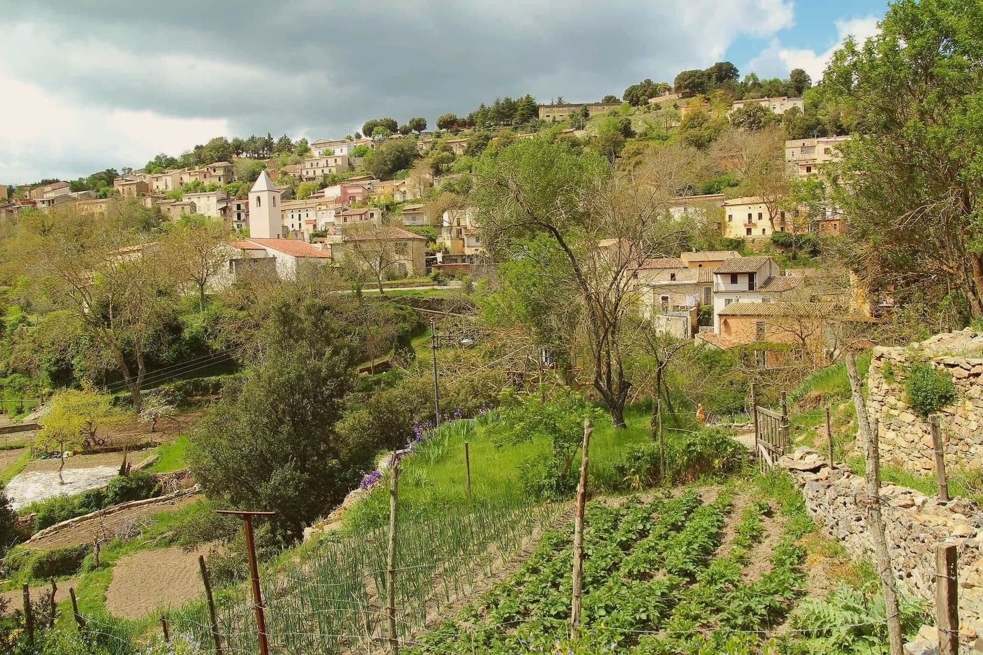
Sadali sits at 750 meters on a karst plateau in the Barbagia di Seulo, an hour and a half by road from Cagliari and far from any coast. The village grew before 1335 around the parish church of San Valentino, and the limestone underneath it does the unusual work that makes the place memorable.
Underground rivers surface as springs inside the village, and one of them, Funtana Manna, drops about seven meters in a cascade beside the church. Sadali is the only Sardinian commune with a waterfall in its centro abitato.
The same karst feeds the Is Janas caves on the edge of town, 300 meters of stalactites and columns open to visitors. Stone houses, narrow lanes, water running audibly through the streets after rain.
The population is under 900 and falling. The Borgo dei Borghi finalist status in 2026 brought the first sustained wave of visitors the village has seen.
What to see in Sadali
- Cascata di San Valentino. Seven-meter waterfall fed by Funtana Manna spring, dropping inside the inhabited centre, the only one of its kind in Sardegna.
- Chiesa di San Valentino. Ancient parish church beside the waterfall, the only Sardinian sanctuary dedicated to Saint Valentine, around which the village formed before 1335.
- Grotte Is Janas. Karst cave system 300 meters long with six rooms of stalactites, stalagmites and ochre flows, joined into columns at the centre.
How to get to Sadali
There is a railway station in the town, so you can arrive without a car and never need one while you are here. Cagliari is roughly 91 minutes away by road.
Our tip
May through October is the workable window in Sadali. The plateau holds at 750 meters, so summer heat stays below the inland average and the springs run cold even in August. June and September are the easiest months: the waterfall is full, the cave temperature stays at 16 degrees, and the village is open. Sagra de is culurgionis falls in August.
Atzara
Why visit Atzara
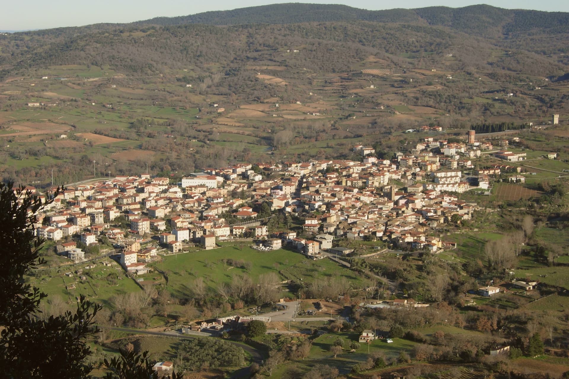
The Mandrolisai sub-region sits at the geographic centre of Sardinia, and Atzara occupies its western edge on the slopes that rise toward the Gennargentu, with the boundary of the national park running close to the eastern side of the commune. The village built its name first on wine: the volume and quality of the Mandrolisai blend was already established in the nineteenth century, before any painter arrived.
What changed at the turn of the twentieth century was who was looking at the place. Visiting artists found in the stone houses and the lanes of dark basalt and granite a ready subject for peasant scenes, and the school that grew out of their stay took the village's name.
The wine economy and the painting school are not separate stories so much as two outputs of the same setting: a farming village at altitude, built of local stone, whose ordinary life became the material for a documented artistic movement. What the town has kept, in its museum, its unchanged centro storico and its parish church, is the physical record of both.
What to see in Atzara
- Museo d'Arte Moderna e Contemporanea Antonio Ortiz Echagüe. Civic museum holding works by the Spanish costumbristas and the Sardinian painters of the Scuola di Atzara, including Antonio Ballero and Filippo Figari.
- Centro storico di Atzara. Stone houses of dark basalt and granite along narrow lanes, the model the painters used at the start of the twentieth century.
- Chiesa di Sant'Antioco Martire. Parish church in the heart of the village, built in Aragonese-Catalan late Gothic style with later modifications.
How to get to Atzara
Cagliari is roughly 103 minutes away by road.
Our tip
April through June and September through November are the dry, mild months at 553 metres, the right season for Mandrolisai cellar visits and walks toward the Gennargentu. July and August touch thirty degrees in the village and the vineyards switch to early-morning work. Winter is cold and quiet, with snow possible on the peaks above. I giorni del Mandrolisai falls in June.
Aritzo
Why visit Aritzo
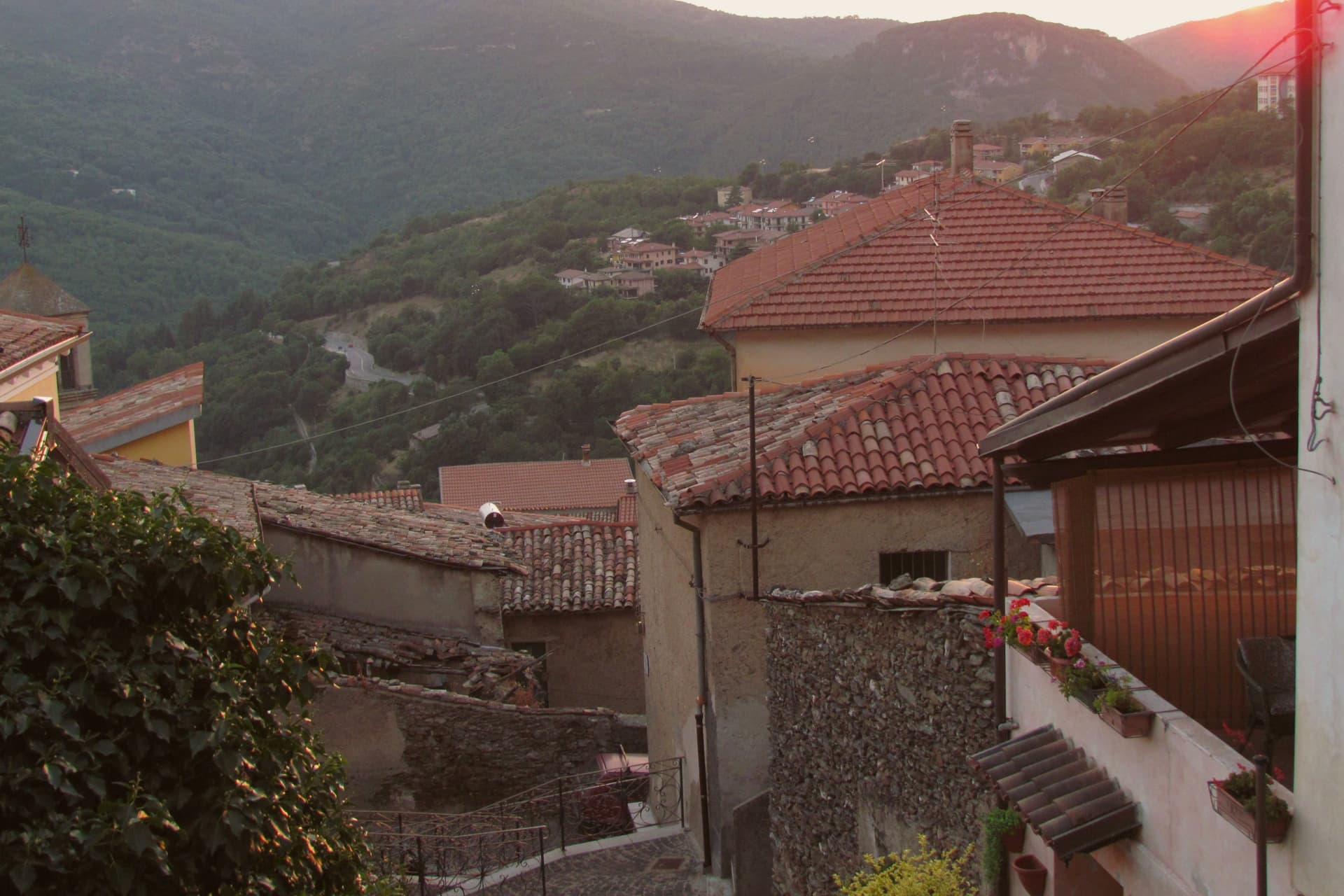
Aritzo sits at around 800 meters on the southern flank of the Gennargentu, in the Mandrolisai region eighty kilometers north of Cagliari. Until the early twentieth century the village ran a snow industry: men climbed to Funtana Cungiada at 1,300 meters, filled the domos de su nie, stone-lined snow wells covered with straw and earth, and sold the pressed snow down to the coast through summer.
The same snow chilled the sorbettières that produced Sa Carapigna, a fine lemon sorbet still made here in the autumn. Along Corso Umberto I stand the seventeenth-century Spanish prison Sa Bovida, with its sharp underpass, the parish church of San Michele Arcangelo, and Casa Devilla, the bourgeois house of the snow contractors.
The Castello Arangino, built in 1917 in neogothic style by Vincenzo Arangino, marks the upper end of the street. The Sagra delle Castagne every late October draws regional crowds for chestnut and hazelnut tastings.
What to see in Aritzo
- Carcere Spagnolo Sa Bovida. Seventeenth-century maximum-security prison in schist and chestnut, used until the 1940s, named for its Spanish-origin vaulted underpass.
- Casa Devilla. Three-level Spanish-era house of the Devilla family, contractors of the snow industry until the early 20th century, now part of the Ecomuseo.
- Castello Arangino. Neogothic castle built in 1917 by Vincenzo Arangino along Corso Umberto I, in medieval pastiche, still standing at the upper end of the street.
How to get to Aritzo
There is a railway station in the town, so you can arrive without a car and never need one while you are here. Cagliari is roughly 135 minutes away by road.
Our tip
May through October is the working season at 800 meters. June through September brings hiking weather in the Gennargentu, with the chestnut woods cool enough for afternoon walks even when the coast is over thirty degrees. October is the Sagra delle Castagne, when the village fills for two weekends of chestnut and hazelnut tastings and Sa Carapigna. Sagra della Castagna di Aritzo falls in October.
Badesi
Why visit Badesi
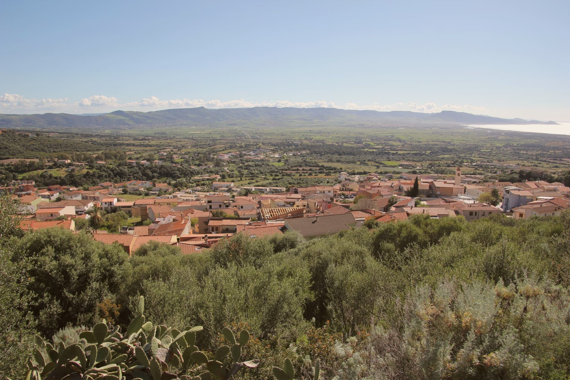
Badesi sits on a hill at 102 meters above the Gulf of Asinara, its municipal territory running north to the dunes and down to the river that forms the natural boundary between Gallura and Anglona. The village formed in the eighteenth century, when shepherding families settled in a Spanish baron's fief and gathered around the parish church built in the early twentieth century.
Badesi became an autonomous comune in 1969, later than the settlement itself, which had already taken shape around the church a generation before. The pattern of the place follows this same line from hill to water: a village core inland, vineyard hillsides around it, and a coastal strip of dunes and river mouth at the far edge of the same territory, held together by the Coghinas, which both feeds the wetlands and marks where Gallura gives way to Anglona.
What began as a shepherding settlement in a feudal fief has ended up governing a stretch of coast and river protected for its water quality and its birdlife, the same land put to grazing now carrying a wine designation and a conservation status instead.
What to see in Badesi
- Spiaggia di Li Junchi. Eight-kilometer beach of fine white sand and juniper-covered dunes from Isola Rossa to the Coghinas mouth, holder of the Bandiera Blu.
- Vermentino di Gallura vineyards. Hilltop vineyards inside the only DOCG zone in Sardinia, white-wine producers concentrated north and west of the village.
- Foce del Coghinas. River mouth marking the boundary between Gallura and Anglona, an EU-protected site for migratory birds nesting in the reed beds.
How to get to Badesi
Sassari is roughly 53 minutes away by road.
Our tip
May through October is the season at Li Junchi. The sea is swimmable from mid-May, the dunes are walkable, and the vineyards on the hills above the beach work through their cycle from flowering to September harvest. July and August are crowded with Italian, German, and French families, and the Delphina resorts above the dunes fill. Sagra delle lumache falls in July.
Santu Lussurgiu
Why visit Santu Lussurgiu
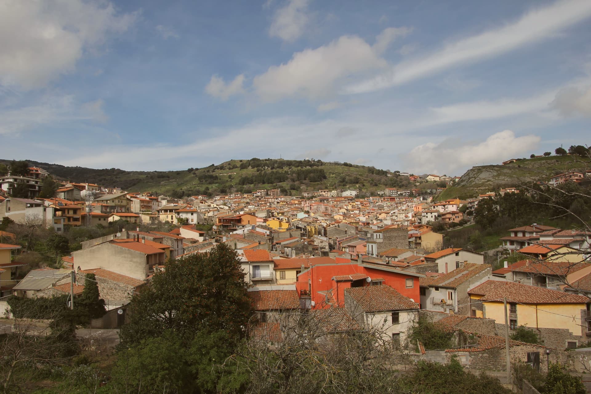
Santu Lussurgiu sits at 503 meters on the eastern slope of the Montiferru, the extinct volcano that defines the inland Oristano province. The village was named for Lussorio, a Roman soldier martyred in 303 under Diocletian.
Horses are the second name. The Giudicato of Arborea and the later Spanish viceroys both increased local breeding, and the village developed lines suited to racing.
Sa Carrela 'e Nanti, the Carnival horse race, runs across the last three days of Carnival each year, masked riders in pairs galloping down a steep stone street, an event placed alongside the Sartiglia of Oristano and the Ardia of Sedilo among the deep events of Sardinian folklore. The Spanu saddlery opened on the Corso in 1923 and is still run by the family.
The narrow Lussurgese horse collar, with a single row of bells, was designed for the racing gallop. The village rises into the Montiferru woods, with the Sos Molinos waterfalls a short drive uphill.
What to see in Santu Lussurgiu
- Sa Carrela 'e Nanti. Carnival horse race down a steep stone street, masked riders in pairs, held over the last three days of Carnival each year.
- Museo della Tecnologia Contadina. Ethnographic museum of rural Montiferru life, tools and crafts of the village before mechanization, in the centro storico.
- Chiesa parrocchiale di Santa Maria degli Angeli. Parish church of the village, the religious anchor of the medieval centro storico on the Montiferru slope.
How to get to Santu Lussurgiu
Sassari is roughly 91 minutes away by road.
Our tip
April through June is the green window in the Montiferru. The oak woods leaf out, the Sos Molinos waterfalls run full, and Santu Lussurgiu at 503 meters keeps mornings cool well into the warm months. September through November brings the second window, mushrooms in the woods and the cattle moved between pastures. Artes e Sabores falls in November.
Calasetta
Why visit Calasetta
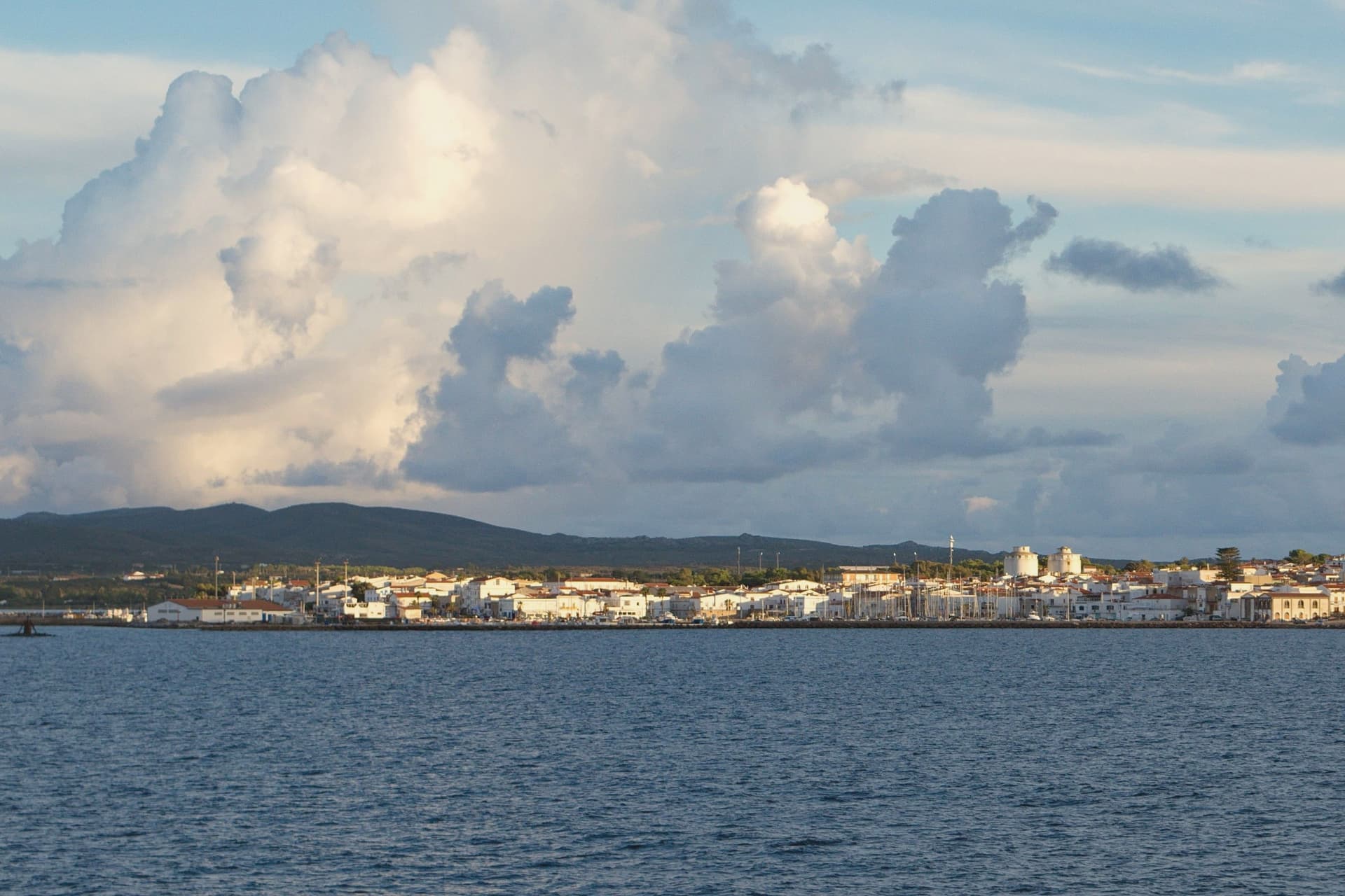
Calasetta sits on the northwest tip of the island of Sant'Antioco, founded in 1770 by Ligurian families who had spent two centuries on the Tunisian island of Tabarka working as coral fishermen for the Genoese Lomellini. When the Tabarka colony collapsed in 1738, King Charles Emmanuel III of Savoy received them in the Kingdom of Sardinia: part settled Carloforte on Isola di San Pietro, the rest received Calasetta thirty-two years later.
The grid plan and low whitewashed houses come from that founding. The Tabarchino dialect, a variant of Ligurian, is still spoken alongside Italian.
The Torre Sabauda, an eleven-meter truncated cone built in the late 18th century as part of the coastal defense network, now houses an exhibition on the town and the territory. The MACC, the Museum of Contemporary Art opened in 2007, holds a collection of European painting from 1960 to 1970 unusual for a town of three thousand.
What to see in Calasetta
- Torre Sabauda. Late 18th-century coastal watchtower, eleven meters high in truncated cone form, built by the Savoy government against pirate raids.
- MACC. Museum of Contemporary Art opened in 2007, holding a collection of European paintings from the 1960s and 1970s.
- Centro storico tabarchino. Grid of whitewashed low houses laid out in 1770 by the Ligurian Tabarka settlers, still the core of the town today.
How to get to Calasetta
Our tip
May through October is the season. May and June bring warm sun and an empty Sottotorre beach. July and August are the busy months when the Carloforte ferry queues stretch back through the grid and the Tabarchino festivals fill the squares. Sagra del pilau falls in May.
Jerzu
Why visit Jerzu
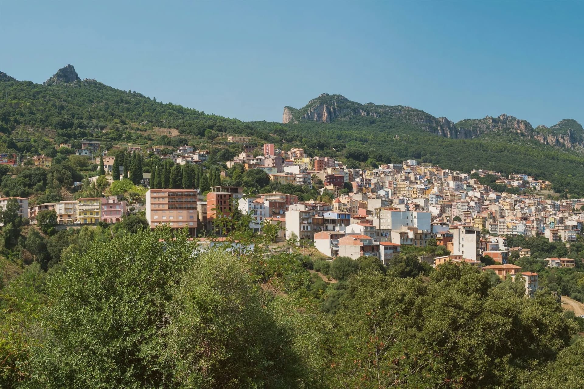
Jerzu sits on the eastern flank of the Ogliastra interior, the village gathered below the limestone wall of Monte Corongiu. The name first appears in a document from 1130 recording a donation of vineyards, and by the 16th century the wine was being shipped across the Alps.
The mountain itself carries a longer history than the village at its foot: a Punic necropolis is cut into its lower slopes, predating the medieval settlement below by centuries. The town's life still runs between these two poles, the vineyards on the lower ground and the mountain rising behind them.
The Antichi Poderi Jerzu cooperative vinifies most of the local crop, and the Sagra del Vino on the first Sunday of August brings carts and traditional dress into the streets, with the parish church at the center of the processions. Jerzu reads as a village organized around a single crop and a single peak, its wine trade and its landscape sharing the same slopes for centuries.
What to see in Jerzu
- Monte Corongiu. Marked footpaths climb the limestone butte above the village, passing a Punic necropolis on the lower slopes before reaching the summit views.
- Cantina Antichi Poderi Jerzu. Cooperative winery grouping roughly 350 Cannonau growers, the largest producer of Jerzu sub-zone wine.
- Chiesa di Sant'Erasmo. Parish church of the village, the focal point of the August feast of Sant'Antonio and the wine festival processions.
How to get to Jerzu
Cagliari is roughly 180 minutes away by road.
Our tip
April through June is the best window: vineyards in leaf, mild temperatures at 450 meters, and trails on Monte Corongiu open without summer heat. September through November is the second window, lining up with the Cannonau harvest in late September and the cooler autumn light. Summer touches the mid-thirties and the village empties between two and six in the afternoon. Sagra del Vino a Jerzu falls in August.
Sardara
Why visit Sardara
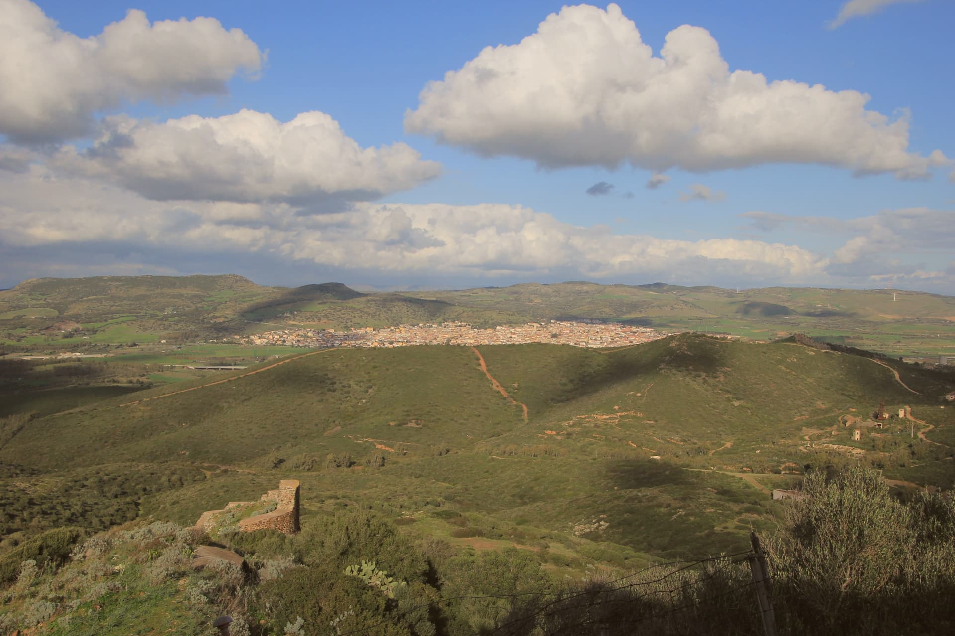
Sardara sits in the centre of the Campidano plain, on the historic frontier between the medieval Giudicato of Arborea and the Giudicato of Cagliari, fifty kilometres north of the regional capital. The thermal waters here surface mineralised at 45 to 60 degrees and have been used since the ninth century BC, when the Nuragic well-temple known as funtana de is dolus marked the source as sacred.
The Romans built the bath complex called Aquae Neapolitanae, recorded by Ptolemy in the second century and still operating today as the Antiche Terme di Sardara. Above the town, the Castello di Monreale rises on a basalt hill: a fourteenth-century Arborea fortress where Eleonora d'Arborea and her father Mariano IV stayed, ruined now but with three surviving towers.
The old centre is a Città della Terra Cruda, built from sun-dried mud bricks, and a Bandiera Arancione of the Touring Club Italiano.
What to see in Sardara
- Castello di Monreale. Hilltop ruined fortress built between 1200 and 1300 on the Arborea-Cagliari frontier, residence of Mariano IV and Eleonora d'Arborea, with three surviving towers.
- Antiche Terme di Sardara (Santa Maria Aquas). Hyperthermal bicarbonate-alkaline springs at 45-60 degrees, used since the Nuragic period and developed by the Romans as Aquae Neapolitanae.
- Pozzo sacro di Sant'Anastasia. Nuragic well-temple from the ninth-eighth centuries BC at the centre of the town, the funtana de is dolus dedicated to a water cult.
How to get to Sardara
Cagliari is roughly 59 minutes away by road.
Our tip
The thermal waters run year-round, which makes Sardara one of the few Sardinian communes where January is as workable as September. Spring and autumn give the dry warmth that suits the Campidano: walks up to the Monreale castle, the Nuragic well-temple under olive trees, the plain spreading toward the Giara. July and August touch thirty-five degrees on the plain, and the thermal pools shift to early morning and evening use. Festa de Su Binu Nou falls in March.
Bosa
Why visit Bosa
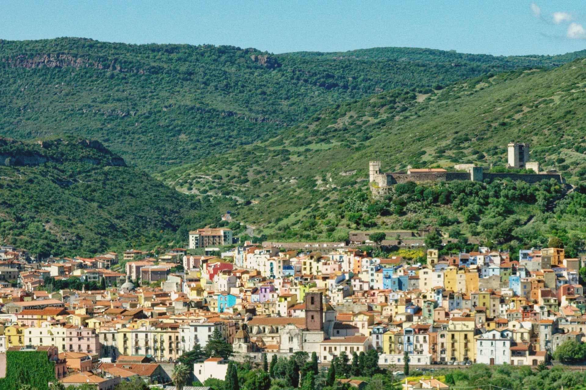
Bosa sits three kilometres inland from the western coast of Sardinia, on the north bank of the Temo, the only navigable river on the island. The Castello di Serravalle, built around the second half of the thirteenth century by the Tuscan Malaspina family of Spino Secco, dominates the town from the hill above the centro storico.
During the Sardinian-Catalan war the Aragonese described it as one of the noblest castles in the world and the key to the entire island. Below the castle, the houses of the Sa Costa quarter step down the slope in lines of pink, yellow, blue and green to the river.
On the opposite bank stretches Sas Conzas, the nineteenth-century tannery district, identical industrial buildings with stone soaking tanks where Bosa hides were processed for export. The Planargia hills behind the town produce Malvasia di Bosa DOC, one of Sardinia's classic sweet wines, alongside olive oil.
What to see in Bosa
- Castello di Serravalle (o dei Malaspina). Thirteenth-century castle built by the Tuscan Malaspina family on the hill above the Temo, with the small chapel of Nostra Signora de sos Regnos Altos in its enclosure.
- Sa Costa. Old quarter of pink, yellow and blue houses climbing the slope from the river to the Malaspina castle, the postcard image of Bosa.
- Sas Conzas. Nineteenth-century riverside district of identical tannery buildings on the south bank of the Temo, an industrial heritage site with original stone soaking tanks.
How to get to Bosa
Sassari is roughly 85 minutes away by road.
Our tip
May through October is the working season on the Temo: river boat trips, the castle climb, the colour-washed quarter, the Malvasia tastings in the Planargia. July and August push past thirty-two degrees and the centro storico empties between two and five each afternoon. April and the second half of October are dry and mild, the right window for the Sas Conzas walk and the cliffs of the Capo Marrargiu coast. Attoppa a camasinu! falls in August.
Tortolì
Why visit Tortolì
Tortolì sits on the central-east coast of Sardinia, the larger of the two co-capitals of Ogliastra alongside Lanusei. The town proper is two kilometers inland on a plain that runs out to the sea at Arbatax, the historic port and now Tortolì's seaward frazione.
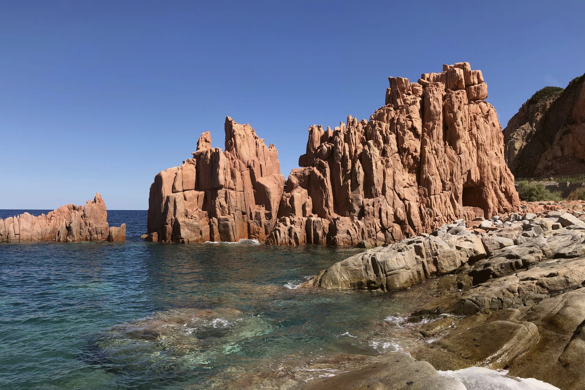
Arbatax is named for the Arabic 'arba'a tashar' (fourteen), the medieval number assigned to the watchtower on the headland. Its defining feature is the Rocce Rosse, a wall of red porphyry that rises fifteen meters out of the water next to the harbor, geologically distinct from the granite that defines most of the Sardinian east coast.
The Tortolì coast carries the Bandiera Blu for both Lido di Orrì and Spiaggia di Cea, the latter known for the two pale-red Scoglius Arrubius sea stacks that rise twenty meters offshore. In May the town stages an Infiorata, carpeting the streets in flower petals for Corpus Domini.
What to see in Tortolì
- Rocce Rosse di Arbatax. Red porphyry cliffs rising 15 meters from the sea next to the Arbatax port, the geological landmark of the east Sardinian coast.
- Spiaggia di Cea. Long pale-sand beach with the two Scoglius Arrubius red sea stacks 20 meters offshore, Bandiera Blu holder.
- Lido di Orrì. Series of small coves and pine-backed beaches south of Arbatax, Bandiera Blu site since the early 2000s.
How to get to Tortolì
There is a railway station in the town, so you can arrive without a car and never need one while you are here. Cagliari is roughly 127 minutes away by road.
Our tip
May through October is the swimming season. May and June stay warm without summer crowds, and the Infiorata fills the centro for one weekend around Corpus Domini. July and August bring full ferries from the mainland to Arbatax and packed beaches at Cea and Orrì. Sa Festa Antiga falls in May.