
The best towns that eat well in the province of Udine
The province of Udine cooks with a border in its pantry. Prosciutto smoked over beech in the Carnic valleys, montasio grated into frico with potato and onion, cjarsons filled sweet and savoury at once, gnocchi with plums in late summer, and along the lagoon edge the fish arrives whole and barely dressed. The wine list runs to friulano, ribolla gialla, refosco, schioppettino, poured in stone-floored osterie in villages of pale rendered houses with deep eaves built for snow. Autumn is the season that rewards a table here, when the mushrooms, the new pressings and the first cold air all land together.
Most people who come to Friuli for food go to the Collio, or to the coast at Grado and Lignano Sabbiadoro, or east to Trieste for the coffee and the Habsburg cafés. The Collio wineries have earned the attention, and in September the cellar doors and the hotel rooms both fill up. Trieste in particular absorbs the region's entire reputation for eating well, which leaves a great deal of Friuli unaccounted for.
The smoking, the cheese cellars and the lagoon boats do not stop at the edge of the famous names. They continue north into the Carnia valleys, west into the moraine hills, and south to the fishing towns of the Marano lagoon, and the towns in this list are where a national or international dining guide has singled out a table. Fewer people book these rooms. The cooking is the same tradition, closer to its source.
Of the 12 communes we have mapped in the province of Udine, 6 qualify as towns that eat well: a national or international dining guide has named a table in each. The smallest, Sauris, has 389 residents.
Elsewhere in the catalogue: The 9 best towns with a serious restaurant in Friuli-Venezia Giulia and The best towns that eat well within 75 minutes of Trieste.
Sauris
Why visit Sauris
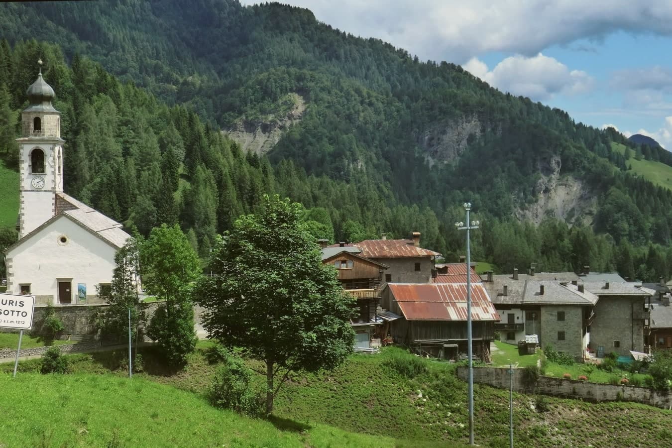
Sauris (Zahre in the local dialect) lies at 1,212 meters in a high valley of the Carnic Alps, the second-highest commune in Friuli-Venezia Giulia. The two main hamlets, Sauris di Sopra and Sauris di Sotto, were founded around the thirteenth century by Tyrolean settlers from the Pustertal; the Saurano dialect they brought with them preserves archaic features of medieval Tyrolean German, and the village has held its language island status into the present.
The Lago di Sauris, a turquoise reservoir, was completed in 1948 by the Lumiei hydroelectric dam, 136 meters high, the tallest in Italy at the time; the village of La Maina lies underwater. The Wolf family has produced Prosciutto di Sauris IGP, smoked over beech wood, since 1862; the brewery Birra di Sauris opened in 1999 and trades under the Zahre name.
The commune operates an albergo diffuso, the scattered hotel model, lodging guests in restored stone-and-larch village houses across the two settlements.
Alla Pace have been named by a guide.
What to see in Sauris
- Lago di Sauris. Turquoise artificial reservoir completed in 1948 by the Lumiei dam, 136 meters tall, the highest in Italy at the time of construction.
- Sauris di Sopra. Upper hamlet at 1,400 meters, with the Chiesa di San Lorenzo, the oldest church in the valley, dating from the thirteenth century.
- Sauris di Sotto. Main lower hamlet at 1,212 meters, anchored by the Chiesa di Sant'Osvaldo and the original albergo diffuso restored stone houses.
How to get to Sauris
Udine is roughly 77 minutes away by road.
Our tip
June through September is the high summer window, when temperatures at 1,212 meters rarely exceed 22 degrees and the Carnic ridges open for hiking. The lake fills in late spring as snowmelt comes off the Lumiei catchment. December through March is winter season: not a major ski resort, but enough cross-country and freeride terrain to fill the albergo diffuso through the Christmas and Carnival weeks. Festa del Prosciutto di Sauris falls in July.
Sappada
Why visit Sappada
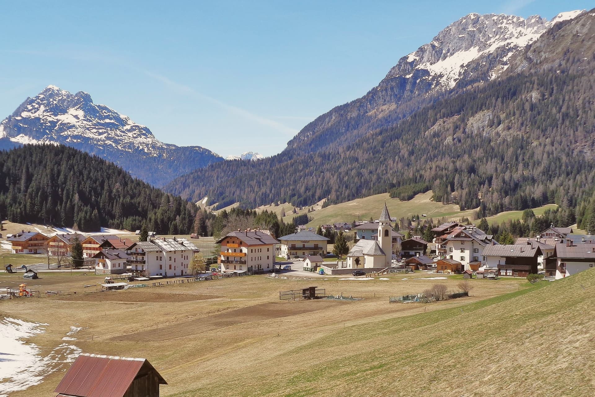
Sappada sits in the upper Piave valley, on the seam between Cadore, Carnia, and East Tyrol. Fifteen borgate are strung along the road between 1,250 and 1,290 meters, among them Mühlbach, Bach, and Hoffe, forming the oldest surviving German-speaking enclave south of the main Alpine ridge.
Settlers crossed the watershed from the Villgraten valley under the Patriarchate of Aquileia, and the dialect they carried is still spoken at home. The river that flows past Treviso and Venice begins as snowmelt above the village, in an enclosed basin reached by a path through pasture.
Sappada belonged to Veneto until 2017, when a referendum moved it into Friuli-Venezia Giulia, a late administrative shift for a place whose deeper affiliations run north toward East Tyrol rather than south toward the Veneto plain. The borgate hold the vernacular, the peak above the valley holds the border views, and the village below ties the two together: a mountain settlement whose language, houses, and geography all point away from the region it now belongs to on paper.
Laite, Mondschein have been named by a guide.
What to see in Sappada
- Sappada Vecchia. Cluster of borgate at the upper end of the village, with seventeenth-century larch-wood houses on stone bases, the best-preserved East Tyrolean vernacular.
- Sorgenti del Piave. An hour's walk up the Val Sesis through pasture and a small votive chapel, ending at the enclosed basin where the river surfaces.
- Monte Peralba. 2,694-meter peak above the Val Sesis, with via ferrata routes, a Franz Joseph chapel near the summit, and views into Austria and Cadore.
How to get to Sappada
Udine is roughly 93 minutes away by road.
Our tip
December through March is one of the two main seasons. The Sappada 2000 lifts run from late November to Easter, the 22 kilometers of pistes hold snow longer than the lower Carnian resorts, and the Plodar Vosenocht carnival runs on three Sundays before Lent. June through September is the second season: the Sorgenti del Piave walk opens, Monte Peralba's via ferrata clears of snow, and the borgate stay cool even when the Veneto plain bakes.
Marano Lagunare

Why visit Marano Lagunare
Marano Lagunare sits on a single fingertip of land at the mouth of the Stella river, surrounded by the Laguna di Marano and Grado: the largest lagoon in Friuli-Venezia Giulia. The town was a Roman port, Maranum, mentioned by Pliny, then a fishing town under the Patriarchate of Aquileia, then a fortified Venetian outpost from 1420 until the fall of the Republic in 1797.
Each layer left its mark on the same small footprint: the Roman-era estuary settlement, the Aquileian fishing economy that still runs the harbour, and the Venetian grid of houses and watchtower around the piazza. The fleet and the lagoon are the same fact seen from two sides.
The moeche harvest, the schie shrimp, and the daily catch move directly from boat to osteria, and the dialect spoken in the streets is a pocket of Venetian speech that outlasted the Republic itself, holding on in a region that speaks Friulian. The town's whole history reads as a single settlement repeatedly absorbed by larger powers, Roman, Aquileian, Venetian, without ever losing the lagoon that defines its geography and its economy alike.
Alla Laguna - Vedova Raddi, Trattoria Barcaneta have been named by a guide.
What to see in Marano Lagunare
- Porto e centro storico. Pastel-coloured fishermen's houses in a tight grid around a single piazza, with the watchtower anchoring the harbour where the fleet still ties up.
- Laguna di Marano. Moeche soft-shell crab harvest runs spring and autumn, alongside daily fishing. Small-boat tours reach the casoni, traditional thatched fishermen's huts on the lagoon islands.
- Riserva Naturale Foci dello Stella. Natura 2000 wetland at the Stella river estuary, reachable by short boat hop from the harbour. Reedbeds, birding hides, herons and migratory waterfowl.
How to get to Marano Lagunare
Udine is roughly 44 minutes away by road.
Our tip
April through October is the prime season — calm lagoon, working fleet daily, and the osterie at full menu. May and September are the moeche soft-shell-crab seasons; the local boats land them at dawn and the osterie serve them within hours. June bears the highest summer light over the lagoon; July-August are hot and busy with regional tourism but the lagoon stays workable. Fasolari in Festa falls in August.
Fagagna
Why visit Fagagna
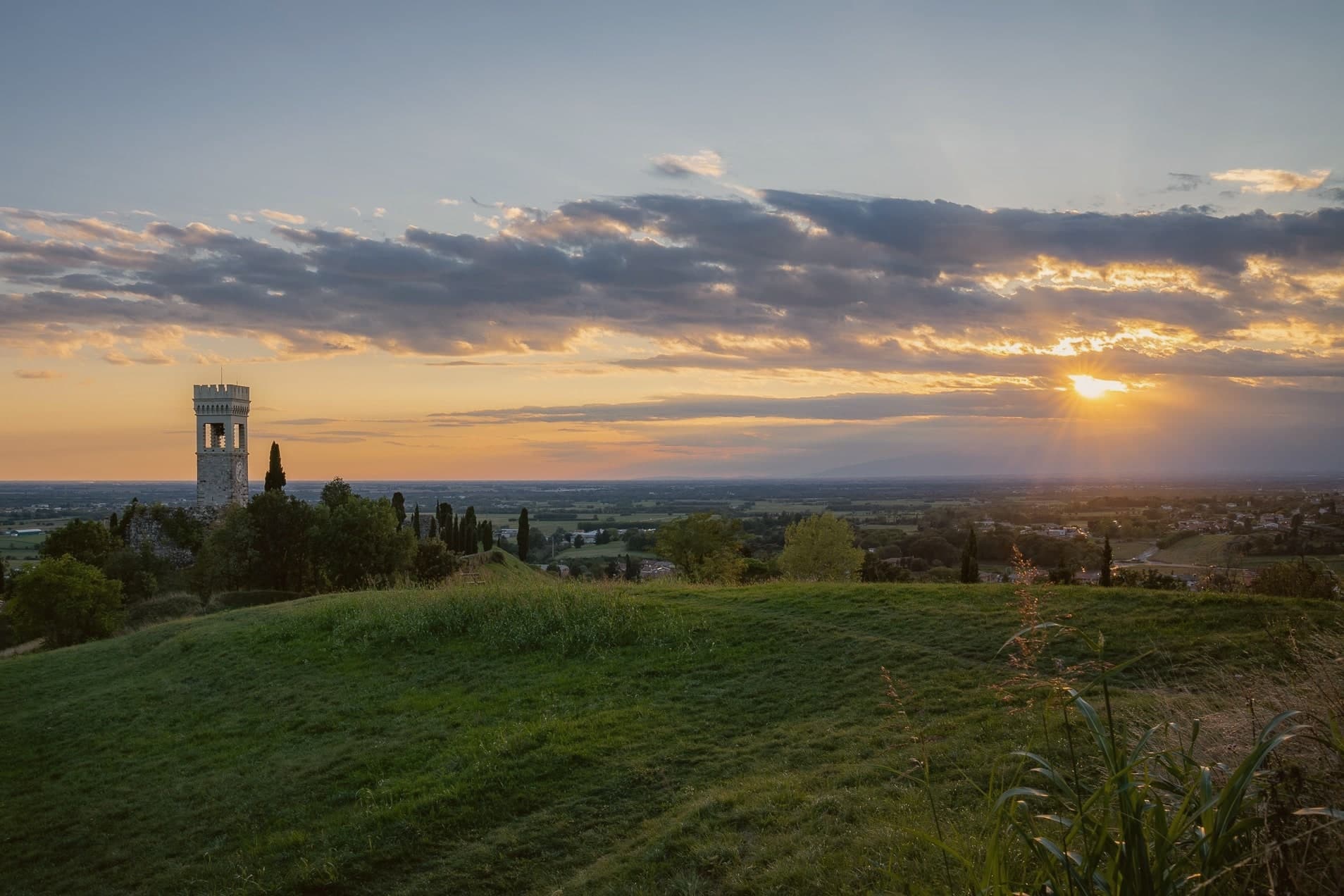
Fagagna, Friulian Feagne, sits at 177 meters on the morainic hills thirteen kilometers northwest of Udine. The hill has been strategic since Roman times, and the castle passed to the Patriarch Rodoaldus as part of the 983 donation.
What remains today is scattered rather than whole: a stretch of wall, the Borgo gate, the clock-tower converted into a bell tower, the ruined keep, a fourteenth-century house, and the small church tucked inside the old walls. The four boroughs, Centro, Palûd, Pic, and Riul, each keep a colour and a stake in the town's identity that surfaces once a year in the piazza, and otherwise define the town's internal geography more than its street plan does.
A regional nature reserve on the edge of town gives Fagagna a second, unrelated distinction alongside its medieval fragments. The town has been a member of Borghi più belli d'Italia since 2007.
Between the broken castle, the annual race, and the ibis reserve, the town reads less as one attraction than as several small, unconnected reasons to stop, each surviving on its own terms.
San Michele have been named by a guide.
What to see in Fagagna
- Castello di Fagagna. What survives is fragmentary: wall fragments, the Borgo gate, and the clock-tower, the visible remnant of the donated fortress.
- Chiesa di San Michele Arcangelo. Small castle chapel inside the original walls, one of the surviving medieval structures from the patriarchal period.
- Oasi dei Quadris. Regional wetland reserve where the ibis colony nests and feeds, set in the countryside outside the built-up center.
How to get to Fagagna
Udine is roughly 20 minutes away by road.
Our tip
April through October is the working window. May and June bring the morainic hills at their greenest; the Oasi dei Quadris is busiest with ibis breeding and visiting birders. July and August get hot, though the elevation keeps nights cooler than Udine on the plain. Sagrute di Vilalte falls in July.
Cividale del Friuli
Why visit Cividale del Friuli
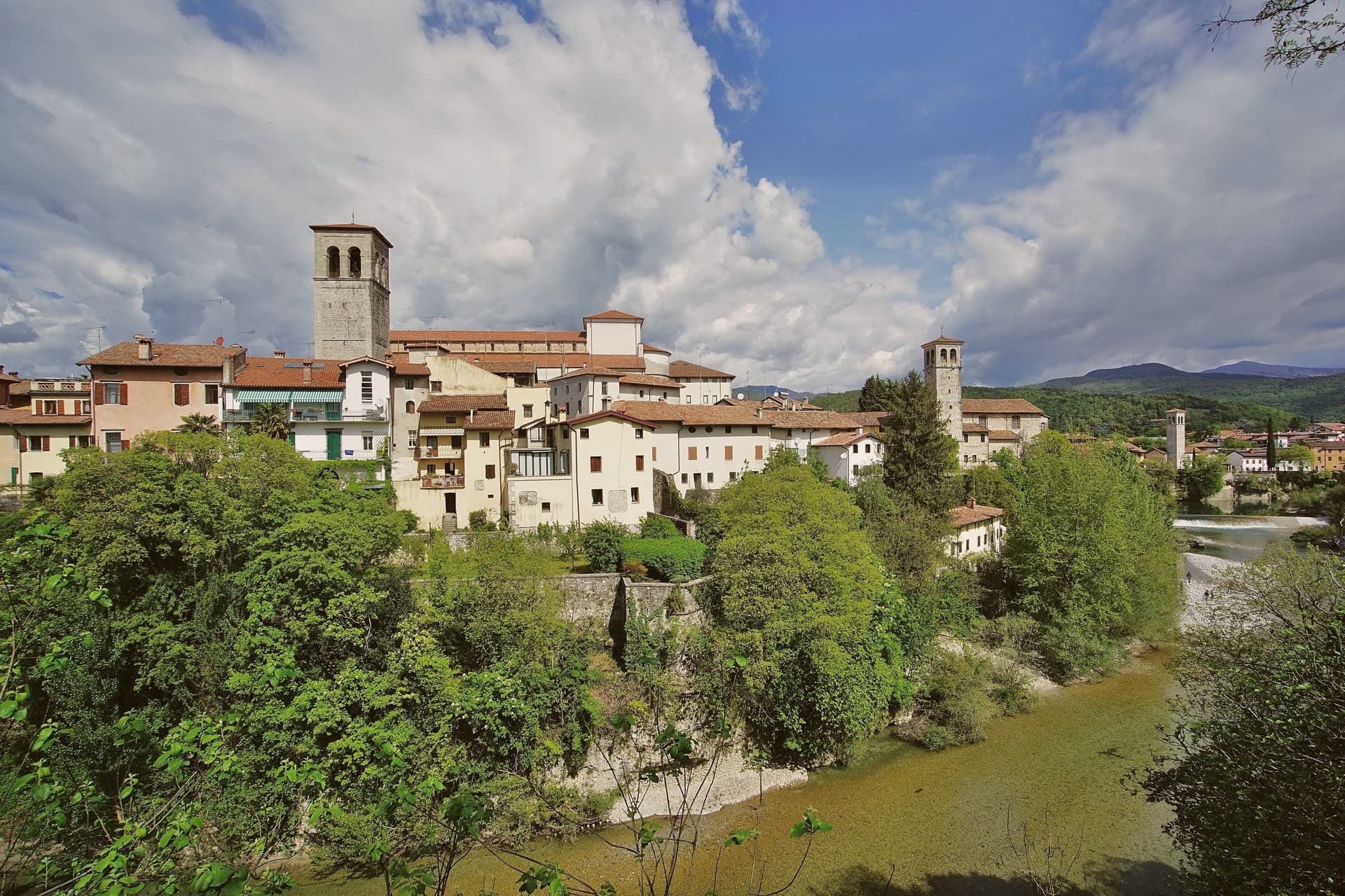
Cividale del Friuli sits at 138 meters on the right bank of the Natisone, fifteen kilometers from Udine and close enough to the Slovenian border that the river marks it. Julius Caesar founded the place as Forum Iulii in the first century BC, the name that eventually gave Friuli its own.
In 568 the Lombard king Alboin made it the capital of his first Italian duchy, and the Patriarchate of Aquileia later moved its seat here for four centuries. The Tempietto Longobardo, an eighth-century palatine chapel, holds six stucco female saints carved around 760, the best-preserved sculpture of the Lombard age in Europe.
It is one of seven sites in the UNESCO serial nomination Longobardi in Italia. The Ponte del Diavolo, begun in 1442, spans the Natisone gorge in two asymmetrical arches.
The Palio di San Donato fills the streets in late August, and Mittelfest brings Central European theater and music to the piazzas every July.
Al Monastero have been named by a guide.
What to see in Cividale del Friuli
- Tempietto Longobardo. Eighth-century palatine chapel in the Monastero di Santa Maria in Valle, with six stucco female saints in high relief, UNESCO-listed since 2011.
- Ponte del Diavolo. Stone bridge over the Natisone gorge, begun in 1442 on two asymmetrical arches resting on a central rock outcrop.
- Duomo di Santa Maria Assunta. Fifteenth-century cathedral with the Pala di Pellegrino II, a twelfth-century gilded silver altarpiece, and an attached Museo Cristiano.
How to get to Cividale del Friuli
There is a railway station in the town, so you can arrive without a car and never need one while you are here. Udine is roughly 26 minutes away by road.
Our tip
April through June and September into October are the months when the Natisone valley shows best, with green hills, mild evenings, and the Slovenian border country open for walking. July brings Mittelfest and August the Palio di San Donato, so the centro storico fills with theater crowds and historical pageant. Both months can push past thirty degrees, though 138 meters of elevation and the river keep nights cooler than the Friulian plain. Palio di San Donato falls in August.
Udine
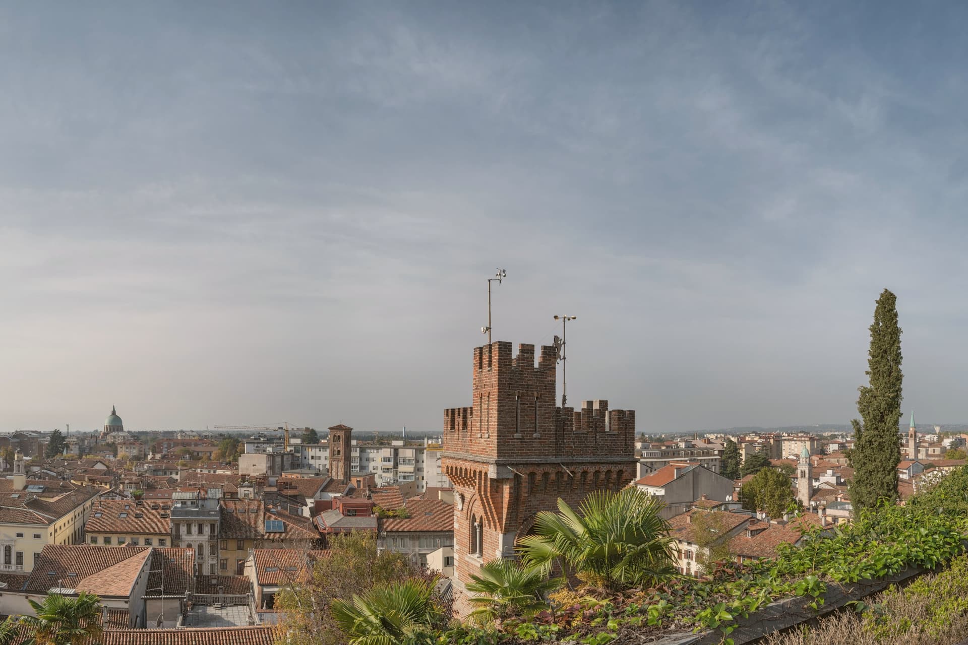
Why visit Udine
Udine sits at 113 meters in the center of the Friulian plain, raised on a single man-made hill that legend assigns to Attila's army. The city is documented from 983, when Emperor Otto II donated the castle to the Patriarchs of Aquileia.
By the twelfth century the patriarchs had moved their residence here, and for four hundred years Udine served as capital of the Patria del Friuli before Venice took the city in 1420 and governed it until 1797. The hill and the square below it still read as two distinct centers: the castle above, rebuilt after the 1511 earthquake, looking down on the civic and religious cluster of the Piazza della Libertà, the Duomo, and the patriarchs' palace.
From May 1915 to October 1917 the city was the seat of the Italian military command and was nicknamed Capitale della Guerra. A town built twice over as a seat of power, first ecclesiastical, then military, with its hill as the constant.
Trattoria Alla Vedova, Agli Amici, Hostaria alla Tavernetta and 4 more have been named by a guide.
What to see in Udine
- Piazza della Libertà. Framed by the Loggia del Lionello of 1448, the Porticato di San Giovanni, and a clock tower with bronze Mori that strike the hour above the square.
- Castello di Udine. Rebuilt in the sixteenth century after the 1511 earthquake, former seat of the Patriarchs of Aquileia and then of the Venetian governors, now housing civic museums on the hill above the city.
- Galleria del Tiepolo (Palazzo Patriarcale). The frescoes here were painted for the Patriarch Dionisio Dolfin; Giambattista Tiepolo's rooms are reached through the palace's staircase and galleries, the setting as much a part of the work as the ceilings themselves.
How to get to Udine
There is a railway station in the town, so you can arrive without a car and never need one while you are here. Udine is roughly 2 minutes away by road.
Our tip
April through June and September into October are the Friulian shoulder months, dry, mild, evenings cool enough to sit out on Piazza della Libertà. July and August push past thirty with high humidity off the plain; the porticos shade the worst of it, but the air stagnates. November through March is fog and cold: short days, gray light, the castle on its hill rising above the haze on Piazza Matteotti. Friuli Doc a Udine falls in the season.
More from Anywhere Italy
- The 9 best towns with a serious restaurant in Friuli-Venezia Giulia
- The best towns that eat well within 75 minutes of Trieste
- The best towns with a food festival in Friuli-Venezia Giulia
- The prettiest villages in the province of Udine
 The best hill towns that eat well in Friuli-Venezia Giulia
 The best towns you can reach by train that eat well in Friuli-Venezia Giulia