
The best towns on a walking route that you can reach by train in Lazio
90 towns visited, 910 to go. Follow along, free: Subscribe on Substack
Walking in Lazio means volcanic country: black tufa cut into house walls, chestnut and oak on the crater rims, water appearing where you would not expect it. The Via Francigena runs down from the Tuscan border through hazelnut groves and past lakes, and the Cammino di San Benedetto crosses the limestone valleys of the interior toward the Aniene. Spring and autumn are the walking seasons, when the light is long and the paths are dry, and the eating follows the ground underfoot: sheep's cheese, wild greens, freshwater fish, olive oil pressed from the Sabine and Pontine slopes. Fountains in the piazzas still run cold, which matters more than it sounds when the stage is a long one.
Almost everyone who comes to Lazio comes to Rome, and Rome absorbs the walking too. The final stretches of the Francigena into the city are the busiest, the pilgrim hostels near the Vatican fill in high summer, and day walkers ring the Appia Antica on Sundays. It is a fine thing to do once. It is also the one part of the route where you queue.
The same routes carry on well past the capital, in both directions, and the regional railways run more or less alongside them. North of the city the road climbs through the tufa hills to the crater lakes; south, it follows the coastal plain and the Ausoni ridges toward the old border with the Kingdom of Naples; east, it climbs into the Simbruini toward Benedict's caves. The towns here are stages, places with a bed and a bar and a station within reach, and fewer people stop in them.
Of the 61 communes we have mapped in Lazio, 10 qualify as towns on a walking route you can reach by train: each is a stage on one of the long historic walking routes, and we have confirmed each is reachable without a car. The smallest, Capranica, has 6,302 residents.
If you are still choosing, we have also written The best hill towns on a walking route in Lazio and The best towns with a serious restaurant that sit on a walking route in Lazio.
Why visit Arpino
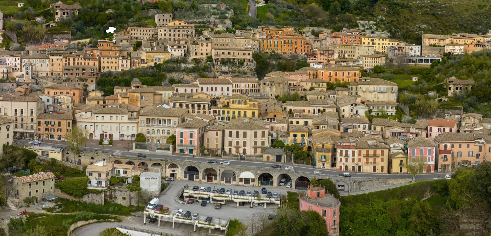
Arpino sits at 450 meters on two hills in the Liri valley, in the Ciociaria region of southern Lazio. The ancient city of Arpinum, on the upper hill now called Civitavecchia, was a Volscian-Samnite stronghold captured by Rome in 305 BC.
The lower hill is the medieval and modern town. Two Roman consuls were born here: Gaius Marius, the military reformer who fought the Cimbri and Teutones, and Marcus Tullius Cicero, the orator and senator killed in 43 BC.
The villa where Cicero was born stood just north, on the Liri, in what is now Isola del Liri. The upper acropolis is ringed by polygonal cyclopean walls of the sixth or fifth century BC, with the Arco a Sesto Acuto, a pointed-arch gate cut into the same stone work.
Arpino is on the Bandiere Arancioni list and on the Cammino di San Benedetto, the long pilgrim route from Norcia to Montecassino.
What to see in Arpino
- Acropoli di Civitavecchia. Pre-Roman upper city on the hill above modern Arpino, surrounded by cyclopean polygonal walls of the sixth or fifth century BC.
- Arco a Sesto Acuto. Pointed-arch gate cut into the cyclopean walls of the acropolis, the only known pre-Roman ogival arch in central Italy.
- Torre di Cicerone. Medieval tower on the acropolis, traditionally linked to Cicero by local memory though built more than a thousand years after his death.
How to get to Arpino
It has its own railway station. Latina is about 1 h 34 min away by road. The full route from Rome.
Our tip
April through June and September through October are the strong months. Spring brings green hills along the Liri and clear views from the acropolis; autumn is dry and gold. July and August push past thirty degrees in the valley, although Arpino's 450-meter position offers some relief in the upper town.
Why visit Castel Gandolfo
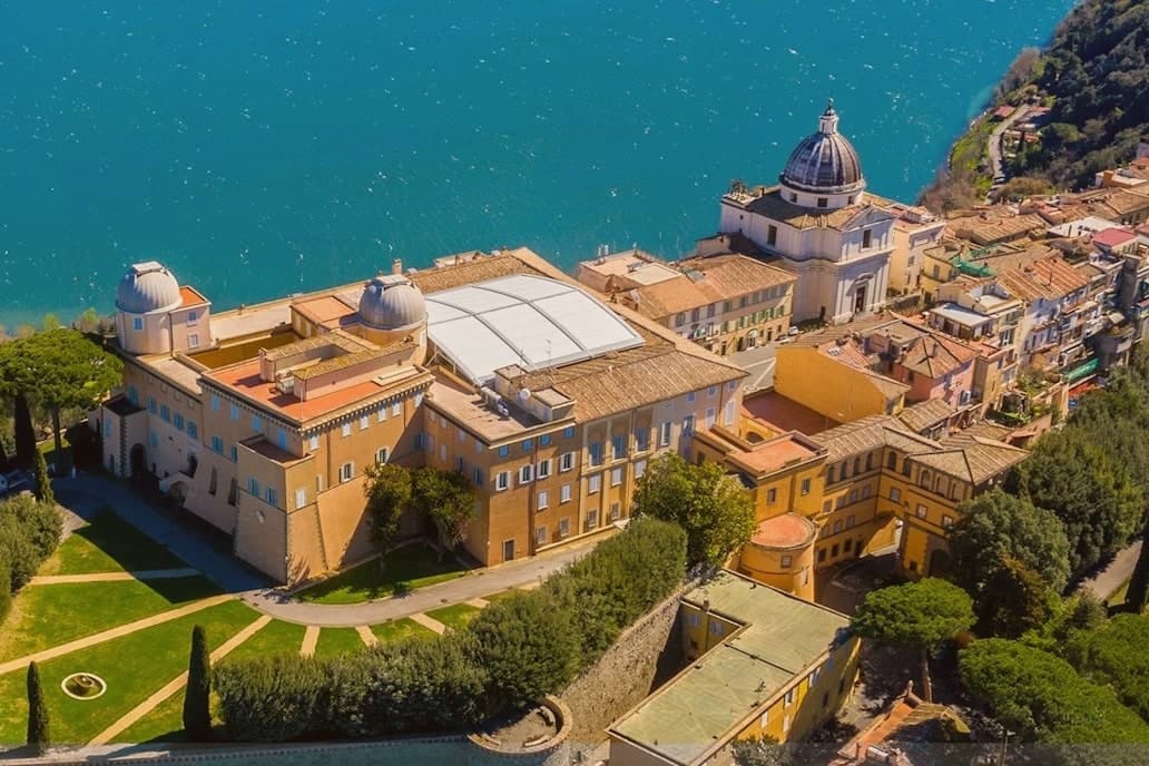
The town sits at 426 meters on the rim of the Lake Albano crater, twenty-five kilometers southeast of Rome among the Castelli Romani. It stands on the site of Alba Longa, the city Aeneas's son Ascanius is said to have founded.
The lake below was formed by the fusion of two volcanic craters and reaches 170 meters deep. The Villa Barberini stands adjacent to the palace, acquired by Taddeo Barberini in 1631, its gardens running down toward the water.
Pope Francis kept the palace as a museum after 2016; Leo XIV restored it to residential use in June 2025 and resides in the Villa Barberini next door, while the Borgo Laudato Si', created by Francis in 2023, carries ecological education across 55 hectares of the same estate. A town built on legend, given over for a time to public viewing, and returned to private residence: three uses of the same ground, laid one on top of the other without erasing what came before.
What to see in Castel Gandolfo
- Palazzo Apostolico. The palace Carlo Maderno raised between 1623 and 1626 stood open as a museum from 2016, its rooms given over to display cases and visitors. In June 2025 it returned to residential use, the museum arrangement dismantled to make way for a household again.
- Ville Pontificie e Giardini Barberini. Fifty-five hectares of papal villas and gardens running down to Lake Albano, with the seventeenth-century Villa Barberini at their center.
- Lago Albano. The crater lake sits at 293 meters above sea level and covers five square kilometers, its rim shared between this town and Albano Laziale.
How to get to Castel Gandolfo
It has its own railway station. Roma is about 35 min away by road. The full route from Rome.
Our tip
April through October is the open season for Castel Gandolfo, with the gardens open and the lake at swimming temperature from June. June and September are the calmer months and the historic papal-residence weeks. July and August fill with Roman day-trippers and Vatican tourists; the lake shore is busy.
Why visit Sermoneta
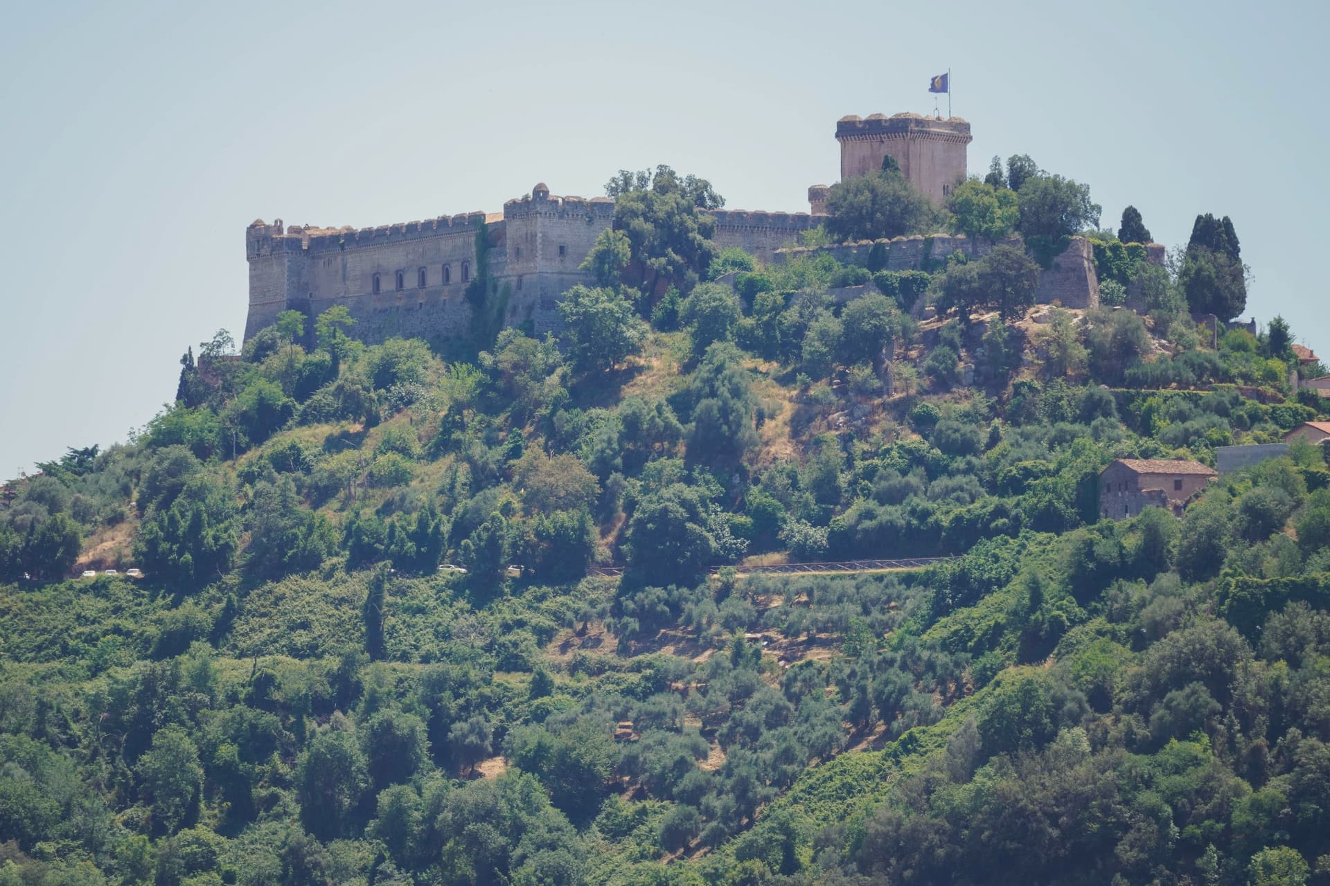
Sermoneta sits at 257 meters on a spur of the Monti Lepini, above what was once the Pontine Marshes and is now reclaimed plain. The Annibaldi held the site in the 13th century until 1297, when Pietro Caetani, nephew of Pope Boniface VIII, bought it and made it the seat of one of the great medieval Roman families.
The walled village climbs from the Porta Annibaldi up through narrow lanes to the fortress at its head, the two parts of the town, lower gate and upper stronghold, built as one continuous piece of Caetani-era stone. Below, in the valley, the family later turned an abandoned settlement into a garden, so the plain that emptied of people in the 17th century became, in the 20th, a cultivated ruin looked after by the same family that once ruled the hill above it.
The town on the spur and the garden in the plain are the same story told at two elevations: a family that built to hold ground in the medieval centuries, then returned centuries later to plant over what the land had reclaimed.
What to see in Sermoneta
- Castello Caetani. The Maschio tower stands beside the smaller Maschietto, and the Camere Pinte hold their frescoes from the 1470s. Charles V lodged here in April 1536 with 1,000 knights and 4,000 infantry.
- Giardino di Ninfa. The garden grows over stone that was once a working medieval town, abandoned in the 17th century after malaria emptied the plain; walls and a former church line survive among the planting.
- Cattedrale di Santa Maria Assunta. Romanesque collegiate church from the 13th century inside the walls, with a 14th-century panel of the Madonna by Benozzo Gozzoli.
How to get to Sermoneta
It has its own railway station. Latina is about 23 min away by road. The full route from Rome.
Our tip
April through June and September through October are when Sermoneta sits at its best. The Lepini spur catches a breeze the Pontine Plain below never gets in summer. April and May are also the months to see the Giardino di Ninfa in flower; the garden opens only on selected weekends from April to early November.
Why visit Capranica
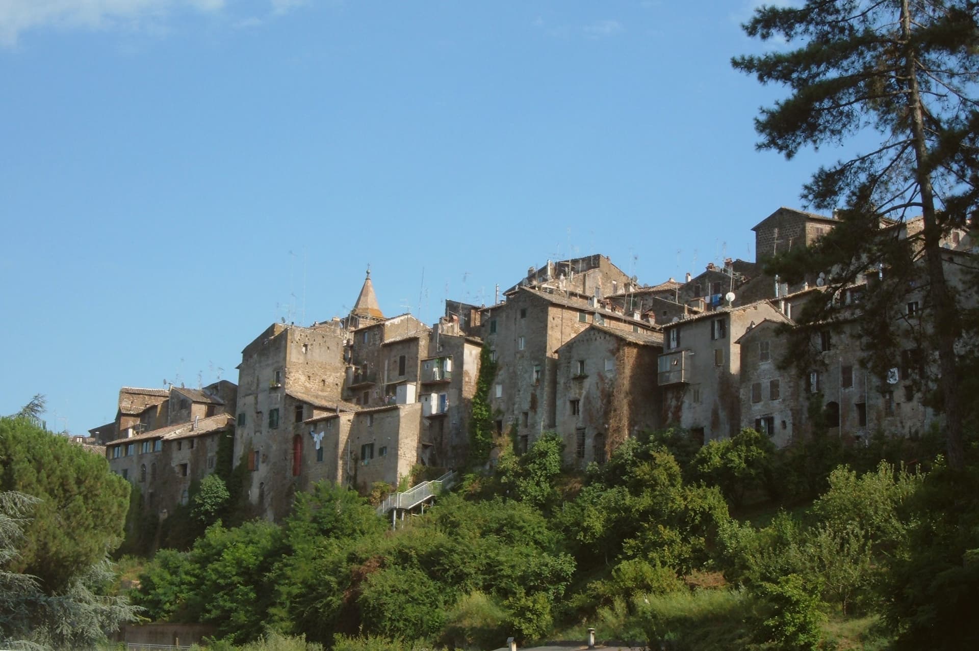
Capranica sits in the Tuscia at the fifty-fifth kilometer of the Via Cassia, on a hill overlooking the Sutri valley between Lake Bracciano and Lake Vico. The Etruscans worked this ground; the medieval borgo grew along the Cassia after the road was rebuilt in the second century BC.
The Anguillara family appeared in 1305 and held the town through most of the fourteenth century. In 1337, under Orso degli Anguillara, Francesco Petrarca stayed here on his way south, the moment local memory still attaches to the place.
Castrovecchio is the oldest quarter, a wedge of stone houses and stepped streets above the Castello degli Anguillara. The town is one of the Italian comuni crossed by the Via Francigena, with a marked stage running north toward Sutri and Vetralla.
Hazelnut groves cover the surrounding slopes; Capranica is a member of the Città della Nocciola network and supplies the Tonda Gentile Romana, the local DOP variety.
What to see in Capranica
- Castello degli Anguillara. Medieval fortress at the head of Castrovecchio, seat of the Anguillara family from 1305 and the place Petrarch stayed in 1337.
- Castrovecchio. Oldest quarter of the town, a wedge of stone houses and stepped streets rising above the Cassia toward the castle.
- Chiesa di San Francesco. Fourteenth-century Franciscan church on the edge of Castrovecchio, with fresco fragments and Anguillara family tombs.
How to get to Capranica
It has its own railway station. Roma is about 1 h 12 min away by road. The full route from Rome.
✷ We have written about Capranica
“So a borgo like Capranica, and especially Capranica, has nothing to offer except this vibe. After darkness sets, the town becomes the same medieval village that it was 500 years ago. The only difference is the electric lighting and some satellite dishes on some roofs.”
Read our piece on Capranica →Capranica | The stop on the journey
Our tip
April through June and September into October are the walking months in the Tuscia, when the hazelnut groves are green and the Cassia is light. July and August push the slopes into the low thirties; the medieval centro storico holds shade well enough, but afternoons stay quiet. The hazelnut harvest runs through late August and September and the air around the town smells of toasted nuts for weeks.
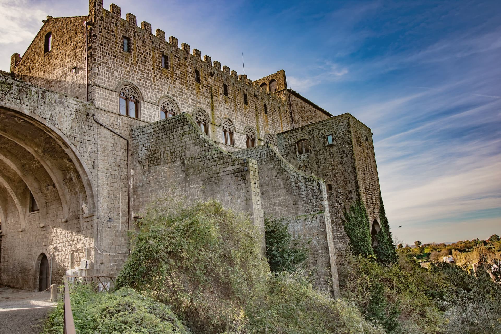
Why visit Viterbo
Viterbo sits at 326 meters in the Tuscia, surrounded by the volcanic Cimini hills and the thermal springs the Etruscans and Romans already used. The city became the favorite papal residence under Eugene III in the twelfth century; between 1257 and 1281, five popes were elected here, and the conclave of 1268-1271 ran nearly three years, the longest in Church history.
To end it, the city's people locked the cardinals inside the Palazzo dei Papi, tore the roof off, and reduced their rations. The decisive conclave is still the reason the word means a place under lock and key.
The San Pellegrino quarter is the largest continuous medieval district in central Italy, with profferli, the external stone staircases that climb to first-floor doorways. The Terme dei Papi outside the walls still draws sulfur-water bathers.
On 3 September the Macchina di Santa Rosa, a thirty-meter illuminated tower weighing five tons, is carried through the streets by a hundred Facchini, a tradition listed by UNESCO since 2013.
What to see in Viterbo
- Palazzo dei Papi. Thirteenth-century papal palace with Gothic loggia and the Sala del Conclave, where the 1268-1271 conclave ran for nearly three years.
- Quartiere San Pellegrino. Largest continuous medieval quarter in central Italy, with stone profferli staircases, towers and the Piazza San Pellegrino.
- Terme dei Papi. Thermal complex outside the walls, fed by sulfur springs used since Etruscan times and named for the medieval popes.
How to get to Viterbo
It has its own railway station. Terni is about 58 min away by road. The full route from Rome.
✷ We have written about Viterbo
“The statues are hundreds of years old. The forest is even older. Everything looks as if it’s been left alone for centuries. Nothing is constructed for the show. There are some new chairs, and a pathway that seems newly constructed, with ramps on the hillside to keep you from falling off, but that is about it.”
Read our piece on Viterbo →Viterbo and Bomarzo | The Monsters Are Not in the Garden
Our tip
Viterbo works as a year-round destination because of the thermal springs. April through June and September into October give the easiest combination of clear weather, open monuments and warm pool water. July and August push the medieval quarter into the mid-thirties; the Macchina di Santa Rosa on 3 September is the single largest event in the calendar and the streets stay packed for the night.
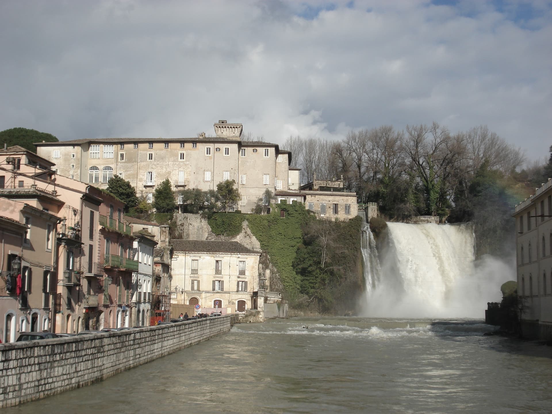
Why visit Isola del Liri
Isola del Liri is built on an actual island, where the Liri river splits into two arms and the two arms fall over a limestone shelf into the lower valley. The Cascata Grande is 27 meters high and lands inside the historic center, fifty meters from the Castello Boncompagni-Viscogliosi, the fortified palace above it.
The second fall, Cascata del Valcatoio, is partly diverted for hydropower. From the 19th century the river ran the paper mills, felt mills and wool mills that gave the town the name Manchester of Italy: the Fibreno-Lefebvre mill exported to North America.
The paper industry collapsed in the late 20th century. The town responded with the Liri Blues Festival, started in 1988 by a local businessman, Luciano Duro, to draw attention back to a place that had lost its trade; it became one of Europe's longer-running free blues festivals.
The Cammino di San Benedetto walking route passes through.
What to see in Isola del Liri
- Cascata Grande. 27-meter waterfall in the center of town, the Liri river dropping over a limestone shelf next to the castle.
- Cascata del Valcatoio. Second urban waterfall on the right arm of the Liri, partially diverted for hydroelectric production.
- Castello Boncompagni-Viscogliosi. Fortified palace from the 14th century above the Cascata Grande, residence of the Boncompagni-Ludovisi from the 16th century.
How to get to Isola del Liri
It has its own railway station. Latina is about 1 h 20 min away by road. The full route from Rome.
Our tip
April through June is when the Liri runs hardest after the spring melt and the Cascata Grande is at maximum volume. July is the festival month: the Liri Blues runs across several July evenings on stages in the centro storico and on the riverbanks. August stays hot in the Liri valley, the town thins out for the coast.
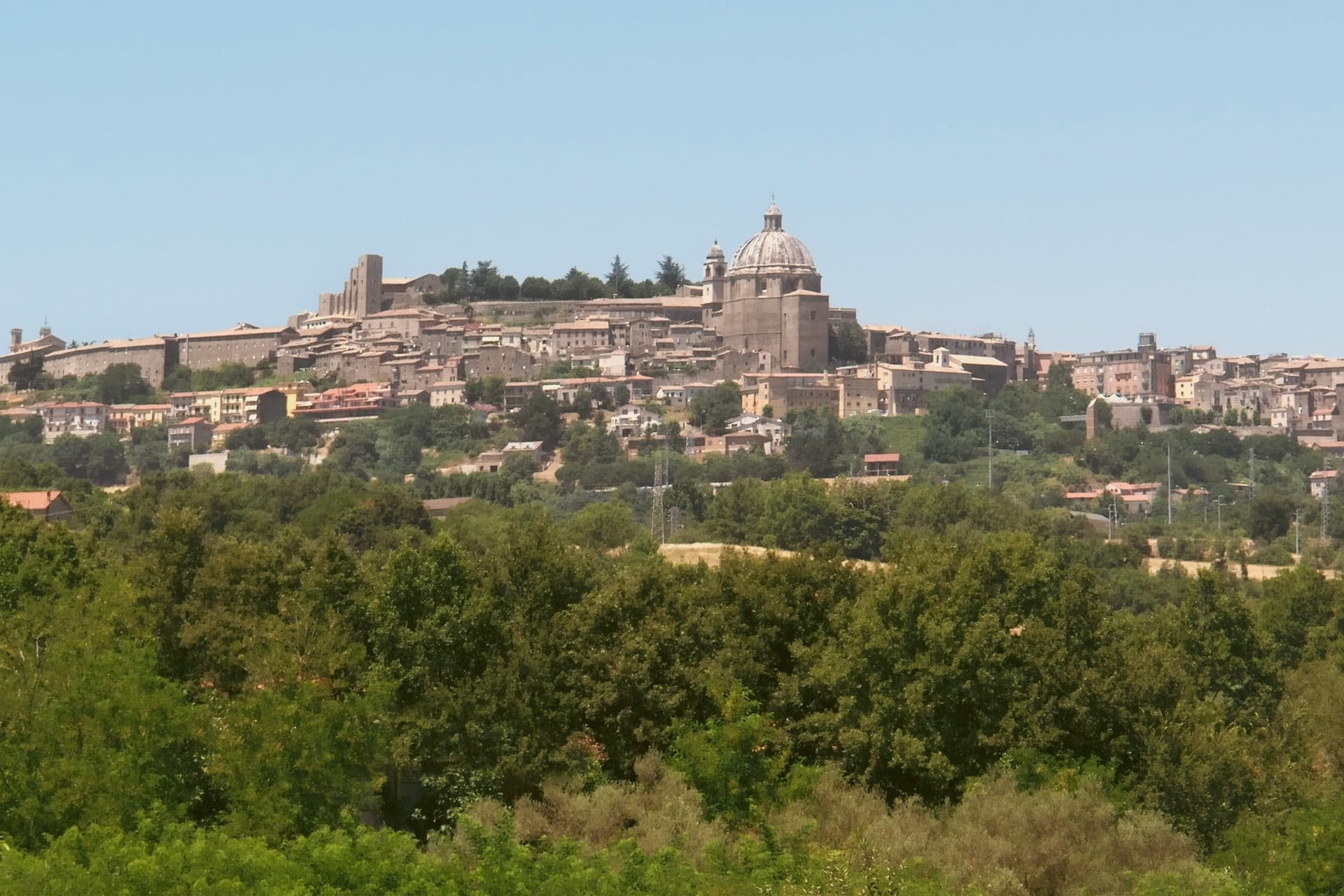
Why visit Montefiascone
The town sits on the southeastern rim of a volcanic crater, about a hundred kilometers north of Rome, with the fortress at its highest point and the rest of the settlement built down the slope from there. The basilica stands just outside the walls at the lower end of that slope, separate enough from the fortress and the cathedral that the three read as three distinct centers of the town rather than one monument with satellites.
The wine takes its name from the same twelfth-century legend that put a German bishop's prelate on the road marking inn doors, and that bishop is the one buried in the basilica below, which ties the town's best-known export to a specific grave rather than to a floating story. The pilgrim route passes through on its way between Bolsena and Viterbo, so the hill that holds a papal summer residence and a wine legend was also, and still is, a stop on a much longer walk to Rome.
What the place adds up to is a small hill town where a fortress, a two-story church, and a road to somewhere else all sit within a short walk of one another, each one a different kind of stop on the same hill.
What to see in Montefiascone
- Rocca dei Papi. The fortress walls enclose the summit; the tower stair is narrow and gives out onto the panorama at once, the water filling the whole crater rim below.
- Basilica di San Flaviano. Two churches stacked on each other, the lower nave older and darker, the upper one built two centuries later and open to more light. The frescoes are original to the walls, not restored copies, and the German bishop Johannes Defuk is buried here.
- Cattedrale di Santa Margherita. The octagonal dome is 27 meters across, third largest in Italy by base diameter, finished in the late sixteenth century. It dominates the town's roofline the way the fortress dominates its summit.
How to get to Montefiascone
It has its own railway station. Terni is about 1 h 15 min away by road. The full route from Rome.
Our tip
April through June and September through October are the strong months. The hilltop position keeps Montefiascone cooler than Viterbo down the road, and the air over the lake is clearest in spring and autumn. July and August reach the low thirties; afternoons in the centro storico thin out between two and five.
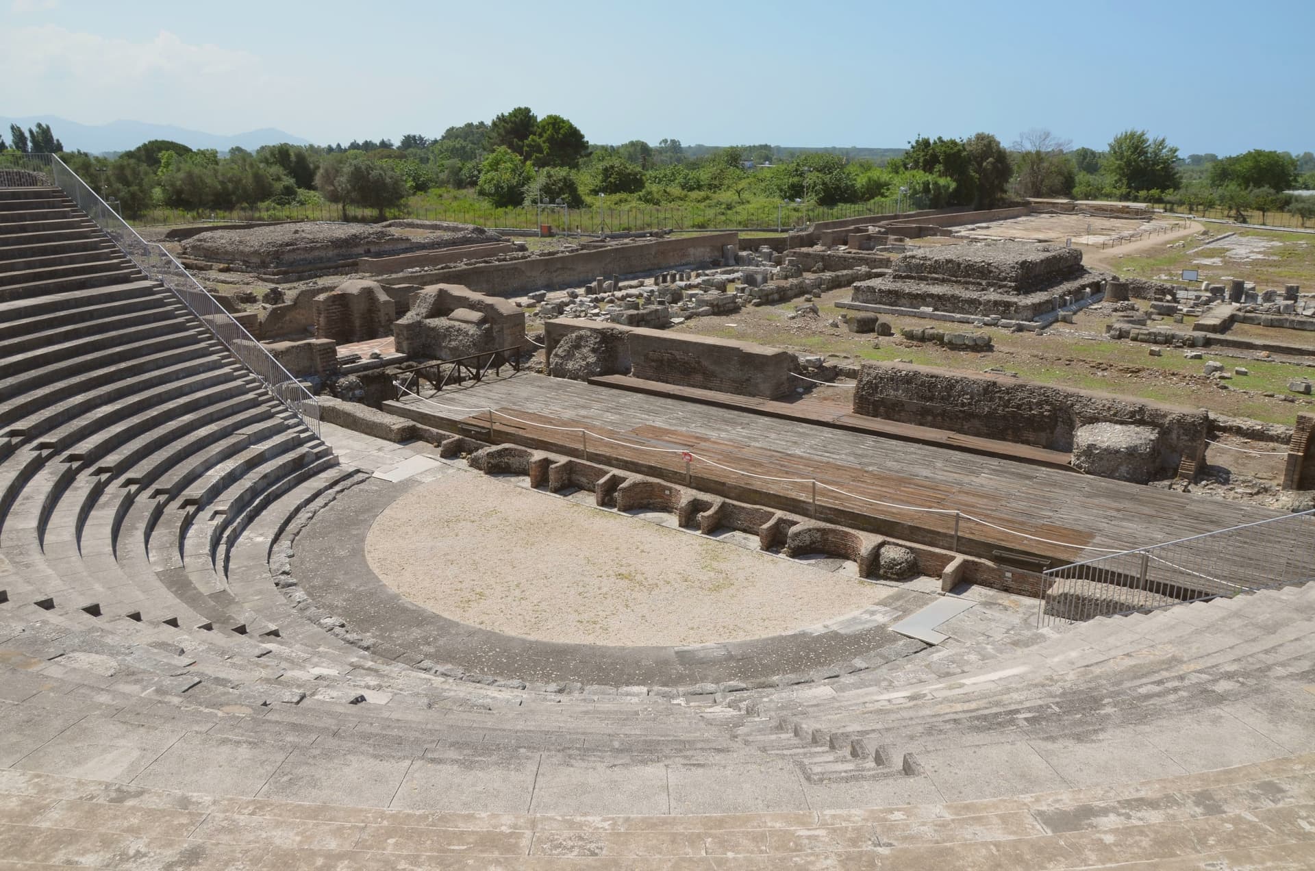
Why visit Minturno
Minturno sits on a hill at 140 meters above the right bank of the Garigliano, with the Scauri and Marina coast running down from it to the Tyrrhenian. The two halves of the comune answer different needs and different centuries: the river mouth held the Roman colony and its flat, engineered plain, while the hill above took over as the medieval settlement once malaria and Saracen raids made the lowland unsafe to live on.
The castle at the center of the upper town carries that shift in its own fabric, with a ninth-century core built up over time by later lords. The coast has its own separate history again, flattened in 1943-44 as a battlefield on the German defensive line and rebuilt afterward around the bathing village of Scauri.
Olive country runs inland behind all of this, and the comune belongs to the Città dell'Olio network. What the town amounts to, then, is three settlements stacked in time rather than one: a Roman river port, a medieval hill town built in retreat from it, and a rebuilt postwar coast, each still legible in its own part of the comune.
What to see in Minturno
- Parco Archeologico di Minturnae. Theater, forum, aqueduct and amphitheater standing together at the river mouth, on the stretch of the Via Appia that once ran through the colony.
- Castello Baronale. Hilltop castle in the centro storico, its core built in the ninth century and expanded in stages by the Caetani and the Carafa through the medieval period.
- Basilica di San Pietro Apostolo. Basilica in the upper town holding a cosmatesque pulpit and Easter candlestick, both worked in the twelfth and thirteenth centuries.
How to get to Minturno
It has its own railway station. Napoli is about 1 h 19 min away by road. The full route from Naples.
Our tip
May through September is the season on the Garigliano coast. June and September give the best balance of warm sea and emptier beaches; July and August fill with Roman and Neapolitan weekenders and the seaside road slows. October is still warm enough to swim on calm days, and the inland olive harvest in late October and November is the busiest moment in the upper town.
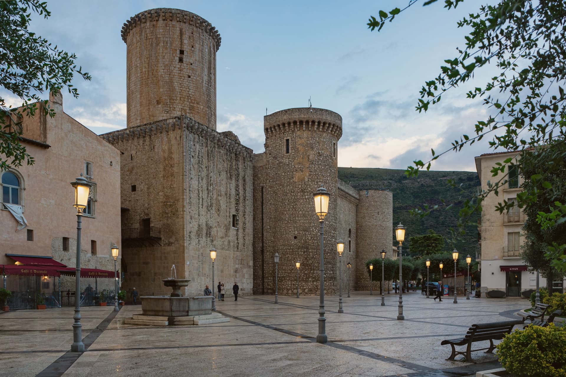
Why visit Fondi
Fondi sits in the middle of its own plain, the Piana di Fondi, a fertile basin between the Ausoni and Aurunci mountains halfway between Rome and Naples, with the Tyrrhenian only a few kilometers south. The Via Appia ran straight through it, and the town has been here since 338 BC, when its inhabitants gained limited Roman citizenship after the Latin War.
The old walls that once ringed the settlement still show at the base of the castle in the center, and inside those same walls sits the Giudea, the former Jewish quarter, so the medieval town and the Roman one occupy the same footprint rather than sitting apart. South of the built-up center the plain gives way to the Lago di Fondi, a brackish lake cut off from the sea by a sand bar and worked for fishing rather than farming.
The fields that surround all of this now feed the Mercato Ortofrutticolo, moving millions of tons of produce a year out of a basin whose flatness once made it easy to defend and now makes it easy to farm.
What to see in Fondi
- Castello Baronale Caetani. Round towers over 30 meters high in the centro storico, raised on Roman walls that still form part of the base.
- Palazzo Caetani-Colonna. Adjoining noble residence built into the castle complex, the seat of Giulia Gonzaga's court between 1526 and 1534.
- Cattedrale di San Pietro Apostolo. Romanesque-Gothic cathedral with a 13th-century pulpit and the throne where the antipope Clement VII was elected.
How to get to Fondi
It has its own railway station. Latina is about 1 h 8 min away by road. The full route from Naples.
Our tip
May through September is when the plain works best for visitors: the lake, the sea, and the centro storico all reachable in a single day, evenings warm enough for late dinners on the piazzas. July and August push past thirty-two degrees and the plain has no relief from heat until the sea breeze comes in. April, October and early November are dry and quiet, the citrus groves heavy, the wholesale market running at full pace.
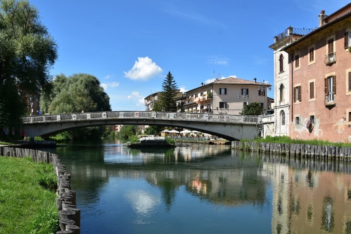
Why visit Rieti
Rieti stands on a low rise at the edge of the Piana Reatina, the plain the Romans made when they drained the Lacus Velinus and sent its water over the cliff at Marmore. Medieval walls still close one side of the centro storico, and Via Roma runs down to the Velino and the stumps of the Roman bridge that carried the Via Salaria into town.
A marker in Piazza San Rufo stands for what Rieti has claimed for centuries: the umbilicus Italiae, the center of Italy. Popes stayed here often enough to build a palace beside the cathedral, and in 1234 Gregory IX canonized Saint Dominic inside it.
Saint Francis spent long stretches in the valley, which is why it is called the Valle Santa; the sanctuaries of Fonte Colombo and La Foresta are both in the comune. Above the plain, Monte Terminillo rises to 2,217 meters and is known as Rome's mountain.
In 2021 the town offered remote workers half their rent, up to 200 euros a month, to come and live here.
What to see in Rieti
- Cattedrale di Santa Maria Assunta. Romanesque outside and Baroque inside, built between 1109 and 1225 with a bell tower of 1252. Pope Gregory IX canonized Saint Dominic here in 1234.
- Palazzo Papale. The bishops' palace raised in 1283 for the papal court beside the cathedral, with a vaulted loggia at street level; it now holds part of the diocesan museum.
- Piazza San Rufo. A small square in the old town with a marker for the traditional center of Italy, the umbilicus Italiae.
How to get to Rieti
It has its own railway station. Terni is about 39 min away by road. The full route from Rome.
Our tip
April to October suits Rieti. Spring turns the plain green and fills the Velino; June is the Giugno Antoniano, which ends in the Processione dei Ceri, and late July brings the Palio della Tinozza, races in wooden tubs on the river. Summer is warm in town at 405 meters and cool on Terminillo, where the high trails open.
Read a sample letter
Todi | The Beverly Hills of Umbria
An unusually global town on a clay hill
Letters from the towns we visit. Free.
The button takes you to the letter's own page on Substack, where you leave your email. About the letter
More from Anywhere Italy
- The best hill towns on a walking route in LazioLaziohill townon a walking route9 towns · smallest 5,266 residents
- The best towns with a serious restaurant that sit on a walking route in LazioLazioon a walking routeserious restaurant7 towns · smallest 5,266 residents
- The best towns you can reach by train that have a serious restaurant in LazioLazioby trainserious restaurant8 towns · smallest 6,684 residents
- The 8 best towns inside a nature park that sit on a walking route in LazioLazioinside a parkon a walking route8 towns · smallest 396 residents
- The best towns on a walking route in the province of ViterboViterbo provinceon a walking route6 towns · smallest 3,708 residents
- The best towns on the Cammino di San Benedetto in LazioLazioon a walking route6 towns · smallest 266 residents