
The best towns on a walking route in the province of Viterbo

Northern Lazio is built out of tufa, the soft volcanic stone that cuts like cheese and weathers to grey and honey, and the walking here runs through it: sunken roads carved by the Etruscans, oak woods, olive terraces, hazel groves that turn the ground bare and open underfoot. The Via Francigena comes down from Tuscany into the province of Viterbo and skirts a lake that sits in an old crater, wide enough that the far shore goes blue. Spring and October are the walking seasons, when the light is long and the ground firm. Food along the route is lake fish, coregone and eel, lentils from the volcanic soil, pecorino, and the local pizza cooked on hot stone in wood ovens. Beds are cheap where pilgrim hostels operate, and towns keep a bar open early for the ones leaving at dawn.
Most walkers who plan an Italian long-distance route plan the Tuscan section instead, and follow the Francigena through the Val d'Orcia and out past Siena, where the paths are waymarked to within an inch and the agriturismi book out months ahead. It is a fine stretch, and it carries the traffic to prove it: coach groups on the ridge above San Quirico, a queue for the one restaurant in a village of stone farmhouses. The postcard hills have become the whole idea of walking in Italy for a lot of people. Costs on that section have risen accordingly.
The route does not stop at the regional border. It carries on south into the province of Viterbo, through the crater rim above the lake, past a papal fortress and down into gorges where the road is cut below head height and the rock face holds carved tombs and a church hollowed straight out of the cliff. Fewer people walk this part, partly because it is closer to Rome and treated as the last dull push, which it is not. These are the towns on those stages, each one a place to stop, eat and sleep before the next day out.
Of the 16 communes we have mapped in the province of Viterbo, 6 qualify as towns on a walking route: each is a stage on one of the long historic walking routes. The smallest, Bolsena, has 3,708 residents.
Two more lists worth reading alongside this one: The best hill towns on a walking route in Lazio and The best towns that eat well in the province of Viterbo.
Bolsena
Why visit Bolsena
Bolsena stands at 350 meters on the eastern shore of Lake Bolsena, the largest volcanic lake in Europe at 114 square kilometers. The site sits on the old Etruscan town of Volsinii, razed by the Romans in 265 BC; the survivors were resettled here as Volsinii Novi.
In 1263 a Bohemian priest, doubting the doctrine of transubstantiation, was celebrating mass in the church when the host bled onto the corporal. The cloth was carried to Urbino, then to Orvieto, and Pope Urban IV extended the feast of Corpus Domini to the universal Church the following year.
The Basilica di Santa Cristina, where the miracle is said to have occurred, holds the original altar stone and an early Christian catacomb. The Rocca Monaldeschi della Cervara, a fourteenth-century fortress of the Orvietan family, dominates the upper town and houses the Museo Territoriale del Lago di Bolsena.
On Corpus Domini the streets fill with floral mosaics for the Infioritalia network.
What to see in Bolsena
- Basilica di Santa Cristina. Eleventh-century basilica with the altar stone of the 1263 Eucharistic miracle and an early Christian catacomb beneath the apse.
- Rocca Monaldeschi della Cervara. Fourteenth-century fortress of the Orvietan Monaldeschi, dominating the upper town and housing the Museo Territoriale.
- Lago di Bolsena. Largest volcanic lake in Europe at 114 square kilometers, with two small islands and a continuous swimming and fishing tradition.
How to get to Bolsena
Terni is roughly 81 minutes away by road.
Our tip
April through June and September into October are the months on the lake, when the water is clear, the chestnut woods on the volcanic slopes are full, and the swimming temperatures hold. The Infiorata for Corpus Domini, usually in late May or June, is the most photographed weekend. July and August push the basin into the low thirties; the lake stays cool enough to swim through the heat and the upper town keeps shade between the Rocca and Santa Cristina. Sagra delle Bontà falls in August.
Acquapendente
Why visit Acquapendente
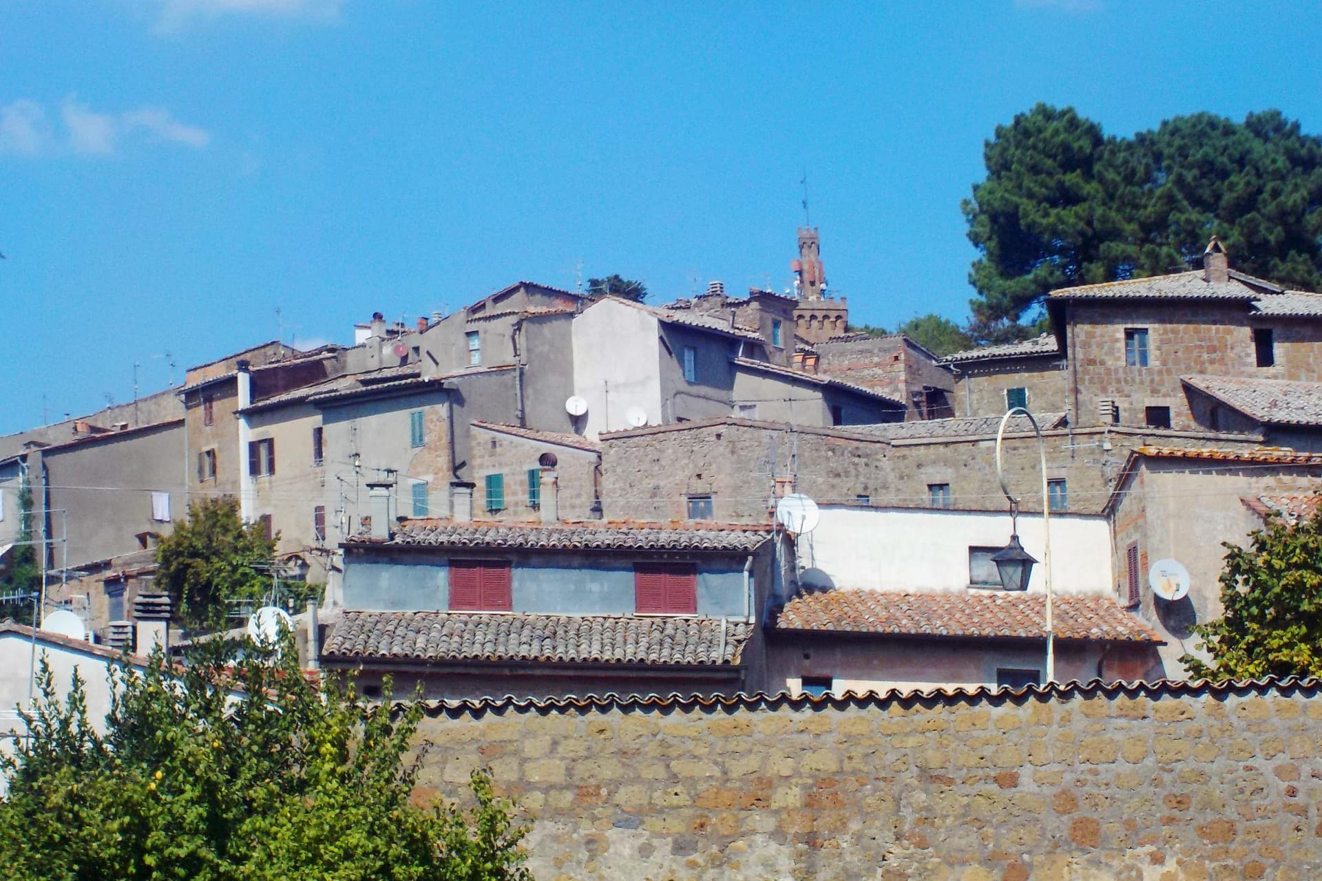
Acquapendente sits at the northern edge of Lazio, where the Paglia river marks the boundary with Tuscany. The name first appears in a document of Emperor Otto I dated 964, taken from the small waterfalls that drop the river toward the plain.
The town grew up along the pilgrim road that runs north to south through it, and the church at its center, with its Romanesque crypt and sacellum copying the tomb in Jerusalem, gave the settlement its old nickname, the Green Jerusalem. The built-up center holds the basilica and the streets that carry the floral mosaics each May, while outward from it the town's territory stretches to two very different edges: the frazione of Torre Alfina to the north, with its own restored castle and a listing among the country's most beautiful villages, and the forest of the Monte Rufeno reserve beyond that, nearly 3,000 hectares of oak and beech reached by marked trails.
A river border, a pilgrim route, and a nickname earned by a copied tomb: together they describe a town shaped less by what it produced than by what passed through it and what was built to receive those travelers.
What to see in Acquapendente
- Basilica Concattedrale del Santo Sepolcro. Twenty-four columns divide the crypt into nine naves. The sacellum sits carved into the rock at the center, a form pilgrims would have recognized as a copy of the tomb it names.
- Pugnaloni. Panels built from flower petals pressed into wooden frames, carried through the streets by each quarter of the town on the third Sunday of May.
- Castello di Torre Alfina. Neo-Gothic restored fortress in the frazione of Torre Alfina, itself listed among I Borghi più belli d'Italia.
How to get to Acquapendente
Terni is roughly 96 minutes away by road.
Our tip
April through June and September into October are the months for walking the Via Francigena and the trails of Monte Rufeno. The Pugnaloni festival fills the streets on the third Sunday of May and is the single best weekend in the calendar. July and August touch the mid-thirties in the Paglia valley; pilgrims start earlier and finish by mid-morning.
Sutri
Why visit Sutri
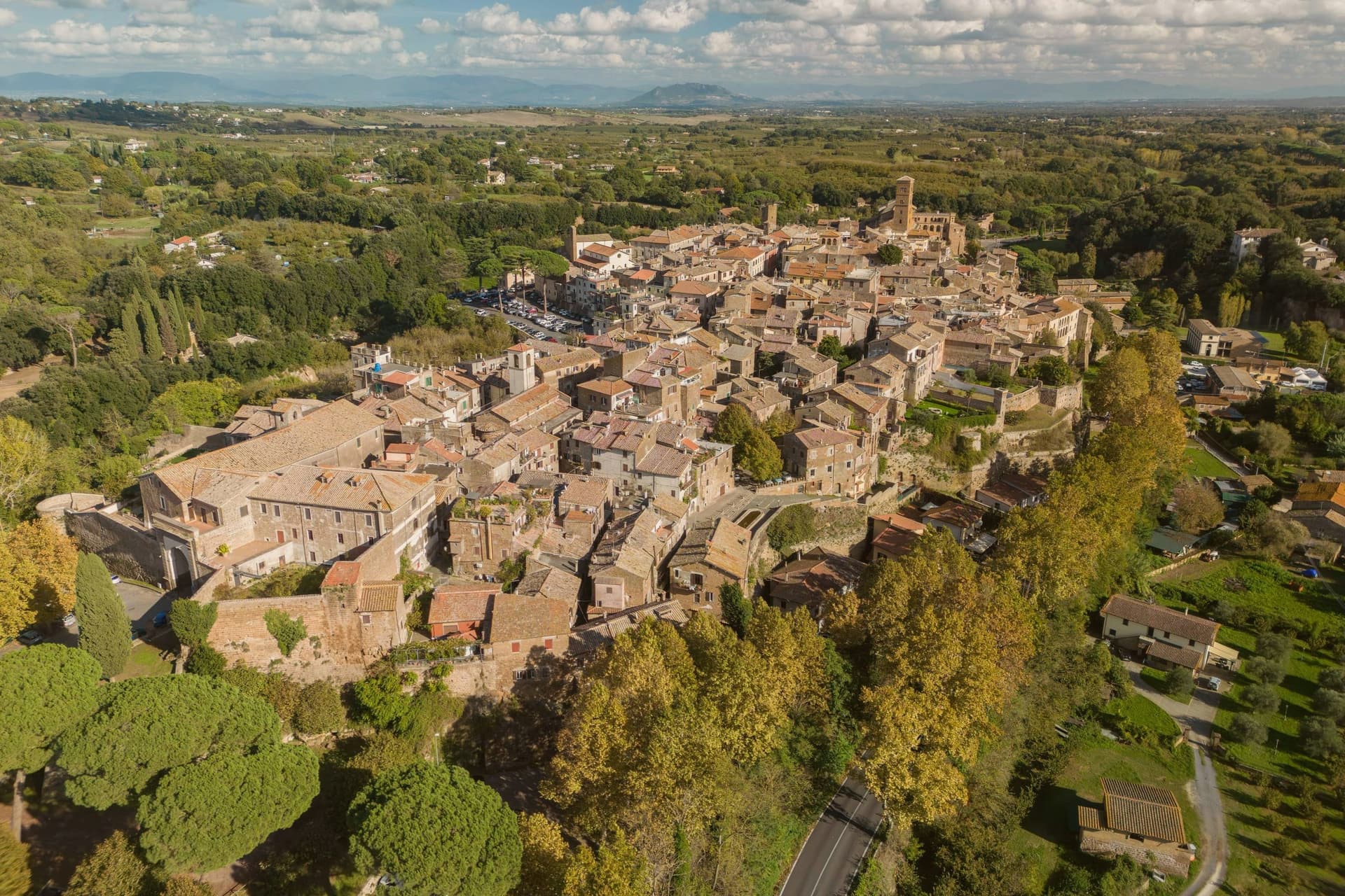
Sutri sits at 291 meters on a narrow tuff spur, fifty kilometers north of Rome on the old road linking the two. The Etruscans held it before the Romans took it in the fourth century BC, and it was among the colonies that refused further military contributions to Rome during the Second Punic War in 209 BC.
The rock-cut monuments that define the town, the arena, the temple turned sanctuary, the chamber tombs, all come from the same tuff spur the town is built on, so the stone that gives Sutri its ground is also what its Etruscan and Roman residents carved into. The high ground above, where the eighteenth-century villa and its gardens sit, looks down over that older excavated town rather than sitting apart from it.
Local tradition ties the town's beans to Charlemagne, who passed through and was supposedly relieved of an attack of gout by Sutri's variety. What the place adds up to is a settlement where the town and its excavation are the same rock: nothing was built so much as removed.
What to see in Sutri
- Anfiteatro Romano. Elliptical amphitheater about forty-nine by forty meters, carved directly out of the tuff rock rather than built on it.
- Mithraeum / Madonna del Parto. Roman temple to Mithras hewn into the tuff and reused as a Marian sanctuary, accessed through the medieval rock-cut church.
- Necropoli rupestre. Etruscan necropolis with dozens of rock-cut chamber tombs in the cliff face along the Via Cassia.
How to get to Sutri
Roma is roughly 57 minutes away by road.
Our tip
April through June and September into October are the best months in the tuff country, when the amphitheater grass is green and the gardens of Villa Savorelli are open. July and August push afternoons into the mid-thirties; the rock-cut Mithraeum and tomb chambers stay cool and become the part of the visit that doesn't need to be timed. November through March is quiet. Sagra del Fagiolo falls in August.
Capranica
Why visit Capranica
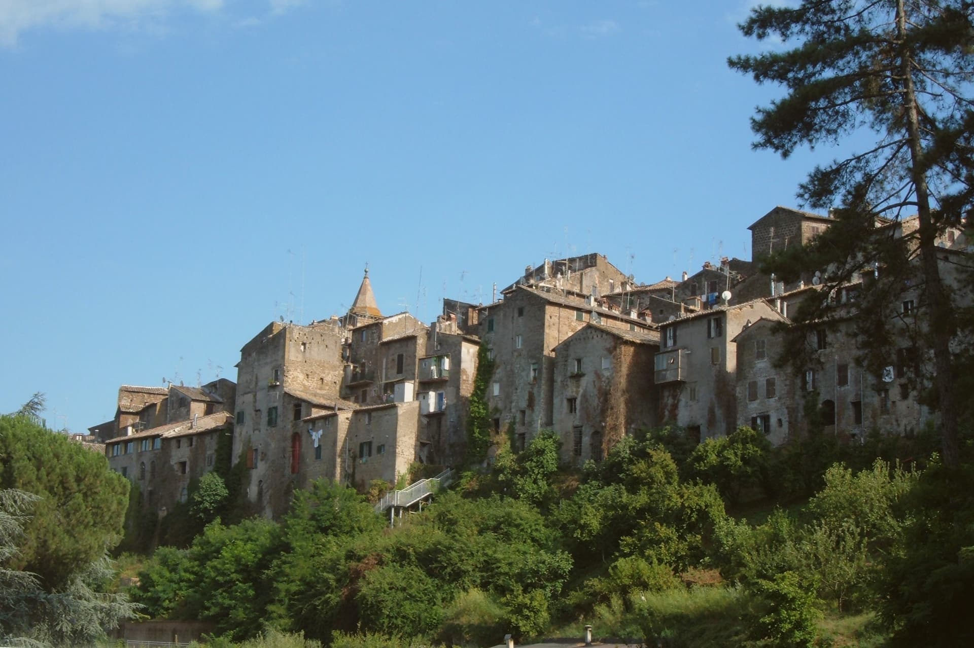
Capranica sits in the Tuscia at the fifty-fifth kilometer of the Via Cassia, on a hill overlooking the Sutri valley between Lake Bracciano and Lake Vico. The Etruscans worked this ground; the medieval borgo grew along the Cassia after the road was rebuilt in the second century BC.
The Anguillara family appeared in 1305 and held the town through most of the fourteenth century. In 1337, under Orso degli Anguillara, Francesco Petrarca stayed here on his way south, the moment local memory still attaches to the place.
Castrovecchio is the oldest quarter, a wedge of stone houses and stepped streets above the Castello degli Anguillara. The town is one of the Italian comuni crossed by the Via Francigena, with a marked stage running north toward Sutri and Vetralla.
Hazelnut groves cover the surrounding slopes; Capranica is a member of the Città della Nocciola network and supplies the Tonda Gentile Romana, the local DOP variety.
What to see in Capranica
- Castello degli Anguillara. Medieval fortress at the head of Castrovecchio, seat of the Anguillara family from 1305 and the place Petrarch stayed in 1337.
- Castrovecchio. Oldest quarter of the town, a wedge of stone houses and stepped streets rising above the Cassia toward the castle.
- Chiesa di San Francesco. Fourteenth-century Franciscan church on the edge of Castrovecchio, with fresco fragments and Anguillara family tombs.
How to get to Capranica
There is a railway station in the town, so you can arrive without a car and never need one while you are here. Roma is roughly 72 minutes away by road.
✷ We have written about Capranica
“So a borgo like Capranica, and especially Capranica, has nothing to offer except this vibe. After darkness sets, the town becomes the same medieval village that it was 500 years ago. The only difference is the electric lighting and some satellite dishes on some roofs.”
Read our piece on Capranica →Capranica | The stop on the journey
Our tip
April through June and September into October are the walking months in the Tuscia, when the hazelnut groves are green and the Cassia is light. July and August push the slopes into the low thirties; the medieval centro storico holds shade well enough, but afternoons stay quiet. The hazelnut harvest runs through late August and September and the air around the town smells of toasted nuts for weeks. Festeggiamenti in Onore di San Terenziano falls in August.
Montefiascone
Why visit Montefiascone
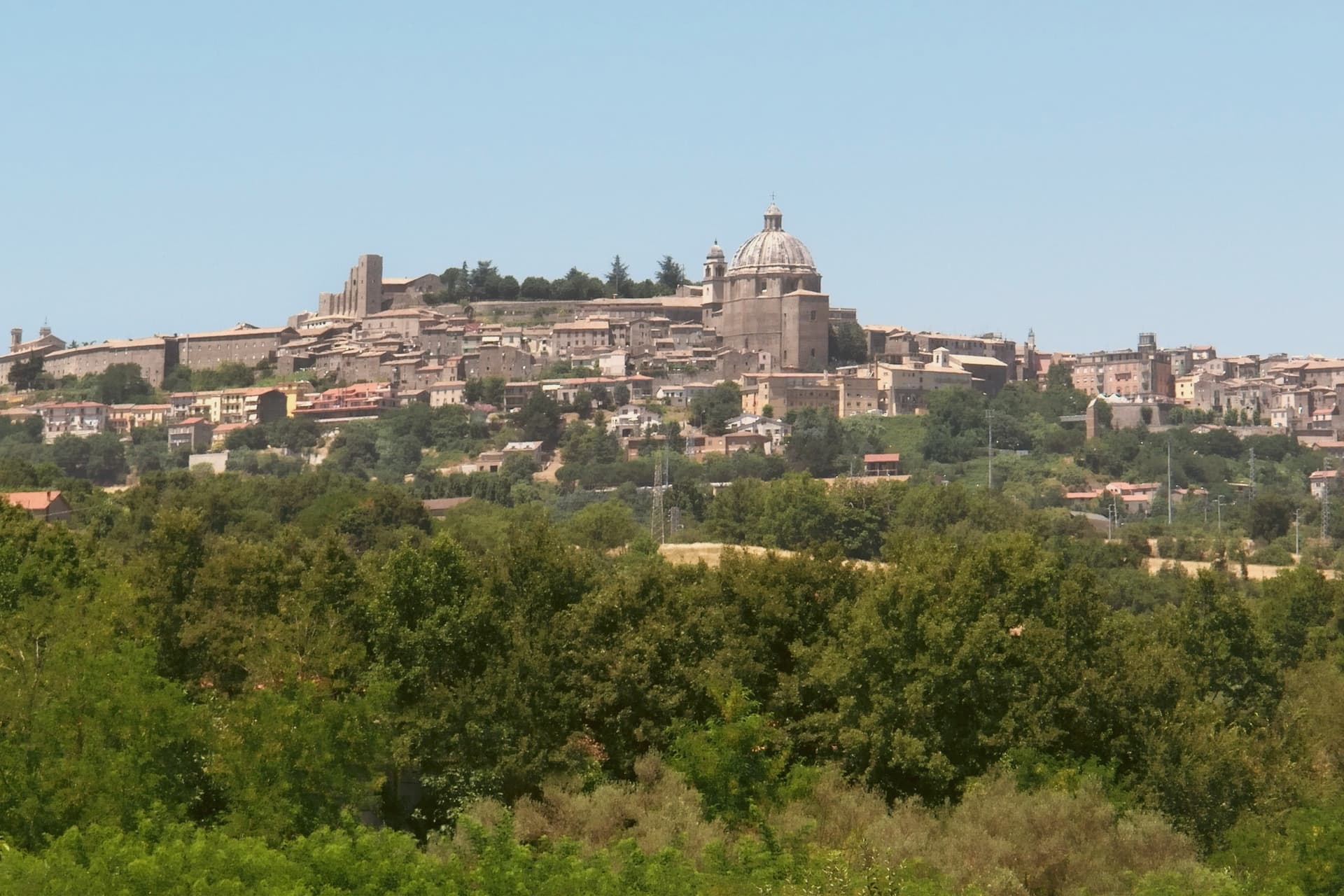
The town sits on the southeastern rim of a volcanic crater, about a hundred kilometers north of Rome, with the fortress at its highest point and the rest of the settlement built down the slope from there. The basilica stands just outside the walls at the lower end of that slope, separate enough from the fortress and the cathedral that the three read as three distinct centers of the town rather than one monument with satellites.
The wine takes its name from the same twelfth-century legend that put a German bishop's prelate on the road marking inn doors, and that bishop is the one buried in the basilica below, which ties the town's best-known export to a specific grave rather than to a floating story. The pilgrim route passes through on its way between Bolsena and Viterbo, so the hill that holds a papal summer residence and a wine legend was also, and still is, a stop on a much longer walk to Rome.
What the place adds up to is a small hill town where a fortress, a two-story church, and a road to somewhere else all sit within a short walk of one another, each one a different kind of stop on the same hill.
What to see in Montefiascone
- Rocca dei Papi. The fortress walls enclose the summit; the tower stair is narrow and gives out onto the panorama at once, the water filling the whole crater rim below.
- Basilica di San Flaviano. Two churches stacked on each other, the lower nave older and darker, the upper one built two centuries later and open to more light. The frescoes are original to the walls, not restored copies, and the German bishop Johannes Defuk is buried here.
- Cattedrale di Santa Margherita. The octagonal dome is 27 meters across, third largest in Italy by base diameter, finished in the late sixteenth century. It dominates the town's roofline the way the fortress dominates its summit.
How to get to Montefiascone
There is a railway station in the town, so you can arrive without a car and never need one while you are here. Terni is roughly 75 minutes away by road.
Our tip
April through June and September through October are the strong months. The hilltop position keeps Montefiascone cooler than Viterbo down the road, and the air over the lake is clearest in spring and autumn. July and August reach the low thirties; afternoons in the centro storico thin out between two and five. Fiera Del Vino falls in August.
Viterbo
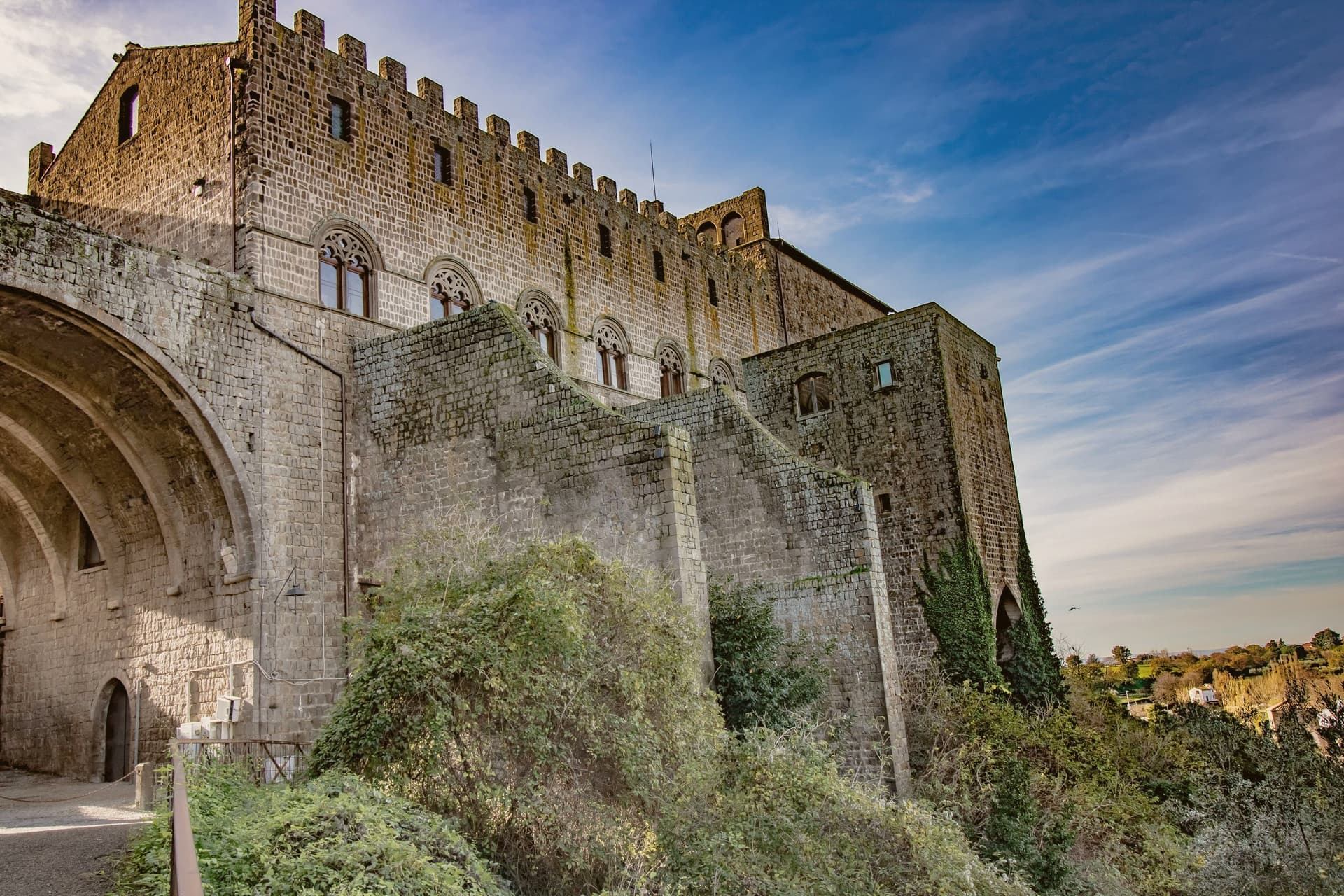
Why visit Viterbo
Viterbo sits at 326 meters in the Tuscia, surrounded by the volcanic Cimini hills and the thermal springs the Etruscans and Romans already used. The city became the favourite papal residence under Eugene III in the twelfth century; between 1257 and 1281, five popes were elected here, and the conclave of 1268-1271 ran nearly three years, the longest in Church history.
To end it, the city's people locked the cardinals inside the Palazzo dei Papi, tore the roof off, and reduced their rations. The decisive conclave is still the reason the word means a place under lock and key.
The San Pellegrino quarter is the largest continuous medieval district in central Italy, with profferli, the external stone staircases that climb to first-floor doorways. The Terme dei Papi outside the walls still draws sulfur-water bathers.
On 3 September the Macchina di Santa Rosa, a thirty-meter illuminated tower weighing five tons, is carried through the streets by a hundred Facchini, a tradition listed by UNESCO since 2013.
What to see in Viterbo
- Palazzo dei Papi. Thirteenth-century papal palace with Gothic loggia and the Sala del Conclave, where the 1268-1271 conclave ran for nearly three years.
- Quartiere San Pellegrino. Largest continuous medieval quarter in central Italy, with stone profferli staircases, towers and the Piazza San Pellegrino.
- Terme dei Papi. Thermal complex outside the walls, fed by sulfur springs used since Etruscan times and named for the medieval popes.
How to get to Viterbo
There is a railway station in the town, so you can arrive without a car and never need one while you are here. Terni is roughly 58 minutes away by road.
Our tip
Viterbo works as a year-round destination because of the thermal springs. April through June and September into October give the easiest combination of clear weather, open monuments and warm pool water. July and August push the medieval quarter into the mid-thirties; the Macchina di Santa Rosa on 3 September is the single largest event in the calendar and the streets stay packed for the night. Festa Medievale Ludika 1243 a Viterbo falls in July.
More from Anywhere Italy
- The best hill towns on a walking route in Lazio
 The best towns that eat well in the province of Viterbo
 The best towns you can reach by train in the province of Viterbo
 The prettiest villages on a walking route in Lazio
- The best towns with a serious restaurant that sit on a walking route in Lazio
 The best cheese towns within two hours of Perugia