
The best towns on a walking route in Puglia
Walking in Puglia means limestone underfoot for hours, dry-stone walls holding back olive groves, and trulli roofs appearing on the far side of a field. The paths run between drystone-walled tracks and old sheep droves, past Romanesque cathedrals built of pale tufa that turns honey-coloured late in the day. Spring and late autumn are the seasons for it, when the heat drops and the wild fennel and thyme come up along the verges. Evening food is what a walker wants: orecchiette with cime di rapa, burrata still soft from the morning, fava beans mashed with chicory, and bread from Altamura that keeps for days in a pack. Water is the planning problem, so the towns become the punctuation of a route rather than an interruption to it.
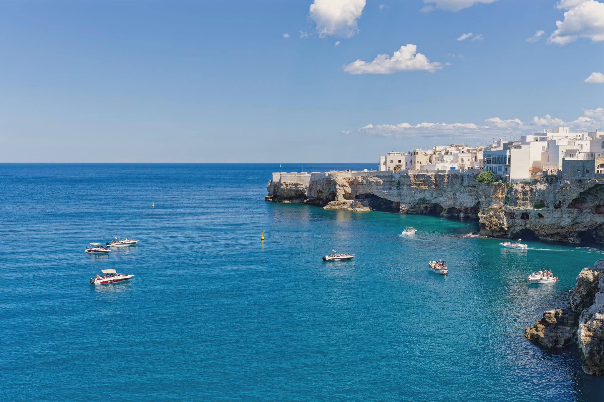
Most visitors arrive by car and stay in Alberobello, where the trulli district fills with coach parties from mid-morning and thins out again after dark, or they base themselves in Polignano a Mare and queue for the view over the cove. Both are worth seeing. Both are also small, walled by their own geometry, and easily overwhelmed. The result is that Puglia gets read at a driving pace, in the shortest hops between famous photographs, with the flat interior and the Gargano's high woods left off the itinerary entirely.
The paths do not stop where the coaches do. The southern Via Francigena continues down through the Salento towards the port where pilgrims once took ship for the Holy Land, and the Micaelic routes climb the Gargano to the cave church that drew walkers across Europe long before any of this was a holiday coast. The towns below are stages on those routes, places built to receive people arriving on foot, with cathedrals, hostels and a bar open early. Fewer people go, which is mostly a matter of how they travel rather than what there is to see.
Of the 59 communes we have mapped in Puglia, 10 qualify as towns on a walking route: each is a stage on one of the long historic walking routes. The smallest, Otranto, has 5,631 residents.
Two more lists worth reading alongside this one: The best coastal towns with a serious restaurant in Puglia and The best olive oil towns with a serious restaurant in Puglia.
Otranto
Why visit Otranto
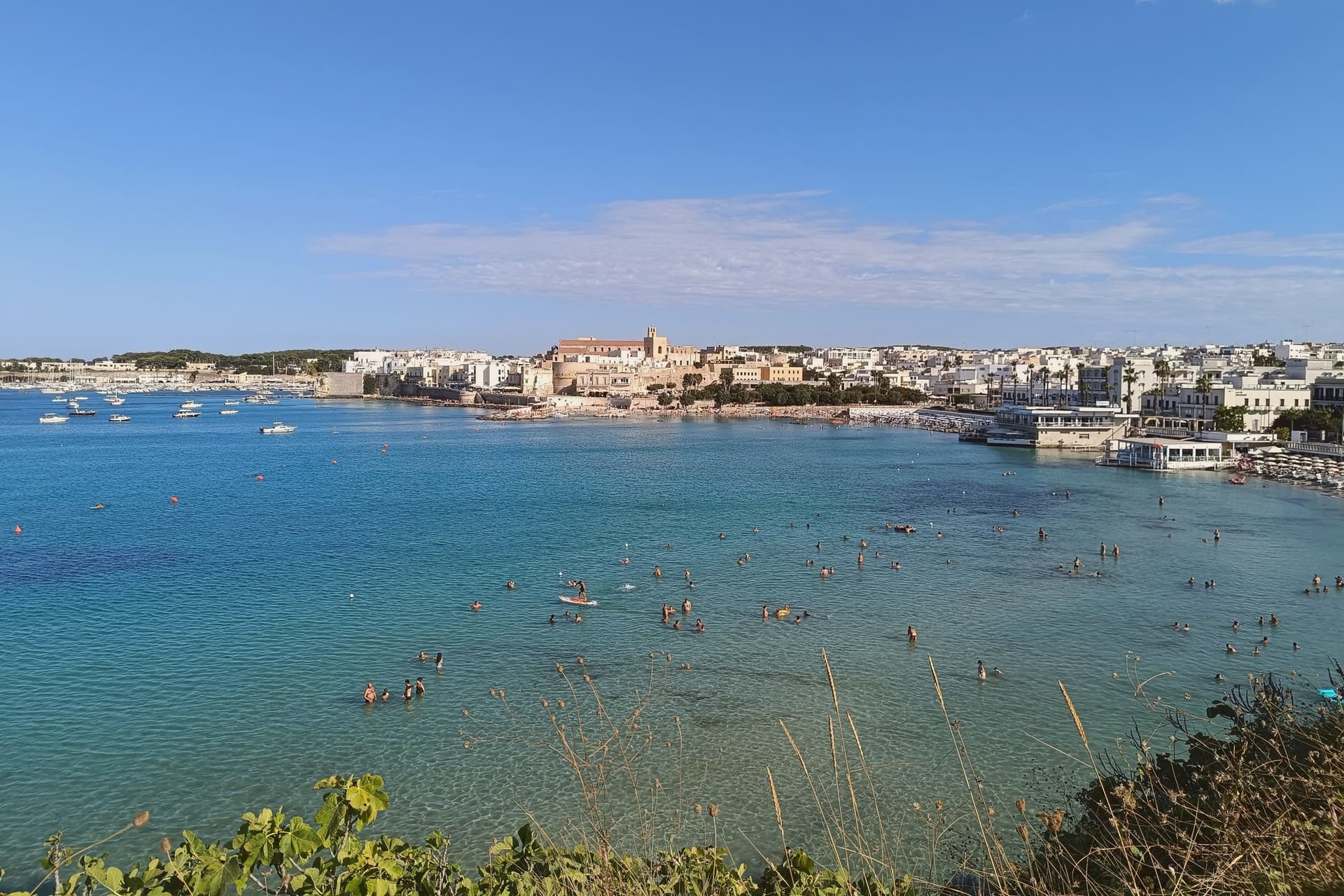
Otranto sits at sea level on a small promontory thirty kilometers southeast of Lecce, the easternmost city of Italy and the closest mainland point to Albania across the eighty-kilometer Strait of Otranto. The Cattedrale di Santa Maria Annunziata, consecrated in 1088, holds a mosaic floor laid between 1163 and 1165 by the monk Pantaleone for Archbishop Gionata.
About 800,000 tesserae across the three naves depict Adam and Eve, Noah, the Tower of Babel and a Tree of Life with biblical, classical and chivalric figures: Alexander the Great, Arthur, the months of the year. On 14 August 1480 an Ottoman force under Gedik Ahmed Pasha took the city; 813 inhabitants who refused to convert were beheaded on the Colle della Minerva and their bones are now in the cathedral, in seven glass-fronted recesses.
Pope Francis canonized them in 2013. The Castello Aragonese, raised by Ferdinand I of Aragon between 1485 and 1498, is the response: a five-sided fortress with a moat, built specifically to prevent a second sack.
What to see in Otranto
- Cattedrale di Santa Maria Annunziata. Norman cathedral consecrated in 1088, with Pantaleone's mosaic floor of 1163-1165 and the relics of the 813 martyrs of 1480 in seven glass recesses.
- Castello Aragonese. Five-sided Aragonese fortress raised 1485-1498 by Ferdinand I after the Ottoman sack, irregular plan with moat running the full perimeter.
- Chiesa di San Pietro. Byzantine cross-plan church in the centro storico, ninth-tenth century, with three apses and frescoes from the tenth through fifteenth centuries.
How to get to Otranto
There is a railway station in the town, so you can arrive without a car and never need one while you are here. Taranto is roughly 137 minutes away by road.
Our tip
May through September is the working coastal season, Adriatic water warm enough to swim by mid-May and the centro storico operational into the evening. July and August fill the small headland with day-trippers from across Salento and beyond; weekends in August are shoulder to shoulder along the Lungomare and the cathedral fills with queues. June and September are the sane choices, mild evenings and the same water without the crush.
Vernole
Why visit Vernole
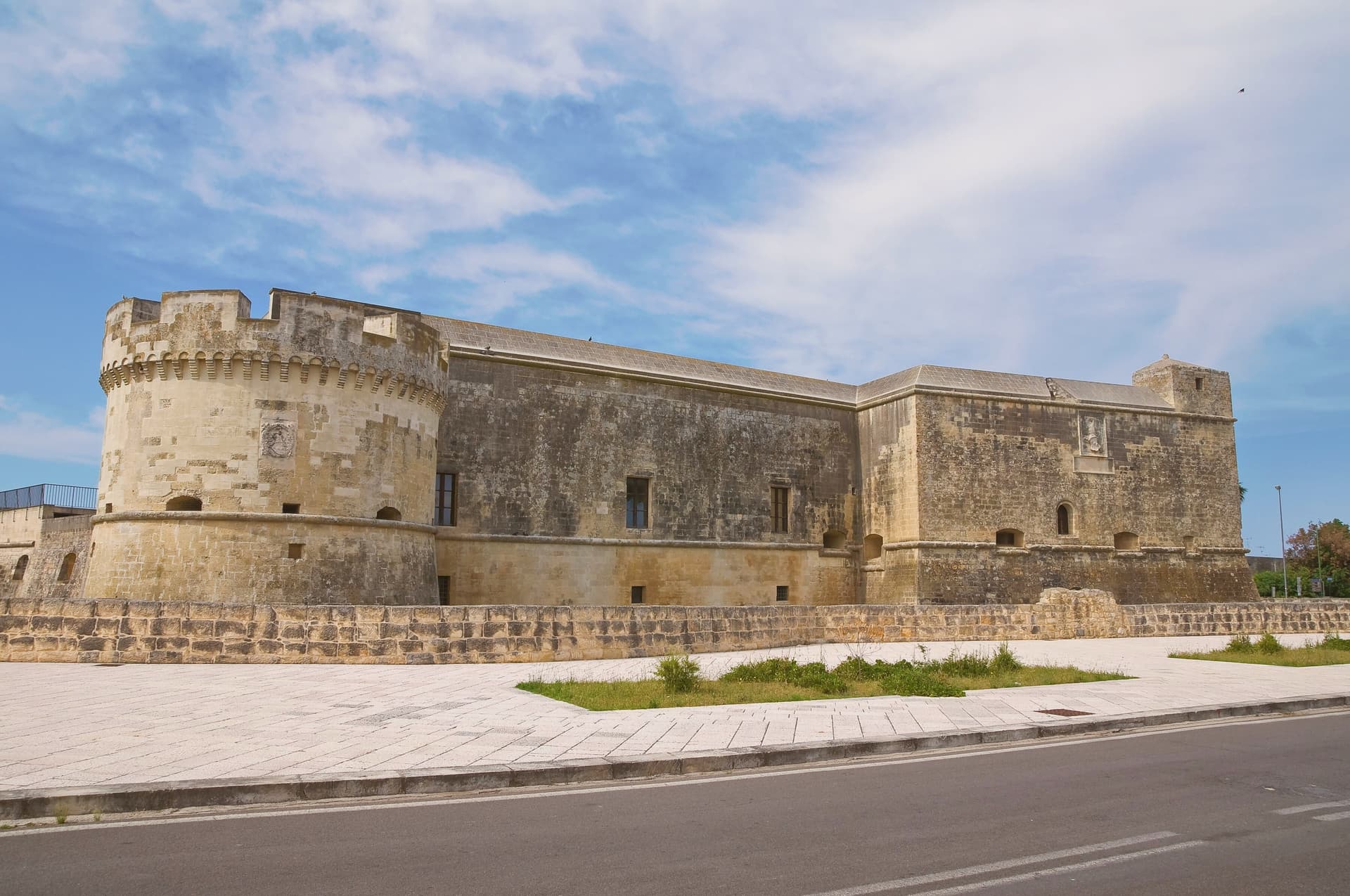
Vernole sits ten kilometers southeast of Lecce, on the line between the city and the Adriatic, with a small stretch of coast of its own and a string of frazioni that includes Strudà, Pisignano, Vanze and Acaya. The village at Acaya was originally called Segine and was granted as a fief in 1294 by Charles II of Anjou to Gervasio dell'Acaya, well before its Renaissance rebuilding.
That earlier history is easy to miss standing in the citadel today, where the grid of streets and the walled perimeter read as a single sixteenth-century act rather than a place with a medieval name underneath it. The commune itself is split between this inland fortified core and the coast, where the Cesine reserve holds the dune system ten kilometers east of the citadel.
Vernole's own centro, with its rebuilt mother church, sits apart from both, the administrative middle point between a Renaissance curiosity and a wetland on the Adriatic. The three parts, town, citadel and coast, rarely overlap in a visitor's day: whichever draws people to the commune, the other two are reached separately, not passed through.
What to see in Vernole
- Castello di Acaya. Renaissance fortress of 1535-1536 by Gian Giacomo dell'Acaya, trapezoidal with a wet moat, one of the best examples of sixteenth-century defensive architecture in Terra d'Otranto.
- Borgo fortificato di Acaya. Walls, gates and a grid of stone streets laid out between 1521 and 1536, still readable underfoot as the plan the engineer drew.
- Riserva Naturale Le Cesine. Dune systems and pine groves along the longest stretch of protected lower-Salento coast, on the Adriatic edge of the commune.
How to get to Vernole
Taranto is roughly 107 minutes away by road.
Our tip
May, June, September and early October are the easiest months: the Acaya walls workable from morning into the evening, Le Cesine in spring migration or autumn passage, and the Adriatic still swimmable. July and August are dry and very hot on the coastal plain, with the citadel best visited at opening or in the last hour of daylight. The classical music programs in the courtyard of the Castello di Acaya run on summer evenings.
Monte Sant'Angelo
Why visit Monte Sant'Angelo
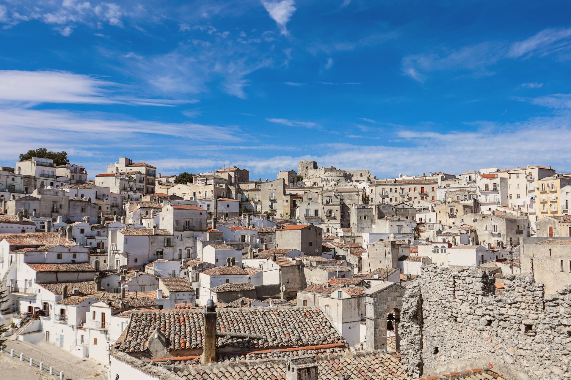
The town sits at 843 meters on the southern slope of the Gargano promontory, the highest inhabited settlement in the massif, with the Adriatic visible to the east on clear days. It is built around a cave where, according to tradition, the Archangel Michael appeared to the bishop of Siponto in 490.
A first sanctuary was raised over the cave in 493, and by the seventh century the Lombards of the Duchy of Benevento had made it the principal Michaeline shrine in the West and a fixed stop on the pilgrimage route to Jerusalem now called the Via Sacra Langobardorum. UNESCO inscribed the site in 2011 as one of seven sites in the serial property 'Longobards in Italy: Places of Power (568-774 A.D.)'.
The town itself steps down from the castle at its highest point through the sanctuary at its center to Rione Junno below, the old pilgrim quarter of stepped alleys and single-pitch roofs that housed the people who served the shrine. Beyond the commune, beech and oak forest of the Gargano National Park closes in on all sides.
What stands today is a settlement shaped entirely around one act of devotion, its layers of castle, cave, and quarter marking who came to guard, worship, and house the pilgrimage rather than any separate reason for a town to exist here at all.
What to see in Monte Sant'Angelo
- Santuario di San Michele Arcangelo. The cave sits at the heart of town, reached by descending stone stairs into rock that has been a shrine since the fifth century. Archangel Michael is said to have appeared here, and the sanctuary that grew around the site remains the town's core.
- Castello di Monte Sant'Angelo. Norman-Swabian-Aragonese castle above the sanctuary, expanded over five centuries on the highest point of the town, with views across the Gargano.
- Tomba di Rotari. Twelfth-century baptistery near the sanctuary, long misidentified as the tomb of the Lombard king Rotari, a fragment of the older religious complex.
How to get to Monte Sant'Angelo
Foggia is roughly 73 minutes away by road.
Our tip
May through October is the working season at 843 meters: cool mornings, dry afternoons, the sanctuary cave naturally cold year-round. June through August stay around twenty-six to twenty-nine degrees in town while Foggia bakes at thirty-eight on the Tavoliere below. The Festa di San Michele on 29 September is the patronal day and the busiest moment in the sanctuary calendar; pilgrims walk the final stretch of the Via Sacra from Siponto.
San Giovanni Rotondo
Why visit San Giovanni Rotondo
San Giovanni Rotondo sits at 565 meters on the slopes of Monte Calvo, inside the national park that carries the Gargano's name. The town itself is named for an eleventh-century baptistery, round in shape and dedicated to John the Baptist, built over what may have been a Roman temple to Janus: the round form and the double dedication are the origin the name still points to.
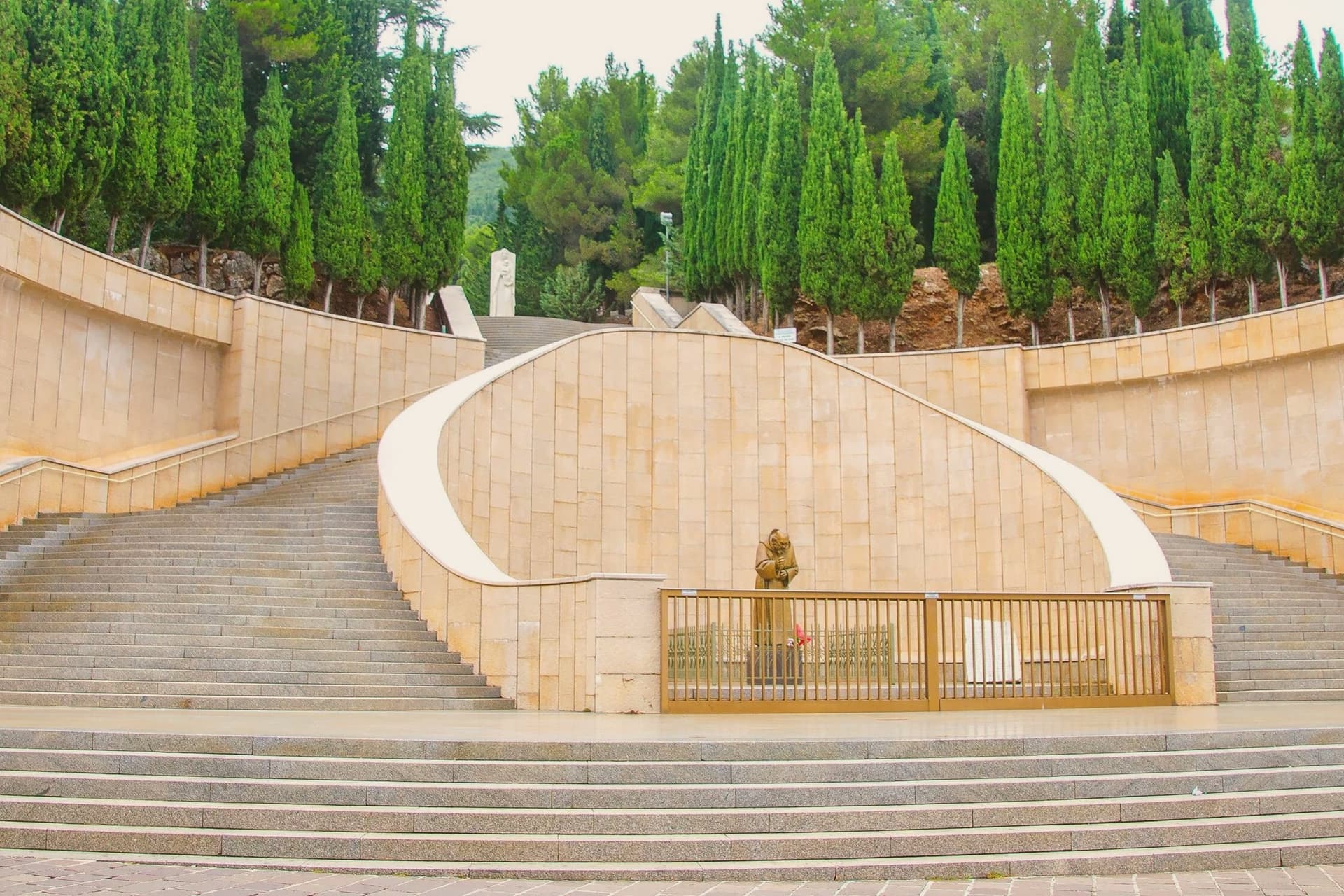
The medieval centro storico gathers around that baptistery, a village of one scale and one era. The contemporary town is built at another scale entirely, around the convent, the sanctuary and the hospital, all raised in the twentieth century and all tied to the same friar.
The two parts of the town sit close together but belong to different centuries: an eleventh-century core that gave the place its name, and a twentieth-century expansion that gave it its purpose. What draws six million visits a year is not the old village but what grew up beside it.
What to see in San Giovanni Rotondo
- Santuario di San Pio da Pietrelcina. Copper roofing over the stone arches is meant to oxidize green over decades, a slow change on a building already built at monumental scale.
- Convento di Santa Maria delle Grazie. The convent where Padre Pio lived from 1916 to 1968; its old and new churches stand side by side, one building added to another rather than replacing it.
- Cripta di San Pio. The lower crypt of the new sanctuary holds the preserved body of Padre Pio, the focus of the pilgrimage and the point most of the six million annual visits are made toward.
How to get to San Giovanni Rotondo
Foggia is roughly 41 minutes away by road.
Our tip
April through June and September through October are the better months on the Gargano interior: cool altitude, dry air, the pilgrim crowds manageable. July and August push above thirty-three degrees and the queues at the crypt of San Pio stretch around the building; midsummer is the peak pilgrimage season. The Feast of San Pio on 23 September draws the largest single-day crowd of the year.
Fasano
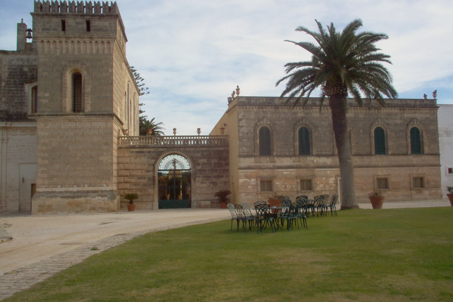
Why visit Fasano
The main centre sits at 118 meters, a hinge point in a wide municipal territory that runs from the Adriatic shore up to the Itria escarpment, home to thirty-eight thousand residents spread across three distinct landscapes rather than one compact town. The coast holds the abandoned city, inhabited from the fifteenth century BC and left empty by the Middle Ages, its excavated stone now sitting a short distance from the museum built to house what came out of the ground there.
Inland and uphill, the wooded escarpment climbs to become the highest ground in the province, the same slopes that carry the wildlife park across its carob and olive scrubland. Further along the shore, the fishing port turned resort gives the territory its beach frontage.
The pattern is coastal city, wooded highland, coastal resort, three pieces of a single municipality that never behaves like a single place. What the town offers is that range within one boundary: Roman ruins at sea level, a panorama at the province's highest point, and a working beachfront, none of them a detour from the others.
What to see in Fasano
- Parco Archeologico di Egnazia. Ruins spread across eighty hectares along the coast, with the Via Traiana running through the site alongside the basilica and a cryptoporticus still traceable underfoot.
- Museo Nazionale Archeologico Giuseppe Andreassi. Museum standing next to the archaeological park, holding the objects pulled from the excavations: Messapian inscriptions, Roman finds, and material spanning the long abandonment of the city.
- Selva di Fasano. Wooded escarpment reaching between 411 and 414 meters, the ground rising from carob and olive scrub to open views that give the terrace its nickname.
How to get to Fasano
There is a railway station in the town, so you can arrive without a car and never need one while you are here. Bari is roughly 52 minutes away by road.
Our tip
May through September is the working season on this stretch of the Adriatic: warm sea, the Bandiera Blu beaches at Savelletri operating, the Selva ten degrees cooler than the coast for an evening break. July and August fill the coast with Italian holidaymakers; Egnazia exposed on the seafront is brutal between noon and three. April and October are quieter alternatives with the sea still mild, the archaeological park at its photographic best, and the olive harvest opening across the surrounding masserie. Festa Della Mietitura E Trebbiatura Del Grano falls in August.
Gravina in Puglia
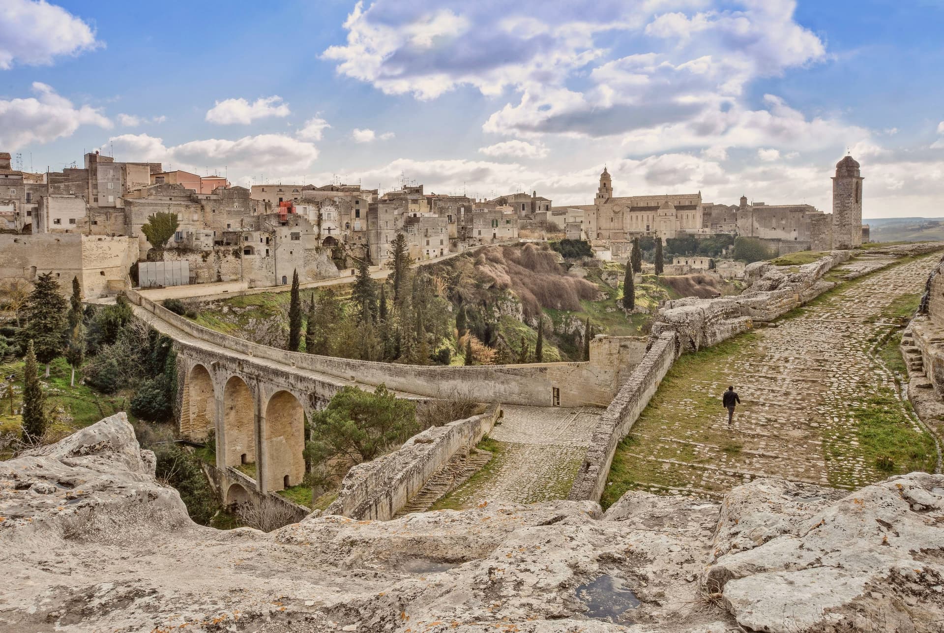
Why visit Gravina in Puglia
Gravina sits within the gravine, the network of limestone canyons cut across the Bari-Matera-Taranto karst plateau, the same geological system that produced Matera's Sassi 30 km west. This canyon is the deepest of them: 100m down, 350m wide at its narrowest, running straight through the centre of the modern town.
The plateau above holds the current population of 42,703; the old town clings to the cliff edge, its houses stacked against the same rock that the canyon walls below carry as a run of rupestrian churches and sanctuaries hollowed straight from the stone. The defining crossing of the two halves is the aqueduct bridge, built in the 18th century to bring water from the Murgia springs into the city and still walkable as a pedestrian route at 37m above the gorge floor.
On the canyon walls below it: a sanctuary carved into the rock, a church reached by a vertical stair and cut entirely into the cliff face, and a crypt complex holding frescoes from the 10th to 12th centuries, Byzantine work surviving in the dark of the rupestrian chambers. Above, on the plateau, the medieval centro takes over: the Cattedrale di Santa Maria Assunta, Romanesque and founded in 1092, holding its own Byzantine icon of the Madonna delle Grazie; the Castello Svevo rebuilt by Federico II; the Fondazione Ettore Pomarici Santomasi with its archaeological and Renaissance collections.
Gravina holds the Borghi più belli d'Italia designation together with Cittaslow, and lies on the Via Francigena, the branch tracing the old Via Appia route south, as well as bordering the Parco Nazionale dell'Alta Murgia, the karst plateau protected as national park immediately to the north. The food follows the same Murgia-Puglian line as the landscape: focaccia barese, orecchiette with cime di rapa, capocollo di Martina Franca, Primitivo di Manduria and the local Murgia DOC reds, built around the Festa di San Michele Arcangelo each September and the Carnevale Gravinese in late winter.
What Gravina adds up to is a town whose deepest cut in the earth doubles as its main street: canyon below carrying the sacred and the ancient, plateau above carrying the civic and the everyday, the two halves joined by a bridge built for water and now crossed for its own sake.
What to see in Gravina in Puglia
- Ponte Acquedotto (Bond's bridge). Crosses the gorge at 37m height on 18th-c stonework, a walkable pedestrian route today. This is the crossing James Bond takes by motorbike in the Matera chase sequence of No Time to Die.
- Chiesa di San Michele delle Grotte. A church carved entirely into the rock cliff of the gravina, reached by a vertical stair. The most striking of the canyon's rupestrian churches.
- Castello Svevo + Cattedrale. The castle sits on the plateau beside the Romanesque cathedral, founded 1092, which holds the Byzantine Madonna delle Grazie icon.
How to get to Gravina in Puglia
There is a railway station in the town, so you can arrive without a car and never need one while you are here. Bari is roughly 68 minutes away by road.
Our tip
Gravina in Puglia is best March–June and September–October — the Murgia summer is brutally hot (38°C+ inland) and the gorge becomes an oven. The Festa di San Michele Arcangelo 28-29 September is the year's headline. February-March brings the Carnevale Gravinese. Historia falls in September.
Monopoli
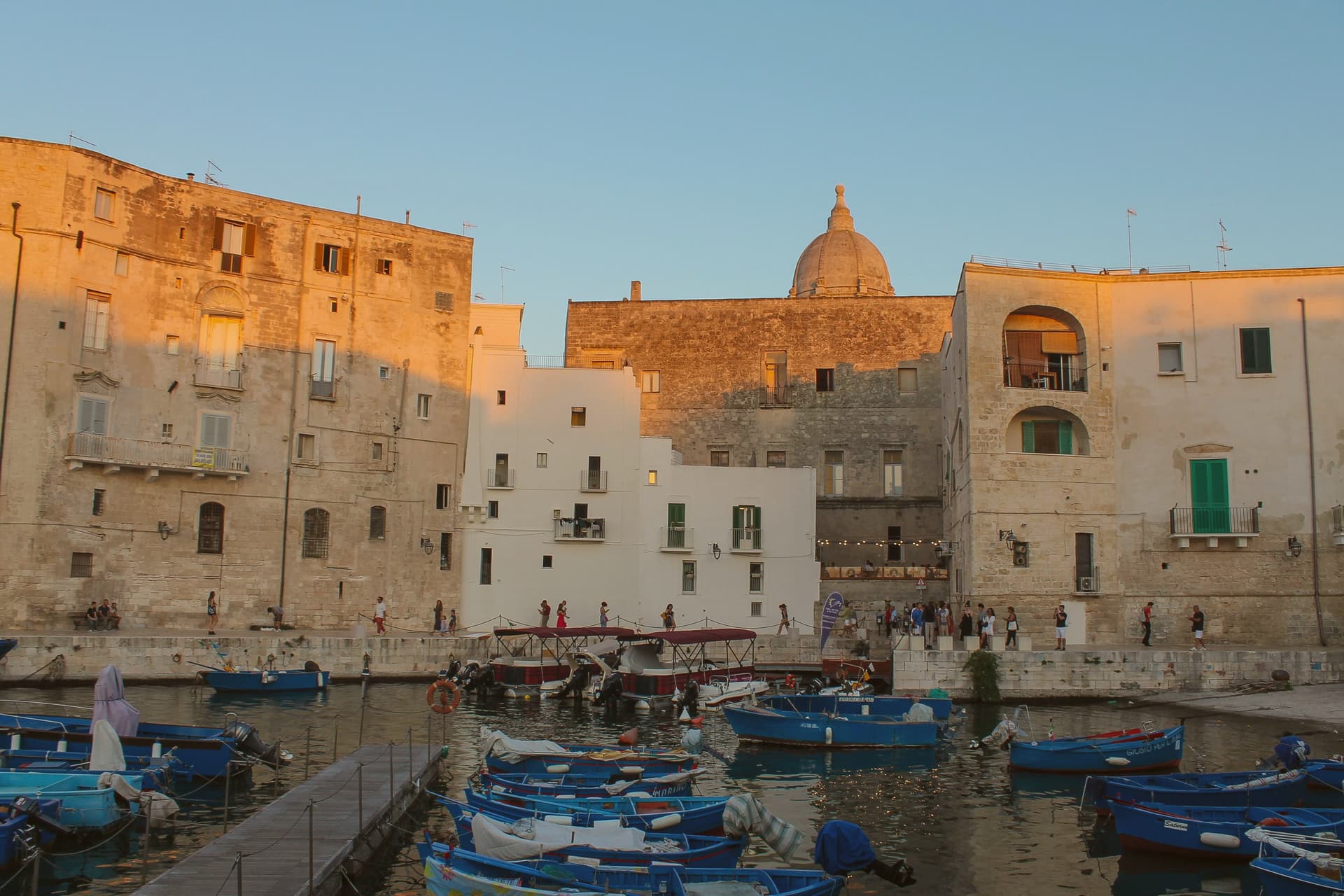
Why visit Monopoli
Monopoli sits on the Adriatic forty kilometers southeast of Bari, a walled town extending from the sea fifteen kilometers inland to the first Murge hills. The territory covers 156 square kilometers with sandy coves, cliff sections and the old port at the centro storico.
The site has been inhabited since the Epigravettian, around fifteen thousand years ago; a fortified Messapian settlement existed by 500 BC. The name comes from the Greek for 'only city,' which Monopoli inherited when refugees from nearby Gnatia arrived after the Ostrogoth king Totila destroyed it in 545.
Byzantines, Normans and Hohenstaufen followed. In 1484 Venice took the town and ran it as a trading port between Bari and Brindisi for sixty years.
The Castello Carlo V on the headland and the resistance to the imperial Armada in 1529, which forced the Spaniards to abandon a three-month siege, both belong to that century of fortification.
What to see in Monopoli
- Castello Carlo V. Sixteenth-century pentagonal fortress on the headland above the old port, built by the Spanish to defend against Ottoman raids and Venetian return.
- Basilica Cattedrale Maria Santissima della Madia. Eighteenth-century baroque cathedral on the old town's central square, raised over earlier medieval foundations, the city's principal monument.
- Centro storico. Walled old town on the small headland, white limestone alleys, the cathedral and the castle facing each other across narrow lanes above the port.
How to get to Monopoli
There is a railway station in the town, so you can arrive without a car and never need one while you are here. Bari is roughly 42 minutes away by road.
Our tip
May through September is the working coastal season, water warm enough for swimming and the old port quay populated until late. July and August push past thirty-three degrees and the centro storico fills with day-trippers from Bari and Polignano; weekends in August are shoulder to shoulder along the quay. June and September are the sane choices, mild evenings and the same water without the crush.
San Severo
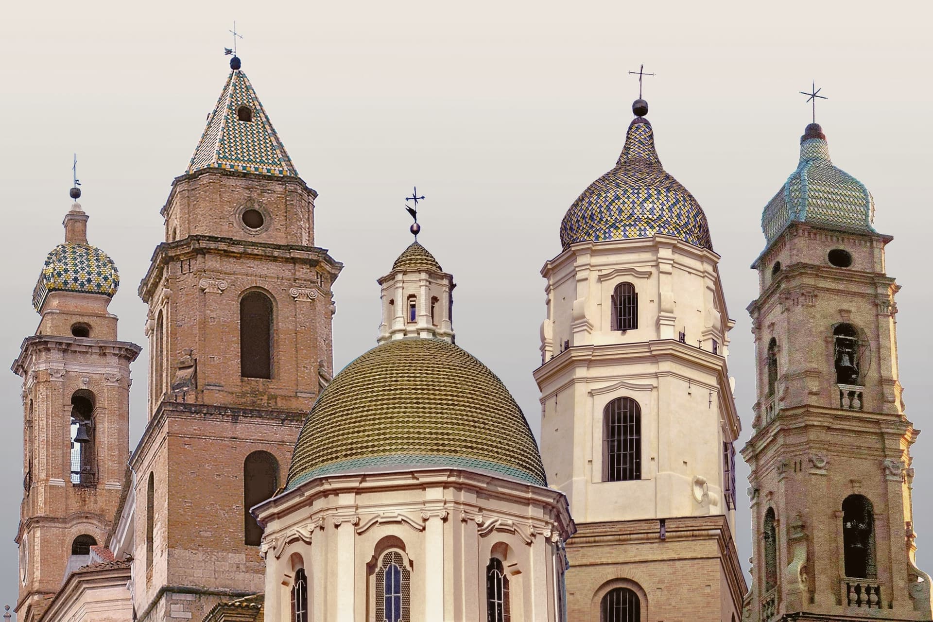
Why visit San Severo
San Severo sits at 86 meters on the Tavoliere delle Puglie, north of Foggia and inland from the Gargano. The town was founded in the eleventh century around a small church built by Benedictine monks from Montecassino, and grew through the medieval period into the capital of the upper Daunia.
The 1627 earthquake almost levelled it, killing eight hundred inhabitants and pulling reconstruction into the late seventeenth century after a plague epidemic in 1656 added three thousand more deaths. The Cattedrale di Santa Maria Assunta, originally late-medieval, was rebuilt in Baroque after the quake.
San Severo is best known nationally for its wine: the San Severo DOC, approved on 19 April 1968 by presidential decree, was the first protected designation in Puglia, with 2,000 hectares of red, white, rosé and the occasional spumante across San Severo, Torremaggiore, San Paolo di Civitate, Apricena, Lucera and Lesina. The annual Carnevale, with its rolling fanoia firework blasts, is one of the loudest in southern Italy.
What to see in San Severo
- Cattedrale di Santa Maria Assunta. Late-medieval cathedral rebuilt in Baroque style after the 1627 earthquake, the principal religious monument of the Daunia.
- Chiesa di San Severino Abate. Baroque basilica dedicated to the patron saint, built over the eleventh-century Benedictine foundation that gave the town its name.
- Palazzi Baroque. Eighteenth-century noble palazzi built in the post-earthquake reconstruction, lining the streets of the centro storico.
How to get to San Severo
There is a railway station in the town, so you can arrive without a car and never need one while you are here. Foggia is roughly 31 minutes away by road.
Our tip
April through June and September through October are the workable months on the Tavoliere. The vineyards of the San Severo DOC are in leaf by April and in harvest from late August through September. July and August push past thirty-eight degrees on the open plain and the centro storico empties between two and five; the Tavoliere is one of the hottest places in Puglia. Festa di San Rocco falls in August.
Trani
Why visit Trani
Trani sits on the Adriatic forty-five kilometers west-northwest of Bari, one of the three capitals of the Barletta-Andria-Trani province. The cathedral is the reason most travelers come.
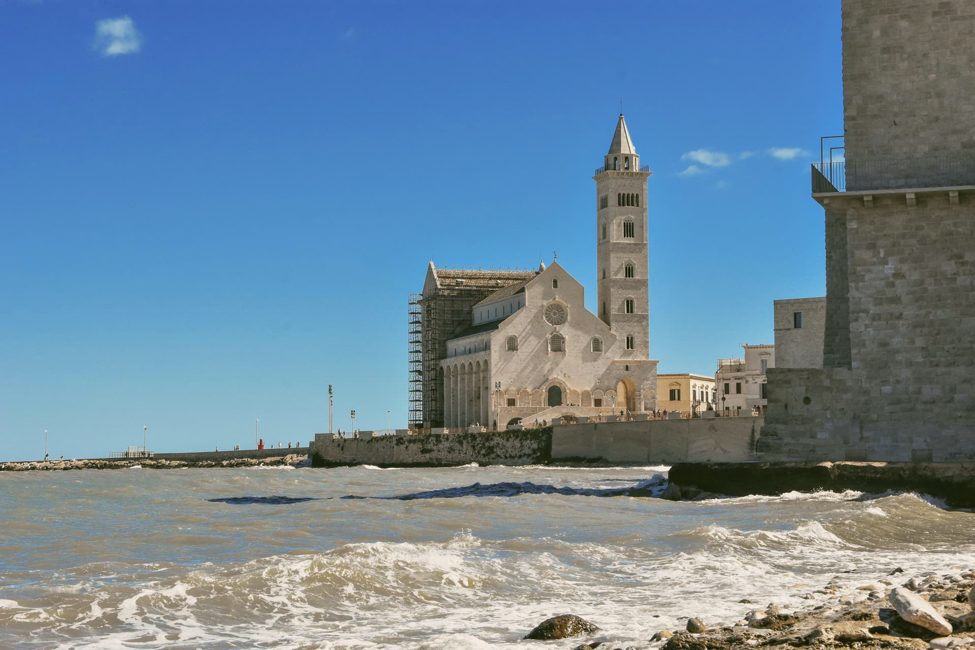
Dedicated to Saint Nicholas the Pilgrim, a Greek who died in Trani in 1094, the church was begun in 1159 and built from the local calcareous tuff that quarries pink-white almost to the point of looking bleached. The fifty-nine-meter bell tower was finished in the fourteenth century; the central bronze door is a 1175 work by Barisano da Trani.
The Castello Svevo on the same harbor was built by Frederick II between 1233 and 1249 to guard the roadstead. Trani's eleventh- and twelfth-century maritime republic linked the Crusader Adriatic to the East and produced the Ordinamenta maris, one of the earliest western sea codes.
The cathedral square at dusk, sea on one side and Castello Svevo on the other, is the photograph.
What to see in Trani
- Cattedrale di San Nicola Pellegrino. Romanesque cathedral begun in 1159 on a sea-edge platform, built of local pink-white tuff, with a fifty-nine-meter bell tower and the 1175 bronze door by Barisano da Trani.
- Castello Svevo. Frederick II fortress of 1233-1249 on a rock at the center of the harbor, designed by Filippo Cinardo, later a royal court seat and provincial prison until 1974.
- Porto e lungomare. Working fishing harbor lined with palazzi and trattorie, with the cathedral at one end and the Castello Svevo at the other.
How to get to Trani
There is a railway station in the town, so you can arrive without a car and never need one while you are here. Bari is roughly 38 minutes away by road.
Our tip
May, June, September and October are the easiest months on the harbor: warm without humidity, the cathedral square workable from morning into the evening, the Adriatic still swimmable. July and August are hot and busy, with cruise day-trippers and weekend Bari traffic taking the port. The fish auction at the molo continues through the summer; the local moscato bottling runs from August into September. Festa di San Nicola Pellegrino falls in August.
Lecce
Why visit Lecce
Lecce sits on the Salento plain at 49 meters above sea level, twelve kilometers inland from the Adriatic, the provincial capital. The Messapian settlement of Lupiae stood on this site by the eighth century BC.
Rome took it in the third century BC, and Hadrian later moved the settlement three kilometers away and renamed it Licea, so the modern city occupies a site distinct from either of its named predecessors. The walled centro storico is ringed by Charles V's fortifications, entered from the north through the Porta Napoli arch and anchored on its eastern edge by his castle, built over older Norman foundations.
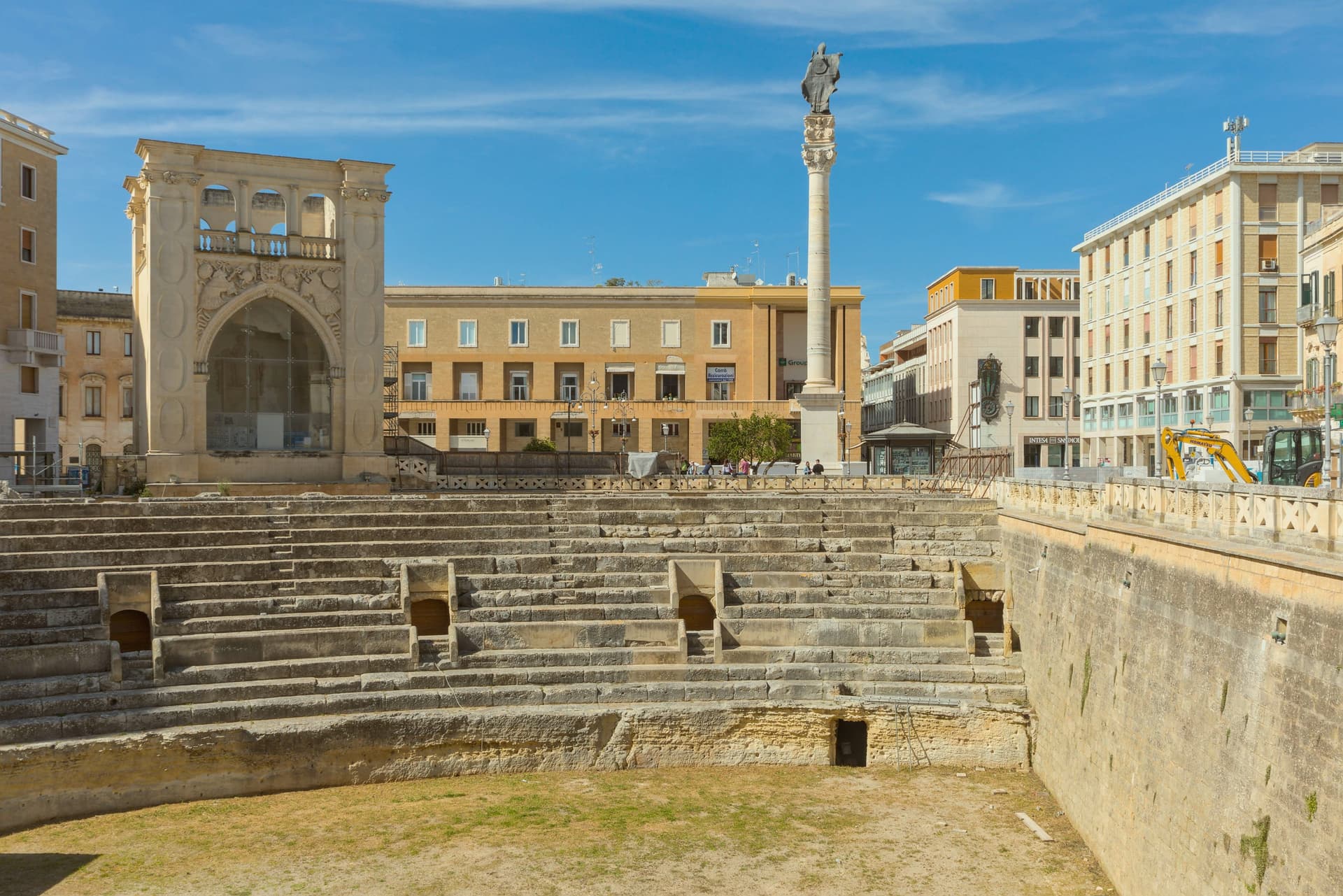
Within those walls the Baroque churches and squares sit close together, the cathedral square closed in on three sides while the amphitheater lies open and half-sunk in the middle of the newer square that formed around it. The University runs a strong humanities program, and the seafront at San Cataldo, some distance from the old center, carries Lecce's Bandiera Blu.
What holds the town together is the stone itself: soft enough to carve finely, hard enough once cut to last, so that a Messapian and Roman settlement site became, centuries later, the surface on which the south's most elaborate Baroque was cut.
What to see in Lecce
- Basilica di Santa Croce. Worked for nearly two hundred years to completion in 1695, the façade carved with cherubs, monsters and allegories layered so densely that the wall surface almost disappears beneath them.
- Piazza del Duomo. Closed on three sides, the only enclosed cathedral square of its kind in Puglia, gathering the Duomo, Campanile, Bishop's Palace and Seminary into one shared courtyard rather than an open street front.
- Piazza Sant'Oronzo. The city's central square, built around a column brought from the Appian Way to honor the patron saint, with the excavated amphitheater floor sitting below street level at its edge.
How to get to Lecce
There is a railway station in the town, so you can arrive without a car and never need one while you are here. Taranto is roughly 95 minutes away by road.
Our tip
April through June is the green window in inland Salento, with the centro storico walkable in the day and aperitivo on Piazza Sant'Oronzo running late. July and August push past thirty-five degrees and the city empties at midday; the Notte della Taranta in nearby Melpignano, the closing concert of the Salento pizzica festival, falls in late August and draws over a hundred thousand. September and October cool back down for the olive harvest. Festa di Sant'Oronzo falls in August.
More from Anywhere Italy
 The best coastal towns with a serious restaurant in Puglia
 The best olive oil towns with a serious restaurant in Puglia
- The best towns with a serious restaurant that sit inside a nature park in Puglia
- The best towns worth staying overnight that eat well in Puglia
 The best coastal towns you can reach by train within 90 minutes of Bari
 The best towns that eat well in the province of Lecce