
The best towns inside a nature park in Veneto
Veneto's protected land is stranger and more varied than the region's reputation suggests. The Colli Euganei rise out of the Padua plain as rounded volcanic cones planted with vines and chestnut woods, the water underneath them hot enough to feed thermal pools all winter. North, the Dolomites turn pale pink at dusk above larch forest and pasture. East, the Po Delta flattens into reed beds, salt lagoons and eel channels, where the mist comes in low and the local plates run to clams, wild duck and radicchio. Houses shift accordingly, from trachyte stone and stucco in the hills to timber and shingle in the mountains.
Most visitors to the region give their days to Venice, and the pressure shows. The queues for San Marco, the day boats unloading at the Riva degli Schiavoni, the price of a coffee near the Rialto: it is one of the most visited cities in the world, and by late morning in summer the calli move at a shuffle. Nobody would tell you to skip it. But it absorbs almost all the attention that Veneto receives, and it is not a place where you go to walk in the woods.
The parks are the other Veneto, and they have towns in them. Thermal villages under the Euganei ridges, a canal port built around boat-hauling on the old Battaglia waterway, a Dolomite valley with a national park on its doorstep, a Delta commune where the pine wood meets the beach. These are the places on this list: still working towns, inside protected land, where the reason to come is what grows and stands outside the walls.
Of the 41 communes we have mapped in Veneto, 7 qualify as towns inside a nature park: each sits inside a regional nature park. The smallest, Arquà Petrarca, has 1,810 residents.
Two more lists worth reading alongside this one: The best towns you can reach by train within an hour of Padua and The best towns you can reach by train within an hour of Venice.
Arquà Petrarca
Why visit Arquà Petrarca
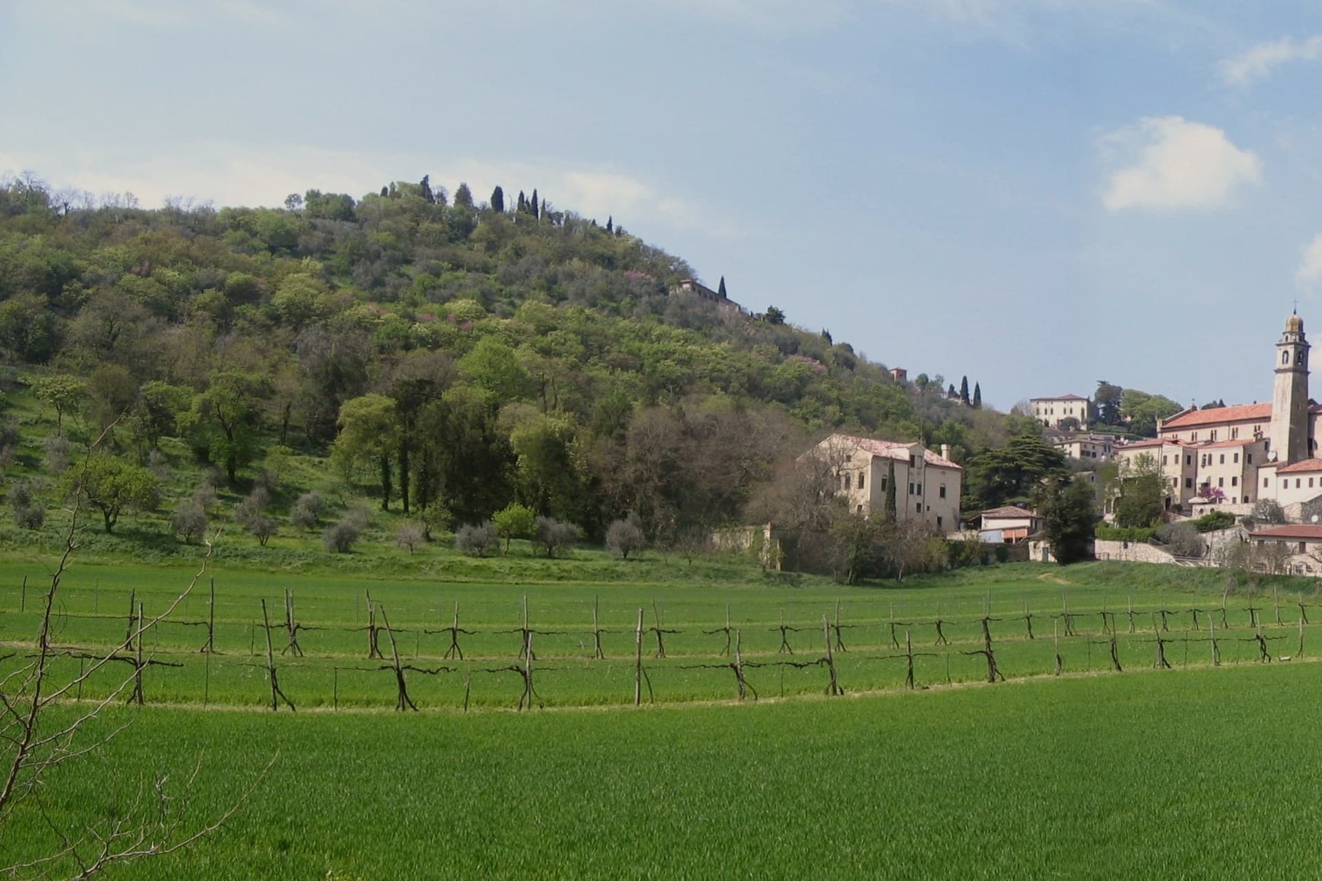
Arquà sits between Monte Ventolone and Monte Castello, in the Euganean Hills south of Padova. The name dates to medieval records; the suffix Petrarca was added in 1868, after the Veneto's annexation to the Kingdom of Italy, as a public homage to the poet who chose to die here.
Francesco Petrarca arrived in 1370 and lived in a thirteenth-century house he renovated himself across two stories, the Casa del Petrarca, now a museum with frescoes from the fifteenth and sixteenth centuries. He died at his desk on the night of 18-19 July 1374.
His tomb, an ark in red Verona marble inspired by Roman sarcophagi, was placed in the churchyard of Santa Maria Assunta in 1380 and reset in 1965. The village kept its medieval layout: two piazzas linked by a stepped path, the Casa above and the church and tomb below.
The hills around it grow Colli Euganei DOC wine, olives, and the giuggiole that go into the local liqueur Brodo di Giuggiole.
What to see in Arquà Petrarca
- Casa di Francesco Petrarca. The poet's thirteenth-century house, renovated by him on two floors and now a museum with frescoes added by later owners in the fifteenth and sixteenth centuries.
- Tomba di Petrarca. Sarcophagus in red Verona marble in the churchyard of Santa Maria Assunta, placed in 1380, six years after the poet's death.
- Chiesa di Santa Maria Assunta. Parish church first documented in 1026, enlarged through the centuries, with frescoes of the Venetian-Byzantine school up to the fifteenth century.
How to get to Arquà Petrarca
There is a railway station in the town, so you can arrive without a car and never need one while you are here. Padova is roughly 28 minutes away by road.
Our tip
April through June and September through October are the months Arquà is built for. The hills are green in spring and gold in autumn; the slope from Piazza Roma down to the church is comfortable walking weather. July and August push past thirty degrees and the village empties between two and six, though Padova day-trippers still arrive in the late afternoon.
Battaglia Terme
Why visit Battaglia Terme
Battaglia Terme sits at 9 meters on the eastern edge of the Euganean Hills, fifteen kilometers south of Padova. The Paduans dug the Battaglia Canal between 1189 and 1201 to link Padova to Monselice, Este and ultimately the Adige and the lagoon; the town grew up at the confluence with the older Bisato Canal from Monselice, completed in 1139.
For seven centuries Battaglia lived from the barge traffic that hauled wheat, marble and wine north and south through the navigable network. The Museo della Navigazione Fluviale, the only river navigation museum in Italy, holds more than four thousand objects from boats and tools to navigation charts and boatmen's diaries.
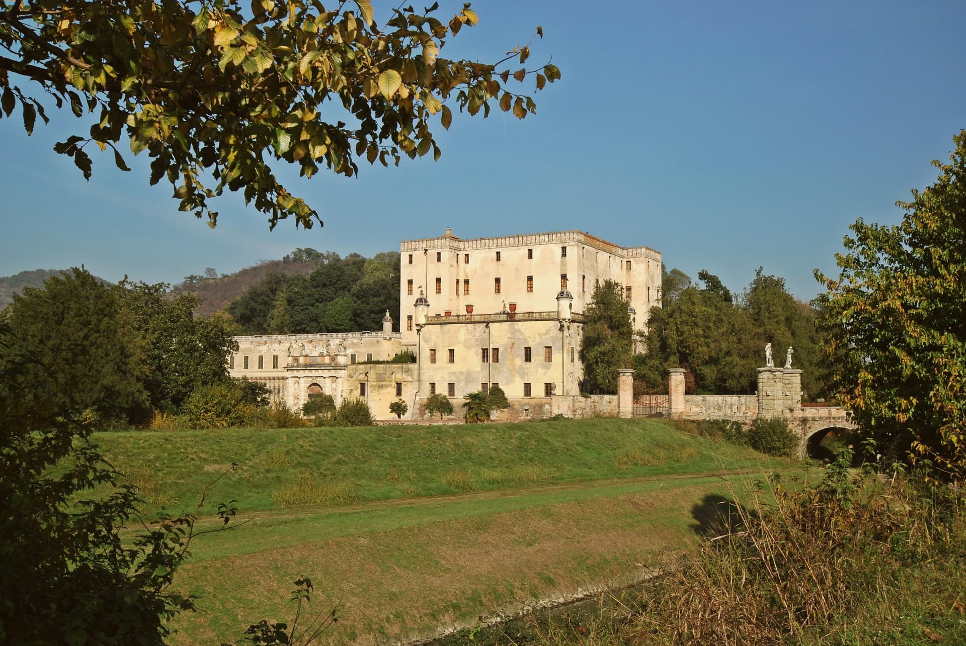
The thermal springs surface here too: warm saline water and a natural vapour grotto known since the Middle Ages, exploited from the eighteenth century at the Terme di Battaglia. Above town stands the Castello del Catajo, built 1570-73 by Pio Aeneas I degli Obizzi to control the canal, with frescoes and Renaissance esoteric symbols across forty rooms.
What to see in Battaglia Terme
- Castello del Catajo. Hilltop castle built 1570-73 by Pio Aeneas I degli Obizzi, with frescoes and esoteric Renaissance symbols across more than forty rooms.
- Museo della Navigazione Fluviale. Italy's only river navigation museum, with over four thousand objects from boats and tools to boatmen's diaries and navigation charts.
- Canale di Battaglia. Canal dug 1189-1201 by the Paduans, still navigable, running through the center of town and crossed by historic bridges.
How to get to Battaglia Terme
There is a railway station in the town, so you can arrive without a car and never need one while you are here. Padova is roughly 21 minutes away by road.
Our tip
Battaglia works year-round through the springs, but the canal-and-castle season runs April through October. Spring and autumn are best for walking the towpaths between Battaglia, Monselice and Este, when the Euganean hills above are green and the canal water is clear. July and August are warm and mosquito-thick along the canal; the spa hotels keep the visitors but the towpaths empty.
Cortina d'Ampezzo
Why visit Cortina d'Ampezzo
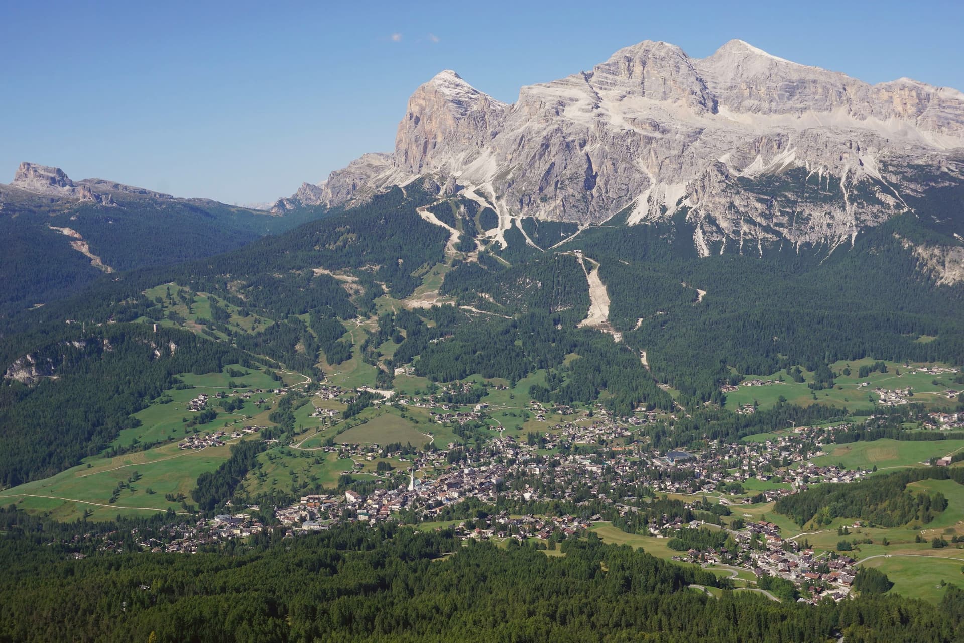
The Ampezzo valley sits at 1,224 meters, closed in by a full ring of peaks: the Tofane to the west, Pomagagnon to the north, Cristallo to the northeast, Faloria and Sorapiss to the east, Croda da Lago and Cinque Torri to the south. The town takes its position from that ring, a flat basin with mountains rising on every side rather than a settlement that spread toward any one of them.
The valley's older identity runs through the Ampezzani, a Ladin-speaking community whose Regole assembly governed communal land through Habsburg rule and continued after the territory passed to Italy in 1919. That assembly still shapes how the surrounding forests and pastures are held, separate from the ski infrastructure and Olympic building laid over the same ground in 1956 and again for 2026.
Summer use of the valley extends outward on foot, with the Alta Via 1 running south to Belluno and a loop east to the Tre Cime. What the valley adds up to is a resort economy built inside a much older frame of land, language and self-government, the two rarely mentioned together but both still active in how the town is run and used.
What to see in Cortina d'Ampezzo
- Tofana di Mezzo. Reached by the Freccia nel Cielo cable car from Corso Italia in three sections via Pomedes and Ra Valles, the ride climbing from the valley floor to open rock and long views over the Ampezzo basin.
- Basilica dei Santi Filippo e Giacomo. Parish church on Corso Italia with an 1858 façade and an 1860 campanile, the centro storico's principal monument and the anchor of its pedestrian street.
- Cinque Torri. Five rock towers south of Cortina at 2,361 meters, a climbing area with First World War open-air trenches restored as a free museum, the wartime positions still legible among the towers.
How to get to Cortina d'Ampezzo
Bolzano is roughly 116 minutes away by road.
Our tip
December through March is the Olympic season: the Dolomiti Superski lifts open, Tofana hosts the women's World Cup downhill on the Olympia delle Tofane in January, and the town runs at capacity through Carnival. June through September is the summer half: walking the Alta Via 1, climbing the Cinque Torri, and the via ferrata routes on Cristallo and Faloria. April, May, October and November are the dead months.
Rosolina
Why visit Rosolina
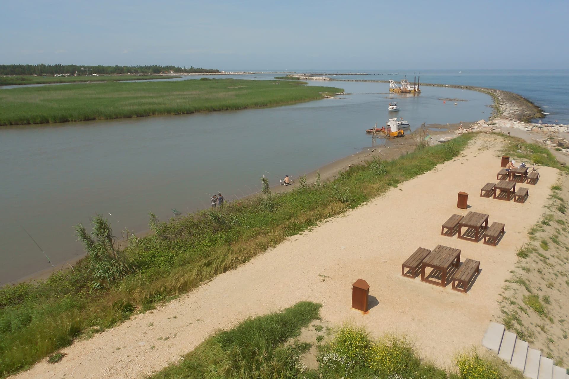
Rosolina sits at three meters above sea level, forty kilometers south of Venice, between the Adige to the north and the Po di Levante to the south, at the northern edge of the Po Delta. The commune is recent: it was drained and made habitable through twentieth-century land reclamation that built channels, raised banks and pulled the land out of the lagoon.
The territory divides into three distinct parts. The frazione of Rosolina Mare holds the mainland coast, backed by the replanted pine forest.
The Isola di Albarella sits offshore as a private, gated development, separate in ownership and access from the rest of the commune. Inland, the reclaimed land carries the traces of the drainage works themselves, documented at the Ca' Vendramin pump station near the commune border.
The land here is not old ground reshaped but new ground made, and the three parts of the commune, the resort island, the public beach and the drained interior, are three different answers to the same reclamation.
What to see in Rosolina
- Rosolina Mare. The beach carries the Bandiera Blu, earned through repeated cycles. The pines behind it have matured into dense woodland since the original planting.
- Parco regionale veneto del Delta del Po. Regional park covering nine communes from the Adige to the Po di Goro, with lagoons, valleys and bird colonies.
- Giardino Botanico Litoraneo. Coastal botanical garden on the dune system, classified as a Site of European Significance for its dune and lagoon flora.
How to get to Rosolina
Venezia is roughly 79 minutes away by road.
Our tip
May through September is the working season. The beach fills with Italian and Central European families through July and August, peak temperatures push past thirty degrees, and the pine forest gives the only shade. Rosolina Mare empties dramatically after the third week of August.
Abano Terme
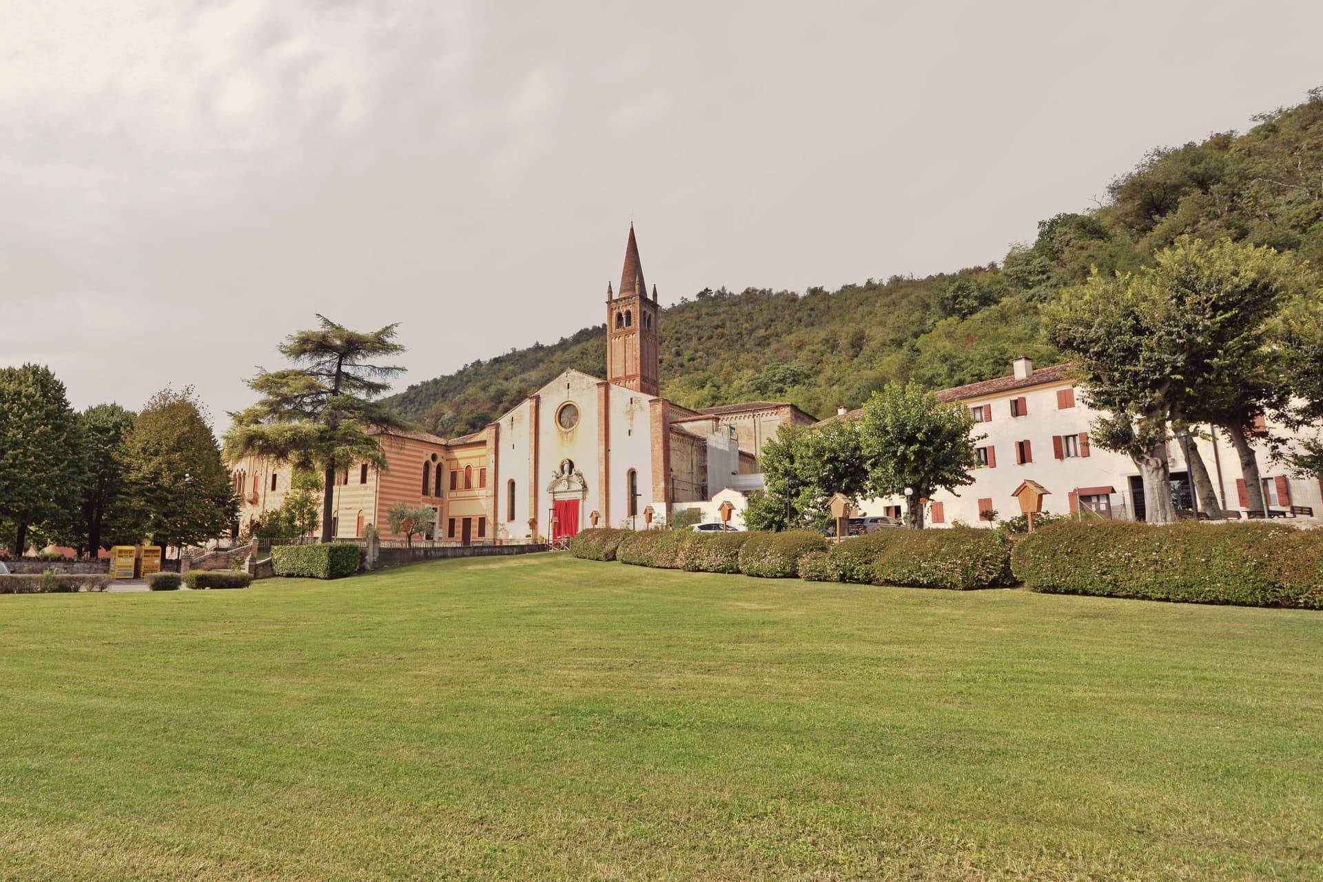
Why visit Abano Terme
Abano Terme sits at 14 meters on the eastern slope of the Euganean Hills, ten kilometers southwest of Padova. The springs surface at 80°C, classified as hyperthermal bromo-iodine-salt water, and the Veneti were already worshipping them in the eighth century BC.
The Romans built a temple to Aponus here and called the place Aquae Patavinae. The Lombards destroyed the baths in the sixth century.
They were rebuilt when Abano became an autonomous comune in the twelfth, enlarged again in the late fourteenth, and absorbed into the Republic of Venice from 1405 to 1797. The Colle Montirone archaeological site still holds traces of the Roman thermal complex, and the Duomo di San Lorenzo, rebuilt in 1780 over an older church, anchors the historic center.
The contemporary draw is fango-balneotherapy: mineral mud aged for sixty days in the source basins, then applied at body temperature. Most of the 250 hotels in Abano-Montegrotto are spa hotels.
What to see in Abano Terme
- Duomo di San Lorenzo. Cathedral rebuilt in 1780 over a pre-existing church, with a campanile dating to the fourteenth century and a Baroque interior.
- Colle Montirone. Archaeological site on a small thermal hill, with traces of the Roman baths of Aponus and an obelisk erected in the eighteenth century.
- Parco Termale Urbano. Public thermal park threading the centro storico, with footpaths between hotels, gardens and the source pools.
How to get to Abano Terme
There is a railway station in the town, so you can arrive without a car and never need one while you are here. Padova is roughly 15 minutes away by road.
Our tip
Abano works year-round because the heat comes from underground. January through March is peak spa season for residents of northern Italy: the contrast between cold air and hot pools is part of the appeal, and hotel cure programs run twelve days at this time. April through June and September through October bring the hills into play, with walking weather and lighter spa traffic.
Bassano del Grappa
Why visit Bassano del Grappa
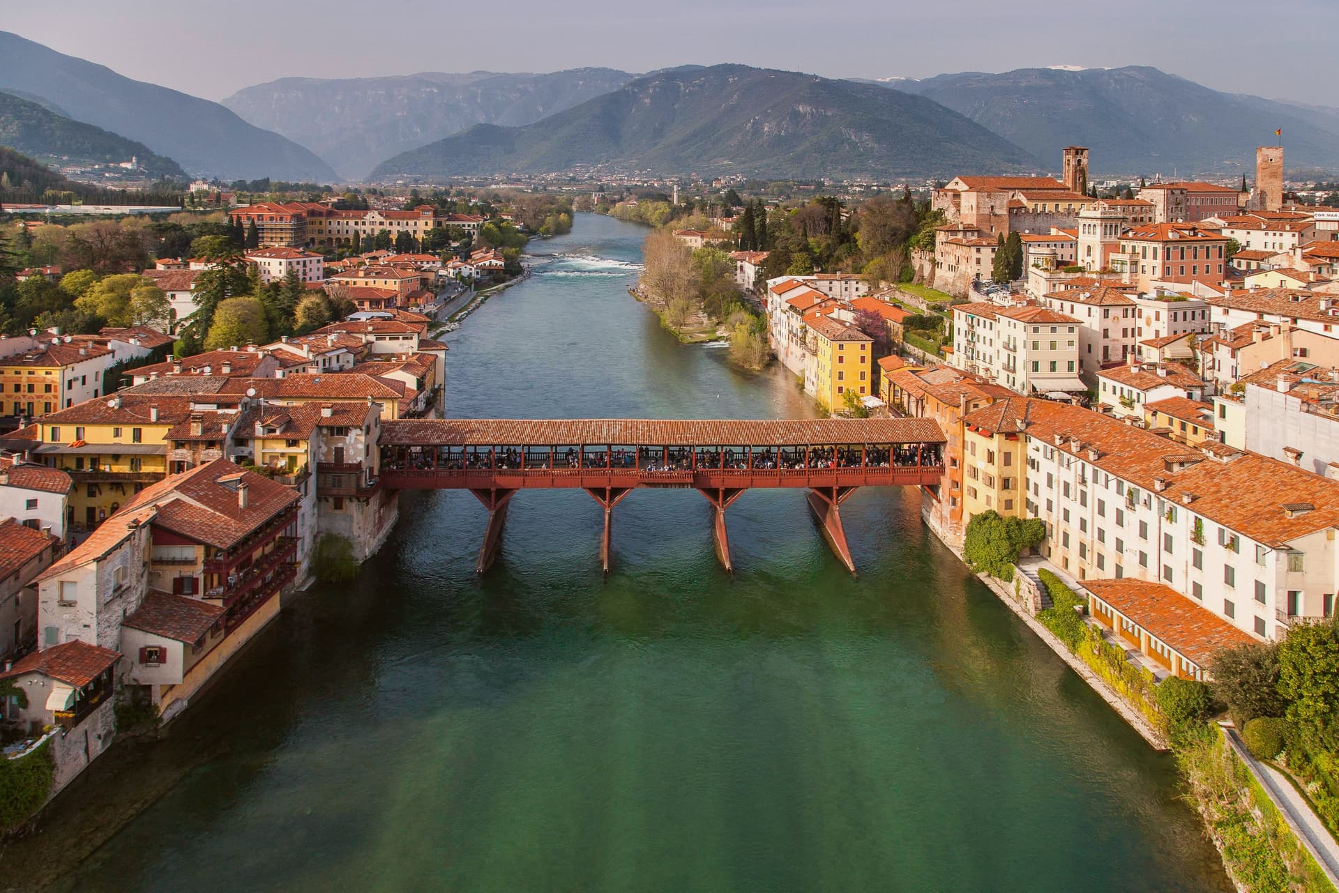
Bassano sits at 129 meters on the Brenta, where the river breaks out of the Alpine foothills onto the Veneto plain forty-five kilometers north of Padova. A Roman estate gave the town its name in the second century BC; a pre-Roman bronze sword found here in 2009 dates to the seventh century BC.
The medieval city is first mentioned in 998. Andrea Palladio designed the covered wooden bridge across the Brenta in 1569, replacing an older bridge documented since 1209.
Floods and wars destroyed it repeatedly; the current version, inaugurated 3 October 1948 with Alcide De Gasperi present, was the seventh build. The Alpini, the Italian mountain troops, adopted the bridge as their symbol in the First World War.
Nardini opened its distillery on the bridge in 1779, the oldest grappa house in Italy; Poli is its main local competitor. The city also kept the ceramics trade that flourished here from the sixteenth century, sharing the tradition with neighboring Nove.
Piazza della Libertà, with its fifteenth-century loggia and clock, holds the historic center together.
What to see in Bassano del Grappa
- Ponte degli Alpini. Covered wooden bridge designed by Andrea Palladio in 1569, rebuilt seven times after floods and wars, current version inaugurated 1948.
- Piazza della Libertà. Main square of the centro storico, overlooked by the Palazzo Municipale with its fifteenth-century loggia and clock tower.
- Grapperia Nardini. Founded 1779, the oldest grappa distillery in Italy; the tasting room on the Ponte degli Alpini still operates daily.
How to get to Bassano del Grappa
There is a railway station in the town, so you can arrive without a car and never need one while you are here. Vicenza is roughly 45 minutes away by road.
Our tip
April through June and September through October are the working months. The Brenta runs cold and clear in spring, the centro storico fills slowly on weekends, and Piazza della Libertà holds the late-afternoon aperitivo crowd without spilling over. July and August push past thirty-two degrees in the valley; Bassano is a transit town for the Asiago plateau then, used for breakfast on the way up.
Treviso
Why visit Treviso
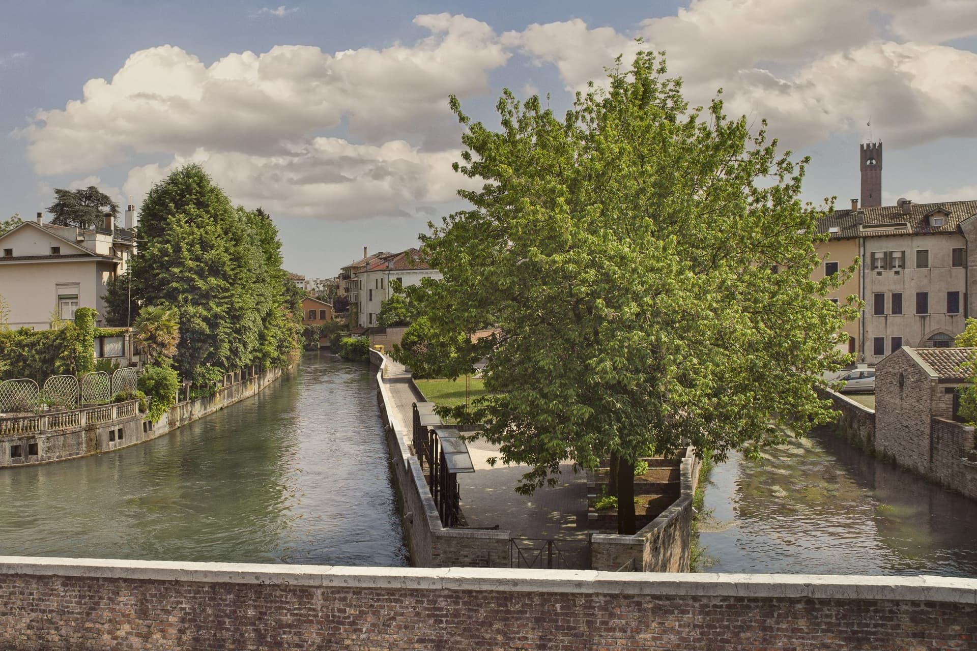
Treviso sits at 15 meters where the Botteniga flows into the Sile, twenty-five kilometers inland from Venice. The Roman Tarvisium took its name from a Celtic root for bull, and the city became a municipium after 89 BC.
After the Caminesi and a brief Scaliger domination, Treviso submitted to the Republic of Venice on 29 June 1339, the first major mainland territory of the Serenissima. The walls and ramparts that still ring the centro storico were built then and renewed in the next century under Fra Giocondo.
The Botteniga splits into a network of canals locals call the cagnan; the Sile runs the southern flank of the walls and feeds the Pescheria, the fish market on its own island. The Palazzo dei Trecento on Piazza dei Signori, the Loggia dei Cavalieri, the Duomo with the Annunciazione of Titian and the frescoed cloister of San Nicolò give the city its medieval and Renaissance spine.
Tiramisu was invented at the Alle Beccherie restaurant near the duomo in the 1970s.
What to see in Treviso
- Piazza dei Signori. Civic heart of Treviso, with the thirteenth-century Palazzo dei Trecento, the Torre Civica and the arcades that frame the medieval public space.
- Duomo di San Pietro. Cathedral founded in the twelfth century and rebuilt in the eighteenth, with the Annunciazione by Titian in the Malchiostro chapel.
- Chiesa di San Nicolò. Gothic Dominican church with frescoes by Tomaso da Modena, including the 1352 chapter house portraits of forty Dominican brothers.
How to get to Treviso
There is a railway station in the town, so you can arrive without a car and never need one while you are here. Venezia is roughly 39 minutes away by road.
Our tip
April through June and September through October are the working months. The Sile and the canals are at their best in spring and autumn, when the willows along the southern walls are in leaf and the trattorie open their courtyards. July and August push past thirty degrees and the centro storico empties in the afternoon; the canals still hold cooler air at dusk.
More from Anywhere Italy
- The best towns you can reach by train within an hour of Padua
- The best towns you can reach by train within an hour of Venice
 The best towns you can reach by train that have a serious restaurant in Veneto
- The best hot-spring towns within 90 minutes of Bologna
- The best hot-spring towns within two hours of Brescia
- The best hot-spring towns within two hours of Padua