
The best ski towns inside a national park within 90 minutes of Pescara
90 towns visited, 910 to go. Follow along, free: Subscribe on Substack
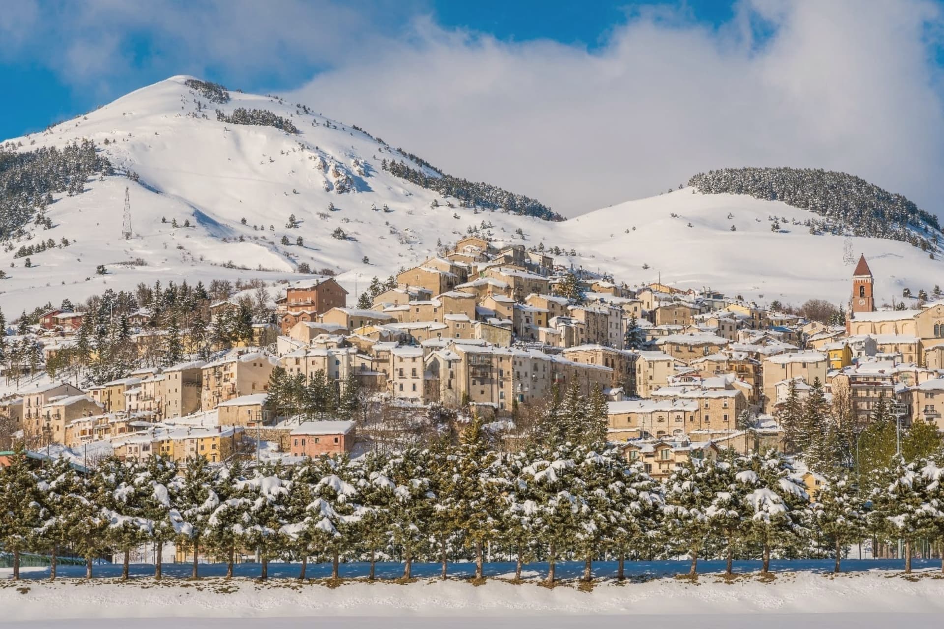
Drive inland from the Pescara seafront and the land climbs fast, from vines and olives to beech woods and then to bare limestone that holds snow into spring. The mountain towns here are built of pale local stone, with wool and wood-carving traditions that outlasted the flocks, and kitchens that lean on lamb, saffron, pecorino and lentils grown on the high plains. Winter is the season the region was made for: cold, dry, blue, with the Adriatic still visible from some ridges on a clear morning. Snow in Abruzzo is a park matter, since most of the skiable ground lies inside the Maiella, Gran Sasso or Abruzzo national parks, where wolves and bears are counted rather than imagined.
Nearly everyone points the car at Roccaraso, and with reason: it has the biggest linked ski area in the central Apennines, the fastest lifts and the widest choice of hotels. On February weekends the road up from the Sangro valley queues, the car parks fill early and the pistes carry coachloads from Naples and Rome. It works well, and it works for a lot of people at once, which is the whole problem with it.
The same mountains carry on either side of that one valley. Ski areas sit on the territory of smaller comuni across the parks, some with a couple of lifts above a stone village, some with cross-country loops through the beech, all with a bar that opens before the chairlift does. Fewer people go, the beds are in the old centers rather than in purpose-built blocks, and lunch is usually a plate of maccheroni alla chitarra rather than a canteen tray. The towns below are where the skiing and the national park are the same place.
Of the 61 communes we have mapped within 90 minutes of Pescara, 8 qualify as ski towns inside a national park: each has a ski area on its own territory, and each sits inside a national park. The smallest, Rivisondoli, has 676 residents.
If you are still choosing, we have also written The best mountain towns inside a national park within 90 minutes of Pescara and The prettiest small villages inside a national park in Abruzzo.
Why visit Rivisondoli
Rivisondoli sits on the flank of Monte Calvario, looking down at the plateau that runs north toward Roccaraso. The town was first recorded in 724 in a diploma of Grimoald II, Duke of Benevento, and grew in the 12th century along the Via degli Abruzzi, the military and trade route across the central Apennines.
It was once known for its weapons production. The 1792 fire destroyed most of the village, and the opening of the Sulmona-Isernia railway in the 19th century turned it toward tourism rather than trade.
The Italian royal family kept a residence here in 1913. Rivisondoli and Roccaraso face each other across the Cinque Miglia plateau, close enough that their ski slopes were joined into one domain and their names are now said together.
The older village, rebuilt twice, climbs one flank of the mountain while the plateau below stays open and treeless, the same ground that once slowed traders and caravans on the route through the Apennines. What began as a stop on a military road became, after fire and war remade the town twice, a place oriented instead toward winter visitors and a single night in January.
There is a mapped ski area on this commune, at 1320 meters.
What to see in Rivisondoli
- Alto Sangro ski area. The lift network runs between 1,309 and 2,142 meters, joining Rivisondoli's slopes to Roccaraso's across the open plateau.
- Presepe Vivente. Hundreds of villagers in period costume take the hillside outside town for the performance, the cast spread across the open ground rather than a stage.
- Altopiano delle Cinque Miglia. Treeless and averaging 1,250 meters, the plateau in the Alto Sangro is prone to extreme winter winds, a stretch that historically caught travelers unprepared.
How to get to Rivisondoli
Pescara is about 1 h 29 min away by road.
Our tip
December through March is the season the town runs on. The Alto Sangro lifts open, weekend numbers multiply, and the Cinque Miglia plateau north of town becomes the cross-country skiing route. The January 5 Presepe Vivente draws the biggest single crowd of the year.
Why visit Campo di Giove
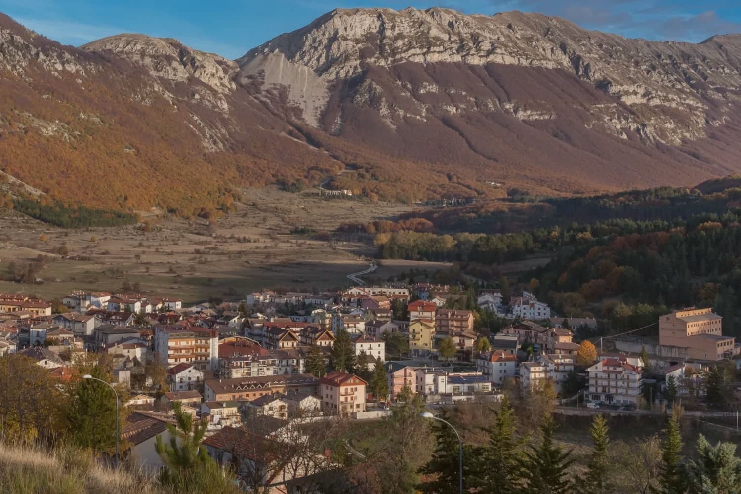
Campo di Giove sits at 1,064 meters at the foot of the southwestern Maiella, the highest commune inside the Maiella National Park. The name is documented as Campo Jovis from the 4th century AD, with local tradition claiming a Roman temple to Jupiter on the site after a victory over the Paeligni.
A villager called Odorisio appears in a document from January 1136. In the 14th century the village was a Cantelmo stronghold; it then passed to the Caldora, the Belprato, the Pignatelli, and finally the Recupito.
Above the village, the ski station operates between 1,150 and 2,360 meters, the highest piste in Abruzzo. The mother church of Sant'Eustachio holds the statue of the patron saint.
Sant'Antonino was one of the sixteen convents founded by Fra Pietro da Morrone, the hermit who would become Pope Celestine V. The Master of Campo di Giove, an anonymous 15th-century painter named for the polyptych he made for the village church, is on display at the Museo Nazionale d'Abruzzo in L'Aquila.
There is a mapped ski area on this commune, at 1064 meters.
What to see in Campo di Giove
- Chiesa Madre di Sant'Eustachio. Parish church of the village patron, with the statue of Sant'Eustachio, the saint celebrated each September with the village feast.
- Convento di Sant'Antonino. One of the sixteen convents founded by Fra Pietro da Morrone, the hermit who became Pope Celestine V, documented in a 1274 papal bull.
- Palazzo delle Logge. 16th-century palazzo with arched loggia on the main piazza, one of several Renaissance buildings from the Caldora and Pignatelli periods.
How to get to Campo di Giove
Pescara is about 1 h 22 min away by road. The full route from Rome.
Our tip
Campo di Giove runs on two seasons. December through March, the Maiella ski lifts run from the village edge to 2,360 meters, the highest piste in Abruzzo. June through September is the second season: temperatures stay below 25 even in August at 1,064 meters, and the Sentiero della Libertà hike, retracing the WWII escape route over the Maiella, draws walkers.
Why visit Pretoro
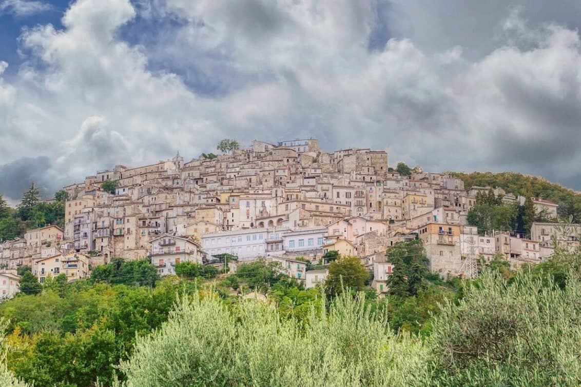
The Maiella is the limestone massif that dominates Chieti province, and Pretoro holds its eastern flank, the houses tiered in narrow stone rows up the hillside rather than spread along it. The village sits inside the Maiella National Park itself, so the wolf enclosure above town and the trails west toward the Blockhaus and Maielletta refuge are not add-ons to the place but part of its ground.
Beech forest covers the slopes above the houses, and that forest is the reason both the timber trade and the wolves ended up here: the trees fed generations of lathe and spindle work on the street below, and the same cover, higher up, gave the wildlife area a place to keep rescued animals in something like their own terrain. The patronal festival draws the two threads together, since its wolf story is acted out in the same streets where the workshops still stand.
What the village amounts to is a single hillside where a forest economy and a forest predator have been worked into daily and annual life rather than kept apart.
There is a mapped ski area on this commune, at 530 meters.
What to see in Pretoro
- Centro storico. Steep medieval village stacked on the hillside, narrow lanes between stone houses, listed among the Borghi più belli d'Italia.
- Area Faunistica del Lupo Appenninico. Enclosure at 750 meters above town, three hectares of beech, hosts up to six rescued Apennine wolves behind fencing.
- Chiesa di San Nicola di Bari. Parish church dating to the late Middle Ages, restored in the eighteenth century, holds the statue of San Domenico used in Lu Lope.
How to get to Pretoro
Pescara is about 49 min away by road.
Our tip
April through October is the season for Pretoro. The wolf enclosure stays open all year but is most accessible from spring to autumn, when trails into the upper Maiella connect from the village. The first Sunday of May brings Lu Lope and the largest crowd.
Why visit Roccamorice
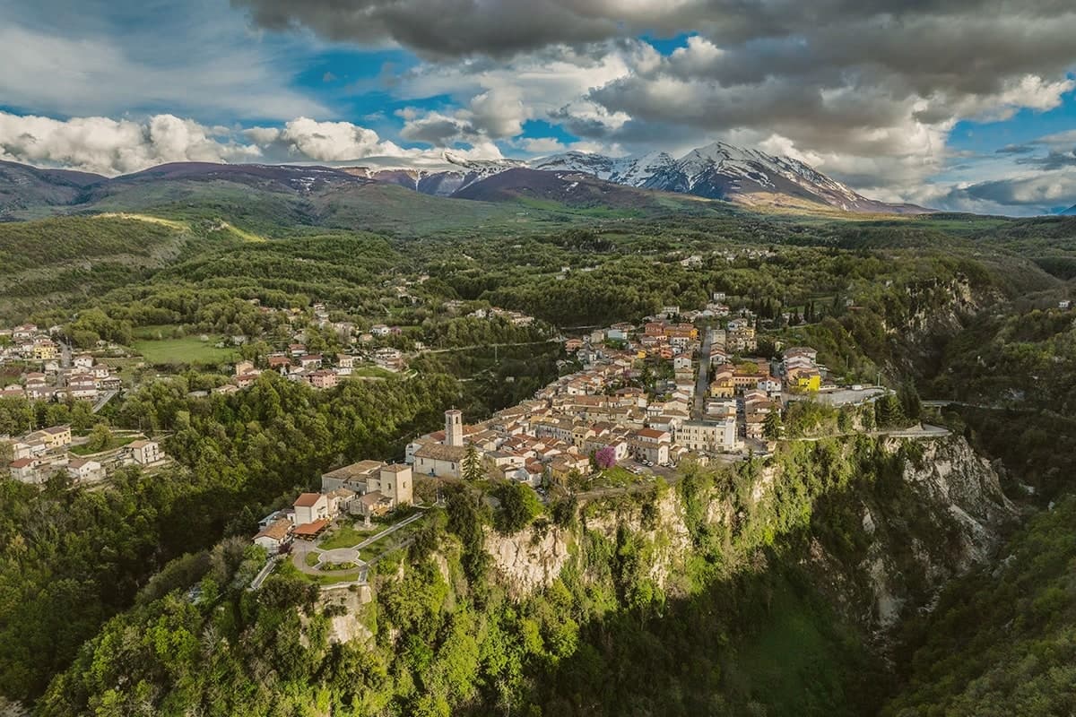
Roccamorice sits at 520 meters on the western flank of the Majella massif, inside the boundaries of the national park. The village was founded around the year 1000 and stayed small, its fortunes shaped less by the settlement itself than by the limestone around it, where the rock has been hollowed into retreats since before the 11th century.
A hermit spent two years in one of them before his election as Pope, and the larger of the two hermitages, cut partly into a cliff face, was another of his retreats during the same years on the Majella. The trails to both hermitages start in the village, so the town functions as the low point from which the mountain is entered rather than a destination in itself.
That relation is repeated every August 25, when a statue is carried down from the rock to the parish church and, presumably, back again: the village receives what the mountain holds. The abdication that followed, an event Dante placed in his Inferno, is the one moment when a hermit's retreat from the world became a subject of it.
There is a mapped ski area on this commune, at 520 meters.
What to see in Roccamorice
- Eremo di San Bartolomeo in Legio. Pre-11th-century rock-cut hermitage at 700 meters under a 50-meter cliff, restored in 1250 by the future Pope Celestine V.
- Eremo di Santo Spirito a Majella. Larger hermitage partly cut into the limestone, reached by the same trails that climb from the village into the massif.
- Chiesa di Sant'Antonio Abate. Parish church of the village, end point of the August 25 procession carrying the statue of the hermitage's patron saint down from the rock.
How to get to Roccamorice
Pescara is about 1 h away by road.
Our tip
April through June and September through October are the months for the hermitage trails, when the limestone is dry and the upper Majella is accessible. July and August can be hot below 800 meters, though the higher hermitages stay cool in the rock. The August 25 procession of San Bartolomeo from the hermitage to the parish church is the village's main gathering.
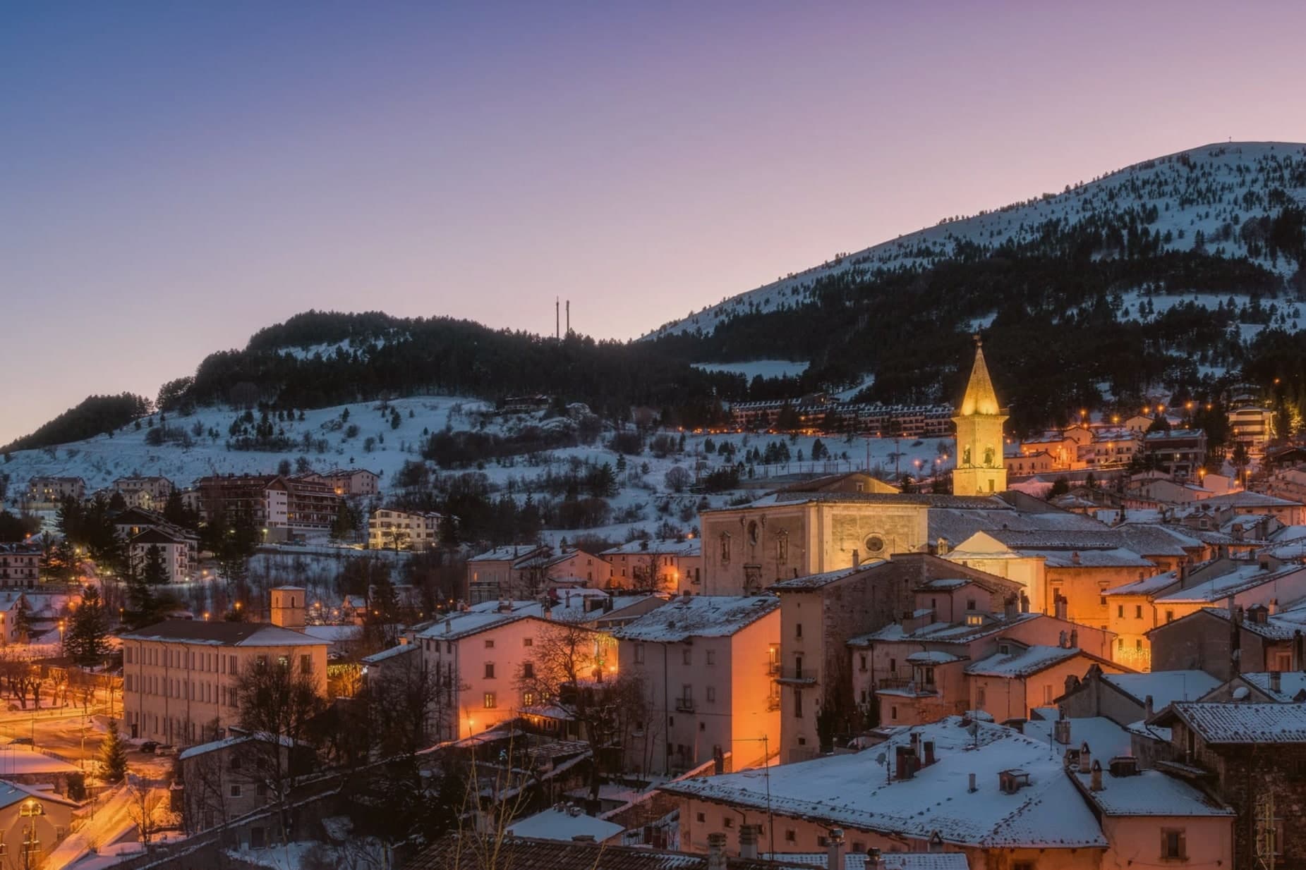
Why visit Pescocostanzo
Pescocostanzo sits at 1,395 meters at the southern edge of the Quarto Grande plateau, the high karst basin above the Sangro valley. The town was reshaped between 1456 and the eighteenth century under the Capua family and a generation of Lombard masons who arrived to build for them.
The plan is unusually regular for a mountain commune: a grid of stone houses oriented to the wind, surrounded by woods and pasture. The Collegiata di Santa Maria del Colle, restructured by Cosimo Fanzago in the seventeenth century, is one of the rare five-nave churches in Abruzzo.
Its wrought iron Chapel of the Sacrament gate, made by Sante di Rocco between 1699 and 1707, is the masterpiece of local ironwork. Bobbin lace, merletto al tombolo, is still made here.
The Museo del Merletto a Tombolo inside Palazzo Fanzago shows the technique and the patterns. Filigree gold, carved wood, and lace are still sold on the Corso Roma.
There is a mapped ski area on this commune, at 1395 meters.
What to see in Pescocostanzo
- Collegiata di Santa Maria del Colle. Five-nave church begun in the late Middle Ages and remodeled by Cosimo Fanzago in the seventeenth century.
- Museo del Merletto a Tombolo. Inside Palazzo Fanzago, displays the local bobbin lace tradition with patterns, tools, and live demonstrations.
- Palazzo Fanzago. Designed by the baroque architect Cosimo Fanzago in 1624, the seat of the lace museum and civic offices.
How to get to Pescocostanzo
Pescara is about 1 h 24 min away by road.
Our tip
December through March brings snow and the ski season, with the Monte Calvario lifts linking to the Alto Sangro system at Roccaraso and Rivisondoli twenty minutes away. June through September is the second season. At 1,395 meters Pescocostanzo rarely crosses twenty-two degrees even in August, and the Bosco di Sant'Antonio offers beech-shaded walks.
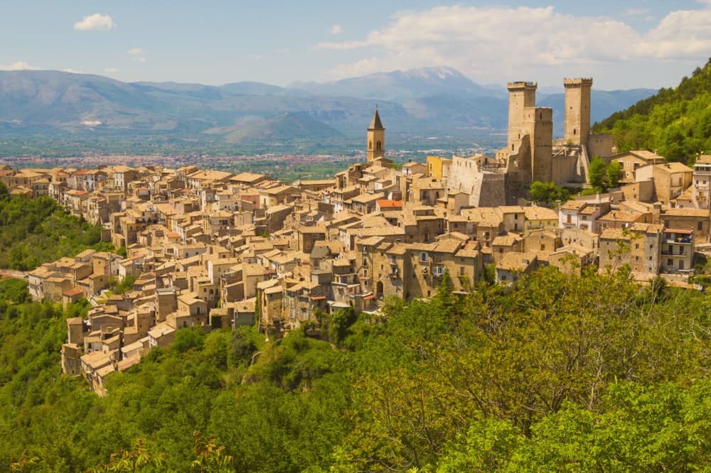
Why visit Pacentro
Pacentro sits at 650 meters on a hill spur in the Peligna valley, eight kilometers from Sulmona and inside the Maiella National Park. The Castello Caldora, with its three surviving square towers, dominates the village from the Colle Castello above.
The site has held a castle since the eleventh century; the structure visible today was begun by the Caldora-Cantelmo family in the late fourteenth century and bought by the comune in 1957 and restored. On the first Sunday of September, the Corsa degli Zingari sends barefoot runners down a rocky slope from Monte Ardinghi into the village in honor of the Madonna di Loreto.
The race is documented since the fifteenth century. The other thing people come for is the Ciccone house.
Madonna's paternal grandparents, Gaetano Ciccone and Michelina Di Iulio, emigrated from Pacentro in 1919. The pop singer visited in 2013.
There is a mapped ski area on this commune, at 650 meters.
What to see in Pacentro
- Castello Caldora-Cantelmo. Late fourteenth-century fortress on the Colle Castello, three of its four corner towers still standing, restored after 1957.
- Borgo medievale. Stone houses arranged on terraces below the castle, listed among the Borghi più belli d'Italia, preserved in its medieval plan.
- Chiesa di Santa Maria Maggiore. Sixteenth-century parish church with a baroque interior, holding the Madonna di Loreto honored in the September race.
How to get to Pacentro
Pescara is about 1 h 9 min away by road.
Our tip
May through October is when Pacentro opens. The first Sunday of September brings the Corsa degli Zingari and the biggest crowd of the year, with runners descending barefoot from Monte Ardinghi and the village in procession by evening. July and August can be warm in the valley but the elevation keeps Pacentro itself cooler than Sulmona below.
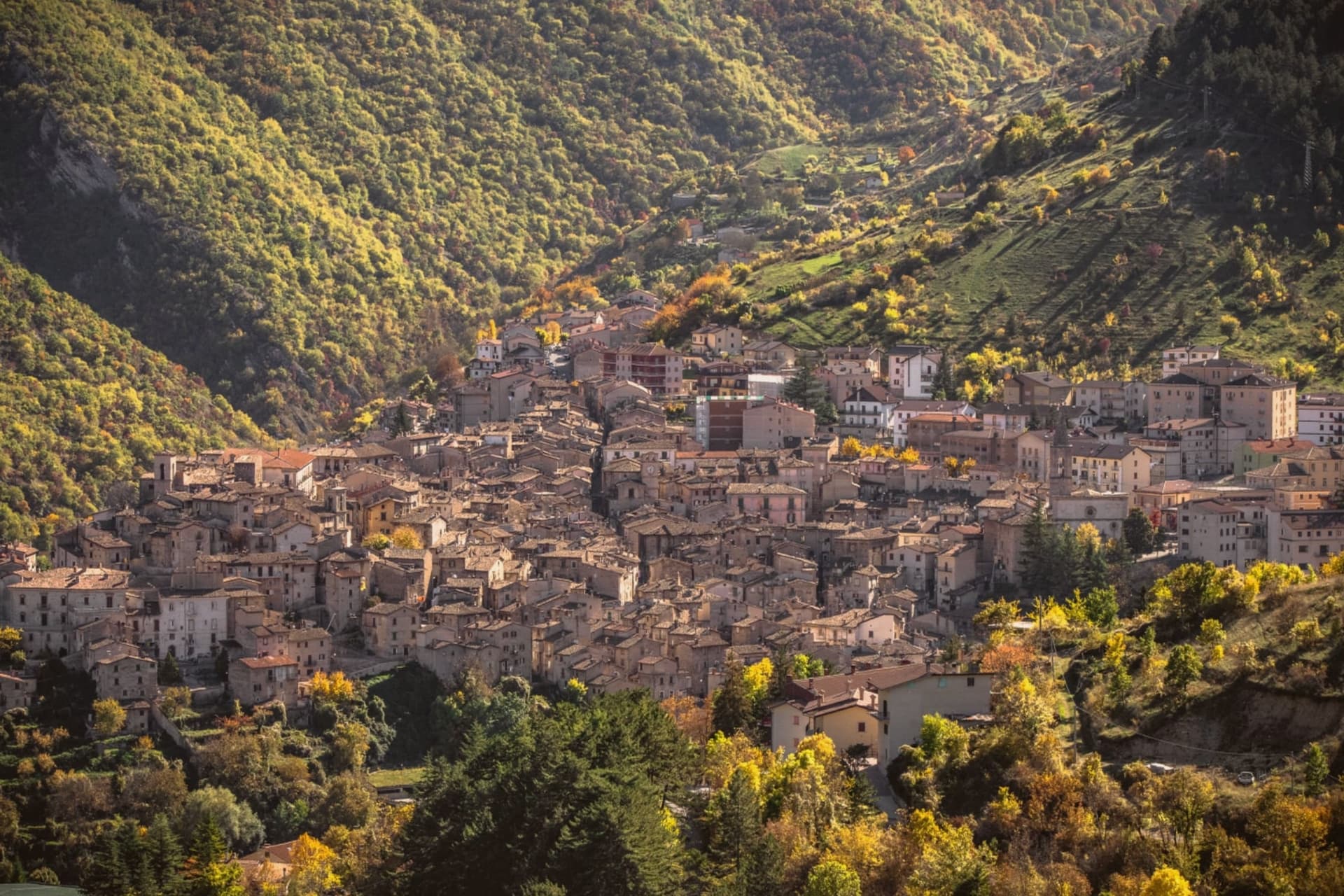
Why visit Scanno
Scanno sits in the Sagittario valley, ringed by the Majella foothills and the Marsicano massif. The lake lies three kilometers down the valley from the town, at a lower elevation, so the walk between them moves from stone alleys to open water framed by the same slopes that produced it: a landslide off the mountain dammed the Tasso river and left the basin behind.
The town's isolation, closed in by the surrounding massifs, is what let the older costume and its headdress survive into the era of the camera, and it is what drew photographers to record it rather than something they invented. The goldsmiths' filigree, made in the same stone streets the women walked, belongs to the same thread: a village shaped by its enclosure in the mountains, still making by hand what it has always made.
There is a mapped ski area on this commune, at 1057 meters.
What to see in Scanno
- Lago di Scanno. Seen from above, the water reads as a clean heart shape against the valley walls.
- Centro storico. Stone-alley medieval center where the black costume, with its folded headdress some historians trace to Balkan or Eastern origins, is still worn by older women against limewashed walls.
- Chiesa di Santa Maria della Valle. Parish church first documented in the eleventh century, rebuilt in the seventeenth, with a Renaissance portal and Baroque interior.
How to get to Scanno
Pescara is about 1 h 20 min away by road.
Our tip
June through September is the summer window: trails open in the national park, the lake holds a Blue Flag for swimming, and the centro fills with photographers chasing the Giacomelli setups. December through March is the second season for snow, with skiing on Monte Rotondo and Passo Godi nearby. April, May, October and November are quiet, with many family-run hotels closed and the lake side restaurants shuttered.
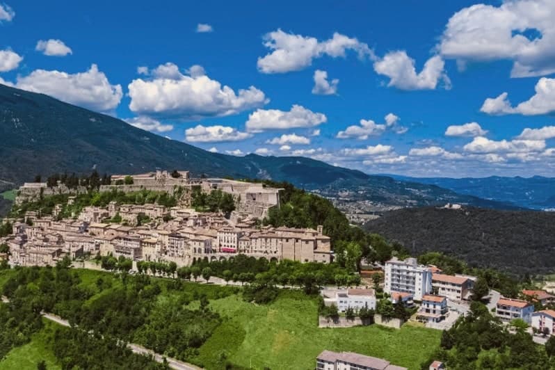
Why visit Civitella del Tronto
Civitella del Tronto sits at 589 meters on a long limestone ridge above the Tronto valley, on the old border between the Papal States and the Kingdom of the Two Sicilies. The Fortezza that runs the spine of the town is the largest fortress in Italy and the second-largest in Europe after the Hohensalzburg at Salzburg, 500 meters long, 45 meters wide, 25,000 square meters of walls, courtyards, and casemates.
It is the reason people come. In 1860 and 1861 the Piedmontese army laid siege to it for five months.
The Bourbon garrison capitulated on 20 March 1861, three days after the Kingdom of Italy had already been proclaimed in Turin. Civitella was the last Bourbon flag still flying.
The centro storico below the fortress narrows into the Ruetta, said to be one of the narrowest streets in Italy at 38 centimeters at its tightest. The town sits inside the Gran Sasso and Monti della Laga National Park.
There is a mapped ski area on this commune, at 589 meters.
What to see in Civitella del Tronto
- Fortezza di Civitella del Tronto. The largest fortress in Italy at 25,000 square meters, last stand of the Bourbon Kingdom of the Two Sicilies in March 1861.
- La Ruetta. Reputedly one of the narrowest streets in Italy, 38 centimeters at its tightest, threading the centro storico below the fortress.
- Chiesa di San Lorenzo. Sixteenth-century parish church inside the walls, with a Renaissance façade and altars salvaged after the 1861 siege.
How to get to Civitella del Tronto
Pescara is about 1 h 12 min away by road.
Our tip
April through June and September through October are the months to climb the ridge. The light is clear, the fortress walls hold warmth into the evening, and the chestnut woods on the Laga side are at their best in October. July and August work, but the stone surfaces of the fortress heat up under direct sun and the climb from the lower town is a slog by midday.
Read a sample letter
A detour with a fixed race
Letters from the towns we visit. Free.
The button takes you to the letter's own page on Substack, where you leave your email. About the letter
More from Anywhere Italy
- The best mountain towns inside a national park within 90 minutes of PescaraNear Pescaramountaininside a parkwithin 90 min10 towns · smallest 114 residents · closest 69 min away
- The prettiest small villages inside a national park in AbruzzoAbruzzoinside a parkprettiest villagessmall10 towns · smallest 114 residents
- The best hidden towns inside a national park that eat well within 90 minutes of PescaraNear Pescarainside a parkwithin 90 mineats wellhidden6 towns · smallest 676 residents · closest 48 min away
- The prettiest villages inside a national park within 90 minutes of PescaraNear Pescarainside a parkwithin 90 minprettiest villages10 towns · smallest 114 residents · closest 48 min away
- The best small ski towns in the province of L'AquilaL'Aquila provinceski areasmall10 towns · smallest 575 residents
- The best small hill towns inside a national park in AbruzzoAbruzzohill towninside a parksmall10 towns · smallest 420 residents