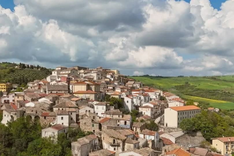
The best small hill towns in Puglia
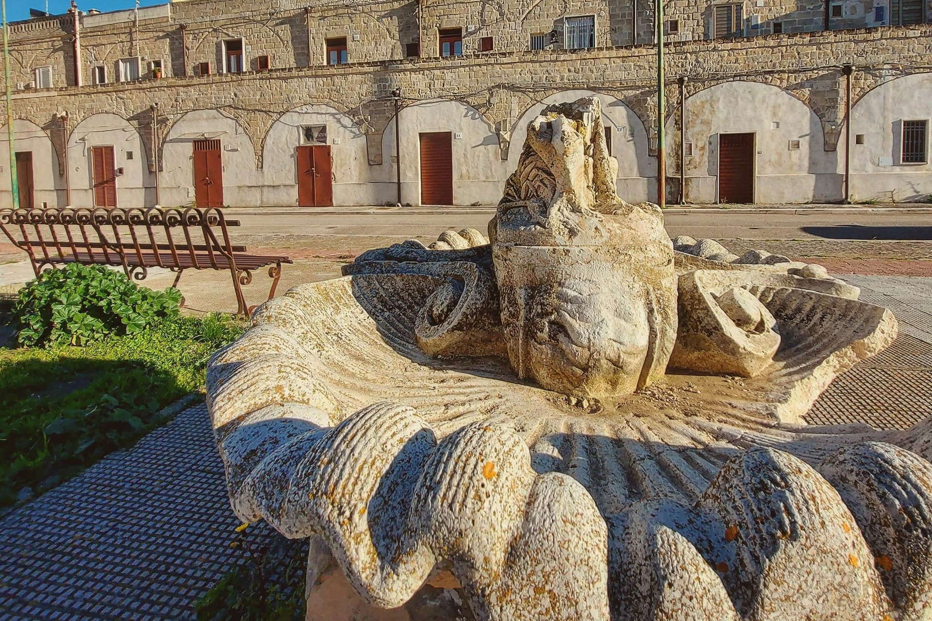
Away from the sea, Puglia goes up. The Daunian mountains in the north and the low limestone rises of the Salento carry settlements that were built for defence and never had room to spread, so the houses lean into each other in pale local stone, whitewashed at the doorways, roofed in flat tiles that hold the heat. Spring brings wild fennel and broad beans, and the plates that follow are the inland ones: fava and chicory, orecchiette with turnip tops, lamb cooked slowly with potatoes, bread from Altamura-style flour with a crust like a shell. Autumn is olive harvest, and the mills run late. In winter the wind comes off the Apennines and the bars are full at four in the afternoon.
Most people going to Puglia go to the coast or to Alberobello, where the trulli fields are remarkable and the tour coaches arrive in convoy from Bari from mid-morning onward. The Valle d'Itria has good reason to be busy: the drystone architecture is unlike anywhere else in Europe, and Ostuni's white slope above the olive groves photographs perfectly. But the visitor route through this part of the region has narrowed to a handful of names, and in July the queues for the trullo interiors run down the street.
The hills do not stop where the tour ends. The same tufa, the same olive terraces, the same slow food carry on north into the Subappennino Dauno and south into the deep Salento, and that is where these towns are. They are small, some very small, with a castle keep or a mother church at the top and the streets falling away beneath it. Fewer people go, which mostly means the bakery still bakes for the town rather than the bus.
Of the 59 communes we have mapped in Puglia, 34 qualify as hill towns: each is an inland hill settlement built on ground too steep to spread. This list is the small ones, 6 in all, ordered smallest first. The smallest, Poggiorsini, has 1,273 residents.
Two more lists worth reading alongside this one: The 6 best hidden hill towns in the province of Lecce and The best hill towns in the province of Lecce.
Poggiorsini
Why visit Poggiorsini
The name records the founding family. The Orsini dukes of Gravina bought the rural estate in 1609 and turned it into a working settlement, raising the ducal palazzo and the parish church of Maria Santissima dei Sette Dolori between 1723 and 1727.
Until 1957 the village was a frazione of Gravina, administered from outside its own borders even as the palazzo and church gave it the shape of a town; only in that year did it become an autonomous commune, and with 1,273 residents it remains the smallest in the metropolitan city. The village sits at 461 meters on the Alta Murgia, fifty-five kilometers south of Bari, entirely inside the national park that carries the plateau's name.
Three kilometers north, on the road between Gravina and Spinazzola, a fortress ruin stands on a Murgia outcrop above the old road that once linked the two towns, listed among the emperor's holdings and predating the town itself by centuries. The current parish church replaced the older building after the 1930 Vulture earthquake, so the settlement's oldest structure sits outside it, on the plateau, while the village center is largely a rebuilt one.
What the estate's late founding and its small size add up to is a place whose civic history is short and legible: bought, built, and only recently let govern itself, set inside a landscape far older than any of its buildings.
What to see in Poggiorsini
- Castello del Garagnone. Norman fortress on a Murgia ridge three kilometers north, rebuilt by Frederick II in 1220 to control the Appian Way; now ruins in the national park.
- Chiesa di Maria Santissima Addolorata. Three-nave parish church built shortly after the 1930 Vulture earthquake, the centerpiece of the modern village.
- Palazzo Orsini. Ducal palace raised by the Orsini family between 1723 and 1727 when they reorganized the rural estate into a town.
How to get to Poggiorsini
Bari is roughly 77 minutes away by road.
Our tip
April through June and September through October are the months the Murgia stays workable: green grass, dry air, the karst plateau at its clearest. July and August push past thirty-five degrees on the open uplands; shade is scarce and the wind off the plain is dry rather than cooling. November through March is cold and quiet at 461 meters, with frost on the plateau and frequent fog at dawn.
Giurdignano
Why visit Giurdignano
Giurdignano sits inland from Otranto on the limestone shelf of southern Salento, at 78 meters, four kilometers from the Adriatic. The village has fewer than two thousand residents and the highest concentration of megalithic monuments in Italy.
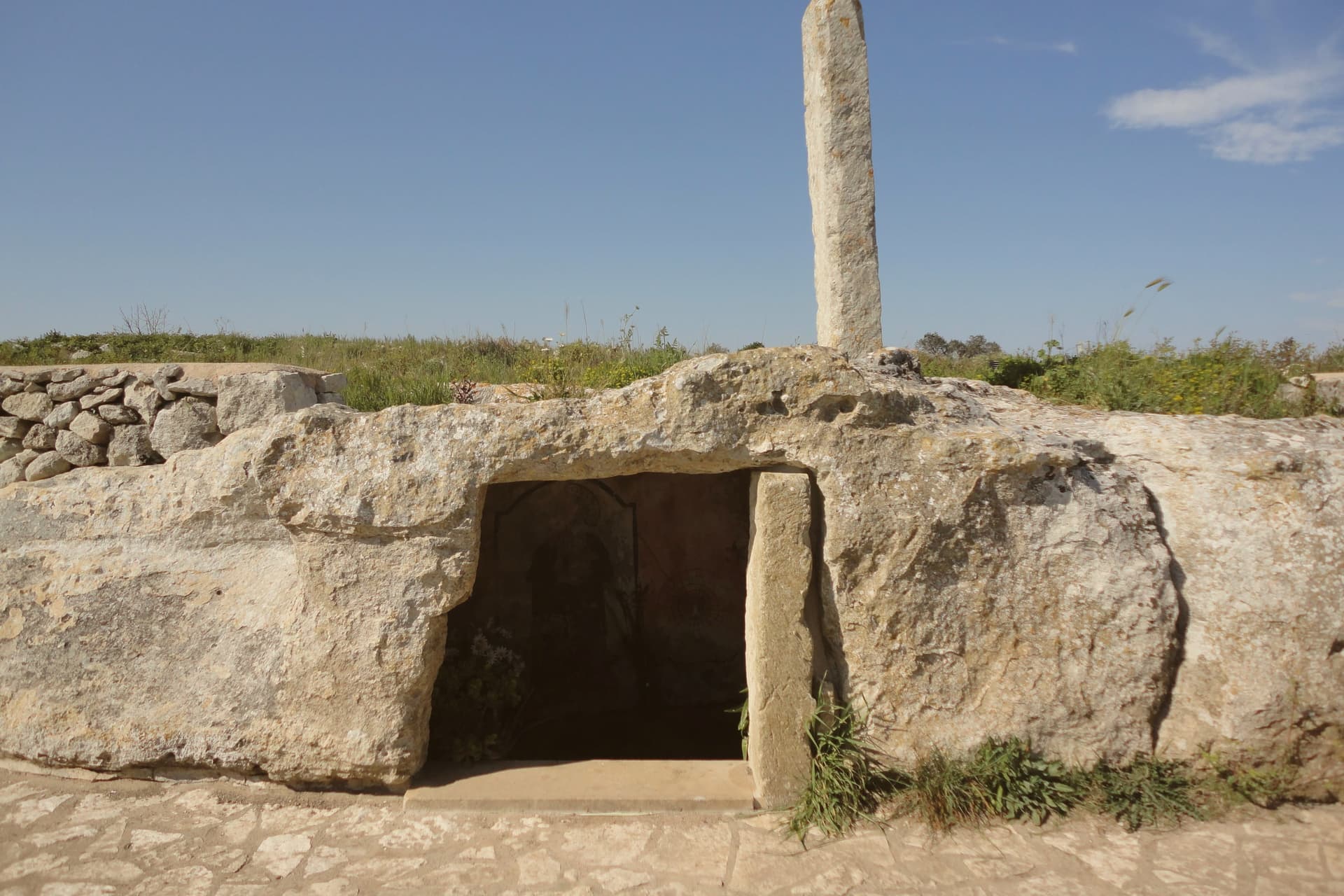
Nineteen menhirs stand in the countryside around it, the tallest the Menhir San Vincenzo at over three and a half meters; several were Christianized in the early medieval period, including the Menhir San Paolo, set beside a Byzantine rupestrian crypt and pierced at the top for an iron cross. The dolmens nearby are likely from the fifth or fourth millennium BC.
Roman imperial necropoleis from the second and third centuries AD have surfaced in the Cantalupi locality. The borgo joined the Città del Tartufo network for the Salento white truffle found in the surrounding macchia and olive groves.
Giurdignano runs as a quiet base for the Otranto coast, four kilometers away.
What to see in Giurdignano
- Menhir San Paolo. Christianized prehistoric standing stone beside a Byzantine rupestrian crypt, pierced at the top in the early medieval period to hold an iron cross.
- Menhir San Vincenzo. The tallest menhir in the Lecce province at over 3.5 meters, one of the nineteen prehistoric standing stones in the territory of Giurdignano.
- Dolmen Stabile. Megalithic funerary chamber on the road to Uggiano, three slabs and a capstone, dated to the fifth or fourth millennium BC.
How to get to Giurdignano
There is a railway station in the town, so you can arrive without a car and never need one while you are here. Taranto is roughly 128 minutes away by road.
Our tip
April through June is mild on this stretch of southern Salento, the countryside in flower and the menhir paths walkable without sweat. July and August push past thirty-five degrees and most travelers move on to the Otranto seafront four kilometers east; the borgo itself stays quiet. September and October cool back down for the olive harvest and the white-truffle season starts in the surrounding macchia.
Nociglia
Why visit Nociglia
Nociglia sits at about 90 meters in the southern Salento, forty kilometers south of Lecce and ten kilometers west of the Adriatic. The name appears on the medieval itinerary map of the Via Traiana as Nucillium, which records that the Roman road passed through and the site was already settled.
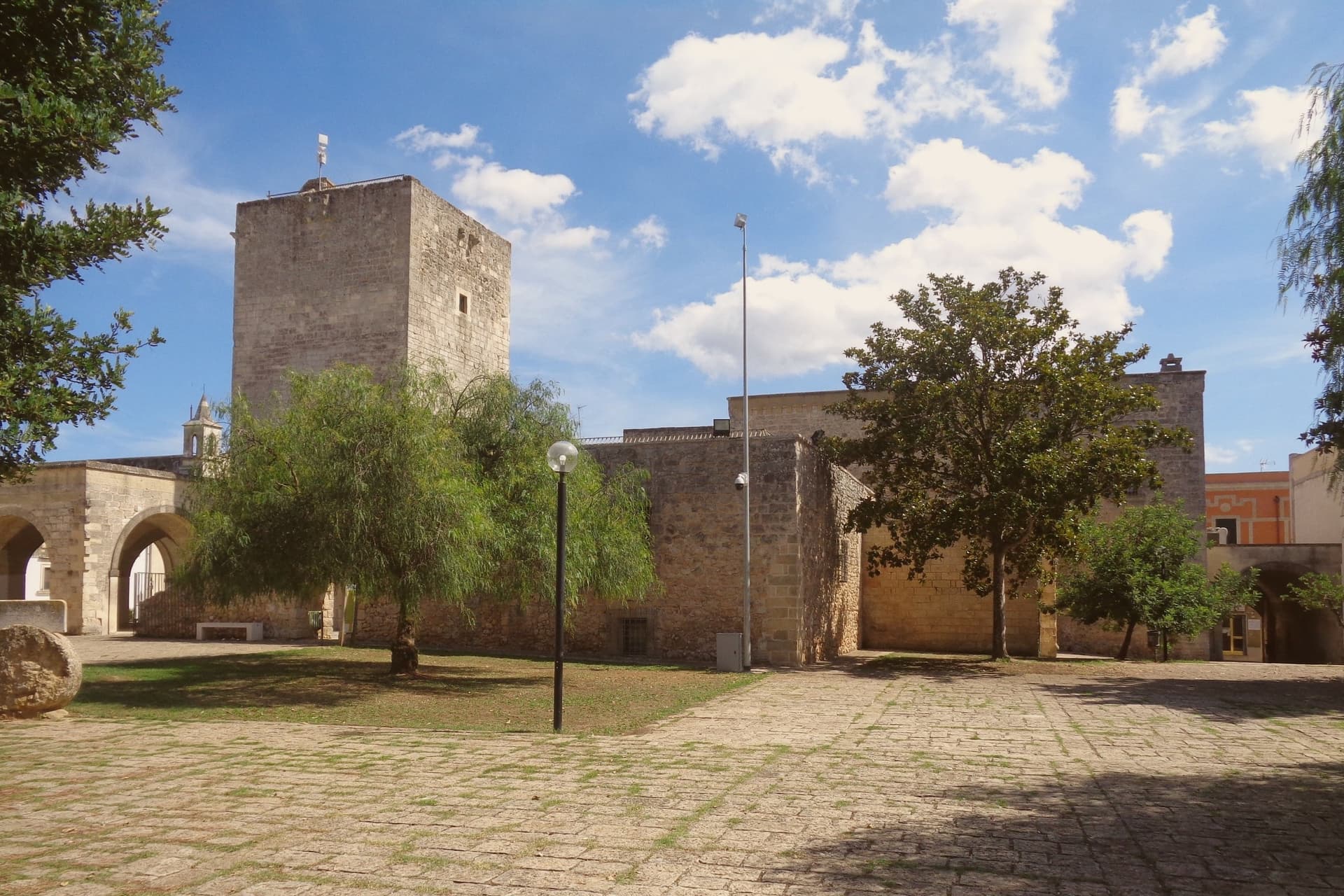
The first documentary mention places Nociglia in the Principato di Taranto in 1378, a Norman-Angevin fief on the Salento interior. The watchtower in the centro storico was built in the early fourteenth century; the nucleus of the Castello Baronale dates to the late fourteenth century and was extended over the following centuries by the local barons.
The Bosco Belvedere that gave the village its origin, where Messapian populations took refuge during the Roman advance, still survives in fragments around the commune. Population is just over two thousand and shrinking, the standard Salento interior pattern.
What to see in Nociglia
- Castello Baronale. Late fourteenth-century baronial castle in the centro storico, extended over the following centuries, the village's principal civic monument.
- Torre di Nociglia. Early fourteenth-century watchtower in the old town, one of the few surviving Angevin defensive towers in the southern Salento interior.
- Centro storico. Small Salento village core organized around the castle and parish church, stone houses with the typical flat roofs of the lower peninsula.
How to get to Nociglia
Taranto is roughly 130 minutes away by road.
Our tip
April through June and September through October are the workable months in the southern Salento interior: olive flowering in spring, mild evenings, the Bosco Belvedere green and walkable. July and August touch thirty-six degrees and the small centro storico empties in the afternoon; the Adriatic is ten kilometers east and pulls the village down to the coast on weekends. The patronal festa falls in late summer.
Pietramontecorvino
Why visit Pietramontecorvino
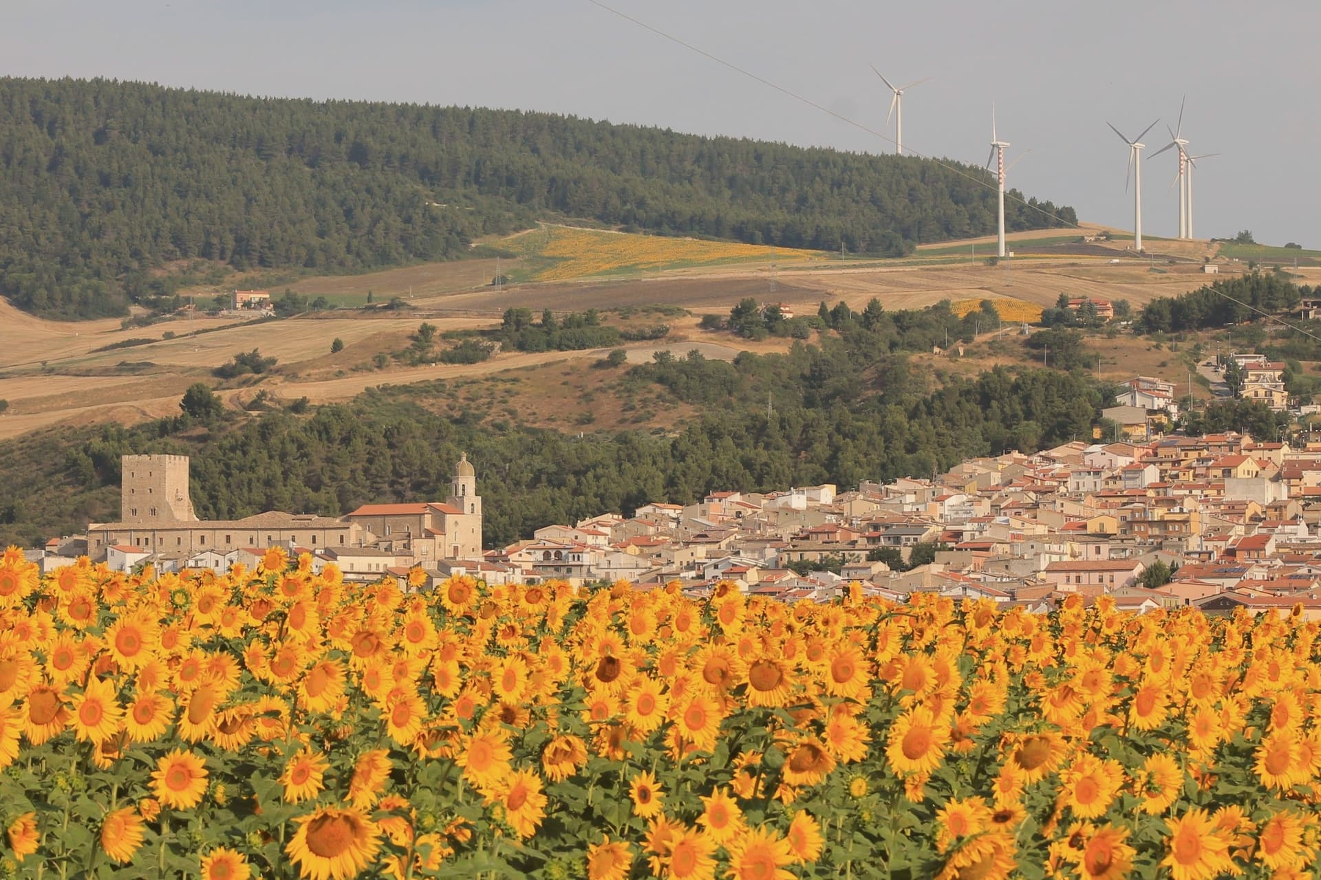
The village sits on a tufa rock spur above the Guado degli Uncini and the Triolo stream, which feeds the Candelaro. The name of the historic core, Terravecchia, marks it as the older settlement, the ground the village grew from before building spread beyond the spur.
The tower and ducal palace sit at the edge of this older quarter, adjoining the mother church, so that the defensive, residential and religious centers of the medieval village stand within reach of one another rather than scattered across it. The tower's passage through Norman, Swabian and Angevin hands, watchtower under Frederick II and then noble residence under the Angevins, and the palace's dating by coat of arms to the same Anjou period, mean the two structures record the same sequence of rule in stone.
What the site adds up to is a village whose defensive and administrative center never moved: tower, palace and church were built adjoining one another on the same spur, and the rock-cut houses of the old quarter grew up around that fixed point rather than apart from it.
What to see in Pietramontecorvino
- Torre Normanna. The tower rises over the ducal complex with mullioned windows, a balcony and a crenellated terrace added when the Angevins converted it to a residence. It stands at the point where the rock spur is narrowest, visible before the rest of the village comes into view.
- Palazzo Ducale. Three floors around two courtyards, a reception hall and a roof garden, adjoining the tower. A coat of arms on the Ducal Arch dates the building to the Anjou period.
- Terravecchia. Tufa-stone dwellings on the spur, some cut so far into the rock that facade and cliff face are the same surface. Streets follow the contour of the outcrop rather than a plan.
How to get to Pietramontecorvino
Foggia is roughly 39 minutes away by road.
Our tip
April through June and September through October are the workable Subappennino months at 456 meters: cool mornings, dry afternoons, the Triolo valley green in spring and gold in autumn. July and August can touch thirty-three on the spur and the village empties at midday, though evenings stay workable. October is the olive harvest in the lower Dauni slopes.
Biccari
Why visit Biccari
Biccari sits at 450 meters on the eastern slope of the Subappennino Dauno, with Monte Cornacchia rising behind it at 1,151 meters, the highest point in Puglia. The municipal territory runs from the peak down to the Tavoliere plain, an unusual vertical range for a Puglian commune.
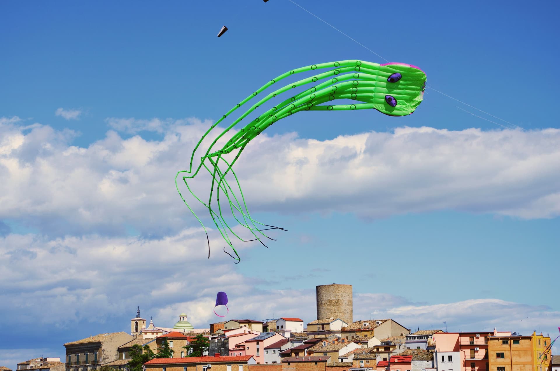
The village was founded by Byzantine catepan Basilio Boioannes around 1024, then taken in the 1050s by a Norman called Pagano who fortified the original tower into a small castrum. The Torre Bizantina still stands at the centre of the village, a square stone tower that names everything around it.
The town carries four institutional signals at once, including Bandiera Arancione and Comuni Virtuosi, and runs an active second-home repopulation scheme. A Neolithic site at Boschetto, 700 meters up the Organo torrent, is one of the highest of its age in Puglia, evidence of seasonal habitation four thousand years before Christ.
What to see in Biccari
- Torre Bizantina. Square stone watchtower built by the Byzantine catepan around 1024, the structure the Norman fortifications grew around, still the highest point in the village.
- Chiesa Madre di Santa Maria Assunta. Mother church in the centro storico, rebuilt over the centuries on Byzantine and Norman foundations, anchoring the upper village.
- Lago Pescara. Small upland lake in the Cornacchia foothills, used for fishing and a summer walking circuit, at the edge of the beech and oak woodland.
How to get to Biccari
Foggia is roughly 40 minutes away by road.
Our tip
April through October are the months the Subappennino Dauno stays workable: cool evenings, dry summer air, the Cornacchia trails open. June through August reach the high twenties at 450 meters while Foggia bakes; the village climate is the main argument for visiting in high summer. October brings the chestnut and porcini season in the woods above the lake.
Specchia
Why visit Specchia
Specchia sits on the Serra Magnone at 130 meters, one of the higher points in lower Salento, forty-five kilometers south of Lecce and ten kilometers from the Ionian coast. The name comes from the specchie, conical piles of dry stones the Messapians built across the peninsula as defensive lookouts.
The medieval nucleus formed in the ninth century when Saracen raids pushed coastal villagers inland and onto the hill. The fifteenth-century street plan survives intact: a tight grid of alleys, courtyards and Baroque portals enclosed by what remains of the walls.
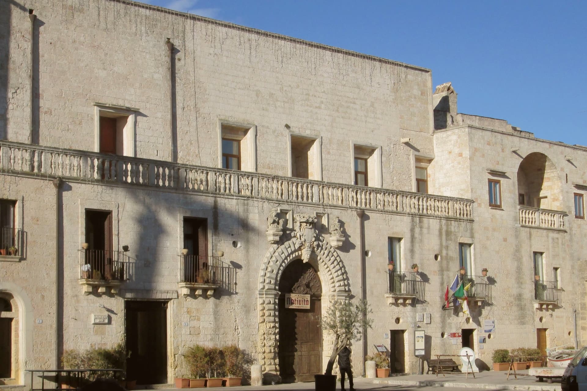
Castello Risolo dominates the center, a sixteenth-century block enlarged in the seventeenth century by the Trane and Protonobilissimo families as their residence. The Convento dei Francescani Neri dates to 1531.
Specchia entered the Borghi più belli d'Italia network in 2004 and the Ministry of Tourism named it Gioiello d'Italia in 2012. Walking the lanes after dusk, the village reads as one continuous courtyard.
What to see in Specchia
- Castello Risolo. Sixteenth-century castle in the heart of the centro storico, enlarged between 1600 and 1700 by the Trane and Protonobilissimo families as their noble residence.
- Convento dei Francescani Neri. Franciscan church and convent of the Black Friars, documented from 1531, with harmonious lines that anchor the upper edge of the old town.
- Centro storico medievale. Fifteenth-century street plan of narrow lanes, stone staircases, courtyards and Baroque portals, preserved nearly intact within the line of the old walls.
How to get to Specchia
There is a railway station in the town, so you can arrive without a car and never need one while you are here. Taranto is roughly 145 minutes away by road.
Our tip
April through June and September through October are the months to come: warm afternoons, cool evenings on the ridge, the countryside green or in olive harvest. July and August push past thirty-five degrees and the old town empties between two and five in the afternoon, then refills after sunset for the passeggiata. The Ionian beaches at Torre Vado and Pescoluse sit ten to fifteen kilometers away and absorb most of the August crowd.