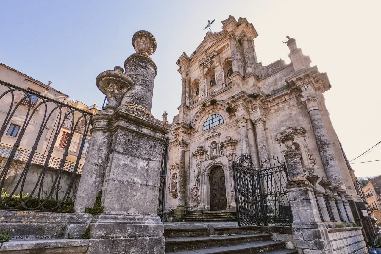
The best small coastal towns in Sicilia
The Sicilian coast changes material as you move around it. On the Ionian side the houses are cut from grey lava stone and pale limestone, stacked on ridges with the sea a long way below and Etna smoking behind. West of Palermo the rock turns white and chalky, the beaches go to fine sand, and couscous with fish broth appears on menus alongside almond granita and tuna preserved in oil. Late spring and early autumn are the seasons that work best: the water holds its warmth into October, the caper bushes flower on the island walls, and the heat of high summer has let go of the interior roads.
The obvious version of this coast is Taormina, with the Greek theatre looking out over the bay and the Corso lined all the way down. It earns its reputation, and the crowds arrive by the coachload from the cruise berths at Messina and Catania from morning onwards. Hotel prices in August reflect that, and so do the queues for a table with a view. Cefalù, on the north coast, has been going the same way for years.
The coast does not stop where the famous names do. The same lava ridges above the Ionian carry villages with Norman churches and views down to the same bay, and the same Tyrrhenian water runs out to islands of black rock and cactus where cars are close to pointless. This list keeps to the smaller places, each one sitting on the sea or looking straight down at it, and each worth a detour off the road everyone else takes.
Of the 61 communes we have mapped in Sicilia, 23 qualify as coastal towns: each sits directly on the sea. This list is the small ones, 8 in all, ordered smallest first. The smallest, Forza d'Agrò, has 835 residents.
Elsewhere in the catalogue: The best coastal towns in the province of Messina and The prettiest villages in the province of Messina.
Forza d'Agrò
Why visit Forza d'Agrò
The first record of the settlement, vicum Agrillae, is in a 1117 decree of Roger II. It names a lower site, the one the residents eventually abandoned when they moved uphill to the rock and renamed the place Fortilicium d'Agrò, the fortress of Agrò, a name the ruin on the peak still carries.
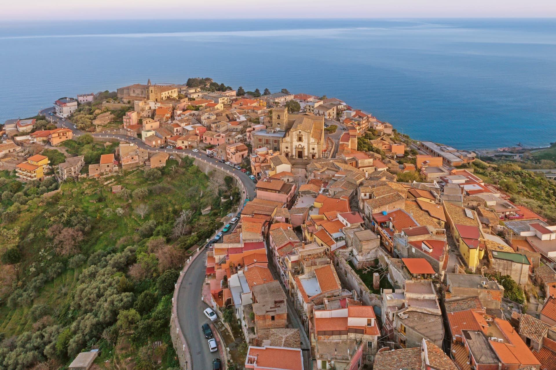
The move from lower ground to the high rock explains the layout that remains: the fortress and its silhouette at the top, the mother church rebuilt after the 1648 and 1693 earthquakes lower down, and the Trinità with its convent of Sant'Agostino set apart from both, reached by its own staircase. The village looks north to Calabria across the strait and sits ten kilometers from Taormina, close enough to the coast to be seen from it but built with its back to the sea.
What the earthquakes and the rebuilding left behind is a village whose churches carry more damage and repair in their walls than its ruined castle does, a place shaped as much by disaster and recovery as by the Norman name on the summit.
What to see in Forza d'Agrò
- Castello Normanno. The ruin still crowns the highest point of the village, visible from the coast road below as the shape that names the place.
- Duomo di Maria Santissima Annunziata e Assunta. Mother church built 1400, damaged by the 1648 and 1693 earthquakes, rebuilt with a Spanish Baroque façade and spiral volutes.
- Chiesa della Santissima Trinità. The church sits above its own staircase, attached to the convent of Sant'Agostino, a quieter approach than the steps below suggest.
How to get to Forza d'Agrò
Messina is roughly 67 minutes away by road.
Our tip
May through October is the season the ridge village works best. The Ionian below stays usable, the air at 420 meters is several degrees cooler than Taormina, and the lanes fill on the days when tour buses come up from the coast to film the Godfather staircase. July and August are crowded with day-trippers and warm but rarely hostile, the sea breeze cuts through the village from late afternoon.
Castelmola
Why visit Castelmola
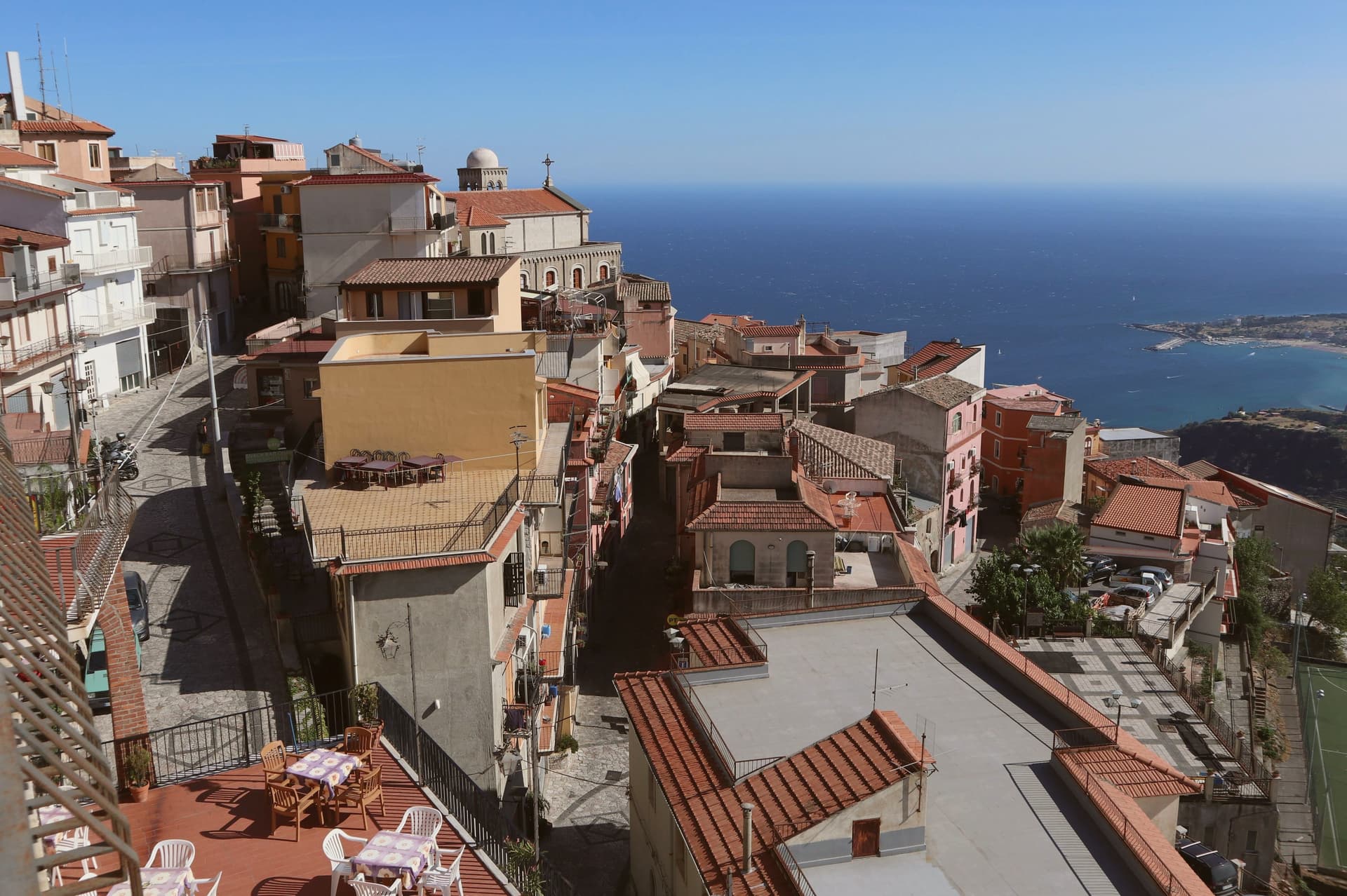
The village occupies a steep limestone rock two kilometers and several hundred meters above the coast, reached by a climb that Taormina itself does not require. The site served as an upper acropolis to Greek Tauromenium below it from the late fourth century BC, a relation of height and defense rather than distance: whoever held the summit watched the lower town and the sea beyond it.
The Byzantines fortified the rock around 800, and the local leader Costantino Caramalo strengthened the walls against Arab raids in the ninth century, work the Normans later built on when they raised the castle whose ruins still stand. The medieval plan of stone lanes climbs from the church at the center up toward that castle, the whole village stacked along the one rock rather than spread across it.
The result is a place defined by its verticality: a fortress town that grew inward and upward because it had nowhere else to go, and that still looks down on the city it was built to guard.
What to see in Castelmola
- Castello Normanno (Castello di Mola). Ruined walls on the summit, standing over Byzantine and Greek foundations. The climb up gives no roof and no interior, only the rock line and the drop on every side.
- Duomo di San Nicolò di Bari. Mother church at the centre of the village, rebuilt in the early twentieth century with a Baroque interior and original portal.
- Piazza Sant'Antonio. Mosaic-paved belvedere with views of Etna, the Gulf of Naxos, and Taormina five hundred meters below.
How to get to Castelmola
Catania is roughly 63 minutes away by road.
Our tip
May through October is the season Castelmola was built for. The Taormina coast fills with tourists, the village above empties out by dusk when the day-trippers descend, and the air at 529 meters stays cooler than the beach. July and August are crowded and hot; the climb from Taormina by foot is two hours and forty minutes of switchbacks.
Ustica
Why visit Ustica
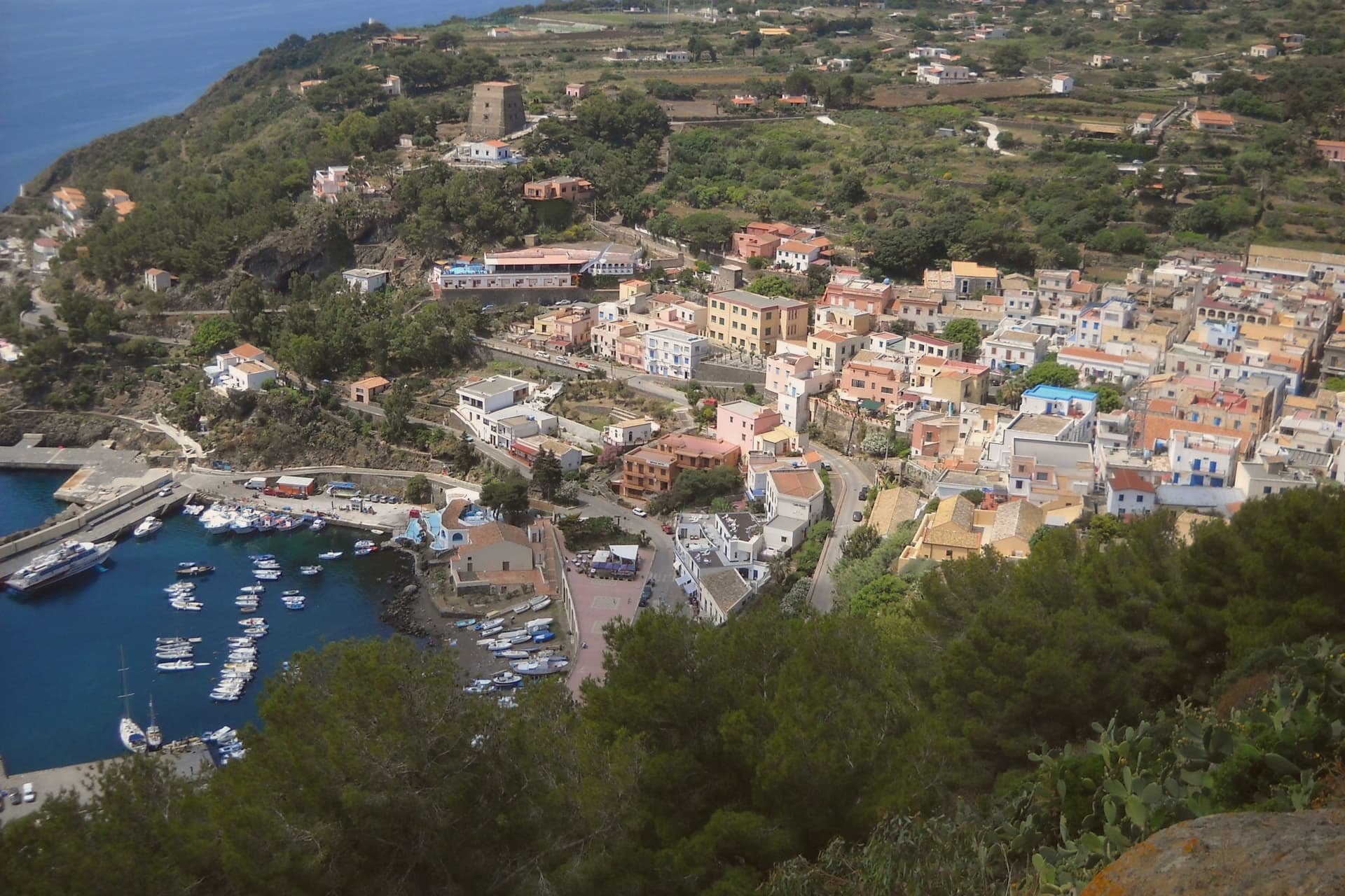
Ustica is a small volcanic island in the Tyrrhenian, fifty-two kilometers north of Capo Gallo, 8.65 square kilometers of basalt and tuff with two old volcanoes at Punta Maggiore at 244 meters and Guardia dei Turchi just below. The island was used as a place of confinement by the Bourbons, the Savoys, and finally the Fascists: Mussolini banished thousands of political opponents here, often 1,500 at a time, including Antonio Gramsci and Amadeo Bordiga, until the 1950s.
In November 1986, Italian fishermen pushed through the establishment of the first marine protected area in Italy, around 15,000 hectares of sea where diving schools now operate one of the Mediterranean's best-known reserves. The lentils and broad beans of Ustica, grown without pesticides on volcanic soil, are Slow Food Presidia.
On 27 June 1980 Itavia Flight 870 was shot down nearby in the sea, the Ustica massacre, killing all 81 on board.
What to see in Ustica
- Area Marina Protetta Ustica. Italy's first marine protected area, established November 1986 over roughly 15,000 hectares, world-known for diving and biodiversity.
- Punta Maggiore. Highest point of the island at 244 meters, vestige of an ancient volcano; the main peak above the village.
- Villaggio preistorico dei Faraglioni. Bronze Age fortified settlement on the cliffs, one of the best-preserved prehistoric villages in the western Mediterranean.
How to get to Ustica
Our tip
May through October is the season the island works for. Ferries and hydrofoils run from Palermo, the sea warms in May, the diving season runs to November. July and August bring crowds and the highest fares, although the population at peak still stays in the low thousands; the protected area regulates boat traffic.
Savoca
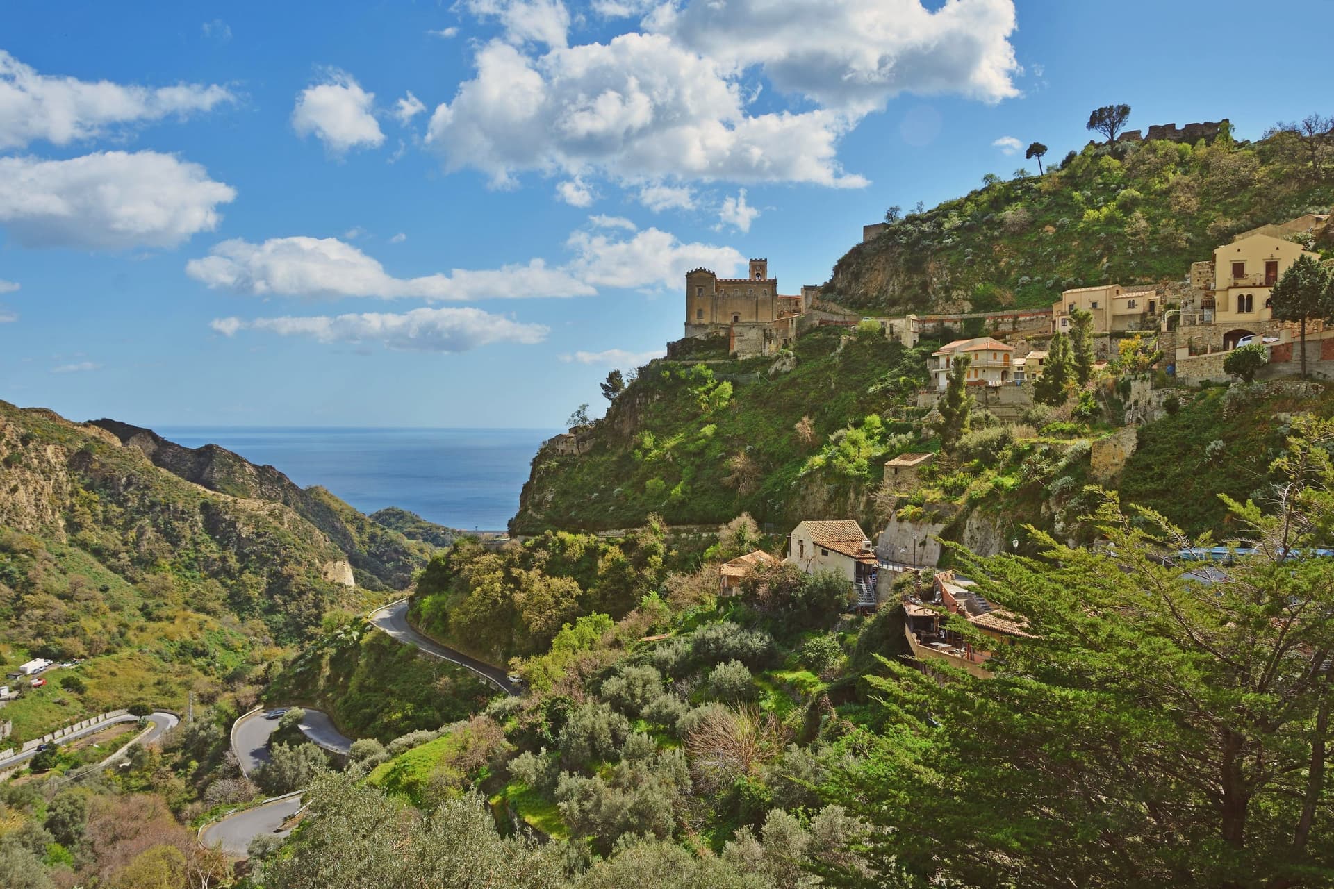
Why visit Savoca
Savoca sits fifteen kilometers north of Taormina, on a hill above the Ionian coast. The centro storico runs along the ridge in stepped lanes and balconied stone houses, with the Capuchin convent below it at the lower edge of the village and the castle ruin above at the highest point, the two anchoring the village from bottom to top.
The convent's crypt holds thirty-seven mummified bodies of notables from the eighteenth and nineteenth centuries, preserved in a colatoio that desiccated the corpses with vinegar and salt. In the summer of 1971, Francis Ford Coppola and Mario Puzo arrived to film the Sicilian scenes of The Godfather here, after the original Corleone in Palermo province was judged too modern for the camera.
The village's shape, a compact ridge with a church at one end and a bar in the lower piazza, gave the film both its wedding location and its courtship scene without need for another set. What draws people now is largely what drew Coppola then: a village small enough to read in a single walk, old enough to need no dressing.
What to see in Savoca
- Chiesa di San Nicolò. Thirteenth-century church suspended on a rock promontory at the top of the village. The Godfather's wedding scene between Michael and Apollonia was filmed here.
- Bar Vitelli. Eighteenth-century palazzo and family bar in the lower piazza, still operating as it did when it stood in for Apollonia's father's bar in The Godfather.
- Cripta dei Frati Cappuccini. Crypt of the Capuchin convent below the centro storico, its ventilated chamber holding the mummified bodies of local notables.
How to get to Savoca
There is a railway station in the town, so you can arrive without a car and never need one while you are here. Messina is roughly 39 minutes away by road.
Our tip
May through October are the months Savoca is busy. The Godfather pilgrims arrive year-round, but the village photographs best in spring and autumn, when the Ionian below is clear and the hill stays cool. July and August are warm; the centro storico is shaded in late afternoon, and the climb up to Pentefur is best at dawn.
Castroreale
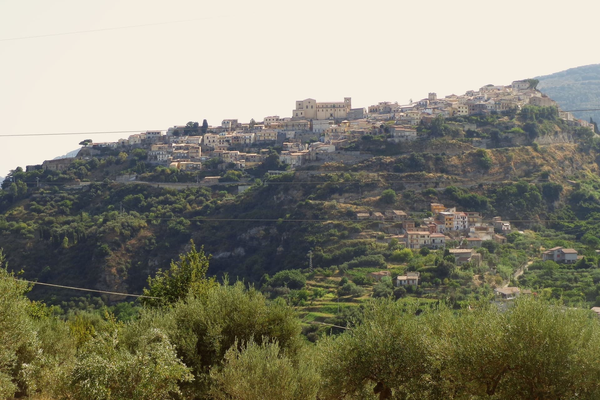
Why visit Castroreale
The ridge that carries the town sits between the Peloritani slopes and the Tyrrhenian, 394 meters above the Milazzo plain, a position that gave the place its name: castrum regale, the royal fortress. By the fifteenth century a Jewish community lived in the quarter behind what became the Monte di Pietà, and an arch of the lost Synagogue still stands there.
The 1717 earthquake killed many residents and brought down buildings across the town, a break that separates what survives now from what came before it. Against that loss, the church count is striking: over eighty churches for barely 2,246 people, a density that has left more sacred buildings than the town could ever have kept in active use, which is part of why so much of what remains ended up gathered into a single museum rather than left scattered through the countryside.
The upper ridge, the site of the vanished Jewish quarter, and the churches spread through the streets below are three layers of the same small footprint, royal, mercantile and devotional, compressed onto one spur of rock above the plain.
What to see in Castroreale
- Torre di Federico II d'Aragona. The tower stands on the highest point of the ridge, the last upright piece of the castle Frederick II of Aragon ordered rebuilt, still read from the plain below as the mark of the town.
- Duomo di Santa Maria Assunta. Mother church on the central piazza, with a Renaissance portal and works from the fifteenth and sixteenth centuries.
- Pinacoteca di Santa Maria degli Angeli. Parish museum housing what could be gathered after the territory's chapels and monasteries were lost, the objects now given a single roof.
How to get to Castroreale
Messina is roughly 59 minutes away by road.
Our tip
May through October is the season the ridge handles well. The Tyrrhenian below stays clear, the air at 394 meters is cooler than Milazzo on the plain, and the centro storico opens its trattorie and churches. July and August push past thirty-two degrees and the lanes empty in mid-afternoon, though the evening sea breeze cools the ridge quickly.
Realmonte
Why visit Realmonte
Realmonte sits on the southern Sicilian coast ten kilometres west of Agrigento, on a marl headland above the Mediterranean. The town's founding probably goes back to the second half of the seventeenth century; what makes it visible on a map of Sicily is older.
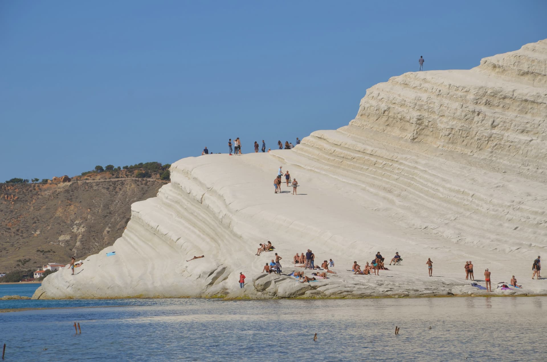
The Scala dei Turchi, the white marl cliff a kilometre west of the centre, is formed of Trubi Formation rock laid down five million years ago when the Mediterranean refilled after the Messinian salinity crisis. Its name remembers the sixteenth-century pirate raids that used the cliff as a landing point.
Andrea Camilleri's Montalbano novels and Giuseppe Tornatore's Malèna both took it for backdrop. Inland, the Realmonte salt mine runs twenty-five kilometres of tunnels a hundred metres underground, with a chapel hollowed from the salt that holds eight hundred people.
A Roman villa with marble and mosaic floors was uncovered above Punta Piccola in 1907 during railway works. The commune holds two institutional signals: Borgo dei Borghi finalist and Città dell'Olio.
What to see in Realmonte
- Scala dei Turchi. White marl cliff of Trubi Formation rock above the sea, named for the sixteenth-century pirate raids that landed below it.
- Miniera di salgemma di Realmonte. Salt mine running twenty-five kilometres of tunnels a hundred metres underground, with a chapel carved into the halite face.
- Villa Romana di Durrueli. First-century AD villa discovered in 1907, with marble opus sectile rooms, mosaic floors and thermal spa overlooking the sea.
How to get to Realmonte
Catania is roughly 143 minutes away by road.
Our tip
May, June, September and October are the months for Realmonte. The marl cliff is bright in soft light, the sea is warm enough to swim, and the heat is bearable on the exposed headland. July and August are hard: full Sicilian summer, no shade on the Scala, and crowds at the cliff from morning through sunset.
Favignana
Why visit Favignana
Favignana is 15 km by ferry from Trapani. The island is shaped like a butterfly, with Punta Marsala forming one wing and Punta Sottile the other, and it is built on calcarenite, the soft cream-coloured limestone that supplied stock material for churches and palazzi across Sicily for centuries.
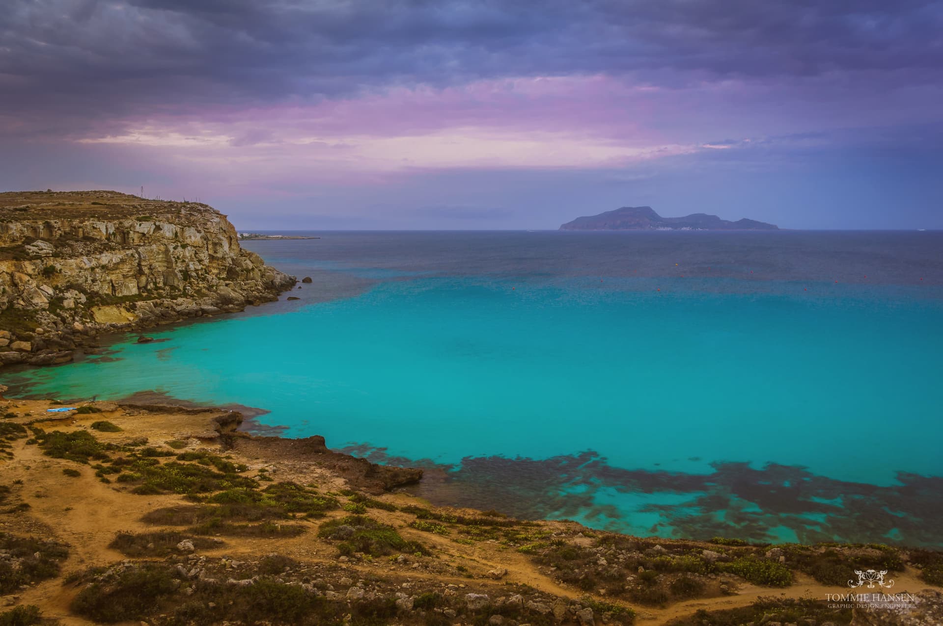
Quarrying left rectangular pits across the coastline, and the sea has since filled them: Cala Rossa and Bue Marino are the best known, turquoise water sitting at the bottom of vertical limestone walls where the rock was cut away. The town itself sits at the center, organized around the Stabilimento Florio delle Tonnare, the industrial complex that once ran the mattanza and now holds the record of it.
The fort above town looks out over both: the flat bikeable body of the island below, and the sea beyond it toward Marettimo and Levanzo. What Favignana offers is this pairing of an extracted landscape, quarried hollow and then reclaimed by the water, with an extracted economy, fished hard and then closed and preserved as memory.
What to see in Favignana
- Cala Rossa. The flooded quarry on the east coast, cliffs dropping straight to the water. Sicily's most-photographed swimming spot, cliff-jumping discouraged but practiced anyway.
- Stabilimento Florio delle Tonnare. The tonnara dominates the town centre. Original equipment inside traces the mattanza ritual and the company history of the Florio dynasty who built it.
- Forte di Santa Caterina. 12th-century Aragonese fort on the highest point of the island, over 300 m up, with views to Marettimo and Levanzo across the Egadi archipelago.
How to get to Favignana
Our tip
May through October is the Egadi season. June and September are the best months: warm Mediterranean sea, the calcarenite swimming spots manageable, ferry from Trapani every 90 minutes. July and August are full — accommodation books months ahead, Cala Rossa swims standing-room-only by 10 am, the ferry runs stand-by from Trapani most mornings. FishTuna a Favignana falls in September.
San Vito Lo Capo
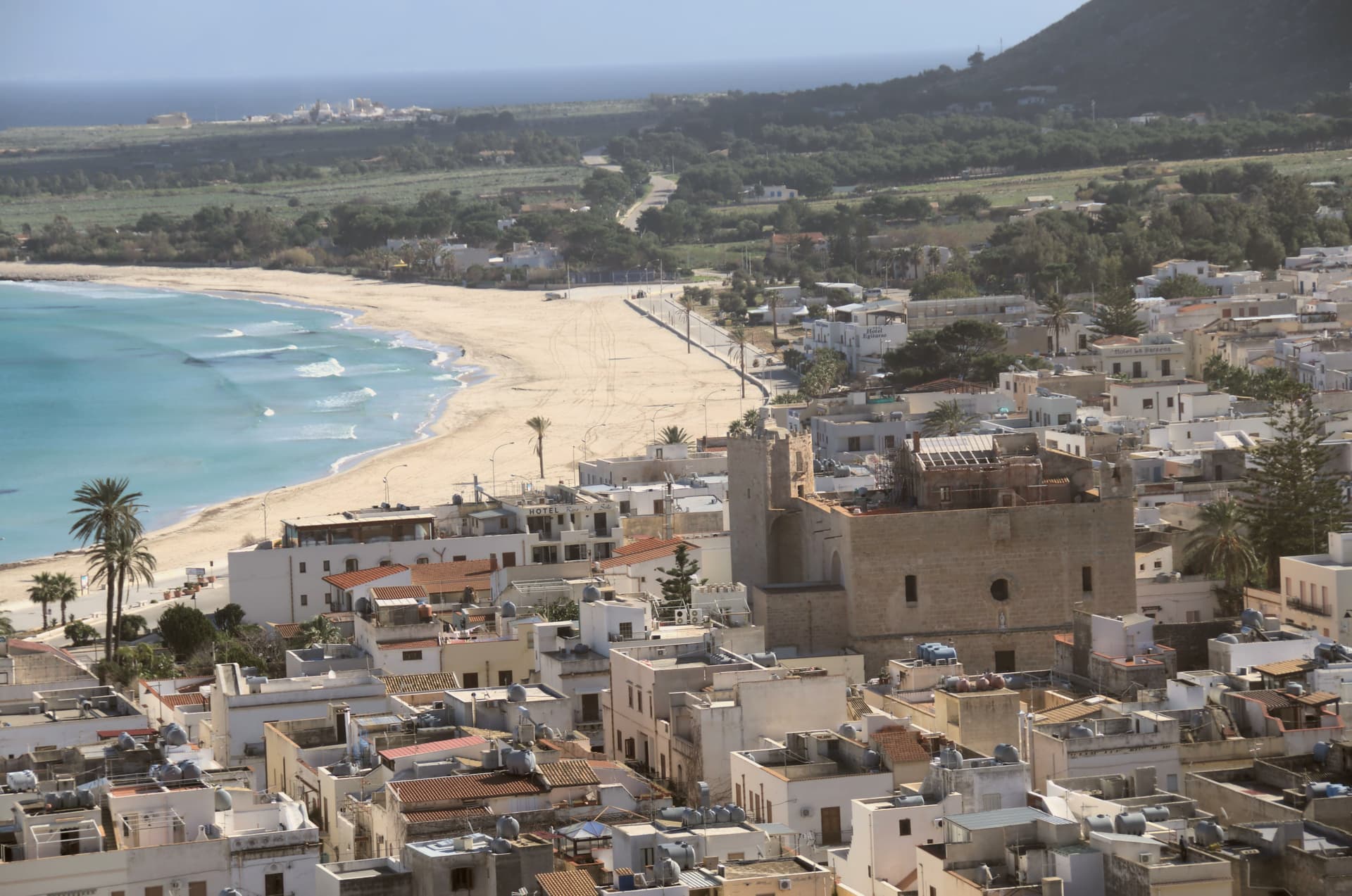
Why visit San Vito Lo Capo
San Vito Lo Capo sits at the tip of a cape on Sicily's northwest coast, between two mountains, fifty-five kilometers from Palermo. The commune was administered from Erice until 1952, when the Sicily Region recognized it as its own municipality, so the fishing village at the foot of the peak is a relatively recent administrative entity even where the sanctuary at its center dates to the fifteenth century.
The old town gathers along Via Savona around the fortress-church, while the shoreline it faces has become the reason the wider world knows the name, a four-thousand-person town whose September festival now draws North African and Sicilian cooks to compete on the same dish. The protected coast begins seven kilometers down the shore, untouched by road, closing off the cape's undeveloped end the way the mountains close it at the back.
A small administrative history, a fortified sanctuary, and an uninterrupted stretch of coast: together they explain a place that stayed a village while becoming a destination.
What to see in San Vito Lo Capo
- Spiaggia di San Vito Lo Capo. Sheltered bay water clear enough to have earned the beach a Caribbean comparison, framed by the peak rising directly behind it.
- Santuario di San Vito Martire. Fortress-sanctuary with Arab-Norman walls dedicated to the patron, standing on Via Savona at the heart of the centro storico.
- Monte Monaco. Limestone peak of just over 500 meters rising directly behind the town, with views over the bay and Capo San Vito.
How to get to San Vito Lo Capo
Palermo is roughly 129 minutes away by road.
Our tip
May through October is the season the town is built for. The bay warms early and stays swimmable into November on a good year. July and August are full, the sand crowded, parking tight, restaurants booked. Cous Cous Fest falls in September.