
The best hidden coastal towns that eat well in Sicilia
The Sicilian coast changes character every few kilometres, from tufa-yellow fishing quarters to black volcanic beaches where the rock still holds the heat at dusk. What holds it together is the eating. Red prawns from the southern channel, swordfish cut thick, wild fennel and sardines, capers cured in salt rather than vinegar, granita with a brioche at breakfast in the hot months. Houses go up in limestone on the north coast and in low, flat-roofed dammusi on the volcanic islands, and both keep the rooms cool enough to sit through a long lunch. Spring and late September are the useful seasons, when the sea is still warm and the tables are not booked out.
People arrive in Palermo or Catania, eat extremely well for a few days, and then move along the well-worn line to Siracusa and Ortigia, where the baroque waterfront and the market on Via Trento do most of the heavy lifting for the whole island's reputation. It is a fine place to eat and it is packed from May onwards, with the same handful of tables written up in every list. The Valley of the Temples takes the rest of the traffic, and the coast in between gets glanced at from the road.
The coastline does not stop where the tour buses turn around. The same waters, the same tuna routes, the same volcanic soil producing capers, malvasia and pistachio continue around the whole island and out to the offshore archipelagos, and the towns along that stretch are smaller, quieter, and eat with the same seriousness. These are places where the harbour and the kitchen are the same short walk, and where fewer people go than the numbers on the island as a whole would suggest.
Of the 61 communes we have mapped in Sicilia, 16 qualify as coastal towns that eat well: each sits directly on the sea, and a dining guide has named a table in each. This list is the hidden ones, 9 in all, ordered smallest first. The smallest, Favignana, has 4,525 residents.
Two more lists worth reading alongside this one: The best hidden towns you can reach by train that eat well in Sicilia and The best coastal towns you can reach by train in Sicilia.
Favignana
Why visit Favignana
Favignana is 15 km by ferry from Trapani. The island is shaped like a butterfly, with Punta Marsala forming one wing and Punta Sottile the other, and it is built on calcarenite, the soft cream-coloured limestone that supplied stock material for churches and palazzi across Sicily for centuries.
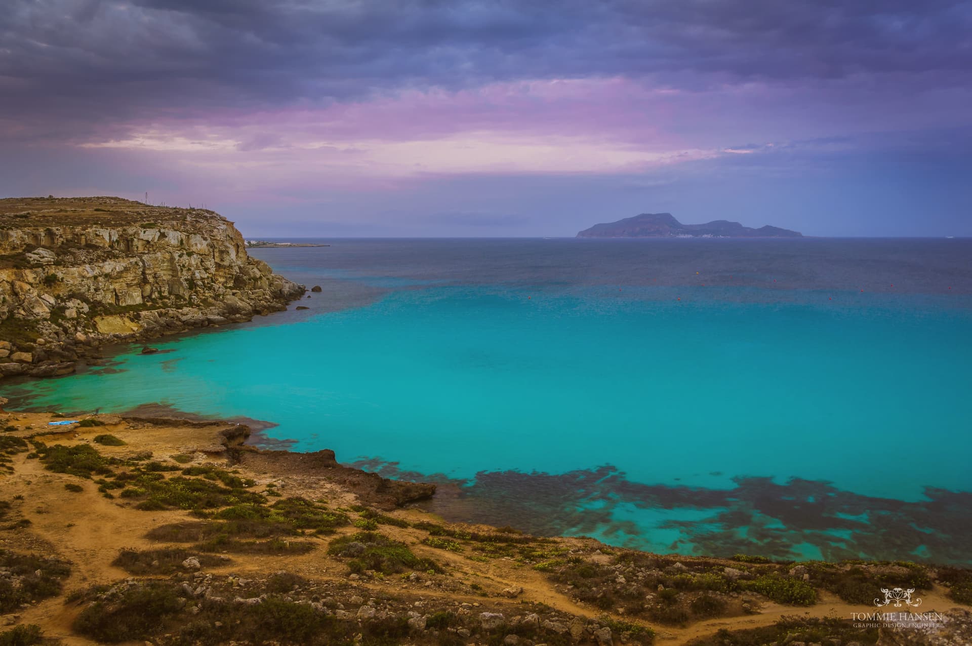
Quarrying left rectangular pits across the coastline, and the sea has since filled them: Cala Rossa and Bue Marino are the best known, turquoise water sitting at the bottom of vertical limestone walls where the rock was cut away. The town itself sits at the center, organized around the Stabilimento Florio delle Tonnare, the industrial complex that once ran the mattanza and now holds the record of it.
The fort above town looks out over both: the flat bikeable body of the island below, and the sea beyond it toward Marettimo and Levanzo. What Favignana offers is this pairing of an extracted landscape, quarried hollow and then reclaimed by the water, with an extracted economy, fished hard and then closed and preserved as memory.
Sotto Sale have been named by a guide.
What to see in Favignana
- Cala Rossa. The flooded quarry on the east coast, cliffs dropping straight to the water. Sicily's most-photographed swimming spot, cliff-jumping discouraged but practiced anyway.
- Stabilimento Florio delle Tonnare. The tonnara dominates the town centre. Original equipment inside traces the mattanza ritual and the company history of the Florio dynasty who built it.
- Forte di Santa Caterina. 12th-century Aragonese fort on the highest point of the island, over 300 m up, with views to Marettimo and Levanzo across the Egadi archipelago.
How to get to Favignana
Our tip
May through October is the Egadi season. June and September are the best months: warm Mediterranean sea, the calcarenite swimming spots manageable, ferry from Trapani every 90 minutes. July and August are full — accommodation books months ahead, Cala Rossa swims standing-room-only by 10 am, the ferry runs stand-by from Trapani most mornings. FishTuna a Favignana falls in September.
San Vito Lo Capo
Why visit San Vito Lo Capo
San Vito Lo Capo sits at the tip of a cape on Sicily's northwest coast, between two mountains, fifty-five kilometers from Palermo. The commune was administered from Erice until 1952, when the Sicily Region recognized it as its own municipality, so the fishing village at the foot of the peak is a relatively recent administrative entity even where the sanctuary at its center dates to the fifteenth century.
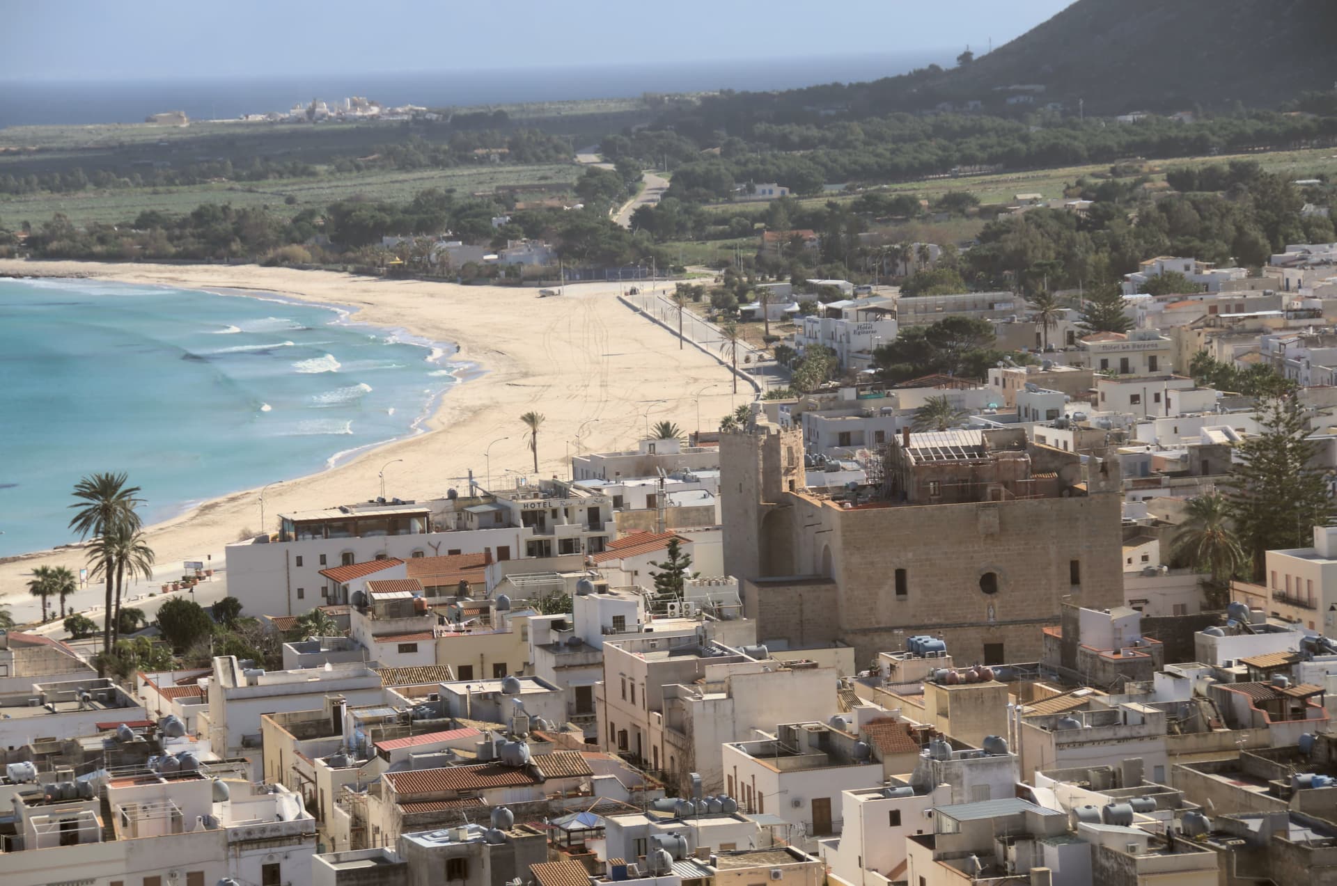
The old town gathers along Via Savona around the fortress-church, while the shoreline it faces has become the reason the wider world knows the name, a four-thousand-person town whose September festival now draws North African and Sicilian cooks to compete on the same dish. The protected coast begins seven kilometers down the shore, untouched by road, closing off the cape's undeveloped end the way the mountains close it at the back.
A small administrative history, a fortified sanctuary, and an uninterrupted stretch of coast: together they explain a place that stayed a village while becoming a destination.
Profumi di Cous Cous, Syrah Ristorantino have been named by a guide.
What to see in San Vito Lo Capo
- Spiaggia di San Vito Lo Capo. Sheltered bay water clear enough to have earned the beach a Caribbean comparison, framed by the peak rising directly behind it.
- Santuario di San Vito Martire. Fortress-sanctuary with Arab-Norman walls dedicated to the patron, standing on Via Savona at the heart of the centro storico.
- Monte Monaco. Limestone peak of just over 500 meters rising directly behind the town, with views over the bay and Capo San Vito.
How to get to San Vito Lo Capo
Palermo is roughly 129 minutes away by road.
Our tip
May through October is the season the town is built for. The bay warms early and stays swimmable into November on a good year. July and August are full, the sand crowded, parking tight, restaurants booked. Cous Cous Fest falls in September.
Lampedusa e Linosa
Why visit Lampedusa e Linosa
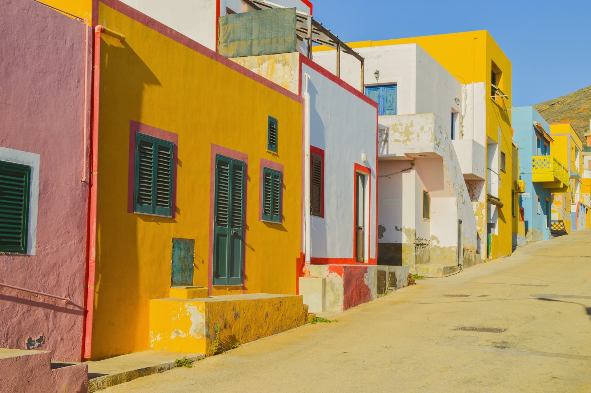
Lampedusa e Linosa is Italy's southernmost commune, three islands in the Strait of Sicily that form the Pelagie archipelago: Lampedusa, Linosa and the uninhabited Lampione. Lampedusa lies 220 kilometers southwest of Agrigento and 260 southeast of Tunis, on the Lampedusa Plateau, a structural high of the African continental shelf separated from Sicily by sea no deeper than 120 meters.
The two main islands are geological opposites. Lampedusa is white Cretaceous limestone, rising to 133 meters at the Sole Tree on the northwest side, with the Spiaggia dei Conigli on the south coast, a protected reserve and one of the last regular Mediterranean nesting sites of the loggerhead sea turtle.
Linosa is black basalt with three ancient craters, the southernmost active volcano of the Italian system, with dark cliffs and small coves. The flora and fauna match North Africa.
Since 1998 the Lampedusa reception centre has been the main European entry point for migrants crossing from Libya and Tunisia, and the island has held that role through every Mediterranean migration cycle of the past twenty-five years.
Cavalluccio Marino, Trattoria Terranova da Bernardo have been named by a guide.
What to see in Lampedusa e Linosa
- Spiaggia dei Conigli. Protected south-coast beach of fine sand, a 220-meter cove inside a 320-hectare nature reserve and a loggerhead sea turtle nesting site.
- Riserva Naturale Isola di Lampedusa. Sicilian regional reserve established 1995, managed by Legambiente, covering most of the south coast from Vallone dell'Acqua to Cala Greca.
- Linosa. Small volcanic island of black basalt with three ancient craters, around forty kilometers north of Lampedusa, with deep coves and a single village.
How to get to Lampedusa e Linosa
Our tip
May, June, September and October are the months for Lampedusa and Linosa. The water in the Spiaggia dei Conigli holds at twenty-three to twenty-six degrees from June through September. Loggerhead turtle laying runs June to August, hatching from August into October, and the reserve closes parts of the beach during the active season.
Pantelleria
Why visit Pantelleria
Pantelleria lies 110 kilometers southwest of Sicily and 70 east of Tunisia, a fifteen-kilometer island that is the emergent summit of a largely submarine volcano. Montagna Grande rises to 836 meters; the coast is black basalt cliff with almost no sand.
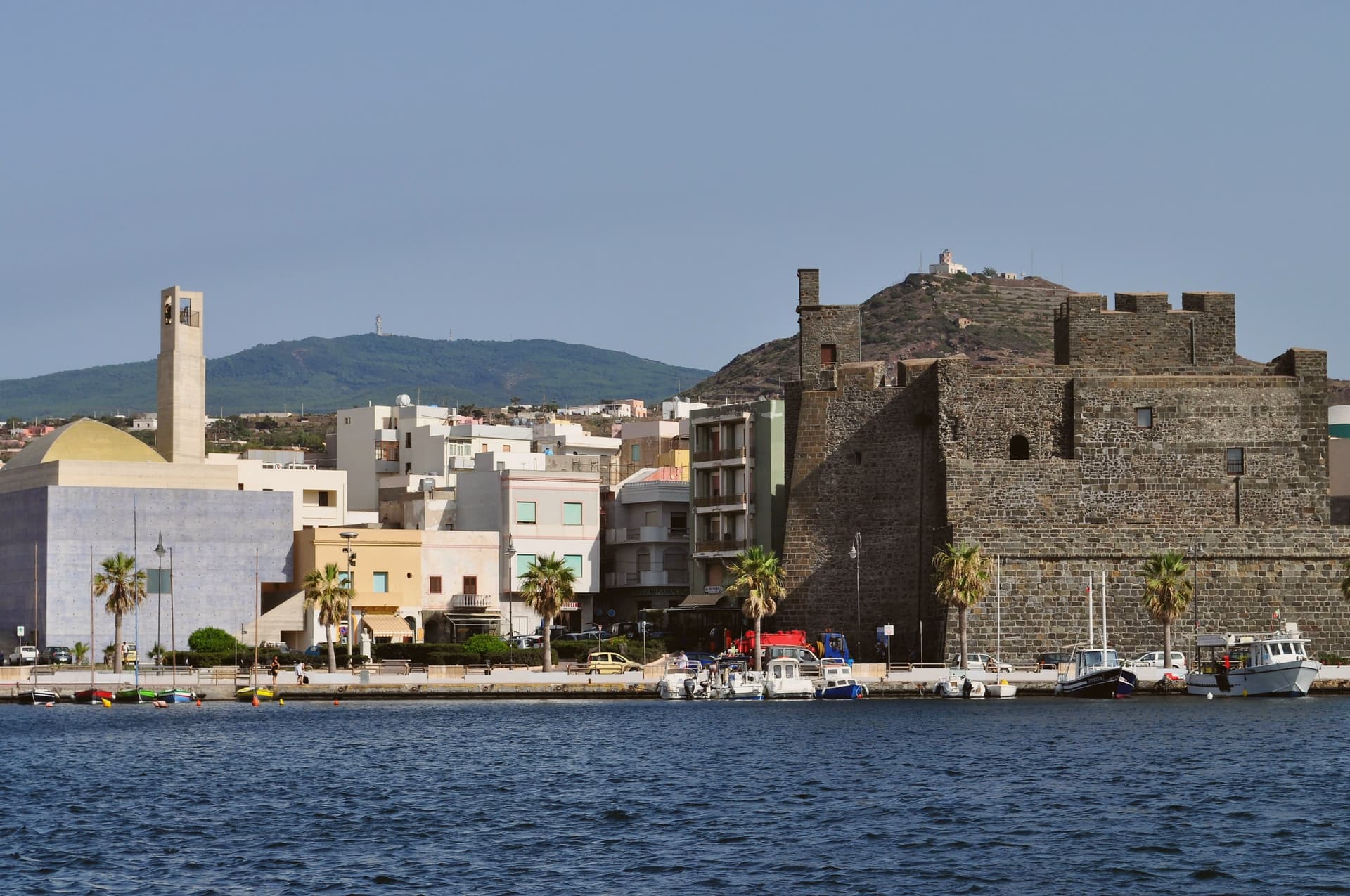
The dammusi, square dry-stone houses with thick walls and white-painted domed roofs, were built from local volcanic rock, the technique dating to around the tenth century when the island was part of the Zirid emirate. The vineyards are planted in the alberello pantesco, vines trained low in shallow pits dug into the volcanic soil to catch wind and dew, the only agricultural practice on the UNESCO Intangible Cultural Heritage list.
The Zibibbo grape, also called Moscato di Alessandria, arrived with the Phoenicians and produces Passito di Pantelleria DOC, made from sun-dried bunches. The Specchio di Venere, a thermal lake fed by springs at 35 to 58 degrees, sits in an elliptical crater in the north of the island.
Osteria Il Principe e Il Pirata, I Giardini dei Rodo, La Nicchia have been named by a guide.
What to see in Pantelleria
- Arco dell'Elefante. Basalt sea arch on the east coast resembling an elephant lowering its trunk into the water, between Cala Levante and Cala Tramontana.
- Specchio di Venere. Thermal volcanic lake in a 450 by 350 meter elliptical crater, fed by three springs running between 35 and 58 degrees.
- Montagna Grande. Island's highest point at 836 meters, an extinct volcanic cone with hiking paths and steam vents inside the Parco Nazionale Isola di Pantelleria.
How to get to Pantelleria
Our tip
May, June, September and October are the workable months on Pantelleria. The scirocco from the Sahara pushes August temperatures past thirty-five degrees and the wind drops dust over everything. Late September is the Zibibbo harvest, the bunches laid out on stenditoi to dry under the sun for Passito.
Taormina
Why visit Taormina
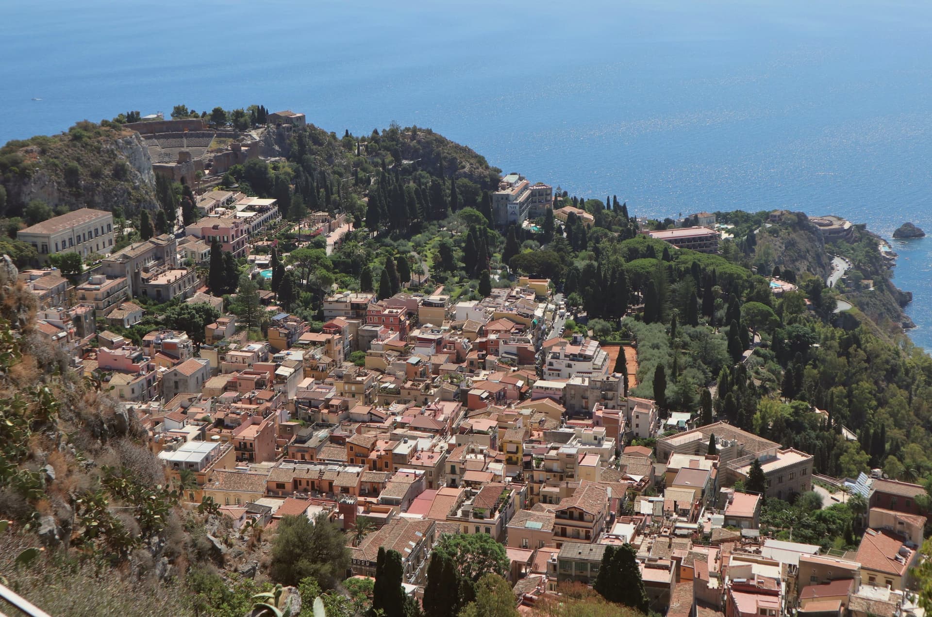
The town sits at 204 meters on the rock above the coast, on the Ionian shore halfway between Messina and Catania. The Siculi welcomed the survivors of the Greek colony of Naxos in 358 BC after Dionysius of Syracuse destroyed it, and Andromachus refounded them as Tauromenium on the height above.
Augustus later made it a Roman colony, deporting much of the population and resettling it with Roman families. The centro sits below the fortress and above the sea: the Arab-Norman stronghold occupies the rock at 397 meters, while further up the hillside the frazione of Castelmola hangs at 884, both looking down on the same stretch of coast the theatre faces.
The small island reserve lies at the opposite end of that vertical arrangement, at sea level below the cliff, reached by cable car or path from the town above. A place built in tiers, from the beach at the base to the fortress on the rock to the village above that, all of it oriented toward the same view of the volcano and the water that made a nineteenth-century travel writer's description enough to start a tourist route still followed today.
St. George by Heinz Beck, La Capinera, Vineria Modì and 11 more have been named by a guide.
What to see in Taormina
- Teatro Antico. The stone rows face south, so the audience looks past the stage wall to Etna rather than toward it. 109 meters in diameter, the remodelling under Roman rule widened the space for spectacle beyond Greek drama.
- Palazzo Corvaja. Fourteenth-century Sicilian-Gothic palace at the entrance to Corso Umberto, on the site of the Roman forum and the Arab cube of the citadel.
- Castello di Monte Tauro. Arab-Norman fortress at 397 meters on the rock above the centro, reached on foot from Via Circonvallazione.
How to get to Taormina
There is a railway station in the town, so you can arrive without a car and never need one while you are here. Catania is roughly 45 minutes away by road.
Our tip
May, June, September and October are the working months in Taormina. Late spring keeps the air clear over Etna and the cruise season has not yet peaked. Taormina Arte runs concerts and opera at the Teatro Antico from June through August; the same weeks bring the highest crowds on Corso Umberto.
Menfi
Why visit Menfi
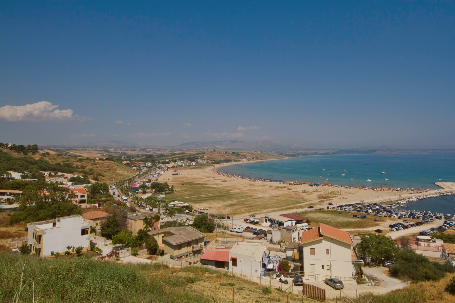
Menfi is an 11,814-resident town on the western Agrigento coast, and its geography frames everything else about it. The town sits at 119 metres on a low limestone ridge between the Belice and Carboj rivers, four kilometres inland from the coast, where a nine-kilometre arc of fine sandy beach runs at Porto Palo di Menfi, backed by a protected dune system of 1,100 hectares, the most important loggerhead turtle nesting site on the southern Sicilian coast.
That gap between ridge and shore is the shape of the whole place: the historic centro on the high ground, the beach and reserve down below, the vineyard and olive plateaux spreading out behind and above the town. The town itself was founded in 1638 by the Tagliavia d'Aragona Pignatelli family on the site of an earlier castello belonging to Federico II.
Nothing from that medieval phase survived the re-foundation except a single surviving tower, the only structure left from before the seventeenth-century rebuilding. Above the town, the plateaux produce the two products that give Menfi the rest of its quality-mark trifecta alongside the beach: a cooperative cellar founded in 1958 that draws on 2,000 grower-members farming 6,000 hectares to produce 50 million bottles a year, the volume that makes it Italy's largest winery, and an olive oil, Nocellara del Belice DOP, grown across the same micro-region that produces the Castelvetrano table olive.
That range of production is what earns the town its Città del Vino status alongside its oil and its beach. Beyond the town, Selinunte's Greek temple site lies 25 km west and the Scala dei Turchi limestone cliff sits 50 km east toward Agrigento, the two standard day trips.
The food is Sicilian-coastal: pasta con le sarde, busiate with Trapani-style pesto, bluefin tuna from one of the last traditional fisheries on the island, couscous showing the same Trapani influence reaching this far along the coast, cassata and cannoli, and the local Grillo or Nero d'Avola poured alongside all of it. What holds the place together is that ridge-to-shore, town-to-plateau layout: a working wine and olive town that happens to sit a short drive from its own protected beach, rather than a beach resort with agriculture as an afterthought.
La Foresteria, Salisà, Il Vigneto have been named by a guide.
What to see in Menfi
- Porto Palo di Menfi (Bandiera Blu). Fine sandy beach below the town, backed by dune wetland where loggerhead turtles nest. The sand runs long enough that the crowd thins fast once you walk past the first stretch.
- Cantine Settesoli + Mandrarossa. Visits and tastings at the cooperative cellar in town: Nero d'Avola, Grillo, Inzolia, Syrah poured where they are made rather than at a distributor's counter.
- Nocellara del Belice DOP olive oil. The local olive oil, from the same micro-region as the Castelvetrano table olives. Several small frantoi in town offer tastings, worth setting alongside the wine visit rather than instead of it.
How to get to Menfi
Palermo is roughly 83 minutes away by road.
Our tip
Menfi is best May–June and September–October — the beach is swimmable May–October, summer crowds peak August. The Inycon Wine & Jazz festival in late June is the year's headline event. October is harvest at Cantine Settesoli and the surrounding cellars. Inycon, la Festa del Vino a Menfi falls in October.
Lipari
Why visit Lipari
Lipari sits forty kilometers off Sicily's Tyrrhenian coast, the largest of the seven Aeolian islands and the only commune that administers six of them: Vulcano, Panarea, Stromboli, Filicudi, Alicudi and Lipari itself. Humans have lived here since 5000 BC, drawn by deposits of obsidian, the volcanic glass that made Neolithic Lipari a Mediterranean trading center.
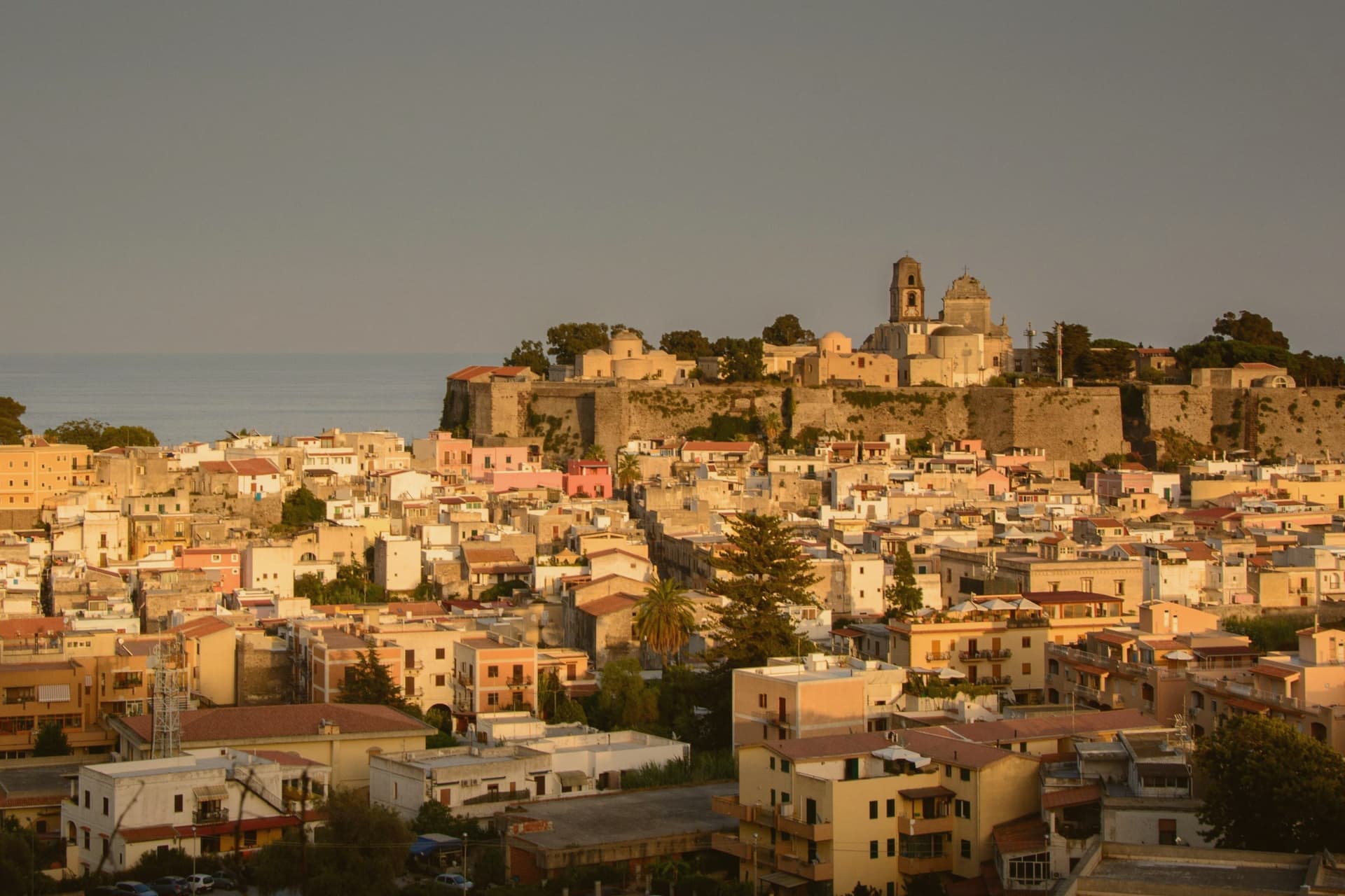
The Rocche Rosse obsidian flow on the north of the island dates to the last eruption in 729 CE. The Spanish rebuilt the castle walls after Hayreddin Barbarossa sacked the town and enslaved the population in 1544; the citadel above Marina Corta now holds the Museo Archeologico Eoliano, one of the most important archaeological collections in the Mediterranean.
The archipelago joined the UNESCO World Heritage list in 2000 for its volcanism. Around 12,500 people live here year-round.
In summer the population doubles. Ferries from Milazzo arrive every two hours.
I Tenerumi, Il Cappero, Filippino and 6 more have been named by a guide.
What to see in Lipari
- Castello di Lipari. Fortified citadel on a volcanic rock fifty meters above the sea, rebuilt by the Spanish under Charles V after the 1544 Barbarossa sack.
- Museo Archeologico Regionale Eoliano. Six-section museum founded by Bernabò Brea and Cavalier in the 1950s, with prehistoric, classical, epigraphic and volcanological collections from the archipelago.
- Cattedrale di San Bartolomeo. Cathedral on the castle plateau, ninth-century foundation rebuilt several times, dedicated to the patron saint whose relics were moved to Benevento in 839.
How to get to Lipari
Our tip
May through June and September through early November are the months Lipari was made for. The sea is warm, the Stromboli boats run, and the ferries are not yet rationed by weather. July and August push toward thirty-five degrees and the population doubles with Italian holidaymakers.
Cefalù
Why visit Cefalù
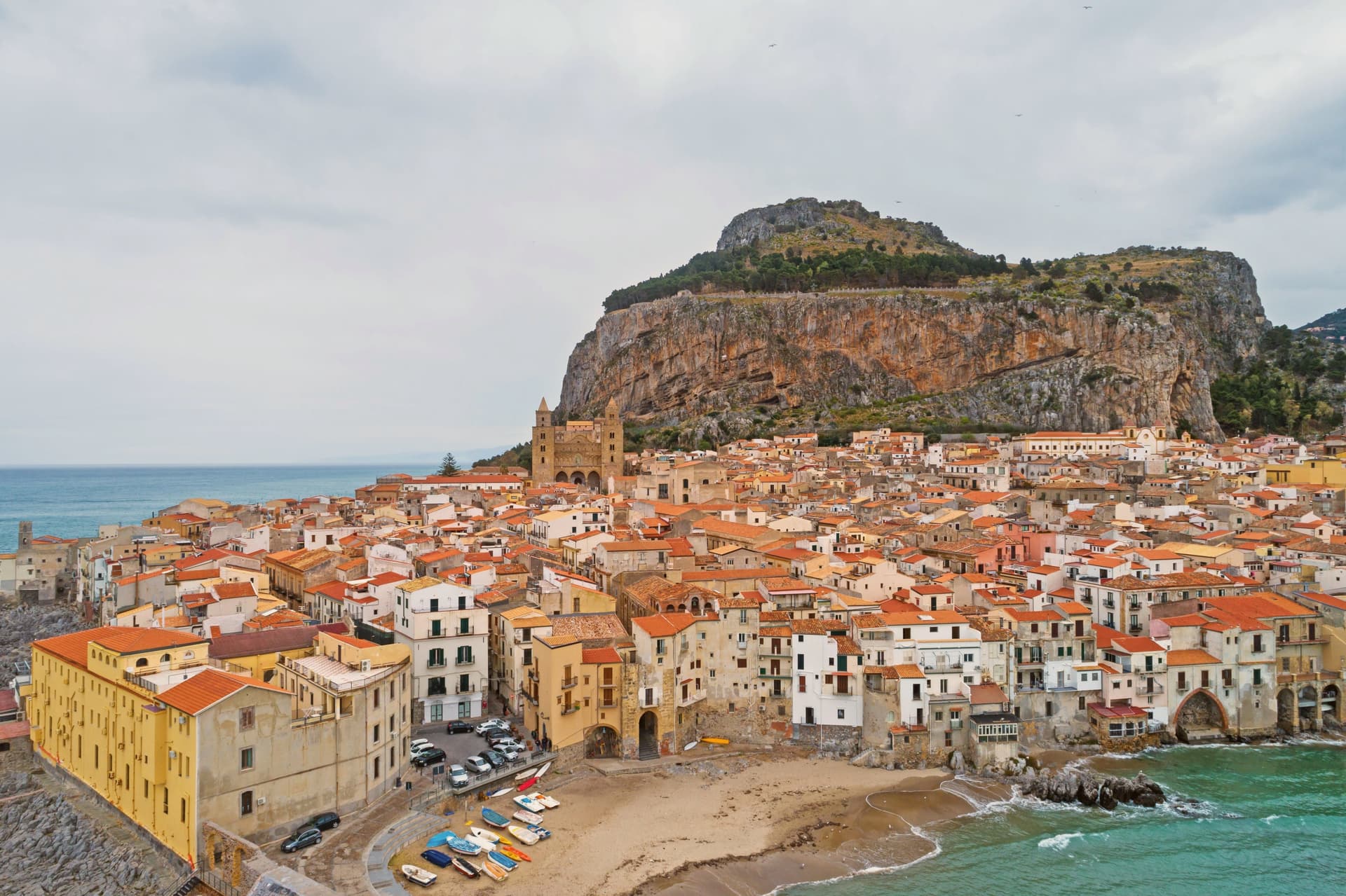
Cefalù sits 70 kilometers east of Palermo where the Madonie meet the Tyrrhenian, the old town built on a strip of land between the sea and the headland that gave the place its name. The Greeks called it Kephaloidion in the fourth century BC.
Roger II refounded the town at the foot of the rock in 1131 and began the cathedral the same year; tradition holds he vowed to build it after surviving a storm offshore. Its mosaics were executed by masters he brought from Constantinople.
The old town keeps the cathedral, the museum, and the working port within the same short walk, the stone lanes running straight down from the Duomo's square to the sea and the lavatoio fed by its own spring along the way. The beach runs below on one side, the rock rises behind on the other, and the harbor still works at the foot of it.
A small coastal town, built once by the Greeks and refounded by a Norman king against the same rock, still reads as one place rather than several eras stacked on top of each other.
Locanda del Marinaio, Cortile Pepe, Cala Luna and 1 more have been named by a guide.
What to see in Cefalù
- Duomo di Cefalù. Twin-towered cathedral built by Roger II, its west front facing a narrow square hemmed by the old town. Inside, the mosaic apse is reached down a nave still laid out to Norman proportions, the Arab-Norman UNESCO listing covering both the fabric and the decoration.
- La Rocca. The trail switchbacks up bare limestone above the roofs, past the megalithic sanctuary walls before reaching the castle ruins, where the town, the harbor, and the coastline in both directions open out below.
- Museo Mandralisca. Private nineteenth-century collection in an eighteenth-century palazzo, holding the Portrait of an Unknown Sailor and Greek vases from Lipari.
How to get to Cefalù
There is a railway station in the town, so you can arrive without a car and never need one while you are here. Palermo is roughly 63 minutes away by road.
Our tip
May, June, September and October are the windows for Cefalù. The Tyrrhenian is warm enough to swim from mid-May, the cathedral and the climb up La Rocca are bearable in the morning, and the town isn't yet at full crowd. July and August fill the beach and the lungomare past capacity, with Palermo and northern European holidaymakers; the cathedral keeps its mosaics behind a steady queue. Festa SS. Salvatore a Cefalù falls in August.
Riposto
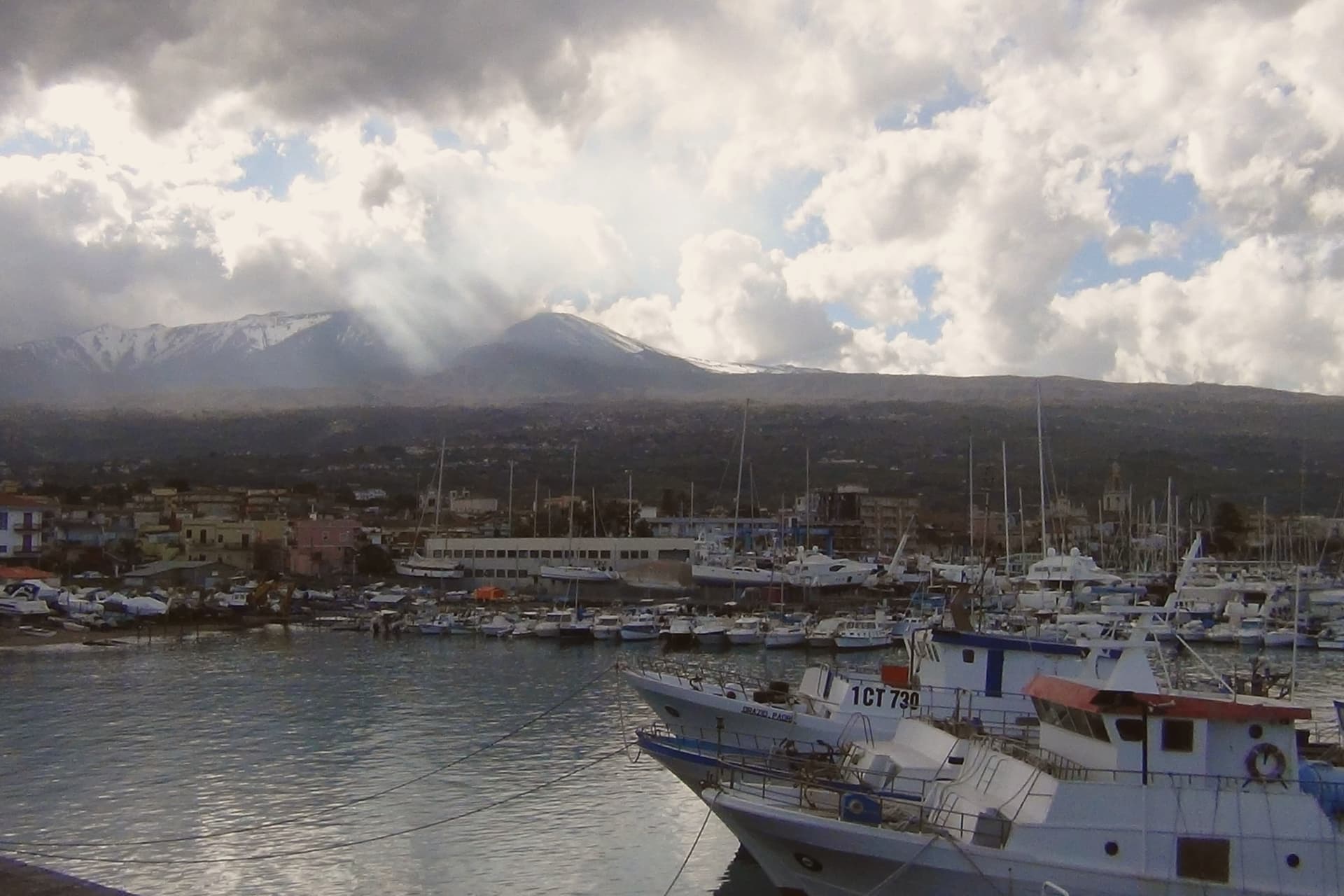
Why visit Riposto
Riposto sits on the Ionian coast twenty-five kilometres north of Catania, at the eastern foot of Etna and the southern edge of the Giarre-Riposto conurbation. The name is commercial: u ripostu in Sicilian, the cellar, because the wine produced in the surrounding county of Mascali was stored here before being loaded onto ships.
The town was the commercial port of Mascali from the sixteenth century onwards, won full administrative autonomy in the eighteenth, and was merged with neighbouring Giarre under the name Jonia from 1939 until 1945, when the two split again. Today the Porto dell'Etna, also called Marina di Riposto, runs as a combined tourist marina, fishing port and small commercial harbour.
Locals still call the town the port of the volcano. Etna fills the western skyline, the railway runs to Catania along the coast, and the historic centre threads between churches built when the wine trade still paid for them.
Zash, La Cucina di Donna Carmela, Vico Astemio have been named by a guide.
What to see in Riposto
- Porto dell'Etna. The combined tourist marina, fishing and commercial port, the largest pleasure harbour between Catania and Messina.
- Chiesa Madre San Pietro. The mother church on the main square, rebuilt in the eighteenth century when Riposto's wine trade financed new construction.
- Centro storico. Grid of streets parallel to the seafront, with palazzi and warehouses built during the eighteenth and nineteenth century wine boom.
How to get to Riposto
There is a railway station in the town, so you can arrive without a car and never need one while you are here. Catania is roughly 29 minutes away by road.
Our tip
May, June, September and October are the dry, clear months when the Ionian is warm enough to swim and Etna stays visible from the seafront. July and August are hot and crowded: the marina fills with sailing traffic and the lungomare runs at full capacity until late. November through March is quiet.
More from Anywhere Italy
 The best hidden towns you can reach by train that eat well in Sicilia
 The best coastal towns you can reach by train in Sicilia
 The best towns inside a nature park that eat well in Sicilia
 The best small coastal towns in Sicilia
- The best towns that eat well within two hours of Palermo
- The best towns you can reach by train that eat well within 90 minutes of Catania