The best olive oil towns in Sicilia
Sicilian olive oil tastes of the ground it comes from: green tomato and artichoke from the Nocellara del Belice groves in the west, something peppery and almost bitter from the trees on the black volcanic soil below Etna. Harvest runs through late autumn, when the mills work at night and the smell of crushed fruit carries down the lanes. The towns that grow it are built of tufa and limestone, often stacked on a ridge above the groves, with a piazza, a church front the colour of dry bread, and a bar where the oil is poured onto toasted bread with salt for anyone who asks. Winter is the season to buy, when the new oil is still cloudy in the tin.
Most visitors meet Sicilian food in Palermo, at the Ballarò and Capo markets, or in Taormina where the terraces look down at the sea and the tasting menus arrive with a sommelier. Both are worth the time, and both are extremely busy from spring onwards, cruise passengers and coach parties moving through the same few streets. The oil served there is excellent and almost never from anywhere nearby. You taste the product without ever seeing the tree.
The groves continue well past the cities, along the Belice, up the Simeto valley, across the Agrigento coast and around the whole base of Etna. That is where these towns are: agricultural places with working mills, cooperative shops, and often a festival built around the pressing. Fewer people go, which mostly means the mill will show you round if you turn up in season.
Of the 61 communes we have mapped in Sicilia, 9 qualify as olive oil towns: each belongs to the national association of olive-oil towns. The smallest, Buccheri, has 1,729 residents.
Two more lists worth reading alongside this one: The best mountain towns within two hours of Catania and The prettiest villages within 90 minutes of Catania.
Buccheri
Why visit Buccheri
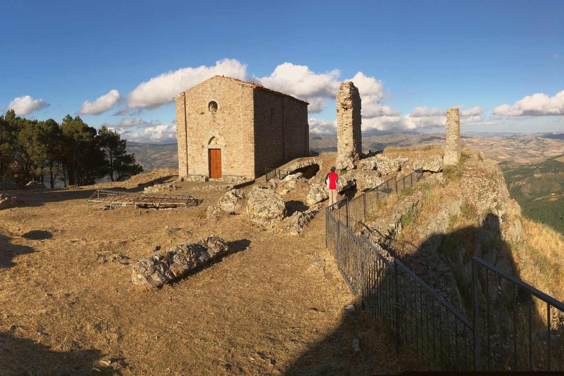
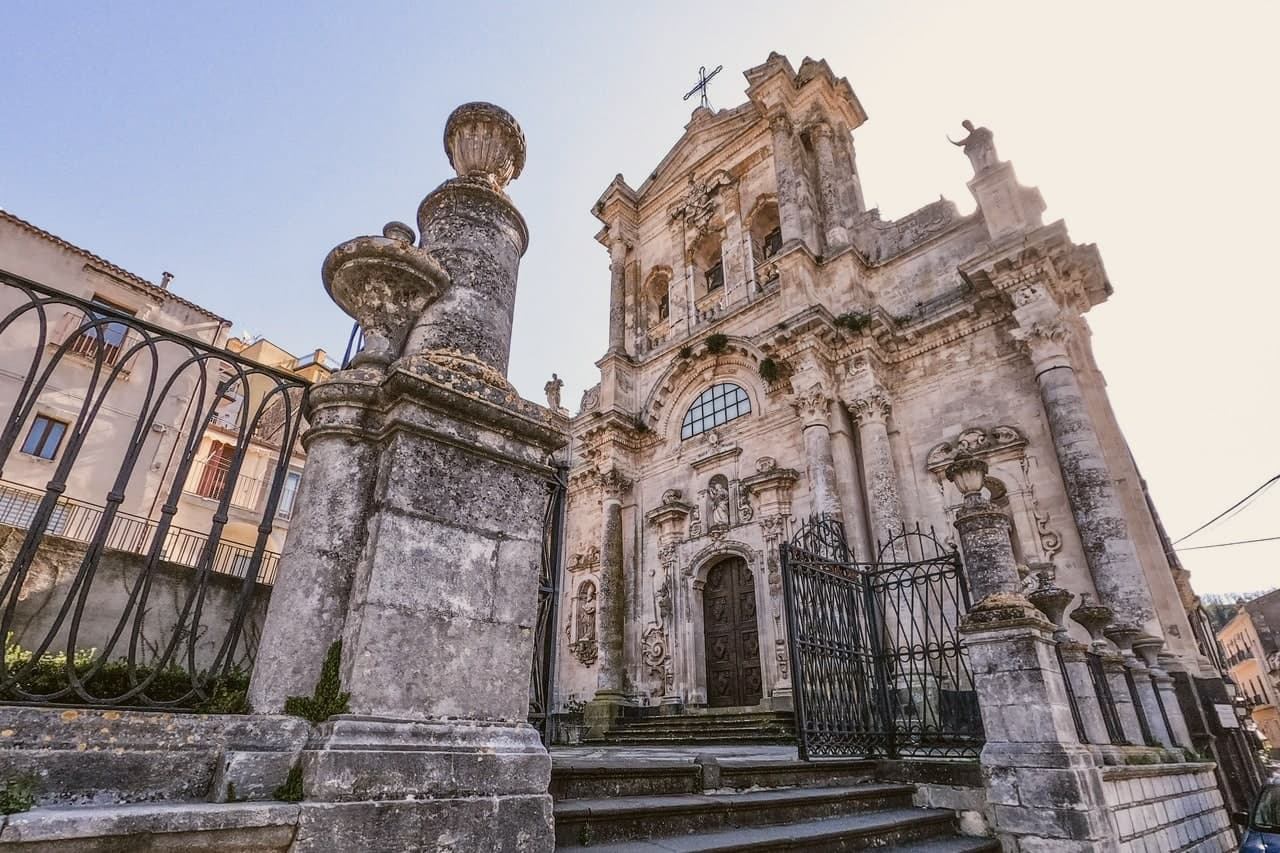
Buccheri sits on the northern slopes above 820 meters, one of the highest villages in the Iblei. Sicels, Greeks, Romans and Byzantines all left traces on the ridge above the village, a long sequence of settlement on ground that offered height and a view over the watershed below.
The 1693 Val di Noto earthquake leveled most of what stood. The rebuild produced the upper village's high baroque staircase church and, separately, the parish church housing a Gagini marble that survived the quake itself, an object older than the building now around it.
The neviere in the surrounding hills supplied granita ice to Syracuse and Catania into the early twentieth century, a trade that tied this upland village to the coastal cities below it long before the road did. The olive groves on the slopes around the peak now carry the same name into a different economy: the Olio e non solo festival each October fills the village with producers and tastings.
What the ridge, the ice caves and the groves add up to is a village whose whole history has run on its altitude, first as vantage and refuge, then as a source of cold, now as a source of oil.
What to see in Buccheri
- Chiesa di Sant'Antonio Abate. Eighteenth-century baroque church at the top of a long staircase in the upper village, rebuilt after the 1693 earthquake destroyed the medieval original.
- Chiesa di Santa Maria Maddalena. Baroque parish church with a façade by local architect Michelangelo Di Giacomo; holds a 1508 marble Magdalene by Antonello Gagini that survived the 1693 quake.
- Monte Lauro. Rises directly above the village; trails climb from the town to the summit, the highest point in the Iblei and the region's central watershed.
How to get to Buccheri
Catania is roughly 80 minutes away by road.
Our tip
May through October is the window for Buccheri. The Iblei stay cooler than the Sicilian coast at 820 meters, and the trails up Monte Lauro and into the Anapo valley toward Pantalica are walkable through summer afternoons. July and August touch thirty in the village but evenings drop into the teens.
Castiglione di Sicilia
Why visit Castiglione di Sicilia
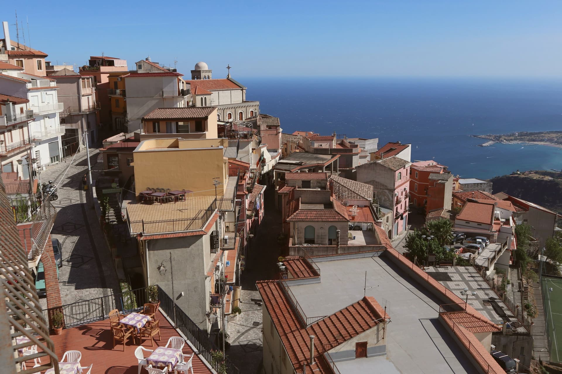
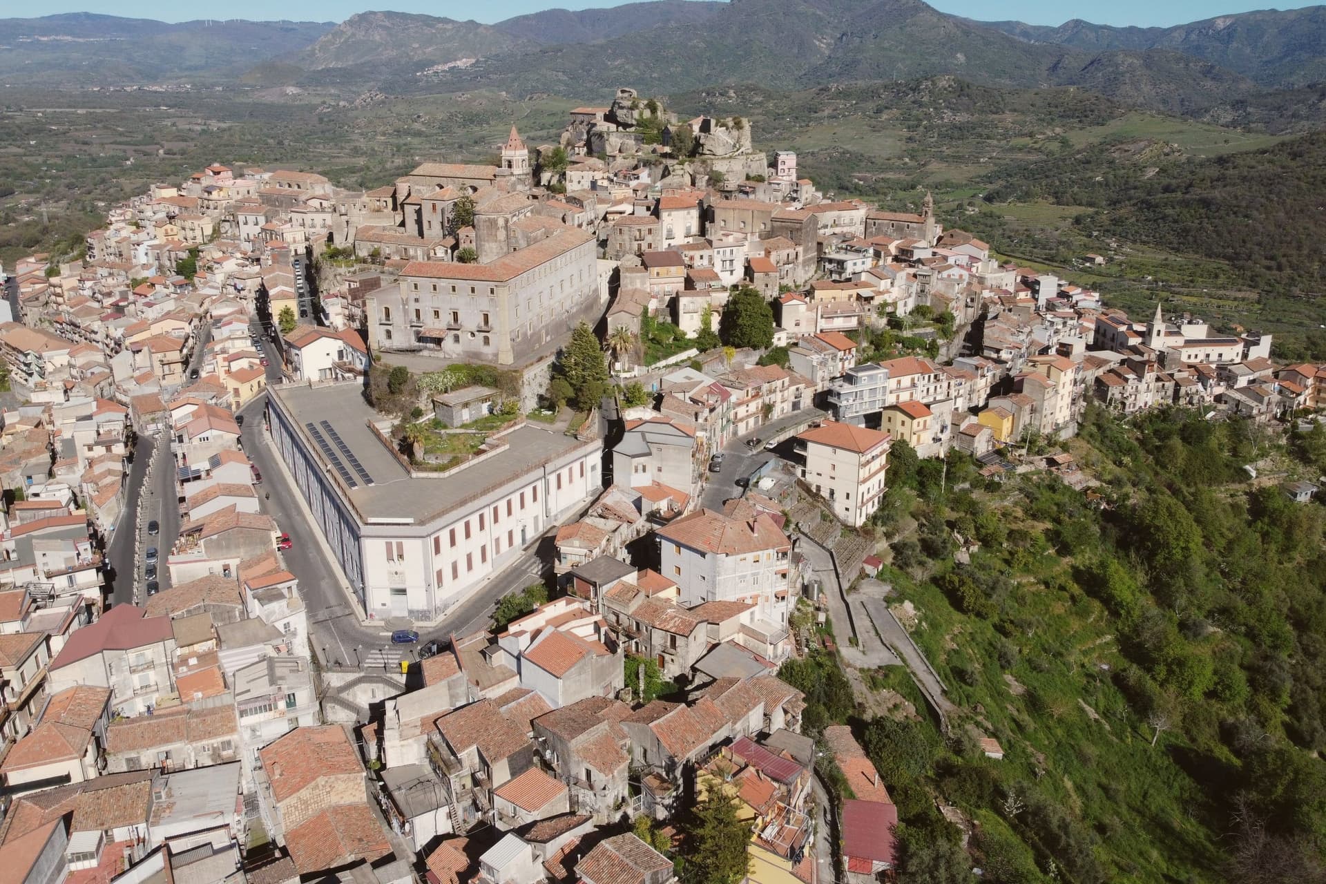
The town looks down the Alcantara river valley between Randazzo and Taormina, its position fixed by Norman count Roger I, who documented it in 1092 as Castrileonis, the great castle. That name still fits the territory more than the town itself: the commune's boundary runs uphill from the historic centre all the way to the summit of Etna, taking in the north-east crater, so the same municipality holds a huddle of streets at 621 meters and a stretch of active volcano above it.
The hills below the centre are the heart of the Etna DOC. Nerello Mascalese and Nerello Cappuccio grow on the volcanic soils around the village, with Carricante carrying the whites, and bottles from Cottanera, Passopisciaro, Tenuta delle Terre Nere and the Alcantara producers all ship from here.
Twenty minutes downhill the Alcantara has cut its gorges through the same lava that feeds those vineyards, basalt walls shaped by water where the fields above are shaped by the grape. Town, castle, vineyard and gorge read as one continuous volcanic system, worked over centuries into a fortress, a wine region and a river cut.
Cave Ox, La Riserva Bistrot have been named by a guide.
What to see in Castiglione di Sicilia
- Castello di Lauria. The fortress stands on its basalt outcrop above the town, its walls carrying the weight of two rebuildings by Ruggero di Lauria's crews. The rooms now hold the Enoteca Regionale for eastern Sicily, so the same stone that once watched for approach up the valley now stores the bottles made from the vines below it.
- Cuba Bizantina di Santa Domenica. Small Byzantine cube-shaped church, seventh to ninth century, in the rural outskirts of the commune, one of the oldest surviving structures in the Etna area.
- Gole dell'Alcantara. Basalt gorges carved by the Alcantara river through prismatic lava columns, around twenty minutes downhill from the centro storico.
How to get to Castiglione di Sicilia
There is a railway station in the town, so you can arrive without a car and never need one while you are here. Catania is roughly 49 minutes away by road.
Our tip
May through October are the working months on Etna nord. Vineyard tours start in June, harvest runs late September through mid-October on the higher contrade, and the slopes turn red and gold into early November. July and August on Etna are bearable at 621 meters: nights drop to seventeen degrees, far cooler than Catania.
Realmonte
Why visit Realmonte
Realmonte sits on the southern Sicilian coast ten kilometres west of Agrigento, on a marl headland above the Mediterranean. The town's founding probably goes back to the second half of the seventeenth century; what makes it visible on a map of Sicily is older.
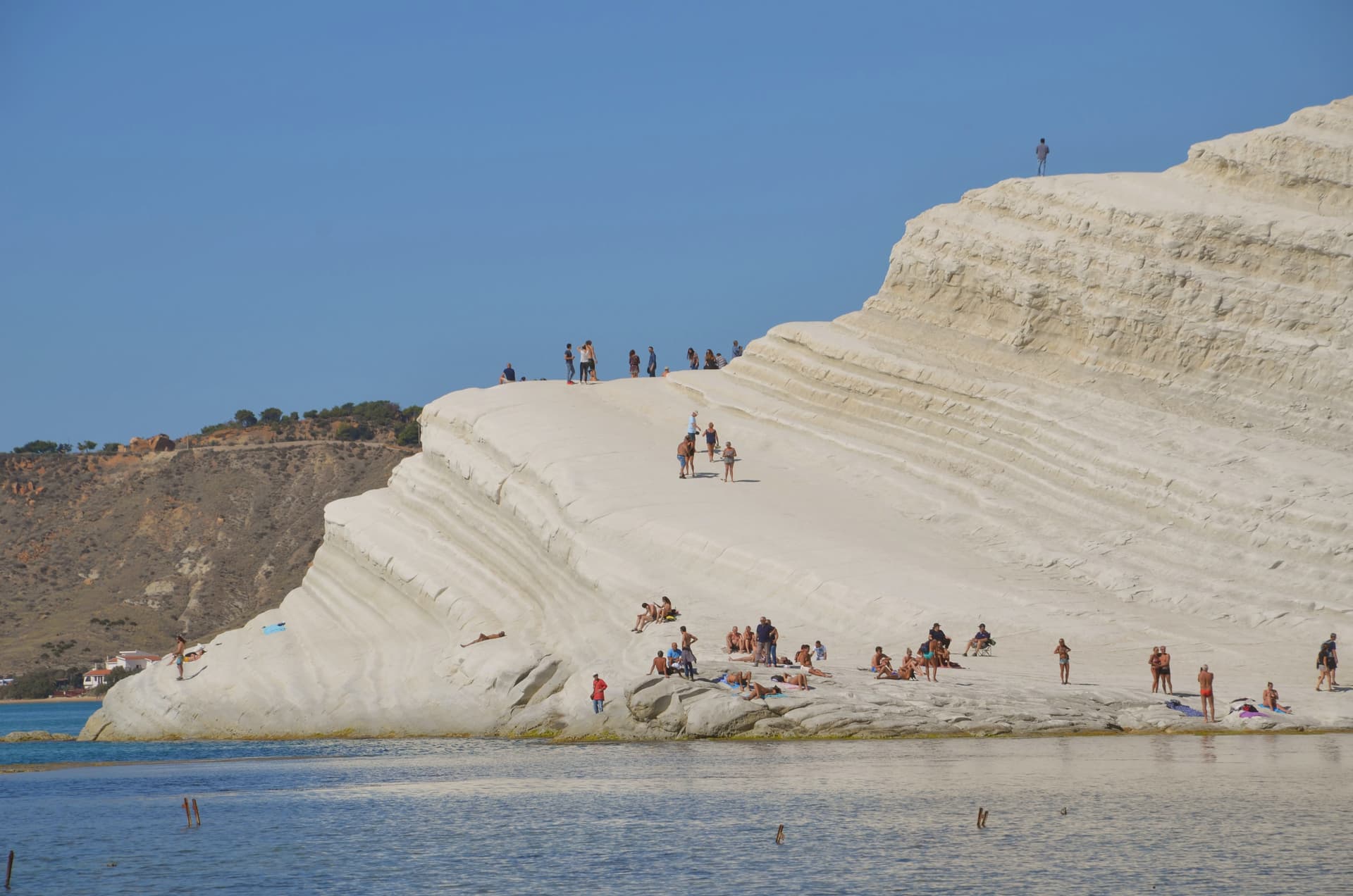
The Scala dei Turchi, the white marl cliff a kilometre west of the centre, is formed of Trubi Formation rock laid down five million years ago when the Mediterranean refilled after the Messinian salinity crisis. Its name remembers the sixteenth-century pirate raids that used the cliff as a landing point.
Andrea Camilleri's Montalbano novels and Giuseppe Tornatore's Malèna both took it for backdrop. Inland, the Realmonte salt mine runs twenty-five kilometres of tunnels a hundred metres underground, with a chapel hollowed from the salt that holds eight hundred people.
A Roman villa with marble and mosaic floors was uncovered above Punta Piccola in 1907 during railway works. The commune holds two institutional signals: Borgo dei Borghi finalist and Città dell'Olio.
What to see in Realmonte
- Scala dei Turchi. White marl cliff of Trubi Formation rock above the sea, named for the sixteenth-century pirate raids that landed below it.
- Miniera di salgemma di Realmonte. Salt mine running twenty-five kilometres of tunnels a hundred metres underground, with a chapel carved into the halite face.
- Villa Romana di Durrueli. First-century AD villa discovered in 1907, with marble opus sectile rooms, mosaic floors and thermal spa overlooking the sea.
How to get to Realmonte
Catania is roughly 143 minutes away by road.
Our tip
May, June, September and October are the months for Realmonte. The marl cliff is bright in soft light, the sea is warm enough to swim, and the heat is bearable on the exposed headland. July and August are hard: full Sicilian summer, no shade on the Scala, and crowds at the cliff from morning through sunset.
San Vito Lo Capo
Why visit San Vito Lo Capo
San Vito Lo Capo sits at the tip of a cape on Sicily's northwest coast, between two mountains, fifty-five kilometers from Palermo. The commune was administered from Erice until 1952, when the Sicily Region recognized it as its own municipality, so the fishing village at the foot of the peak is a relatively recent administrative entity even where the sanctuary at its center dates to the fifteenth century.
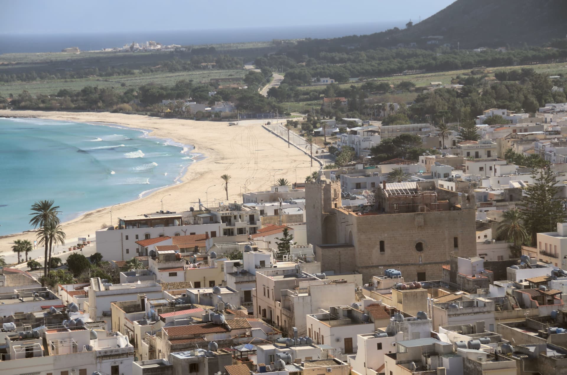
The old town gathers along Via Savona around the fortress-church, while the shoreline it faces has become the reason the wider world knows the name, a four-thousand-person town whose September festival now draws North African and Sicilian cooks to compete on the same dish. The protected coast begins seven kilometers down the shore, untouched by road, closing off the cape's undeveloped end the way the mountains close it at the back.
A small administrative history, a fortified sanctuary, and an uninterrupted stretch of coast: together they explain a place that stayed a village while becoming a destination.
Profumi di Cous Cous, Syrah Ristorantino have been named by a guide.
What to see in San Vito Lo Capo
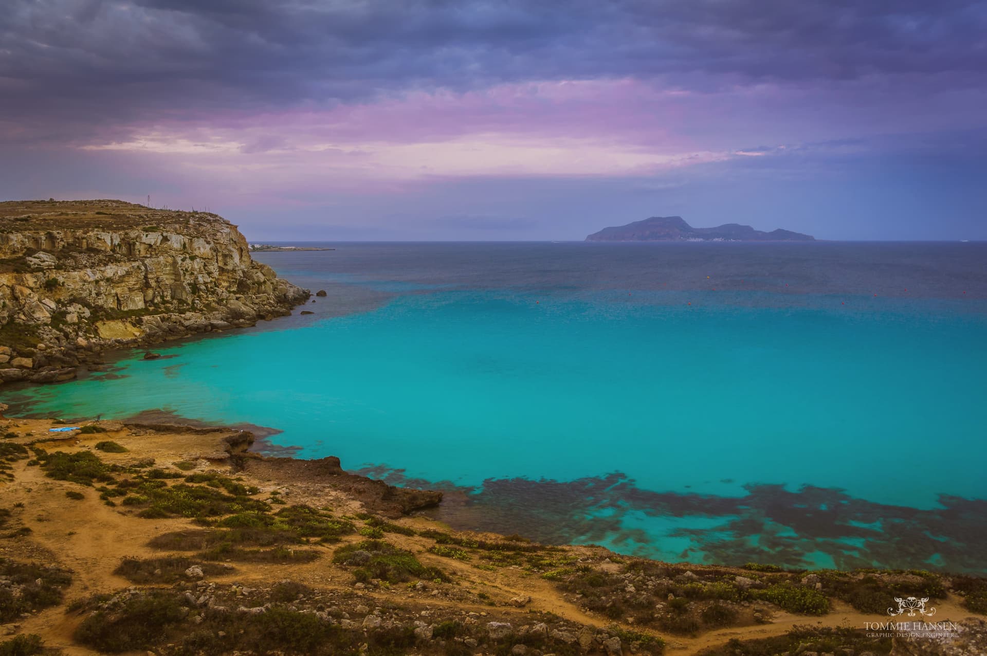
- Spiaggia di San Vito Lo Capo. Sheltered bay water clear enough to have earned the beach a Caribbean comparison, framed by the peak rising directly behind it.
- Santuario di San Vito Martire. Fortress-sanctuary with Arab-Norman walls dedicated to the patron, standing on Via Savona at the heart of the centro storico.
- Monte Monaco. Limestone peak of just over 500 meters rising directly behind the town, with views over the bay and Capo San Vito.
How to get to San Vito Lo Capo
Palermo is roughly 129 minutes away by road.
Our tip
May through October is the season the town is built for. The bay warms early and stays swimmable into November on a good year. July and August are full, the sand crowded, parking tight, restaurants booked. Cous Cous Fest falls in September.
Nicolosi
Why visit Nicolosi
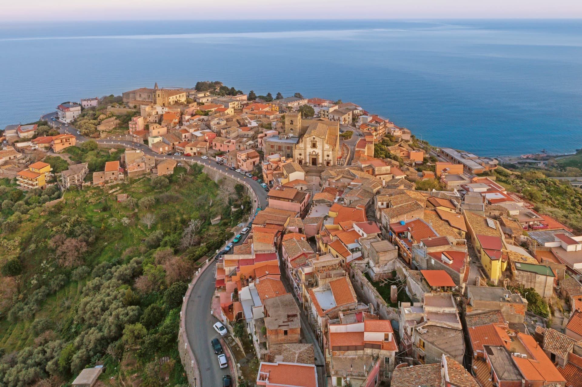
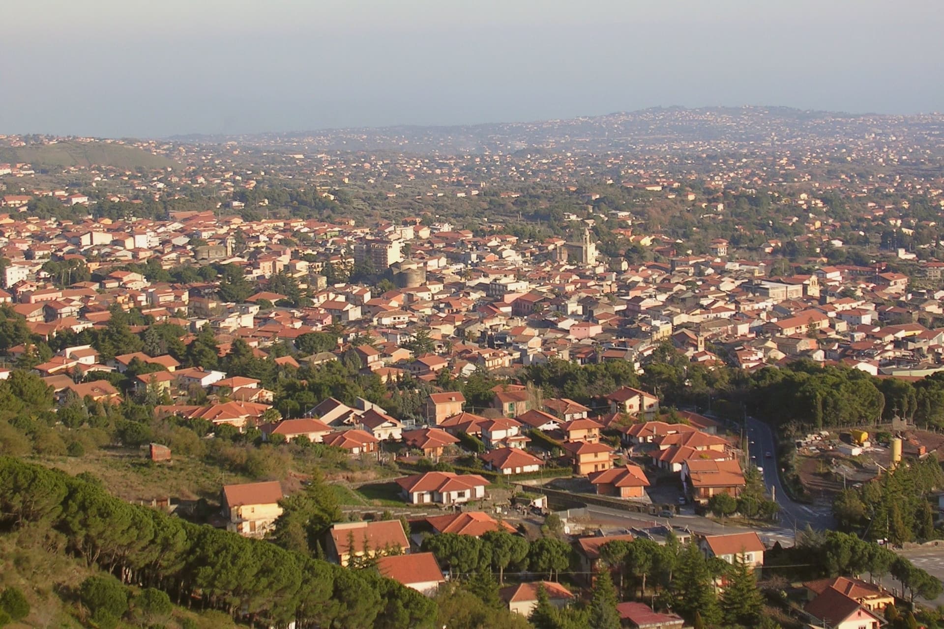
Nicolosi sits at 698 meters on the southern slope of Etna, twelve kilometers north of Catania. The town was founded in 1359 around the Benedictine monastery of San Nicolò l'Arena.
In March 1669 a fissure opened above the town and Etna erupted for four months, lava burying part of the settlement and pushing on to Catania harbor. What remained was rebuilt around the church the flow had spared, and the cones left by that eruption, first called Monte della Ruina, later took their name from their color.
Above the rebuilt town the road climbs toward the volcano park and the cable car station, so that Nicolosi works as the point where the settled southern slope, its bread, honey and olive groves, gives way to the bare upper mountain. The town is where the ordinary, inhabited Etna ends and the crater country begins.
What to see in Nicolosi
- Monti Rossi. Twin cones standing over the town, walkable on paths that circle the craters, the ground still dark scoria underfoot.
- Funivia dell'Etna a Rifugio Sapienza. Cable car rising to 2,500 meters, the station reached twenty minutes uphill from Nicolosi and marking the start of the southern ascent on foot beyond the lift.
- Chiesa di Santa Maria delle Grazie. The church the lava did not reach, standing at the center of the rebuilt town, its fabric showing the later repairs made after further seismic damage.
How to get to Nicolosi
Catania is roughly 28 minutes away by road.
Our tip
May through October are the working months on the southern Etna slope. Nicolosi at 698 meters runs five to seven degrees cooler than Catania; July and August are bearable here while the coast is not. The Funivia dell'Etna operates year-round, with snow at the cable car upper station from late November through April.
Troina
Why visit Troina
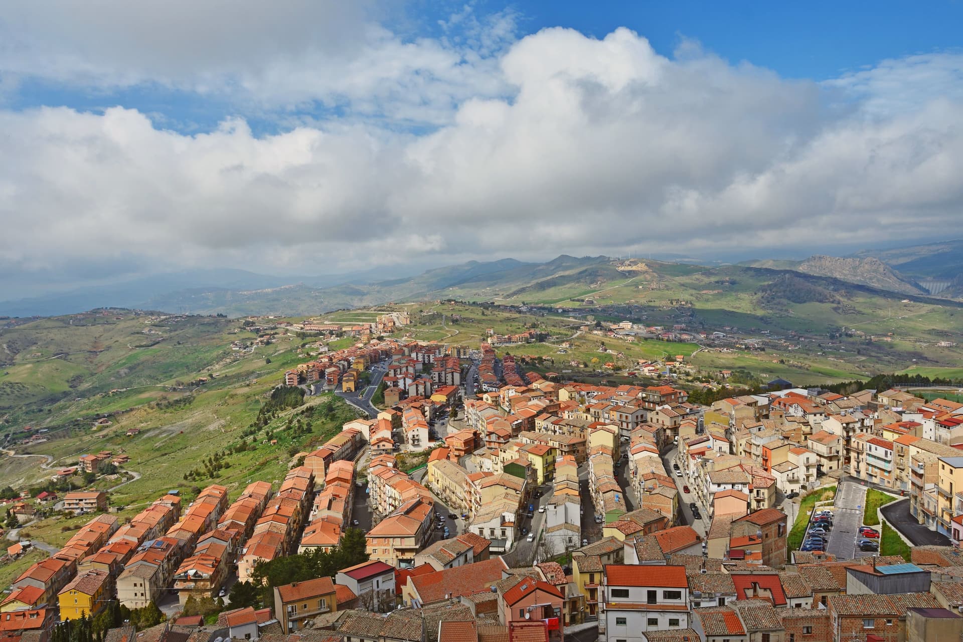
Troina sits at 1,121 meters on the southern edge of the Nebrodi, one of the highest commune centers in Sicily, with Etna visible to the east on clear days. The area was settled in the seventh millennium BC and the urban core dates to the fourth century BC.
In 1061 Roger I took the Saracen castle here and made the town the first political and military base of the Norman conquest of the island. The Diocese of Troina, established in 1082, was the first Sicilian bishopric founded after centuries of Arab rule.
The Chiesa Madre, dedicated to Maria Santissima Assunta, stands at the highest point of the town with its Norman tower still intact, the earliest Norman cathedral built in Sicily. Below the centro storico, the ruins of the Basilian monastery of San Michele Arcangelo, endowed by Count Roger, sit on an outcrop above the Fiume sotto di Troina valley.
The Nebrodi Park surrounds the commune on three sides.
What to see in Troina
- Chiesa Madre (Maria Santissima Assunta). First Norman cathedral built in Sicily, founded under Roger I after 1061, with its original Norman bell tower still standing at the highest point of the centro storico.
- Castello di Troina. Medieval fortress taken from the Saracens by Roger I in 1061 and used as the political and military base of the Norman conquest of Sicily; partial walls and towers survive.
- Monastero di San Michele Arcangelo. Ruined Basilian monastery on a rocky outcrop below the town, endowed by Count Roger after the conquest and one of the oldest Norman monastic foundations on the island.
How to get to Troina
Catania is roughly 61 minutes away by road.
Our tip
June through September brings dry highland weather, ridge trails open across the Nebrodi, and temperatures stay below thirty even when the Sicilian coast burns. December through March is the second season: Troina's altitude catches snow, and the Nebrodi roads close for storms but the town itself stays open. April, May, October and November are quiet and often wet, the wind sharp on the ridge, with many guesthouses shut.
Menfi
Why visit Menfi
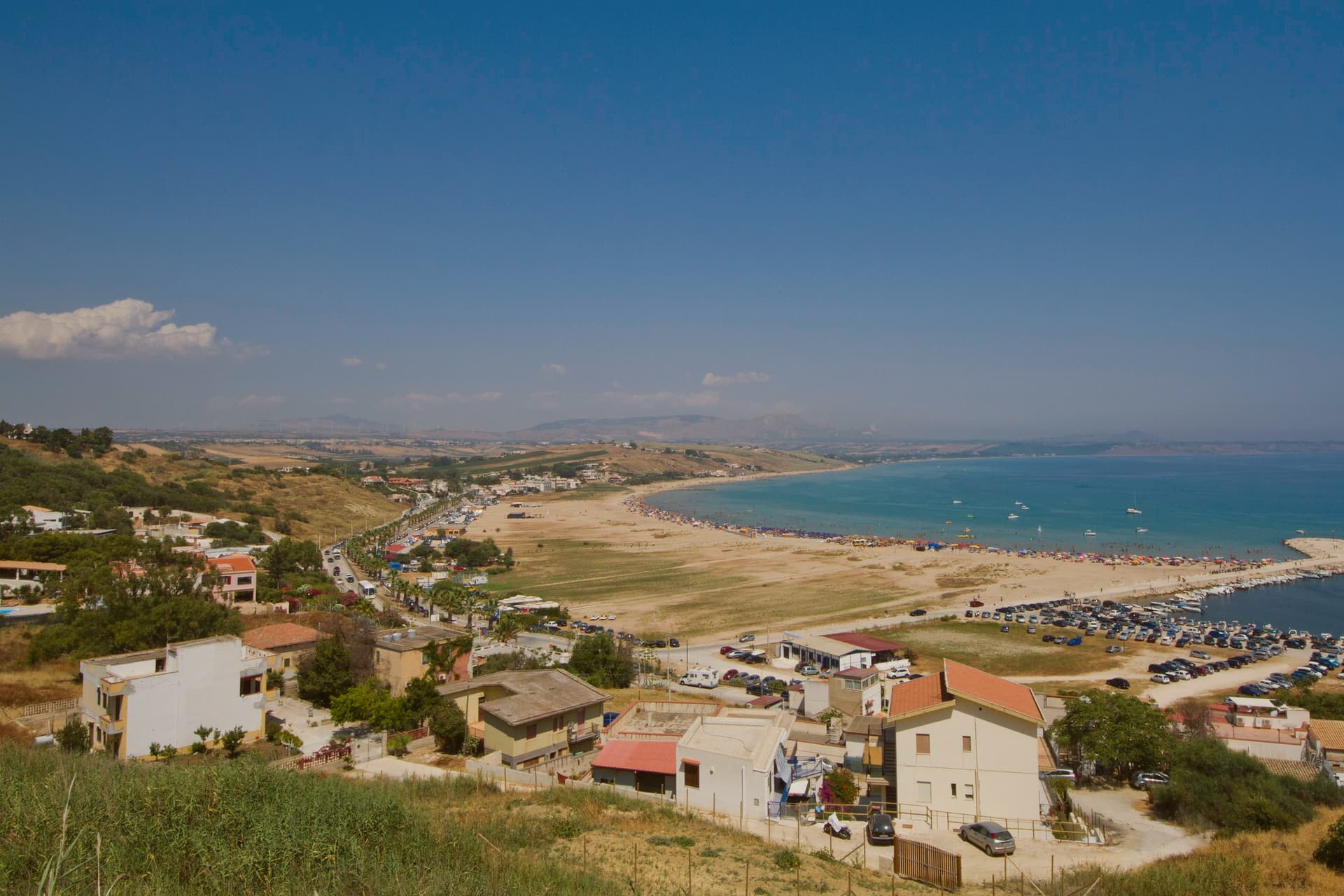
Menfi is an 11,814-resident town on the western Agrigento coast, and its geography frames everything else about it. The town sits at 119 metres on a low limestone ridge between the Belice and Carboj rivers, four kilometres inland from the coast, where a nine-kilometre arc of fine sandy beach runs at Porto Palo di Menfi, backed by a protected dune system of 1,100 hectares, the most important loggerhead turtle nesting site on the southern Sicilian coast.
That gap between ridge and shore is the shape of the whole place: the historic centro on the high ground, the beach and reserve down below, the vineyard and olive plateaux spreading out behind and above the town. The town itself was founded in 1638 by the Tagliavia d'Aragona Pignatelli family on the site of an earlier castello belonging to Federico II.
Nothing from that medieval phase survived the re-foundation except a single surviving tower, the only structure left from before the seventeenth-century rebuilding. Above the town, the plateaux produce the two products that give Menfi the rest of its quality-mark trifecta alongside the beach: a cooperative cellar founded in 1958 that draws on 2,000 grower-members farming 6,000 hectares to produce 50 million bottles a year, the volume that makes it Italy's largest winery, and an olive oil, Nocellara del Belice DOP, grown across the same micro-region that produces the Castelvetrano table olive.
That range of production is what earns the town its Città del Vino status alongside its oil and its beach. Beyond the town, Selinunte's Greek temple site lies 25 km west and the Scala dei Turchi limestone cliff sits 50 km east toward Agrigento, the two standard day trips.
The food is Sicilian-coastal: pasta con le sarde, busiate with Trapani-style pesto, bluefin tuna from one of the last traditional fisheries on the island, couscous showing the same Trapani influence reaching this far along the coast, cassata and cannoli, and the local Grillo or Nero d'Avola poured alongside all of it. What holds the place together is that ridge-to-shore, town-to-plateau layout: a working wine and olive town that happens to sit a short drive from its own protected beach, rather than a beach resort with agriculture as an afterthought.
La Foresteria, Salisà, Il Vigneto have been named by a guide.
What to see in Menfi
- Porto Palo di Menfi (Bandiera Blu). Fine sandy beach below the town, backed by dune wetland where loggerhead turtles nest. The sand runs long enough that the crowd thins fast once you walk past the first stretch.
- Cantine Settesoli + Mandrarossa. Visits and tastings at the cooperative cellar in town: Nero d'Avola, Grillo, Inzolia, Syrah poured where they are made rather than at a distributor's counter.
- Nocellara del Belice DOP olive oil. The local olive oil, from the same micro-region as the Castelvetrano table olives. Several small frantoi in town offer tastings, worth setting alongside the wine visit rather than instead of it.
How to get to Menfi
Palermo is roughly 83 minutes away by road.
Our tip
Menfi is best May–June and September–October — the beach is swimmable May–October, summer crowds peak August. The Inycon Wine & Jazz festival in late June is the year's headline event. October is harvest at Cantine Settesoli and the surrounding cellars. Inycon, la Festa del Vino a Menfi falls in October.
Castelvetrano
Why visit Castelvetrano
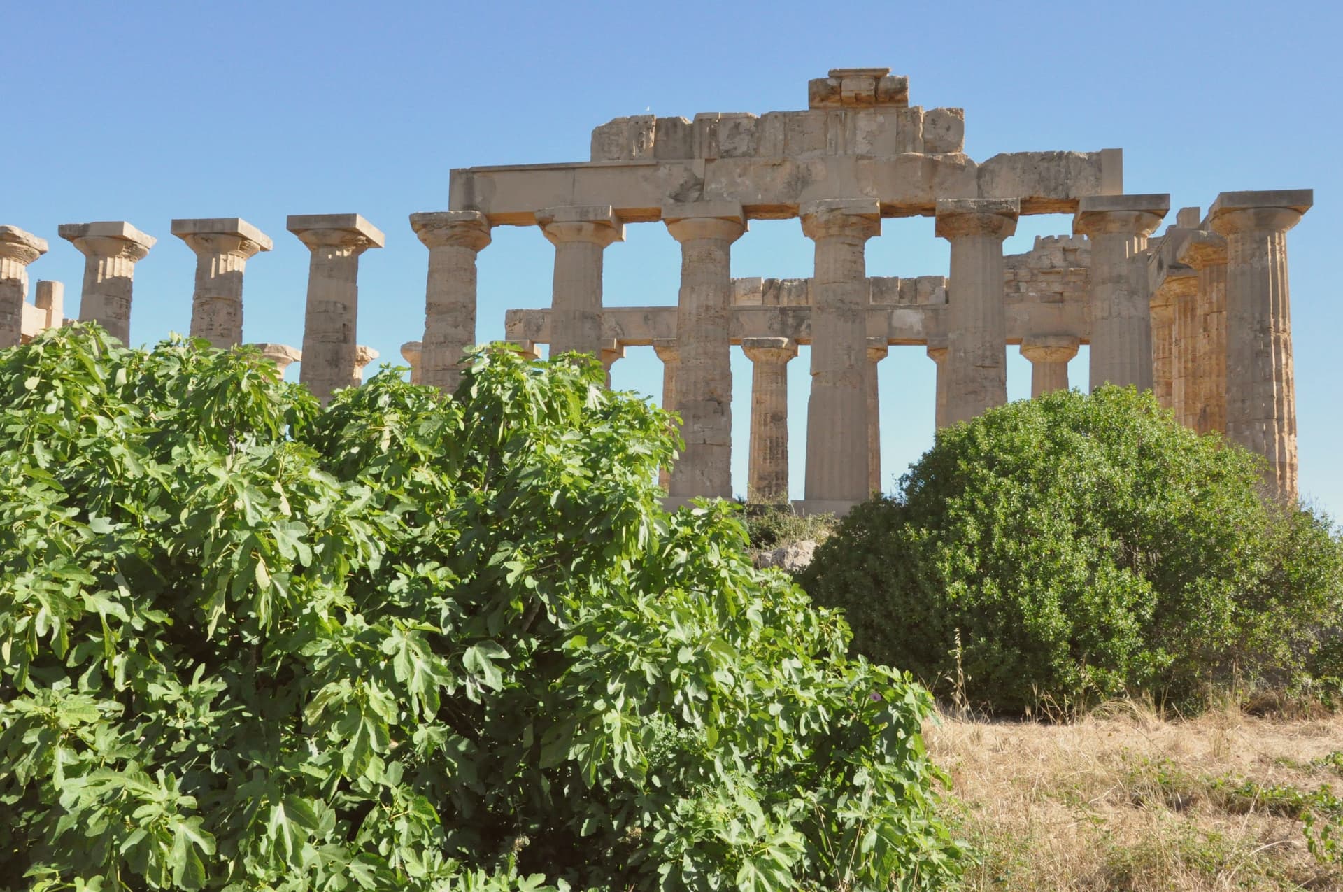
Castelvetrano sits at 187 meters in the Belice valley, fifteen kilometers from the south coast of Trapani province. Within its municipal territory lies Selinunte, founded in the seventh century BC by Greek settlers from Megara Hyblea, named for the wild parsley that still grows on the site, and now the largest archaeological park in Europe at 337 hectares of Doric temples, walls and necropoleis.
The town itself developed in the twelfth and thirteenth centuries; its centro is built around the Sistema delle Piazze, three linked squares (Garibaldi, Umberto I and Cavour) framed by the sixteenth-century Chiesa Madre with stucco work by Antonio Ferraro and Gaspare Serpotta. The Civic Museum holds the Efebo di Selinunte, an 85-centimeter bronze cast around 470 BC, one of the rare authentic Greek originals in Sicily.
Castelvetrano produces Nocellara del Belice DOP table olives and the pane nero, baked from autochthonous tumminia and rusulidda grains in wood-fired ovens, grain found in noble tombs at Selinunte.
What to see in Castelvetrano
- Parco Archeologico di Selinunte. Largest archaeological park in Europe at 337 hectares, with Doric temples E, F and G along the Marinella plain between the Belice and Modione rivers.
- Sistema delle Piazze. Three linked squares (Garibaldi, Umberto I, Cavour) at the heart of the centro storico, framed by the Chiesa Madre and Palazzo dei Principi.
- Chiesa Madre. Sixteenth-century mother church with tufaceous neo-Romanesque façade, three naves under wooden ceilings, and stucco decoration by Antonio Ferraro and Gaspare Serpotta.
How to get to Castelvetrano
There is a railway station in the town, so you can arrive without a car and never need one while you are here. Palermo is roughly 92 minutes away by road.
Our tip
May, June, September and October are the working months at Selinunte. The site has almost no shade, July and August push past thirty-five degrees, and the long path between the eastern and western hills becomes punishing. April brings the asphodels and wild parsley that gave Selinunte its name. Sagra del Pane Nero falls in October.
Sciacca
Why visit Sciacca
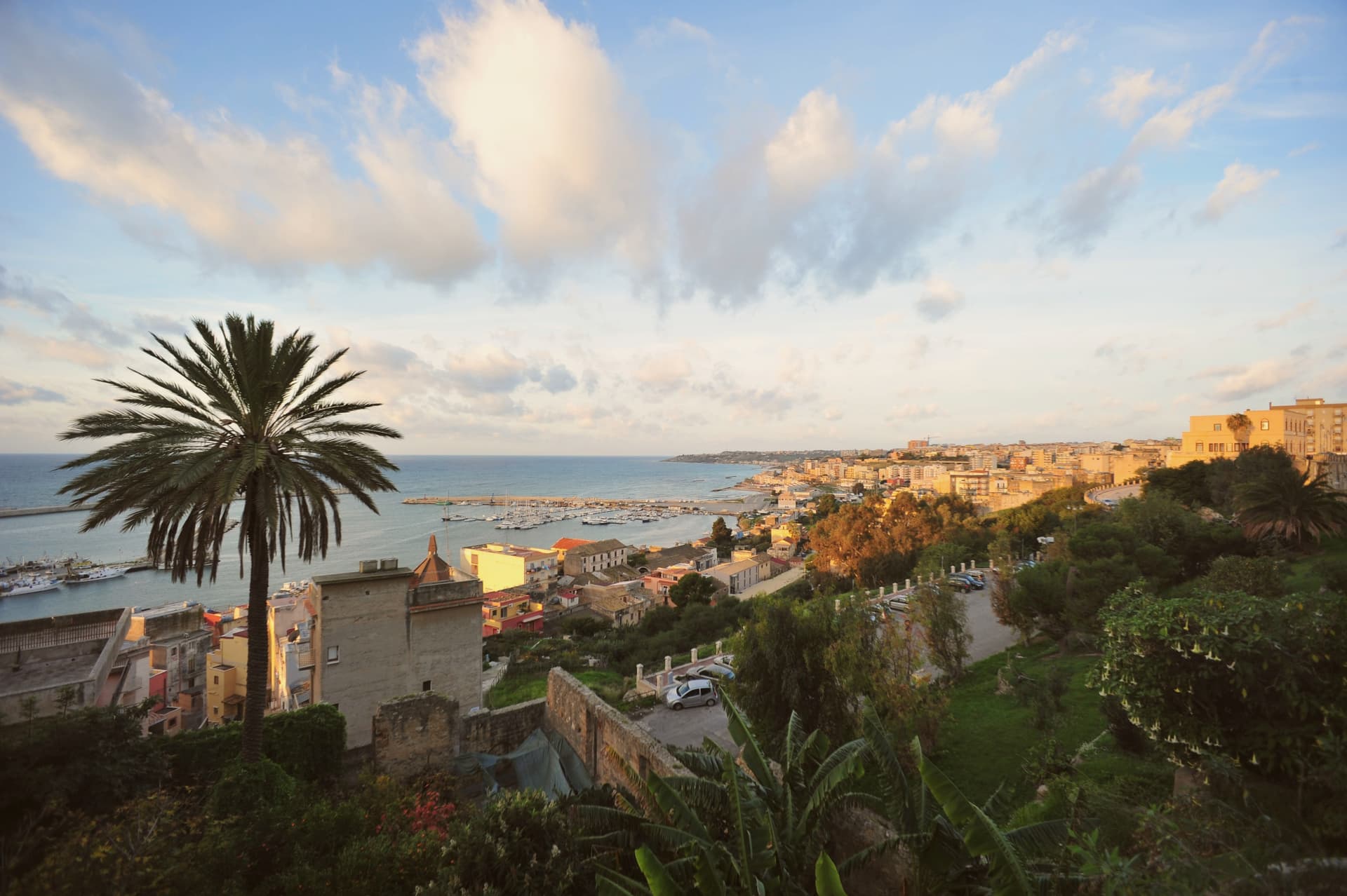
Sciacca sits on terraces above its harbor on the southwestern coast of Sicily, between Selinunte and Agrigento. The mountain that rises 386 meters behind the town still vents steam into rock chambers where the sulfurous springs draw the same spa use that began in antiquity.
The Arabs renamed the town Xacca, water; the present name comes from that. Sciacca is the second-largest commune in the Agrigento province after the capital, with about 39,000 inhabitants, and one of the great fishing harbors of southern Sicily.
The town's layout still carries its origins: a medieval core divided between fishermen's and artisans' quarters, terraced on the cliff, with the harbor below and the mountain and its steam caves behind. Two industries have grown out of that position, one drawing on the clay and craft tradition of the province, the other filling the calendar each year with a Carnival whose roots reach back to Roman festival.
What the springs began as a cure, the town turned into an identity: water gave Sciacca its name, its baths, and eventually the industries that keep it going.
Hostaria del Vicolo, La Lampara have been named by a guide.
What to see in Sciacca
- Palazzo Steripinto. 1501 palazzo with a diamond-pointed ashlar façade, one of the finest examples of Gothic-Renaissance Plateresque art in Sicily.
- Stufe di San Calogero. Natural steam caves on Monte Kronio with temperatures of 40-45 degrees, reached through rock chambers that still vent into the cave walls.
- Castello Incantato. Open-air museum on the outskirts with hundreds of stone heads carved into the rock by the artist Filippo Bentivegna in the early twentieth century.
How to get to Sciacca
Palermo is roughly 99 minutes away by road.
Our tip
May through October are the months Sciacca is at full pace. The harbor stays open, the beaches west and east of town fill, and the centro storico stays usable into October. July and August push past thirty-five degrees and the centro storico empties between two and six.