
The best small ski towns in the province of L'Aquila
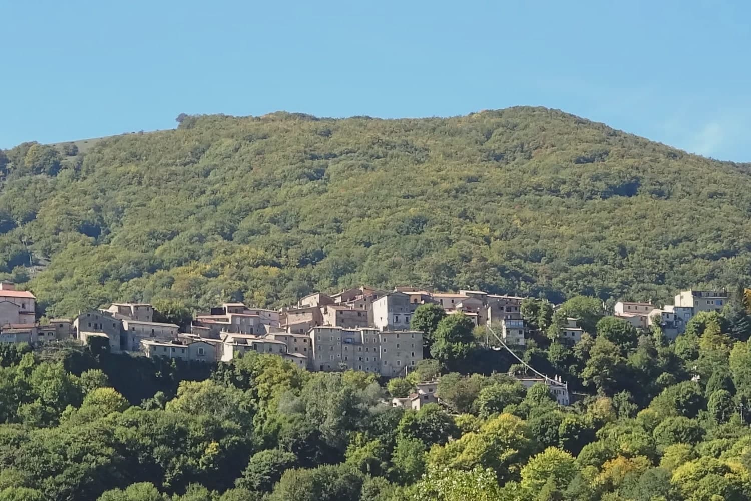
Abruzzo skis on limestone. The province of L'Aquila is mountain almost everywhere, and the snow settles on bare grassy plateaux, beech woods and the shoulders of the Maiella and the Velino-Sirente, with the Gran Sasso closing off the northern horizon. The villages beneath the lifts are built of pale local stone, tight streets and church façades that were cut long before anyone thought of a chairlift, and the eating is winter eating: mutton, saffron, lentils from the high fields, pecorino, sagne with beans, arrosticini turned over a long narrow brazier. Season runs from around Christmas through to early spring, and the plateaux hold snow because they are high and open rather than because a marketing team decided they should.
Most skiers in central Italy who want a name go to the Terminillo side of things or, more often, drive straight past Abruzzo to the Dolomites, where the lift networks are enormous and the queues match. Rome empties into the nearer Apennine slopes at weekends and in the holiday fortnight, and the car parks below the best-known lift bases fill early. The result is a strange split: a region with real snow and mountain villages, seen mostly as a Saturday car park or skipped in favour of the Alps.
The same plateaux and the same stone villages carry on, and the smaller places also have lifts on their own ground. These are towns with a piazza, a butcher, a couple of trattorie and a ski area up the road, sitting either on the high tablelands or inside the national park where wolves and bears are counted rather than advertised. Fewer people come, particularly midweek, and that is the point of the list below.
Of the 42 communes we have mapped in the province of L'Aquila, 12 qualify as ski towns: each has a ski area on its own territory. This list is the small ones, 10 in all, ordered smallest first. The smallest, Cappadocia, has 575 residents.
Two more lists worth reading alongside this one: The 6 best small towns that eat well in the province of L'Aquila and The best towns that eat well in the province of L'Aquila.
Cappadocia
Why visit Cappadocia
The village sits in a karst-limestone valley in western Abruzzo, 32 km north of Avezzano on the SS5 toward Tagliacozzo, at 1,102m in the Marsican mountains. That valley geology is what produced the cave system: the Grotte di Pietrasecca, one of the most extensive in the central Apennines, first explored in 1893 and opened for public visits in 1991, its passages running roughly 5 km with three large chambers on the standard tour and ongoing speleological work in the sections beyond.
Pietrasecca belongs to the Città delle Grotte, the Italian network of cave-tourism towns, and the cave accounts for most of the visitor traffic the village sees. Above ground, the borgo itself is small and gets less attention than what lies beneath it: a settlement of stone houses around a 12th-century parish church with later restorations, partial medieval walls still standing, holding a Borgo Autentico designation for the kind of community life and continuity that mark is meant to recognize.
To the east the Marsica plain opens toward Avezzano; to the west the Roveto valley is the route toward Sora and Frosinone. To the south, the regional park gives the village its hiking access, with the standard half-day summit reached directly from the settlement.
The name is a separate thread from the geography, tied instead to a tradition that Byzantine refugees fleeing the Arab conquests in the 7th-8th centuries AD carried the word from the Anatolian region of the same name when they settled here, a purely toponymic link with no rock-cut landscape or hot-air balloons attached to it. Depopulation here has been steep and steady: 1,800 residents in 1951, 575 today, a pattern common to Marsican mountain villages generally.
What holds the place together, in the end, is the coincidence of geology and a borrowed name. The caves draw people for what is underground, the name draws people confused about what country they are looking at, and the borgo, modest and largely unchanged, sits between the two doing the quieter work of actually being a village.
There is a mapped ski area on this commune, at 1102 metres.
What to see in Cappadocia
- Grotte di Pietrasecca. Three large chambers on the 90-minute guided tour: Sala del Tempio, Sala del Drago, Sala del Lago. Active speleological exploration continues in the deeper sections beyond the mapped route.
- Centro storico + Chiesa di San Biagio. Quietly handsome medieval mountain settlement at 1,102m. Stone houses, the 12th-century Chiesa di San Biagio with later restorations, partial medieval walls.
- Monti Simbruini + Monte Calvo. Monte Calvo, at 1,500m, is the standard half-day summit from the village, reached directly from the settlement into the regional park's trail network.
How to get to Cappadocia
Roma is roughly 140 minutes away by road.
Our tip
Cappadocia is mountain-seasonal — May through September is the sweet spot, with the cave open year-round but most surface activities (hiking, trail network) needing the snow-free months. The cave's interior temperature is a constant 7°C — bring a sweater even in August. Winter is severely cold at 1,102m with possible heavy snow; the cave stays open with reduced hours.
Rivisondoli
Why visit Rivisondoli
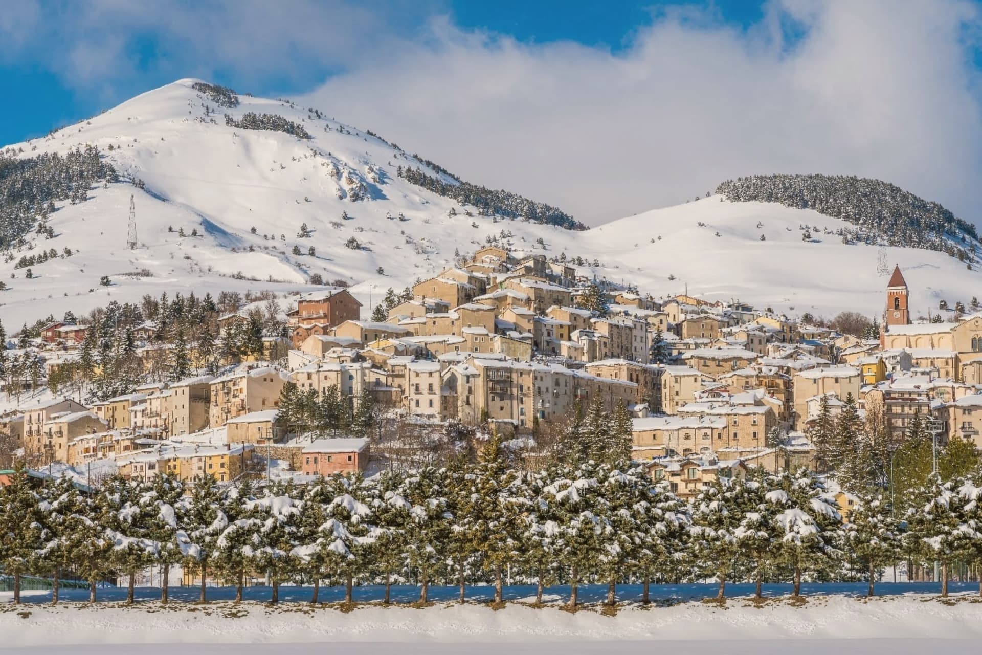
Rivisondoli sits on the flank of Monte Calvario, looking down at the plateau that runs north toward Roccaraso. The town was first recorded in 724 in a diploma of Grimoald II, Duke of Benevento, and grew in the 12th century along the Via degli Abruzzi, the military and trade route across the central Apennines.
It was once known for its weapons production. The 1792 fire destroyed most of the village, and the opening of the Sulmona-Isernia railway in the 19th century turned it toward tourism rather than trade.
The Italian royal family kept a residence here in 1913. Rivisondoli and Roccaraso face each other across the Cinque Miglia plateau, close enough that their ski slopes were joined into one domain and their names are now said together.
The older village, rebuilt twice, climbs one flank of the mountain while the plateau below stays open and treeless, the same ground that once slowed traders and caravans on the route through the Apennines. What began as a stop on a military road became, after fire and war remade the town twice, a place oriented instead toward winter visitors and a single night in January.
There is a mapped ski area on this commune, at 1320 metres.
What to see in Rivisondoli
- Alto Sangro ski area. The lift network runs between 1,309 and 2,142 meters, joining Rivisondoli's slopes to Roccaraso's across the open plateau.
- Presepe Vivente. Hundreds of villagers in period costume take the hillside outside town for the performance, the cast spread across the open ground rather than a stage.
- Altopiano delle Cinque Miglia. Treeless and averaging 1,250 meters, the plateau in the Alto Sangro is prone to extreme winter winds, a stretch that historically caught travelers unprepared.
How to get to Rivisondoli
Pescara is roughly 89 minutes away by road.
Our tip
December through March is the season the town runs on. The Alto Sangro lifts open, weekend numbers multiply, and the Cinque Miglia plateau north of town becomes the cross-country skiing route. The January 5 Presepe Vivente draws the biggest single crowd of the year.
Barrea
Why visit Barrea
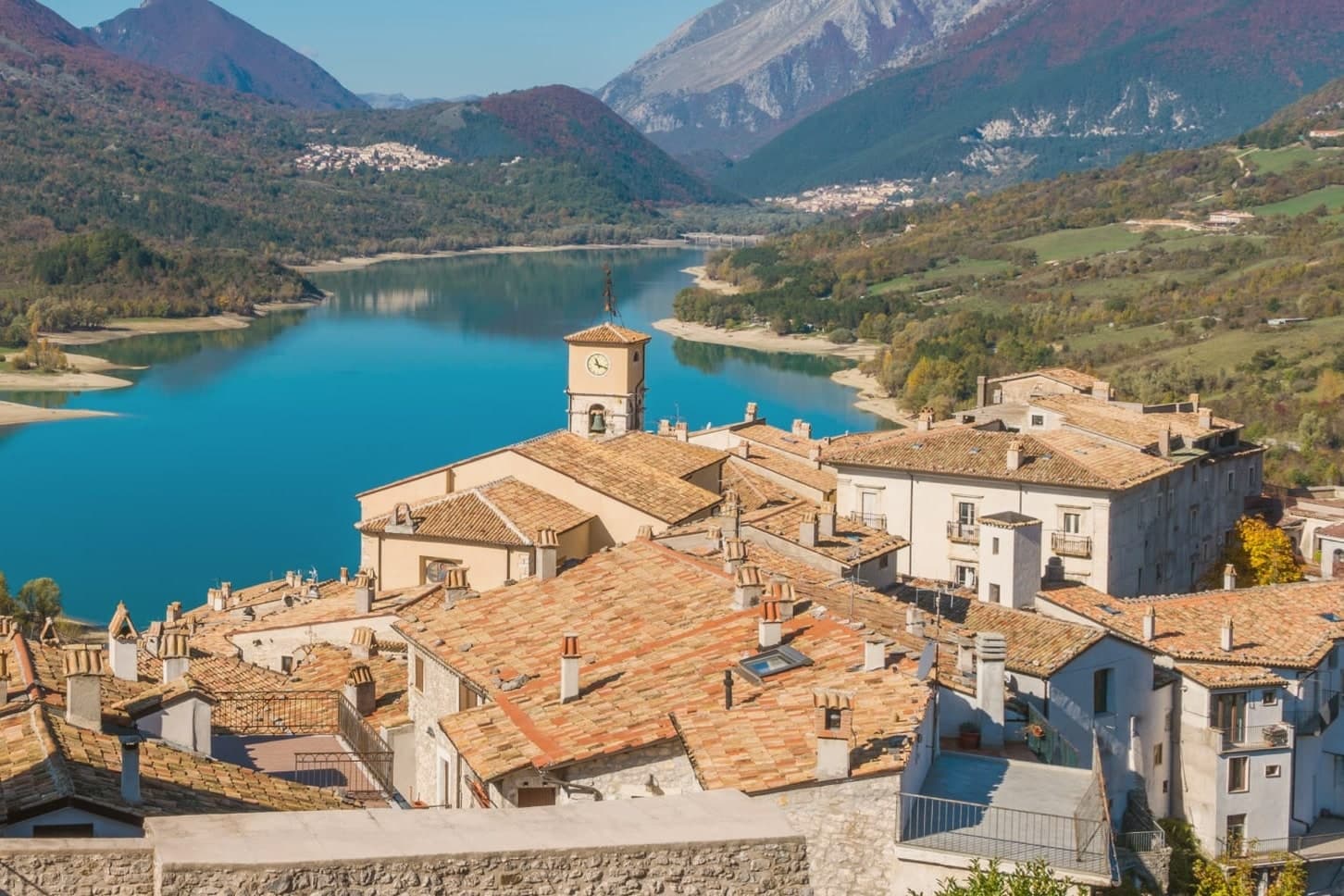
Barrea sits at 1,066 meters on a spur at the heart of the Parco Nazionale d'Abruzzo, Lazio e Molise, looking down on Lago di Barrea, the lake created in 1951 by damming the Sangro river. The lake is 5 kilometers long, 980 meters above sea level, and the most photographed body of water in inland Abruzzo.
The village descends from the pre-Roman Samnites, whose Colleciglio necropolis just outside the town has produced funeral artifacts from the 6th-7th century BC, now in a small museum opened in 2007. The medieval centro storico is a fortified knot of stone houses and narrow streets.
The Chiesa di San Tommaso Apostolo was first built in the 13th century, repeatedly destroyed by earthquakes, fires, and war, and rebuilt with a baroque-stuccoed interior. The original castle, built in the 11th century by the di Sangro family who held the fief, stands just outside the village with towers and walls intact.
Roughly 700 people remain. The park around them holds the largest population of Marsican brown bear and Apennine wolf in Italy.
There is a mapped ski area on this commune, at 1066 metres.
What to see in Barrea
- Castello dei di Sangro. 11th-century fortress built by the di Sangro family, first feudal lords of Barrea, with towers and connecting walls now used for cultural events.
- Chiesa di San Tommaso Apostolo. 13th-century parish church, repeatedly damaged by earthquake, fire, and war, with baroque stucco and gilding from the 1600s and 18th-century paintings.
- Chiesa della Madonna delle Grazie. 14th-century church, one of the oldest standing buildings of medieval Barrea, with a small portal of carved local stone.
How to get to Barrea
Pescara is roughly 122 minutes away by road.
Our tip
June through September is when Barrea works in full: the lake warms enough to kayak, the park trails are clear, and the festa di San Tommaso fills the village in late August. December through March brings the second season, when the surrounding peaks turn white and the road from Pescasseroli stays clear for skiers heading to Roccaraso. October and November are damp and bear-sighting season; many guesthouses close.
Campo di Giove
Why visit Campo di Giove
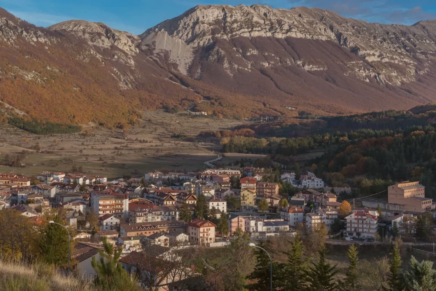
Campo di Giove sits at 1,064 meters at the foot of the southwestern Maiella, the highest commune inside the Maiella National Park. The name is documented as Campo Jovis from the 4th century AD, with local tradition claiming a Roman temple to Jupiter on the site after a victory over the Paeligni.
A villager called Odorisio appears in a document from January 1136. In the 14th century the village was a Cantelmo stronghold; it then passed to the Caldora, the Belprato, the Pignatelli, and finally the Recupito.
Above the village, the ski station operates between 1,150 and 2,360 meters, the highest piste in Abruzzo. The mother church of Sant'Eustachio holds the statue of the patron saint.
Sant'Antonino was one of the sixteen convents founded by Fra Pietro da Morrone, the hermit who would become Pope Celestine V. The Master of Campo di Giove, an anonymous 15th-century painter named for the polyptych he made for the village church, is on display at the Museo Nazionale d'Abruzzo in L'Aquila.
There is a mapped ski area on this commune, at 1064 metres.
What to see in Campo di Giove
- Chiesa Madre di Sant'Eustachio. Parish church of the village patron, with the statue of Sant'Eustachio, the saint celebrated each September with the village feast.
- Convento di Sant'Antonino. One of the sixteen convents founded by Fra Pietro da Morrone, the hermit who became Pope Celestine V, documented in a 1274 papal bull.
- Palazzo delle Logge. 16th-century palazzo with arched loggia on the main piazza, one of several Renaissance buildings from the Caldora and Pignatelli periods.
How to get to Campo di Giove
There is a railway station in the town, so you can arrive without a car and never need one while you are here. Pescara is roughly 82 minutes away by road.
Our tip
Campo di Giove runs on two seasons. December through March, the Maiella ski lifts run from the village edge to 2,360 meters, the highest piste in Abruzzo. June through September is the second season: temperatures stay below 25 even in August at 1,064 meters, and the Sentiero della Libertà hike, retracing the WWII escape route over the Maiella, draws walkers.
Pescocostanzo
Why visit Pescocostanzo
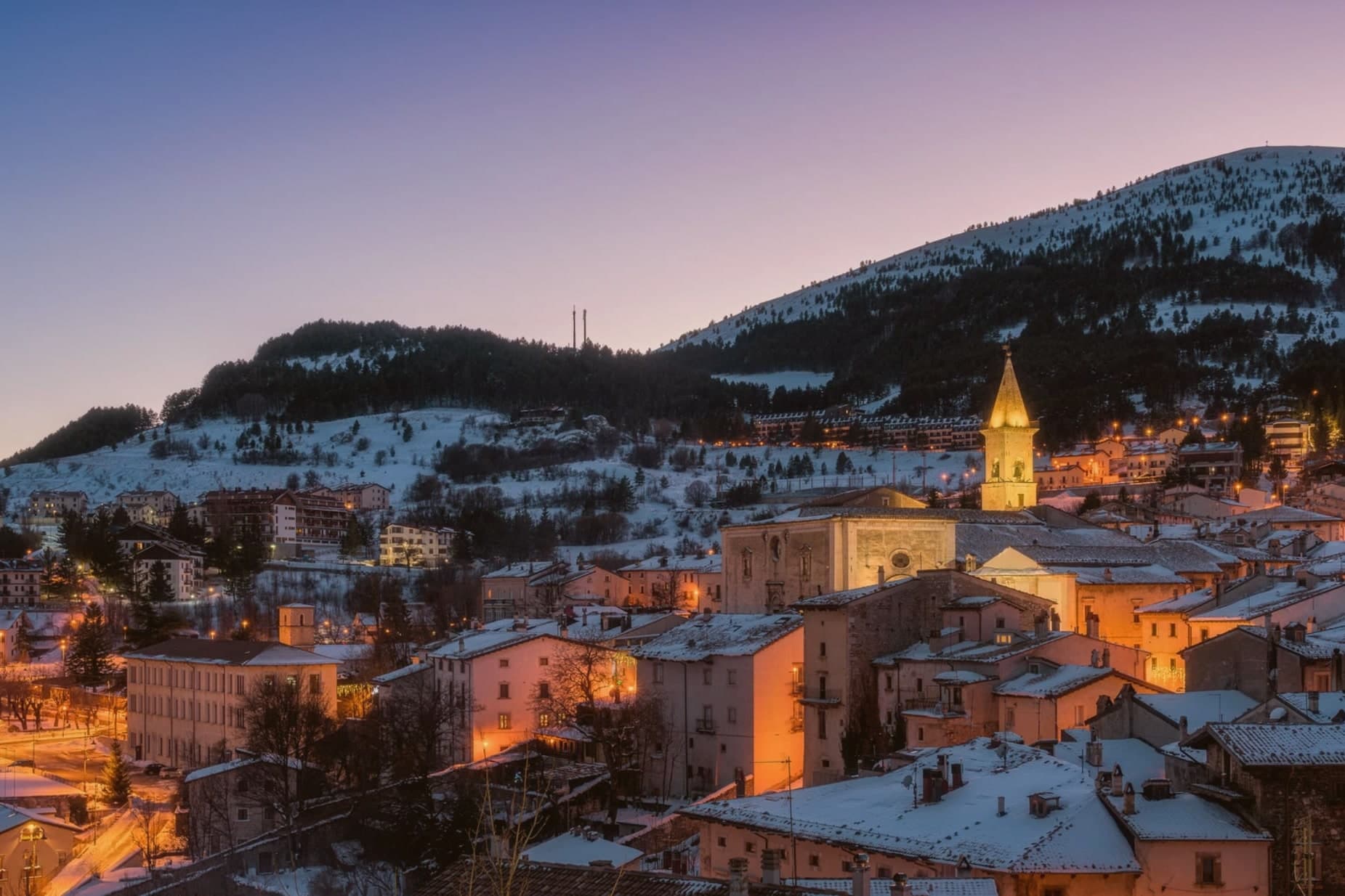
Pescocostanzo sits at 1,395 meters at the southern edge of the Quarto Grande plateau, the high karst basin above the Sangro valley. The town was reshaped between 1456 and the eighteenth century under the Capua family and a generation of Lombard masons who arrived to build for them.
The plan is unusually regular for a mountain commune: a grid of stone houses oriented to the wind, surrounded by woods and pasture. The Collegiata di Santa Maria del Colle, restructured by Cosimo Fanzago in the seventeenth century, is one of the rare five-nave churches in Abruzzo.
Its wrought iron Chapel of the Sacrament gate, made by Sante di Rocco between 1699 and 1707, is the masterpiece of local ironwork. Bobbin lace, merletto al tombolo, is still made here.
The Museo del Merletto a Tombolo inside Palazzo Fanzago shows the technique and the patterns. Filigree gold, carved wood, and lace are still sold on the Corso Roma.
There is a mapped ski area on this commune, at 1395 metres.
What to see in Pescocostanzo
- Collegiata di Santa Maria del Colle. Five-nave church begun in the late Middle Ages and remodeled by Cosimo Fanzago in the seventeenth century.
- Museo del Merletto a Tombolo. Inside Palazzo Fanzago, displays the local bobbin lace tradition with patterns, tools, and live demonstrations.
- Palazzo Fanzago. Designed by the baroque architect Cosimo Fanzago in 1624, the seat of the lace museum and civic offices.
How to get to Pescocostanzo
Pescara is roughly 84 minutes away by road.
Our tip
December through March brings snow and the ski season, with the Monte Calvario lifts linking to the Alto Sangro system at Roccaraso and Rivisondoli twenty minutes away. June through September is the second season. At 1,395 meters Pescocostanzo rarely crosses twenty-two degrees even in August, and the Bosco di Sant'Antonio offers beech-shaded walks.
Pacentro
Why visit Pacentro
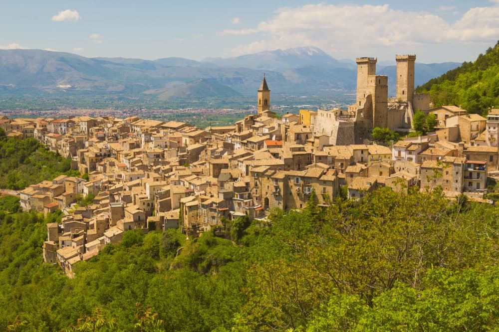
Pacentro sits at 650 meters on a hill spur in the Peligna valley, eight kilometers from Sulmona and inside the Maiella National Park. The Castello Caldora, with its three surviving square towers, dominates the village from the Colle Castello above.
The site has held a castle since the eleventh century; the structure visible today was begun by the Caldora-Cantelmo family in the late fourteenth century and bought by the comune in 1957 and restored. On the first Sunday of September, the Corsa degli Zingari sends barefoot runners down a rocky slope from Monte Ardinghi into the village in honor of the Madonna di Loreto.
The race is documented since the fifteenth century. The other thing people come for is the Ciccone house.
Madonna's paternal grandparents, Gaetano Ciccone and Michelina Di Iulio, emigrated from Pacentro in 1919. The pop singer visited in 2013.
There is a mapped ski area on this commune, at 650 metres.
What to see in Pacentro
- Castello Caldora-Cantelmo. Late fourteenth-century fortress on the Colle Castello, three of its four corner towers still standing, restored after 1957.
- Borgo medievale. Stone houses arranged on terraces below the castle, listed among the Borghi più belli d'Italia, preserved in its medieval plan.
- Chiesa di Santa Maria Maggiore. Sixteenth-century parish church with a baroque interior, holding the Madonna di Loreto honored in the September race.
How to get to Pacentro
Pescara is roughly 69 minutes away by road.
Our tip
May through October is when Pacentro opens. The first Sunday of September brings the Corsa degli Zingari and the biggest crowd of the year, with runners descending barefoot from Monte Ardinghi and the village in procession by evening. July and August can be warm in the valley but the elevation keeps Pacentro itself cooler than Sulmona below.
Ovindoli
Why visit Ovindoli
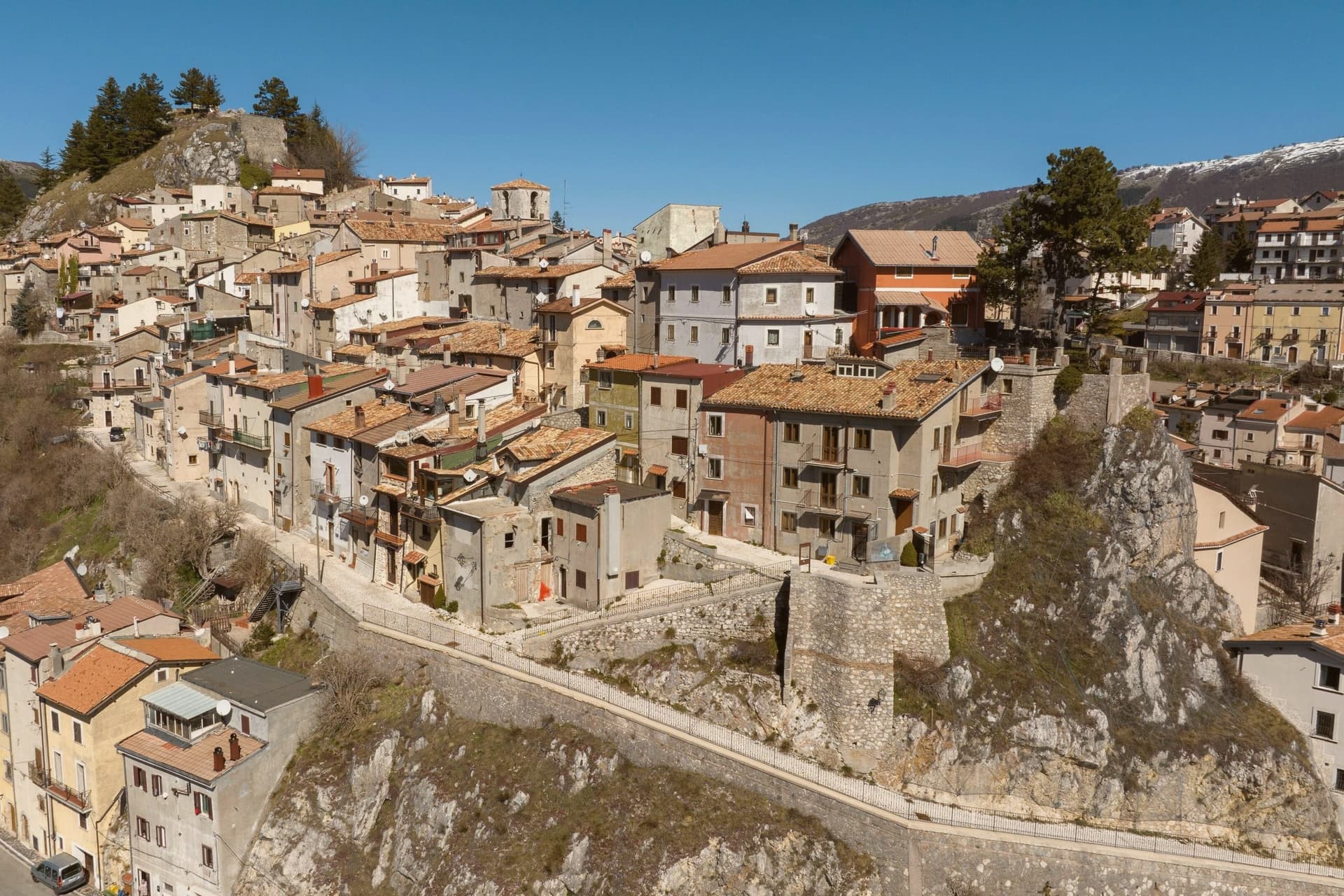
Ovindoli sits at 1,375 meters on the southern edge of the Altopiano delle Rocche, the karst plateau shared with Rocca di Mezzo, Rocca di Cambio and Rovere, inside the Sirente-Velino regional park. The town built itself around skiing.
Downhill became a serious draw after World War I, but the modern resort was organized in 1959 under the name Valturvema. Lifts opened in the 1961-62 season and the trails were expanded.
In 1994, new management renamed the operation Monte Magnola and modernized the lifts, the snowmaking, and the network. The ski area now runs from the village at 1,413 meters to the top of Monte Magnola at 2,056 meters, with about 30 kilometers of downhill, three triple chairlifts, two chairlifts, one cable car, four magic carpets and one drag lift.
It is part of the Skipass dei Parchi consortium with Campo Felice, Campo Imperatore and Grotte di Stiffe. Summer is hiking, mountain biking and horse-riding country.
Population is 1,167.
There is a mapped ski area on this commune, at 1375 metres.
What to see in Ovindoli
- Monte Magnola. Ski station from 1,413 to 2,056 meters, 30 kilometers of downhill terrain on the slopes above Ovindoli, modernized in 1994.
- Altopiano delle Rocche. Karst plateau at 1,300-1,400 meters shared with Rocca di Mezzo, Rocca di Cambio and Rovere, the central terrain of the Sirente-Velino park.
- Parco Naturale Regionale Sirente-Velino. Regional park that surrounds the town, with high meadows, beech forests and trails toward the Sirente and Velino summits.
How to get to Ovindoli
Pescara is roughly 78 minutes away by road.
Our tip
December through March is the ski season, the months Ovindoli was built around. The Monte Magnola lifts run, the town hotels fill on weekends, and the Skipass dei Parchi makes the village a hub for the four-station consortium. June through September is the second draw: at 1,375 meters the village stays cool through August, and the same plateaus that hold the skiers become trail-running, hiking and grazing country.
Roccaraso
Why visit Roccaraso
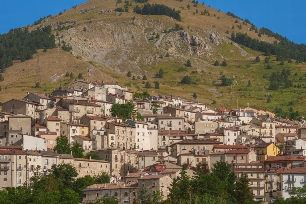
The town sits where the plateaus of Aremogna and Pizzalto meet the higher ground toward Monte Greco, the peak that anchors the whole range at 2,283 meters. The two plateaus are joined by lift, grazed and hiked in summer, cut into pistes in winter: the same trails serve both seasons under different cover.
Four kilometers uphill sits the older, smaller settlement, a medieval frazione that took the weight of the war the valley town below did not escape either. The Germans dug into the Gustav Line where it crossed through here, the Allies bombed in response, and the town below was leveled along with it.
What stands in Roccaraso now was rebuilt after that, stone by stone, from what the bombing left. The first ski lift on Monte Zurrone went up in 1936, years before any of it, and skiing resumed after the rebuilding and never really stopped.
The area has held its place as the south's ski capital since, though the snow line keeps rising: in January 2024 only twenty of Abruzzo's 122 pistes were open. A resort built twice, once by engineers before the war and once by survivors after it, still runs on the same slopes either way.
There is a mapped ski area on this commune, at 1236 metres.
What to see in Roccaraso
- Chiesa di Santa Maria Assunta. Baroque travertine façade, gilded walnut pulpit in the shape of a Greek cross, painted and gilded wooden organs.
- Pietransieri. Medieval frazione where the Limmari Massacre took place; the Gold Medal of Military Valour recognizes what its people lost that winter.
- Piano Aremogna. High pasture and ski terrain at 1,650 meters, the eastern flank of the Alto Sangro ski domain.
How to get to Roccaraso
There is a railway station in the town, so you can arrive without a car and never need one while you are here. Pescara is roughly 94 minutes away by road.
Our tip
December through March is the season Roccaraso was built for. The Alto Sangro lifts open, the slopes fill, and the town doubles on weekends. June through September is the second season: 1,236 meters means temperatures rarely cross 23 degrees even in August, and the same plateaus that hold the lifts become hiking and pasture country.
Scanno

Why visit Scanno
Scanno sits in the Sagittario valley, ringed by the Majella foothills and the Marsicano massif. The lake lies three kilometers down the valley from the town, at a lower elevation, so the walk between them moves from stone alleys to open water framed by the same slopes that produced it: a landslide off the mountain dammed the Tasso river and left the basin behind.
The town's isolation, closed in by the surrounding massifs, is what let the older costume and its headdress survive into the era of the camera, and it is what drew photographers to record it rather than something they invented. The goldsmiths' filigree, made in the same stone streets the women walked, belongs to the same thread: a village shaped by its enclosure in the mountains, still making by hand what it has always made.
There is a mapped ski area on this commune, at 1057 metres.
What to see in Scanno
- Lago di Scanno. Seen from above, the water reads as a clean heart shape against the valley walls.
- Centro storico. Stone-alley medieval centre where the black costume, with its folded headdress some historians trace to Balkan or Eastern origins, is still worn by older women against limewashed walls.
- Chiesa di Santa Maria della Valle. Parish church first documented in the eleventh century, rebuilt in the seventeenth, with a Renaissance portal and Baroque interior.
How to get to Scanno
Pescara is roughly 80 minutes away by road.
Our tip
June through September is the summer window: trails open in the national park, the lake holds a Blue Flag for swimming, and the centro fills with photographers chasing the Giacomelli setups. December through March is the second season for snow, with skiing on Monte Rotondo and Passo Godi nearby. April, May, October and November are quiet, with many family-run hotels closed and the lake side restaurants shuttered.
Pescasseroli
Why visit Pescasseroli
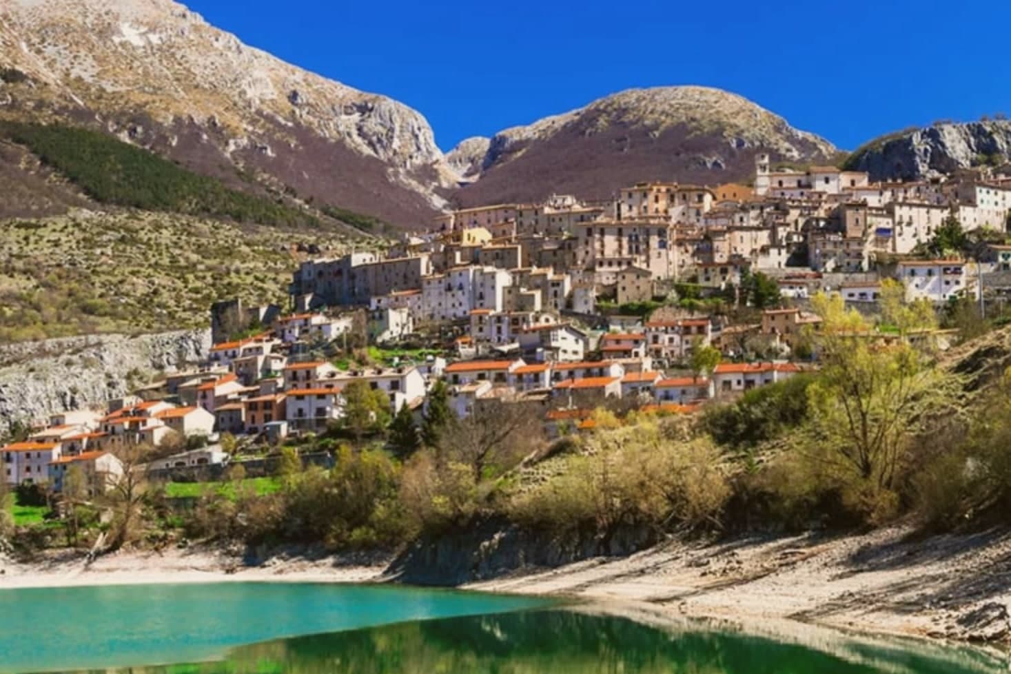
Pescasseroli sits at 1,167 meters at the head of the upper Sangro valley, the administrative heart of the Abruzzo, Lazio and Molise National Park. The park was provisionally established in 1922 and confirmed in 1923, making it the first national park in Italy and one of the earliest in the world.
The philosopher Benedetto Croce was born here in February 1866 in the Palazzo Sipari, the family house his grandfather Pietrantonio expanded in 1839. The park itself was largely the work of Erminio Sipari, Croce's cousin, an environmentalist and member of parliament.
The park protects roughly fifty Marsican brown bears, a subspecies found nowhere else, along with Apennine wolves and Abruzzo chamois. The Centro Visita on the edge of town holds a naturalistic museum, an Apennine garden, and an enclosure for injured wildlife.
In winter, Pescasseroli is the southernmost serious ski town in the central Apennines.
There is a mapped ski area on this commune, at 1167 metres.
What to see in Pescasseroli
- Palazzo Sipari. Birthplace of Benedetto Croce in 1866, now a historic house museum, with the family balcony from which Croce wrote of his Pescasseroli.
- Centro Visita del Parco. Park headquarters with naturalistic museum, Apennine garden, and enclosures for Marsican brown bears, Apennine wolves and roe deer.
- Chiesa di San Paolo Apostolo. Parish church of Pescasseroli, with a 13th-century wooden Madonna and Child known as the Madonna Nera, locally venerated.
How to get to Pescasseroli
Pescara is roughly 97 minutes away by road.
Our tip
June through September is the hiking season in Pescasseroli, with July and August the busiest weeks and the only ones where the town fills. December through March is the second season, when the modest local ski area opens and snowshoers head into the Marsicani. April, May, October and November are quiet.
More from Anywhere Italy
- The 6 best small towns that eat well in the province of L'Aquila
- The best towns that eat well in the province of L'Aquila
 The best high-altitude villages within 90 minutes of Pescara
 The best mountain towns inside a national park within 90 minutes of Pescara
- The best hidden towns with a serious restaurant in the province of L'Aquila
 The 10 prettiest small villages in the province of L'Aquila