
The best olive oil towns that eat well within 90 minutes of Foggia
The land around Foggia is built on wheat and olives, and in autumn the difference is audible: tractors on the plain, then the low grinding of the frantoi in the hill towns above it. New oil here is grassy and peppery enough to catch at the back of the throat, poured over broad bean puree with wild chicory, over grilled lamb, over bread that comes to the table unsalted and enormous. The houses are tufo and pale limestone, the colour of the fields in July. Come between the olive harvest and Christmas and the food is at its best, though the wind off the Tavoliere is cold.
Most people travelling through this part of Puglia are heading for Vieste, or further south to Alberobello and the trulli, and the coast road along the Gargano fills solid from June onwards. There are good reasons for that: sea caves, the Foresta Umbra, white cliffs dropping into clear water. But the restaurants that fill first are the ones on the seafront, and August in Vieste is a car park with a view.
The olive groves do not stop at the resort towns. They climb inland into the Daunian hills, cross into Molise and Irpinia, and run down to the Murge, and the towns spread through that landscape are where the oil is actually made. Each of the places below belongs to the national association of olive-oil towns, and each has a table a dining guide thought worth naming. Fewer people eat at them, which is most of the point.
Of the 23 communes we have mapped within 90 minutes of Foggia, 7 qualify as olive oil towns that eat well: each belongs to the national association of olive-oil towns, and a dining guide has named a table in each. The smallest, Mattinata, has 5,976 residents.
If you are still choosing, we have also written The 8 best olive oil towns you can reach by train within 90 minutes of Foggia and The best towns you can reach by train that eat well within 90 minutes of Foggia.
Mattinata
Why visit Mattinata
Mattinata sits at seventy-five meters on the eastern Gargano. The Iapyges, immigrants from Greece and the Balkans, settled the surrounding hills from the fifth century BC; the Roman port of Matinum, on the modern seafront, gave the town its name.
The current settlement is younger than most Garganic centers: it was administered as part of Monte Sant'Angelo until 1955, when it became an independent comune. The town proper sits below the mountain that watches over it, the two bound by the same limestone that runs from the abbey ruins down to the coast.
South of town the shoreline drops toward the sea stacks and, ten kilometers further on, the pebble crescent and cliffs of Baia di Vignanotica. The national park covers all of it, mountain, coast and town alike.
A settlement younger than its neighbors, built on ground far older: the Roman port beneath the seafront, the settled hills behind it, the abbey above it, all folded into a comune that has only carried its own name since the middle of the last century.
La Locanda del Maniscalco have been named by a guide.
What to see in Mattinata
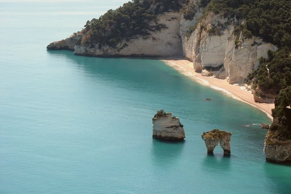
- Baia delle Zagare. Bay south of town with two iconic limestone sea stacks, the arch-shaped Arco di Diomede and the scissor-shaped Le Forbici.
- Baia di Vignanotica. Pebble crescent under tall limestone cliffs, reached on foot from the Sentiero dell'Amore from Baia dei Mergoli.
- Monte Sacro and Abbazia della Santissima Trinità. Ruined abbey standing where Benedictine monks raised it to abbey status in 1138, after annexation to the abbey of Siponto brought its abandonment.
How to get to Mattinata
Foggia is roughly 72 minutes away by road.
Our tip
May through September is the season Mattinata runs at full strength. The Adriatic water at Vignanotica and Baia delle Zagare is swimmable from late May, the Monte Sacro trail is at its best when the orchids flower in May and June, and the coastal cliffs catch a long evening light through the summer. July and August push past thirty degrees and fill the beaches; the boat shuttle to the faraglioni is the easier access.
Larino
Why visit Larino
Larino sits at 341 meters in the lower Biferno valley, twenty kilometers inland from Termoli. The Frentani held the place before Rome and minted bronze coins here in the third century BC; the wool trade made it a regional centre.
The orator Cicero defended a Larino-born equestrian, Aulus Cluentius Habitus, in his Pro Cluentio of 66 BC, a case that ties the town to the wider world of the capital beyond its own remains. The old town runs along the ridge above the ancient city, so the medieval borgo and the old street plan sit in view of each other rather than layered one on top of the other.
The cathedral stands at one end of this arrangement, the arena and forum fragments at the level below. Every 25 to 27 May the streets carry the Carrese di San Pardo, a three-day procession of oxen and flower-decked carts that retraces the eleventh-century translation of the patron's relics from Daunia, linking the medieval town's religious life to the same ground the Frentani and the arena's builders had already used.
The surrounding hills carry the Città dell'Olio mark. What holds the town together, across the Frentani coinage, the law case, the arena, and the May procession, is that each layer used the same ridge and valley without erasing what came before it.
Osteria del Borgo, Ciafi dal 1976 have been named by a guide.
What to see in Larino
- Anfiteatro Romano. Elliptical arena, 100 by 80 meters, built by a Larinum citizen who made his fortune in Rome. It stands within walking distance of the old town, its outline still legible against the surrounding streets.
- Cattedrale di San Pardo. The portal is the work to look at closely, carved by Francesco Petrini of Lanciano, its stone figures still sharp against the facade's plainer masonry.
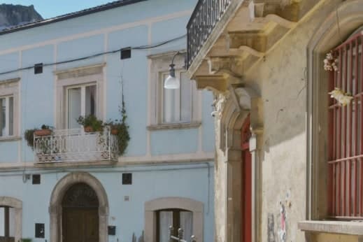
- Centro storico (borgo). Medieval old town stretched along the ridge above the Roman remains, with Renaissance palazzi and narrow stone streets.
How to get to Larino
There is a railway station in the town, so you can arrive without a car and never need one while you are here. Foggia is roughly 82 minutes away by road.
Our tip
April through October is the working season. May is the month most travellers come for: the three-day Carrese di San Pardo runs 25 to 27 May, with around 130 flower-decked ox carts moving through the town. June and September keep the Roman amphitheatre and cathedral comfortable to walk.
Minervino Murge
Why visit Minervino Murge
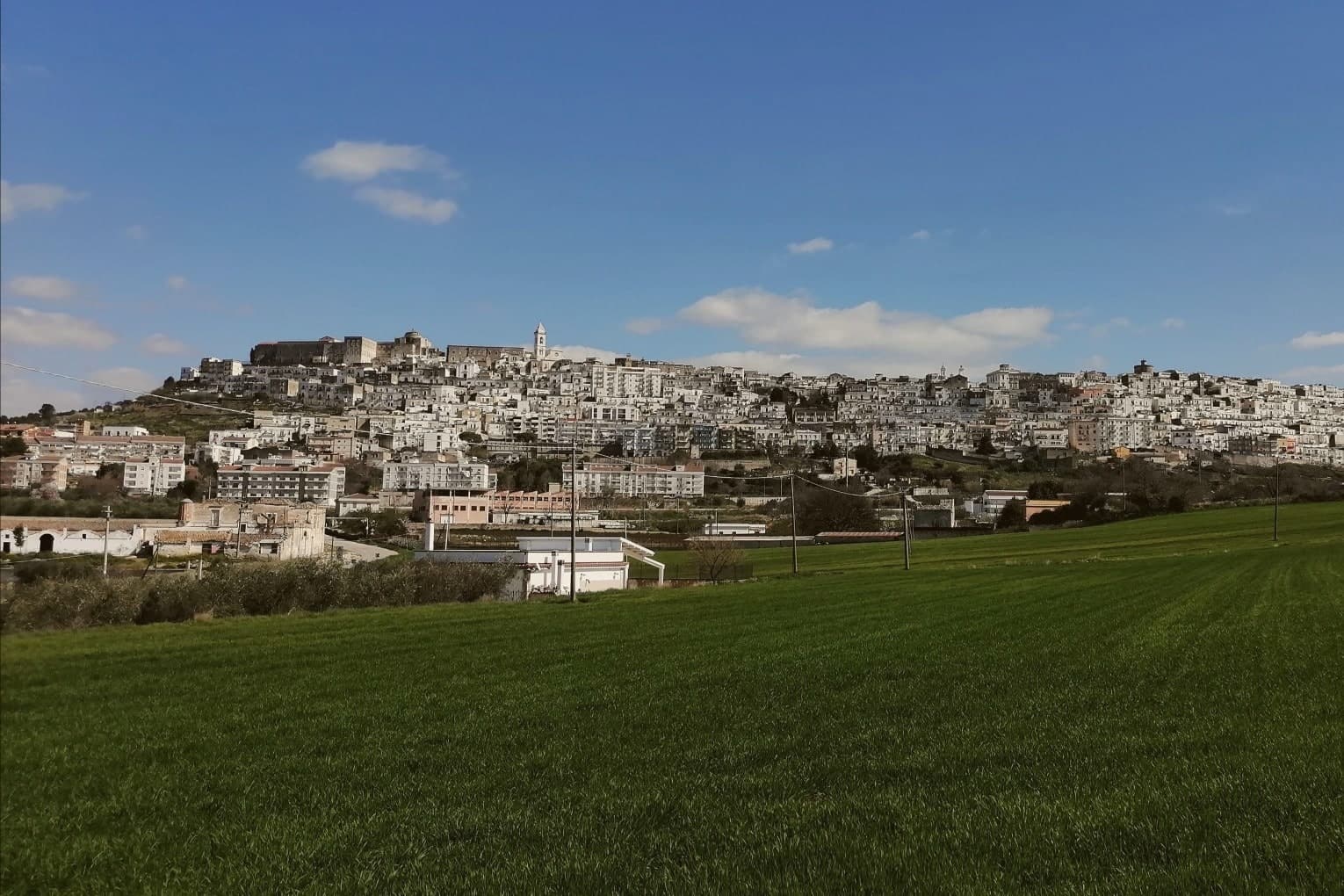
The town is built on two hills at the western edge of the Murgia plateau, where the limestone tableland gives out and the ground drops toward lower country on three sides. That break is what gives the ridge its long view and its nickname: to the east the eye crosses Murgia limestone toward the Gargano and the Adriatic, to the west it crosses cultivated fields into Basilicata, and to the north it runs the length of the Ofanto valley.
The old town sits above this drop, castle and tower on the high ground, cathedral below, the settlement organized around the same ridge that draws the view. Olive oil, almonds and grain define the rural economy beyond the walls, the plateau put to farming where it is not left to steppe grass and karst.
A ridge town, in other words, whose whole character, defensive site, pilgrimage cave, farmed hinterland, follows from the one geological fact of where the plateau ends.
La Tradizione - Cucina Casalinga, Masseria Barbera, A Sud dell'Anima have been named by a guide.
What to see in Minervino Murge
- Castello Normanno-Svevo. Norman fortress remodeled in the baronial period, with surviving towers and bastions on the high ridge above the old town.
- Torre di Pirro del Balzo. Fifteenth-century tower built between 1460 and 1490 when Minervino came to Pirro del Balzo as part of Maria Donata's dowry.
- Grotta di San Michele. Cave formed roughly two million years ago, reached through the karst rather than built, and still kept as a place of pilgrimage rather than display.
How to get to Minervino Murge
There is a railway station in the town, so you can arrive without a car and never need one while you are here. Foggia is roughly 62 minutes away by road.
Our tip
April through June and September through October are the months the Alta Murgia plateau runs best. The wildflower steppe peaks in May, almond blossom comes earlier in February, and the Ofanto valley below stays mild through autumn. July and August push past thirty-five degrees on the limestone with little shade; the centro storico empties between two and five and the panoramic belvedere is best at dawn or dusk.
Melfi
Why visit Melfi
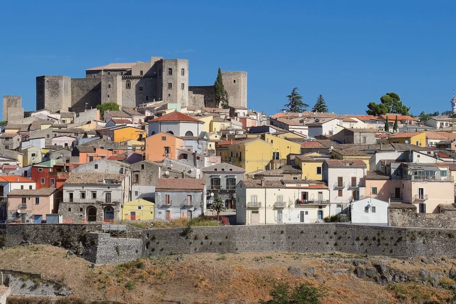
Melfi sits on the slopes of an extinct volcano east of the Apennine spine, the same mass whose crater holds the Laghi di Monticchio and whose soils now define a wine zone. The Hauteville Normans took the town in 1041 and made it the first capital of their southern Italian duchy, a status that explains the density of what followed: a cathedral built within a generation, a castle raised soon after and expanded by an emperor, a legal code drafted within those walls that shaped a kingdom's law.
The walled centro storico spreads below the castle, its gate and noble palazzi still arranged along the lines the Norman-Swabian town laid down. Upper fortress and lower town, volcanic mountain and walled centre: Melfi reads as a place where secular power, church authority and the raw geology of Monte Vulture sat close enough together to shape one small hill town into a seat of empire-level decisions.
La Villa have been named by a guide.
What to see in Melfi
- Castello di Melfi. Late-eleventh-century Norman fortress with ten towers, seven rectangular and three pentagonal. Frederick II expanded it after 1194, and the Constitutions of Melfi were promulgated within its walls.
- Cattedrale di Santa Maria Assunta. Dating from 1056, host of five ecumenical councils between 1059 and 1137. Stands at the heart of the walled centre below the castle.
- Museo Archeologico Nazionale del Vulture-Melfese. Inside the castle, with the second-century Roman sarcophagus of Rapolla and finds from the Daunian, Lucanian and Roman periods.
How to get to Melfi
There is a railway station in the town, so you can arrive without a car and never need one while you are here. Foggia is roughly 55 minutes away by road.
Our tip
April through June and September through October are the best windows in Melfi, with cool evenings and the Aglianico vineyards at their most photogenic. July and August reach the mid-thirties; the castle interiors and the cathedral hold the heat at bay. The Aglianico harvest runs into November and the Cantine and museums stay open. Sagra della castagna Varola falls in October.
Ariano Irpino
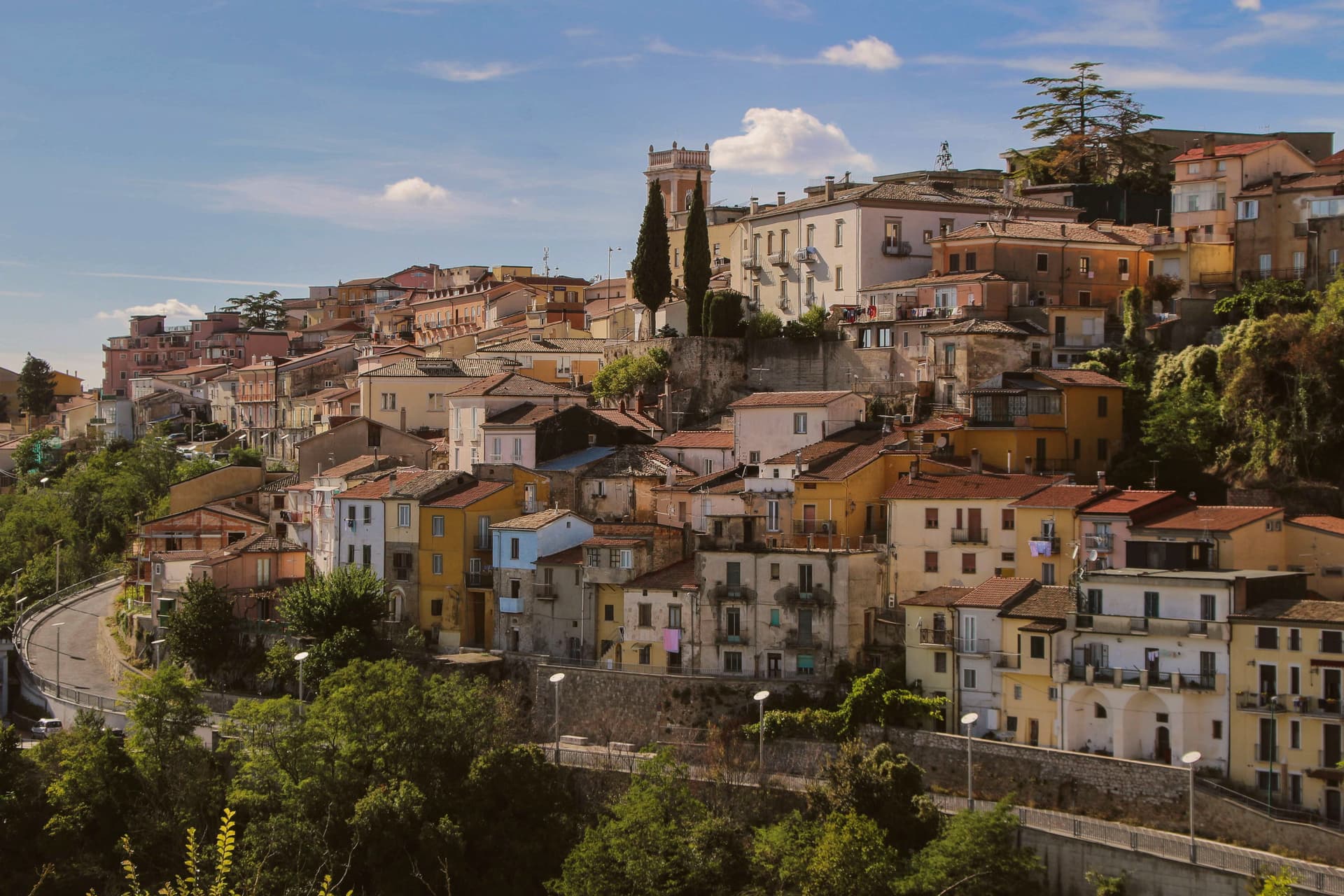
Why visit Ariano Irpino
Ariano Irpino rises on three hills, Castello, Calvario and San Bartolomeo, at 788 meters above sea level, where the Apennines narrow into the pass between Campania and Apulia. The Lombards held it, the Normans rebuilt the castle, and in the summer of 1140 Roger II convened the Assizes of Ariano, the forty-clause legal code that unified Norman, Lombard, Byzantine, Latin canon, Muslim and Jewish law for the Kingdom of Sicily.
The cathedral, dedicated to the Assumption, was completed in its current form in 1736. Ariano's majolica, glazed ceramic made here in waves of style since the medieval period, hit its peak in the eighteenth century with eleven kilns and twenty-nine craftsmen; the Museo Civico e della Ceramica in Palazzo Forte holds more than 250 pieces from the fourteenth century forward.
Known as Ariano di Puglia until 1930, the town carries both the Città dell'Olio and Città della Ceramica designations.
Maeba Restaurant, La Pignata have been named by a guide.
What to see in Ariano Irpino
- Castello Normanno. Norman fortress on the highest of the three hills, anchor of the Assizes of Ariano in 1140 and the strategic pass between Campania and Apulia.
- Cattedrale di Santa Maria Assunta. Cathedral of the Ariano-Lacedonia diocese, completed in its current form in 1736 by bishop Filippo Tipaldi.
- Museo Civico e della Ceramica. Civic and Ceramics Museum in Palazzo Forte, over 250 majolica pieces from the fourteenth century onward, the record of Ariano's kiln tradition.
How to get to Ariano Irpino
There is a railway station in the town, so you can arrive without a car and never need one while you are here. Foggia is roughly 64 minutes away by road.
Our tip
May through October is the open season at 788 meters: warm days, cool nights, and clear air across the Ufita valley. July and August are tolerable up here while the Foggia plain bakes; the August Festa della Madonna fills the Tricolle. April and November are shoulder months with shifting weather.
Termoli
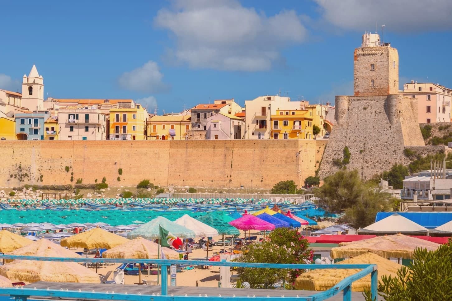
Why visit Termoli
Termoli sits on a promontory pushing into the Adriatic between two beaches, the only seaside town and the only port in Molise. The walled quarter occupies the tip of the promontory itself: a maze of narrow lanes lined with low white and ochre houses, built for fishermen and still laid out as they left it, with the castle anchoring one end and the cathedral square at the center.
Outside the walls, the coast runs east and west with the wooden trabucchi platforms still worked from the rocks on calm days, while the newer town extends inland from the old core. One of the largest tank battles of the 1943 Italian campaign was fought through these streets between 2 and 6 October.
What holds the town together is the promontory itself: a small fortified point that has had to serve as harbor, defense, parish and battlefield in turn, with the rest of Termoli built up around it rather than the other way round.
Federico II, Svevia, Don Giovanni Steak House and 2 more have been named by a guide.
What to see in Termoli
- Castello Svevo. The fortress Frederick II rebuilt stands as the visual anchor of the borgo antico, its walls facing the sea rather than the town it once defended.
- Cattedrale di Santa Maria della Purificazione. Apulian Romanesque cathedral from the twelfth and thirteenth centuries, holding the relics of San Basso and San Timoteo, patrons of the city.
- Borgo antico. Walled fishermen's quarter on the promontory, a maze of low white and colored houses, narrow lanes and small piazzas above the sea.
How to get to Termoli
There is a railway station in the town, so you can arrive without a car and never need one while you are here. Foggia is roughly 69 minutes away by road.
Our tip
May through September is the season Termoli was built for: hot dry days, Adriatic light, the beaches working at full capacity, and the ferry to the Tremiti islands running daily. July and August fill with Italian families on holiday and the lungomare becomes hard to walk in the evening. April and October are the shoulder months; the borgo antico opens again to people who actually want to walk it, and the cathedral piazza is quiet. Sagra del pesce falls in the season.
San Severo
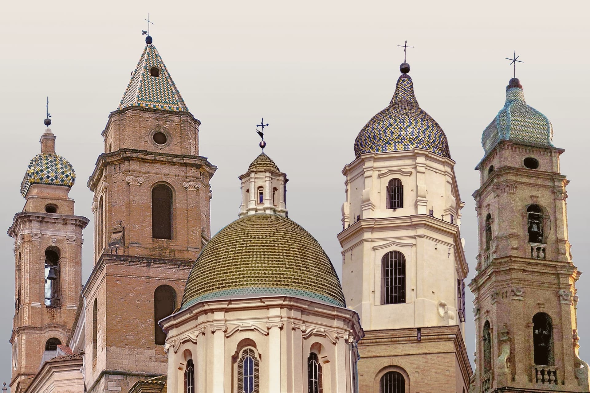
Why visit San Severo
San Severo sits at 86 meters on the Tavoliere delle Puglie, north of Foggia and inland from the Gargano. The town was founded in the eleventh century around a small church built by Benedictine monks from Montecassino, and grew through the medieval period into the capital of the upper Daunia.
The 1627 earthquake almost levelled it, killing eight hundred inhabitants and pulling reconstruction into the late seventeenth century after a plague epidemic in 1656 added three thousand more deaths. The Cattedrale di Santa Maria Assunta, originally late-medieval, was rebuilt in Baroque after the quake.
San Severo is best known nationally for its wine: the San Severo DOC, approved on 19 April 1968 by presidential decree, was the first protected designation in Puglia, with 2,000 hectares of red, white, rosé and the occasional spumante across San Severo, Torremaggiore, San Paolo di Civitate, Apricena, Lucera and Lesina. The annual Carnevale, with its rolling fanoia firework blasts, is one of the loudest in southern Italy.
La Fossa del Grano have been named by a guide.
What to see in San Severo
- Cattedrale di Santa Maria Assunta. Late-medieval cathedral rebuilt in Baroque style after the 1627 earthquake, the principal religious monument of the Daunia.
- Chiesa di San Severino Abate. Baroque basilica dedicated to the patron saint, built over the eleventh-century Benedictine foundation that gave the town its name.
- Palazzi Baroque. Eighteenth-century noble palazzi built in the post-earthquake reconstruction, lining the streets of the centro storico.
How to get to San Severo
There is a railway station in the town, so you can arrive without a car and never need one while you are here. Foggia is roughly 31 minutes away by road.
Our tip
April through June and September through October are the workable months on the Tavoliere. The vineyards of the San Severo DOC are in leaf by April and in harvest from late August through September. July and August push past thirty-eight degrees on the open plain and the centro storico empties between two and five; the Tavoliere is one of the hottest places in Puglia. Festa di San Rocco falls in August.
More from Anywhere Italy
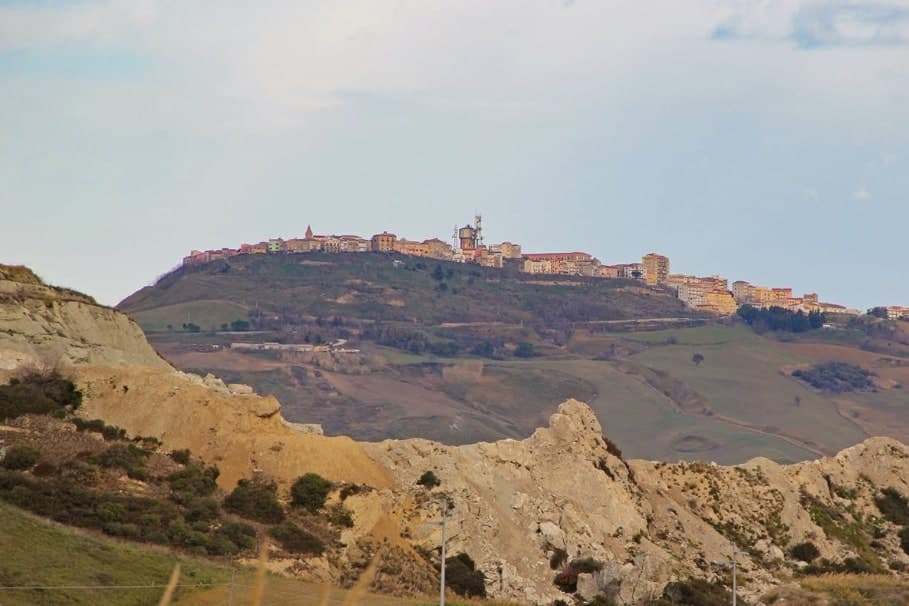 The 8 best olive oil towns you can reach by train within 90 minutes of Foggia
 The best towns you can reach by train that eat well within 90 minutes of Foggia
- The best towns with a serious restaurant that eat well within 90 minutes of Foggia
 The best hill towns you can reach by train within 90 minutes of Foggia
 The best hidden olive oil towns within 90 minutes of Foggia
- The best hidden olive oil towns that eat well in Puglia