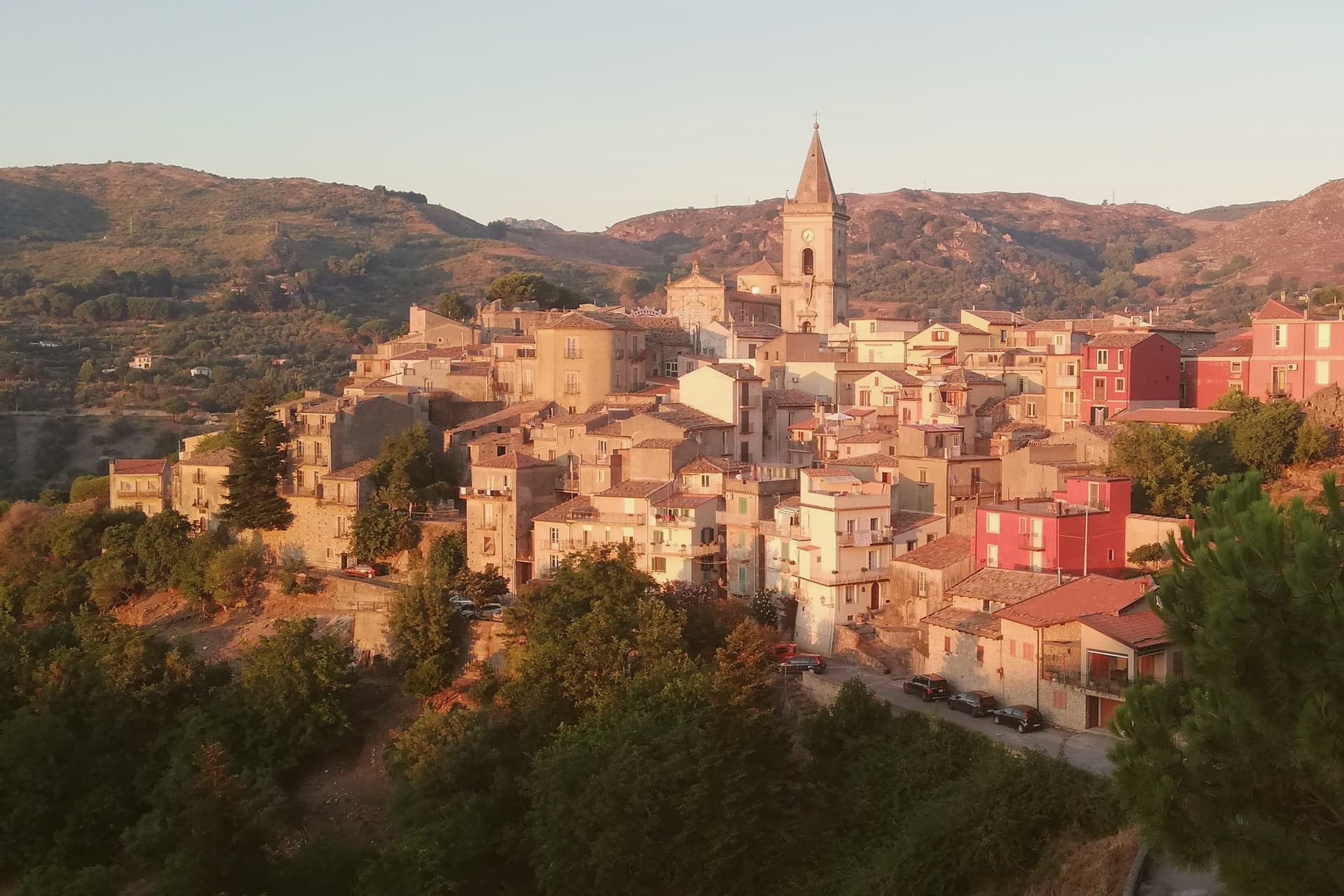
The prettiest villages within 90 minutes of Catania
Eastern Sicily builds in what it stands on. Around Etna the houses are lava stone, dark and heavy, with pale limestone at the doorways, while south towards the Hyblaean hills the walls turn honey-coloured and the roofs are pantiled. Spring brings broom and wild fennel to the roadsides, autumn brings the pistachio harvest at Bronte and the grape harvest on the volcano's northern slopes. Between the two seasons there is the food: ricotta still warm, sausage flavoured with fennel seed, granita eaten with brioche at the hour when the shops reopen. Catania itself sits below all of it, black-stoned and loud, an hour or less from most of these places.
Almost everyone who lands at Fontanarossa heads for Taormina, and the reasons are obvious enough: the Greek theatre with the volcano framed behind it, the Corso Umberto, the sea a long drop below. In high summer the town works at capacity, coaches queueing at the switchbacks and the terraces booked out well ahead. Nearby Acireale and the Riviera dei Ciclopi take the overflow. None of this is a mistake, but it does mean the eastern coast is where the crowd concentrates.
The same volcano, the same stone, the same kitchens continue inland and uphill. The villages here sit on ridges above the Alcantara valley, on the Erei plateau towards Enna, and in the oak woods of the Hyblaean interior, and each one has passed the national assessment of Italy's most beautiful villages. Fewer people go, partly because the roads take longer than the map suggests. They are worth the drive, and most can be done as a day out from the city.
Of the 14 communes we have mapped within 90 minutes of Catania, 6 qualify as prettiest villages: each has passed the national assessment of Italy's most beautiful villages. The smallest, Castelmola, has 1,062 residents.
If you are still choosing, we have also written The best mountain towns within two hours of Catania and The best olive oil towns in Sicilia.
Castelmola
Why visit Castelmola
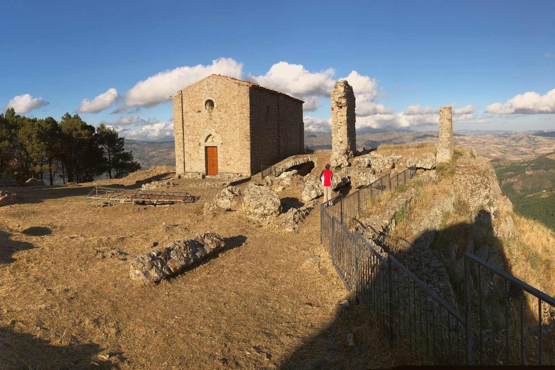
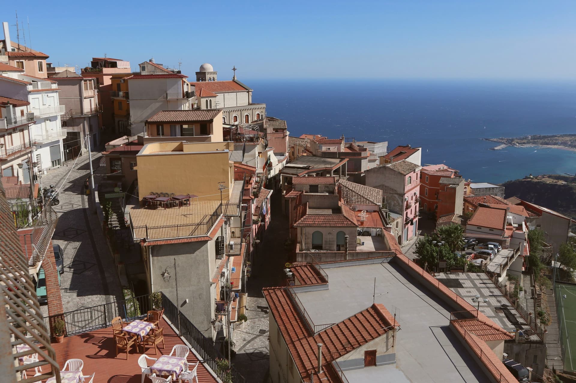
The village occupies a steep limestone rock two kilometers and several hundred meters above the coast, reached by a climb that Taormina itself does not require. The site served as an upper acropolis to Greek Tauromenium below it from the late fourth century BC, a relation of height and defense rather than distance: whoever held the summit watched the lower town and the sea beyond it.
The Byzantines fortified the rock around 800, and the local leader Costantino Caramalo strengthened the walls against Arab raids in the ninth century, work the Normans later built on when they raised the castle whose ruins still stand. The medieval plan of stone lanes climbs from the church at the center up toward that castle, the whole village stacked along the one rock rather than spread across it.
The result is a place defined by its verticality: a fortress town that grew inward and upward because it had nowhere else to go, and that still looks down on the city it was built to guard.
What to see in Castelmola
- Castello Normanno (Castello di Mola). Ruined walls on the summit, standing over Byzantine and Greek foundations. The climb up gives no roof and no interior, only the rock line and the drop on every side.
- Duomo di San Nicolò di Bari. Mother church at the centre of the village, rebuilt in the early twentieth century with a Baroque interior and original portal.
- Piazza Sant'Antonio. Mosaic-paved belvedere with views of Etna, the Gulf of Naxos, and Taormina five hundred meters below.
How to get to Castelmola
Catania is roughly 63 minutes away by road.
Our tip
May through October is the season Castelmola was built for. The Taormina coast fills with tourists, the village above empties out by dusk when the day-trippers descend, and the air at 529 meters stays cooler than the beach. July and August are crowded and hot; the climb from Taormina by foot is two hours and forty minutes of switchbacks.
Buccheri
Why visit Buccheri
Buccheri sits on the northern slopes above 820 meters, one of the highest villages in the Iblei. Sicels, Greeks, Romans and Byzantines all left traces on the ridge above the village, a long sequence of settlement on ground that offered height and a view over the watershed below.
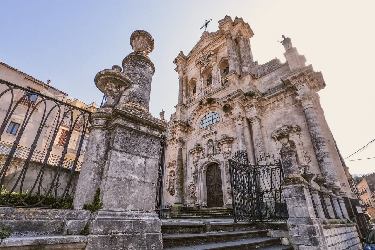
The 1693 Val di Noto earthquake leveled most of what stood. The rebuild produced the upper village's high baroque staircase church and, separately, the parish church housing a Gagini marble that survived the quake itself, an object older than the building now around it.
The neviere in the surrounding hills supplied granita ice to Syracuse and Catania into the early twentieth century, a trade that tied this upland village to the coastal cities below it long before the road did. The olive groves on the slopes around the peak now carry the same name into a different economy: the Olio e non solo festival each October fills the village with producers and tastings.
What the ridge, the ice caves and the groves add up to is a village whose whole history has run on its altitude, first as vantage and refuge, then as a source of cold, now as a source of oil.
What to see in Buccheri
- Chiesa di Sant'Antonio Abate. Eighteenth-century baroque church at the top of a long staircase in the upper village, rebuilt after the 1693 earthquake destroyed the medieval original.
- Chiesa di Santa Maria Maddalena. Baroque parish church with a façade by local architect Michelangelo Di Giacomo; holds a 1508 marble Magdalene by Antonello Gagini that survived the 1693 quake.
- Monte Lauro. Rises directly above the village; trails climb from the town to the summit, the highest point in the Iblei and the region's central watershed.
How to get to Buccheri
Catania is roughly 80 minutes away by road.
Our tip
May through October is the window for Buccheri. The Iblei stay cooler than the Sicilian coast at 820 meters, and the trails up Monte Lauro and into the Anapo valley toward Pantalica are walkable through summer afternoons. July and August touch thirty in the village but evenings drop into the teens.
Castiglione di Sicilia
Why visit Castiglione di Sicilia
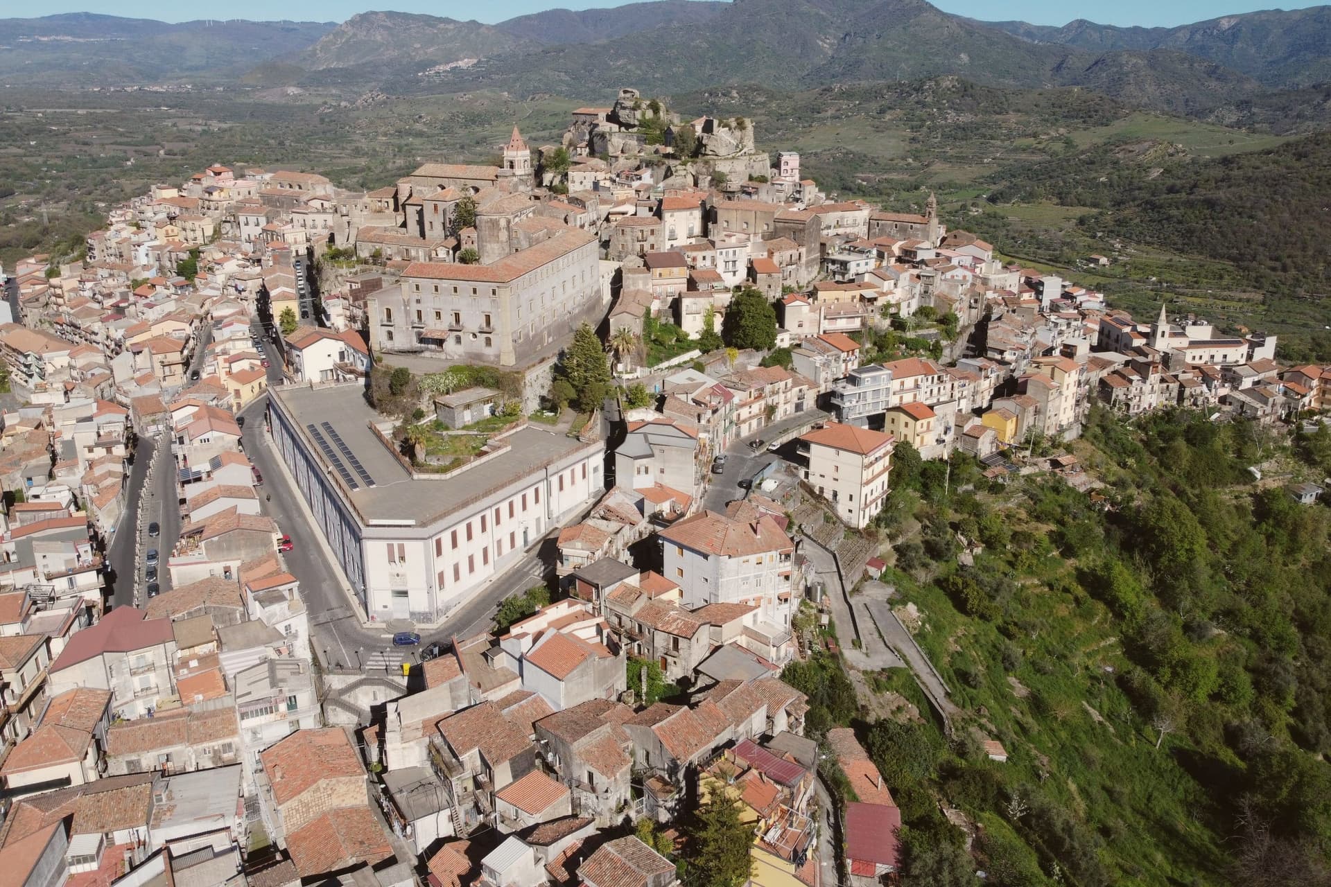
The town looks down the Alcantara river valley between Randazzo and Taormina, its position fixed by Norman count Roger I, who documented it in 1092 as Castrileonis, the great castle. That name still fits the territory more than the town itself: the commune's boundary runs uphill from the historic centre all the way to the summit of Etna, taking in the north-east crater, so the same municipality holds a huddle of streets at 621 meters and a stretch of active volcano above it.
The hills below the centre are the heart of the Etna DOC. Nerello Mascalese and Nerello Cappuccio grow on the volcanic soils around the village, with Carricante carrying the whites, and bottles from Cottanera, Passopisciaro, Tenuta delle Terre Nere and the Alcantara producers all ship from here.
Twenty minutes downhill the Alcantara has cut its gorges through the same lava that feeds those vineyards, basalt walls shaped by water where the fields above are shaped by the grape. Town, castle, vineyard and gorge read as one continuous volcanic system, worked over centuries into a fortress, a wine region and a river cut.
What to see in Castiglione di Sicilia
- Castello di Lauria. The fortress stands on its basalt outcrop above the town, its walls carrying the weight of two rebuildings by Ruggero di Lauria's crews. The rooms now hold the Enoteca Regionale for eastern Sicily, so the same stone that once watched for approach up the valley now stores the bottles made from the vines below it.
- Cuba Bizantina di Santa Domenica. Small Byzantine cube-shaped church, seventh to ninth century, in the rural outskirts of the commune, one of the oldest surviving structures in the Etna area.
- Gole dell'Alcantara. Basalt gorges carved by the Alcantara river through prismatic lava columns, around twenty minutes downhill from the centro storico.
How to get to Castiglione di Sicilia
There is a railway station in the town, so you can arrive without a car and never need one while you are here. Catania is roughly 49 minutes away by road.
Our tip
May through October are the working months on Etna nord. Vineyard tours start in June, harvest runs late September through mid-October on the higher contrade, and the slopes turn red and gold into early November. July and August on Etna are bearable at 621 meters: nights drop to seventeen degrees, far cooler than Catania.
Calascibetta
Why visit Calascibetta
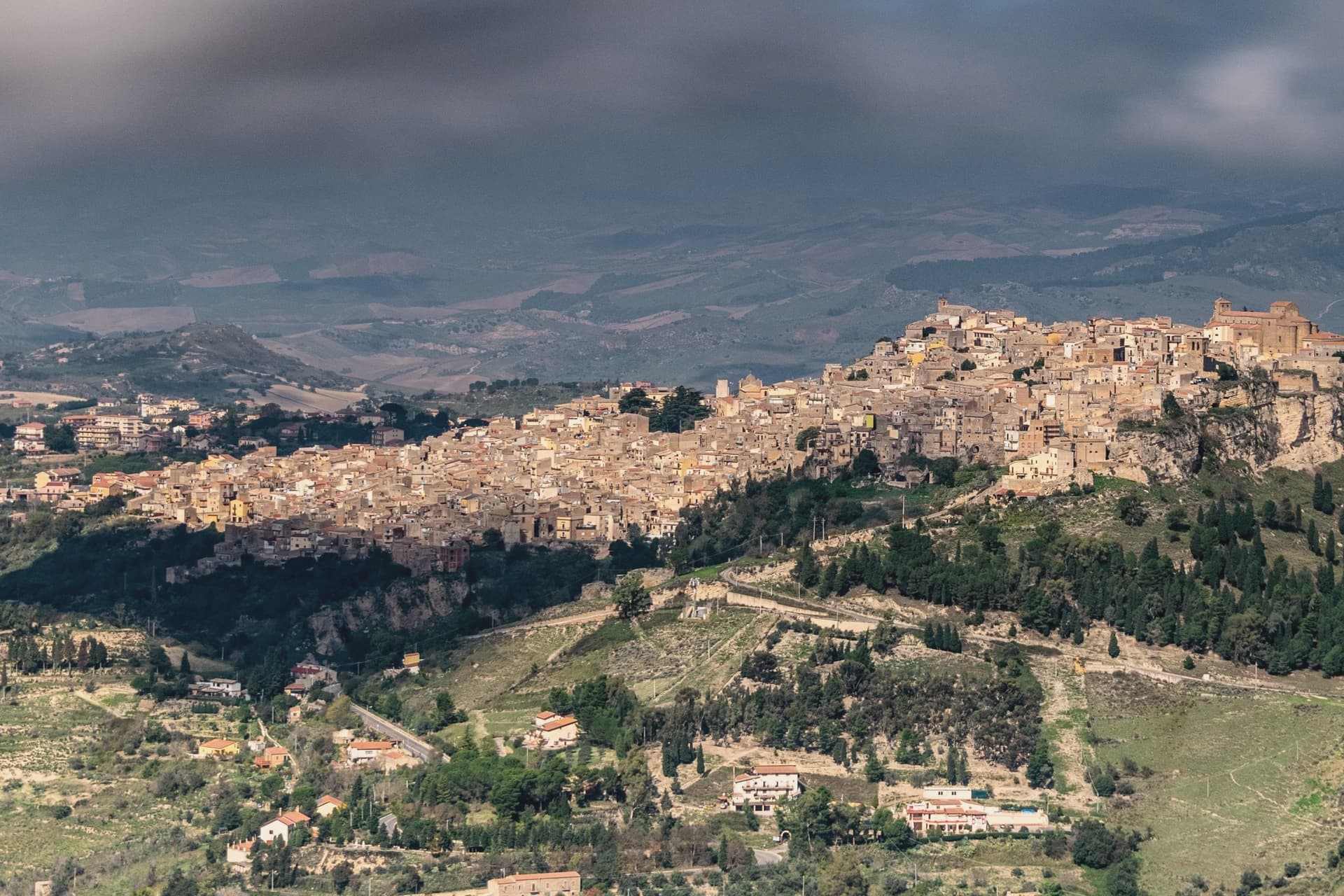
Calascibetta sits on a limestone promontory at 691 meters, two and a half kilometers north of Enna across a deep ravine, in the geographic centre of Sicily. The town was founded in the ninth century as a Muslim military camp built to besiege Byzantine Henna on the opposite hill.
After the Norman conquest it stayed in the orbit of Enna, the two settlements visible from each other from any rooftop. Three kilometers northwest, the Necropoli di Realmese cuts 288 rock tombs into white limestone cliffs, dating from the eleventh to the sixth century BC; it is the second-largest pre-Greek necropolis in Sicily after Pantalica.
The historic centre keeps its medieval bones: the Chiesa Madre di San Pietro on the high point, narrow lanes climbing the rock, the Aragonese mint quarter where the kingdom struck coins in the fourteenth century. From the belvedere the view runs from Etna in the east to the Madonie in the north.
What to see in Calascibetta
- Necropoli di Realmese. 288 rock-cut tombs from the eleventh to sixth century BC, the second-largest pre-Greek necropolis in Sicily after Pantalica.
- Chiesa Madre di San Pietro. Fourteenth-century mother church at the top of the historic centre, with a Gothic-Catalan portal and views across the ravine to Enna.
- Quartiere Castello. The oldest district on the rock, with stepped lanes and remains of the medieval fortification that gave the town its name.
How to get to Calascibetta
Catania is roughly 83 minutes away by road.
Our tip
April through June and September into November are the months that work in central Sicily. Wildflowers cover the slopes around Realmese in spring, the wheat ripens in early summer, and the autumn light turns the limestone gold. July and August routinely cross thirty-five degrees; the interior bakes and the centro storico empties in mid-afternoon. Festa di San Pietro a Calascibetta falls in August.
Agira
Why visit Agira
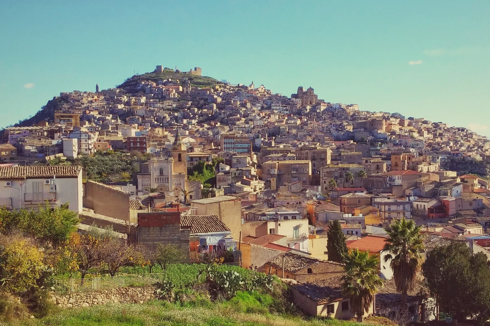
Agira sits on the summit and slopes of Monte Teja in the mid-valley of the Salso river, thirty-five kilometers east of Enna. The town stands on the site of the Sicel city of Agyrion, where the Greek general Timoleon settled ten thousand colonists in 339 BC.
The lower town spreads at the base of the mountain while the old quarter climbs its slopes in stone lanes toward the castle at the summit, a layout that stacks Greek, Byzantine, Norman and Aragonese remains one above the other as the ground rises. In July 1943 Agira fell to the Canadians after five days of fighting, the largest Canadian battle of the Sicilian campaign.
The town's position on high ground, the same position that made it a Sicel stronghold and a Norman abbey seat centuries earlier, is what made it worth the five days of fighting: whoever held Monte Teja held the central Sicilian interior below it.
What to see in Agira
- Reale Abbazia di San Filippo. The church stands as the central monument of the town, its Basilian origins folded into the Norman reconstruction; the crypt beneath holds the patron saint.
- Castello di Agira. Medieval fortress on the summit of Monte Teja above the town, with surviving walls and towers; the strategic outpost that controlled the central Sicilian interior.
- Agira Canadian War Cemetery. The cemetery sits on a hill outside the town, its rows of graves facing the slopes of Monte Teja where the fighting that put the soldiers there took place.
How to get to Agira
Catania is roughly 53 minutes away by road.
Our tip
April through June and September through November are the windows for Agira. The hilltop town stays in the low twenties through May, the trails up Monte Teja are dry, and the Canadian Cemetery on its outside hill is the right walk in cool morning light. July and August push past thirty-five in the interior; the centro storico empties in the afternoons and the climb to the castle is for sunrise only.
Troina
Why visit Troina
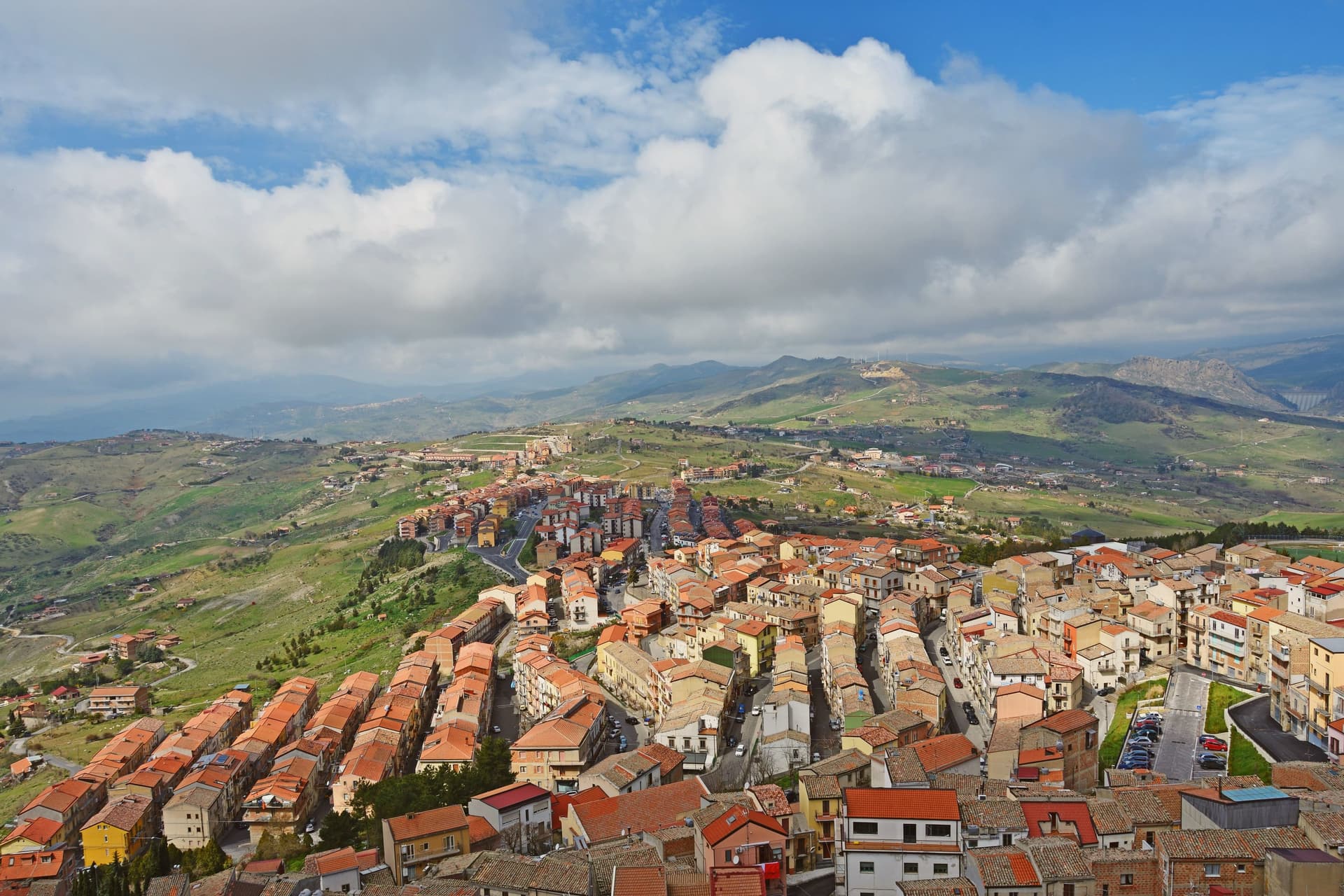
Troina sits at 1,121 meters on the southern edge of the Nebrodi, one of the highest commune centers in Sicily, with Etna visible to the east on clear days. The area was settled in the seventh millennium BC and the urban core dates to the fourth century BC.
In 1061 Roger I took the Saracen castle here and made the town the first political and military base of the Norman conquest of the island. The Diocese of Troina, established in 1082, was the first Sicilian bishopric founded after centuries of Arab rule.
The Chiesa Madre, dedicated to Maria Santissima Assunta, stands at the highest point of the town with its Norman tower still intact, the earliest Norman cathedral built in Sicily. Below the centro storico, the ruins of the Basilian monastery of San Michele Arcangelo, endowed by Count Roger, sit on an outcrop above the Fiume sotto di Troina valley.
The Nebrodi Park surrounds the commune on three sides.
What to see in Troina
- Chiesa Madre (Maria Santissima Assunta). First Norman cathedral built in Sicily, founded under Roger I after 1061, with its original Norman bell tower still standing at the highest point of the centro storico.
- Castello di Troina. Medieval fortress taken from the Saracens by Roger I in 1061 and used as the political and military base of the Norman conquest of Sicily; partial walls and towers survive.
- Monastero di San Michele Arcangelo. Ruined Basilian monastery on a rocky outcrop below the town, endowed by Count Roger after the conquest and one of the oldest Norman monastic foundations on the island.
How to get to Troina
Catania is roughly 61 minutes away by road.
Our tip
June through September brings dry highland weather, ridge trails open across the Nebrodi, and temperatures stay below thirty even when the Sicilian coast burns. December through March is the second season: Troina's altitude catches snow, and the Nebrodi roads close for storms but the town itself stays open. April, May, October and November are quiet and often wet, the wind sharp on the ridge, with many guesthouses shut.