The best mountain towns within two hours of Catania
Sicily has a mountain register that surprises people who come for the beaches. Above Catania the ground rises through citrus and vine into black basalt villages, then into oak, chestnut and beech forest on the Nebrodi, and finally onto the bare limestone shoulders of the Madonie, where snow lies for weeks and the bars keep the heating on until Easter. The building material changes as you climb, from lava stone cut into doorways and church fronts to pale sandstone and rough grey rock. Autumn is the strongest season here, when the mushroom stalls appear, the chestnuts roast in the piazzas, and menus turn to wild fennel, pork, sheep's ricotta and lentils grown on the high plateaux.
Most visitors take the coast road north instead, to Taormina, and the reason is obvious: the Greek theatre with Etna framed behind it is one of the best views in the Mediterranean, and the town is small, walkable and full of good hotels. In summer the cruise arrivals and the tour coaches compress it all into the same few hours in the same few streets, and Corso Umberto moves at a shuffle. Prices behave accordingly. It is worth going, but it is not where the mountains are.
The same volcano and the same ranges continue well past the famous viewpoint, and that is where these towns sit: on the upper slopes of Etna where the lava flows are dated by the vineyards planted on them, in the Nebrodi forests, and along the Madonie ridge line where the villages hold their altitude and their cold. They are reachable from Catania in a morning's drive, and fewer people go. What you get instead is a mountain lunch, a stone belvedere over half of Sicily, and a piazza that belongs to the people who live on it.
Of the 33 communes we have mapped in a 120-minute drive of Catania, 10 qualify as mountain towns: each sits in the mountains proper. The smallest, Buccheri, has 1,729 residents.
Two more lists worth reading alongside this one: The 8 best high-altitude villages in Sicilia and The best small mountain towns in Sicilia.
Buccheri
Why visit Buccheri
Buccheri sits on the northern slopes above 820 meters, one of the highest villages in the Iblei. Sicels, Greeks, Romans and Byzantines all left traces on the ridge above the village, a long sequence of settlement on ground that offered height and a view over the watershed below.
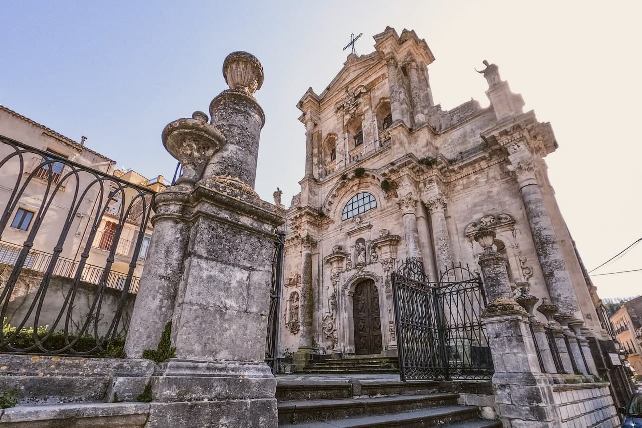
The 1693 Val di Noto earthquake leveled most of what stood. The rebuild produced the upper village's high baroque staircase church and, separately, the parish church housing a Gagini marble that survived the quake itself, an object older than the building now around it.
The neviere in the surrounding hills supplied granita ice to Syracuse and Catania into the early twentieth century, a trade that tied this upland village to the coastal cities below it long before the road did. The olive groves on the slopes around the peak now carry the same name into a different economy: the Olio e non solo festival each October fills the village with producers and tastings.
What the ridge, the ice caves and the groves add up to is a village whose whole history has run on its altitude, first as vantage and refuge, then as a source of cold, now as a source of oil.
The village sits at 820 metres.
What to see in Buccheri
- Chiesa di Sant'Antonio Abate. Eighteenth-century baroque church at the top of a long staircase in the upper village, rebuilt after the 1693 earthquake destroyed the medieval original.
- Chiesa di Santa Maria Maddalena. Baroque parish church with a façade by local architect Michelangelo Di Giacomo; holds a 1508 marble Magdalene by Antonello Gagini that survived the 1693 quake.
- Monte Lauro. Rises directly above the village; trails climb from the town to the summit, the highest point in the Iblei and the region's central watershed.
How to get to Buccheri
Catania is roughly 80 minutes away by road.
Our tip
May through October is the window for Buccheri. The Iblei stay cooler than the Sicilian coast at 820 meters, and the trails up Monte Lauro and into the Anapo valley toward Pantalica are walkable through summer afternoons. July and August touch thirty in the village but evenings drop into the teens.
Montalbano Elicona
Why visit Montalbano Elicona
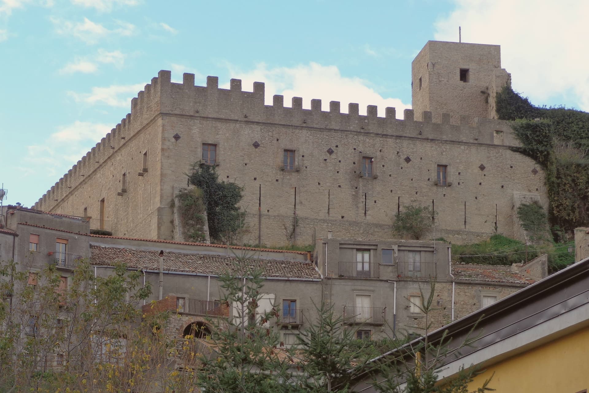
Montalbano Elicona stands at 907 meters in the Nebrodi mountains, north of Etna and inland from the Tyrrhenian coast above Patti. The Castello di Montalbano was raised in 1233 under Frederick II of Swabia, then rebuilt and adopted as a summer royal residence by Frederick III of Aragon between 1302 and 1308, who brought his physician Arnaldo da Villanova with him to treat his gout.
The castle still combines a Norman rectangular nucleus with crenellated towers and an Aragonese addition with arrow slits and large windows. The town won the RAI Borgo dei Borghi competition in 2015.
A short drive from the village, the Argimusco plateau holds a set of large eroded sandstone formations that some scholars read as a fourteenth-to-eighteenth-century hermetic site and others as wind-and-water sculpture. The surrounding hills are Città della Nocciola territory; hazelnut groves run from 700 to 1,000 meters.
The village sits at 907 metres.
What to see in Montalbano Elicona
- Castello di Montalbano. Frederick II castle of 1233 rebuilt as the summer residence of Frederick III of Aragon between 1302 and 1308, two towers and a Norman-Aragonese hybrid plan.
- Megaliti dell'Argimusco. Eroded sandstone plateau twelve kilometers from the village, large free-standing formations read variously as natural sculpture and a medieval hermetic site.
- Chiesa Madre di Santa Maria Assunta. Norman-era mother church near the castle, fourteenth-century reworking and a Renaissance baptismal font, restored after twentieth-century seismic damage.
How to get to Montalbano Elicona
Messina is roughly 70 minutes away by road.
Our tip
May through October are the working months at 907 meters. The Nebrodi air stays cooler than the coast through July and August, often a ten-degree drop from Patti, and the Bosco di Malabotta gives shade for walking. Late July brings the Festa del Corteo Storico, with reenactments of Frederick III's court and a procession from the castle through the medieval quarter. Feste Aragonesi di Montalbano Elicona falls in August.
Castiglione di Sicilia
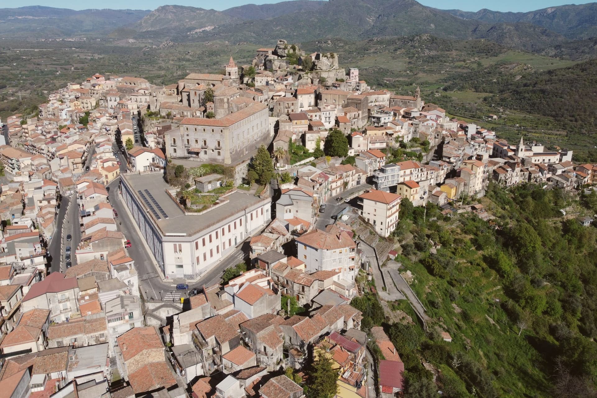
Why visit Castiglione di Sicilia
The town looks down the Alcantara river valley between Randazzo and Taormina, its position fixed by Norman count Roger I, who documented it in 1092 as Castrileonis, the great castle. That name still fits the territory more than the town itself: the commune's boundary runs uphill from the historic centre all the way to the summit of Etna, taking in the north-east crater, so the same municipality holds a huddle of streets at 621 meters and a stretch of active volcano above it.
The hills below the centre are the heart of the Etna DOC. Nerello Mascalese and Nerello Cappuccio grow on the volcanic soils around the village, with Carricante carrying the whites, and bottles from Cottanera, Passopisciaro, Tenuta delle Terre Nere and the Alcantara producers all ship from here.
Twenty minutes downhill the Alcantara has cut its gorges through the same lava that feeds those vineyards, basalt walls shaped by water where the fields above are shaped by the grape. Town, castle, vineyard and gorge read as one continuous volcanic system, worked over centuries into a fortress, a wine region and a river cut.
The village sits at 621 metres.
What to see in Castiglione di Sicilia
- Castello di Lauria. The fortress stands on its basalt outcrop above the town, its walls carrying the weight of two rebuildings by Ruggero di Lauria's crews. The rooms now hold the Enoteca Regionale for eastern Sicily, so the same stone that once watched for approach up the valley now stores the bottles made from the vines below it.
- Cuba Bizantina di Santa Domenica. Small Byzantine cube-shaped church, seventh to ninth century, in the rural outskirts of the commune, one of the oldest surviving structures in the Etna area.
- Gole dell'Alcantara. Basalt gorges carved by the Alcantara river through prismatic lava columns, around twenty minutes downhill from the centro storico.
How to get to Castiglione di Sicilia
There is a railway station in the town, so you can arrive without a car and never need one while you are here. Catania is roughly 49 minutes away by road.
Our tip
May through October are the working months on Etna nord. Vineyard tours start in June, harvest runs late September through mid-October on the higher contrade, and the slopes turn red and gold into early November. July and August on Etna are bearable at 621 meters: nights drop to seventeen degrees, far cooler than Catania.
Polizzi Generosa
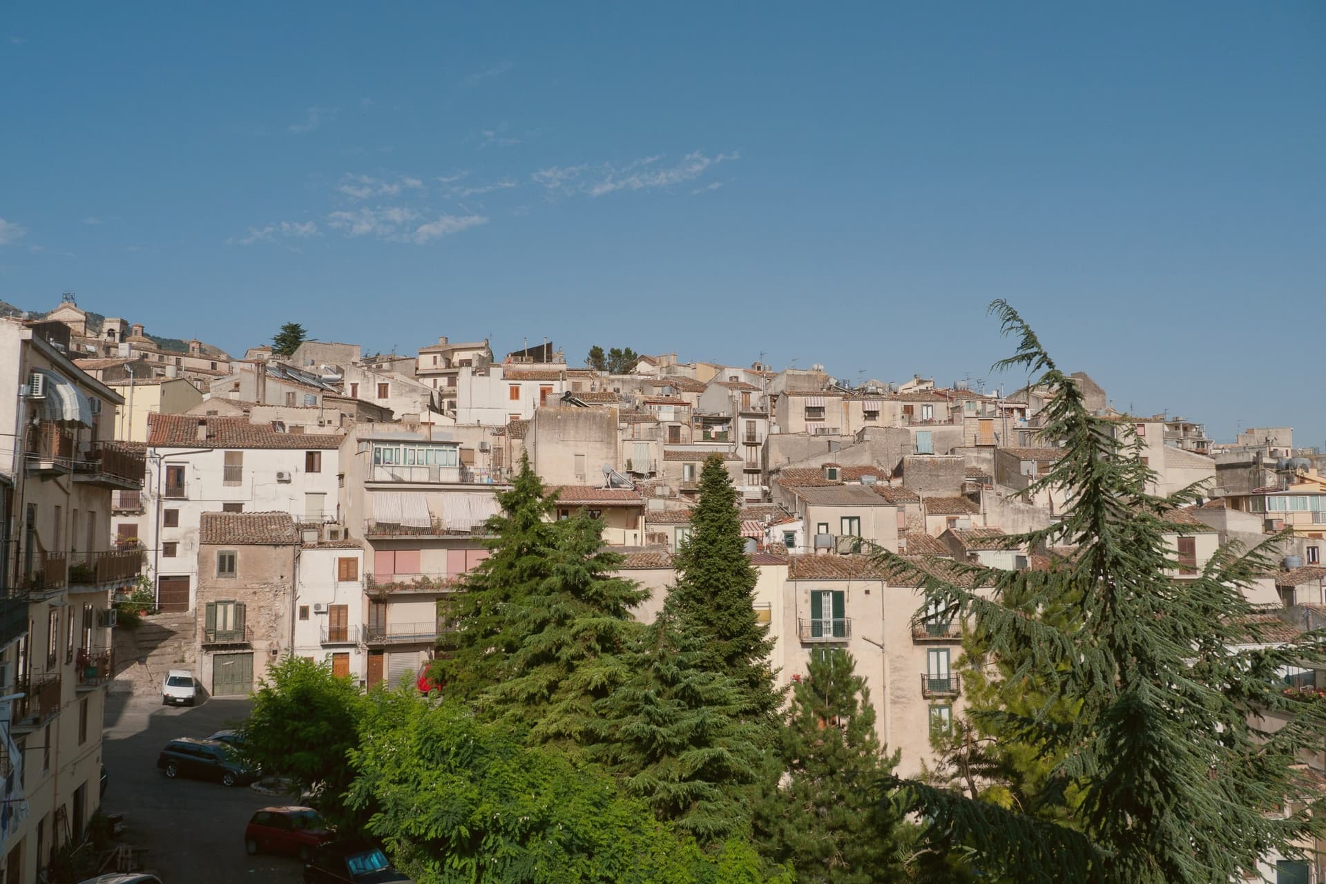
Why visit Polizzi Generosa
The name Polizzi is thought to derive from the Greek Polis Isis, City of Isis, and archaeological finds attest continuous settlement since at least the sixth century BC, including coins from the nearby Greek colony of Himera. The Normans rebuilt the hilltop settlement, and Frederick II later added the epithet generosa.
The old town climbs the ridge in stone houses, convents and churches, with the church and its twin bell towers at the summit, while the surrounding limestone massif, now protected as part of a UNESCO Global Geopark, supplies the slopes where hazelnuts are grown and where the town's convents once produced the sfoglio still made today. Domenico Dolce of Dolce & Gabbana was born here in 1958.
Giuseppe Antonio Borgese, the novelist who refused the Fascist loyalty oath in 1931 and emigrated to the United States, came from the same town. A settlement old enough to trace its name to Greek colonists, remade by Normans and by an emperor, still produces the same hazelnuts and the same pastry its convents made centuries ago, and still sends its people beyond the mountain.
The village sits at 917 metres.
What to see in Polizzi Generosa
- Chiesa Madre di Polizzi Generosa. Norman foundation rebuilt in Baroque style in the seventeenth century, with twin bell towers, a clock and a grand staircase at the top of the town.
- Museo Archeologico di Himera. Civic museum with finds from the area's continuous settlement, including coins and amphorae linked to the Greek colony of Himera on the coast.
- Parco delle Madonie. Regional natural park and UNESCO Global Geopark since 2015, covering the limestone massif that rises around the town.
How to get to Polizzi Generosa
Palermo is roughly 72 minutes away by road.
Our tip
May through October is the open season. At 917 meters the summer stays well below the coastal heat, the Madonie holds its forests through August, and the hazelnut harvest comes in late August and September. October fills the woods with mushrooms and turning beech.
Petralia Soprana
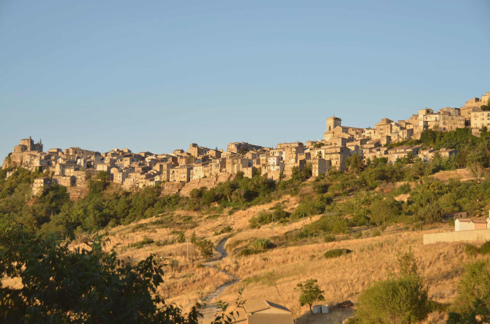
Why visit Petralia Soprana
Petralia Soprana sits at 1,147 meters at the heart of the Madonie Natural Park, the highest commune in the range. The town and its lower twin Petralia Sottana grew from the Roman Petra, then took its current form under the Normans, who fortified the ridge.
The Chiesa Madre, dedicated to Saints Peter and Paul, dates to the fifteenth century and faces Piazza Duomo with a clear view across the Madonie. Below the village, the Raffo salt mine runs 80 kilometers of tunnels through one of the largest salt deposits in Europe, mined since at least the fourteenth century; the active mine now hosts MACSS, a contemporary art museum carved into the salt, one of a kind worldwide.
RAI named Petralia Soprana Borgo dei Borghi in 2018, the year of the salt mine's wider opening to the public. The stone streets, the mountain air at 1,147 meters, and the salt below the floor are the three things the village trades on.
The village sits at 1147 metres.
What to see in Petralia Soprana
- Chiesa Madre (Santi Pietro e Paolo). Fifteenth-century mother church on Piazza Duomo, central monument of the village, with a baroque interior added after the 1693 earthquake.
- Miniera di Sale di Raffo. Active salt mine below the village with 80 km of tunnels in one of Europe's largest salt deposits, worked since the fourteenth century.
- MACSS — Museo Arte Contemporanea Sotto Sale. Contemporary art museum inside the active Raffo salt mine, sculptures cut directly into rock salt walls, the only museum of its kind worldwide.
How to get to Petralia Soprana
Palermo is roughly 88 minutes away by road.
Our tip
June through September brings dry mountain weather, ridge trails open across the Madonie, and temperatures stay below twenty-five even when Palermo touches forty. The salt mine and MACSS run all year, lit and warm inside. December through March catches snow at 1,147 meters and the village fills briefly with day-trippers from Cefalù coming up to see white roofs. Sagra del Grano a Pianello - Petralia Soprana falls in August.
Gangi
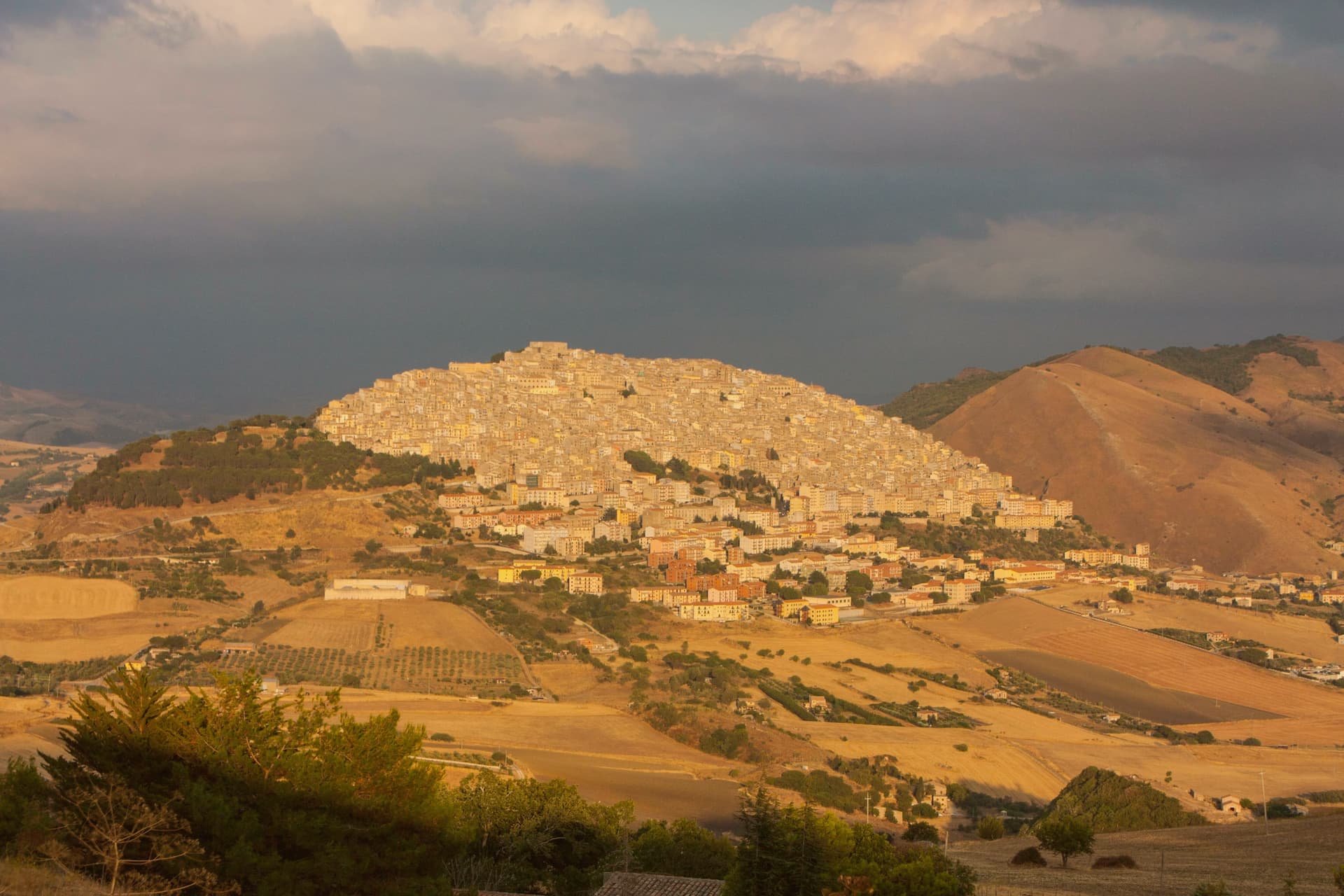
Why visit Gangi
Gangi sits at 1,011 meters on the southern slope of the mountain, the easternmost edge of the Madonie, eighty kilometers southeast of Palermo. The current settlement dates to 1300, rebuilt as part of the Ventimiglia county of Geraci after its earlier town was destroyed in the Sicilian Vespers war.
Below the fortress at the top, the houses descend in tight stone tiers toward the Salso valley, upper town and lower slope reading as one continuous fall of rooftops rather than separate quarters. The municipal council launched a one-euro-house scheme the year after the town's television win and stuck with it longer than most.
The territory is Città del Tartufo, with black truffles from the surrounding woodlands, and the local sausage with wild fennel travels as far as the manna and ricotta from neighboring Castelbuono. What holds the place together is the mountain itself: a defensive site chosen after destruction, built up by one family, and preserved largely intact because the slope that once protected it now simply keeps it visible from below.
The village sits at 1011 metres.
What to see in Gangi
- Castello dei Ventimiglia. Fortress at the top of the town, walls and tower line still visible against the sky, the seat from which the counts governed the rebuilt settlement.
- Torre dei Ventimiglia. Square stone tower attached to the mother church, the second piece of the defensive system, standing alongside the castle above the rooftops.
- Chiesa Madre di San Nicolò. Mother church holding a Giuseppe Salerno altarpiece and the Camposanto, an underground crypt with mummified clergy.
How to get to Gangi
Palermo is roughly 118 minutes away by road.
Our tip
At 1,011 meters, Gangi runs cooler than coastal Sicily. June through September are the dry trekking months in the Madonie, with daytime temperatures around twenty-five degrees and the surrounding beech forests in full leaf. July and August on the coast are oppressive; up here they are walkable. Sagra della Spiga e Corteo di Demetra falls in August.
Nicolosi
Why visit Nicolosi
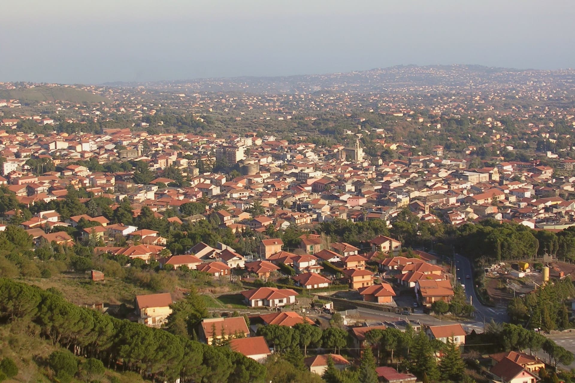
Nicolosi sits at 698 meters on the southern slope of Etna, twelve kilometers north of Catania. The town was founded in 1359 around the Benedictine monastery of San Nicolò l'Arena.
In March 1669 a fissure opened above the town and Etna erupted for four months, lava burying part of the settlement and pushing on to Catania harbor. What remained was rebuilt around the church the flow had spared, and the cones left by that eruption, first called Monte della Ruina, later took their name from their color.
Above the rebuilt town the road climbs toward the volcano park and the cable car station, so that Nicolosi works as the point where the settled southern slope, its bread, honey and olive groves, gives way to the bare upper mountain. The town is where the ordinary, inhabited Etna ends and the crater country begins.
The village sits at 698 metres.
What to see in Nicolosi
- Monti Rossi. Twin cones standing over the town, walkable on paths that circle the craters, the ground still dark scoria underfoot.
- Funivia dell'Etna a Rifugio Sapienza. Cable car rising to 2,500 meters, the station reached twenty minutes uphill from Nicolosi and marking the start of the southern ascent on foot beyond the lift.
- Chiesa di Santa Maria delle Grazie. The church the lava did not reach, standing at the center of the rebuilt town, its fabric showing the later repairs made after further seismic damage.
How to get to Nicolosi
Catania is roughly 28 minutes away by road.
Our tip
May through October are the working months on the southern Etna slope. Nicolosi at 698 meters runs five to seven degrees cooler than Catania; July and August are bearable here while the coast is not. The Funivia dell'Etna operates year-round, with snow at the cable car upper station from late November through April.
Troina
Why visit Troina
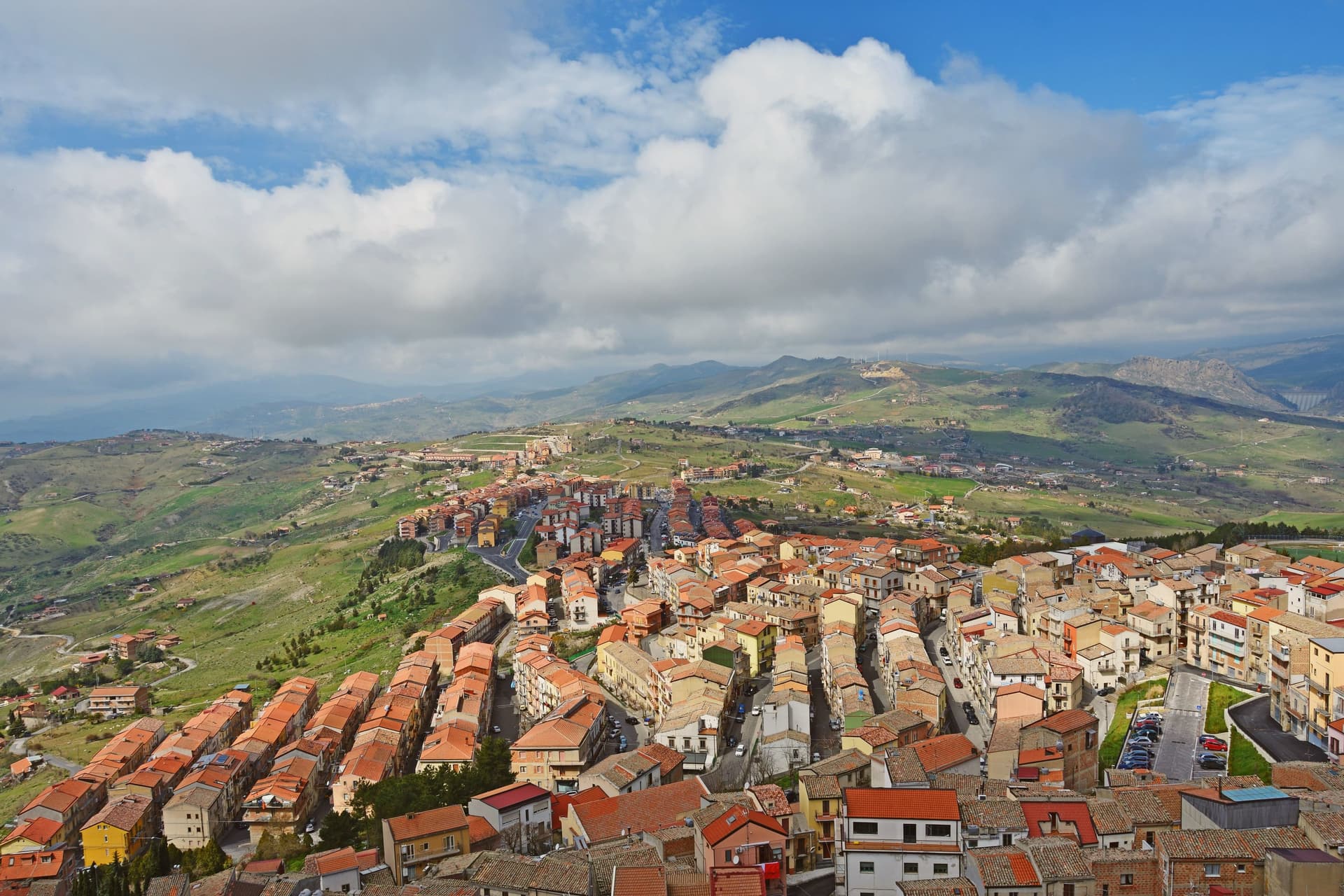
Troina sits at 1,121 meters on the southern edge of the Nebrodi, one of the highest commune centers in Sicily, with Etna visible to the east on clear days. The area was settled in the seventh millennium BC and the urban core dates to the fourth century BC.
In 1061 Roger I took the Saracen castle here and made the town the first political and military base of the Norman conquest of the island. The Diocese of Troina, established in 1082, was the first Sicilian bishopric founded after centuries of Arab rule.
The Chiesa Madre, dedicated to Maria Santissima Assunta, stands at the highest point of the town with its Norman tower still intact, the earliest Norman cathedral built in Sicily. Below the centro storico, the ruins of the Basilian monastery of San Michele Arcangelo, endowed by Count Roger, sit on an outcrop above the Fiume sotto di Troina valley.
The Nebrodi Park surrounds the commune on three sides.
The village sits at 1121 metres.
What to see in Troina
- Chiesa Madre (Maria Santissima Assunta). First Norman cathedral built in Sicily, founded under Roger I after 1061, with its original Norman bell tower still standing at the highest point of the centro storico.
- Castello di Troina. Medieval fortress taken from the Saracens by Roger I in 1061 and used as the political and military base of the Norman conquest of Sicily; partial walls and towers survive.
- Monastero di San Michele Arcangelo. Ruined Basilian monastery on a rocky outcrop below the town, endowed by Count Roger after the conquest and one of the oldest Norman monastic foundations on the island.
How to get to Troina
Catania is roughly 61 minutes away by road.
Our tip
June through September brings dry highland weather, ridge trails open across the Nebrodi, and temperatures stay below thirty even when the Sicilian coast burns. December through March is the second season: Troina's altitude catches snow, and the Nebrodi roads close for storms but the town itself stays open. April, May, October and November are quiet and often wet, the wind sharp on the ridge, with many guesthouses shut.
Randazzo
Why visit Randazzo
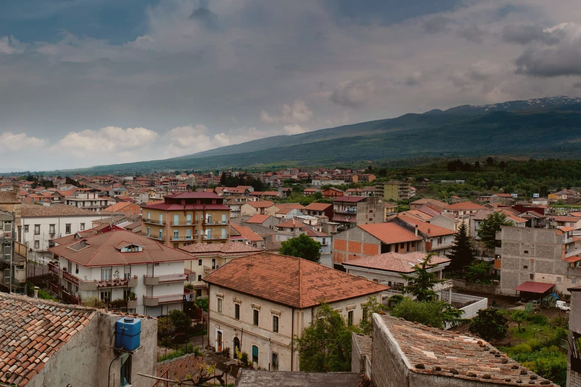
Randazzo sits at 750 meters on the northern foot of Etna, seventy kilometers northwest of Catania along the Alcantara valley. Byzantine in origin, Swabian and medieval in character, the town has three great churches that mark its three historic quarters, once inhabited by communities that spoke different tongues: the Latins in Santa Maria, the Greeks in San Nicolò, and the Lombards in San Martino.
In 1210 Frederick II of Hohenstaufen and his young wife Constance of Aragon sheltered here from the plague in Palermo; Randazzo became, after Palermo and Messina, one of the most populous towns on the island. The architecture is lava: Santa Maria Assunta, begun in the thirteenth century, has a façade entirely in black volcanic stone with three polygonal apses shaped as towers and Catalan-Gothic side portals.
The forty-one-meter bell tower of San Martino, called one of the most beautiful in Sicily, has stood since the thirteenth century.
The village sits at 750 metres.
What to see in Randazzo
- Basilica di Santa Maria Assunta. Thirteenth-century basilica in black lava stone with three polygonal apses shaped as towers and fifteenth-century Catalan-Gothic side portals.
- Chiesa di San Martino. Church of Swabian origin from the thirteenth century with a forty-one-meter bell tower in four storeys, anchor of the Lombard quarter.
- Chiesa di San Nicolò. Largest of the three quarter churches, repeatedly rebuilt; the fourteenth-century bell tower fell in the 1693 earthquake.
How to get to Randazzo
There is a railway station in the town, so you can arrive without a car and never need one while you are here. Catania is roughly 60 minutes away by road.
Our tip
May through October is the open season. At 750 meters Randazzo stays cooler than the Catanese coast even in August; the harvest in the Etna Nord vineyards runs September into October. November through April is quiet; snow falls on the upper slopes through winter and the town gets occasional dustings.
Nicosia
Why visit Nicosia
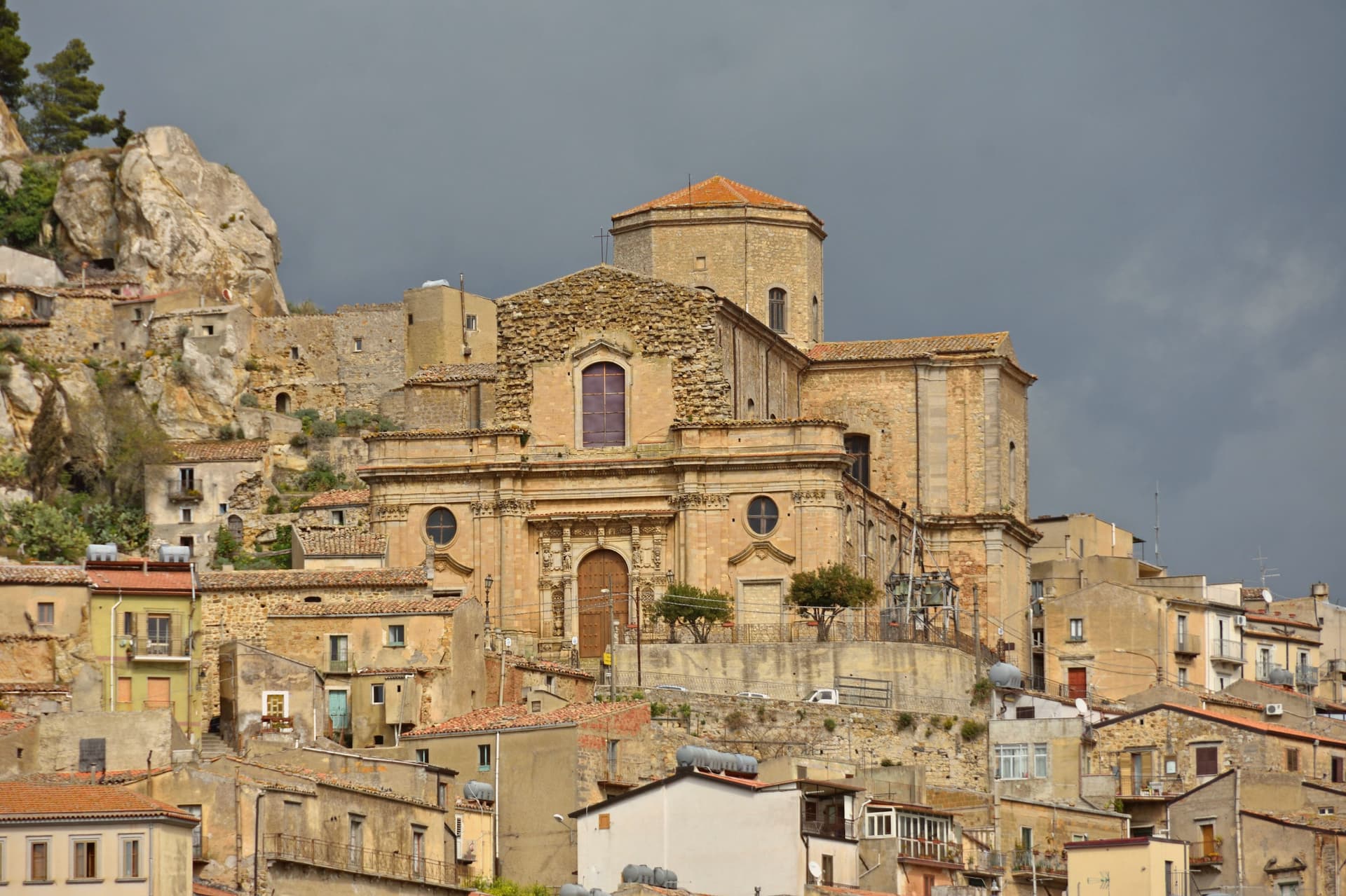
Nicosia sits at 720 meters in the Erei mountains of inland Sicily, on four rocky hills crowned by a Norman castle. The modern town was founded by Byzantine colonists in the sixth century and expanded under Arab and then Norman rule.
When the Normans took the city in 1064, Roger I repopulated it with settlers from Piedmont and Liguria, the Lombardi, whose Gallo-Italic dialect still lives in town as nkoukkà. King William II made Nicosia a royal city.
The Cattedrale di San Nicolò, dedicated to Nicholas of Bari, was begun in the early 1300s under Frederick II of Aragon and completed by 1340, in Gothic style with a fourteenth-century wooden ceiling and a bell tower listed as a national monument since 1940. Pope Leo X raised the church to collegiate status in 1521.
The Castello Normanno still stands in ruins above the town, anchoring the highest of the four hills.
The village sits at 720 metres.
What to see in Nicosia
- Cattedrale di San Nicolò. Gothic cathedral begun under Frederick II of Aragon and completed by 1340, with a fourteenth-century wooden ceiling and a national-monument bell tower.
- Chiesa di Santa Maria Maggiore. Second great church of the town, on one of the four hills, with a marble polyptych by Antonello Gagini.
- Castello Normanno. Ruined Norman fortress on the highest of the four hills, built during the eleventh-century conquest of the city.
How to get to Nicosia
There is a railway station in the town, so you can arrive without a car and never need one while you are here. Catania is roughly 108 minutes away by road.
Our tip
May through October is the open season. At 720 meters Nicosia stays cooler than the lowlands, and July and August are bearable even when the Catanese plain crosses thirty-five degrees. September and October are the dry, gold months, the Erei hills turning. Festa della Montagna a Nicosia falls in September.