
The best mountain towns in Toscana
The Tuscan mountains are built of grey sandstone and chestnut wood, and they smell of woodsmoke from October onwards. In the Garfagnana and the Lunigiana the valleys run narrow between the Apuane and the Apennine ridge, with beech forest above the last houses and marble quarries showing white through the trees. The cooking is mountain cooking: chestnut flour polenta and necci, farro soup, pecorino aged in ash, wild boar, mushrooms carried down in baskets in autumn. Winter brings real snow to the passes above Pistoia, and summer brings a temperature drop that the coast never gets.
Almost everyone who comes to Toscana goes to the hills instead, which is a different landscape entirely. Florence, Siena and the cypress roads of the Val d'Orcia absorb the great bulk of visitors, and in high summer the Chianti wine roads move at the pace of the coach in front. It is a reasonable choice, because those places are extraordinary, and it is also why the queue at the Uffizi is measured in hours. The mountains sit an hour or two north and south of all that, and the coach tours do not turn off.
The same region keeps going upward. Past the vineyards the roads climb into the Apennines above Pistoia, north-west into the Garfagnana along the Serchio, on into the Lunigiana under the Cisa pass, and south to the old volcanic mass of Amiata with its beech woods and springs. The towns in this list sit up there, in stone, with fortresses, chestnut mills, snow in season and fewer people. They are worth a detour, and several of them are worth a base for a week.
Of the 84 communes we have mapped in Toscana, 6 qualify as mountain towns: each sits in the mountains. The smallest, Castiglione di Garfagnana, has 1,705 residents.
If you are still choosing, we have also written The best small towns with a medieval festival in Toscana and The best towns known for what they grow within two hours of Pisa.
Santa Fiora
Why visit Santa Fiora
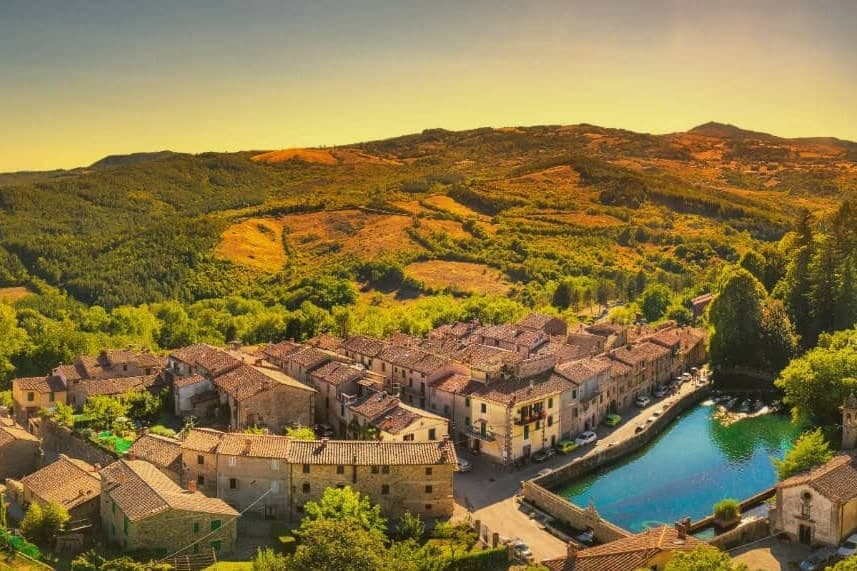
Santa Fiora sits on the wooded southern slope of Monte Amiata, forty kilometers east of Grosseto. The Aldobrandeschi held the hill from the eleventh century, walling the borgo around their castle; through the late Middle Ages and Renaissance the town passed to the Sforza branch that produced the Sforza-Cesarini, Counts of Santa Fiora.
The upper part of the borgo keeps the castle and the old walled core, while the parish church and the spring-fed pool sit lower, closer to where the Fiora rises. The Sforza left their mark in both directions: religious patronage in the terracotta commissions for the church, and practical engineering in the walled fish pool built over the river's source, a chapel standing beside it.
The Fiora leaves the town under the counts' pool and runs the rest of its length down through Maremma to the sea. The place reads as a single family's imprint worked into stone, water and clay across five centuries, upper fortress and lower spring both answering to the same patrons.
The village sits at 687 metres.
What to see in Santa Fiora
- Pieve delle Sante Flora e Lucilla. Parish church founded before the year 1000 and rebuilt in the thirteenth century. Inside, Andrea della Robbia's Baptism of Christ, Coronation of the Virgin and a pulpit relief of the Last Supper.
- Peschiera Sforzesca. Clear water holding carp and trout inside the walled enclosure, the small Chapel of the Madonna delle Nevi standing alongside.
- Castello Aldobrandesco. The original walled core of the borgo, begun in 1082, later serving as residence of the Sforza-Cesarini counts.
How to get to Santa Fiora
Perugia is roughly 113 minutes away by road.
Our tip
May through October is the season at 687 meters: the woods on Monte Amiata in full leaf, the Peschiera water cold and clear, evenings cool. June and July are the busiest months with weekenders from Grosseto and Rome. August touches the high twenties on the lower slopes but never the inland Maremma heat.
Piancastagnaio
Why visit Piancastagnaio
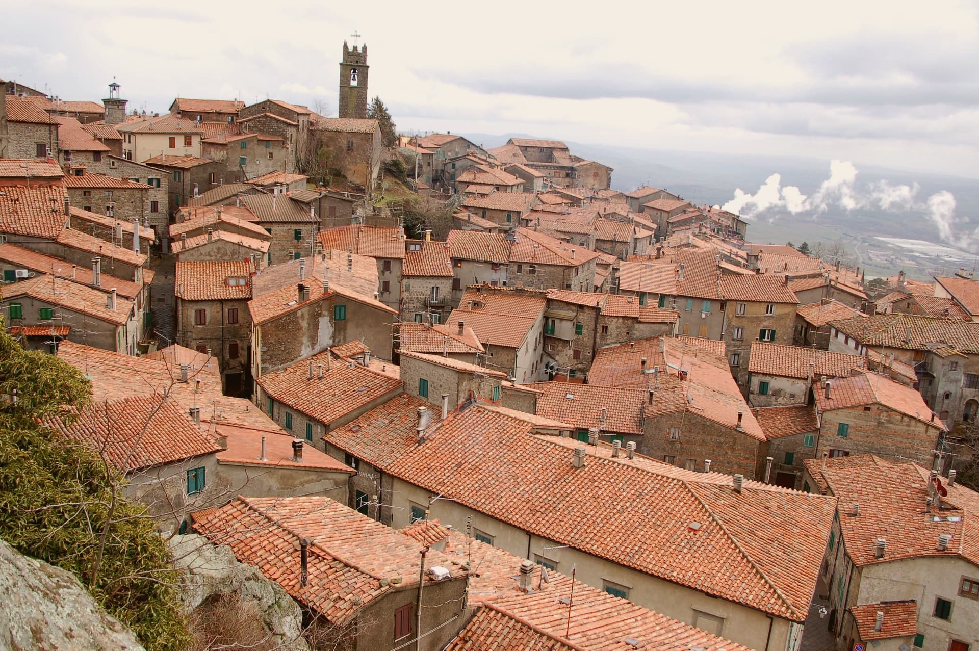
The name means plain of the chestnut, and the forest that still climbs the slope above the town is what fed it for most of its history: sweet chestnut, sessile oak, beech. The town itself sits at 772 meters, built around a twelfth-century keep that passed to Siena in 1418 and to the Medici in 1559, and the palazzo built into its old defenses in the sixteenth century reads as the Medici layer set directly against the Aldobrandeschi one.
Contrade named Borgo, Castello, Coro and Voltaia divide the centro storico for the August race, while the mining museum keeps the record of an industry, cinnabar and mercury, that ran on the mountain from Etruscan times until it closed in 1982 and that has otherwise left the town to the chestnut trade. What Piancastagnaio adds up to is a place where a volcano's slope has supplied, in turn, timber and food, ore, and a festival calendar, and where the built town still carries each of those histories as a separate, legible layer rather than a single blended one.
The village sits at 772 metres.
What to see in Piancastagnaio
- Rocca Aldobrandesca. Twelfth-century Aldobrandeschi keep at the heart of the centro storico, with a square tower and surviving curtain wall.
- Palazzo Bourbon del Monte. Sixteenth-century Medici-era palazzo built into the medieval defenses, with a courtyard loggia and ceremonial hall.
- Museo Minerario di Sant'Anna. Mining museum on the cinnabar and mercury extraction of Monte Amiata, active from the Etruscans until the mine closed in 1982.
How to get to Piancastagnaio
Perugia is roughly 135 minutes away by road.
Our tip
May through September is the season on the southern Amiata slope. The chestnut woods are open, the air at 772 meters stays cool against the Maremma heat below, and the trails to the volcano summit run from town. The Palio delle Contrade is the second weekend in August, the only date most outsiders know. Crastatone di Piancastagnaio falls in the season.
Castiglione di Garfagnana
Why visit Castiglione di Garfagnana
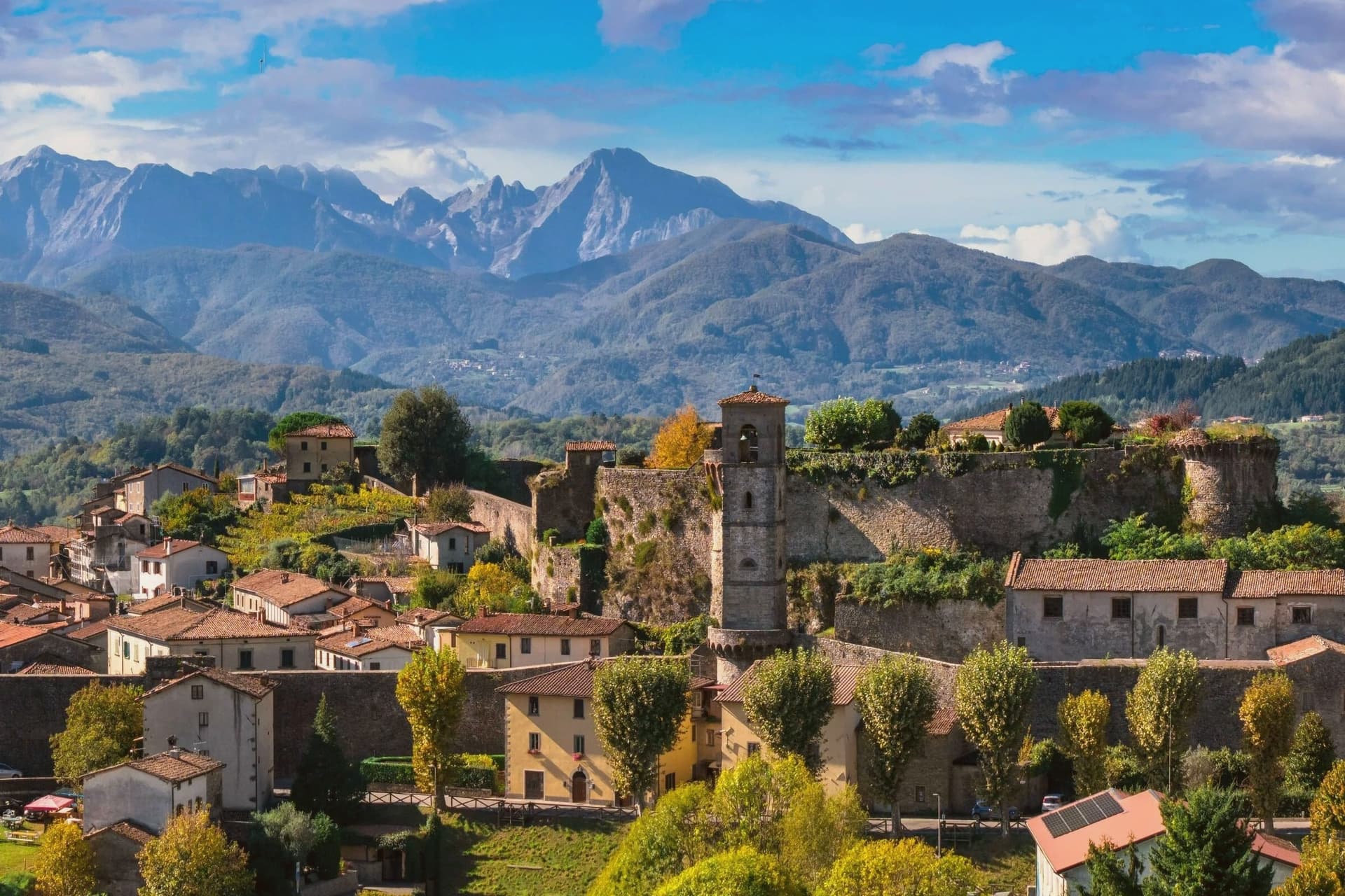
Castiglione di Garfagnana sits at 540 meters on the road to the San Pellegrino pass, in the upper Serchio valley, surrounded by chestnut woods and the Apuan and Apennine ridges. The Romans built a castrum here, the Castrum Leonis, to command the route between Lucca and Modena; what stands now is the thirteenth-century walled town, with three Torrioni and a Rocca that still anchor the south flank.
Through the fifteenth and sixteenth centuries, while the rest of the Garfagnana fell to the Este of Ferrara and was administered by Ariosto from nearby Castelnuovo, Castiglione held for the Republic of Lucca. The Estensi besieged it in 1603 and 1613 without taking it.
The Pieve di San Pietro Apostolo, the oldest church in the borgo, was first built in 723 by two Lombard brothers and rebuilt in the twelfth century. In winter the trattorie serve chestnut polenta with boiled pork bones, the standard cold-weather dish of the valley.
The village sits at 540 metres.
What to see in Castiglione di Garfagnana
- Rocca medievale. Thirteenth-century fortress with three Torrioni, the symbol of Castiglione and the anchor of the medieval walls.
- Mura medievali. Well-preserved thirteenth-century walls with large defensive towers ringing the borgo, intact for most of their length.
- Pieve di San Pietro Apostolo. Oldest church in town, first built in 723 by two Lombard brothers and rebuilt in the twelfth century by Bishop Guido III of Lucca.
How to get to Castiglione di Garfagnana
Pisa is roughly 95 minutes away by road.
Our tip
May through September is the high season in the Garfagnana, the chestnut woods and the Apennine passes open and warm in the day, cool at night. June and July bring the long evening light at 540 meters; August is busy but never coastal-hot. October is the chestnut harvest, the dish of polenta di castagne starts to appear on menus, the Sagra della Castagna runs the third weekend. Festa Medievale di Castiglione di Garfagnana falls in August.
Abetone Cutigliano
Why visit Abetone Cutigliano
Abetone sits at 1,388 meters on the watershed of the Apennines, where Tuscany meets Emilia-Romagna at the pass of the same name. The merged commune, created in 2017 when Abetone and Cutigliano were joined, runs from 678 meters at Cutigliano up to 1,940 at the summit of Libro Aperto.
The two stone pyramids on the pass, the Piramidi del Granduca, were erected in 1778 to mark the border between the Granduchy of Tuscany and the Duchy of Modena after the Brennero road through the pass was opened. The ski area runs about 50 kilometers of slopes across Val di Luce and Doganaccia, the oldest organized ski resort in the central Apennines, established in 1937.
Zeno Colò, the 1952 Olympic downhill gold medalist, was born in Cutigliano in 1920 and grew up on these slopes. The lower village of Cutigliano keeps a Palazzo Pretorio of 1377 with the coats of arms of fourteenth-century podestà set into the façade.
The village sits at 1388 metres.
What to see in Abetone Cutigliano
- Piramidi del Granduca. Two stone obelisks erected in 1778 on the Abetone pass, marking the border between Granducato di Toscana and Ducato di Modena.
- Val di Luce. Open glacial valley above Abetone with the main ski lift system, around 50 kilometers of pistes shared with Doganaccia.
- Palazzo Pretorio di Cutigliano. Fourteenth-century seat of the podestà in the lower village, with podestà coats of arms set into the façade.
How to get to Abetone Cutigliano
Prato is roughly 77 minutes away by road.
✷ We have written about Abetone Cutigliano
“The chairlift was not moving. Of course it was not moving. It was the middle of August, and the slope above me was green from end to end, the cabins hanging in the still air, empty. This is a ski village in August. This is the part of Italy nobody talks about, because nobody is here.”
Read our piece on Abetone Cutigliano →Abetone & Tuscan Alps | A Ski Village in August
Our tip
December through March is the ski season, when the village fills with Florentine and Bolognese weekenders and the lifts on Val di Luce run from morning to dusk. Snow cover varies by year and the season has been shortening; warmer winters leave the lower stations dependent on snowmaking. June through September is the second season: hiking on the watershed, the silver fir forests cool against the lowland heat, and the alpine flowers on the open ridges.
Castelnuovo di Garfagnana
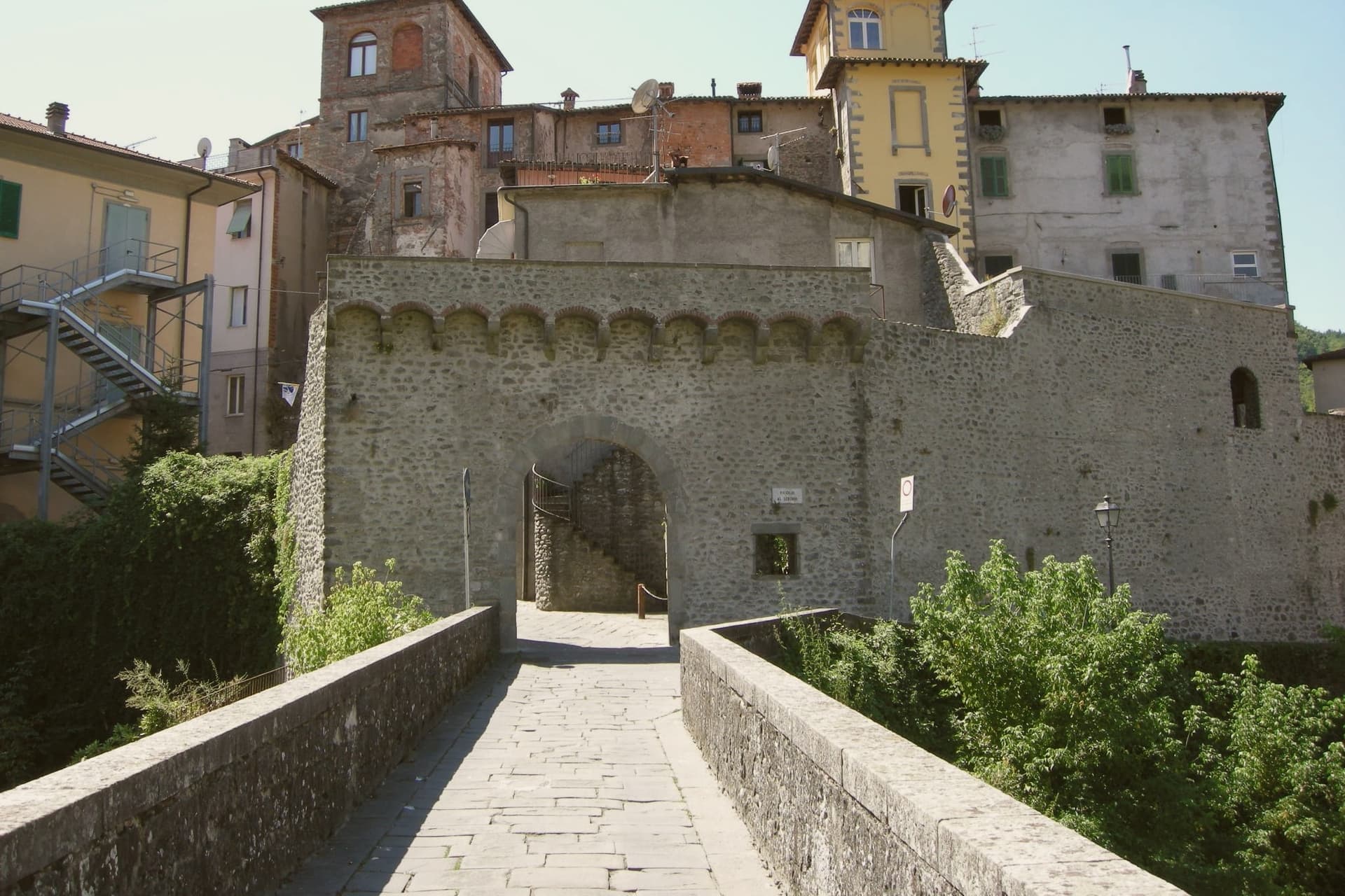
Why visit Castelnuovo di Garfagnana
Castelnuovo di Garfagnana is the historic capital of the Garfagnana, the deep mountain valley between the Apuane Alps and the Tuscan Apennine main ridge, 50 km north of Lucca along the Serchio river. The town sits where the Serchio meets the Turrite, and it anchors the valley both politically and economically: 5,600 residents, and the only real services, hospital, secondary schools, government offices, for the 30,000 people spread across the Garfagnana comuni around it.
The historic core is the fortress that now serves as the municipal museum, the building where the Este governor lived out his posting writing to friends about being stuck among bandits and chestnut-eaters even as he completed the final additions to his poem. Above the town, on the hill, stands the much larger Este fortress of 1579, built to control the trans-Apennine trade route and now a cultural centre and concert venue with the most photographed view of the Apuane peaks.
The two fortresses read together as a record of how the valley was held: one seat of government inside the town, one larger garrison commanding the pass above it. Castelnuovo is also the point of departure for the higher ground: the Apuane Regional Park, whose white-marble peaks are the same stone quarried at Carrara seen from the back, the Parco dell'Orecchiella further up, the show cave reached 45 minutes to the south, the Eremo di Calomini cliff-monastery, and over 200 km of marked Apennine trails.
The valley's food follows the same logic of scarcity turned to identity: alongside the farro and the chestnut dishes there is formentone otto file, a local maize cornbread, pecorino della Garfagnana, biroldo, a sweet-spiced blood sausage, and salt-cured prosciutto bazzone from the indigenous Garfagnana pig breed. A town built to govern a valley still does exactly that: the fortress on the hill and the one in the center were both instruments of control over a mountain pass, and the food still served in its bakeries and trattorie is what the same isolation once made necessary.
The village sits at 277 metres.
What to see in Castelnuovo di Garfagnana
- Rocca Ariostesca. The fortress core of the town, now the municipal museum. Its rooms hold the record of the governor who complained about the posting even as he finished his poem here.
- Fortezza di Mont'Alfonso. Larger Este fortress on the hill above town (1579), built to control the trans-Apennine route. Now a cultural centre and concert venue with the great Apuane view.
- Farro della Garfagnana IGP + zuppa di farro. Terraced hillsides still grow the grain that shows up in every trattoria's soup bowl. Bags of it are sold at the Saturday market.
How to get to Castelnuovo di Garfagnana
There is a railway station in the town, so you can arrive without a car and never need one while you are here. Pisa is roughly 84 minutes away by road.
✷ We have written about Castelnuovo di Garfagnana
“There are two ways to drive from Aulla to Lucca. The first is the one everyone takes: the coast, the A12, the cruise control, ninety minutes of the same Tyrrhenian to your right. The second is the one we took with Daniel, on a clear day in November, and it is two and a half hours longer if you stop, but it is in a different country.”
Read our piece on Castelnuovo di Garfagnana →Apuan Roadtrip | A Steak, a Friend, and the Long Way Down to Lucca
Our tip
Castelnuovo di Garfagnana is mountain-seasonal — June through September is the sweet spot, when the trails are clear, the festivals run (Sagra del Farro late August, San Pellegrino in Alpe pilgrimages), and the high refugi are open. October is chestnut and porcini season — the best food month. Winter is alpine — heavy snow possible above 800m, several ski-touring options, but the borgo itself stays accessible.
Fivizzano
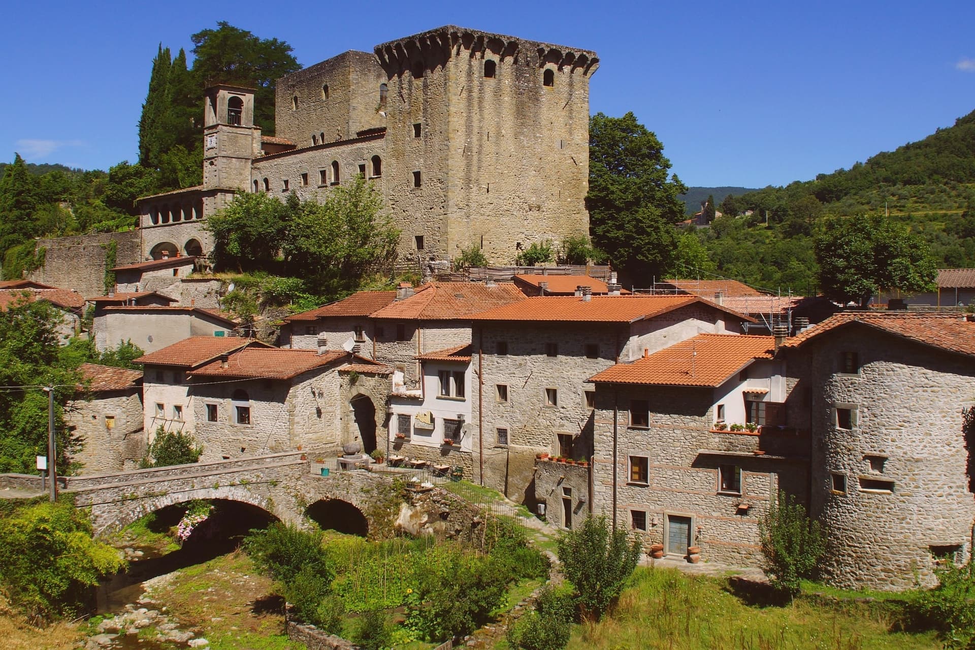
Why visit Fivizzano
Fivizzano-capoluogo is a quietly handsome, small Lunigiana centro of 7,000 residents on the SS63 between La Spezia and Reggio Emilia: a medieval Medici-era piazza with the Fontana Medicea of 1576, porticoes, a parish church. Fine, walkable, worth an hour.
The commune around it is the actual subject: 264 km² and 92 frazioni spread across the upper Lunigiana mountains inside the Parco Nazionale dell'Appennino Tosco-Emiliano, and several of those hamlets are individually destination-grade. Equi Terme sits in a deep, narrow gorge under vertical limestone walls, the kind of setting that makes the thermal water and the cave system feel like a single geological event rather than separate attractions.
Verrucola stands apart from it, a fortified hilltop borgo rather than a gorge-bottom spa town, its scale small enough that the whole place can be seen from the courtyard Cascella once used as his studio. Gassano and the smaller hamlets, Bottignana, Ceserano, Pieve San Paolo, Pognana, Soliera Apuana, Tenerano, are strung across the ridges between them, stone-house centri with the Apuane at their backs, each one a fragment of the same mountain commune rather than a satellite of the town below.
The food carries the same regional logic across every hamlet: testaroli and panigacci unique to this valley, torta d'erbi, pasta with porcini, lardo di Colonnata from the nearby Apuane quarries, and Lunigiana DOP olive oil from the lower-valley groves, with the mid-July pasta festival at the Fivizzano centre pulling the scattered frazioni back together for one event. Depopulation has been heavy, as in most ultraperiferico Apennine communes: 13,000 residents in 1951, 7,000 today, some smaller frazioni down to 20 or 30 winter residents.
What this adds up to is a commune held together less by its capoluogo than by the mountains and the park that surround it, a single administrative territory made of places that would each stand alone if they were anywhere else.
The village sits at 373 metres.
What to see in Fivizzano
- Equi Terme (frazione) — thermal springs + Grotta. 11 sulphurous thermal springs sit in a vertical limestone gorge at Equi Terme, feeding the Grotta di Equi karst cave system, 3 km of tunnels with prehistoric cave-bear remains found inside. The Terme di Equi spa has used the spring water for sulphur therapy since the Etruscans, and the Solco di Equi trail runs the length of the gorge on foot.
- Verrucola (frazione) — Fortezza dei Malaspina. The fortress is small enough to take in on foot in minutes, its stone walls close around a courtyard open to the public. Pietro Cascella lived and worked inside it until 2008, and the rooms he used now hold the museum.
- Gassano + Lunigiana frazioni. Gassano is the panoramic perched hamlet on a ridge facing the Apuane. Bottignana, Ceserano, Pieve San Paolo, Pognana, Soliera Apuana, Tenerano: all small mountain hamlets with stone-house centri and Apennine and Apuane views.
How to get to Fivizzano
There is a railway station in the town, so you can arrive without a car and never need one while you are here. Pisa is roughly 95 minutes away by road.
✷ We have written about Fivizzano
“We chose it the way you choose a card from a deck. We pulled up the map, ignored everything we recognized, scrolled north until the roads thinned out and the names stopped meaning anything to us, and there, behind the marble of Carrara, in a fold of the Apuane I had never heard of, was a borgo called Marciaso. There was one Airbnb.”
Read our piece on Fivizzano →The Lunigiana | The Real Off the Beaten Path Italy
Our tip
Fivizzano commune is mountain-seasonal — May through September is the sweet spot, when the frazioni are accessible by car, the trails are clear, and the Equi Terme spa and cave are open without booking pressure. October is chestnut and porcini season — the best food month in the Lunigiana. Winter is Apennine — heavy snow possible in the upper frazioni, several roads close. Disfida degli arcieri di Fivizzano falls in July.
More from Anywhere Italy
 The best small towns with a medieval festival in Toscana
 The best towns known for what they grow within two hours of Pisa
 The 6 best hidden towns inside a nature park in Toscana
 The best towns inside a national park in Toscana
 The best towns inside a nature park that you can reach by train in Toscana
 The 8 best towns you can reach by train in the province of Lucca