
The best lake towns within two hours of Rome
The lakes around Rome sit in old volcanic craters, which is why the water goes deep and cold within a few strokes of the shore and why the villages above it are built from grey-brown tufa quarried on the spot. Coregone and lake eel come off the boats at Bolsena, and the wild strawberries of the Alban hills turn up in June on every bar counter as fragoline, sold in paper cones. Spring brings green wheat on the crater rims and the first tables outside; late September clears the water and empties the lidos while it is still warm enough to swim. The Castelli Romani vineyards, the ilex woods, the beaches of black volcanic sand and the ferries out to Bisentina all sit inside a short drive of the ring road.
Most visitors to Rome who want a day by water head for Ostia and the Lazio coast, or, if they have longer, drive north to Lake Trasimeno or take the train up to Orvieto. Ostia in high summer means traffic on the Cristoforo Colombo, paid rows of loungers and a sea that struggles against the mouth of the Tiber. It is the default because it is the thing Romans have always done, and on a July Sunday all of the city seems to be doing it at once.
The craters are the better answer, and they are barely further out. The same tufa, the same fish menus and the same swimming keep going around shores that most people passing through Rome never think to look at, in towns where the lakeside promenade is a working street rather than a resort strip. These are the places on the water, north of the city and south of it, within a couple of hours of the centre.
Of the 95 communes we have mapped in a 120-minute drive of Rome, 7 qualify as lake towns: each sits on the water. The smallest, Capodimonte, has 1,667 residents.
Two more lists worth reading alongside this one: The 7 best lake towns in Lazio and The best towns inside a nature park in the province of Roma.
Capodimonte
Why visit Capodimonte
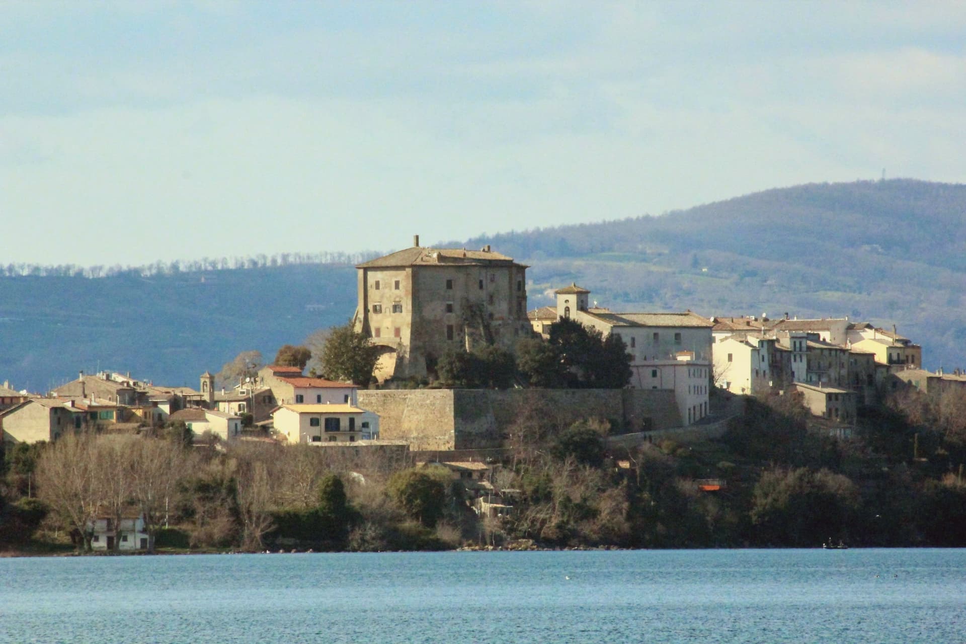
Capodimonte is a 1,700-resident lakeside borgo on the southwestern shore of the lake, formed 370,000 years ago when the Vulsini volcanic complex collapsed inward. The town sits on a low peninsula that juts into the water, and the centro is built around that geography: the fortress anchors the point of land, the gardens run beside it, and the shore curves away on both sides into the pebble beaches used for swimming.
From the peninsula's tip the view opens across the water toward the larger of Bolsena's two islands, still privately owned but open for guided visits, while the smaller Isola Martana nearby is uninhabited. Capodimonte is also a Città dell'Olio, and the Tuscia hills behind the town produce a DOP Sabina-style olive oil pressed in small frantoi within 10 km.
The lake itself is deep and clean, warm enough for swimming from May to October, and bream and coregone from its water turn up on every local table. The Via Francigena pilgrimage route passes 8 km east.
The Etruscan necropolis at Vulci is 30 minutes west, and the painted tombs of Tarquinia an hour southwest, both UNESCO sites, while Civita di Bagnoregio, the dying city on its tufa pinnacle, lies 25 km north. The town's identity comes from that position on the water: a fortified point of land looking out at an island that was once its own private world, with the surrounding hills supplying the oil that still runs through the local economy.
The town sits on the water, at 364 metres.
What to see in Capodimonte
- Palazzo Farnese (Rocca Farnese). The fortress built for Pope Paul III's family stands over formal Italian gardens, partially open for visits. Its octagonal plan is unusual among lakeside strongholds of the period.
- Isola Bisentina. Reached from the peninsula's tip, the island holds seven Renaissance chapels, a Franciscan convent and the Farnese tombs, a quiet cluster of buildings for a place that was long the only inhabited island on the lake.
- Lago di Bolsena swimming + beaches. Clean and warm from May to October, with short pebble strands on either side of the Capodimonte peninsula.
How to get to Capodimonte
Terni is roughly 74 minutes away by road.
Our tip
Capodimonte is best May through October — the lake is swimmable and the Isola Bisentina ferries run. June and September are the sweet spot (warm water, no crowds). July–August fills with Roman families on weekends and at ferragosto.
Nemi
Why visit Nemi
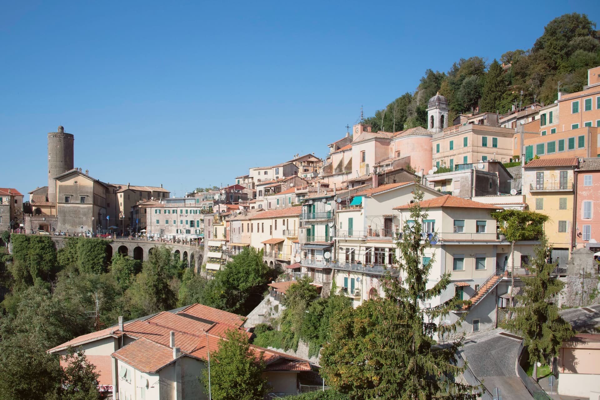
Nemi sits at 521 meters on the rim of a volcanic crater, the smallest of the Castelli Romani and thirty kilometers southeast of Rome. The lake below was the Speculum Dianae, the mirror of Diana, with a sanctuary on its northern shore that covered around 45,000 square meters and drew pilgrims from across Latium.
Emperor Caligula built two ceremonial ships on the lake, ninety meters of timber and bronze that sat on the water until they sank. Mussolini drained part of the lake between 1929 and 1932 to recover them.
They were destroyed by fire in 1944, almost certainly by retreating German troops. The Museo delle Navi Romane, built in 1940 to hold them, now shows scaled reconstructions and salvaged fragments.
Palazzo Ruspoli, a ninth-century castle restored by Valadier, anchors the centro storico. The wild strawberries grown on the inner slopes of the crater are sold from stalls along Via Roma and celebrated each June at the Sagra delle Fragole.
The town sits on the water, at 521 metres.
What to see in Nemi
- Palazzo Ruspoli. Ninth-century castle of the Counts of Tuscolo, restored by Valadier, with cylindrical tower and hanging garden over the lake.
- Museo delle Navi Romane. Lakeshore museum built in 1940 for Caligula's two recovered ships, destroyed by fire in 1944, now housing scaled models and fragments.
- Santuario di Diana Nemorense. Remains of the federal sanctuary on the lake's northern shore, once 45,000 square meters of temple, porticoes and theater.
How to get to Nemi
Roma is roughly 52 minutes away by road.
Our tip
April through June and September into October are the dry months on the crater rim, when the wild strawberries ripen and the lake holds its color. The Sagra delle Fragole runs the first Sunday of June and draws thousands. July and August push the basin into the low thirties; the centro storico stays cooler at 521 meters than the coast or the city, but weekends fill with day-trippers from Rome. Borgo diVino in tour falls in September.
Bolsena

Why visit Bolsena
Bolsena stands at 350 meters on the eastern shore of Lake Bolsena, the largest volcanic lake in Europe at 114 square kilometers. The site sits on the old Etruscan town of Volsinii, razed by the Romans in 265 BC; the survivors were resettled here as Volsinii Novi.
In 1263 a Bohemian priest, doubting the doctrine of transubstantiation, was celebrating mass in the church when the host bled onto the corporal. The cloth was carried to Urbino, then to Orvieto, and Pope Urban IV extended the feast of Corpus Domini to the universal Church the following year.
The Basilica di Santa Cristina, where the miracle is said to have occurred, holds the original altar stone and an early Christian catacomb. The Rocca Monaldeschi della Cervara, a fourteenth-century fortress of the Orvietan family, dominates the upper town and houses the Museo Territoriale del Lago di Bolsena.
On Corpus Domini the streets fill with floral mosaics for the Infioritalia network.
The town sits on the water, at 350 metres.
What to see in Bolsena
- Basilica di Santa Cristina. Eleventh-century basilica with the altar stone of the 1263 Eucharistic miracle and an early Christian catacomb beneath the apse.
- Rocca Monaldeschi della Cervara. Fourteenth-century fortress of the Orvietan Monaldeschi, dominating the upper town and housing the Museo Territoriale.
- Lago di Bolsena. Largest volcanic lake in Europe at 114 square kilometers, with two small islands and a continuous swimming and fishing tradition.
How to get to Bolsena
Terni is roughly 81 minutes away by road.
Our tip
April through June and September into October are the months on the lake, when the water is clear, the chestnut woods on the volcanic slopes are full, and the swimming temperatures hold. The Infiorata for Corpus Domini, usually in late May or June, is the most photographed weekend. July and August push the basin into the low thirties; the lake stays cool enough to swim through the heat and the upper town keeps shade between the Rocca and Santa Cristina. Sagra delle Bontà falls in August.
Trevignano Romano
Why visit Trevignano Romano
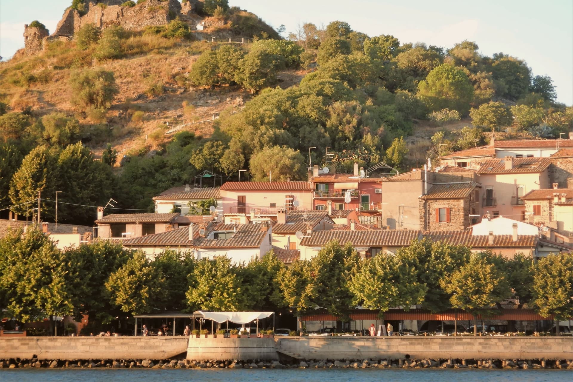
Trevignano Romano sits on the northern shore of Lake Bracciano, the volcanic crater lake thirty-five kilometers northwest of Rome. The town climbs from the lakefront to the ruined Rocca Orsini, the medieval fortress that once controlled the northern approach.
The Chiesa dell'Assunta, halfway up the hill, holds a sixteenth-century apse fresco painted by a follower of Raphael. The lake itself is the second largest in Lazio and supplies a portion of Rome's drinking water, which is why motorboats are banned: only sail and electric craft cross the surface.
Three communes share the shore, Bracciano, Anguillara Sabazia, and Trevignano, and Trevignano is the smallest and quietest of the three. The waterfront promenade fills on summer weekends with Romans escaping the city for a swim and grilled coregone, the lake whitefish.
Outside the summer months it returns to the residents.
The town sits on the water, at 173 metres.
What to see in Trevignano Romano
- Rocca Orsini. Medieval fortress ruins above the town, built by the Orsini family in the fifteenth century to control the lake's northern approach.
- Chiesa dell'Assunta. Sixteenth-century church on the hillside with an apse fresco of the Assumption painted by a follower of Raphael.
- Lago di Bracciano lakefront. Volcanic crater lake at 164 meters above sea level, swimmable and reserved for sail and electric boats; Rome's secondary water reservoir.
How to get to Trevignano Romano
Roma is roughly 57 minutes away by road.
Our tip
April through June brings warm days and a quiet lakefront, the best window for swimming before the Roman weekend crowds arrive. July and August are hot, around thirty degrees, and the waterfront fills from Friday afternoon through Sunday evening; weekdays stay calmer. September and October return the lake to the residents, with water still warm enough for swimming into early October.
Castel Gandolfo
Why visit Castel Gandolfo
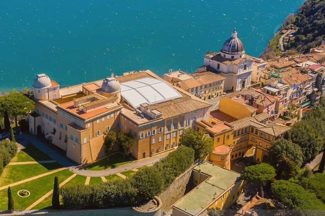
The town sits at 426 meters on the rim of the Lake Albano crater, twenty-five kilometers southeast of Rome among the Castelli Romani. It stands on the site of Alba Longa, the city Aeneas's son Ascanius is said to have founded.
The lake below was formed by the fusion of two volcanic craters and reaches 170 meters deep. The Villa Barberini stands adjacent to the palace, acquired by Taddeo Barberini in 1631, its gardens running down toward the water.
Pope Francis kept the palace as a museum after 2016; Leo XIV restored it to residential use in June 2025 and resides in the Villa Barberini next door, while the Borgo Laudato Si', created by Francis in 2023, carries ecological education across 55 hectares of the same estate. A town built on legend, given over for a time to public viewing, and returned to private residence: three uses of the same ground, laid one on top of the other without erasing what came before.
The town sits on the water, at 426 metres.
What to see in Castel Gandolfo
- Palazzo Apostolico. The palace Carlo Maderno raised between 1623 and 1626 stood open as a museum from 2016, its rooms given over to display cases and visitors. In June 2025 it returned to residential use, the museum arrangement dismantled to make way for a household again.
- Ville Pontificie e Giardini Barberini. Fifty-five hectares of papal villas and gardens running down to Lake Albano, with the seventeenth-century Villa Barberini at their center.
- Lago Albano. The crater lake sits at 293 meters above sea level and covers five square kilometers, its rim shared between this town and Albano Laziale.
How to get to Castel Gandolfo
There is a railway station in the town, so you can arrive without a car and never need one while you are here. Roma is roughly 35 minutes away by road.
Our tip
April through October is the open season for Castel Gandolfo, with the gardens open and the lake at swimming temperature from June. June and September are the calmer months and the historic papal-residence weeks. July and August fill with Roman day-trippers and Vatican tourists; the lake shore is busy.
Bracciano
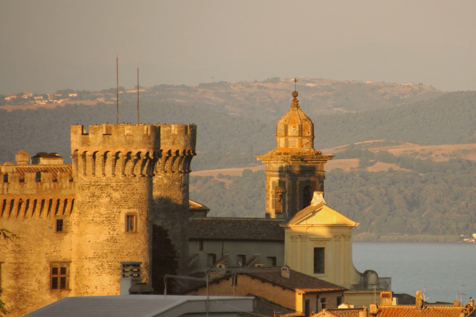
Why visit Bracciano
Bracciano stands at 280 meters above the southern shore of Lago di Bracciano, the volcanic crater lake known historically as Sabatino, the eighth largest in Italy. The Castello Orsini-Odescalchi was begun by Napoleone Orsini in 1470 and completed by his son Virginio Gentile in 1485; the architect was Francesco di Giorgio Martini.
It is one of the better-preserved examples of Renaissance military architecture in Italy, a five-towered pentagon on a polygonal base, with frescoes by Antoniazzo Romano and the Zuccari brothers. The Orsini lost it through debt in 1696 to Livio Odescalchi, nephew of Pope Innocent XI; the Odescalchi still own it.
Bracciano supplies a significant part of Rome's drinking water through the aqueduct that begins in the lake. The town is also a hazelnut commune, member of the Città della Nocciola network.
Tom Cruise married Katie Holmes in the castle in November 2006, which is how most people outside Italy heard of the place.
The town sits on the water, at 280 metres.
What to see in Bracciano
- Castello Orsini-Odescalchi. 1470-1485 Renaissance castle, five round towers on a pentagonal plan, frescoes by Antoniazzo Romano and the Zuccari brothers.
- Lago di Bracciano. Volcanic crater lake, eighth largest in Italy at 57 square kilometers, source of part of Rome's drinking water.
- Centro storico. Medieval town below the castle walls, organized in concentric rings around the rocca, with two surviving medieval gates.
How to get to Bracciano
There is a railway station in the town, so you can arrive without a car and never need one while you are here. Roma is roughly 58 minutes away by road.
Our tip
April through October is the lake season. May and June bring the warmest weather without the August crowd from Rome; the shore villages of Anguillara and Trevignano fill on weekends and empty mid-week. July and August are hot and busy.
Anguillara Sabazia
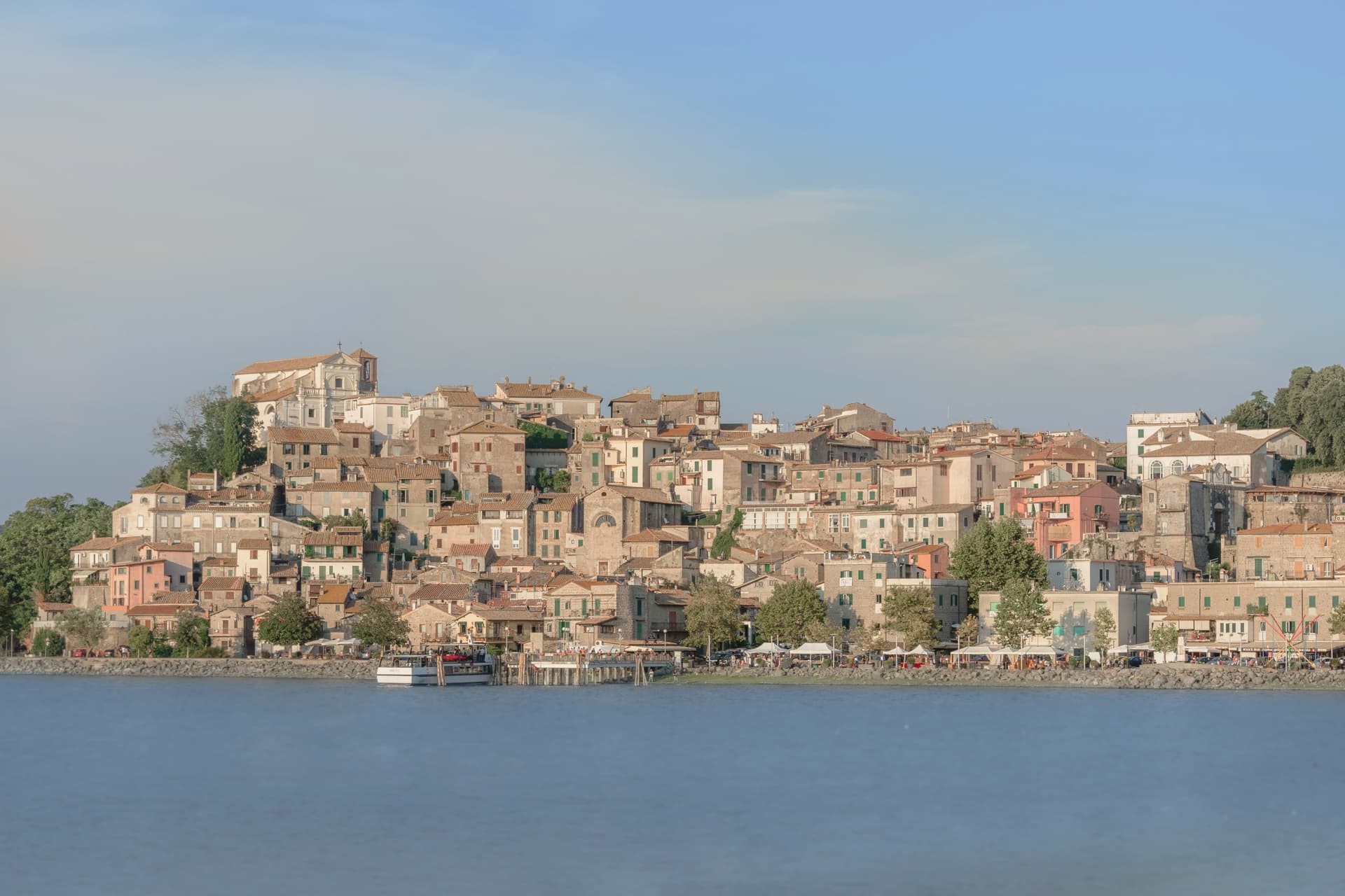
Why visit Anguillara Sabazia
Anguillara Sabazia sits on a small volcanic cape that pushes into Lake Bracciano from the southern shore, twenty-five kilometers northwest of Rome. The medieval town climbs from the lake on stepped streets to the Porta Maggiore and the Collegiata di Santa Maria Assunta at the top.
The setting is older than the medieval town: La Marmotta, a few hundred meters offshore from the cape, is one of the oldest underwater archaeological sites in Europe, an Early Neolithic lakeshore village dated to 5700 BC, with preserved wooden canoes and grain stores in the lakebed mud. The Romans came later: Rutilia Polla, a Roman patrician, owned a villa on the cape in the first century BC, and the modern town name carries the surname of the medieval Anguillara family who took the place after the empire.
Anguillara is one of three communes on Lake Bracciano with Bracciano and Trevignano, and it is the closest to Rome of the three.
The town sits on the water, at 195 metres.
What to see in Anguillara Sabazia
- Porta Maggiore e centro storico. Medieval gate and stepped town climbing from the lakefront on the volcanic cape, with stone streets converging on the upper piazza.
- Collegiata di Santa Maria Assunta. Main church at the top of the cape, rebuilt in the sixteenth century on earlier foundations, with views over the lake from the parvis.
- Lungolago e cape. Lakefront promenade and small beaches along the cape, with views east to Trevignano and west to Bracciano across the volcanic basin.
How to get to Anguillara Sabazia
There is a railway station in the town, so you can arrive without a car and never need one while you are here. Roma is roughly 50 minutes away by road.
Our tip
April through June and September through October are the strong months. The cape is exposed and the wind off the lake keeps the temperature mild even in warm weeks. July and August are hot, around thirty degrees, and the lakefront fills on weekends with Romans driving up for a swim and grilled coregone. Sagra delle Pizzòle falls in August.
More from Anywhere Italy
- The 7 best lake towns in Lazio
 The best towns inside a nature park in the province of Roma
 The best towns you can reach by train within an hour of Rome
- The best hidden towns inside a nature park in the province of Roma
 The best towns you can reach by train in the province of Roma
- The best towns that eat well within an hour of Rome