
The best towns you can reach by train in the province of Roma
The province of Roma is wider and stranger than the city that names it. North of the capital the ground gives way into volcanic craters filled with water, and the tufa the villages are cut from is the same soft grey rock the Etruscans hollowed their tombs into. South and east the land climbs into the Alban Hills and the Simbruini, where the porchetta is sliced warm at roadside counters, the white wine is poured cold from unlabelled jugs, and spring brings broad beans eaten raw with pecorino. Autumn is the better season for walking here, when the chestnut woods turn and the lake water still holds the summer's heat. Regional trains leave Termini and Tiburtina all day, which means much of this is a morning's decision rather than a hire car and a deposit.
Almost everyone who arrives in Roma stays in Roma, and the day trip they take is Ostia Antica, or a coach to Pompeii, or the queue at the Vatican Museums that starts before the gates open. The centre absorbs the crowds because it is built to, and because the guidebooks make the province look like a blank ring around it. The result is that the regional platforms at Termini stay quiet while the Colosseo metro stop does not.
The hills and the lakes and the vineyards carry on past the last stop of the metro, and the same trains that commuters use in the morning go out empty in the middle of the day. Fewer people go to the towns on the crater rim above Lago di Bracciano, or to the papal villages in the Castelli, or up the Aniene valley towards the monasteries in the rock. All of the places gathered here have been checked as reachable without a car, by train or by train and a short local bus.
Of the 16 communes we have mapped in the province of Roma, 10 qualify as towns you can reach by train: we have confirmed each is reachable without a car. The smallest, Subiaco, has 8,466 residents.
Elsewhere in the catalogue: The best towns you can reach by train within an hour of Rome and The best towns you can reach by train that eat well within 90 minutes of Roma.
Subiaco
Why visit Subiaco
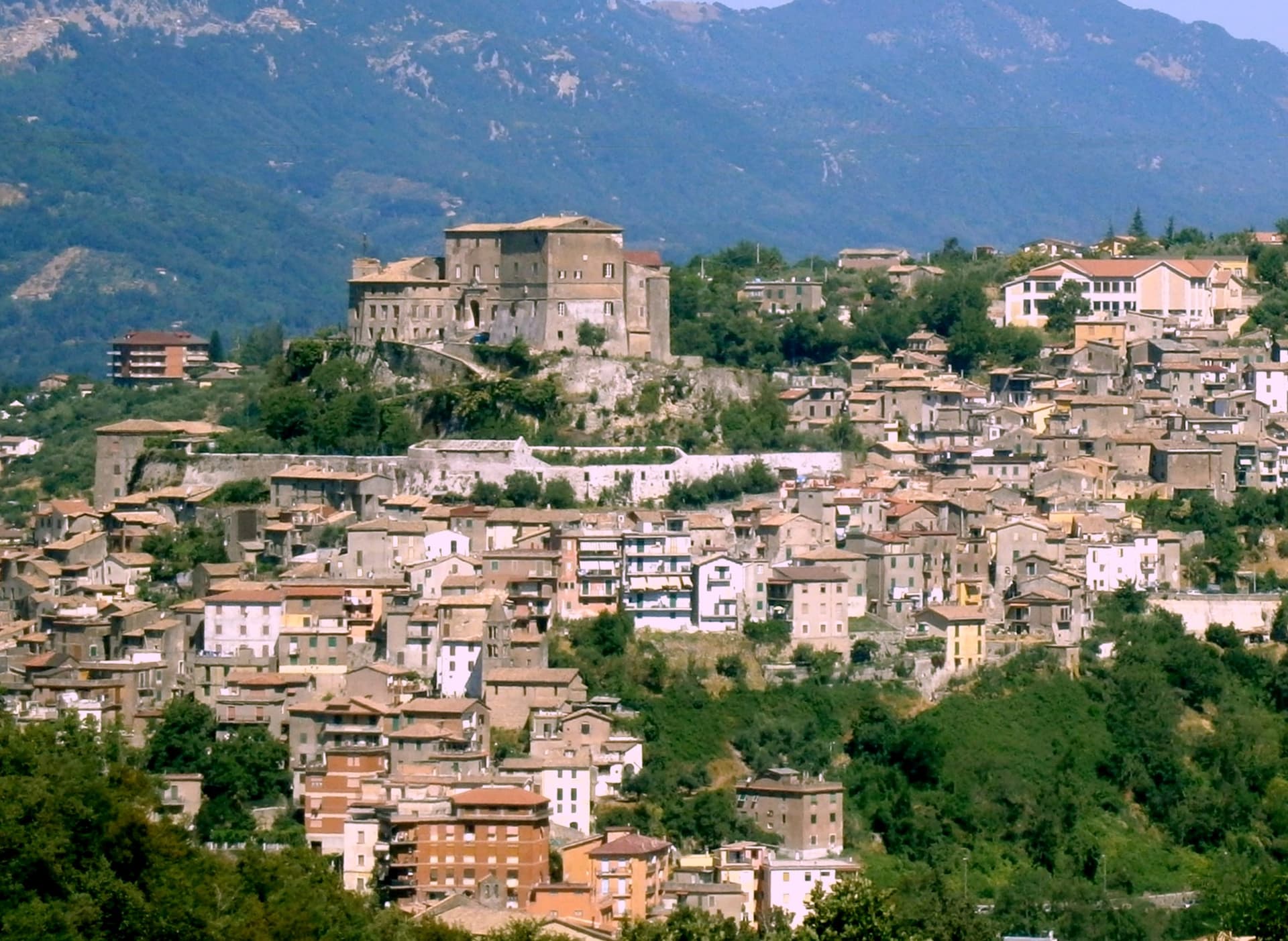
Subiaco sits at 408 meters along the upper Aniene, seventy-three kilometers east of Rome and forty from Tivoli. Nero built a villa here in the first century, damming the river into artificial lakes known as Sublaqueum, below the lake, and the name outlasted the villa and the emperor both.
The town that grew up here reads in layers going up the valley side: the river and the bridge at the bottom, the abbey partway up the hill, the fortress at the summit, and the cliff sanctuary further out along the cliff face that gave the hermit's cave its shelter, each one built at a different remove from the water and from the town center. What holds these layers together is a single life.
A man who came here as a young man to live alone in a cave gave his name to a monastery down the hill, and centuries later that same monastery's press put the first printed book on Italian soil into circulation. The fortress above answers to a different history, the abbots who ruled here as feudal lords, one of whom fathered a child who became one of the most written-about women of her age.
A river valley that supplied an emperor's pleasure lakes became, without much overlap, the ground where monastic life took its early shape.
We confirmed you can reach this one by train.
What to see in Subiaco
- Monastero del Sacro Speco. Built into the cliff face of Monte Taleo, the sanctuary rises in tiers over the cave itself, and the frescoes by Conxolus and the school of Cimabue cover walls that follow the rock rather than a flat plan.
- Abbazia di Santa Scolastica. The only one of Benedict's twelve original monasteries still standing, sixth century in origin; its library holds three hundred manuscripts, including a copy of the Lactantius run off the abbey's own press.
- Rocca Abbaziale (Rocca dei Borgia). Set on the highest ground of the borgo, the fortress was raised by abbot Giovanni V in the twelfth century and later gave Lucrezia Borgia, daughter of the abbot Rodrigo Borgia, a birthplace in 1480.
How to get to Subiaco
There is a railway station in the town, so you can arrive without a car and never need one while you are here. Roma is roughly 70 minutes away by road.
Our tip
April through June and September through October are the months for Subiaco: the Aniene runs full, the cliff sanctuaries are open from morning, and the pilgrim road south fills with walkers on the Cammino di San Benedetto. July and August are warm in town and cool in the monasteries; the cave at the Sacro Speco holds twelve degrees year-round. November through March is the quiet pilgrim season, mist on the river and few coaches in the lots. Festa Madonna di Pompei Rione Colle falls in August.
Castel Gandolfo
Why visit Castel Gandolfo
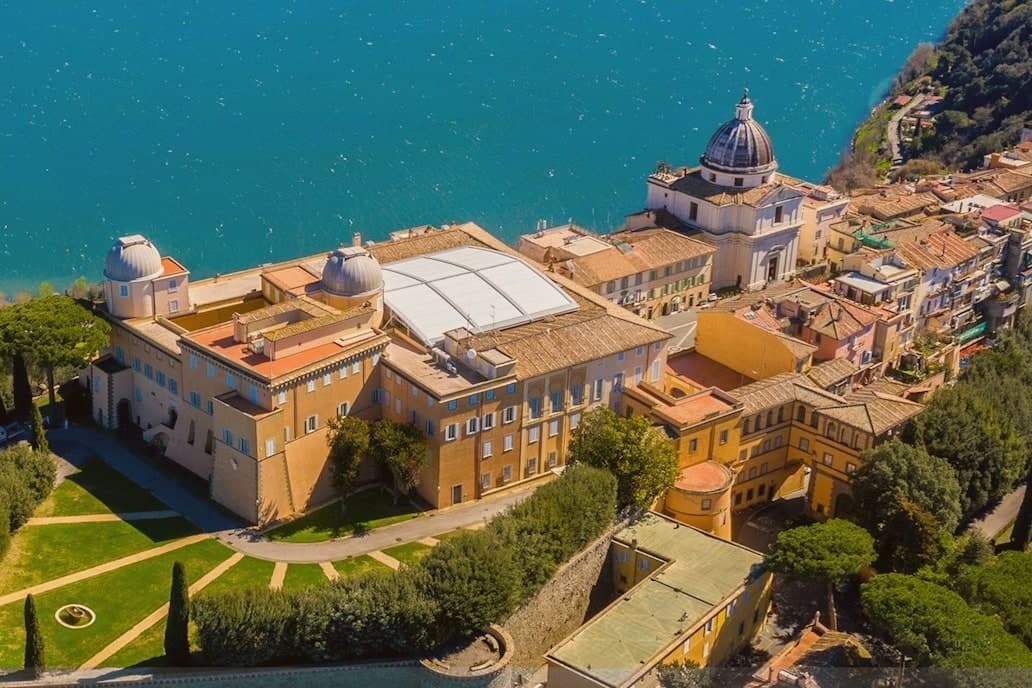
The town sits at 426 meters on the rim of the Lake Albano crater, twenty-five kilometers southeast of Rome among the Castelli Romani. It stands on the site of Alba Longa, the city Aeneas's son Ascanius is said to have founded.
The lake below was formed by the fusion of two volcanic craters and reaches 170 meters deep. The Villa Barberini stands adjacent to the palace, acquired by Taddeo Barberini in 1631, its gardens running down toward the water.
Pope Francis kept the palace as a museum after 2016; Leo XIV restored it to residential use in June 2025 and resides in the Villa Barberini next door, while the Borgo Laudato Si', created by Francis in 2023, carries ecological education across 55 hectares of the same estate. A town built on legend, given over for a time to public viewing, and returned to private residence: three uses of the same ground, laid one on top of the other without erasing what came before.
We confirmed you can reach this one by train.
What to see in Castel Gandolfo
- Palazzo Apostolico. The palace Carlo Maderno raised between 1623 and 1626 stood open as a museum from 2016, its rooms given over to display cases and visitors. In June 2025 it returned to residential use, the museum arrangement dismantled to make way for a household again.
- Ville Pontificie e Giardini Barberini. Fifty-five hectares of papal villas and gardens running down to Lake Albano, with the seventeenth-century Villa Barberini at their center.
- Lago Albano. The crater lake sits at 293 meters above sea level and covers five square kilometers, its rim shared between this town and Albano Laziale.
How to get to Castel Gandolfo
There is a railway station in the town, so you can arrive without a car and never need one while you are here. Roma is roughly 35 minutes away by road.
Our tip
April through October is the open season for Castel Gandolfo, with the gardens open and the lake at swimming temperature from June. June and September are the calmer months and the historic papal-residence weeks. July and August fill with Roman day-trippers and Vatican tourists; the lake shore is busy.
Castelnuovo di Porto
Why visit Castelnuovo di Porto
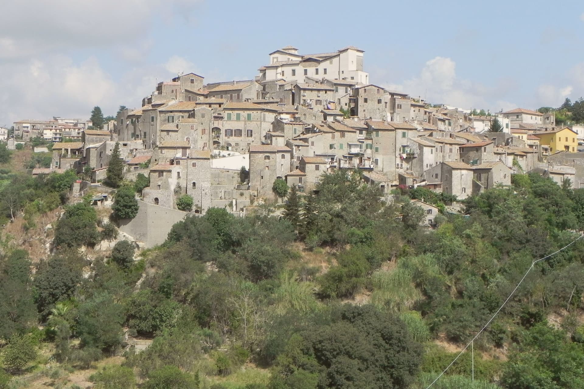
Castelnuovo di Porto sits at 250 meters on a tufa spur between the Chiarano and Mola valleys. The first fortification went up before the year 1000 under the senator Alberico, and the medieval village grew around it in concentric loops that still shape the centro storico today.
The Colonna family took the fief in the late Middle Ages and built the fortress that occupies the highest point of the ridge, the keep from which the whole settlement takes its layout, houses and passages stepping down the slope in rings. The town's name preserves its administrative link to the river: this was the Castrum Novum of the bishop of Porto, the old diocesan seat at the Tiber mouth, a naming that ties a tufa hilltop village to an ecclesiastical authority seated on the coast.
The Borghi più belli d'Italia membership covers the centro storico and the fortress together, while Etruscan and Roman archaeology runs through the Veio park that surrounds both. The result is a village whose name records a bishop's jurisdiction, whose form records a medieval defense, and whose surroundings record two much older civilizations, all still legible on the same ridge.
We confirmed you can reach this one by train.
What to see in Castelnuovo di Porto
- Rocca Colonna. Ducal palace inside the keep at the highest point of the ridge, used by Marcantonio Colonna after Lepanto and later by Christina of Sweden passing through to Rome.
- Centro storico. Tufa houses and vaulted passages along the concentric loops, with the surviving village gates still marking the old perimeter.
- Chiesa di Santa Lucia. Parish church inside the walls, with Renaissance frescoes and a baptismal font dating to the period of the fortress above it.
How to get to Castelnuovo di Porto
There is a railway station in the town, so you can arrive without a car and never need one while you are here. Roma is roughly 37 minutes away by road.
Our tip
April through June and September through October are the strongest months. The Tiber valley is green in spring and the rocca terraces open cleanest at low sun. July and August touch the upper thirties; the centro storico stays cooler than Rome twenty-five kilometers downhill but the Veio park trails go silent in midday heat. Sagra Degli Gnocchi A Castelnuovo Di Porto falls in September.
Ariccia
Why visit Ariccia
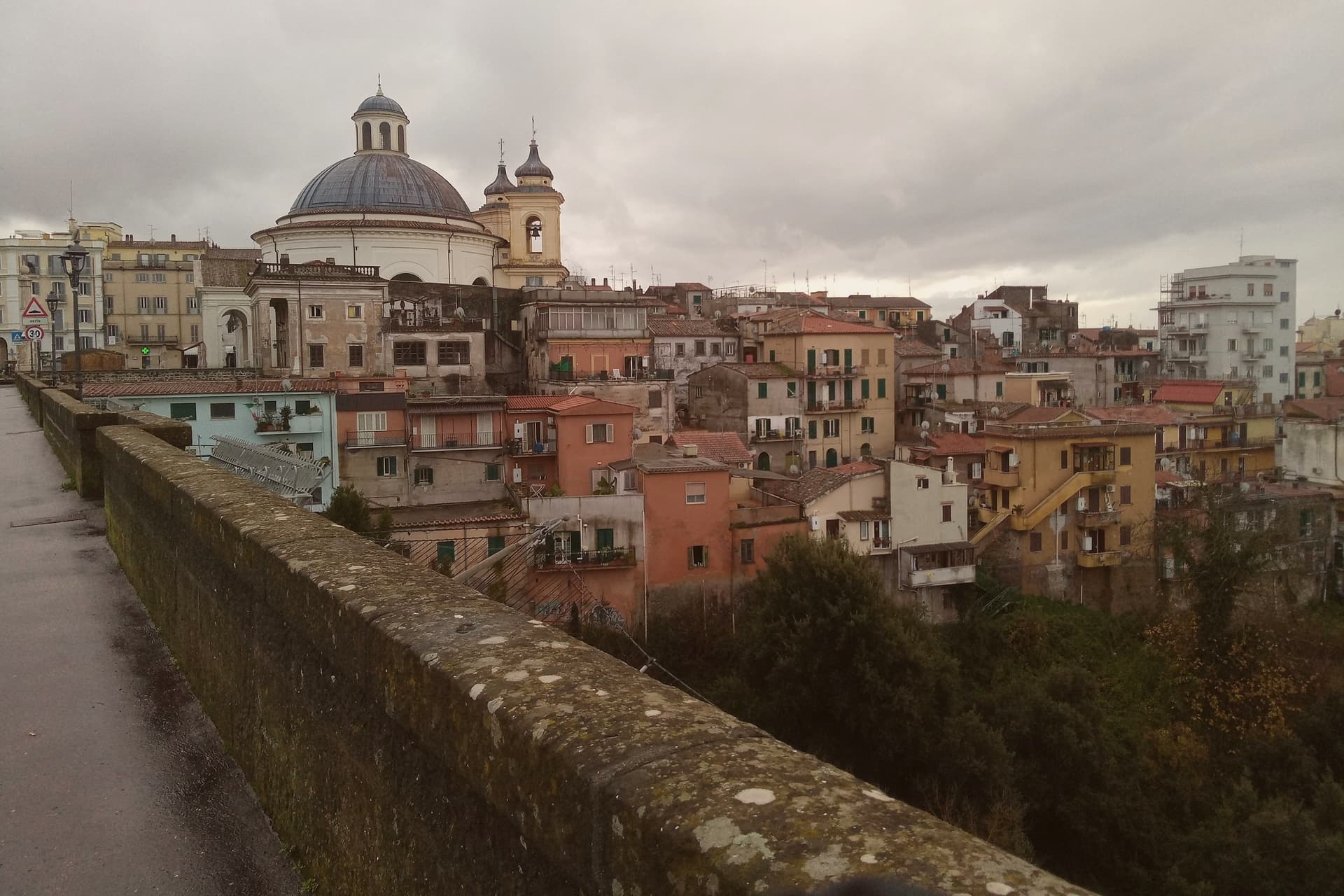
Ariccia sits on the rim of the Alban Hills volcanic complex, and the crater geography organizes everything about the place. The town centre occupies the ridge; below it on the eastern side the ground drops into the deep crater valley of Vallericcia, crossed by the viaduct linking the town to the next ridge.
The gorge itself became notorious after a series of suicides in the 1990s, now blocked with high railings. Further east and below, the volcanic lakes and the papal estate sit in a cluster within a few kilometres of the town centre, part of the same crater system that shaped Ariccia's position in the first place.
The Roman past predates the Baroque town by centuries: Aricia was the southern terminus of the original Via Appia, laid out in 312 BC, and the neighbouring lake was the site of the Latin League's federal sanctuary of Diana Aricina. The porchetta tradition is separate again: whole pork loin, deboned and seasoned with rosemary, garlic, pepper and wild fennel, slow-roasted on rotating spits in wood-fired ovens and served at room temperature in panini or by the etto.
The fraschette that serve it were originally outdoor wine vendors, marked with frasche, branches, as signs, and the town's status as a Città del Vino within the Frascati zone explains why the wine on the table is local rather than incidental. What makes Ariccia distinct among the Castelli towns is that these layers, Roman road terminus, crater rim settlement, unified Baroque set piece, and porchetta town, sit on top of each other in one small place rather than being scattered across the region.
We confirmed you can reach this one by train.
What to see in Ariccia
- Palazzo Chigi + Piazza di Corte (Bernini). The Chigi family's Baroque summer residence. The palazzo, the piazza and the church facing it were designed as one ensemble. The palazzo is preserved as a 17th-c interior museum.
- Santa Maria dell'Assunzione (Bernini). Bernini's circular church, domed and modelled on the Pantheon: small, perfect, often empty.
- Ponte Monumentale. 1854 triple-tier brick viaduct spanning the 312m-deep Vallericcia crater. Walk across for the panoramic view; the gorge below is wooded and undeveloped.
How to get to Ariccia
There is a railway station in the town, so you can arrive without a car and never need one while you are here. Roma is roughly 41 minutes away by road.
Our tip
Ariccia is year-round — the Castelli Romani are Rome's cooler escape in summer (400m altitude buys 5-7 degrees off the city heat) and the porchetta is cold-served so it works in any weather. October–November is the Sagra dell'Uva and the Sagra della Porchetta (first weekend in September) — fraschette spill into the streets. Saturday lunch in any season is the locals' main event.
Bracciano
Why visit Bracciano
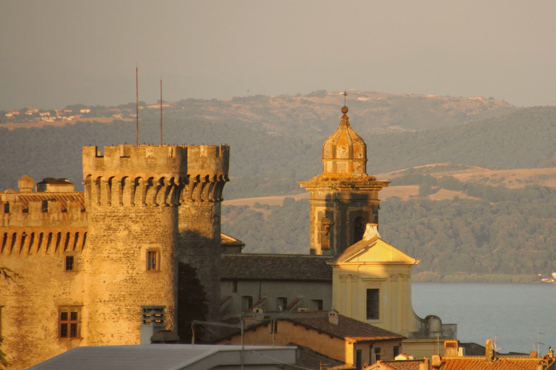
Bracciano stands at 280 meters above the southern shore of Lago di Bracciano, the volcanic crater lake known historically as Sabatino, the eighth largest in Italy. The Castello Orsini-Odescalchi was begun by Napoleone Orsini in 1470 and completed by his son Virginio Gentile in 1485; the architect was Francesco di Giorgio Martini.
It is one of the better-preserved examples of Renaissance military architecture in Italy, a five-towered pentagon on a polygonal base, with frescoes by Antoniazzo Romano and the Zuccari brothers. The Orsini lost it through debt in 1696 to Livio Odescalchi, nephew of Pope Innocent XI; the Odescalchi still own it.
Bracciano supplies a significant part of Rome's drinking water through the aqueduct that begins in the lake. The town is also a hazelnut commune, member of the Città della Nocciola network.
Tom Cruise married Katie Holmes in the castle in November 2006, which is how most people outside Italy heard of the place.
We confirmed you can reach this one by train.
What to see in Bracciano
- Castello Orsini-Odescalchi. 1470-1485 Renaissance castle, five round towers on a pentagonal plan, frescoes by Antoniazzo Romano and the Zuccari brothers.
- Lago di Bracciano. Volcanic crater lake, eighth largest in Italy at 57 square kilometers, source of part of Rome's drinking water.
- Centro storico. Medieval town below the castle walls, organized in concentric rings around the rocca, with two surviving medieval gates.
How to get to Bracciano
There is a railway station in the town, so you can arrive without a car and never need one while you are here. Roma is roughly 58 minutes away by road.
Our tip
April through October is the lake season. May and June bring the warmest weather without the August crowd from Rome; the shore villages of Anguillara and Trevignano fill on weekends and empty mid-week. July and August are hot and busy.
Anguillara Sabazia
Why visit Anguillara Sabazia
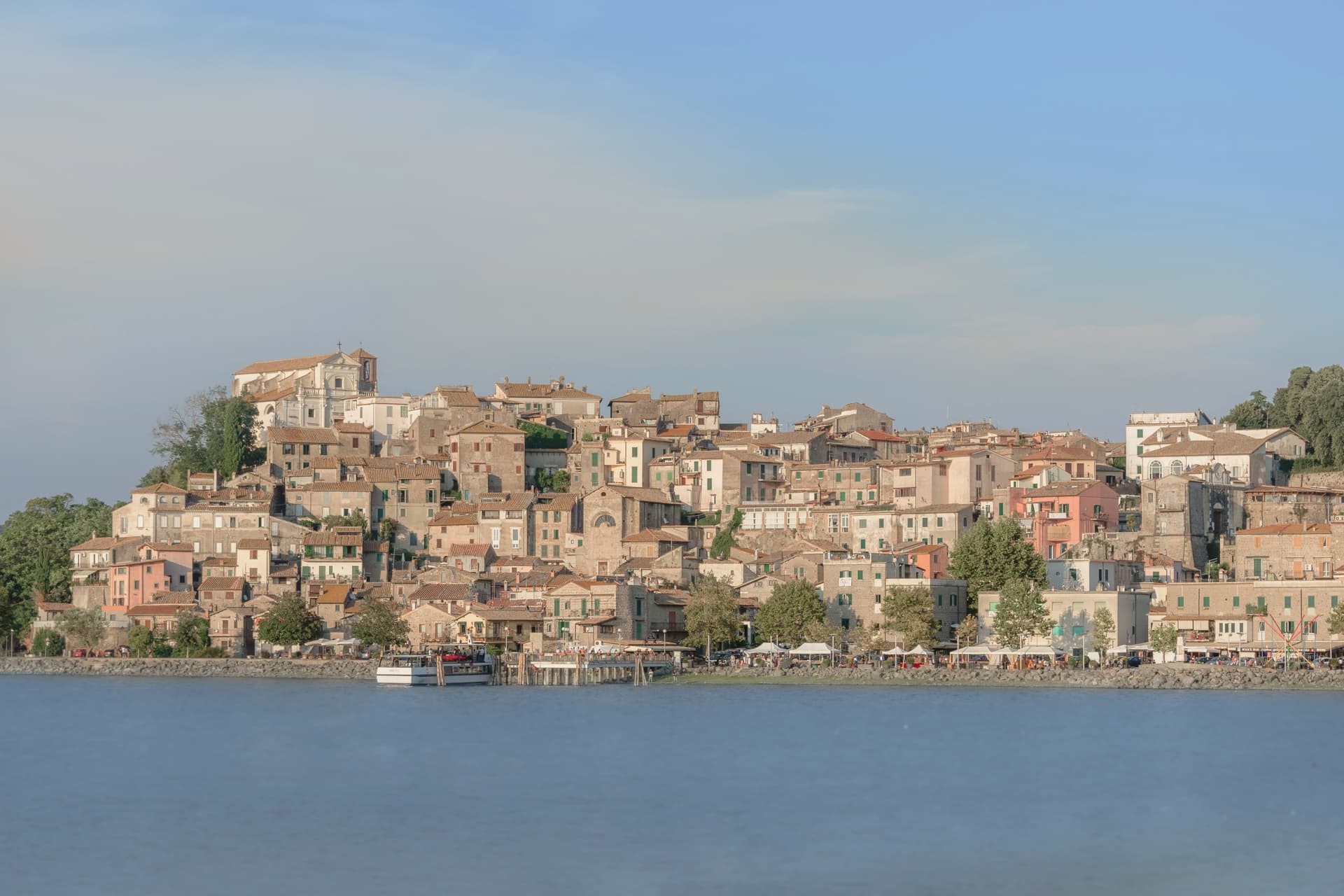
Anguillara Sabazia sits on a small volcanic cape that pushes into Lake Bracciano from the southern shore, twenty-five kilometers northwest of Rome. The medieval town climbs from the lake on stepped streets to the Porta Maggiore and the Collegiata di Santa Maria Assunta at the top.
The setting is older than the medieval town: La Marmotta, a few hundred meters offshore from the cape, is one of the oldest underwater archaeological sites in Europe, an Early Neolithic lakeshore village dated to 5700 BC, with preserved wooden canoes and grain stores in the lakebed mud. The Romans came later: Rutilia Polla, a Roman patrician, owned a villa on the cape in the first century BC, and the modern town name carries the surname of the medieval Anguillara family who took the place after the empire.
Anguillara is one of three communes on Lake Bracciano with Bracciano and Trevignano, and it is the closest to Rome of the three.
We confirmed you can reach this one by train.
What to see in Anguillara Sabazia
- Porta Maggiore e centro storico. Medieval gate and stepped town climbing from the lakefront on the volcanic cape, with stone streets converging on the upper piazza.
- Collegiata di Santa Maria Assunta. Main church at the top of the cape, rebuilt in the sixteenth century on earlier foundations, with views over the lake from the parvis.
- Lungolago e cape. Lakefront promenade and small beaches along the cape, with views east to Trevignano and west to Bracciano across the volcanic basin.
How to get to Anguillara Sabazia
There is a railway station in the town, so you can arrive without a car and never need one while you are here. Roma is roughly 50 minutes away by road.
Our tip
April through June and September through October are the strong months. The cape is exposed and the wind off the lake keeps the temperature mild even in warm weeks. July and August are hot, around thirty degrees, and the lakefront fills on weekends with Romans driving up for a swim and grilled coregone. Sagra delle Pizzòle falls in August.
Cerveteri
Why visit Cerveteri
Cerveteri sits on a tufa outcrop at 81 meters above the coastal plain, seven kilometers inland from the Tyrrhenian and thirty-five northwest of Rome. The Etruscans called it Caisra, the Greeks Agylla, the Romans Caere; at its height around 600 BC it covered fifteen times the area of the modern town and held an estimated 25,000 to 40,000 people, the equal of Tarquinia at the peak of Etruscan power.
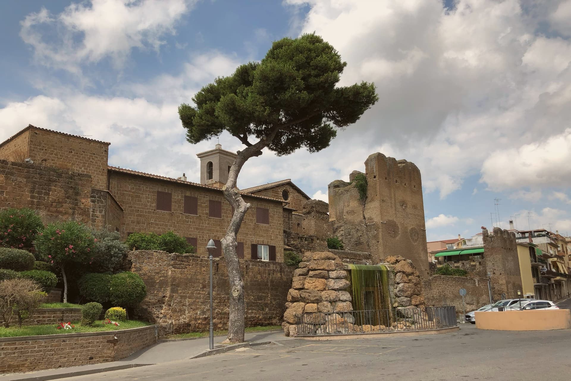
The medieval town inherited the central plateau and was renamed Caere Vetus, the Old Caere, to distinguish it from the coastal Caere Novum that no longer exists. The Castello Ruspoli at the centre of the medieval town encloses sections of fourth-century BC Etruscan walls in its base.
Two kilometers north, the Banditaccia necropolis covers 400 hectares of which 10 are visitable, with around 1,000 rock-cut tombs and the great earth tumuli that gave Etruscan funerary architecture its most concentrated expression. It joined the UNESCO list with Tarquinia in 2004.
We confirmed you can reach this one by train.
What to see in Cerveteri
- Necropoli della Banditaccia. UNESCO Etruscan necropolis 2 km north of town, covering 400 hectares with around 1,000 tombs and the great earth tumuli that defined Etruscan funerary architecture.
- Museo Nazionale Cerite. National Etruscan museum inside the Castello Ruspoli, with sarcophagi, ceramics and grave goods recovered from the Banditaccia tombs.
- Castello Ruspoli. Medieval Orsini-Ruspoli fortress at the centre of the old town, with fourth-century BC Etruscan walls preserved in its base.
How to get to Cerveteri
There is a railway station in the town, so you can arrive without a car and never need one while you are here. Roma is roughly 50 minutes away by road.
Our tip
May through September is the strongest window. The Banditaccia tumuli need open ground and clear weather; April and October are workable but rain blurs the rock-cut interiors. Summer crowds concentrate on the coastal section of the comune around Marina di Cerveteri and Cerenova, leaving the necropolis quieter than the dates would suggest. Festa della Birra falls in August.
Nettuno
Why visit Nettuno
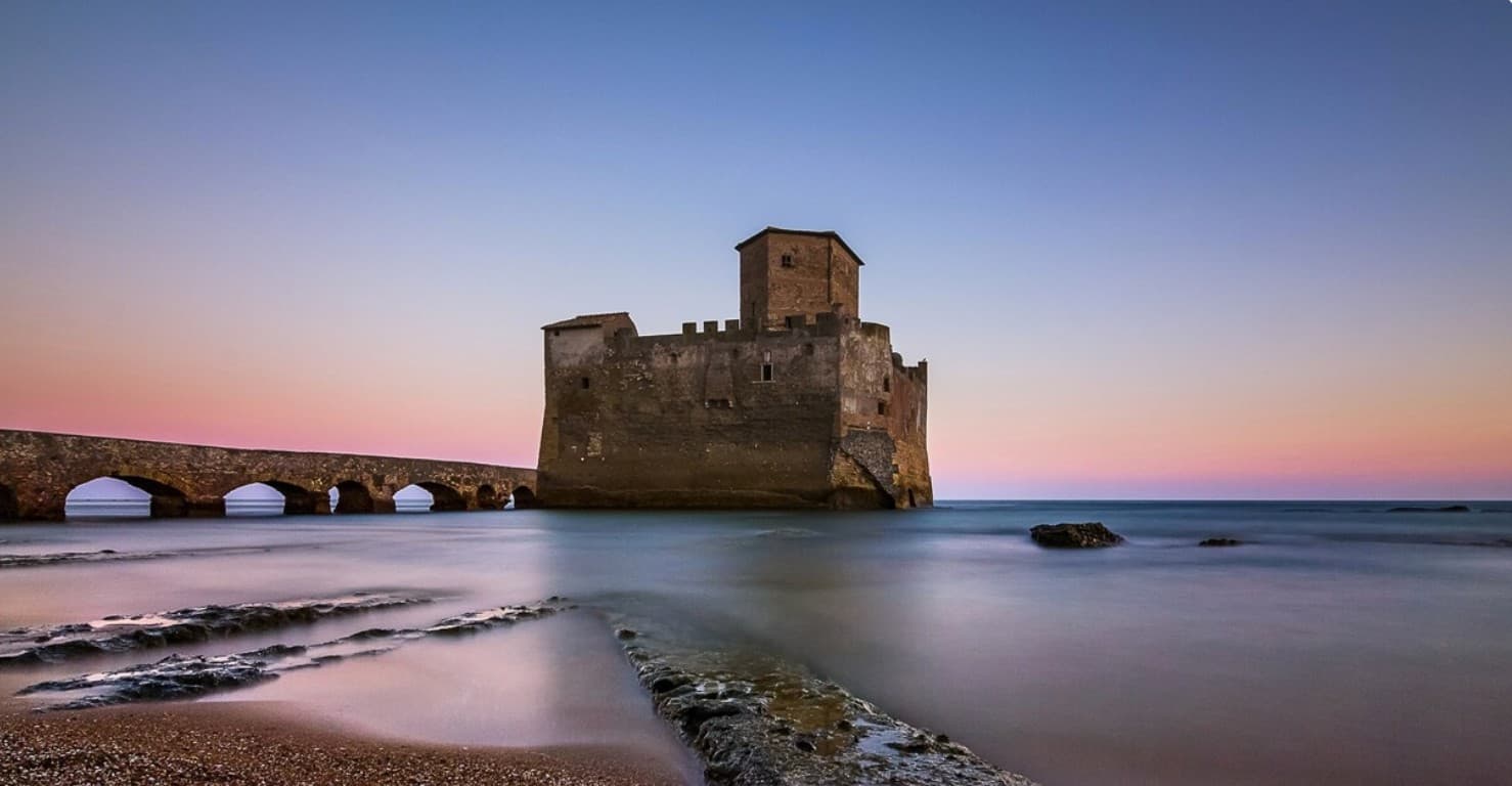
Nettuno is the half of the old Antium coast that kept its walls. The Borgo Medievale stands on a low spur above the beach, ringed by round towers from the 1300s, its lanes and small squares still lived in.
A short walk along the shore, Antonio da Sangallo the Elder built the Forte Sangallo for the Borgia between 1501 and 1503, when Nettuno was the fortified granary of the Lazio coast; it now holds the town's Antiquarium and the Museo dello Sbarco Alleato. That museum is here because of 22 January 1944, when Allied troops came ashore at Anzio and on the beaches running south from Nettuno to Torre Astura.
More than 7,800 American soldiers lie in the Sicily-Rome American Cemetery at the edge of town, and the baseball the troops taught afterwards stayed: the Steno Borghese is the largest baseball stadium in Italy. In summer the town fills from Rome for the beaches and the long evening walk on the lungomare, and the local white is Cacchione, from Bellone grapes.
We confirmed you can reach this one by train.
What to see in Nettuno
- Borgo Medievale. The walled old town on a spur above the beach, ringed by round towers from the 1300s, with the Palazzo Baronale and the church of San Giovanni among its lanes and small squares.
- Forte Sangallo. Square fortress with four corner bastions, built between 1501 and 1503 by Antonio da Sangallo the Elder to guard the coast. It houses the Antiquarium and the Museo dello Sbarco Alleato.
- Santuario di Nostra Signora delle Grazie e Santa Maria Goretti. Passionist sanctuary at the end of the lungomare, rebuilt in 1914. The crypt holds Maria Goretti, who died in Nettuno in 1902, and the church keeps the wooden Madonna delle Grazie.
How to get to Nettuno
There is a railway station in the town, so you can arrive without a car and never need one while you are here. Roma is roughly 76 minutes away by road.
Our tip
May through September is the season on this coast. June and September are the best months: the sea is warm and Rome's weekend crowds are thinner than in high summer. July and August are hot and full, with the lungomare busy until late.
Velletri
Why visit Velletri
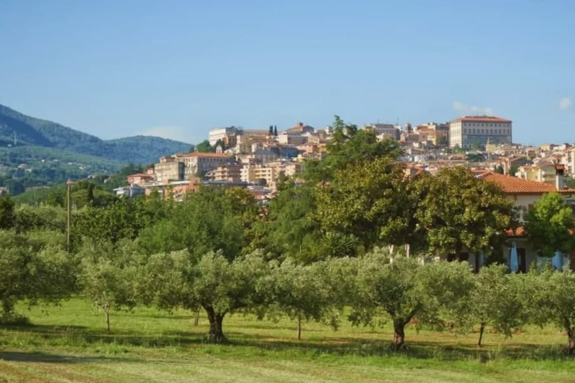
The town sits at 332 meters, thirty-five kilometers from Rome, on the southeastern rim of a volcanic ring of craters and lakes. Before it was a papal possession and a diocesan seat, it was a Volscian stronghold, and before that the home ground of the Octavii, the paternal family of the man who became Augustus: Suetonius records a street here called Octavian and an altar consecrated by an Octavius, and the future emperor passed his childhood in the town under its old name, Velitrae.
That layering, Volscian settlement, imperial family seat, papal diocese, is what the center still shows once the war is accounted for: an army broke through a German defensive line here in May 1944, and much of the town was destroyed in the process. What stands now above the old piazza and around the rebuilt town hall is largely reconstruction fitted around what survived, with a wine trade going back to the volcanic soil that predates all of it.
A town whose name changed twice, whose family produced an emperor, and whose center was rebuilt from a battle line, but whose vineyards on the same slopes never stopped being the constant.
We confirmed you can reach this one by train.
What to see in Velletri
- Torre del Trivio. 50-meter Romanesque bell tower from the 14th century, the only structure to come through the 1944 bombing intact, still the shape by which the town is recognized from a distance.
- Palazzo Comunale. Renaissance town hall designed by Giacomo Della Porta, rebuilt after wartime damage, facing the piazza named for the emperor born to the town.
- Cattedrale di San Clemente. Cathedral seat of the suburbicarian Diocese of Velletri-Segni, a title held today by the Dean of the College of Cardinals.
How to get to Velletri
There is a railway station in the town, so you can arrive without a car and never need one while you are here. Latina is roughly 35 minutes away by road.
Our tip
April through June brings the Alban Hills at their greenest, vineyards in leaf, and mild evenings on the piazzas. September and October are the wine months: the Festa dell'Uva, one of the oldest grape festivals in Italy, runs in the first week of September. July and August are hot in the lower town and at their best after sunset, when the volcanic slopes hold the breeze. Calici sotto le stelle falls in August.
Tivoli
Why visit Tivoli
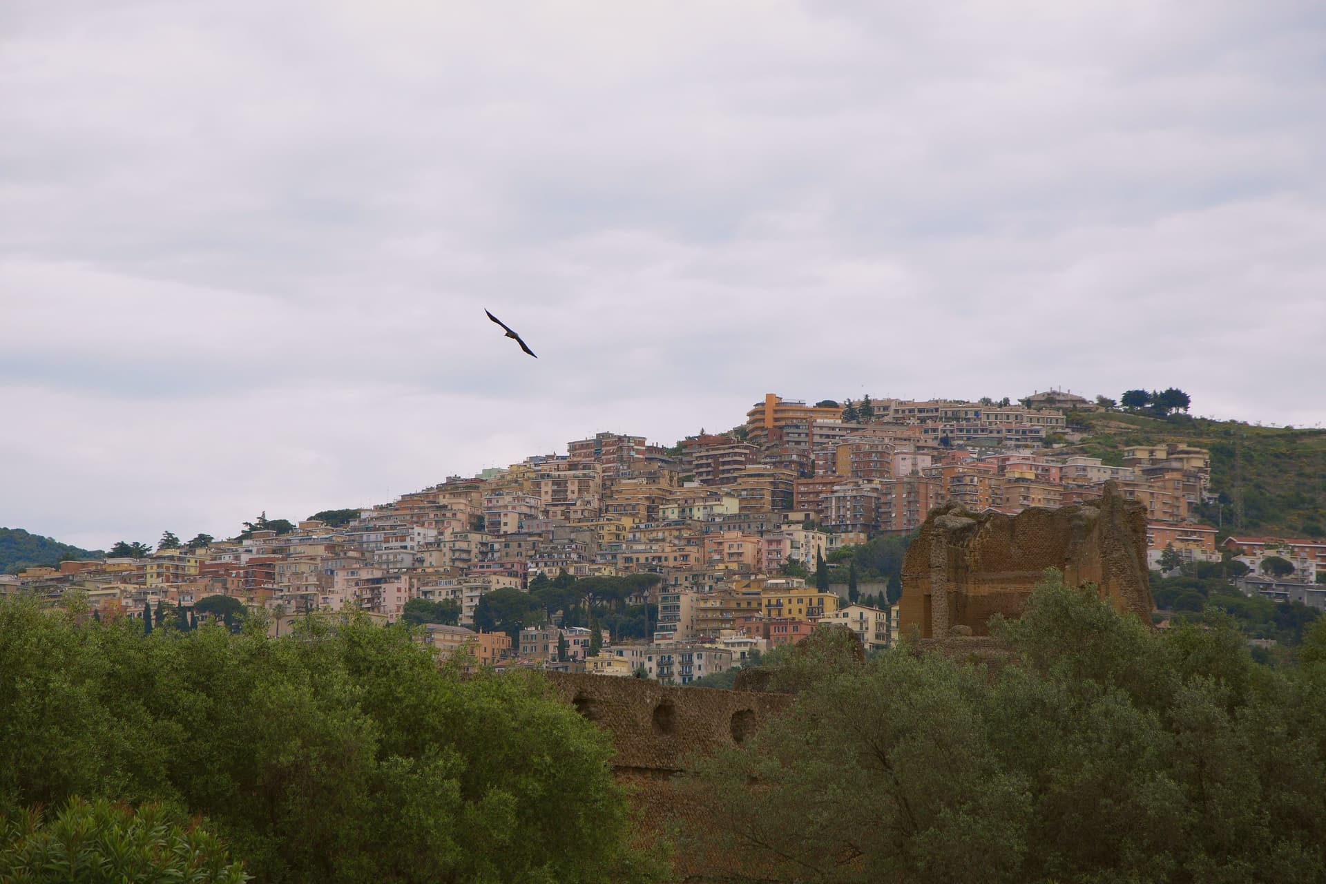
Tivoli sits at 235 meters on the Aniene where it drops 120 meters off the Tiburtini hills, twenty-five kilometers east of Rome. The Romans called it Tibur and built it up as their summer station; the moneyed classes carried on building here for two thousand years afterward.
Two of those projects became UNESCO sites, listed separately despite standing close together. Hadrian's estate, four kilometers below town, covers 120 hectares with the remains of thirty monumental buildings the emperor built between 117 and 138 AD to recreate the architectural memories of Egypt, Greece and Asia Minor.
The Renaissance garden inside the upper town was laid out from 1550 onward for a cardinal of the Este family; its grounds carry 51 fountains powered entirely by gravity from the Aniene. The cardinal stripped much of the marble from Hadrian's estate to decorate his own grounds, so the imperial villa on the plain and the garden in the upper town are bound together by more than proximity: one was quarried to build the other.
Below them both, the Villa Gregoriana park drops into the gorge where the river was diverted in 1832 to create the 120-meter Cascata Grande. The travertine quarries that built Rome are still working in the plain below.
The upper town, the lower estate, and the gorge between them form a single continuous cut through two thousand years of building, borrowing, and quarrying around the same fall of water.
We confirmed you can reach this one by train.
What to see in Tivoli
- Villa d'Este. The fountains step down the hillside in tiers, fed by nothing but gravity, so the sound of falling water carries through the whole garden. Cardinal Ippolito d'Este stripped much of the marble for it from Hadrian's villa down the hill.
- Villa Adriana. The remains of thirty monumental buildings spread across the Tiburtine plain, among them the Canopo and the Teatro Marittimo, a walled island retreat inside the larger estate.
- Villa Gregoriana. The park drops into the gorge cut by the Aniene, where the river was diverted through Monte Catillo to feed the fall below town.
How to get to Tivoli
There is a railway station in the town, so you can arrive without a car and never need one while you are here. Roma is roughly 31 minutes away by road.
Our tip
April through June and September through October are when the Aniene gardens look the way Cardinal Ippolito wanted them to. The Villa d'Este fountains run hardest in spring after the winter rains; the Villa Adriana hectares are walkable in shoulder weather without burning. July and August touch the upper thirties and the unshaded ruins at Villa Adriana become punishing by mid-morning; the gorge at Villa Gregoriana stays cooler. Festa dell'Inchinata falls in August.
More from Anywhere Italy
 The best towns you can reach by train within an hour of Rome
- The best towns you can reach by train that eat well within 90 minutes of Roma
 The best towns inside a nature park in the province of Roma
- The best towns that eat well within an hour of Rome
- The best hill towns in the province of Roma
 The best hill towns you can reach by train within 90 minutes of Roma