
The best lake towns within two hours of Turin
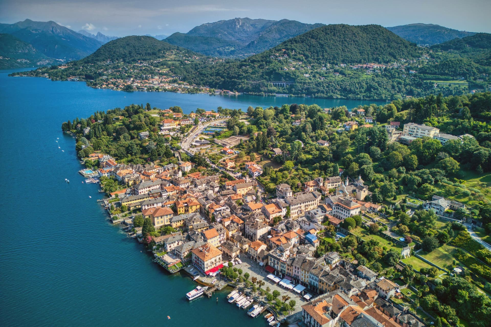
The lakes above Turin start where the plain gives out and the Alps begin, and the change is abrupt: rice fields, then a wall of green hills, then water the colour of slate. The houses are built from the local granite and beola quarried around Baveno and Mergozzo, pale grey with iron balconies, and the gardens hold camellias, azaleas and magnolias that flower from March. Lake perch fried in butter and folded into risotto is the standard dish on the water, along with missoltini on the Lombard side and Ossola cheeses from the valleys behind. Late spring and September are the good months, when the ferries still run and the lakefront promenades are open to the evening.
The obvious move is the Borromean Islands, and there is nothing wrong with the reasoning: Isola Bella's terraced garden and the palace above it are among the great baroque set pieces in Italy. The boats leave all day through summer, the queues on the jetties are long, and the island lanes are narrow enough that a full ferry fills them. Most visitors arrive from Milan, do the crossing, eat lunch on the water and leave, which concentrates everyone into the same few hours and the same short stretch of shoreline.
The lakes carry on well past that stretch. The same granite quays, the same ferry timetable and the same perch continue north towards the Ossola valleys, west into the quieter basin of Orta, and south to where the Ticino leaves the lake at Sesto Calende. The towns below sit on the water, fewer people stop in them, and all of them are within a couple of hours of Turin.
Of the 83 communes we have mapped in a 120-minute drive of Turin, 11 qualify as lake towns: each sits on the water. This list is 10 of them. The smallest, Belgirate, has 473 residents.
If you are still choosing, we have also written The best lake towns you can reach by train in Piemonte and The best lake towns that eat well within 90 minutes of Novara.
Orta San Giulio
Why visit Orta San Giulio
The town occupies a promontory pushed into the eastern shore of the lake, facing the small island 275 meters long and 140 meters wide. The two are close enough that the island reads as an extension of the town rather than a separate place, and a five-minute motorboat from the piazza is the only way across.
The old town holds three Tier-A signals at once: Borghi più belli, Bandiera Arancione, and the UNESCO inscription of 2003. The relationship between the three parts of the town explains how it works: the waterfront square and its lanes sit at lake level, facing the island directly across the water, while the hill above holds the devotional complex, reached by climbing away from the shore rather than along it.
Piazza Motta was also the seat of the Comunità della Riviera di San Giulio, an autonomous federation of lake towns that survived from the Middle Ages to the mid-eighteenth century, which is why the square, not the hill or the island, was built as a civic center. What results is a town in three registers at once: civic life at the water's edge, monastic life offshore, and devotional life on the hill above, each occupying its own ground and visible from the others.
The town sits on the water, at 294 metres.
What to see in Orta San Giulio
- Basilica di San Giulio. Serpentine ambo inside and a silver shrine dated 1697. Reached by boat, the basilica stands close to the water's edge, the focal point of the view from every point on the promontory.
- Piazza Motta and Palazzo della Comunità. The broletto's arcades face the water directly, and the square narrows toward the boat landing where the crossing to the island begins.
- Sacro Monte di Orta. The chapels climb the wooded hillside in sequence, each framing a scene, with the town and the lake opening up in views between them as the path gains height.
How to get to Orta San Giulio
There is a railway station in the town, so you can arrive without a car and never need one while you are here. Novara is roughly 46 minutes away by road.
Our tip
April through June brings the Sacro Monte chapels into the chestnut shade and the lake water warm enough for the open-air bars on Piazza Motta. July and August fill the ferry to the island and the piazza turns over by the hour; the centro pedestrian zone slows to a queue at lunch. September and October are the clearest window: low light on the basilica across the water, fewer day-trippers from Milano, and the Sacro Monte path almost empty after eleven.
Mergozzo
Why visit Mergozzo
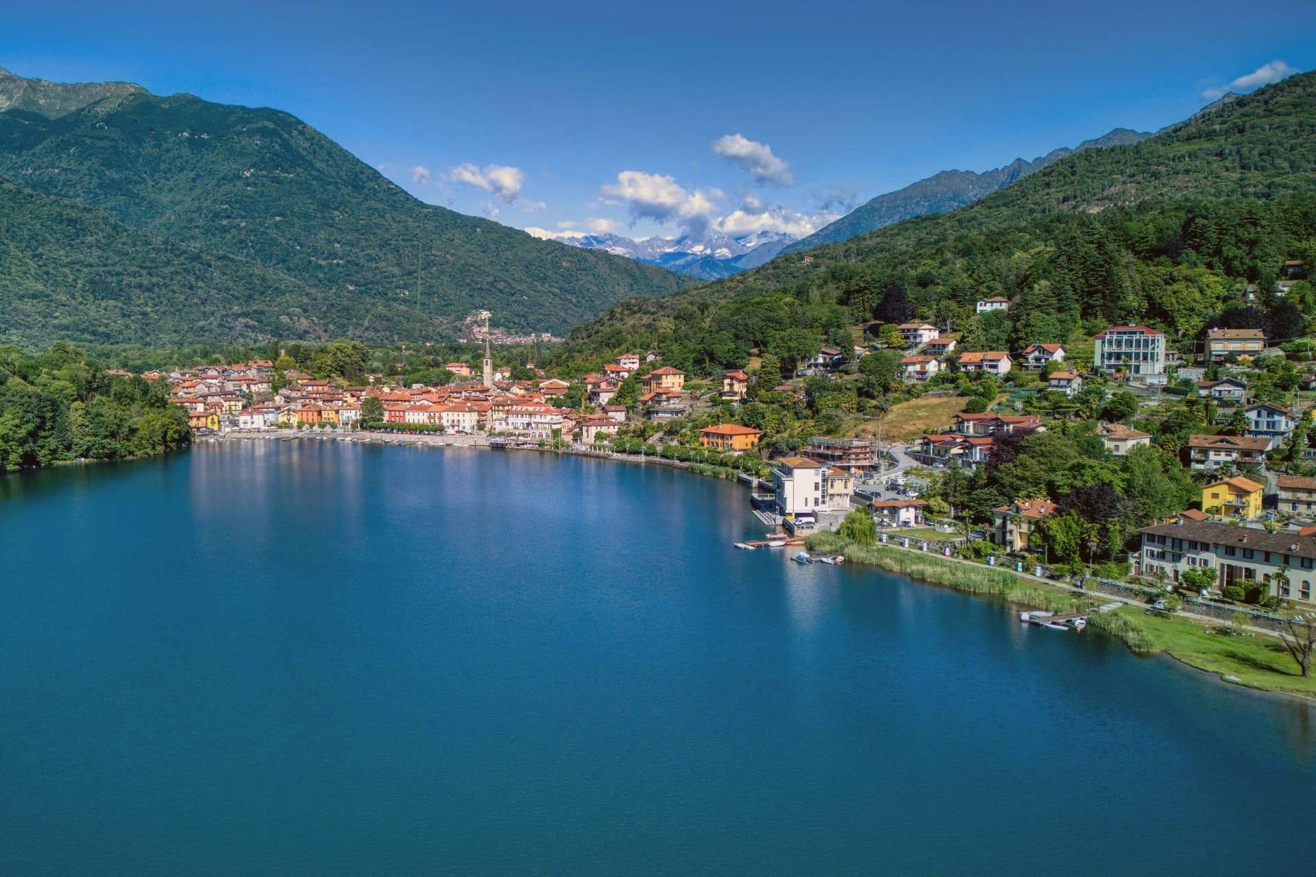
The lake is 74 meters deep and sits at 204 meters, separated in antiquity from its larger neighbor when sediment from the Toce river closed the channel between them. The village faces the water from the western shore, folded behind a lakefront piazza where the parish church holds a painting from 1623 already showing the elm that gives the square its character.
Behind the piazza, narrow stone-paved lanes called strece climb toward terraced gardens, the houses built of the same granite quarried on neighboring Montorfano hill. Stone has long been the local economy, tying Mergozzo to the wider region: the same quarries that cut the lanes' paving supplied material used in Rome and across northern Italy.
Trailheads above the village lead into Val Grande, so the same slopes that shelter the piazza from behind also open, higher up, onto one of the wildest valley systems in the Alps. What holds the place together is this stacking of scales: a small, closed-off lake at the bottom, a worked hillside of stone above it, and beyond that, wilderness.
The town sits on the water, at 204 metres.
What to see in Mergozzo
- L'Olmo di Mergozzo. Hollow-trunked field elm on the lakefront piazza, still standing and shading the square it has watched over for generations.
- Lago di Mergozzo. 2.5 km lake separated from Lago Maggiore by Toce sediment, motorboat-free and ranked among Europe's cleanest waters.
- Centro storico. Stone-paved lanes (strece) and granite houses climbing the slope behind the lakefront piazza.
How to get to Mergozzo
There is a railway station in the town, so you can arrive without a car and never need one while you are here. Novara is roughly 67 minutes away by road.
Our tip
April through June and September into October are the months the lakefront works best: mild water, open trattorie and Val Grande trails clear of snow but cool enough to walk. July and August fill the small beach and the parking lots, though Mergozzo never reaches the volume of nearby Stresa on Maggiore. November through March is quiet.
Ghiffa
Why visit Ghiffa
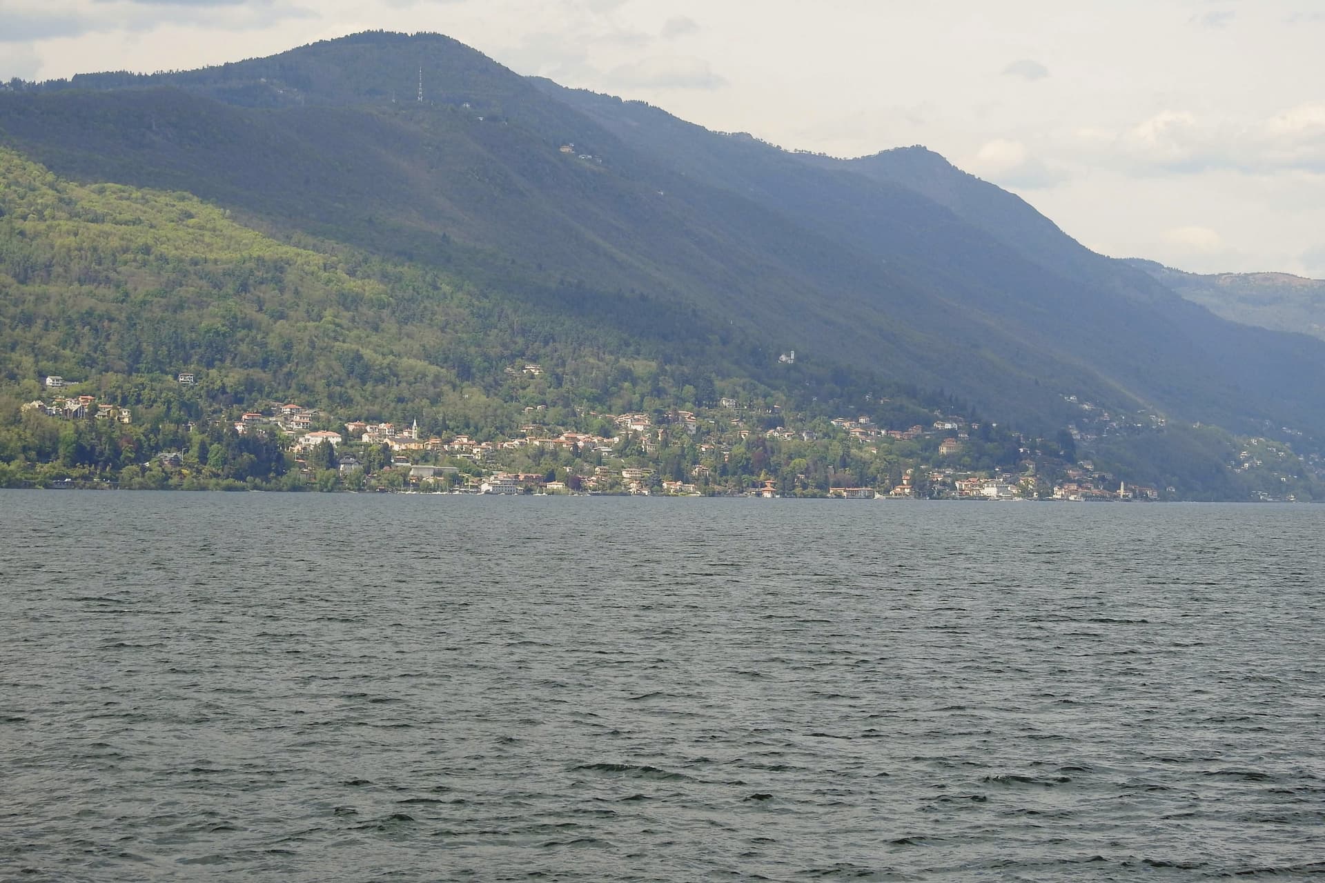
Ghiffa runs along the west shore of Lake Maggiore between Verbania and Cannobio, a strip of lakefront at 201 meters facing the Lombard side of the lake. Above the village, at 360 meters on the slope of Monte Carciago, the ground rises to the Sacro Monte della SS.
Trinità, inscribed by UNESCO in 2003 among the nine Sacri Monti of Piemonte and Lombardia. The village below and the sanctuary above form the two halves of Ghiffa: one built on the lake trade and the ferry crossings to the Lombard shore, the other set apart in woodland on the mountain.
From 1879 the Panizza hat factory turned Ghiffa into one of Europe's hat-making centers, and the trade employed most of the village for a century before the factory closed. What is left of that trade sits in the same lakefront ground the sanctuary looks down on: a village shaped as much by an industry that has ended as by the devotional complex that has outlasted it.
The town sits on the water, at 201 metres.
What to see in Ghiffa
- Sacro Monte della SS. Trinità. Sanctuary plus three chapels and porticoed Stations of the Cross set in a 200-hectare reserve, built around an older medieval chapel.
- Museo dell'Arte del Cappello. Lakefront museum in the former factory building, holding molds, stamps, and records from a century of Ghiffa hat-making, including the Borsalino style made and exported here.
- Riserva Naturale del Sacro Monte. Two hundred hectares of beech and chestnut woods around the sanctuary, with marked trails to Cappella del Porale at 470 meters.
How to get to Ghiffa
There is a railway station in the town, so you can arrive without a car and never need one while you are here. Novara is roughly 75 minutes away by road.
Our tip
April through October is the lake season. May and June bring the wisteria along the lakefront and clear days on the Sacro Monte. September and October are dry, with the sanctuary's chestnut woods turning and the ferry schedule still running.
Stresa
Why visit Stresa
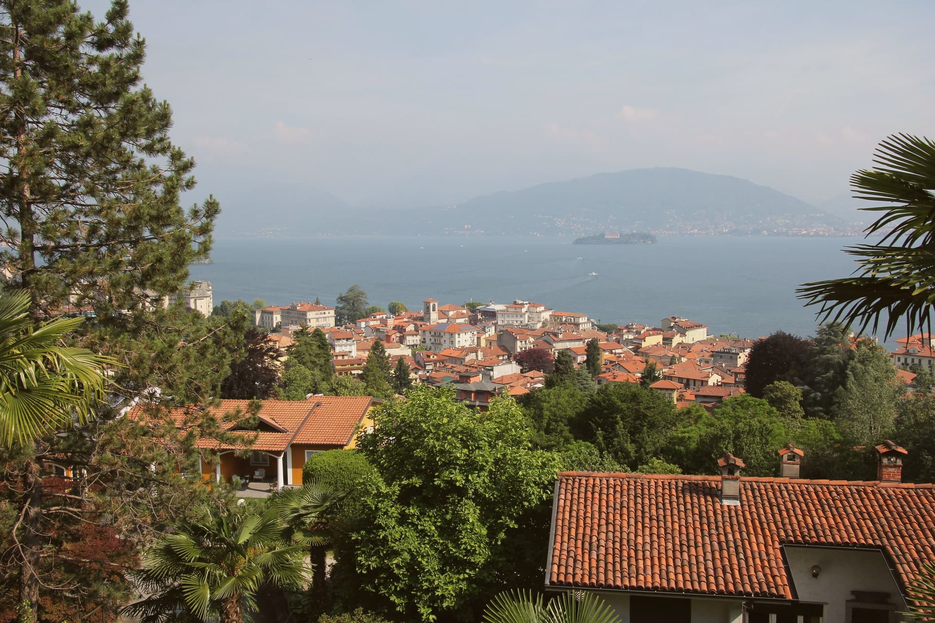
Stresa sits at 200 meters on the western shore of Lake Maggiore, ninety kilometers north of Milano on the line of the Simplon railway. The town first appears in documents in 998, as Strixsya.
From the seventeenth century the lake stage here belonged to the Borromeo family: the palazzo on what had been called l'isola inferiore was begun in 1632, the island renamed after its patron's wife. The other two islands of the group lie 400 meters offshore alongside it, reached by regular ferry from the two town piers, one still inhabited, one given to its park.
Villa Pallavicino, established 1855, sits apart from this cluster on the southern edge of town, its own botanical and wildlife ground answering the islands' gardens without belonging to the same estate. The town's other identity, as a resort, dates to 1863 and the lakefront hotel building that opened international tourism here, later drawing the festival that has filled the town each late summer since 1962.
What Stresa amounts to is a small lake shore town organized almost entirely around water it faces rather than land it occupies: the islands offshore, the piers that reach them, and a lakefront built for arrival rather than settlement.
The town sits on the water, at 200 metres.
What to see in Stresa
- Isola Bella. The island sits close to the town piers, its terraced Baroque gardens rising in tiers above the water and the palazzo facing the lakefront directly.
- Isola Madre. The largest of the group, given over almost entirely to its park: paths through subtropical planting and glimpses of the villa between the trees.
- Isola dei Pescatori. The one island still lived in year-round, its lanes narrow between the houses and the trattorie facing the water where the fishing boats once worked.
How to get to Stresa
There is a railway station in the town, so you can arrive without a car and never need one while you are here. Novara is roughly 57 minutes away by road.
Our tip
April through June is the green window on Lake Maggiore: Isola Bella's terraced gardens in flower, the ferries running full timetable, and the lakefront promenade open without the August press. July and August are warm and crowded; the centro empties between two and four in the afternoon heat, and the islands fill on day trips from Milano. The Settimane Musicali run from late August into September, the busiest cultural weeks of the year.
Baveno
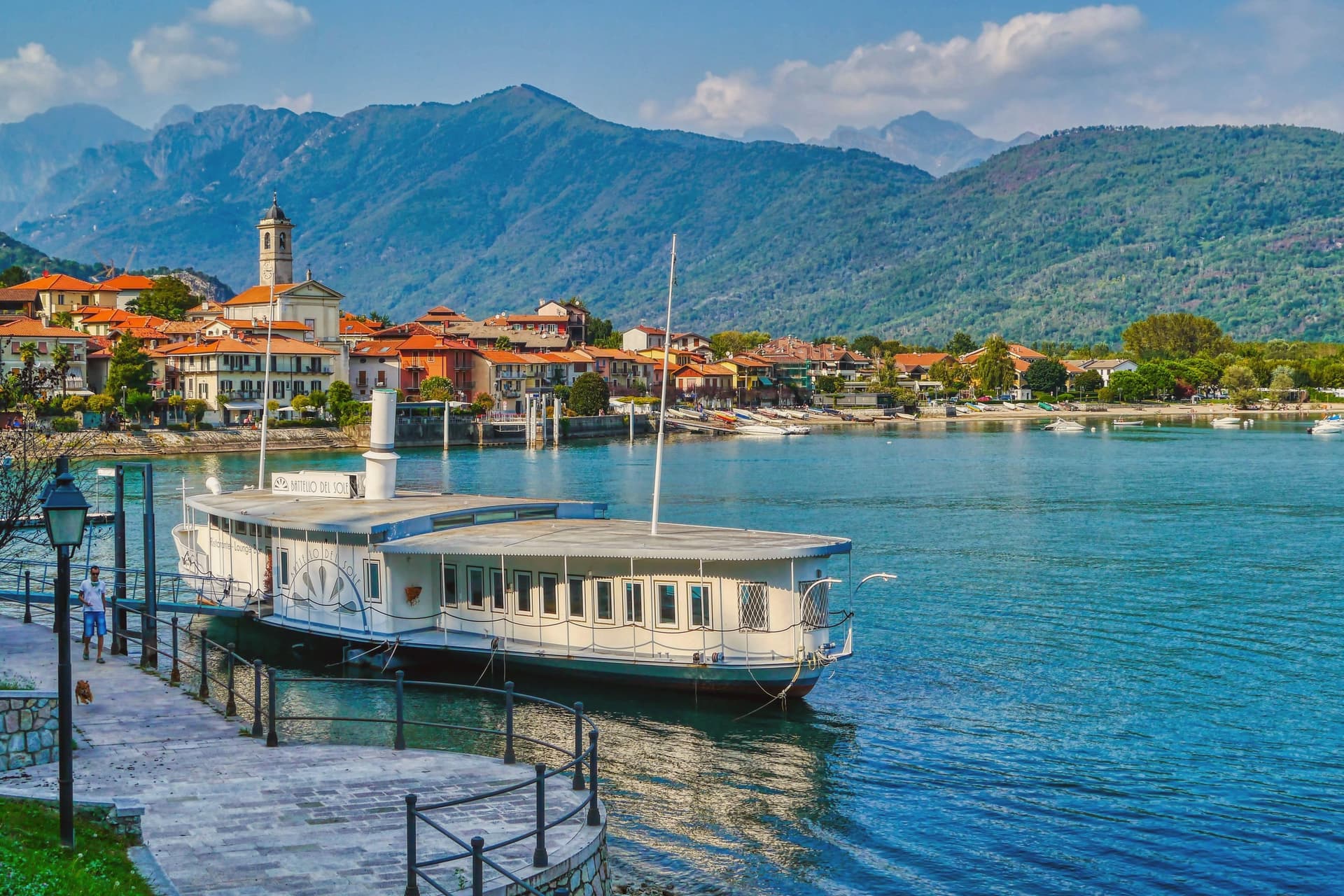
Why visit Baveno
Baveno sits at 205 meters on the west shore of the lake, twenty-one kilometers north-west of Arona. The town was occupied in the Iron Age by the Lepontii, a tribe of the Ligures, before the Romans reached the lake, and its historic core still gathers around the raised church and its baptistery above the shore road.
To the north-west, the granite quarries have cut into the hillside since the early sixteenth century, and the stone they produced left Baveno for Milan and Rome, built into a cathedral, a basilica, and a shopping gallery. Along the water, a line of nineteenth-century villas marks the period when Lake Maggiore became a fixed point on the European Grand Tour, and from that same shore the Isole Borromee sit a ten-minute ferry away, close enough that the gulf reads as one continuous view rather than a lake and its islands.
The town's quarries built landmarks elsewhere while its own shore stayed a place people came to look at the water.
The town sits on the water, at 205 metres.
What to see in Baveno
- Chiesa dei Santi Gervasio e Protasio. The two Romanesque buildings, church and baptistery, form the religious centre of the historic core, raised above the road that runs along the water.
- Cave di Granito Rosa. The quarries lie north-west of town, cut into the hillside, the source of stone that traveled to two large churches and a shopping gallery.
- Golfo Borromeo. The gulf opens out between Baveno and Stresa, the water broken by three islands, Isola Bella, Isola dei Pescatori and Isola Madre, each reachable within minutes.
How to get to Baveno
There is a railway station in the town, so you can arrive without a car and never need one while you are here. Novara is roughly 55 minutes away by road.
Our tip
April through June and September into October are the best months on the Borromean Gulf. The lake stays cool, the ferries to Isola Bella run a full timetable, and the lakeside promenade carries traffic without congestion. July and August are warm and crowded: full hotels, restaurant queues, and ferry decks pressed shoulder to shoulder on the short hop from Stresa.
Angera
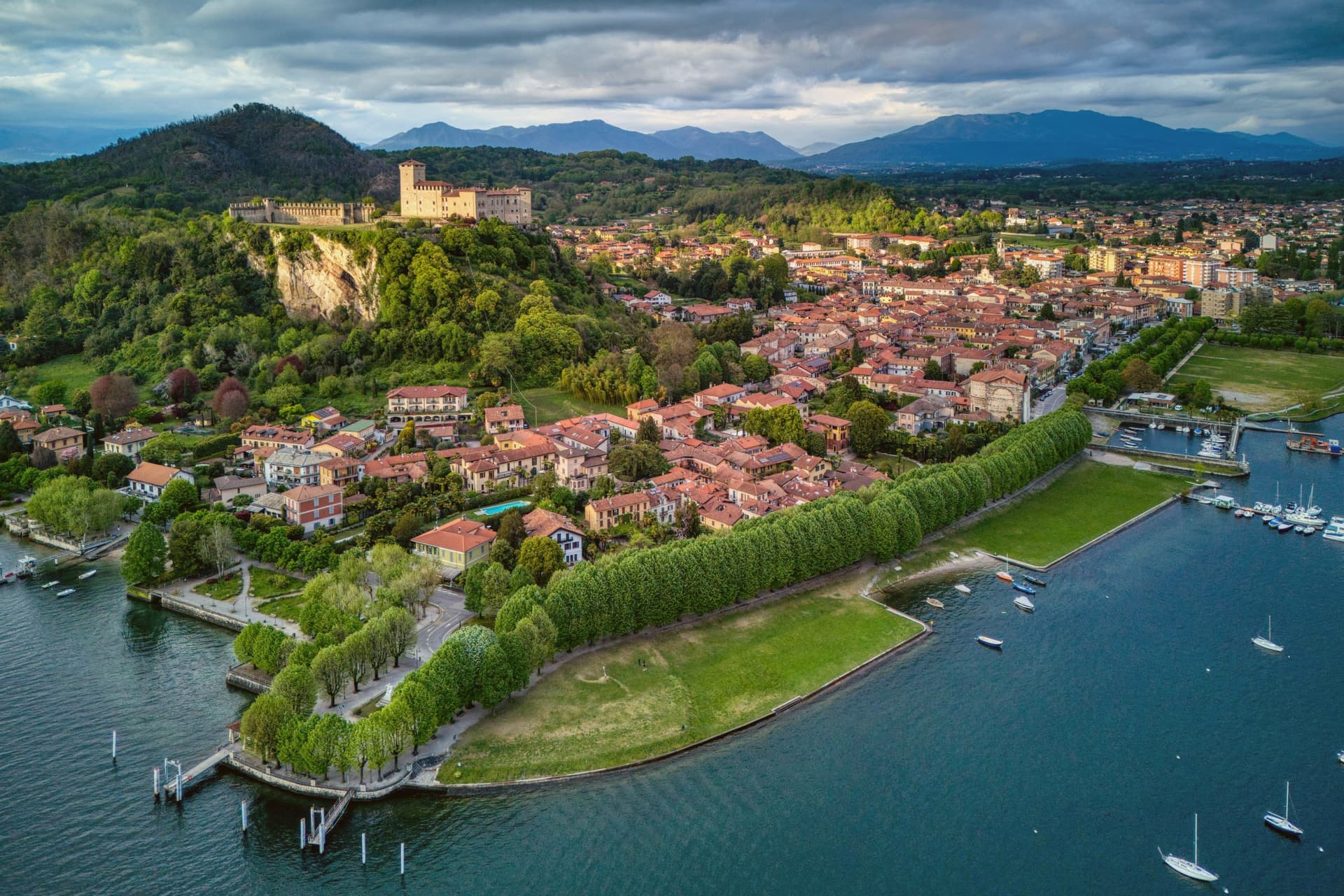
Why visit Angera
The town sits on the southern shore of Lake Maggiore, facing Arona directly across the water on the Piedmontese side. The two towns read as a pair, close enough that the crossing between them is a short ferry ride rather than a journey, and the view from the promenade is framed by that opposite shore as much as by the lake itself.
The town's built order rises from the water: harbor and promenade at lake level, then the limestone bluffs behind them, then the castle on its spur above everything, with the Caves of Bògia cut into the same limestone the castle stands on. The Rocca Borromea has belonged to the Borromeo family since 1449, and Justice Hall, inside it, holds one of the most important 13th-century fresco cycles in northern Italy.
The Diocesan Museum and the Doll Museum occupy the same upper rooms, so the visit to the castle moves from religious art to costume dolls without leaving the building. What this adds up to is a single vertical town: prehistoric cliff, medieval seat, and lakefront strolling ground stacked on top of each other rather than spread apart, which is why the place reads as compact and walkable next to the crowds and day-trip traffic of the lake's better-known resorts, while still holding the same family's seat of power at its summit.
The town sits on the water, at 205 metres.
What to see in Angera
- Rocca Borromea. The castle stands on a limestone spur with the lake below it on all approachable sides. Inside, the Sala della Giustizia is reached through a sequence of bare medieval rooms, so the fresco cycle opens without warning after plain stone.
- Museo Diocesano + Doll Museum. Two collections share the castle's upper rooms: medieval religious art in one wing, a run of over a thousand antique dolls in period costume in the other. The contrast between the two, armor-adjacent stonework giving way to glass cases of costume dolls, is more jarring than either collection alone.
- Lungolago di Angera. The promenade runs level along the water from the harbor to the base of the limestone bluffs, with the castle visible above for most of its length and open water toward the Piedmontese shore for the rest.
How to get to Angera
Novara is roughly 52 minutes away by road.
Our tip
April through October is the season on southern Lake Maggiore — calm lake, mild evenings, and the Rocca open daily. May and June are the best months for the gardens and the lakefront walk; July and August fill with regional tourists but Angera stays calmer than Stresa or Verbania across the lake. September and October give the best light for photography and the warmest lake water of the year.
Gozzano
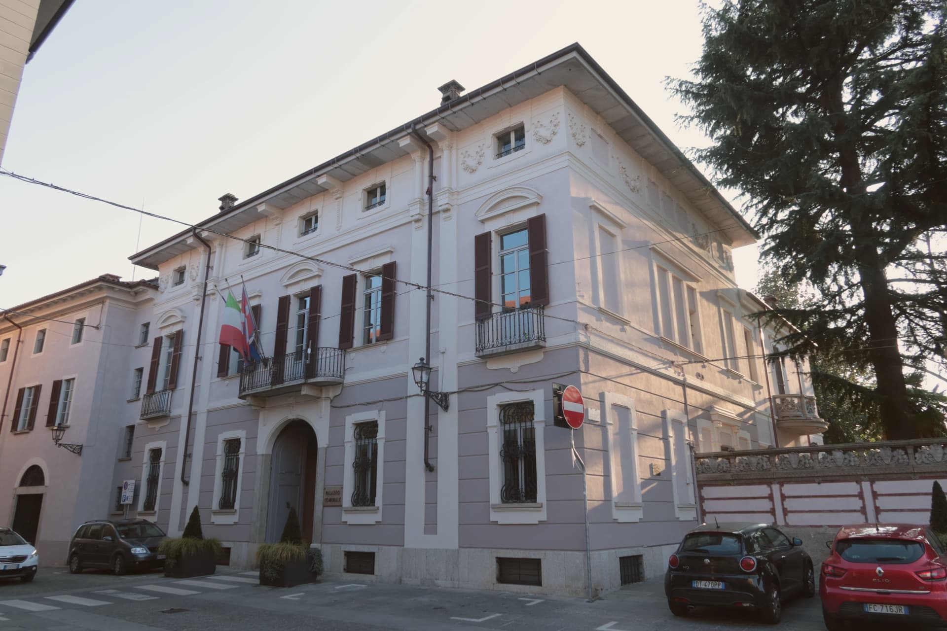
Why visit Gozzano
Gozzano sits at 367 meters above the southern tip of Lake Orta, the smaller of the Italian subalpine lakes. The Latin name Gaudianum meant 'place of enjoyment,' a Roman villa from the late imperial era.
By the fourth century the area had been evangelized by two saints who arrived together, brothers by tradition, and their memory shaped the town's religious geography for centuries after. Gozzano is the largest town on the southern Orta shore and the main road access to the lake from the Po valley, the point where travelers from the Po valley meet the water.
The basilica sits at the center of town while the lookout tower stands above it on higher ground, watching the lake rather than living beside it, one building for worship and pilgrimage, the other for defense and signaling. The lake itself holds a Bandiera Blu for water quality, one of the few inland lakes in Italy to qualify.
Together the low church and the high tower mark Gozzano as a place shaped by both the water at its feet and the routes passing over it.
The town sits on the water, at 367 metres.
What to see in Gozzano
- Basilica di San Giuliano. The bell tower dates to the eleventh century, older than the reconstruction around it. The building follows the model of the basilica on Isola San Giulio and the old Novara cathedral, a copy of a copy standing at the water's edge.
- Torre di Buccione. The tower is the remnant of a vanished castle, standing alone where walls and keep did not survive. Three internal wooden decks remain inside, a climb above the lake rather than a ruin at ground level.
- Lago d'Orta lungolago. Southern shore lakefront at 290 meters of water elevation, the gateway to Orta San Giulio and the Isola San Giulio.
How to get to Gozzano
There is a railway station in the town, so you can arrive without a car and never need one while you are here. Novara is roughly 41 minutes away by road.
Our tip
April through October is when the lake town opens. May and June bring camellias and the lake at its clearest, with the Buccione tower visible from the southern lungolago. September and October are dry and the chestnut woods on the surrounding hills turn.
Laveno-Mombello
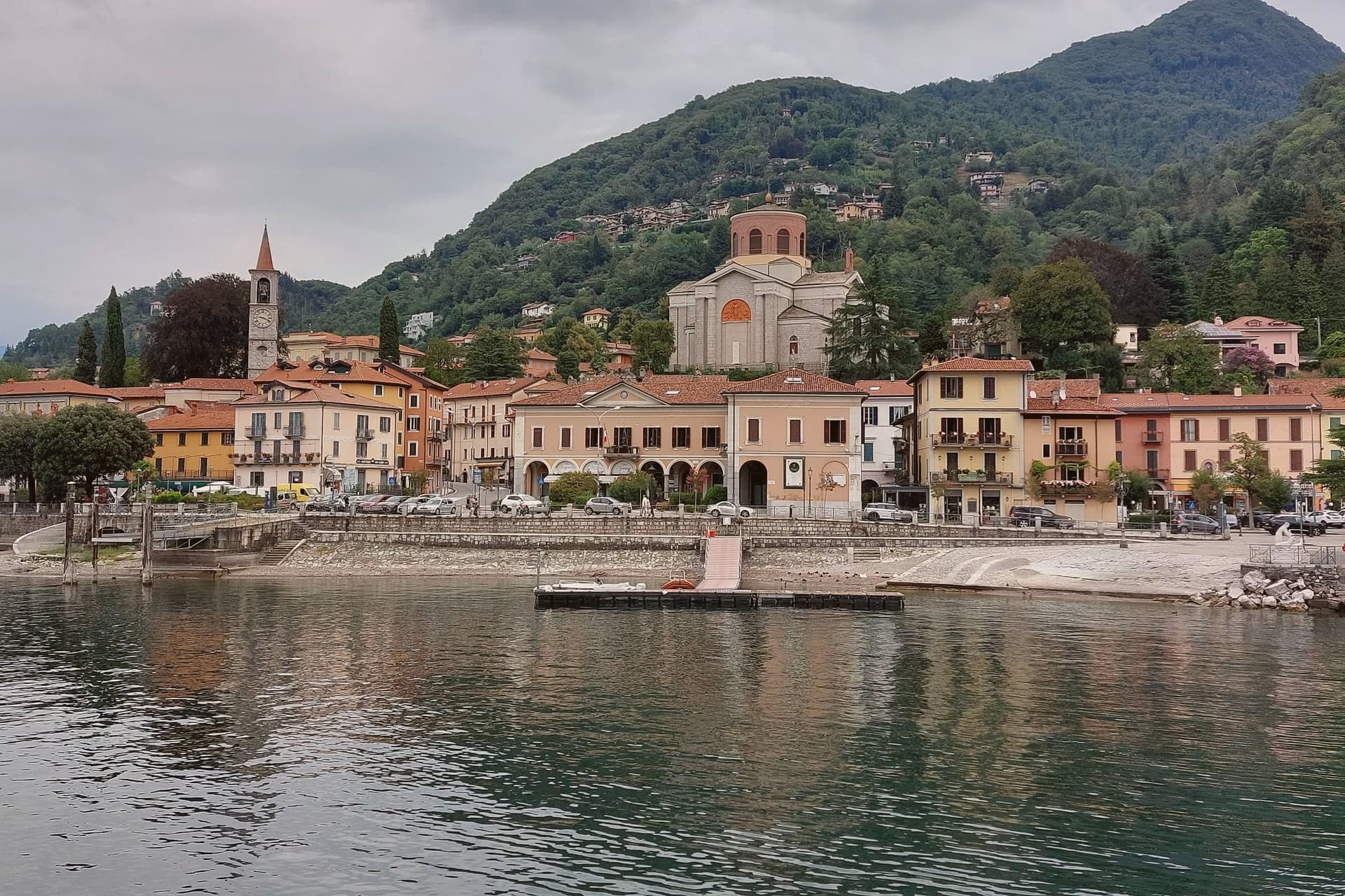
Why visit Laveno-Mombello
Laveno-Mombello sits on Lake Maggiore's eastern shore in the province of Varese, where a limestone wall drops directly to the water at the town's back. The ferry here crosses to Verbania and the Borromean Islands on the opposite shore, making the town as much a hinge point between Lombardia and Piemonte as a destination in itself.
Cerro, the lakefront hamlet folded into the town, kept the workshops after the ceramics factories closed in the 1990s, and its Palazzo Perabò now holds the museum that charts that industry from 1856 forward. South along the shore, a fifteen-minute drive reaches the monastery built into the cliff face, reachable by stairs, lift or boat where the road does not reach directly.
The town's shape follows the lake and the rock in equal measure: industry and transit at the shoreline, the mountain rising straight behind it, and the monastery holding on to the cliff a short way south as if the same geology that made Laveno a port also made it a place for building into stone.
The town sits on the water, at 200 metres.
What to see in Laveno-Mombello
- MIDeC – Museo Internazionale Design Ceramico. Ceramics design museum in the sixteenth-century Palazzo Perabò at Cerro, covering Laveno production from 1856 to the 1990s.
- Sasso del Ferro. Limestone summit reached by the bucket funicular, with a terrace looking across Lake Maggiore to Lago d'Orta and the southern Alps.
- Santa Caterina del Sasso. Fourteenth-century monastery clinging to a cliff above Lake Maggiore, fifteen minutes south, reached by stairs, lift or boat.
How to get to Laveno-Mombello
There is a railway station in the town, so you can arrive without a car and never need one while you are here. Novara is roughly 74 minutes away by road.
Our tip
April through October covers the working calendar. The Sasso del Ferro funicular runs most days from spring through autumn, weather permitting, and is unreliable in winter. May, June, September and October are the calmest weeks on the eastern shore.
Arona
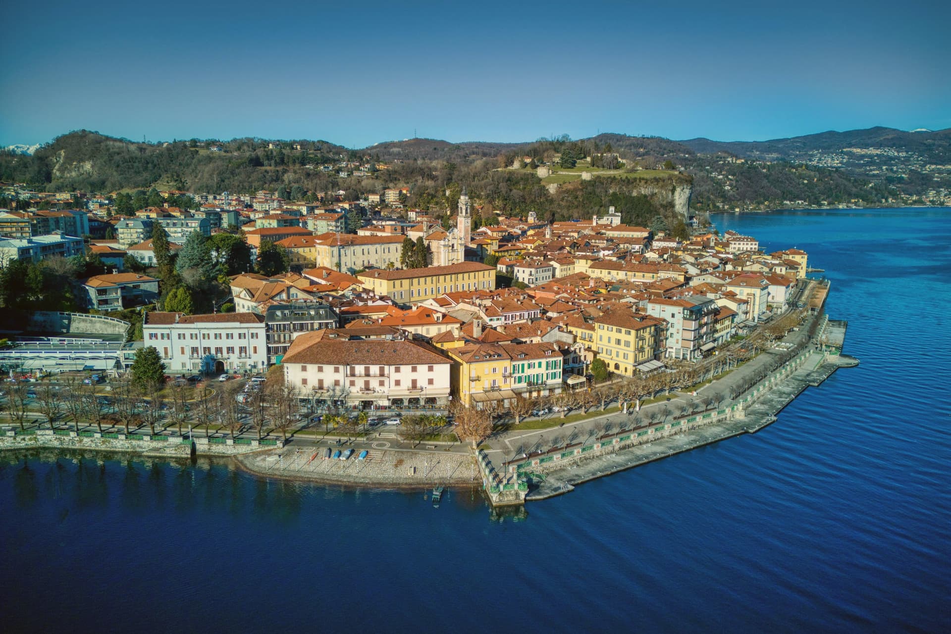
Why visit Arona
Arona sits ninety kilometers north of Milano, the first stop most travellers reach when they leave the city for the lakes. The town came under the Borromeo family in 1439 and stayed there for centuries: the castle on the hill above town was their stronghold, and the next hill over holds the statue raised in the family's honor, so the two high points of Arona both belong to the same lineage looking down on the water and on each other.
The lakefront below connects the two hills to the church on the shore and to the promenade that runs north with Angera visible across the water on the Lombard side. The natural park on the southern edge of the commune sits apart from this Borromeo core, its pile-dwelling remains far older than anything else in town and unconnected to the family's centuries of rule.
What the place adds up to is a town organized around one family's presence in stone and copper, with a much older, unrelated settlement preserved at its edge.
The town sits on the water, at 212 metres.
What to see in Arona
- Sancarlone. Copper colossus of San Carlo Borromeo, designed by Il Cerano and built between 1614 and 1698, standing above the Sacro Monte.
- Rocca di Arona. Ruined fortress on the hill above town, the walls broken into towers since the demolition, with views over the water below.
- Collegiata di Santa Maria Nascente. Late medieval church on the lakefront, holding a polyptych by Gaudenzio Ferrari completed in 1511.
How to get to Arona
There is a railway station in the town, so you can arrive without a car and never need one while you are here. Novara is roughly 49 minutes away by road.
Our tip
April through June and September into October are the best months on the south shore of Lake Maggiore. The lake stays cool, the lungolago carries traffic without congestion, and the ferries run a full timetable to Angera and the Borromeo islands further north. July and August are warm and busy: ferry queues, full hotels, and the southern lake basin gathering most of the day-trip volume from Milano.
Omegna
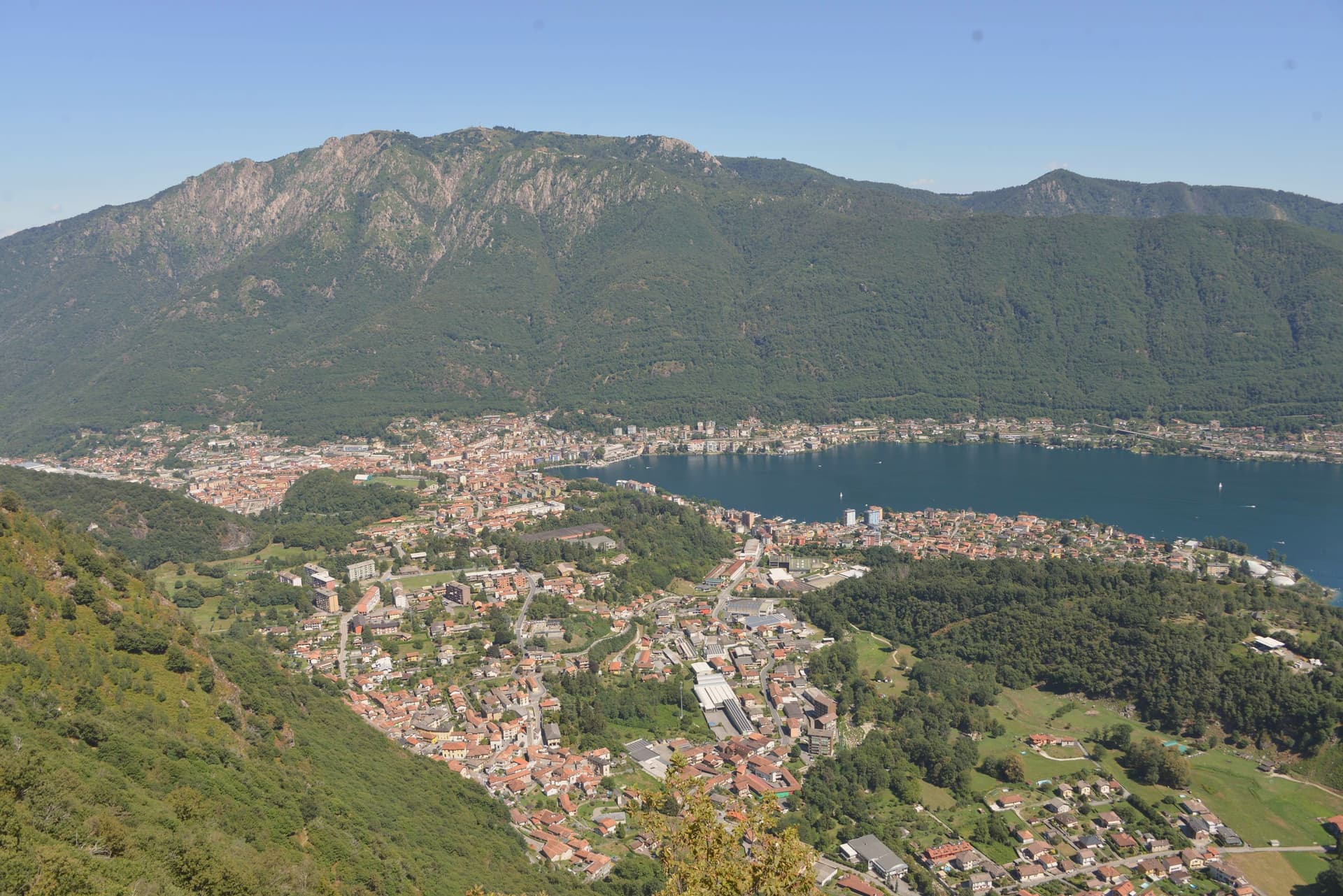
Why visit Omegna
Omegna sits at 295 meters at the northern tip of Lake Orta, in the Verbano-Cusio-Ossola, where the Nigoglia leaves the lake and runs north toward the Toce, one of the few Italian rivers that flows uphill on a map. The town first appears in records in 1221, when it swore allegiance to the commune of Novara.
The Sant'Ambrogio collegiate church goes back to the tenth century, with a Romanesque nave and a Porta Romana that survives from the medieval walls. The real shift came after 1900, when Alessi (founded 1921), Bialetti, Lagostina and Girmi turned the Strona valley into the production hub for Italian pots, moka pots and pressure cookers.
Gianni Rodari was born here in 1920; the lakefront still carries the Parco della Fantasia named after him. The Forum, a steel works converted into a museum, holds the permanent collection of the local household-goods district.
The lake stays close on three sides.
The town sits on the water, at 295 metres.
What to see in Omegna
- Collegiata di Sant'Ambrogio. Tenth-century Romanesque collegiate church with three naves, side chapels and an ossuary, the oldest building in the centro storico.
- Porta Romana. Eleventh-century medieval gate, the last surviving of the five gates of the original city walls, standing above the Nigoglia.
- Ponte Antico. Late fifteenth-century Sforza-Visconti bridge over the Nigoglia, built after 1490 on Duke Ludovico Sforza's prompting.
How to get to Omegna
There is a railway station in the town, so you can arrive without a car and never need one while you are here. Novara is roughly 60 minutes away by road.
Our tip
April through June brings green Strona slopes and a quiet lake before the day-trippers from Milano arrive. July and August fill the Lungolago and the ferry to Orta San Giulio runs at capacity; afternoons in the centro storico thin under direct sun. September and October are the best months: clear light on the lake, the cantine of the Strona open, and the household-goods outlet shops (Alessi, Bialetti, Lagostina) operate without the summer queues.
More from Anywhere Italy
 The best lake towns you can reach by train in Piemonte
- The best lake towns that eat well within 90 minutes of Novara
- The best towns with a serious restaurant that eat well within 90 minutes of Novara
- The best lake towns in the province of Verbano-Cusio-Ossola
- The best small lake towns in Piemonte
- The 8 best towns you can reach by train in the province of Verbano-Cusio-Ossola