The best hill towns within 75 minutes of Verona
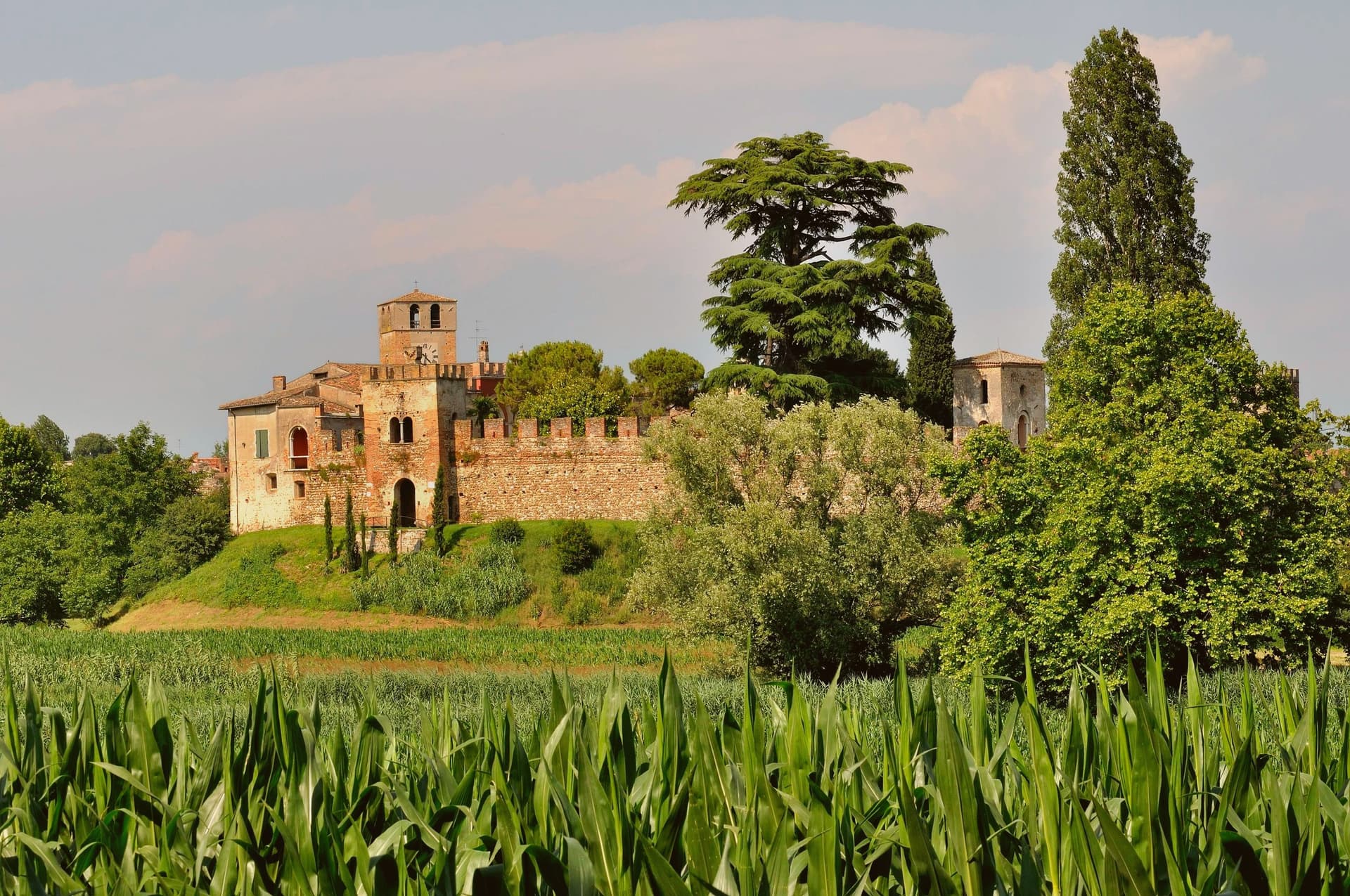
Leave Verona in any northern direction and the ground starts to rise. First come the glacial moraine hills between the Mincio and Lake Garda, low and rounded, planted with vines and cypress and topped by walled villages of brick and lake stone. Then the Valpolicella terraces, dry-walled and steep, where the grapes for Amarone are dried on racks through autumn and the cellars open their doors in spring. Further north the Adige cuts its corridor towards Trentino, and the hill towns become mountain towns, with cherry orchards on the lower slopes and snow on the ridgelines well into April.
Most visitors take the other road, south to the lake shore at Sirmione, where the peninsula narrows to a single street and the queue for the Scaliger castle runs along it in July and August. It is a fine place, a Roman villa at the end of a spit of land in very clear water, which is exactly why the car parks fill by mid-morning and the gelato costs what it costs. The lakefront resorts either side absorb the overflow, so the whole southern shore reads as one long promenade in high season.
The hills behind that shoreline do not fill in the same way. The same moraine ridges that hold Sirmione's vines carry walled villages above reed-fringed lakes, and the same limestone that makes Valpolicella wine keeps going north into the Adige valley and the Vicentine uplands. These are the towns on the high ground: fewer people go, the cellars and osterie are used mainly by locals, and the view from the walls takes in the plain the crowds are sitting on.
Of the 35 communes we have mapped in a 75-minute drive of Verona, 7 qualify as hill towns: each stands on high ground rather than on the plain. The smallest, Castellaro Lagusello, has 250 residents.
If you are still choosing, we have also written The best hill towns within 75 minutes of Brescia and The best hill towns within 75 minutes of Trento.
Castellaro Lagusello
Why visit Castellaro Lagusello
Castellaro Lagusello is a frazione of Monzambano on the morainic hills south of Lake Garda, and one of the smallest entries in the Borghi più belli d'Italia network. The village sits inside a tight ring of 13th-century stone walls built by the Scaligeri of Verona, and the single arched gate opens onto the central piazza in front of the parish church of San Nicola.
The defining feature is the small heart-shaped lake below — the laghetto di Castellaro Lagusello, a natural glacial pond formed at the end of the last ice age — which the village overlooks from its low promontory and which has shaped the village's name (Lagusello = "little lake") for centuries. The lakeside path is a marshland reserve protected by the WWF, with birdwatching hides and a constant population of herons and kingfishers.
Villa Tacoli on the south side of the village is privately held but visible from the promenade. The whole place takes less than an hour to walk and is best paired with the morning produce market in Monzambano or an afternoon at the Lago di Garda south shore, twenty minutes away.
What to see in Castellaro Lagusello
- Mura medievali e porta d'ingresso. 13th-century walled ring built by the Scaligeri of Verona, with a single arched gate opening into the village's central piazza.
- Laghetto di Castellaro Lagusello. Small heart-shaped glacial lake below the village, a WWF-protected marshland reserve with birdwatching hides and a circular footpath.
- Chiesa di San Nicola. Parish church on the central piazza, with a 16th-century facade and a single nave looking onto the village's only square.
How to get to Castellaro Lagusello
Verona is roughly 38 minutes away by road.
Our tip
April through October is the open season for the morainic hills south of Lake Garda. May and June bring the wildflowers around the heart-lake and the warmest birdwatching activity. July and August are warmer but the village stays small and uncrowded compared to the Garda shore fifteen kilometers north.
Polpenazze del Garda
Why visit Polpenazze del Garda
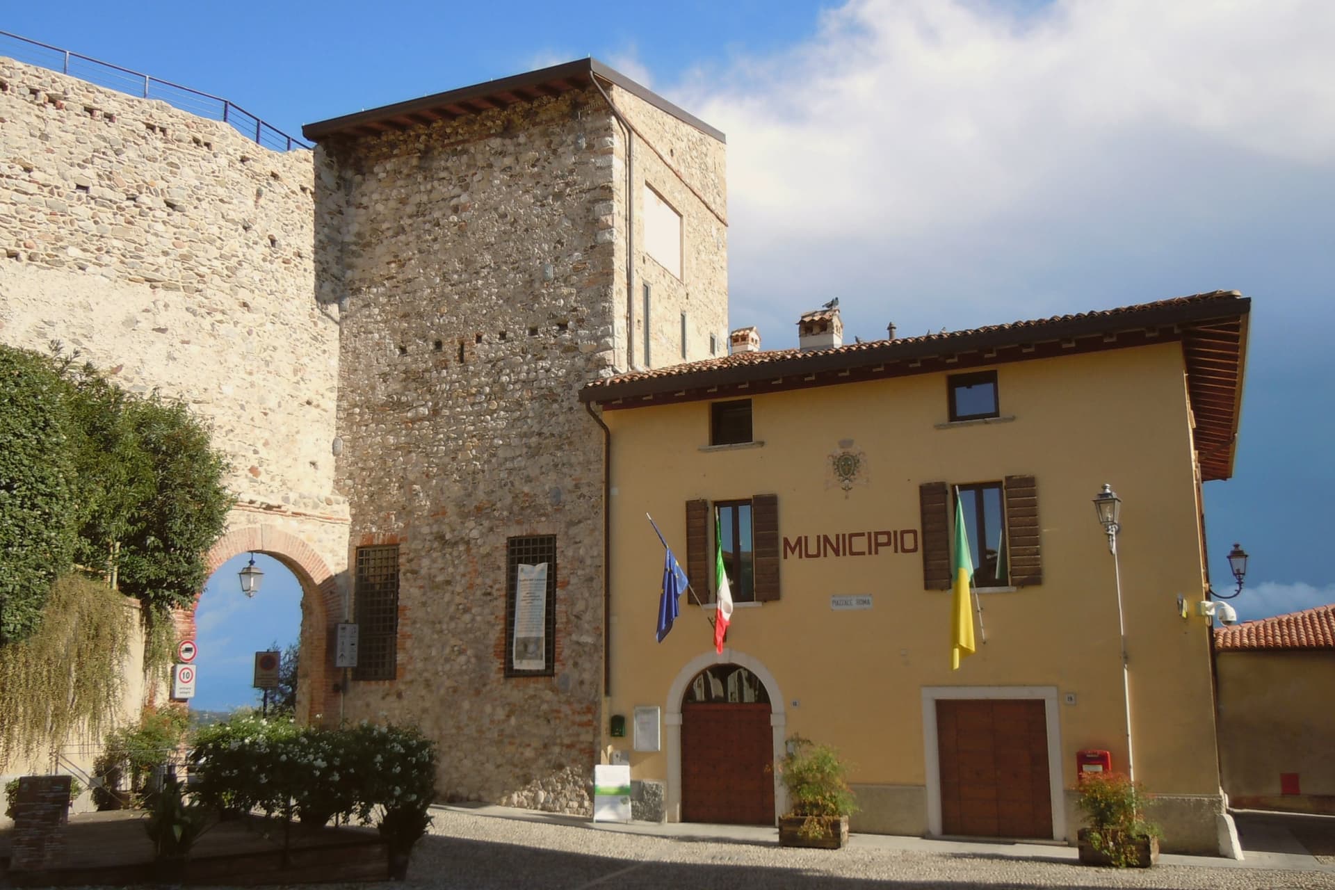
Polpenazze sits on a Valtenesi hill 207 meters above sea level, six kilometers inland from Lake Garda's western shore. The lower ground below the village was once Lake Lucone, a small basin between the hills of Cassaga, Brassina and San Pietro, progressively drained between the fifteenth and eighteenth centuries to recover farmland.
The village itself reads as a set of layers around that basin: the castle and its parish church occupy the high point, the Romanesque pieve stands on the hill facing the drained lake, and the vineyards and olive groves spread across the slopes between. The wine fair in the central piazza draws on the same Valtenesi ground that produces the Chiaretto and Garda Classico rosso poured there each May.
What holds the place together is the drained basin itself: land reclaimed from water now carries vines and olives, while the water's former bed preserved, in its clay, the traces of the people who lived on its edge millennia earlier.
What to see in Polpenazze del Garda
- Castello di Polpenazze. Medieval hilltop castle with the parish church inside its walls, the visible center of the village.
- Pieve di San Pietro in Lucone. Romanesque parish church on the hill above the basin, with twelfth-century frescoes.
- Sito palafitticolo del Lucone. The pile-dwelling site sits in the drained basin sediments, with on-site interpretation panels explaining the wooden tools, vases and fabrics preserved by the wet clay.
How to get to Polpenazze del Garda
Brescia is roughly 34 minutes away by road.
Our tip
April through October is when Polpenazze functions. The wine fair on the last weekend of May is the largest event of the year and fills the village with producers from the Valtenesi and Garda hills. June through August the Lucone path is open and the vineyards work the harvest run-up.
Monzambano
Why visit Monzambano
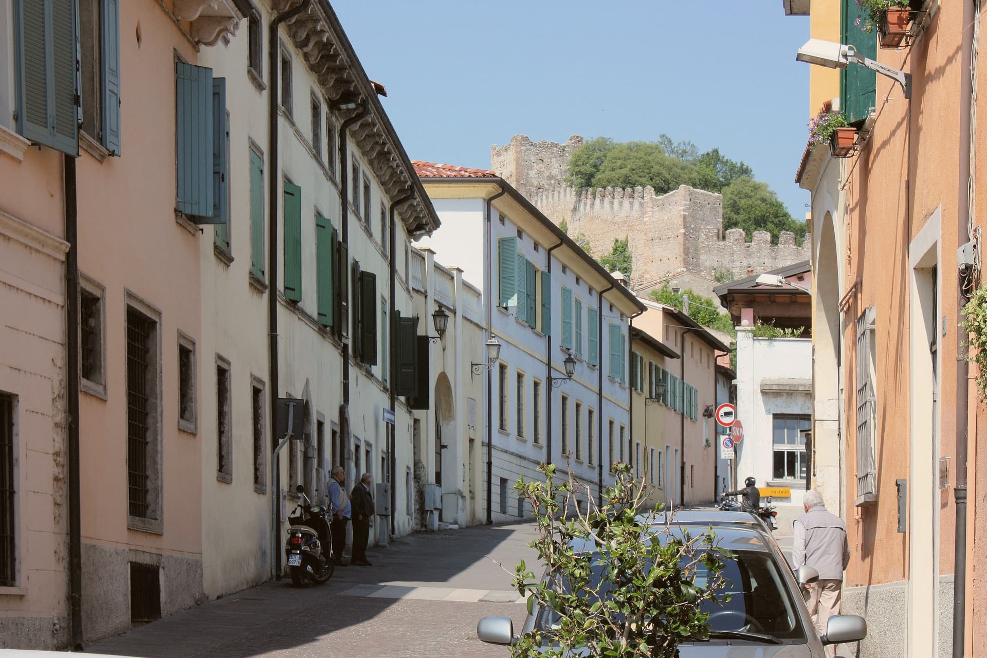
Monzambano sits at 88 meters on the right bank of the Mincio, in the moraine hills the last Alpine glacier pushed up south of Lake Garda. The commune covers 4,800 people across several frazioni, but the one travelers come for is Castellaro Lagusello, a fortified medieval village built around a small heart-shaped lake.
Pope Eugenio III's document of 1145 lists its parish among those of the Diocese of Verona. The castle and walls date to the eleventh and twelfth centuries.
The Gonzaga of Mantua tried and failed to hold it through the Quattrocento, and it passed to Venice, then to Napoleon, who in 1803 annexed it to Monzambano. Pile-dwelling settlements under the lake belong to the Prehistoric Pile Dwellings around the Alps UNESCO site.
The commune holds five institutional signals at once: Borghi più belli, Bandiera Arancione, Borgo dei Borghi finalist, Città del Vino, Città dell'Olio. The wines are Lugana and Garda Colli Mantovani; the oil is Garda DOP.
What to see in Monzambano
- Castellaro Lagusello. Fortified medieval frazione inside crenellated walls and ten towers, set above a heart-shaped lake on a moraine hill.
- Castello di Castellaro. Eleventh- to twelfth-century castle on the hill above the lake, long contested between Mantua and Venice.
- Prehistoric pile dwellings. Submerged Bronze Age stilt-house settlement in the lake, part of the UNESCO Prehistoric Pile Dwellings around the Alps.
How to get to Monzambano
Verona is roughly 39 minutes away by road.
Our tip
April through June and September into October are the months the moraine hills work best. The vines are leafing or harvested, the lake reflects the walls, and the small reserve around Castellaro is open to walkers. July and August get humid and still; Lake Garda is fifteen kilometers away and pulls the day-trippers off the back roads. Sagra di San Bartolomeo falls in August.
Sant'Ambrogio di Valpolicella
Why visit Sant'Ambrogio di Valpolicella
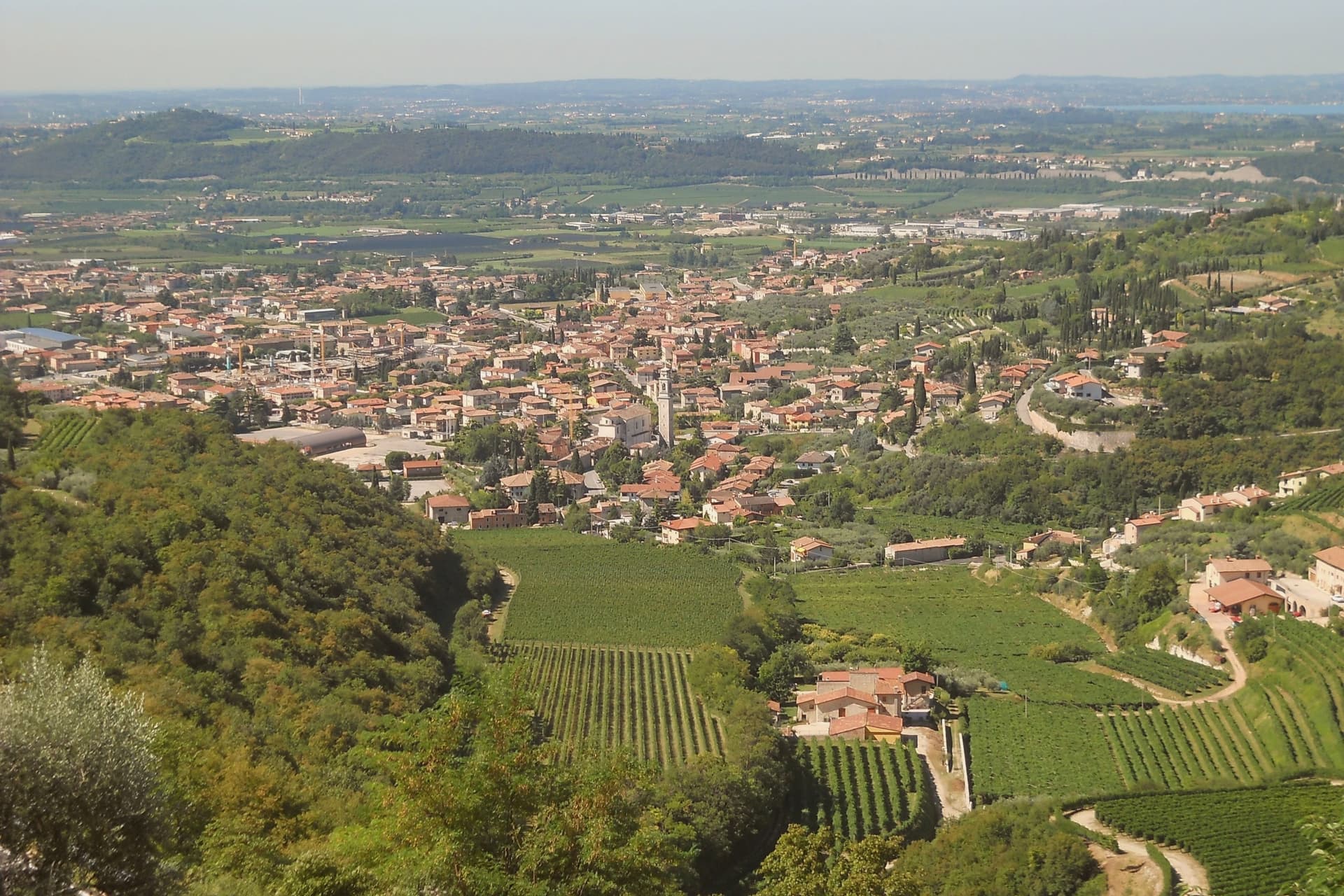
Sant'Ambrogio di Valpolicella sits at 174 meters in the heart of the Valpolicella DOC, fifteen kilometers northwest of Verona, on the rolling hills that close the eastern shore of Lake Garda. The commune groups five frazioni around the main village: Domegliara, Gargagnago, Monte, Ponton and the ridge settlement above them.
Gargagnago sits at the foot of the hills, its cellars closest to the valley floor; the ridge frazione occupies the higher limestone ground, reached by a climb steep enough to have earned the church its nickname. Between them the Serego Alighieri estate has worked the same parcels since Pietro Alighieri, son of Dante the poet who had followed his father into exile in Verona, bought the property in 1353, and the family still grows Corvina, Rondinella and Molinara there, with the Vaio Armaron Amarone counted among the appellation's cru benchmarks.
The pattern of the commune is one of a valley economy and a hill economy sharing a single administrative roof: wine pressed and aged below, an older, stiller settlement kept above it, with the quarries that once supplied Verona still worked on the slopes that join the two.
What to see in Sant'Ambrogio di Valpolicella
- Pieve di San Giorgio Ingannapoltron. Romanesque parish church whose ciborium columns carry an inscription naming the master builder Orso and his disciples Juventino and Juviano.
- San Giorgio di Valpolicella. Frazione on the limestone ridge above the valley, in the Borghi più belli d'Italia network, nicknamed Ingannapoltron for the steep climb up to it.
- Villa Serego Alighieri. Estate still owned by the Alighieri descendants; produces Vaio Armaron Amarone from Corvina, Rondinella and Molinara grown on the same parcels the family has worked.
How to get to Sant'Ambrogio di Valpolicella
There is a railway station in the town, so you can arrive without a car and never need one while you are here. Verona is roughly 34 minutes away by road.
Our tip
April through June and September through October are the months for Valpolicella. The vineyards green up in spring, harvest runs from mid-September into October, and the appassimento drying begins in the cellars while the leaves turn. July and August push past thirty degrees in the valley and the village empties between two and six in the afternoon; cellar visits move to morning slots.
Marostica
Why visit Marostica
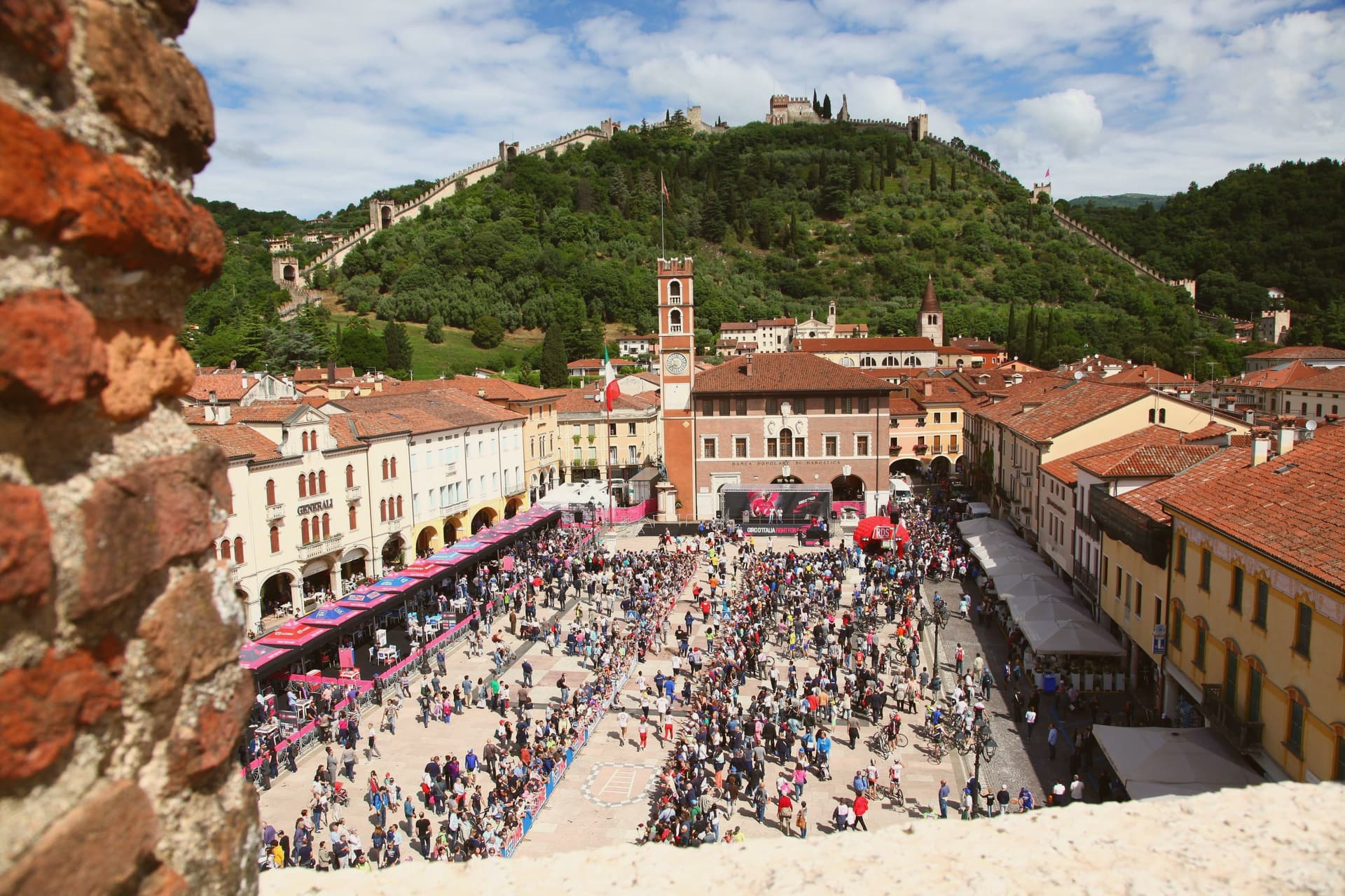
Marostica sits at 103 meters at the foot of the Asolan hills, forty-five kilometers northwest of Padova. Cangrande della Scala took the town in 1311, building his lower fortress on the plain and a second stronghold on the hill above it, then joining the two with a wall long enough to carry two dozen towers and four gates between them.
The arrangement is unusual: most walled towns fortify a single point, but here the defense runs uphill, turning the slope itself into the connecting structure between plain and ridge. The upper stronghold did not survive the artillery of the War of the League of Cambrai in 1510 and has stood as a ruin since, while the lower one remained inhabited and working, which is why the town's public life, its square, its church, its chess board, still gathers at the base of the hill rather than at its summit.
The cherries grown on the slopes to the north, since given IGP status, are the one product of the surrounding land that made it into the local kitchen as the crostata. What the town amounts to is a fortification that never stopped being a town: the walls did not seal Marostica off from its hillside, they organized it, and the square where the chess is played twice a decade sits exactly where the two castles' lines of sight once met.
What to see in Marostica
- Castello Inferiore. Built from 1311 on Piazza Castello, its keep rising 44 meters over the square, with a museum inside on the chess match traditions.
- Castello Superiore. Ruined by Venetian artillery in 1510, standing on Monte Pausolino and reached by a footpath through the walls, with views over the Brenta valley.
- Mura di Marostica. Fourteenth-century walls running two kilometers between the two castles, with twenty-four towers and four gates; the parapet walk is open to the public.
How to get to Marostica
Vicenza is roughly 43 minutes away by road.
Our tip
April through June and September through October are the working months. The cherry harvest runs from late May to mid-June and the orchards on the lower slopes of the Asolan hills mark the season; the Mostra delle Ciliegie in early June is the major spring event. The Partita a Scacchi falls on the second weekend of September in even-numbered years and books the town a year ahead.
Rovereto
Why visit Rovereto
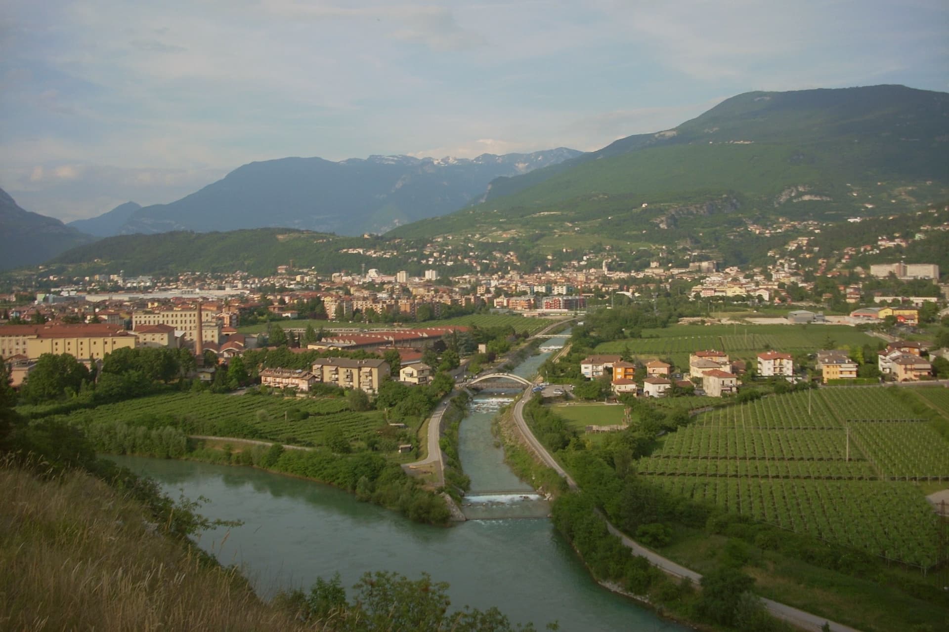
Rovereto sits at 204 metres in the Vallagarina, halfway between Trento and Verona on the Adige plain. The castle rises above the Leno torrent at the southern edge of the centre, built by the Castelbarco, expanded into a four-bastioned fortress by the Venetians from 1416, and handed to the Habsburgs in 1509 after the Venetian defeat at Agnadello.
That handover is the hinge of the town's layout: the porticoed streets of the centro storico still carry Venetian facades alongside Habsburg ones, running from Piazza Rosmini to the castle walls, with the Borgo Sacco quarter and the old silk-trade palazzi marking where the town's merchant wealth once sat. Above the centre, on the hill of Miravalle, the war made its own monument, cast from the bronze of cannons gathered from both sides of a conflict that had run through these mountains.
Depero, who lived and worked in Rovereto, gave the town a second, later claim, and the museum built around his work in 2002 sits inside a domed building at the opposite end of the town's story from the castle: one structure built for defence and passed between powers, the other built for a single collection and opened once, in peacetime. Between the fortress, the bell, and the museum, the town reads as a place shaped twice by the same war, first as ground fought over, later as ground that chose to remember it.
What to see in Rovereto
- Castello di Rovereto. Rises above the Leno torrent at the southern edge of the centre, four bastions facing the town, the line where Venetian masonry gives way to the additions made after the handover to Austria.
- MART. The circular building by Mario Botta centres on a glass-and-steel dome over the entrance plaza. Inside, the permanent collection runs from Depero through Morandi, de Chirico and Carrà.
- Museo Storico Italiano della Guerra. Inside the castle, the collection of uniforms, trench artefacts, prints and personal testimonies tells the war from the Italian-Austrian front, the fighting that ran through the mountains around the town.
How to get to Rovereto
There is a railway station in the town, so you can arrive without a car and never need one while you are here. Trento is roughly 31 minutes away by road.
Our tip
April through June and September through October are the working months for Rovereto, with the Vallagarina mild and the MART, the war museum and the Campana all on full schedule. May brings the Festival Mozart and the spring concert season. September is festival month, with the Oriente Occidente contemporary dance programme and the wine harvest across the surrounding slopes.
Trento
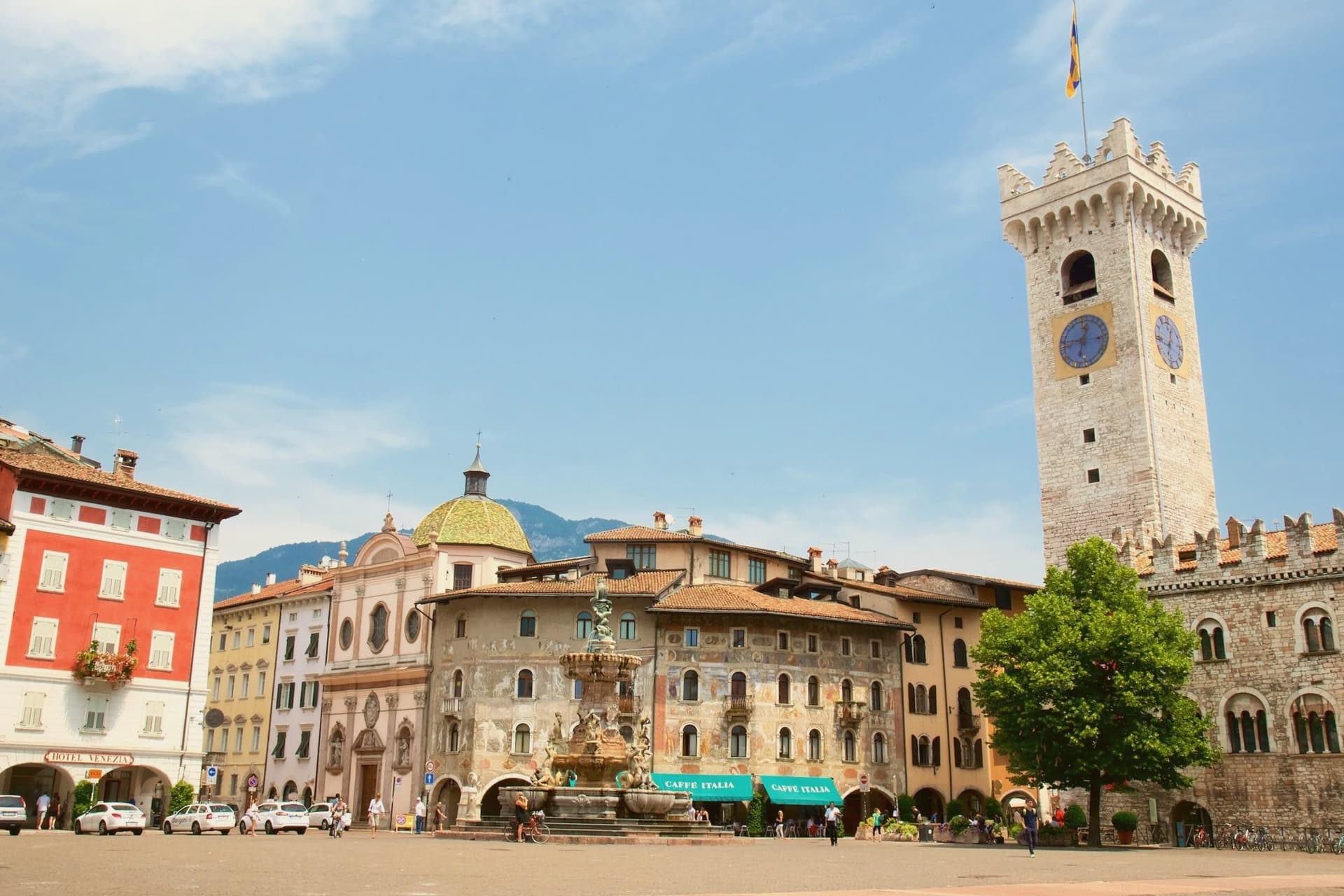
Why visit Trento
Trento sits at 194 metres on the Adige, the city Italy chose as the seat of one of its two northern autonomous provinces and the regional capital of Trentino-Alto Adige. Monte Bondone rises to two thousand metres directly above the western edge; the Brenta Dolomites are an hour west.
Between 1545 and 1563, the Council of Trent met here in twenty-five sessions across the Duomo di San Vigilio and the Castello del Buonconsiglio, formulating the Catholic response to the Protestant Reformation and shaping the next four centuries of European Christianity. The Duomo, begun in 1212 on the foundations of a late-Roman basilica, still stands at the centre of Piazza Duomo.
The Buonconsiglio, built 1239 to 1255 as the residence of the prince-bishops, is now the city's main museum. In 2013 Renzo Piano completed MUSE, the natural science museum on the south edge of town, with a six-storey jagged roofline that imitates the Dolomites.
What to see in Trento
- Castello del Buonconsiglio. Thirteenth-century residence of the prince-bishops of Trento, host to sessions of the Council of Trent and now the city's main museum, with Gothic frescoes in the Torre Aquila.
- Duomo di San Vigilio. Romanesque-Gothic cathedral begun in 1212 on the remains of a late-Roman basilica, where most public sessions of the Council of Trent were held between 1545 and 1563.
- MUSE. Museum of natural science by Renzo Piano, opened 2013, with a 130-metre roofline that rises and falls in imitation of the Dolomites visible to the east.
How to get to Trento
There is a railway station in the town, so you can arrive without a car and never need one while you are here. Trento is roughly 4 minutes away by road.
Our tip
April through June brings green slopes on Monte Bondone, mild evenings in Piazza Duomo and the start of the open-air concert season. September and October are dry and clear, with the Trento Film Festival of mountain cinema and the start of the autumn wine sagre in the Vallagarina to the south. July and August can hit thirty-three degrees in the city centre at 194 metres; the air cools sharply if you climb Monte Bondone, and locals spend afternoons on the mountain or at the lake. Trento Busker Food falls in September.