
The best hill towns within 75 minutes of Trento
The land around Trento rises fast. Leave the Adige valley floor, with its apple orchards and Teroldego vines, and the road switches back into terraces of Nosiola and Marzemino, then chestnut woods, then meadow. The towns up there are built of pale local limestone and porphyry, roofed in slate, with fountains still running from the mountain and church towers that carry both Italian and Tyrolean shapes. Autumn is the season that pays best: grape harvest, new olive oil around the lake basins, mushrooms, and canederli and polenta back on the menus in the osterie.
Most people come for the Dolomites or for the water, and in July the shoreline at Riva del Garda is a slow queue of campers, windsurf vans and coaches inching along the cliff road from Torbole. The reasons are sound. The lake is warm, the peaks come down almost to the beach, and the cycle paths are among the best in Europe. It is simply a narrow strip of land carrying a great many visitors at once.
The same slopes keep climbing behind that strip, and the terraces, the wine and the mountain water continue well past the point where the crowds turn back. These are the towns on the high ground: above the lake basins, along the Valsugana, up the Valpolicella hillsides, each of them standing over a valley rather than sitting in it. Fewer people go, and most are reachable from Trento inside a comfortable morning.
Of the 26 communes we have mapped in a 75-minute drive of Trento, 6 qualify as hill towns: each stands on high ground rather than on the plain. The smallest, Tenno, has 2,002 residents.
Two more lists worth reading alongside this one: The best hill towns in Trentino-Alto Adige/Südtirol and The best hill towns within 90 minutes of Bolzano.
Tenno
Why visit Tenno
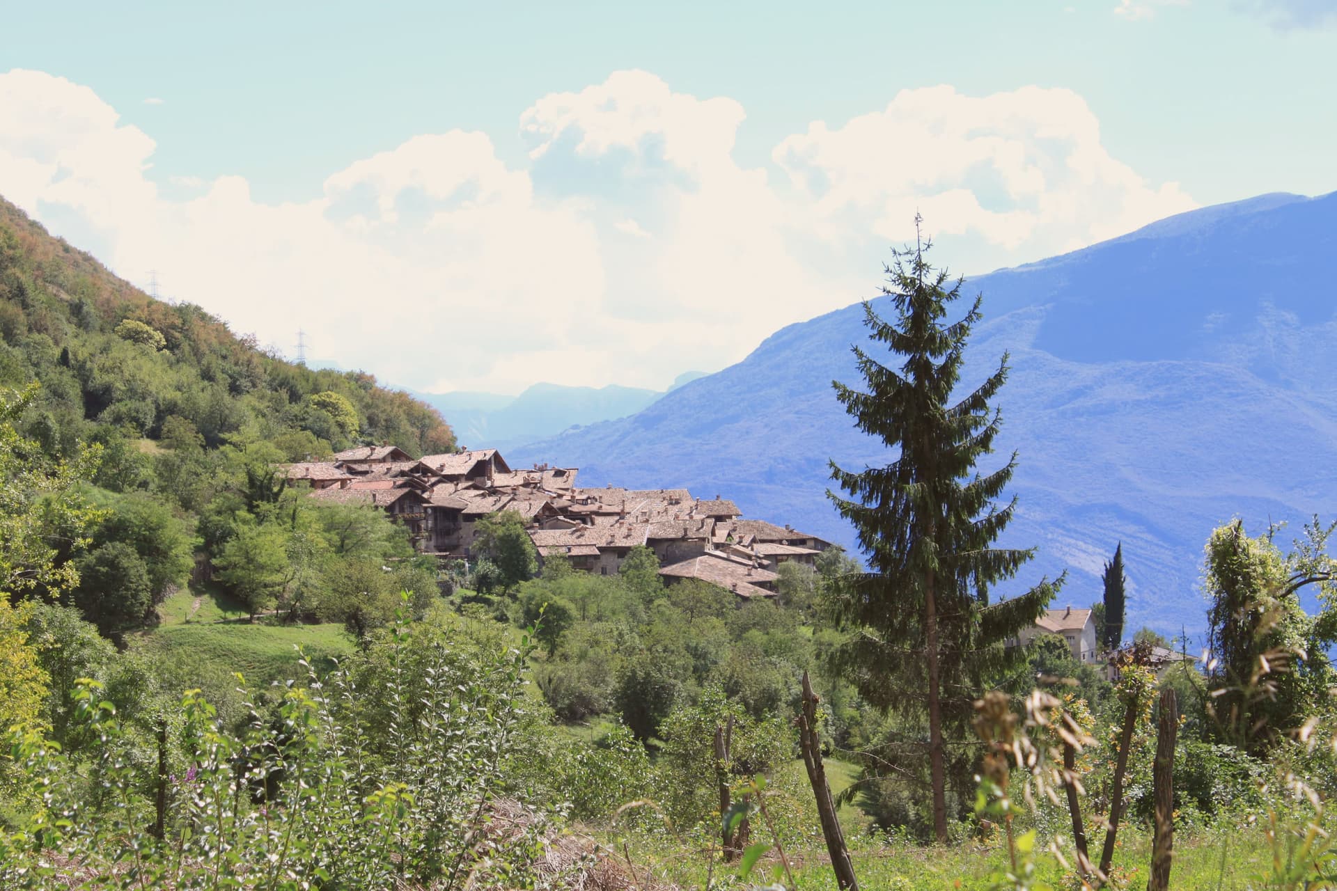
Tenno sits at 428 metres on the slope above Riva del Garda, on the old road that climbed from the Sarca valley toward the Giudicarie. The territory wraps the upper end of the lake, and the south-facing slopes carry vineyards and olive terraces up toward the settlements above.
Two places anchor the commune, a few kilometres apart. A fortress holds the high ground on a rocky outcrop, built over an older prehistoric site and positioned to watch the road below.
North of it, the hamlet keeps to its four streets and a square, stone houses joined by arches, close enough to the mountain lake that the walk between them takes half an hour. The olive groves run along the slopes between all of them, the northern edge of a growing tradition that has otherwise moved south with the climate.
What holds the commune together is elevation: a hilltop position that let a fortress watch the valley road, a hamlet keep its shape for centuries, and olives ripen further north than anywhere else that grows them by tradition.
What to see in Tenno
- Canale di Tenno. Arched passages tie the stone houses together over the road, and the four streets still converge on the same small square the hamlet was built around.
- Castello di Tenno. Fortress on a rocky outcrop above the Sarca valley, raised over the remains of a prehistoric site, once controlling the road between Garda and the Giudicarie. The view runs down to the lake below.
- Lago di Tenno. The water sits at 570 metres, still enough to show its color, with a small island near the centre and the reserve's paths tracing the shoreline.
How to get to Tenno
Trento is roughly 44 minutes away by road.
Our tip
April through June brings the olive groves into leaf, the meadows above Ville del Monte in flower and Lake Tenno at its clearest. September and October are dry and gold, with the olive harvest beginning in the second half of October on the terraces above the lake. July and August are the busiest months, when Lake Tenno fills with swimmers from Riva and the August Rustico Medioevo festival draws visitors to Canale di Tenno.
Borgo Valsugana
Why visit Borgo Valsugana
Borgo Valsugana sits at 380 metres on the Brenta, thirty kilometres east of Trento, in the lower part of the Valsugana valley that carries the road and the railway between Trento and the Veneto plain. The Roman settlement of Ausugum stood on the same site, on the Claudia Augusta Altinate road from Altino to Tridentum, which set the town on a route between the plain and the mountains long before the present centre took shape.
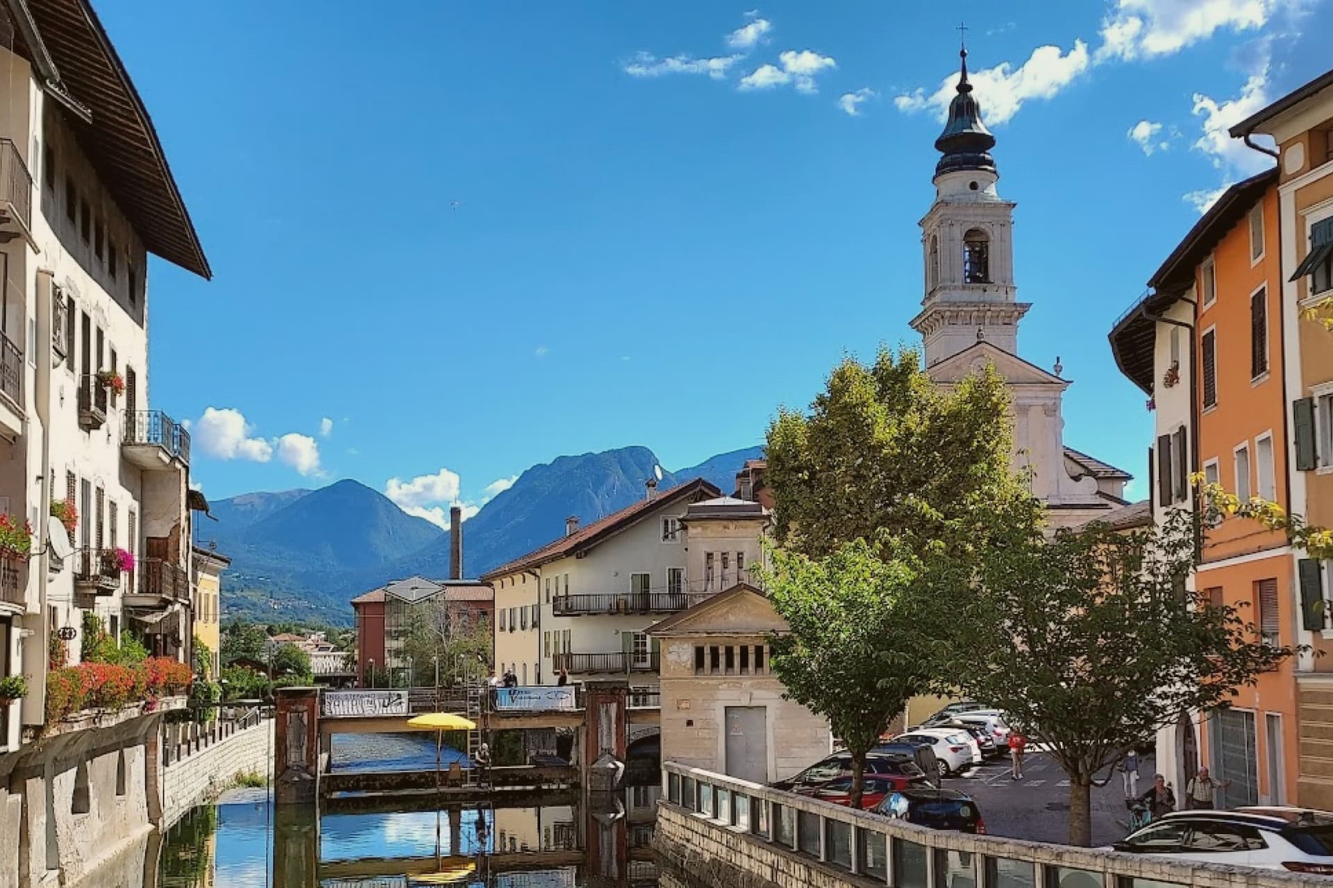
The centro storico straddles the Brenta, arcades opening onto the quays on each bank, which is why locals and visitor guides call it the Little Venice of Trentino. The castle above the town looks down on this river centre, and the side valley to the west holds the art project among the meadows, so the town reads in three layers: the water level where the old houses face each other across the river, the height of the watchtower on the hill, and the separate, quieter valley given over to the works in natural materials.
The valley was the front line in 1915 to 1916 and much of the historic centre was rebuilt after the war, so the painted facades standing over the water today are largely a twentieth-century reconstruction of a much older river town.
What to see in Borgo Valsugana
- Castel Telvana. Twelfth-century castle on Mount Ciolino above the town, built around a square watchtower five metres per side and twenty-six metres high.
- Ponte Veneziano. Fifteenth-century bridge over the Brenta crowned by two aedicules with graffiti inspired by seventeenth-century works of Jacopo Fiorentini.
- Arte Sella. Open-air contemporary art project in the Val di Sella since 1986, with works in natural materials around Malga Costa, including the Cattedrale Vegetale.
How to get to Borgo Valsugana
There is a railway station in the town, so you can arrive without a car and never need one while you are here. Trento is roughly 49 minutes away by road.
Our tip
April through June brings mild weather along the Brenta, the Val di Sella in full green and Arte Sella at its most photogenic between bud and full leaf. September and October are the dry months, with the Tognola peaks above the valley starting to colour and the river running clear after the summer rains. July and August can hit thirty-three degrees at 380 metres, with the quays in shadow by late afternoon and Arte Sella busy with visitors.
Sant'Ambrogio di Valpolicella
Why visit Sant'Ambrogio di Valpolicella
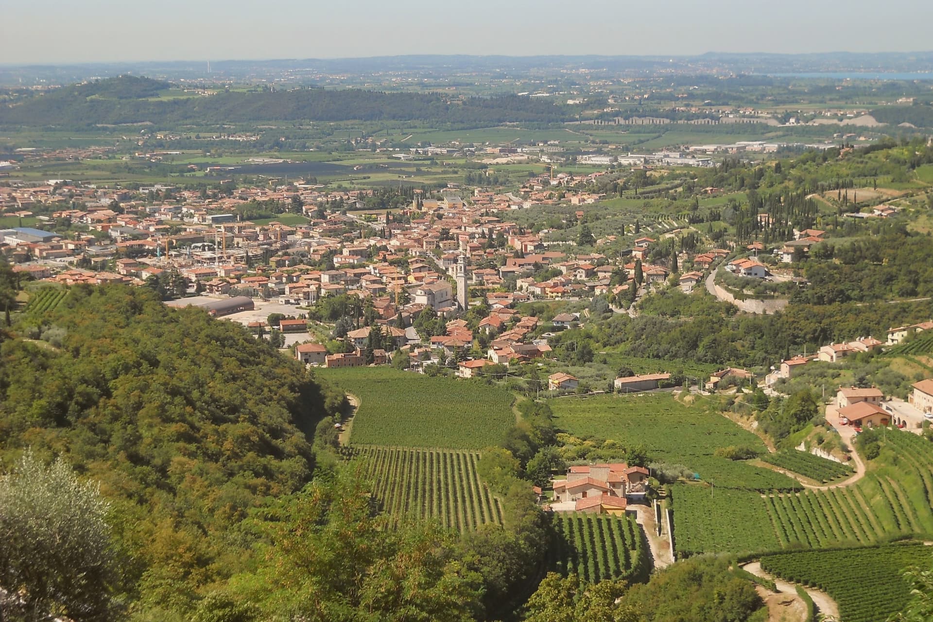
Sant'Ambrogio di Valpolicella sits at 174 meters in the heart of the Valpolicella DOC, fifteen kilometers northwest of Verona, on the rolling hills that close the eastern shore of Lake Garda. The commune groups five frazioni around the main village: Domegliara, Gargagnago, Monte, Ponton and the ridge settlement above them.
Gargagnago sits at the foot of the hills, its cellars closest to the valley floor; the ridge frazione occupies the higher limestone ground, reached by a climb steep enough to have earned the church its nickname. Between them the Serego Alighieri estate has worked the same parcels since Pietro Alighieri, son of Dante the poet who had followed his father into exile in Verona, bought the property in 1353, and the family still grows Corvina, Rondinella and Molinara there, with the Vaio Armaron Amarone counted among the appellation's cru benchmarks.
The pattern of the commune is one of a valley economy and a hill economy sharing a single administrative roof: wine pressed and aged below, an older, stiller settlement kept above it, with the quarries that once supplied Verona still worked on the slopes that join the two.
What to see in Sant'Ambrogio di Valpolicella
- Pieve di San Giorgio Ingannapoltron. Romanesque parish church whose ciborium columns carry an inscription naming the master builder Orso and his disciples Juventino and Juviano.
- San Giorgio di Valpolicella. Frazione on the limestone ridge above the valley, in the Borghi più belli d'Italia network, nicknamed Ingannapoltron for the steep climb up to it.
- Villa Serego Alighieri. Estate still owned by the Alighieri descendants; produces Vaio Armaron Amarone from Corvina, Rondinella and Molinara grown on the same parcels the family has worked.
How to get to Sant'Ambrogio di Valpolicella
There is a railway station in the town, so you can arrive without a car and never need one while you are here. Verona is roughly 34 minutes away by road.
Our tip
April through June and September through October are the months for Valpolicella. The vineyards green up in spring, harvest runs from mid-September into October, and the appassimento drying begins in the cellars while the leaves turn. July and August push past thirty degrees in the valley and the village empties between two and six in the afternoon; cellar visits move to morning slots.
Rovereto
Why visit Rovereto
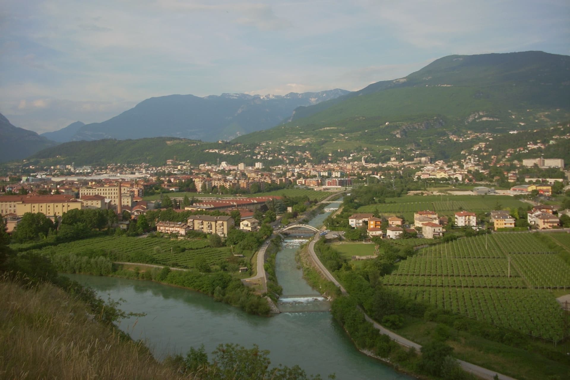
Rovereto sits at 204 metres in the Vallagarina, halfway between Trento and Verona on the Adige plain. The castle rises above the Leno torrent at the southern edge of the centre, built by the Castelbarco, expanded into a four-bastioned fortress by the Venetians from 1416, and handed to the Habsburgs in 1509 after the Venetian defeat at Agnadello.
That handover is the hinge of the town's layout: the porticoed streets of the centro storico still carry Venetian facades alongside Habsburg ones, running from Piazza Rosmini to the castle walls, with the Borgo Sacco quarter and the old silk-trade palazzi marking where the town's merchant wealth once sat. Above the centre, on the hill of Miravalle, the war made its own monument, cast from the bronze of cannons gathered from both sides of a conflict that had run through these mountains.
Depero, who lived and worked in Rovereto, gave the town a second, later claim, and the museum built around his work in 2002 sits inside a domed building at the opposite end of the town's story from the castle: one structure built for defence and passed between powers, the other built for a single collection and opened once, in peacetime. Between the fortress, the bell, and the museum, the town reads as a place shaped twice by the same war, first as ground fought over, later as ground that chose to remember it.
What to see in Rovereto
- Castello di Rovereto. Rises above the Leno torrent at the southern edge of the centre, four bastions facing the town, the line where Venetian masonry gives way to the additions made after the handover to Austria.
- MART. The circular building by Mario Botta centres on a glass-and-steel dome over the entrance plaza. Inside, the permanent collection runs from Depero through Morandi, de Chirico and Carrà.
- Museo Storico Italiano della Guerra. Inside the castle, the collection of uniforms, trench artefacts, prints and personal testimonies tells the war from the Italian-Austrian front, the fighting that ran through the mountains around the town.
How to get to Rovereto
There is a railway station in the town, so you can arrive without a car and never need one while you are here. Trento is roughly 31 minutes away by road.
Our tip
April through June and September through October are the working months for Rovereto, with the Vallagarina mild and the MART, the war museum and the Campana all on full schedule. May brings the Festival Mozart and the spring concert season. September is festival month, with the Oriente Occidente contemporary dance programme and the wine harvest across the surrounding slopes.
Meran
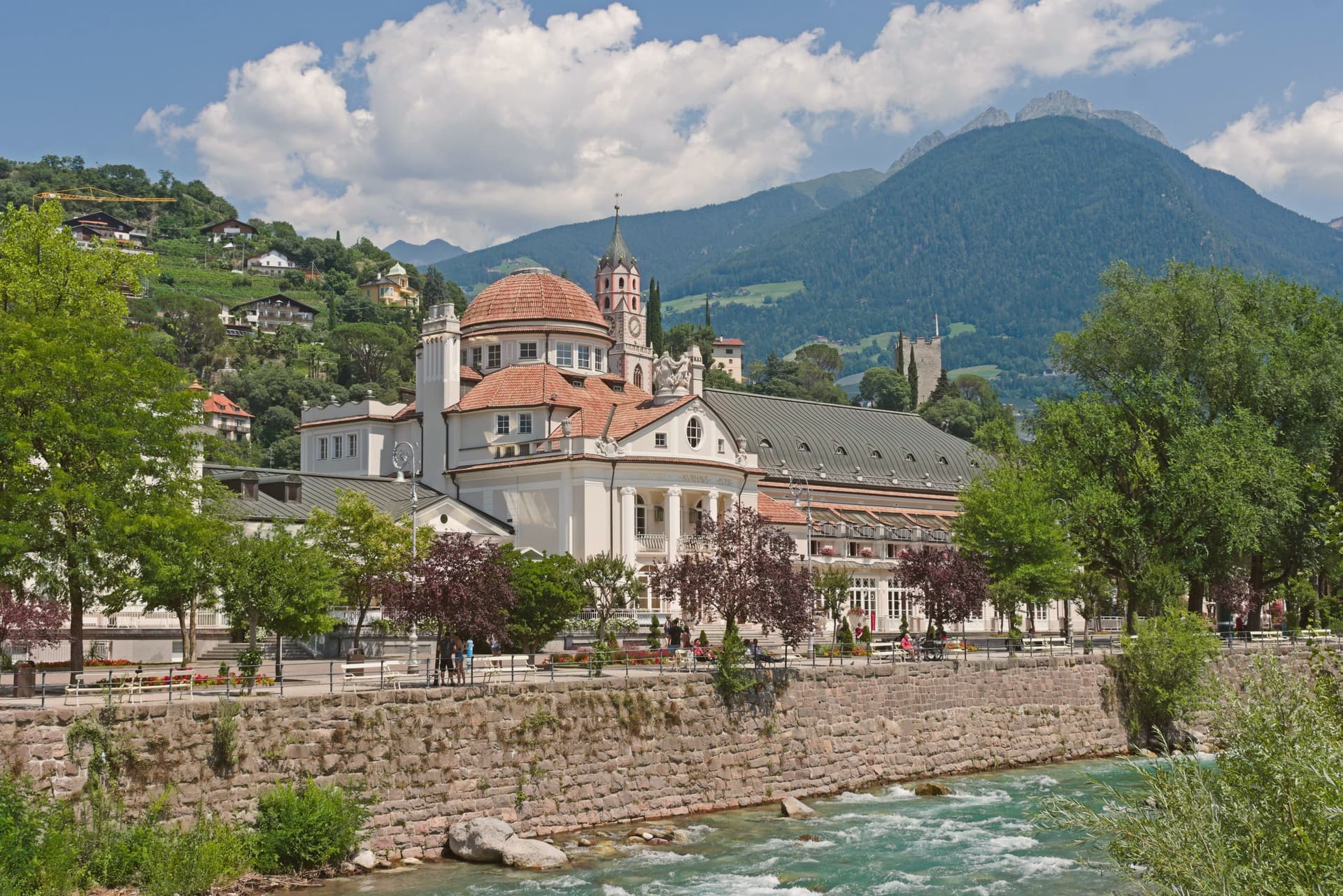
Why visit Meran
Merano sits at 324 metres in the basin where the Passer river meets the Adige, at the entrance to the Passeier and Vinschgau valleys, with mountains rising to 3,335 metres around it. The town was the capital of the County of Tyrol from the thirteenth century until 1420, when the Habsburgs moved the residence to Innsbruck.
Empress Elisabeth of Austria began wintering here in 1870 for the climate and the mild basin air; her stays turned Merano into a late-Habsburg spa destination, drawing Kafka, Rilke and Richard Strauss. The Kurhaus, an Art Nouveau pavilion on the Passer promenade, and Castel Trauttmansdorff, where Sissi stayed and which now holds twelve hectares of botanical gardens and the Touriseum, anchor the imperial layer of the city.
Merano was annexed to Italy in 1919 under the Treaty of Saint-Germain. The bilingual city today is the centre of South Tyrolean wine and apple farming, host of the Merano WineFestival each November at the Kurhaus.
What to see in Meran
- Giardini di Castel Trauttmansdorff. Twelve hectares of botanical gardens around the castle where Empress Elisabeth wintered, with eighty landscapes over a hundred-metre slope and the Touriseum tourism museum.
- Kurhaus. Art Nouveau pavilion on the Passer promenade, the spa-town centrepiece of nineteenth-century Merano and venue of the Merano WineFestival each November.
- Passeggiata Lungo Passirio. Spa promenade along the Passer river through the centre of the city, lined with palms, flowers and the Wandelhalle, the covered Art Nouveau walking gallery.
How to get to Meran
There is a railway station in the town, so you can arrive without a car and never need one while you are here. Bolzano is roughly 29 minutes away by road.
Our tip
April through October is the long season in the Merano basin: the Trauttmansdorff gardens open from March to November with the spring bloom and the autumn colours, the Passer promenades fill with walkers, and the apple orchards above the city move from blossom to harvest. June through August can hit thirty degrees on the valley floor; the covered Wandelhalle and the shaded lungo Passirio keep the city walkable in the afternoon. November brings the Merano WineFestival at the Kurhaus and the Christmas markets that follow. Festa dell'Uva a Merano falls in August.
Trento
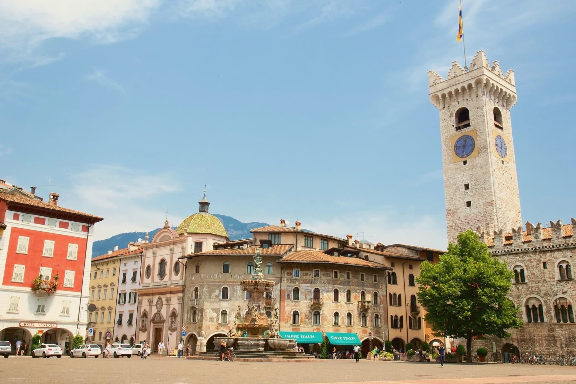
Why visit Trento
Trento sits at 194 metres on the Adige, the city Italy chose as the seat of one of its two northern autonomous provinces and the regional capital of Trentino-Alto Adige. Monte Bondone rises to two thousand metres directly above the western edge; the Brenta Dolomites are an hour west.
Between 1545 and 1563, the Council of Trent met here in twenty-five sessions across the Duomo di San Vigilio and the Castello del Buonconsiglio, formulating the Catholic response to the Protestant Reformation and shaping the next four centuries of European Christianity. The Duomo, begun in 1212 on the foundations of a late-Roman basilica, still stands at the centre of Piazza Duomo.
The Buonconsiglio, built 1239 to 1255 as the residence of the prince-bishops, is now the city's main museum. In 2013 Renzo Piano completed MUSE, the natural science museum on the south edge of town, with a six-storey jagged roofline that imitates the Dolomites.
What to see in Trento
- Castello del Buonconsiglio. Thirteenth-century residence of the prince-bishops of Trento, host to sessions of the Council of Trent and now the city's main museum, with Gothic frescoes in the Torre Aquila.
- Duomo di San Vigilio. Romanesque-Gothic cathedral begun in 1212 on the remains of a late-Roman basilica, where most public sessions of the Council of Trent were held between 1545 and 1563.
- MUSE. Museum of natural science by Renzo Piano, opened 2013, with a 130-metre roofline that rises and falls in imitation of the Dolomites visible to the east.
How to get to Trento
There is a railway station in the town, so you can arrive without a car and never need one while you are here. Trento is roughly 4 minutes away by road.
Our tip
April through June brings green slopes on Monte Bondone, mild evenings in Piazza Duomo and the start of the open-air concert season. September and October are dry and clear, with the Trento Film Festival of mountain cinema and the start of the autumn wine sagre in the Vallagarina to the south. July and August can hit thirty-three degrees in the city centre at 194 metres; the air cools sharply if you climb Monte Bondone, and locals spend afternoons on the mountain or at the lake. Trento Busker Food falls in September.
More from Anywhere Italy
- The best hill towns in Trentino-Alto Adige/Südtirol
- The best hill towns within 90 minutes of Bolzano
 The best towns you can reach by train within an hour of Trento
 The best hill towns within 75 minutes of Verona
 The 9 best towns you can reach by train that eat well in Trentino-Alto Adige/Südtirol
 The prettiest villages in the province of Trento