
The best hidden towns you can reach by train that eat well in Lazio
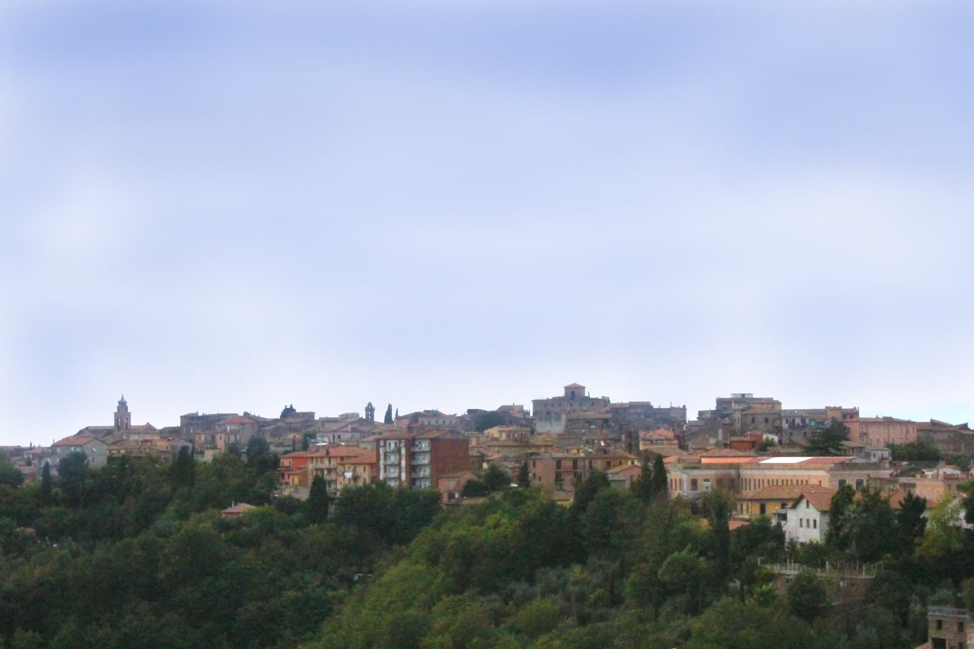
Lazio eats in a way that rarely makes the export version of Italian food: coda alla vaccinara and pasta with pecorino and pepper, yes, but also the freshwater fish of the crater lakes, the hazelnuts of the Cimini hills, olive oil pressed in the Sabina where the trees are old enough to be listed, and lamb from the Aniene valley cooked over wood. The houses are grey volcanic tufa in the north, pale limestone as you move south towards Frosinone, and the streets between them go uphill. Spring brings artichokes and wild greens, autumn brings porcini, chestnuts and the first pressing. Regional trains run out of Termini and Tiburtina all day, which means lunch is a ticket rather than a hire car.
Almost everyone who gets on one of those trains stays on it as far as Rome, or takes the day trip to Tivoli for the fountains at Villa d'Este, and the queue at the gate on a warm Saturday tells you how well that plan is known. The Castelli Romani coach circuit fills up on Sundays for the same reason. None of this is undeserved. It simply means the tables are booked, the terraces are full and the walk to the belvedere is a shuffle.
The same railway keeps going. It runs north through the tufa and the crater lakes towards Viterbo, east up the Aniene into the mountains, and south along the old Casilina line into the Ciociaria, and there are stops the whole way where fewer people get off. The towns here are the smaller ones on those lines, each with a kitchen a dining guide has thought worth naming, and each reachable without a car.
Of the 60 communes we have mapped in Lazio, 15 qualify as towns you can reach by train that eat well: we have confirmed each is reachable without a car, and a dining guide has named a table in each. This list is the hidden ones, 6 in all, ordered smallest first. The smallest, Magliano Sabina, has 3,433 residents.
Two more lists worth reading alongside this one: The prettiest villages you can reach by train in Lazio and The best towns you can reach by train that eat well within 90 minutes of Roma.
Magliano Sabina
Why visit Magliano Sabina
Magliano Sabina sits at 222 meters on a terrace above the Tiber valley, fifty kilometers north of Rome on the border between Lazio and Umbria. The hill above the river was Sabine ground; the Roman town of Ocriculum, just across in modern Umbria, was the regional anchor.
The medieval centre grew up under the Benedictine abbey of Farfa and passed to the Holy See in the fourteenth century, and the diocesan seat later moved up from the older episcopal site at Vescovio, in the comune's own territory, to the town's upper church. The upper town, walled and gathered around the Palazzo Comunale and the cathedral, occupies the terrace edge; the Vescovio remains lie apart in the surrounding countryside, marking where the diocese first sat before the seat moved uphill into Magliano itself.
From the ridge the ground gives way west to the Tiber and then climbs into Monte Soratte on the far bank, a view that alone earned the town membership in the Borghi più belli d'Italia in 2003. The town's standing, then, rests less on any single monument than on the relation between an old river crossing, an abbey's authority, and a line of sight that has drawn notice since antiquity.
Degli Angeli have been named by a guide.
What to see in Magliano Sabina
- Cattedrale di San Liberatore. The cathedral stands on Piazza Duomo, its stone façade the dominant note of the square and the seat around which the diocese has organized itself since the medieval period.
- Chiesa di San Pietro. Twelfth-century Romanesque church, one of the oldest standing buildings in town, with its original masonry preserved.
- Centro storico. Medieval upper town on the Tiber terrace, with the Palazzo Comunale, the diocesan seat and surviving sections of the village walls.
How to get to Magliano Sabina
There is a railway station in the town, so you can arrive without a car and never need one while you are here. Terni is roughly 41 minutes away by road.
Our tip
April through June and September through October are the strongest months in the Tiber valley. The Sabine olive country is green in spring and the panorama toward Monte Soratte opens cleanest after rain clears the haze. July and August touch the mid-thirties; the centro storico stays cooler than the river plain below, but the open ridge walks empty around midday.
Castro dei Volsci
Why visit Castro dei Volsci
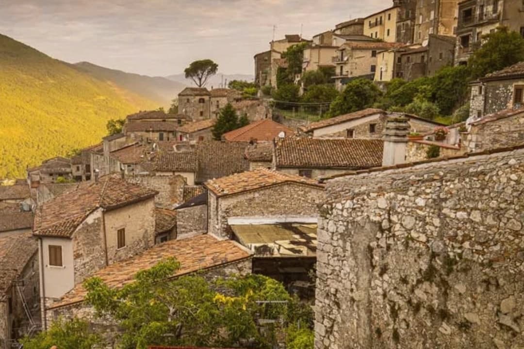
Castro dei Volsci sits at 385 meters on a ridge above the Sacco river valley, ninety kilometers southeast of Rome and fourteen from Frosinone. The Volsci, an Italic tribe Rome spent two centuries subduing, held this hill before the Latins took it; the name preserves both occupants, Castrum and Volsci, castle and people.
After the year 1000 the village fell to the Papal States and stayed inside that orbit until unification. The valley floor below the ridge holds Roman-era foundations and mosaics, remains of a settlement separate from the hill village above it.
The slopes between the two carry the olive groves that still supply the town's oil. The upper village, where the clock tower and castle ruins stand, is where Nino Manfredi was born in 1921 before the family's path led him to Rome and to postwar cinema; the town he left behind kept its stacked houses, its gates and its position over the valley, and it is that unbroken layout, hill above, groves on the slope, valley floor beneath, that the Borghi più belli d'Italia listing recognizes.
Locanda del Ditirambo have been named by a guide.
What to see in Castro dei Volsci
- Torre dell'Orologio. Medieval clock tower in the upper village. Inside, a permanent exhibition holds Nino Manfredi's films, scripts and personal effects.
- Castello. Ruins of the medieval fortress at the top of the borgo, with a panorama over the Sacco valley and the Monti Ausoni.
- Centro storico. Stacked stone houses, vaulted passages and medieval gates that earned the borgo its Borghi più belli d'Italia membership.
How to get to Castro dei Volsci
There is a railway station in the town, so you can arrive without a car and never need one while you are here. Latina is roughly 71 minutes away by road.
Our tip
April through June and September through October are the best windows. The Sacco valley is green in spring and the panoramas from the castle ruins open clean once the haze burns off. July and August push past thirty-five degrees; the centro storico empties between two and five in the afternoon, and the olive groves on the slopes go silent until evening.
Arpino
Why visit Arpino
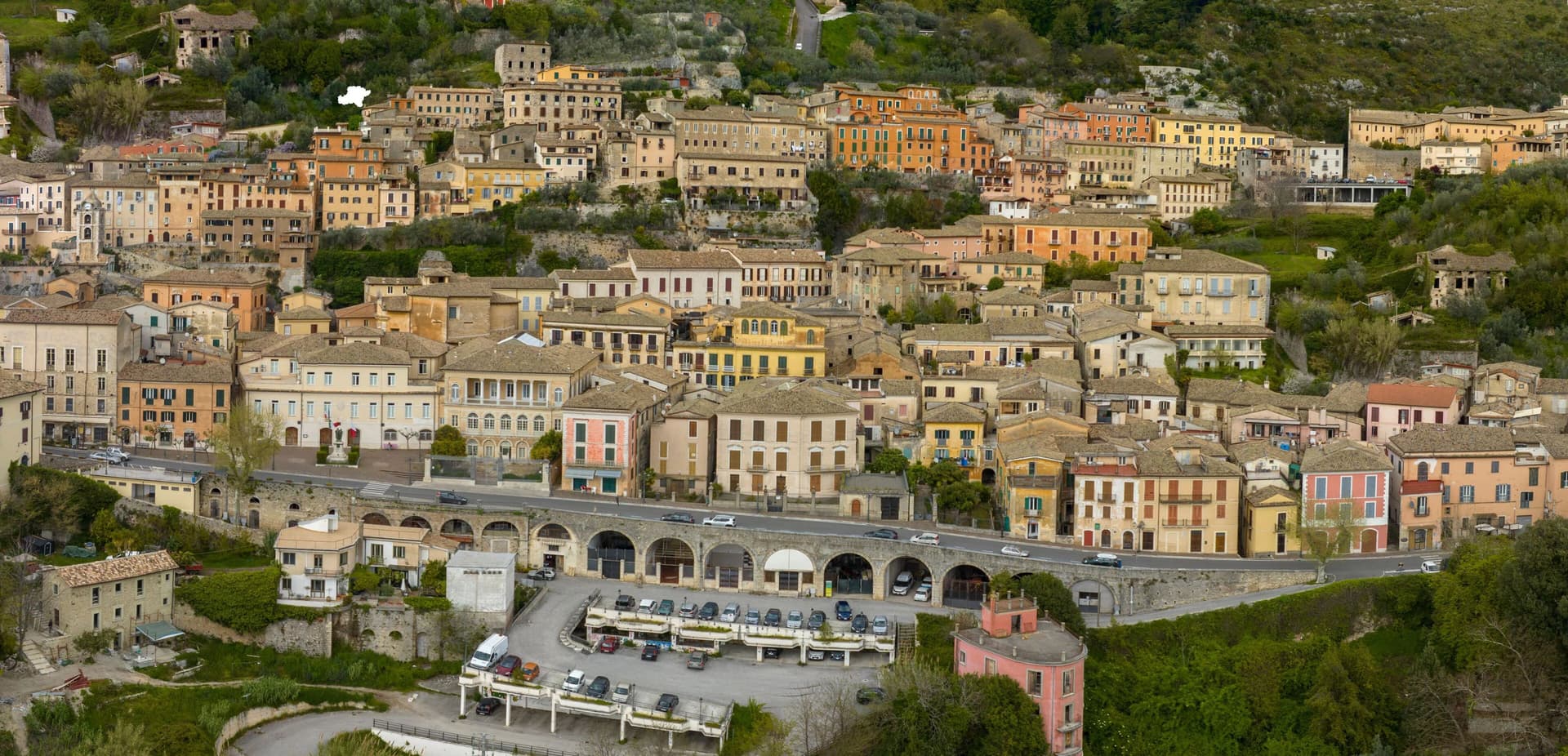
Arpino sits at 450 meters on two hills in the Liri valley, in the Ciociaria region of southern Lazio. The ancient city of Arpinum, on the upper hill now called Civitavecchia, was a Volscian-Samnite stronghold captured by Rome in 305 BC.
The lower hill is the medieval and modern town. Two Roman consuls were born here: Gaius Marius, the military reformer who fought the Cimbri and Teutones, and Marcus Tullius Cicero, the orator and senator killed in 43 BC.
The villa where Cicero was born stood just north, on the Liri, in what is now Isola del Liri. The upper acropolis is ringed by polygonal cyclopean walls of the sixth or fifth century BC, with the Arco a Sesto Acuto, a pointed-arch gate cut into the same stone work.
Arpino is on the Bandiere Arancioni list and on the Cammino di San Benedetto, the long pilgrim route from Norcia to Montecassino.
Mingone, La Perla have been named by a guide.
What to see in Arpino
- Acropoli di Civitavecchia. Pre-Roman upper city on the hill above modern Arpino, surrounded by cyclopean polygonal walls of the sixth or fifth century BC.
- Arco a Sesto Acuto. Pointed-arch gate cut into the cyclopean walls of the acropolis, the only known pre-Roman ogival arch in central Italy.
- Torre di Cicerone. Medieval tower on the acropolis, traditionally linked to Cicero by local memory though built more than a thousand years after his death.
How to get to Arpino
There is a railway station in the town, so you can arrive without a car and never need one while you are here. Latina is roughly 94 minutes away by road.
Our tip
April through June and September through October are the strong months. Spring brings green hills along the Liri and clear views from the acropolis; autumn is dry and gold. July and August push past thirty degrees in the valley, although Arpino's 450-meter position offers some relief in the upper town. Il Gonfalone falls in July.
Ronciglione
Why visit Ronciglione
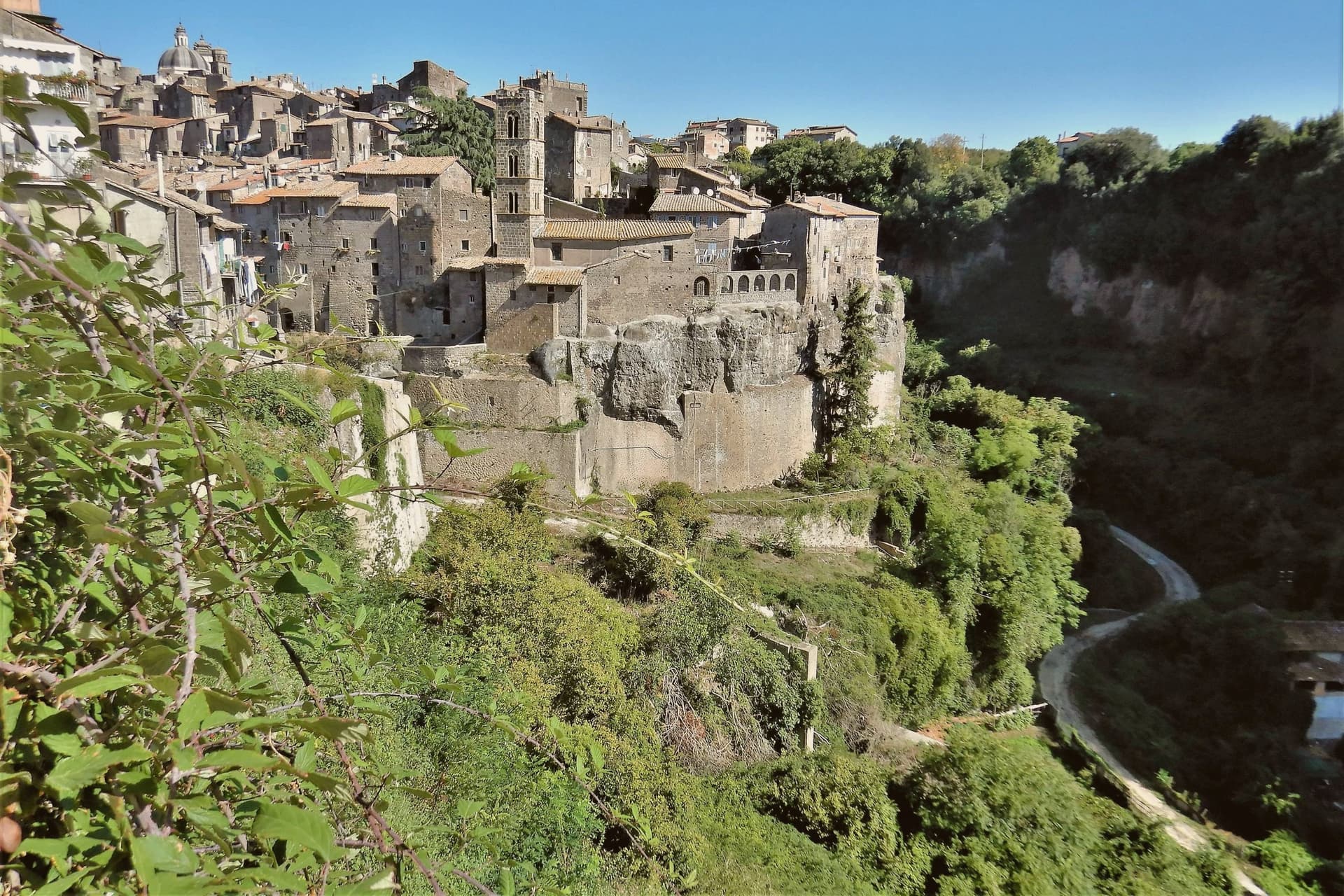
The town stands on a tufa spur at 441 meters, five kilometers from the lake, with the Cimini hills and their hazelnut groves closing in around it on every side. The first record of it dates to 1103.
The Prefetti di Vico held it before the Farnese took it as a Duchy, and the sixteenth-century pontiff who granted the town its Carnival did so during that same passage of rule from prefects to dukes. The fortress's towers control the single natural approach to the historic center, so the medieval town and its defenses are really one structure: whoever held the towers held the road in.
Everything built afterward, the cathedral, the contrade, the Carnival itself, sits inside that same defended perimeter. What the RAI title recognized in 2023 was less a single monument than that whole arrangement still intact: a fortified approach, a walled center, and a lake and hills that have not changed shape around it.
Riva Felice have been named by a guide.
What to see in Ronciglione
- Rocca dei Borgia (I Torrioni). Medieval fortress of the Prefects of Vico, twin round towers guarding the only natural approach to the centro storico.
- Duomo dei Santi Pietro e Caterina. Baroque cathedral of 1671, polychrome marble altar, fifteenth-century triptych by a Viterbo painter, wooden statue of San Bartolomeo.
- Lago di Vico. Volcanic lake ringed by the Cimini hills, its waters filling the crater below the level of the town on its spur.
How to get to Ronciglione
There is a railway station in the town, so you can arrive without a car and never need one while you are here. Roma is roughly 64 minutes away by road.
✷ We have written about Ronciglione
“Suddenly, we weren't running around. Ronciglione has nothing, and I mean zero things to show you. It's a pretty generic medieval town near Rome. It doesn't have a big piazza. There is a gate, a duomo, 2-3 main streets, and pretty much that's it. Yet, it was the center of our attention at that time. After spending just a few days there, we went back to Rome without wrinkles, with an oddly weird smile on our faces.”
Read our piece on Ronciglione →Ronciglione | Baptism into the Other Italy
Our tip
April through June brings the Cimini hills into green, hazelnut groves in flower and Lake Vico cool enough for the morning. September and October are the harvest months, dry, mild, with the air clear enough to see Monte Cimino from the Rocca. July and August touch the upper thirties and fill the lake with Romans on weekends. Palio di Ronciglione falls in July.
Subiaco
Why visit Subiaco
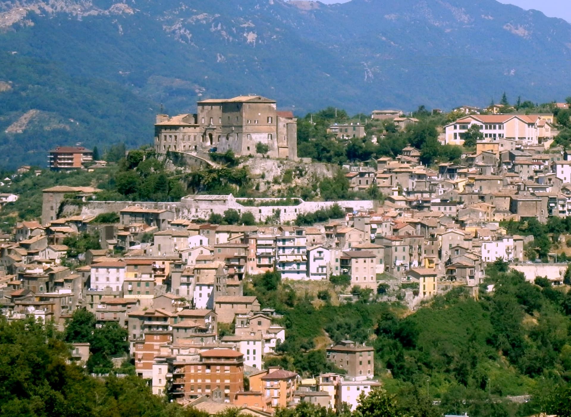
Subiaco sits at 408 meters along the upper Aniene, seventy-three kilometers east of Rome and forty from Tivoli. Nero built a villa here in the first century, damming the river into artificial lakes known as Sublaqueum, below the lake, and the name outlasted the villa and the emperor both.
The town that grew up here reads in layers going up the valley side: the river and the bridge at the bottom, the abbey partway up the hill, the fortress at the summit, and the cliff sanctuary further out along the cliff face that gave the hermit's cave its shelter, each one built at a different remove from the water and from the town center. What holds these layers together is a single life.
A man who came here as a young man to live alone in a cave gave his name to a monastery down the hill, and centuries later that same monastery's press put the first printed book on Italian soil into circulation. The fortress above answers to a different history, the abbots who ruled here as feudal lords, one of whom fathered a child who became one of the most written-about women of her age.
A river valley that supplied an emperor's pleasure lakes became, without much overlap, the ground where monastic life took its early shape.
Contrada Rapello have been named by a guide.
What to see in Subiaco
- Monastero del Sacro Speco. Built into the cliff face of Monte Taleo, the sanctuary rises in tiers over the cave itself, and the frescoes by Conxolus and the school of Cimabue cover walls that follow the rock rather than a flat plan.
- Abbazia di Santa Scolastica. The only one of Benedict's twelve original monasteries still standing, sixth century in origin; its library holds three hundred manuscripts, including a copy of the Lactantius run off the abbey's own press.
- Rocca Abbaziale (Rocca dei Borgia). Set on the highest ground of the borgo, the fortress was raised by abbot Giovanni V in the twelfth century and later gave Lucrezia Borgia, daughter of the abbot Rodrigo Borgia, a birthplace in 1480.
How to get to Subiaco
There is a railway station in the town, so you can arrive without a car and never need one while you are here. Roma is roughly 70 minutes away by road.
Our tip
April through June and September through October are the months for Subiaco: the Aniene runs full, the cliff sanctuaries are open from morning, and the pilgrim road south fills with walkers on the Cammino di San Benedetto. July and August are warm in town and cool in the monasteries; the cave at the Sacro Speco holds twelve degrees year-round. November through March is the quiet pilgrim season, mist on the river and few coaches in the lots. Festa Madonna di Pompei Rione Colle falls in August.
Castel Gandolfo
Why visit Castel Gandolfo
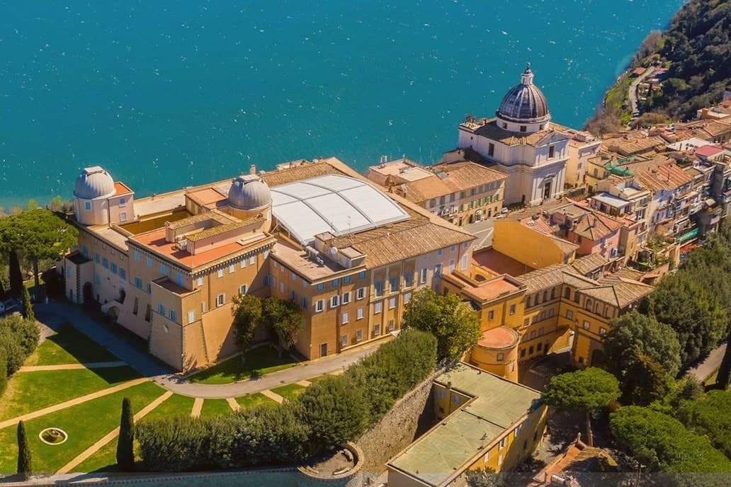
The town sits at 426 meters on the rim of the Lake Albano crater, twenty-five kilometers southeast of Rome among the Castelli Romani. It stands on the site of Alba Longa, the city Aeneas's son Ascanius is said to have founded.
The lake below was formed by the fusion of two volcanic craters and reaches 170 meters deep. The Villa Barberini stands adjacent to the palace, acquired by Taddeo Barberini in 1631, its gardens running down toward the water.
Pope Francis kept the palace as a museum after 2016; Leo XIV restored it to residential use in June 2025 and resides in the Villa Barberini next door, while the Borgo Laudato Si', created by Francis in 2023, carries ecological education across 55 hectares of the same estate. A town built on legend, given over for a time to public viewing, and returned to private residence: three uses of the same ground, laid one on top of the other without erasing what came before.
Tinello Bistrot, Antico Ristorante Pagnanelli have been named by a guide.
What to see in Castel Gandolfo
- Palazzo Apostolico. The palace Carlo Maderno raised between 1623 and 1626 stood open as a museum from 2016, its rooms given over to display cases and visitors. In June 2025 it returned to residential use, the museum arrangement dismantled to make way for a household again.
- Ville Pontificie e Giardini Barberini. Fifty-five hectares of papal villas and gardens running down to Lake Albano, with the seventeenth-century Villa Barberini at their center.
- Lago Albano. The crater lake sits at 293 meters above sea level and covers five square kilometers, its rim shared between this town and Albano Laziale.
How to get to Castel Gandolfo
There is a railway station in the town, so you can arrive without a car and never need one while you are here. Roma is roughly 35 minutes away by road.
Our tip
April through October is the open season for Castel Gandolfo, with the gardens open and the lake at swimming temperature from June. June and September are the calmer months and the historic papal-residence weeks. July and August fill with Roman day-trippers and Vatican tourists; the lake shore is busy.
More from Anywhere Italy
 The prettiest villages you can reach by train in Lazio
 The best towns you can reach by train that eat well within 90 minutes of Roma
- The best towns you can reach by train that have a serious restaurant in Lazio
 The best small towns in Lazio for dinner
 The best hill towns that eat well within 90 minutes of Roma
 The best towns on the Cammino di San Benedetto in Lazio