
The best hidden ski towns in the province of Trento
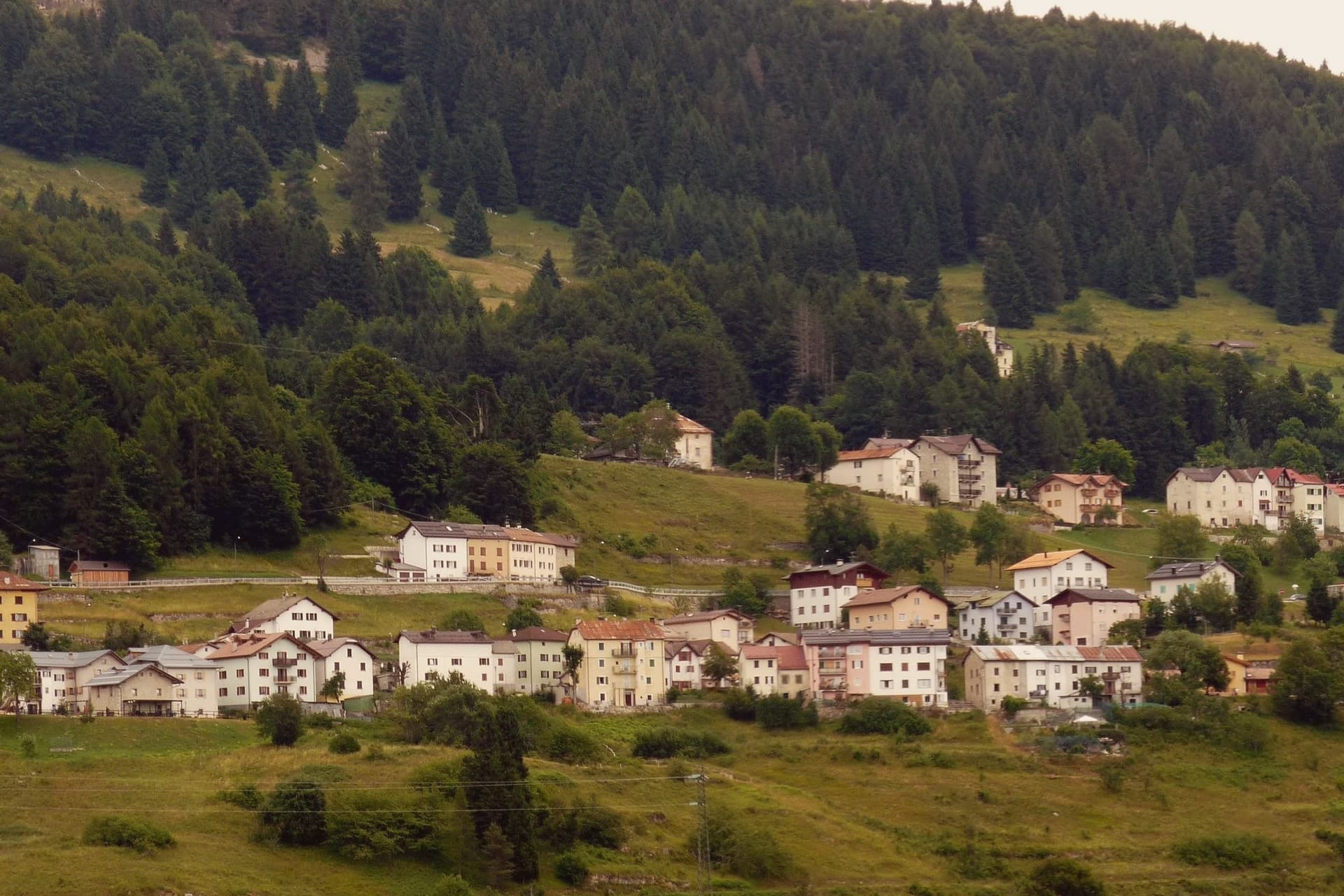
Winter in the province of Trento smells of woodsmoke and wet larch. The valleys run north and west off the Adige, and the snow settles on pasture that was cut for hay in August, on barns with stone bases and dark timber above, on churches with onion spires. Lifts start close to the village, sometimes at the edge of the car park, and the pistes cut through spruce before opening onto meadow. Lunch is canederli in broth, polenta with cheese from the valley dairy, strudel and a grappa that tastes of pine, eaten indoors while the light goes blue by mid afternoon. From December into March the cold here is dry, and the mornings are often clear.
Most people who ski Trentino head for Madonna di Campiglio, which has the reputation, the shops and the connected circuit to justify it, and the traffic that comes with all three. The Val di Fassa and the Sella Ronda pull the rest, especially in February when the Italian school holidays and the international coach parties overlap. Prices climb, lift queues form at the base stations, and the good tables need booking before you arrive. None of this makes the skiing worse. It just means you are sharing it.
The same mountains keep going. The Brenta group, the Lagorai, the Altopiano di Folgaria and the high shelf above Lake Garda all carry ski areas that serve their own villages first and the wider market second, and those are the towns collected here. Some sit on plateaux where the runs are gentle and the cross country tracks matter more than the descents. Fewer people go, which changes what a winter week costs and how long you wait in the morning.
Of the 21 communes we have mapped in the province of Trento, 11 qualify as ski towns: each has a ski area on its own territory. This list is the hidden ones, 10 in all, ordered smallest first. The smallest, Luserna, has 267 residents.
Two more lists worth reading alongside this one: The 10 best high-altitude villages in the province of Trento and The best ski towns with a serious restaurant in Trentino-Alto Adige/Südtirol.
Luserna
Why visit Luserna
Luserna sits on the northwestern edge of the Folgaria plateau, four kilometres south of Lavarone and forty kilometres southeast of Trento. The village was founded around 1400 by Bavarian-Cimbrian colonists who moved up from nearby Lavarone, and the dialect they carried is classed by linguists as the oldest peripheral language of the German domain and the southernmost surviving in the Alps.
It was protected after the Second World War by the Gruber-De Gasperi Agreement and officially recognised in 2001 under Trentino's minority law, a legal history that runs a full half-century behind the community's own persistence in speaking the language at home. The village itself holds 267 residents, small enough that the museum complex, the restored peasant house, the old fort and the stone-and-wood core all sit within reach of each other rather than spread across a larger settlement.
What holds the place together is less any single building than the fact that the colonists' original tongue outlasted the empire whose frontier fort now stands as a museum piece nearby: the language, not the fortification, is what makes the plateau edge worth the four kilometres from Lavarone.
There is a mapped ski area on this commune, at 1333 metres.
What to see in Luserna
- Centro Documentazione Lusérn. Documentation Centre with permanent exhibitions on the Cimbrian community, the Great War on the plateaus, prehistoric metallurgy, and Cimbrian bobbin lace.
- Casa Museo Haus von Prükk. House museum in a restored nineteenth-century Cimbrian peasant dwelling, presented by guides who explain the dialect and the traditions of plateau life.
- Werk Lusérn. Austro-Hungarian Great War fortress on the imperial frontier with Italy, heavily shelled in 1915 and now part of the plateau's fortification museum circuit.
How to get to Luserna
Trento is roughly 51 minutes away by road.
Our tip
June through September is the alpine summer at 1,333 metres: cool evenings even in July, hiking on the plateau between Luserna and Lavarone, and the museums open at full schedule. December through March is the ski season on the Alpe Cimbra circuit, with snow holding above 1,300 metres into early April. April and May are quiet shoulder months between the lift closure and the green-up of the high pastures; many services close.
Molveno
Why visit Molveno
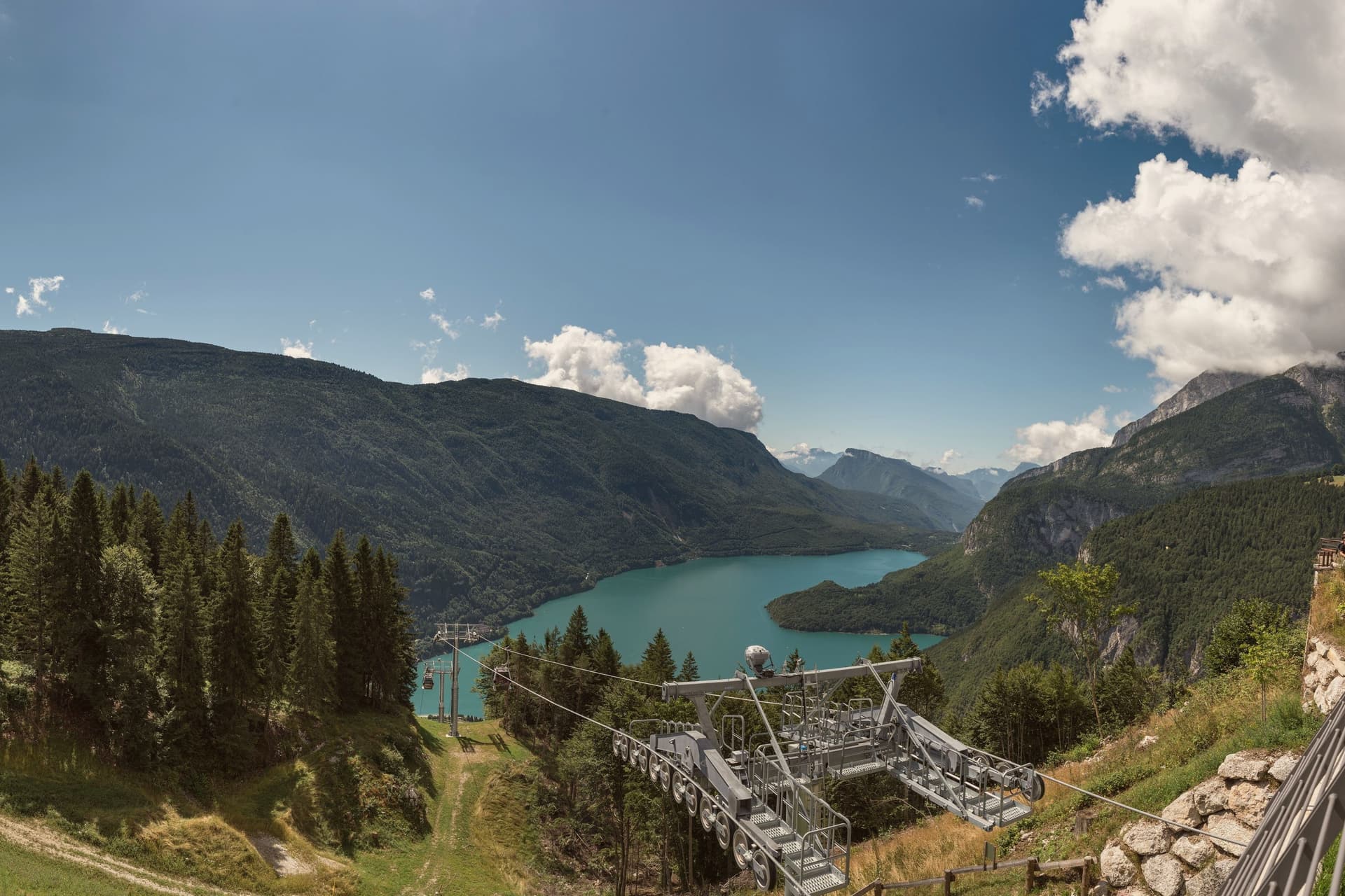
Molveno sits at 864 metres on the northern shore of a lake formed by a landslide about 4,000 years ago, held in on one side by the Brenta Dolomites and on the other by Monte Paganella. The village and its historic centre face the water from below the plateau of Pradel, which rises behind it and is reached by cable car, so the two halves of the place, lake shore and high ground, look at each other across the same stretch of blue.
The cemetery church stands slightly apart, above the centre, on the same slope. The lake is second-largest in the region by surface and the deepest in Trentino.
The nature park that holds the Brenta group begins right at the western shore, which means the mountains are not a backdrop seen from Molveno but a boundary the village is built against. The result is a place with almost no distance between the water, the settlement and the wild ground above it: the whole of Molveno can be read as a narrow shelf between a deep lake and a limestone wall.
There is a mapped ski area on this commune, at 864 metres.
What to see in Molveno
- Lago di Molveno. Four kilometres of water at 864 metres, formed by a landslide around 4,000 years ago, ringed by the Brenta Dolomites on one side and Monte Paganella on the other.
- Chiesa di San Vigilio. Gothic 13th-century church inside the village cemetery above the historic centre, with stone walls and a separate bell tower.
- Parco Naturale Adamello-Brenta. Largest protected area in Trentino, beginning at Molveno's western shore, with the Brenta Dolomites, brown bears, glaciers and a network of rifugi.
How to get to Molveno
Trento is roughly 71 minutes away by road.
Our tip
April through October is the running season for the lake. The water stays cold but is swimmable from late June through August; the perimeter path is 11 kilometres of mostly flat shoreline. July and August bring Italian-family crowds and full hotels around the small village core.
Andalo
Why visit Andalo
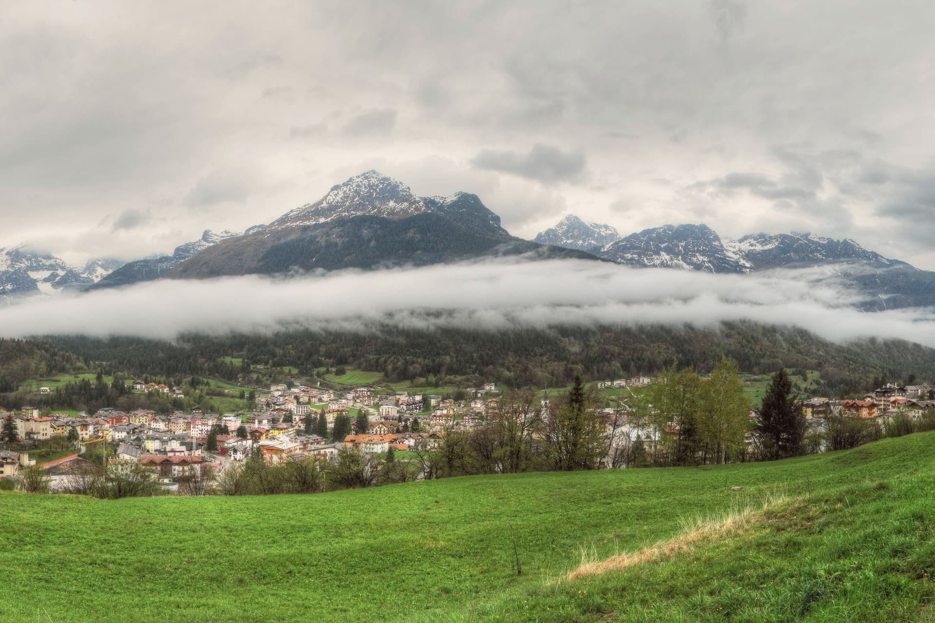
The plateau opens between Piz Galin at 2,442 metres and Cima Paganella at 2,125 metres, with the mountain massif on one side and Mount Paganella on the other. The settlement began in the Middle Ages as thirteen scattered masi, the farm clusters typical of Trentino's high pastures, which merged into a single town over the centuries: the grassy pass the village now occupies was, in effect, assembled from separate hamlets rather than founded as one place.
From the second half of the twentieth century the village grew into a winter sports resort, with lift infrastructure climbing from the village centre toward the higher slopes and summit. The lake at the edge of the settlement follows its own seasonal rhythm, full in spring and drained by late summer, apart from the built-up resort around it.
Together the pieces read as a farming settlement that kept its old shape at the centre while building a ski resort around its edge, with a nature park and a disappearing lake as the fixed, non-negotiable backdrop to both.
There is a mapped ski area on this commune, at 1042 metres.
What to see in Andalo
- Cima Paganella. Summit reached by gondola from the village centre via Doss Pelà, with panoramic views over the Brenta Dolomites and the Adige valley.
- Lago di Andalo. The lake sits at the edge of the village, a stretch of water that is full in spring and gone by late summer, its bed exposed where the shoreline had been.
- Parco Naturale Adamello-Brenta. The park covers most of the Andalo territory, taking in the Brenta Dolomites group inscribed in the UNESCO World Heritage list in 2009.
How to get to Andalo
Trento is roughly 39 minutes away by road.
Our tip
December through March is the ski season, the village's busiest months, with the Paganella lifts running from the centre and snow held above 1,000 metres into early April. June through September is the summer alpine season: cool evenings even in July, hiking and biking on the plateau, and the lake at its fullest in late June. April and May are quiet shoulder months when snow has gone and the meadows have not yet bloomed; many lifts and hotels close.
Lavarone
Why visit Lavarone
The plateau lies between the Folgaria highlands and the Cimbrian island of Luserna, forming the southern edge of the Alpe Cimbra ski circuit. Its territory is a scatter of twenty hamlets spread across pasture and conifer woods, settled by Bavarian-Cimbrian colonists between the tenth and thirteenth centuries, a history that still binds the plateau to Luserna under the same historic community.
At the centre of this scattered geography sits the lake, a sinkhole slowly filled with water, and to the south the ground rises to a limestone spur over the Val d'Astico where the fort was raised to mark the old imperial border with the Kingdom of Italy. The two landmarks sit at opposite ends of the same plateau, one low and wooded, one high and exposed, and both look out over the same valley that once divided empires.
In winter the lifts run from the hamlets above 1,000 metres, closing the loop between a pastoral upland and a line built for war.
There is a mapped ski area on this commune, at 1172 metres.
What to see in Lavarone
- Forte Belvedere Gschwent. Austro-Hungarian fortress built 1908-1912 on a limestone spur at 1,177 metres over the Val d'Astico, with armoured cupolas and a Great War museum.
- Lago di Lavarone. Karst lake at 1,079 metres, formed by the filling of a sinkhole, awarded the Bandiera Blu for water quality and ringed by a conifer-shaded walking path.
- Altopiano di Lavarone. Forested plateau between the Folgaria highlands and Luserna, a scatter of twenty hamlets across pasture and woods at 1,000 to 1,200 metres.
How to get to Lavarone
Trento is roughly 42 minutes away by road.
Our tip
June through September is the alpine summer: cool evenings even in July, hiking on the plateau, swimming and sailing on the Bandiera Blu lake, and the Forte Belvedere open to visitors. December through March is the ski season, with the Alpe Cimbra lifts running from the plateau hamlets above 1,000 metres and snow holding into early April. April and May are quiet shoulder months between the ski closure and the green-up of the meadows; many hotels close.
Canazei
Why visit Canazei
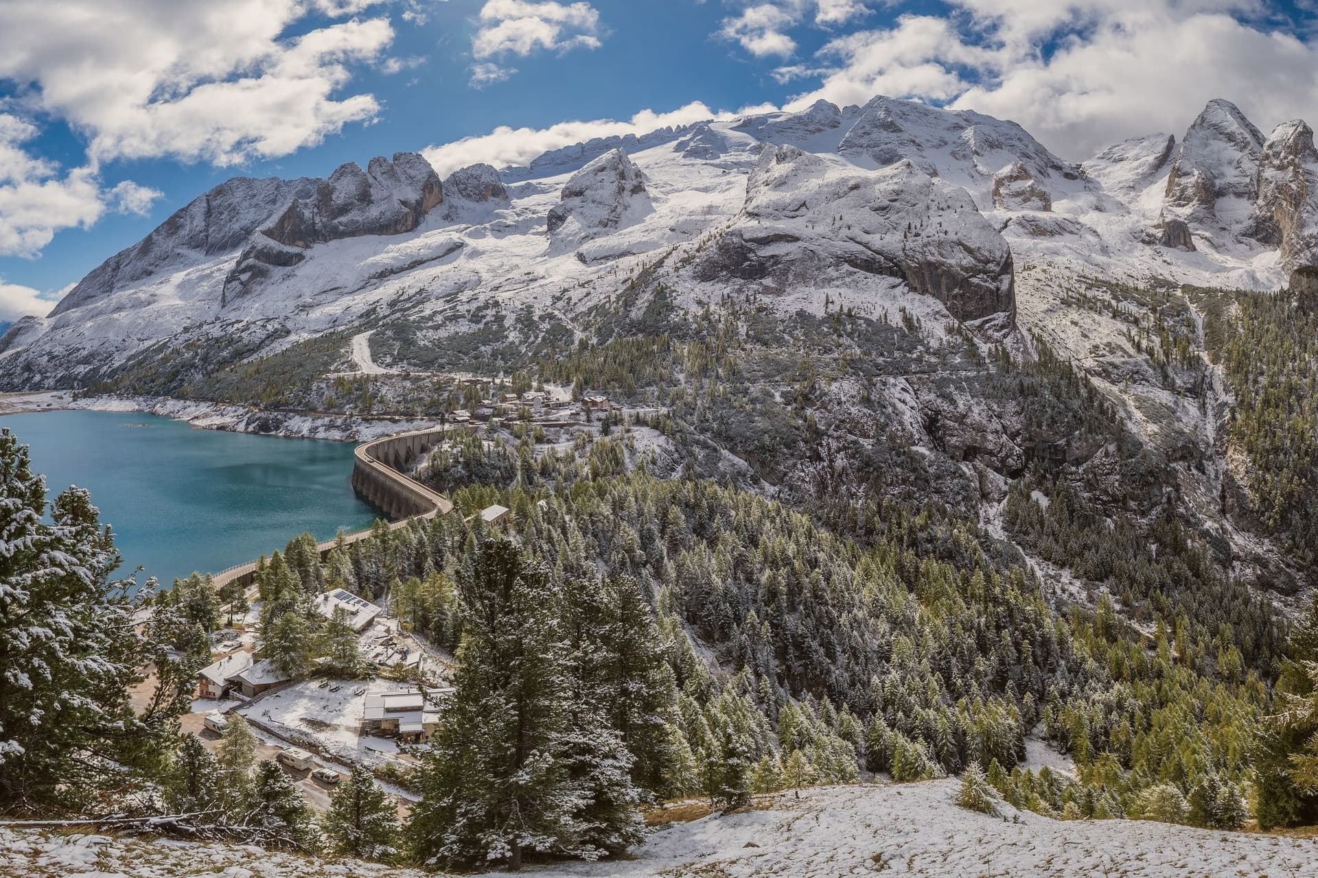
Canazei sits at 1,465 metres at the head of the Val di Fassa, one of the thirty highest towns in Italy, ringed by the Marmolada, the Sella Group and the Sassolungo. The commune includes the hamlets of Alba, Gries and Penia, which run together with the central village along the upper Avisio river.
Eight in ten residents speak Ladin as their first language, part of the small Dolomitic minority recognised by the autonomous statute, and the local Folk Group preserves the costumes, music and language traditions of the valley. Four ski areas connect from the village base: Belvedere, Ciampac, Col Rodella and the Marmolada cable car from Malga Ciapèla, all part of the Sellaronda and the wider Dolomiti Superski circuit.
The Pordoi cable car climbs to the Terrazza delle Dolomiti at 2,950 metres for a full view of the surrounding peaks, including the Marmolada at 3,343 metres, the highest summit in the Dolomites and a UNESCO World Heritage site since 2009.
There is a mapped ski area on this commune, at 1465 metres.
What to see in Canazei
- Marmolada. Highest summit in the Dolomites at 3,343 metres, reached by cable car from Malga Ciapèla above Canazei, with the only Dolomitic glacier on its northern face.
- Passo Pordoi. Dolomite road pass at 2,239 metres with a cable car to Sass Pordoi at 2,950 metres, called the Terrazza delle Dolomiti for its 360-degree view.
- Belvedere Ski Area. Main winter base of Canazei, gondola-linked to the Sellaronda circuit and the lift system across the four Ladin valleys of the Sella group.
How to get to Canazei
Bolzano is roughly 86 minutes away by road.
Our tip
December through March is the ski season, the village's busiest months, with the Sellaronda circuit running from the Belvedere base and snow held above 1,500 metres into early April. June through September is the summer alpine season, with the Pordoi cable car running to the Terrazza delle Dolomiti and a full network of hiking and via ferrata routes on the Marmolada, Sassolungo and Sella. July and August are the peak months, with refuges full and bookings tight on the Fedaia and Pordoi passes. Gran Festa da d'Istà falls in September.
Moena
Why visit Moena
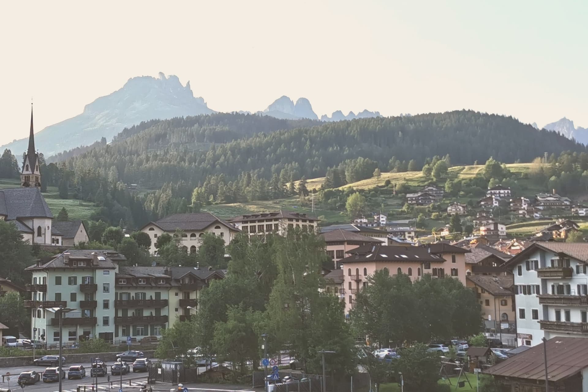
Moena sits at 1,184 metres at the entrance to Val di Fassa, which climbs north toward Canazei and the Sella massif. To the southeast a side valley rises toward the Passo San Pellegrino and the Marmolada group, while a plateau above the village, reached by cable car, opens onto the Catinaccio, Latemar and Pale di San Martino to the south.
The village is the largest in the valley and functions as its entrance point, with the high peaks visible on three sides and the pastures of San Pellegrino working land rather than backdrop. What holds the place together is less the geography than what the two festivals and the church commemorate: a language kept alive as an everyday tongue, a costume festival built around a foreign soldier's arrival, and a painter who left and came back.
Moena reads less like a single Alpine village and more like a crossing point, between valleys, and between a local story and the outside events that keep getting folded into it.
There is a mapped ski area on this commune, at 1184 metres.
What to see in Moena
- Chiesa di San Vigilio. Parish church rebuilt across the centuries, with a gilded wooden altar by Valentino Poschiavin and 18th-century paintings by Valentino Rovisi. It also holds work by Domenico Chiocchetti.
- Chiesa di San Volfango. Small Romanesque church next to the parish, with 15th-century frescoes and a wooden Baroque ceiling carved by Giovanni Guadagnini in the 17th century.
- Museo Ladin de Fascia (sezione Moena). The Ladin cultural museum network with a Moena exhibit on local language, costume and rural life in the lower Val di Fassa.
How to get to Moena
Bolzano is roughly 65 minutes away by road.
Our tip
June through September brings the green Dolomite season: alpine pastures open, the Catinaccio and Latemar are walkable from the cable cars above town, and the August Turchia festival fills the streets for three days. December through March is the ski half of the year, with lifts running on Alpe Lusia and over the Passo San Pellegrino into the Tre Valli circuit. April, May, October and November are quiet, between seasons. Festival del Puzzone falls in September.
Pinzolo
Why visit Pinzolo
Val Rendena runs the length of the valley floor, separating the granite of the Adamello-Presanella to the west from the Dolomites to the east, and Pinzolo sits at its center at 770 metres. The settlement is documented from 1211 as Penzollo, a medieval community of farmers and pastoralists that kept a degree of independence from the D'Arco counts through its own village assembly, the Università.
Most of the municipal territory now falls inside the Adamello-Brenta Nature Park, the largest protected area in Trentino, which places both mountain ranges within the same administrative boundary as the town itself. Up the valley, the frazione of Madonna di Campiglio grew from a travelers' hospice into a resort, and the two settlements are now linked by gondola as well as by governance, the older farming village at the valley floor and the younger resort on the slopes above it.
Pinzolo became a ski town in the second half of the twentieth century, and the cable car climbing from its centre to 2,100 metres is the physical expression of that link, carrying the town's growth up toward the peaks that have always framed it.
There is a mapped ski area on this commune, at 770 metres.
What to see in Pinzolo
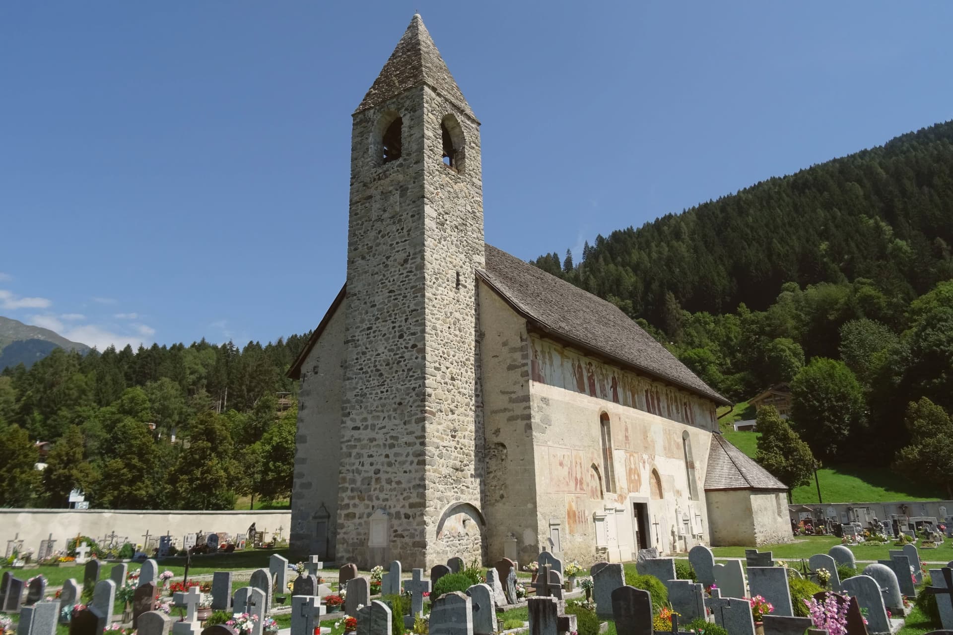
- Chiesa di San Vigilio. The church stands above the village. Its painted procession of eighteen skeleton pairs leads pope, emperor, king, beggar and child in a single line across the exterior wall, the fresco surviving in near-complete condition.
- Chiesa di Santo Stefano. Cemetery church on the edge of the village, frescoed inside and outside by the Baschenis painters with another Dance of Death cycle and scenes of saints.
- Parco Naturale Adamello-Brenta. Largest protected area in Trentino, covering most of the Pinzolo territory and including the Brenta Dolomites and the Adamello-Presanella glaciers.
How to get to Pinzolo
Trento is roughly 93 minutes away by road.
Our tip
May through October is the open season in Pinzolo, with the longest days in June and July and the Val Genova waterfalls running full from snowmelt. September is the cleanest light, the larches still green, the high refuges in the Brenta Dolomites still staffed. December through April reopens the village as a ski base, but the editorial calendar tracks summer use: hiking, the rifugio circuit, the Baschenis frescoes accessible without snow.
Cavalese
Why visit Cavalese
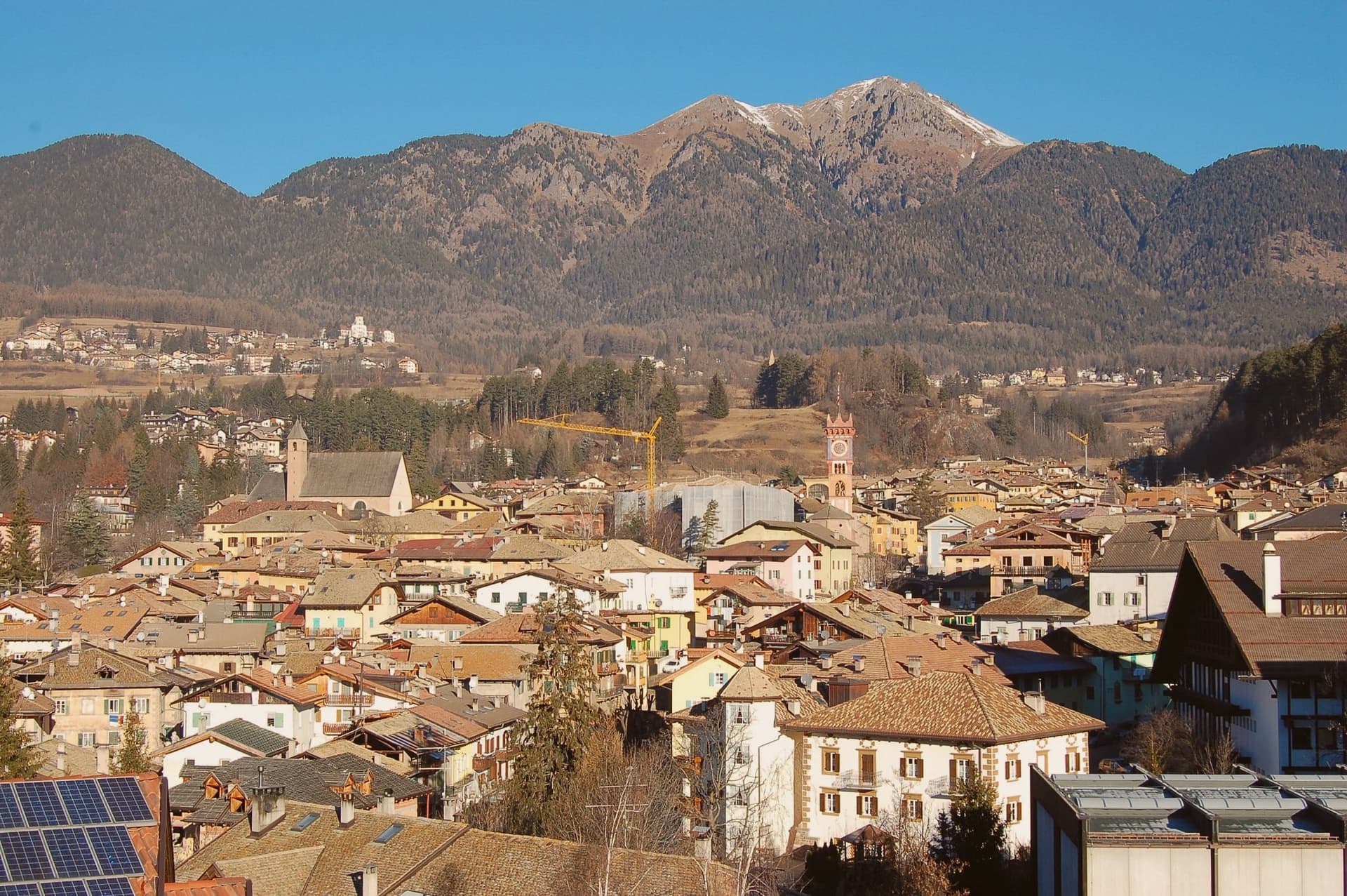
Cavalese sits at 1,000 metres on a south-facing terrace above the Avisio, forty kilometres northeast of Trento, the main town of the Val di Fiemme. The valley's eleven communes held their forest commons in common under the Magnifica Comunità, the self-governing body founded by the founding charter of 1111, and Cavalese has kept its seat through the Bavarian abolition of 1807 and every legal change since.
The valley floor carries the working memory of that governance: the archive of parchments, the frescoed council chambers, the bench in the open air where disputes were once judged. Above the town, the cableway to the Alpe Cermis climbs toward 1,912 metres, and the flat route along the Avisio ties Cavalese to the other Fiemme communes strung along the valley floor from Predazzo down toward the Adige.
Nine centuries of continuous self-rule and a valley of communes bound by a single river explain why Cavalese reads less like a single town than like the administrative floor of the whole valley.
There is a mapped ski area on this commune, at 1000 metres.
What to see in Cavalese
- Palazzo della Magnifica Comunità di Fiemme. Medieval bishop's residence enlarged in the Renaissance, seat of the community since 1810, with a picture gallery and an archive of parchments from the thirteenth to eighteenth centuries.
- Pieve di Santa Maria Assunta. Parish church of Cavalese, consecrated in 1134 on an older foundation, standing beside the park where the valley's representatives once sat in judgment.
- Banco della Reson. Stone bench in the Parco della Pieve where the representatives named in the Patti Ghebardini met as an open-air parliament to judge valley disputes.
How to get to Cavalese
Bolzano is roughly 95 minutes away by road.
Our tip
June through September is the high-valley season: meadows open above 1,000 metres, the Latemar and the Lagorai are reachable on day walks from the town, and the cycle path along the Avisio fills with day-trippers. December through March is the ski season on Alpe Cermis and the Lavazè plateau, with snow held above 1,000 metres into early April and the Tour de Ski final climb up the Cermis slope each January. April, May, October and November are the quiet shoulder months between the seasons, when the cable car runs reduced schedules and the valley returns to its residents.
Brentonico
Why visit Brentonico
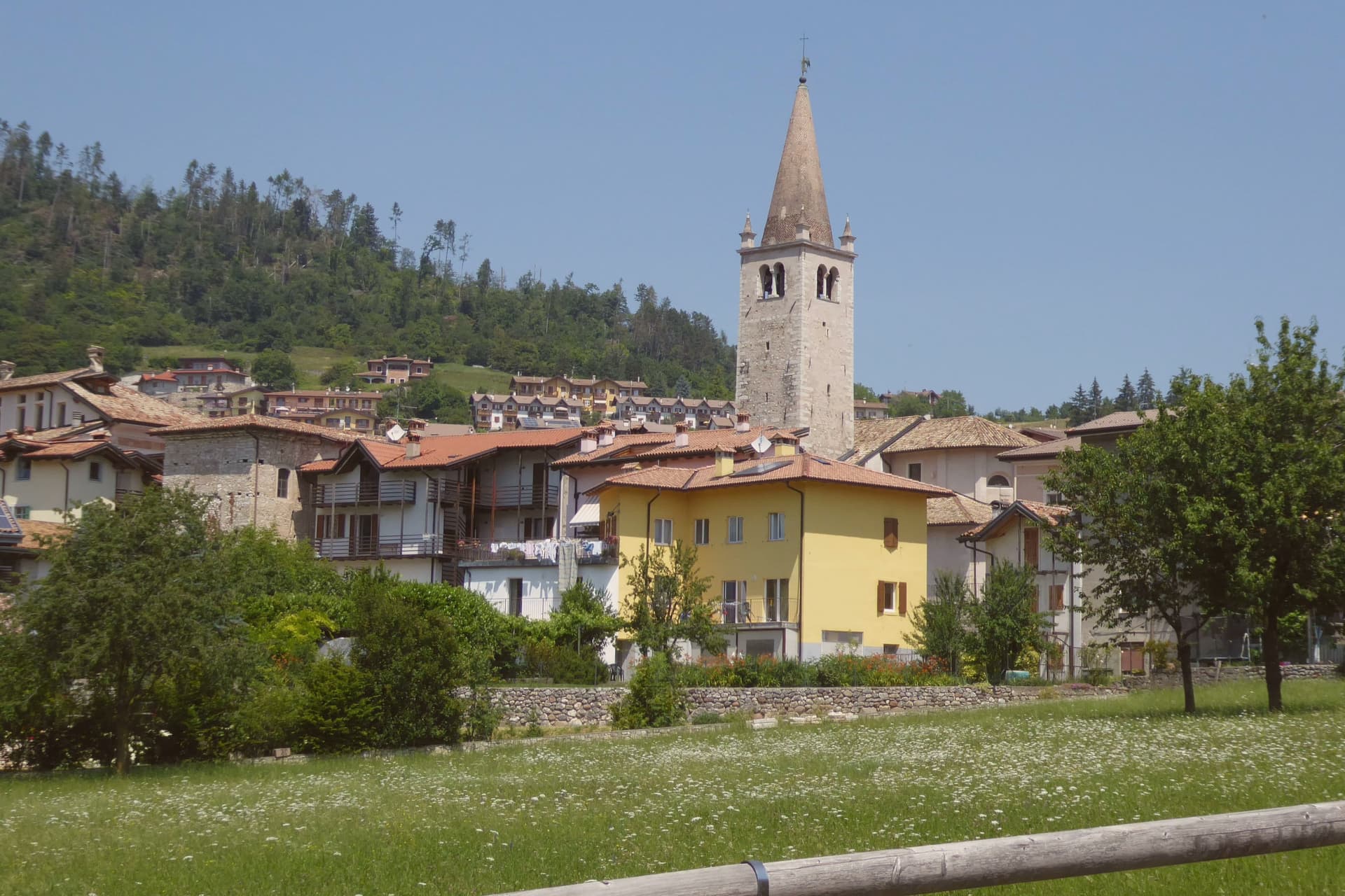
Brentonico sits at 692 metres on a plateau between Lake Garda and the Vallagarina. The commune runs from 500 metres in the valley to over 2,000 at the ridge, an altitude range wide enough to hold a chestnut hamlet at one end and ski hamlets at the other.
Castione, the lower hamlet, faces the Adige valley and lives by its terraces. San Valentino, Polsa and San Giacomo, the upper hamlets above 1,200 metres, face the opposite way, toward pasture and snow.
Palazzo Eccheli-Baisi anchors the centre and has changed hands once in a way that says something about the town: built in 1597 by mine managers, it passed in 1840 to a family of salami merchants, before ending up, in this century, as a house for fossils and for the office that manages the mountain's protected slope. That slope, and the garden set in front of the palace, both draw on the same fact: the mountain was named by European botanists for what grows on it, and the town's two conservation projects, one wild, one planted, sit on either side of the same building.
Above Crosano the ground still carries the trenches of the First World War, dug where the Austro-Hungarian line crossed the plateau. The valley below has been worked for chestnuts and the ridge above was fought over, and the palace in the centre now holds the record of both.
There is a mapped ski area on this commune, at 692 metres.
What to see in Brentonico
- Palazzo Eccheli-Baisi. The building's later life traces the town's own turns: sold in 1840 by the founding mine-manager family to salami merchants, it now sits open to visitors as museum and park office at once, fossils in the rooms where ore accounts were once kept.
- Giardino Botanico di Brentonico. Opened in 2005 at 690 metres, directly in front of the palace, the garden gathers native and rare Monte Baldo plants into a plot small enough to walk in an afternoon.
- Parco Naturale Locale del Monte Baldo. The protected slope is where the mountain earns its old reputation: paths through it cross the endemic flora that gave the range its name among European botanists.
How to get to Brentonico
Trento is roughly 42 minutes away by road.
Our tip
May through October brings the warm months on the plateau, with the botanical garden in flower from late May, the Monte Baldo paths open above 1,500 metres, and the chestnut hamlets cool against the heat of the Vallagarina below. June and July see the rare Monte Baldo endemics in bloom on the upper slopes. October is the chestnut harvest, the busiest month in Castione, with the marroni roasted at autumn sagre.
Levico Terme
Why visit Levico Terme
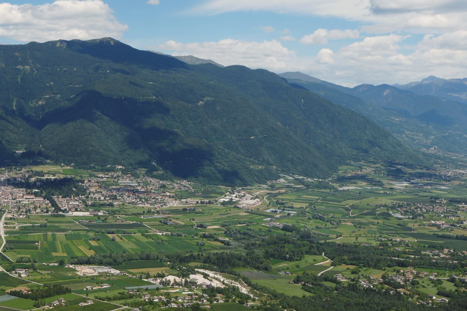
Levico Terme sits at 520 metres in the Valsugana, twenty kilometres east of Trento, between the Lagorai chain and the high plateaus of Folgaria and Lavarone. The settlement passed under Habsburg jurisdiction in 1779 and was elevated to city rank in 1894 by decree of Franz Joseph I.
The spa quarter, the park and the lake sit close together at the edge of the old centre, with the fort watching all three from the hill above. The historic centre, with its imperial-era villas and the parish church of Santissimo Redentore, grew up around the spa rather than the other way round: the streets follow the shape of a resort built in the space of a few decades under Austro-Hungarian rule, rather than a town that predates it.
What survives is a place whose entire layout, from park gate to lakeshore to the fort on the ridge, still reads as the imperial spa it was built to be.
There is a mapped ski area on this commune, at 520 metres.
What to see in Levico Terme
- Parco delle Terme. Grounds laid out by Georg Ziehl around the spa buildings and the hotel, with paths shaded by mature planting where the Christmas market sets up each winter.
- Grand Hotel Imperial. Art Nouveau facade facing the park it anchors, the rooms where Empress Elisabeth stayed still forming the core of the working hotel.
- Terme di Levico. The spa buildings that gave the town its purpose, drawing on water piped down from the mountain springs and still run as a treatment centre today.
How to get to Levico Terme
There is a railway station in the town, so you can arrive without a car and never need one while you are here. Trento is roughly 30 minutes away by road.
Our tip
Levico runs year-round: the thermal cures operate from spring through autumn, the Christmas market fills the Habsburg park through December, and the spa hotels stay open through the cold months. May through October is the lake season, with the Bandiera Blu waters warm enough for swimming from mid-June and the sailing and windsurfing clubs open. June through August can hit thirty degrees in the valley floor; the park and the lakeside hold the heat better than the centro storico in the afternoon.
More from Anywhere Italy
- The 10 best high-altitude villages in the province of Trento
 The best ski towns with a serious restaurant in Trentino-Alto Adige/Südtirol
- The best small ski towns that eat well in Trentino-Alto Adige/Südtirol
- The best small towns that eat well in the province of Trento
 The best towns with a serious restaurant in the province of Trento
- The 9 best mountain towns within 90 minutes of Trento