
The best beach towns in Abruzzo
The Abruzzo coast is sand rather than shingle, wide and shallow-shelving, with rows of pine trees planted behind the beach to hold the dunes and give shade by late morning. Fishing boats still work out of the harbours, and the local dish is brodetto, tomato-loose fish stew eaten with bread, served in restaurants that also do skewers of grilled lamb from the mountains an hour inland. Summer is long here, warm into late September, and the seafront promenades fill with cyclists using the old railway line that now runs as a coastal green route. Behind it all, on a clear day, the Gran Sasso holds snow while people swim.
Most people who come to Abruzzo for the outdoors head for the Parco Nazionale d'Abruzzo or make the drive up to Campo Imperatore, and the coast they see is Pescara: a working city with a big beach, a good fish market, and traffic. In August the Pescara seafront is solidly booked, its lidos lined up umbrella to umbrella, and the trains in from Rome empty onto the same stretch of sand. It is a decent place to eat and a poor place to look for quiet water.
The same sand continues north and south of it for a long way, past river mouths and pine belts and old fishing quarters, and the towns along that continuation are where fewer people go. Some sit under hilltop old centres, some behind pinewoods, one or two on cliffs where the coast finally breaks its flatness. We have included a couple of lake towns from the mountains inland as well, for swimming that is not the sea. Each of the coastal towns here holds the national award for clean bathing water and well-run beaches.
Of the 73 communes we have mapped in Abruzzo, 10 qualify as beach towns: each holds the national award for clean bathing water and well-run beaches. The smallest, Villalago, has 511 residents.
Two more lists worth reading alongside this one: The best coastal towns in Abruzzo and The best coastal towns that eat well within 90 minutes of Pescara.
Villalago
Why visit Villalago
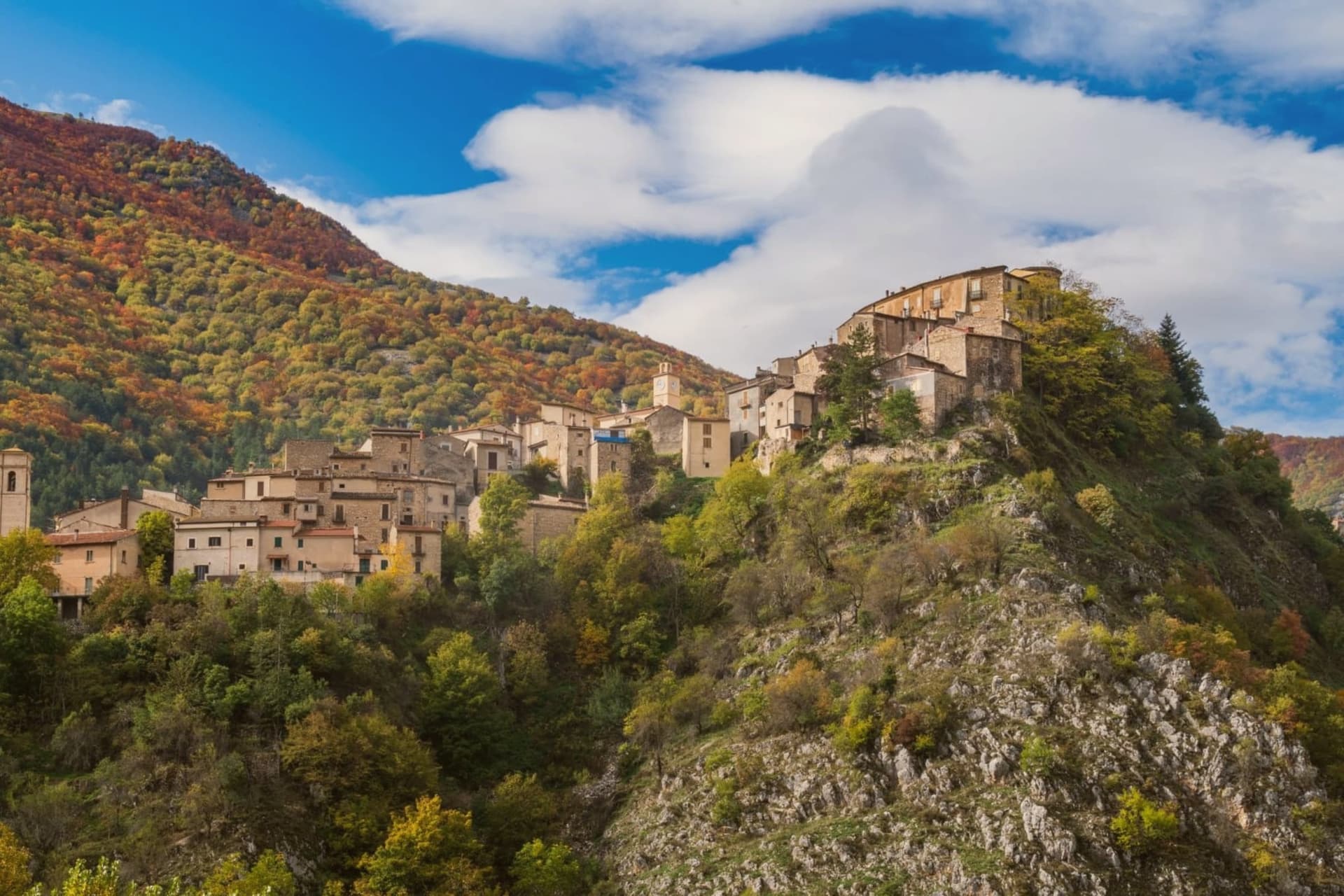
Villalago sits at 930 meters in the Sagittario valley between Scanno and Anversa degli Abruzzi, inside the Parco Nazionale d'Abruzzo, Lazio e Molise. The name comes from the vulgar Latin valle de lacu, the valley of the lake, a reference to the nine natural lakes once present in the territory, most now gone.
Three remain: Lago Pio for swimming, Lago di Scanno to the south with its famous heart shape, and Lago di San Domenico to the north, the artificial reservoir completed in 1929 by the State Railways to electrify the Rome-Sulmona line. On the lake's edge stands the Eremo di San Domenico, a small church built into a cave where, around the year 1000, the Benedictine monk Domenico di Sora lived.
The actual chapel went up in the 1400s, the portico in the 1600s. The parish church holds an altar to the saint carved in stone in the 12th century.
Villalago has been a Borgo dei Borghi finalist on RAI and is one of only three Bandiera Blu lake towns in Abruzzo.
The beach here holds the national bathing award, which a comune has to win back every year on water quality, beach management and safety.
What to see in Villalago
- Eremo di San Domenico. Hermitage on the lake's edge, built into a cave where Saint Dominic of Sora lived around the year 1000, with the chapel added in the 15th century.
- Lago di San Domenico. Artificial reservoir completed in 1929 to power the Rome-Sulmona railway, fed by the Sagittario gorge and held by a dam at the village's edge.
- Centro storico. Stone-built medieval core at 930 meters with the parish church preserving a 1521 Madonna del Rosario and a 12th-century stone altar to San Domenico.
How to get to Villalago
Pescara is roughly 75 minutes away by road.
Our tip
May through October is the window. The lakes warm enough for swimming from June, and the trails through the Gole del Sagittario stay clear until late October. July and August fill with Italian summer visitors but at 930 meters the air remains cool by evening.
Scanno

Why visit Scanno
Scanno sits in the Sagittario valley, ringed by the Majella foothills and the Marsicano massif. The lake lies three kilometers down the valley from the town, at a lower elevation, so the walk between them moves from stone alleys to open water framed by the same slopes that produced it: a landslide off the mountain dammed the Tasso river and left the basin behind.
The town's isolation, closed in by the surrounding massifs, is what let the older costume and its headdress survive into the era of the camera, and it is what drew photographers to record it rather than something they invented. The goldsmiths' filigree, made in the same stone streets the women walked, belongs to the same thread: a village shaped by its enclosure in the mountains, still making by hand what it has always made.
The beach here holds the national bathing award, which a comune has to win back every year on water quality, beach management and safety.
What to see in Scanno
- Lago di Scanno. Seen from above, the water reads as a clean heart shape against the valley walls.
- Centro storico. Stone-alley medieval centre where the black costume, with its folded headdress some historians trace to Balkan or Eastern origins, is still worn by older women against limewashed walls.
- Chiesa di Santa Maria della Valle. Parish church first documented in the eleventh century, rebuilt in the seventeenth, with a Renaissance portal and Baroque interior.
How to get to Scanno
Pescara is roughly 80 minutes away by road.
Our tip
June through September is the summer window: trails open in the national park, the lake holds a Blue Flag for swimming, and the centro fills with photographers chasing the Giacomelli setups. December through March is the second season for snow, with skiing on Monte Rotondo and Passo Godi nearby. April, May, October and November are quiet, with many family-run hotels closed and the lake side restaurants shuttered.
Fossacesia
Why visit Fossacesia
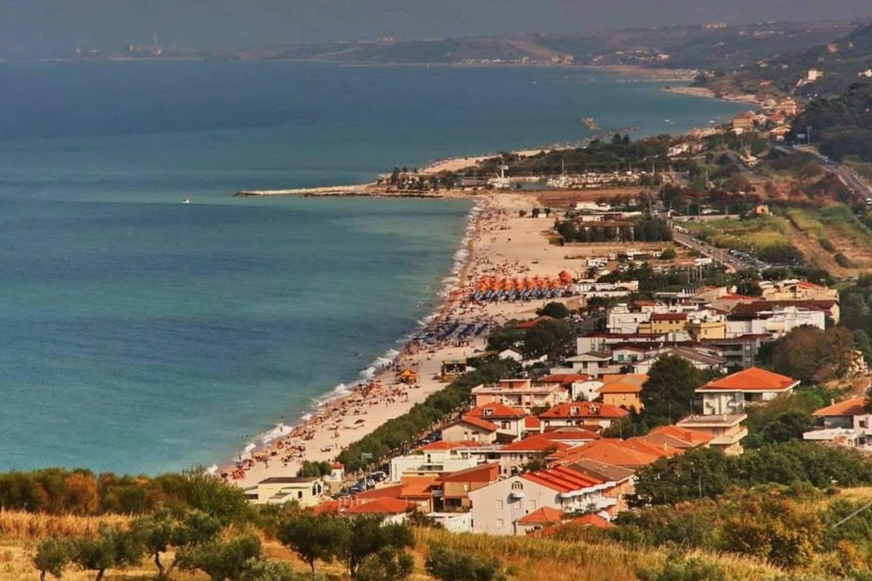
Most people arrive at Fossacesia for the abbey and stay for the coast underneath it. San Giovanni in Venere was rebuilt in the twelfth century on ground that had held a temple to Venus, which is where the name comes from, and it sits on a shoulder of hill with the Adriatic laid out below and olive groves on every side.
Down at sea level, Fossacesia Marina is the northern end of the Via Verde, the cycle path laid along the route of the old coastal railway, and the trabocchi themselves stand out over the water on their wooden legs.
The beach here holds the national bathing award, which a comune has to win back every year on water quality, beach management and safety.
What to see in Fossacesia
- Abbazia di San Giovanni in Venere. The Benedictine abbey above the coast, rebuilt in the twelfth century on the site of a Roman temple. The carved portal and the crypt are the reasons to climb up.
- Via Verde della Costa dei Trabocchi. The coastal cycle path on the old railway line. Fossacesia Marina is its northern trailhead.
- The trabocchi. The timber fishing platforms built out over the water along this stretch of coast. Several are still worked and a few serve dinner.
How to get to Fossacesia
There is a railway station in the town, so you can arrive without a car and never need one while you are here. Pescara is roughly 44 minutes away by road.
Our tip
May, June and September are the best of it. The abbey is worth the trip in any month, but the coast below only works when the sea is warm and the path is not baking. August is busy at the marina and quiet up at the abbey.
Alba Adriatica
Why visit Alba Adriatica
Alba Adriatica is the northernmost of the seven coastal communes of the province of Teramo, the chain of resort towns known collectively as the seven sisters. The commune did not exist before 1956: it was created by referendum that year when the coastal residents of Tortoreto voted for administrative autonomy.
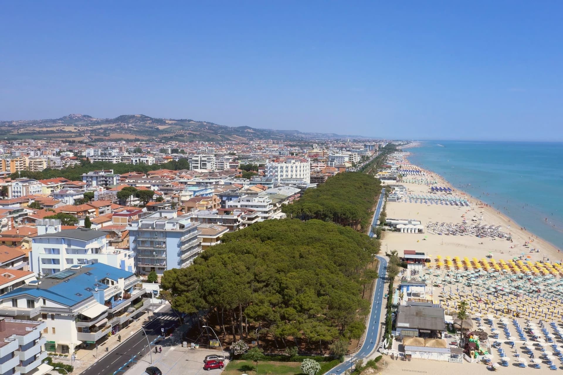
The town's identity is its sand. The three-kilometer beach is called the Spiaggia d'Argento, the silver beach, for the fineness of its grains.
The Blue Flag flew here continuously from 2000 to 2013 and again in recent years. The lungomare runs the whole length of the commune, palm-lined and largely flat, joining the towns on either side without a clear visual break.
Inland from the beach, the town is laid out on a 20th-century grid, with no centro storico to speak of: the historic centers belong to the older inland communes. Alba Adriatica was built to be a beach.
The beach here holds the national bathing award, which a comune has to win back every year on water quality, beach management and safety. It is also rated for accessibility, which most of this coast is not.
What to see in Alba Adriatica
- Spiaggia d'Argento. The three-kilometer fine-sand beach, gently sloped, Blue-Flag-rated for water quality continuously from 2000 to 2013 and after.
- Lungomare Marconi. Palm-lined promenade running the length of the commune, joining Tortoreto Lido to the north and Giulianova to the south.
- Chiesa Sant'Eufemia. Parish church set on the inland grid, a modest 20th-century construction reflecting the town's recent 1956 foundation date.
How to get to Alba Adriatica
There is a railway station in the town, so you can arrive without a car and never need one while you are here. Pescara is roughly 51 minutes away by road.
Our tip
May through September is the season. June and early September are the temperate weeks before and after the August crowds. July and August fill the beach and the boardwalks: temperatures sit in the low thirties, the water is warm by mid-July, and the lungomare runs late.
Pineto
Why visit Pineto
Pineto sits at sea level, one of the Sette Sorelle, the seven Adriatic resorts of the Teramo coast. The town was planned in the 1920s by Luigi Filiani as a beach resort under pine forest, and renamed Pineto in 1925 after Gabriele D'Annunzio's poem La Pioggia nel Pineto.
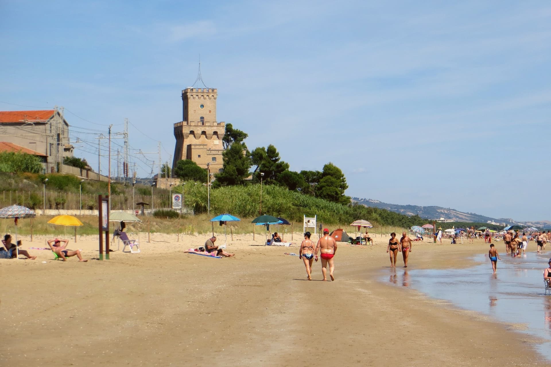
In 1929 it replaced Mutignano, the older hill village above, as the capoluogo of the comune. Two kilometers south of the centre stands the Torre del Cerrano, built around 1568 by Charles V as a watchtower against Ottoman raiders.
In 2010 the tower and the stretch of sea in front of it became Abruzzo's first marine protected area, 3,431 hectares of coast and shallow water. The beach has held a Blue Flag in most years since 2007.
The pine canopy, planted to hold the dunes, still shades the seafront promenade as far north as the Vibrata river.
The beach here holds the national bathing award, which a comune has to win back every year on water quality, beach management and safety.
What to see in Pineto
- Torre del Cerrano. Sixteenth-century watchtower built around 1568 under Charles V against Ottoman raids, now the gateway to Abruzzo's first marine reserve.
- Area Marina Protetta Torre del Cerrano. 3,431 hectares of protected coast and shallow Adriatic water established in 2010, the first marine reserve in the region.
- Pineta Catucci. Coastal pine forest planted in the early twentieth century to hold the dunes, shading the seafront promenade and the bike path.
How to get to Pineto
There is a railway station in the town, so you can arrive without a car and never need one while you are here. Pescara is roughly 26 minutes away by road.
Our tip
May through September is the season. June and September are the best beach months, warm but not hot, with the marine reserve open for guided snorkelling and the bike path along the pineta in full use. July and August bring Italian summer crowds, especially from Pescara, and the seafront fills.
Silvi
Why visit Silvi
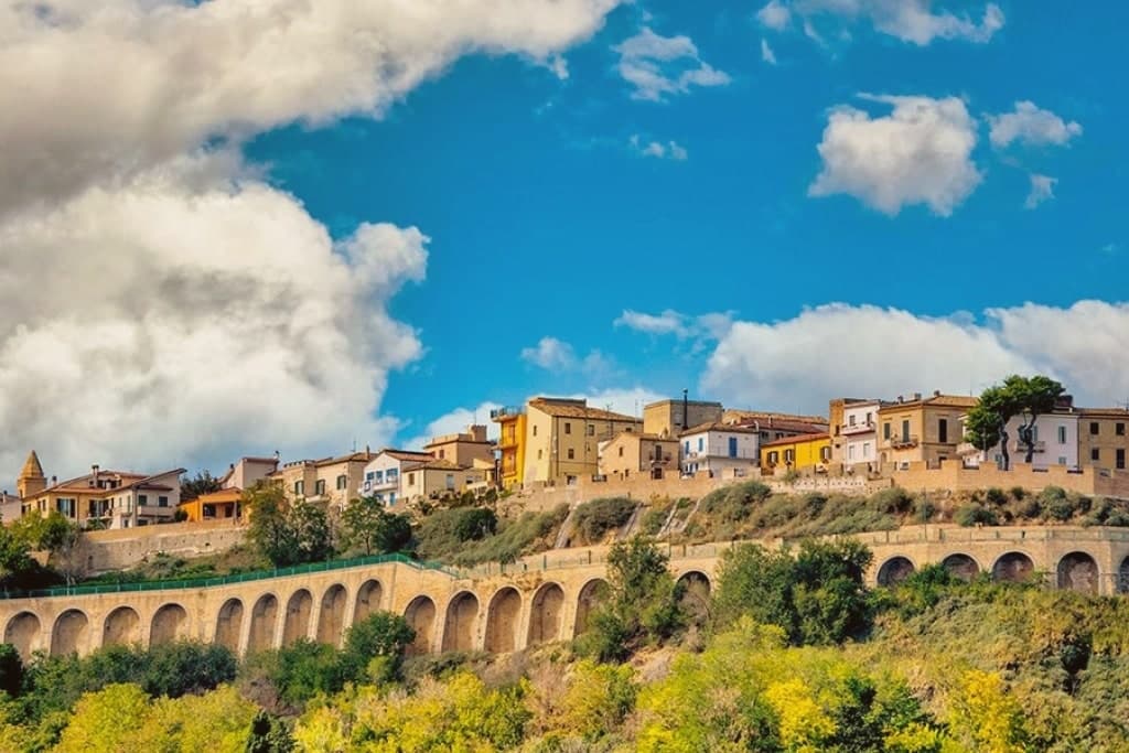
Silvi is two places held together by a hill. The upper town sits at 242 meters on a ridge above the water, known as Castrum Silvi in the Middle Ages and as Matrinum in earlier times.
The lower town, a fishing strip until 1931, took over as municipal seat that year and turned the coast into a summer resort, so the newer half now outranks the older one administratively even as the older half keeps the name's origin. The two halves run on industries that have nothing to do with each other and never did: one bottled its economy in licorice from a converted theater in the 1930s, the other guards a stretch of protected sea and dune around a sixteenth-century watchtower.
Pescara is fifteen kilometers south. What holds the town together is not a shared trade but the hill itself, the thing that separates the medieval ridge from the resort strip below and forces the place to be read as two settlements rather than one.
The beach here holds the national bathing award, which a comune has to win back every year on water quality, beach management and safety.
What to see in Silvi
- Silvi Paese. Stone alleys along a ridge, the old Castrum Silvi, with the coastline visible the length of the walk.
- Torre del Cerrano. The watchtower stands alone on the sand between the two towns, squat and stone, with the reserve's dune scrub pressing up against its base.
- Area Marina Protetta Torre del Cerrano. The first marine protected area in Abruzzo, established in 2010, covering a seven-kilometer stretch of coastline with intact dunes.
How to get to Silvi
There is a railway station in the town, so you can arrive without a car and never need one while you are here. Pescara is roughly 27 minutes away by road.
Our tip
May through September is when Silvi Marina fills, the lidos open, and the nine-kilometer beach works as advertised. July and August bring heat, Italian school holidays, and the maximum crowd density between Pescara and Teramo. June and September are the better months: the sea warms enough to swim, the lidos still run, and the inland breeze keeps the evenings tolerable.
Ortona
Why visit Ortona
Ortona is the largest town on the Costa dei Trabocchi and the least postcard-like. It has a real harbour with real boats in it, a castle on the cliff edge that the sea is slowly taking back, and a cathedral that has drawn pilgrims since 1258, when the relics were carried here from Chios.
It is also a war town. Over eight days at the end of 1943 Canadian and German troops fought through these streets house by house, and the town that stands now was largely rebuilt afterwards.
The Moro River cemetery on the edge of town is where most visitors end up going quiet.
The beach here holds the national bathing award, which a comune has to win back every year on water quality, beach management and safety.
What to see in Ortona
- Castello Aragonese. The fifteenth-century castle on the cliff above the port, open to walk around. Coastal erosion has taken part of it, which is visible from the seaward side.
- Basilica di San Tommaso Apostolo. The cathedral holding relics venerated as those of the apostle Thomas, brought from the island of Chios in 1258.
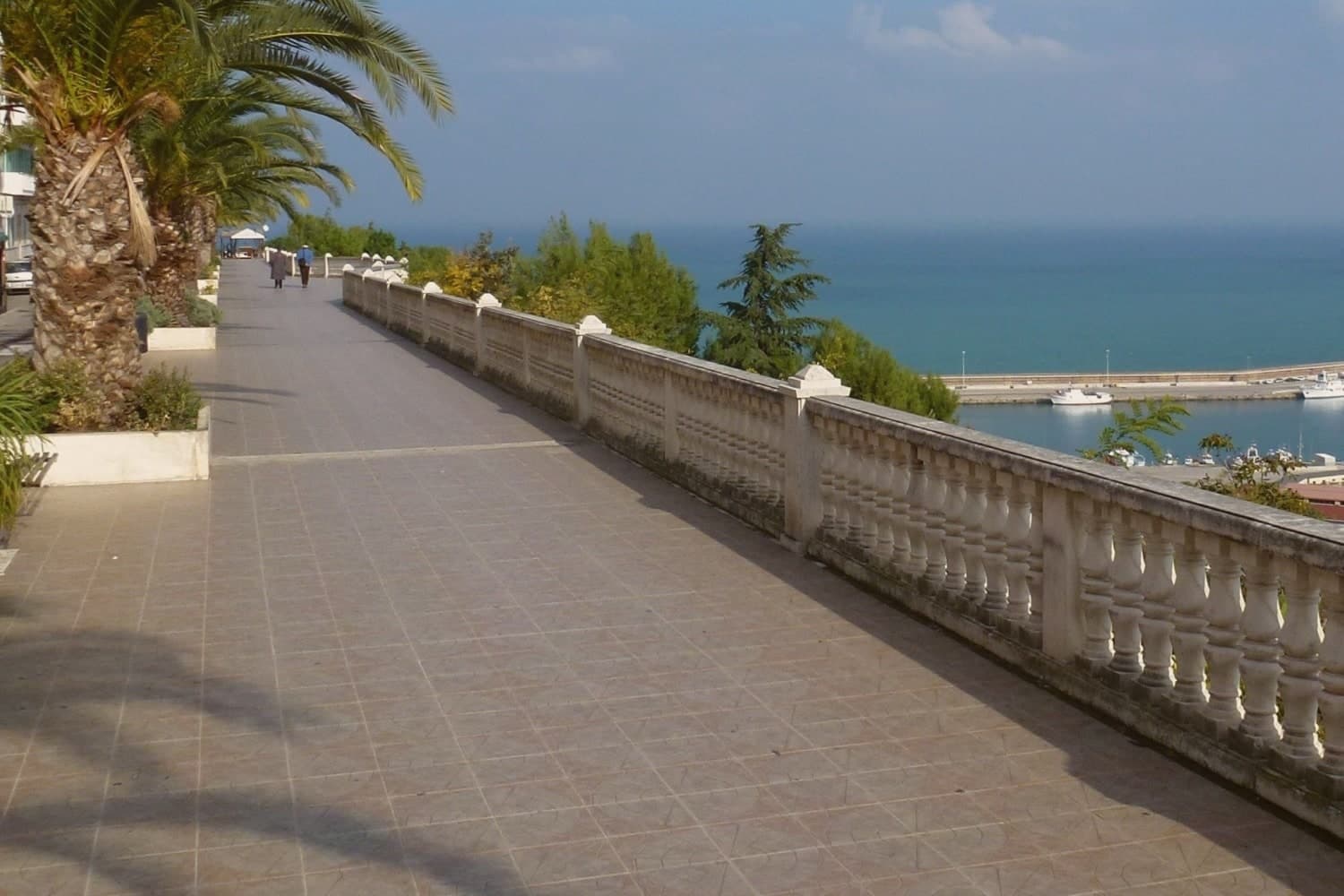
- Passeggiata Orientale. The belvedere walk along the cliff edge, looking north up the coast toward Pescara.
How to get to Ortona
There is a railway station in the town, so you can arrive without a car and never need one while you are here. Pescara is roughly 33 minutes away by road.
Our tip
May to September is the season, and the sea is warm from late June. July and August fill the beaches south of the harbour with Italian families rather than foreign coaches. The Via Verde is best in May or September, when the path is not hot. Sagra della Triglia e del Pesce Fritto falls in August.
Giulianova
Why visit Giulianova
The town sits at the mouth of the Tordino river, where colonists from Praetutii territory established Castrum Novum in the 3rd century BC. A medieval settlement, Castrum divi Flaviani, later stood on the same hill until it was destroyed in the Battle of the Tordino in 1460.
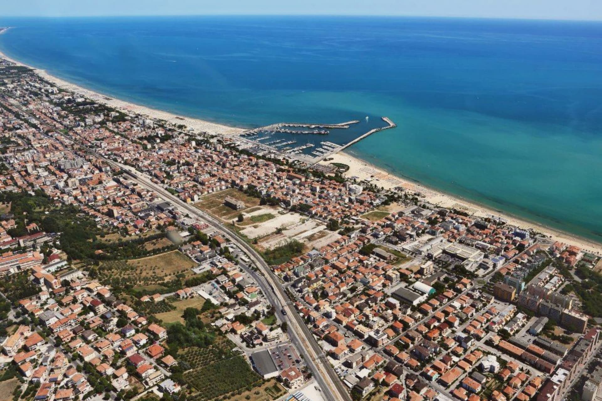
What rose after covers the upper part of the town today: a walled, planned town on the hill, 68 meters above the water. The Lido came later and by a different route, growing from the 19th century around the railway rather than around any single founding decision.
It is now one of Abruzzo's main fishing ports, and the fish stew served along its promenade, brodetto alla giuliese, is the local counterpart to the better-known Vastese version from further south. The sanctuary on the road between the two halves of town marks the physical and historical hinge between them: hill above, coast below.
In August the Sant'Andrea feast carries the saint by boat along the water, a rite that belongs to the Lido's fishing life rather than to the hill's planned streets. The town, in effect, holds two founding stories side by side, one Renaissance and deliberate, one maritime and gradual, and neither has absorbed the other.
The beach here holds the national bathing award, which a comune has to win back every year on water quality, beach management and safety.
What to see in Giulianova
- Duomo di San Flaviano. Cathedral in the hilltop Paese, its dome visible above the Renaissance street plan. Holds the relics of the saint after whom the medieval settlement was named.
- Paese. The hilltop town, walled and centered on a single piazza, its street plan unchanged since Giulio Antonio Acquaviva laid it out over the ruins of the settlement destroyed in 1460.
- Lido. The coastal town with promenade, fishing port and Blue-Flag beach, developed from the 19th-century railway era.
How to get to Giulianova
There is a railway station in the town, so you can arrive without a car and never need one while you are here. Pescara is roughly 46 minutes away by road.
Our tip
May through September is the beach season. June and September are the calm weeks, July and August the busy ones. The Lido fills with Italian families on holiday and the lungomare runs late.
Roseto degli Abruzzi
Why visit Roseto degli Abruzzi
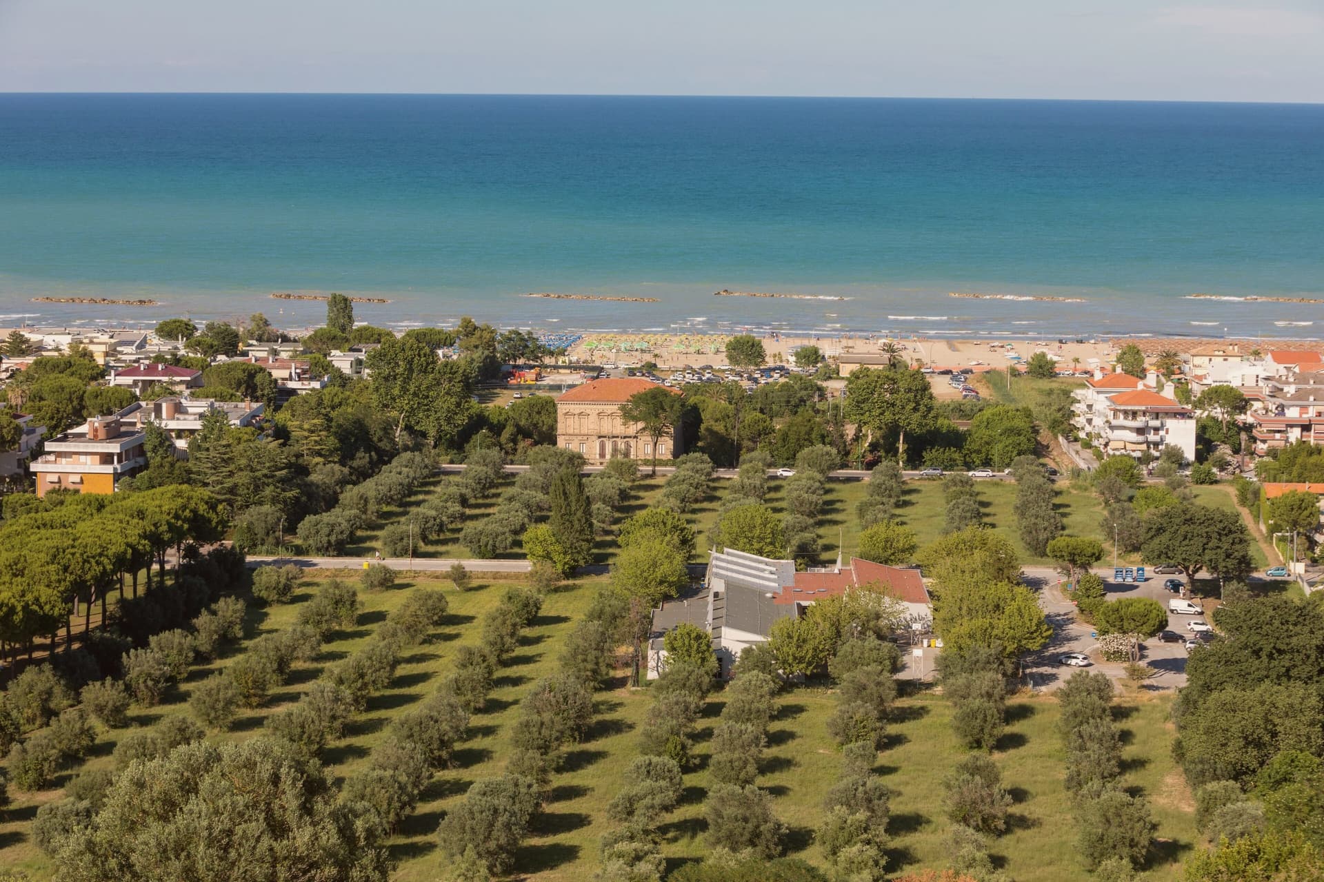
Roseto degli Abruzzi sits on the Adriatic between Giulianova and Pineto, with a flat lower town at sea level and the older nucleus of Montepagano on a hill 285 meters above. Ten kilometers of sand run continuously from the Tordino river south to the Vomano, divided into the historic lidos and the Cologna stretch.
The town carried the name Rosburgo until 1927, when it was changed because the Austrian-sounding form had become unpopular after the First World War. Rosburgo had been the local rebranding of the medieval Montepagano settlement that descended to the coast in the nineteenth century, taking its new name from the rose and oleander hedges that lined the new streets.
Roseto has held a Bandiera Blu Blue Flag every year since 1995 and is a Borgo Autentico d'Italia. The Riserva Naturale del Borsacchio, at the northern edge of town, protects the last dunes and Mediterranean scrub on this stretch of coast.
The beach here holds the national bathing award, which a comune has to win back every year on water quality, beach management and safety. It is also rated for accessibility, which most of this coast is not.
What to see in Roseto degli Abruzzi
- Lungomare and lidos. Ten kilometers of low-rise sand from the Tordino to the Vomano, with the Lido delle Rose, Cologna, and free-beach sections.
- Montepagano. Original medieval village on a hill 285 meters above the coast, with walls, stone houses, and a panoramic terrace over the sea.
- Riserva Naturale del Borsacchio. Coastal nature reserve at the north end of town, protecting dunes, Mediterranean scrub, and the nesting site of the Kentish plover.
How to get to Roseto degli Abruzzi
There is a railway station in the town, so you can arrive without a car and never need one while you are here. Pescara is roughly 37 minutes away by road.
Our tip
May through September is the beach season. June and September are the best balance of warm sea and lower crowds. July and August fill the lidos, especially the weekends of Ferragosto in mid-August.
Vasto
Why visit Vasto
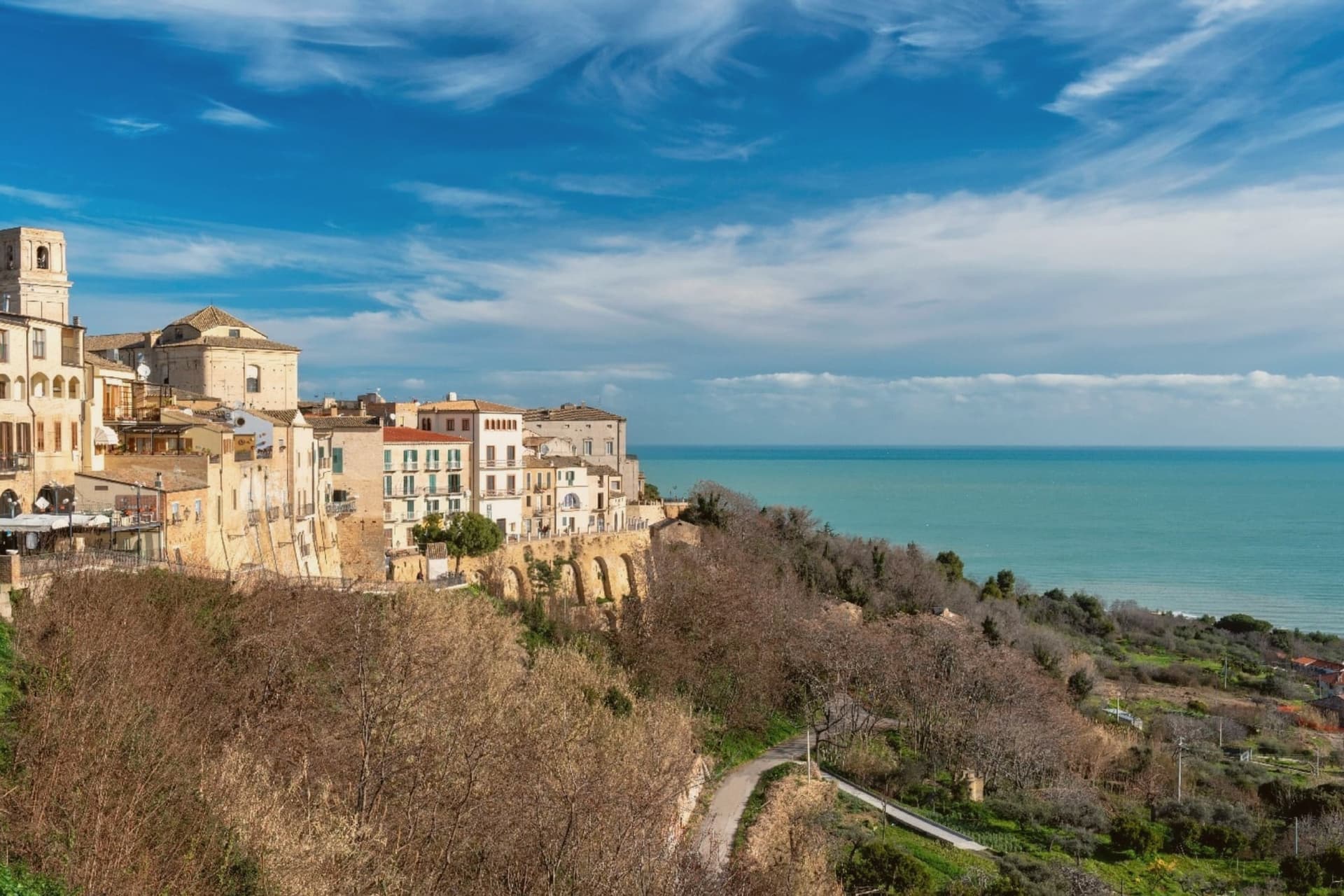
Vasto was the Roman Histonium, a name that predates the hill town's later medieval and Renaissance layers. It sits at 144 meters above the Adriatic, with the upper town, the castle and palace, set above the coast and the Punta Aderci reserve lying below to the north, cliffs and sandy beach against the built hill.
The coast running north from here to Ortona is the Costa dei Trabocchi, seventy kilometers of shoreline named for the wooden stilt-fishing platforms that still work its length. The brodetto alla vastese was invented, by tradition, in 1800 by the wife of a fisherman in the Trave district, who enriched the daily catch with tomato, parsley and garlic from her vegetable garden, a dish born of the same waters the trabocchi work.
The summer Capriccio festival fills the city with music in August. Upper town, reserve, and coast read as one arrangement: a hill settlement that has always faced the sea it feeds from and now also draws visitors to.
The beach here holds the national bathing award, which a comune has to win back every year on water quality, beach management and safety.
What to see in Vasto
- Palazzo d'Avalos. The palace now houses the civic archaeological museum and the Gabriele Rossetti poetry library, its rooms given over to collections rather than court life.
- Castello Caldoresco. Burned by Ottoman forces in 1566 and rebuilt afterward, the castle still anchors the upper town, a scarred structure standing in place of the one that fell.
- Punta Aderci. A nature reserve north of the town with sandy beaches, cliffs, and a migratory bird stopover protected since 1998, lying below the hill the old town sits on.
How to get to Vasto
There is a railway station in the town, so you can arrive without a car and never need one while you are here. Pescara is roughly 59 minutes away by road.
Our tip
May through September is the season. June and September are the calm weeks before and after the August crowds. The water reaches its warmest in early August and the Punta Aderci reserve cliffs hold afternoon shade.
More from Anywhere Italy
 The best coastal towns in Abruzzo
- The best coastal towns that eat well within 90 minutes of Pescara
 The best towns with a serious restaurant that you can reach by train within 90 minutes of Pescara
 The best towns you can reach by train in the province of Teramo
- The best olive oil towns within 90 minutes of Ancona
- The best hidden coastal towns within 90 minutes of Pescara