
The best towns you can reach by train that have a serious restaurant in Abruzzo
90 towns visited, 910 to go. Follow along, free: Subscribe on Substack
Abruzzo is a region of arrosticini turning over a narrow brazier, saffron from the Navelli plateau, confetti from Sulmona in paper cones, and brodetto made with whatever the Adriatic boats brought in that morning. The coast is long and low, its towns built in pale render and brick behind rows of pine, while inland the houses turn to gray stone and the light goes thin above the beech woods. Summer belongs to the shoreline, autumn to the mountains, when the truffles and the mutton come back onto the menus. The main line hugs the sea and the branch lines climb west toward the passes, so a good deal of this is reachable on a ticket rather than a hire car.
the reason most visitors come is the Parco Nazionale d'Abruzzo, Lazio e Molise and the trailheads around it, or a day trip to L'Aquila to see how the reconstruction is going. Both are worth the time, and in high season both are full: the park's car parks fill by mid-morning in August, and the Scanno road slows to a crawl. Neither is easy to reach without driving, which is part of why the same visitors circulate through the same towns.
The same coast and the same mountains carry on past all that, and the railway carries on with them. The towns here sit on the line, from the fishing harbors and pine-backed beaches of the north Adriatic down to the ports of the south, and up the valleys toward the ski country and the high plains. Each one has a kitchen that the most demanding of the Italian guides has thought worth listing, which is a reasonable reason to get off the train.
Of the 73 communes we have mapped in Abruzzo, 7 qualify as towns you can reach by train with a serious restaurant: we have confirmed each is reachable without a car, and each holds a restaurant listed by the most demanding of the guides. The smallest, Carsoli, has 5,007 residents.
Elsewhere in the catalogue: The best towns with a serious restaurant that you can reach by train within 90 minutes of Pescara and The best beach towns in Abruzzo.
Why visit Carsoli
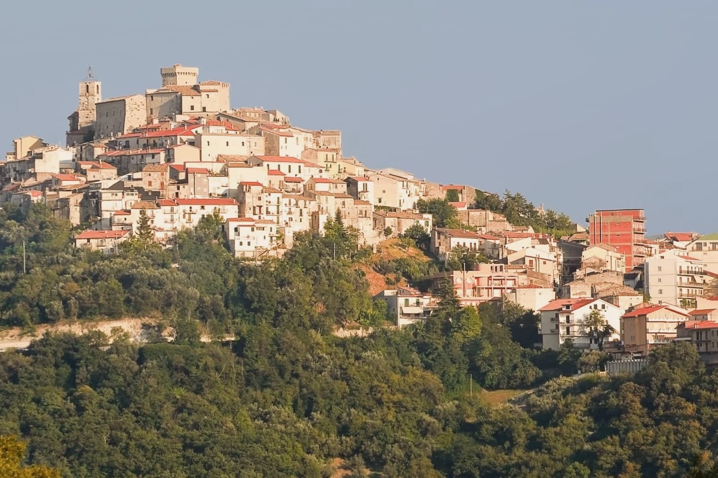
Carsoli sits at 616 meters in the Marsica, between the plain of the former Fucino lake and the valley of the Turano river, with Monte Velino and Monte Calvo both rising above 2,000 meters on its skyline. The modern town stands four kilometers northeast of Alba Fucens's neighbor Carsioli, the Roman colony founded between 302 and 298 BC as a stronghold to guard the road to Alba Fucens; walls and an aqueduct still stand at the locality of Muro Pertuso, surveyed in 1901 by the archaeologists Pfeiffer and Ashby.
The town's religious and military history sits closer to the modern center than the Roman ruins do. The Castle of Colle Sant'Angelo, raised around the year 1000 by the Counts of the Marsi, stood until later wars, and ruins of its adjoining church remain near the site.
Carsoli's autumn season runs on chestnut and polenta fairs with deep peasant roots, and the patron-saint feast of Santa Vittoria fills the streets with procession and stalls. The town's layout traces its own history: a Roman garrison post relocated over centuries into a medieval and then modern settlement, so that walking from the modern center outward means walking backward through the different periods that built it.
L'Angolo d'Abruzzo (MICHELIN and Gambero Rosso) and V'Incanto Osteria Moderna (Gambero Rosso) are listed in food guides.
What to see in Carsoli
- Sito archeologico di Carsioli. The city walls and aqueduct still stand at the site, four km from the modern town, surveyed by archaeologists in 1901.
- Chiesa di Santa Maria in Cellis. The church stands on the edge of town, with a rose window set over the main portal.
- Chiesa di Sant'Antonio. 16th-century church inside the centro storico, used as a hospital and later as a nursery, with a frescoed altar inside.
How to get to Carsoli
It has its own railway station. Roma is about 1 h away by road. The full route from Rome.
Our tip
May through October is the strong window for Carsoli. Spring brings clear views toward Monte Velino and the high Marsica meadows in flower. June and September are the most comfortable months at 616 meters, with cool nights and dry days.
Why visit Alba Adriatica
Alba Adriatica is one of the seven coastal communes of the province of Teramo, the chain of resort towns known collectively as the seven sisters. The commune did not exist before 1956: it was created by referendum that year when the coastal residents of Tortoreto voted for administrative autonomy.
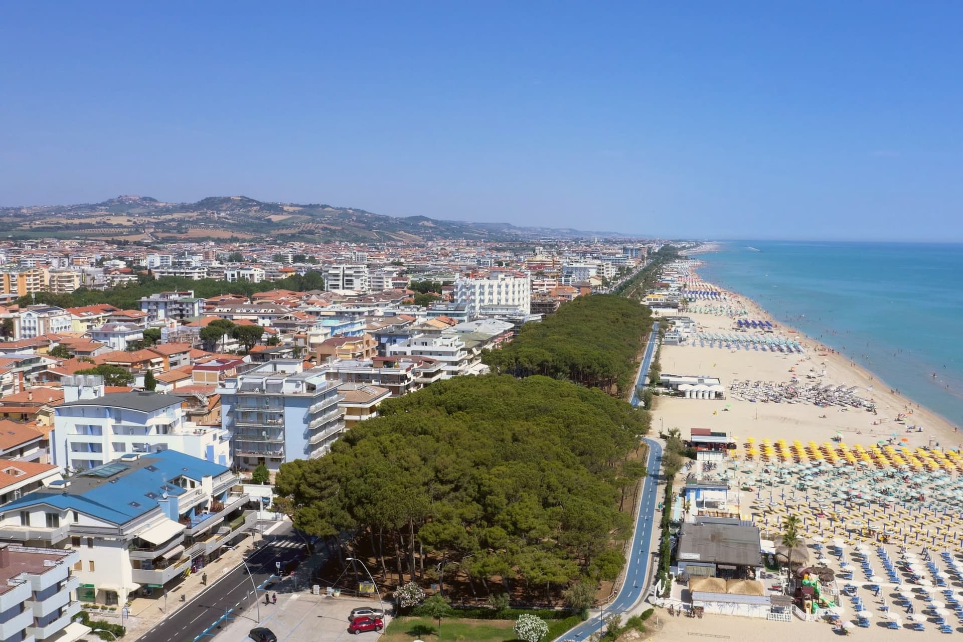
The town's identity is its sand. The three-kilometer beach is called the Spiaggia d'Argento, the silver beach, for the fineness of its grains.
The Blue Flag flew here continuously from 2000 to 2013 and again in recent years. The lungomare runs the whole length of the commune, palm-lined and largely flat, joining the towns on either side without a clear visual break.
Inland from the beach, the town is laid out on a 20th-century grid, with no centro storico to speak of: the historic centers belong to the older inland communes. Alba Adriatica was built to be a beach.
Da Gianfranco (MICHELIN) and Il Palmizio (Gambero Rosso) are listed in food guides.
What to see in Alba Adriatica
- Spiaggia d'Argento. The three-kilometer fine-sand beach, gently sloped, Blue-Flag-rated for water quality continuously from 2000 to 2013 and after.
- Lungomare Marconi. Palm-lined promenade running the length of the commune, joining Tortoreto Lido to the north and Giulianova to the south.
- Chiesa Sant'Eufemia. Parish church set on the inland grid, a modest 20th-century construction reflecting the town's recent 1956 foundation date.
How to get to Alba Adriatica
It has its own railway station. Pescara is about 51 min away by road. The full route from Rome.
Our tip
May through September is the season. June and early September are the temperate weeks before and after the August crowds. July and August fill the beach and the boardwalks: temperatures sit in the low thirties, the water is warm by mid-July, and the lungomare runs late.
Why visit Pineto
Pineto sits at sea level, one of the Sette Sorelle, the seven Adriatic resorts of the Teramo coast. The town was planned in the 1920s by Luigi Filiani as a beach resort under pine forest, and renamed Pineto in 1925 after Gabriele D'Annunzio's poem La Pioggia nel Pineto.
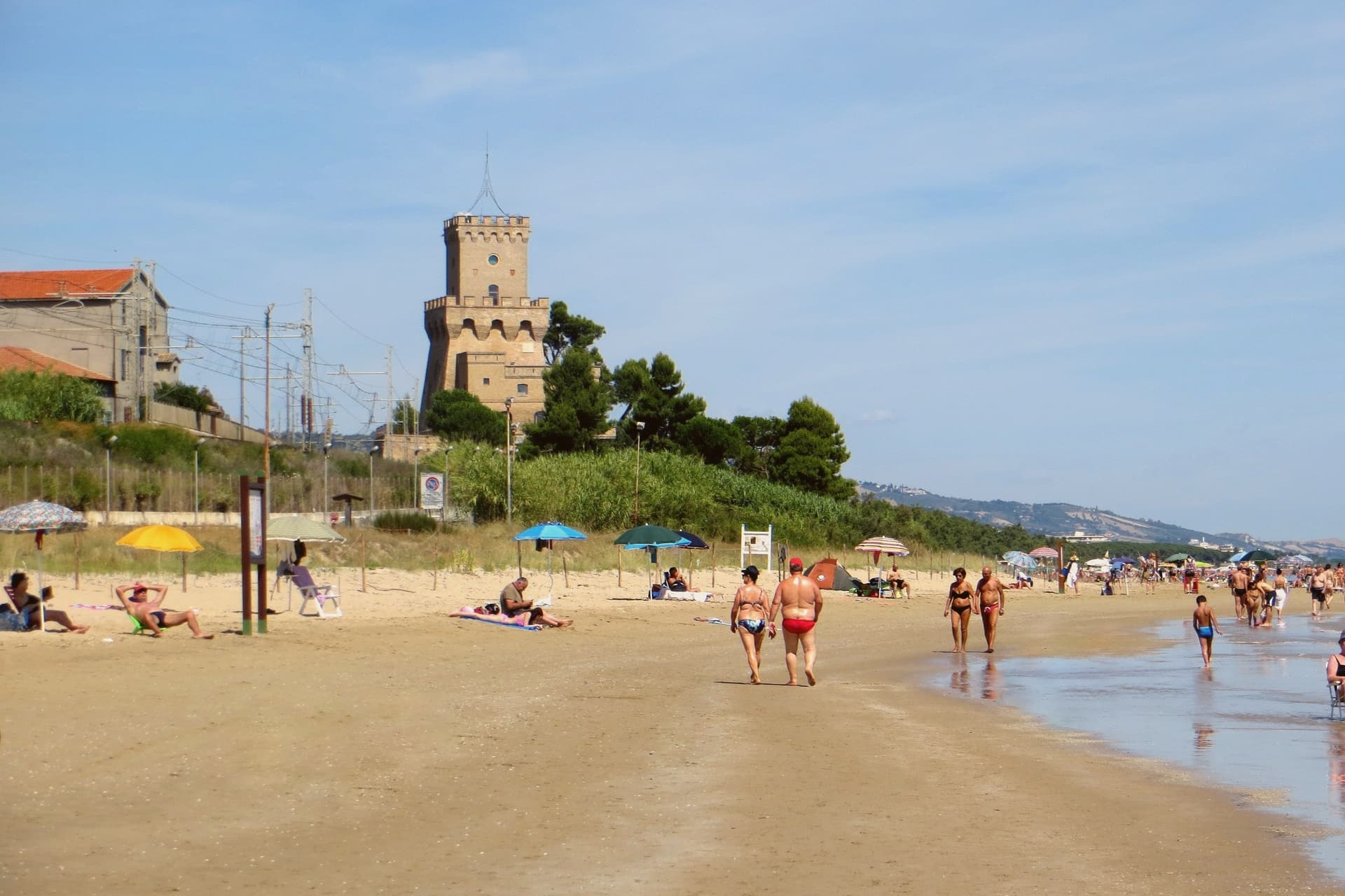
In 1929 it replaced Mutignano, the older hill village above, as the capoluogo of the comune. Two kilometers south of the center stands the Torre del Cerrano, built around 1568 under Philip II as a watchtower against Ottoman raiders.
In 2010 the tower and the stretch of sea in front of it became Abruzzo's first marine protected area, 3,431 hectares of coast and shallow water. The beach has held a Blue Flag in most years since 2007.
The pine canopy, planted to hold the dunes, still shades the seafront promenade as far north as the Vibrata river.
Resilienza (MICHELIN), La Conchiglia d'Oro (MICHELIN) and Bacucco d’Oro (Slow Food) are listed in food guides.
What to see in Pineto
- Torre del Cerrano. Sixteenth-century watchtower built around 1568 under Philip II against Ottoman raids, now the gateway to Abruzzo's first marine reserve.
- Area Marina Protetta Torre del Cerrano. 3,431 hectares of protected coast and shallow Adriatic water established in 2010, the first marine reserve in the region.
- Pineta Catucci. Coastal pine forest planted in the early twentieth century to hold the dunes, shading the seafront promenade and the bike path.
How to get to Pineto
It has its own railway station. Pescara is about 26 min away by road. The full route from Rome.
Our tip
May through September is the season. June and September are the best beach months, warm but not hot, with the marine reserve open for guided snorkelling and the bike path along the pineta in full use. July and August bring Italian summer crowds, especially from Pescara, and the seafront fills.
Why visit Sulmona
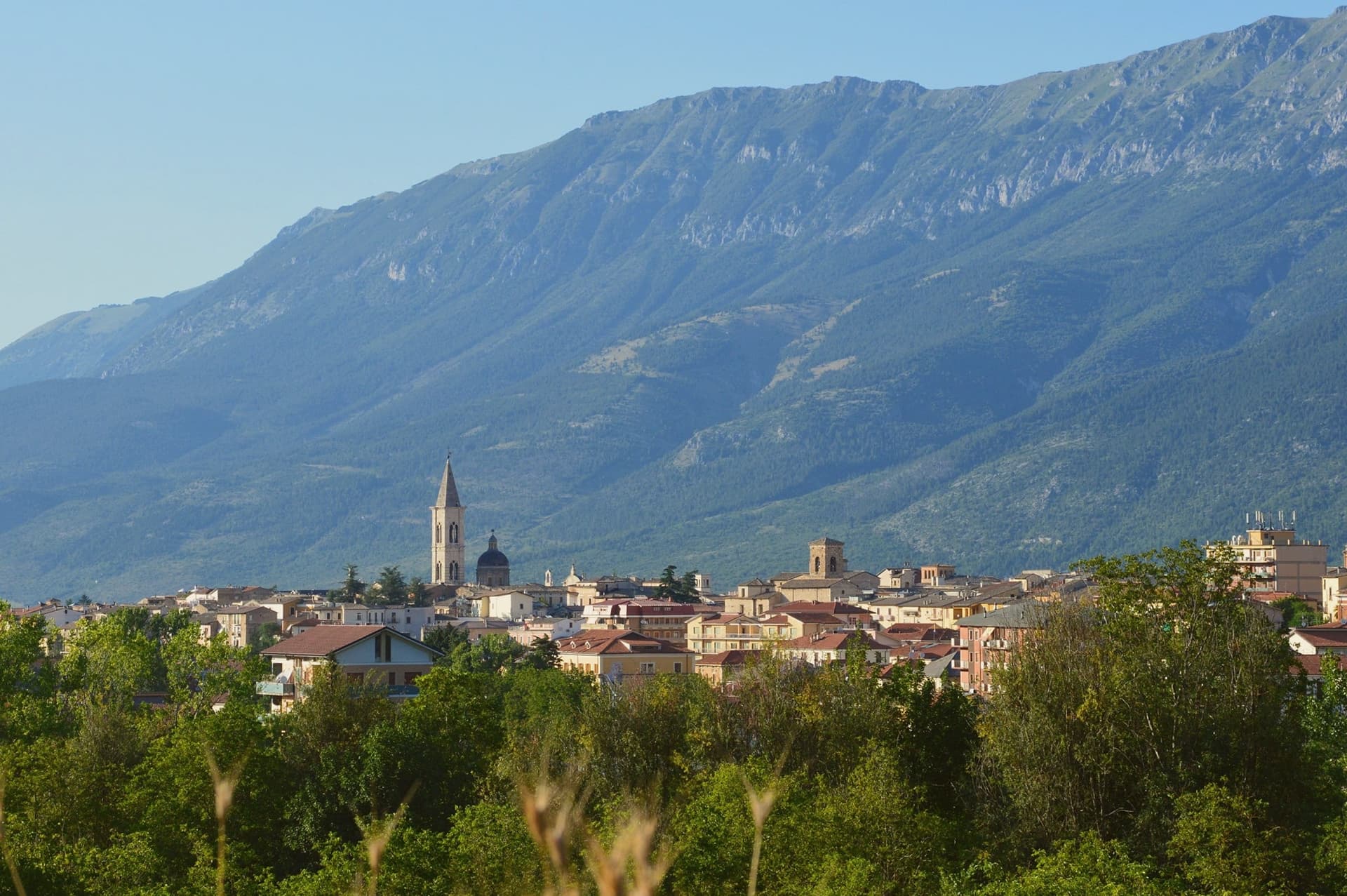
Sulmona sits at 405 meters in the Valle Peligna, at the confluence of the Gizio and Vella rivers, ringed by the Maiella, the Morrone and the Genzana ranges. The Roman poet Ovid was born here in 43 BC and never stopped writing about the salubrity of its water, a claim still made by the town.
Under Frederick II in the 13th century, Sulmona became the capital of the imperial province of Abruzzo and got the aqueduct of Manfred of Swabia, which still defines the long side of Piazza Garibaldi. The town survived two earthquakes, in 1349 and 1456, and emerged as the home of confetti, the sugared-almond confection given at weddings and baptisms.
Confetti Pelino, the best-known house, has been producing in town since 1783. Every July, the Giostra Cavalleresca brings out the city's seven boroughs in Renaissance procession from the Cathedral of San Panfilo, ending in a ring-jousting tournament in Piazza Garibaldi.
Clemente is listed in the MICHELIN Guide and Slow Food's Osterie d'Italia.
What to see in Sulmona
- Piazza Garibaldi. The town's main piazza, dominated on its long side by the 13th-century aqueduct of Manfred of Swabia, host of the July Giostra Cavalleresca.
- Cattedrale di San Panfilo. Cathedral of the city's patron, the oldest church in Sulmona, starting point of the Giostra historical procession.
- Palazzo dell'Annunziata. Late-Gothic and Renaissance palace on Corso Ovidio with three different facade phases visible, now housing the civic museum.
How to get to Sulmona
It has its own railway station. Pescara is about 57 min away by road. The full route from Rome.
Our tip
April through June is the green season in the Valle Peligna, when the Maiella above the town still holds snow. The last week of July brings the Giostra Cavalleresca, the town's biggest annual gathering. August is hot, mid-thirties at midday, and the centro storico empties between two and six.
Why visit Giulianova
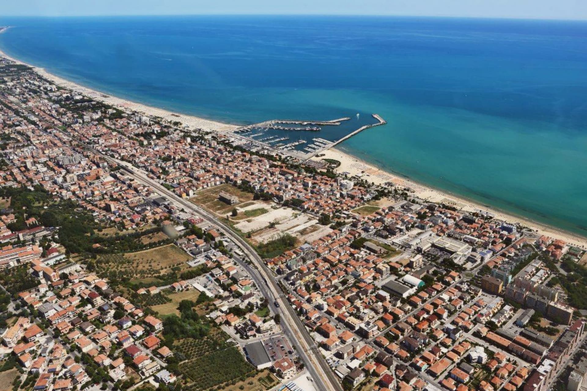
The town sits at the mouth of the Tordino river, where colonists from Praetutii territory established Castrum Novum in the 3rd century BC. A medieval settlement, Castrum divi Flaviani, later stood on the same hill until it was destroyed in the Battle of the Tordino in 1460.
What rose after covers the upper part of the town today: a walled, planned town on the hill, 68 meters above the water. The Lido came later and by a different route, growing from the 19th century around the railway rather than around any single founding decision.
It is now one of Abruzzo's main fishing ports, and the fish stew served along its promenade, brodetto alla giuliese, is the local counterpart to the better-known Vastese version from further south. The sanctuary on the road between the two halves of town marks the physical and historical hinge between them: hill above, coast below.
In August the Sant'Andrea feast carries the saint by boat along the water, a rite that belongs to the Lido's fishing life rather than to the hill's planned streets. The town, in effect, holds two founding stories side by side, one Renaissance and deliberate, one maritime and gradual, and neither has absorbed the other.
Aprudia (MICHELIN and Gambero Rosso), Rotta Cucina e Ristoro (L'Espresso and Gambero Rosso), Bora Bora (Gambero Rosso) and 1 more place are listed in food guides.
What to see in Giulianova
- Duomo di San Flaviano. Cathedral in the hilltop Paese, its dome visible above the Renaissance street plan. Holds the relics of the saint after whom the medieval settlement was named.
- Paese. The hilltop town, walled and centered on a single piazza, its street plan unchanged since Giulio Antonio Acquaviva laid it out over the ruins of the settlement destroyed in 1460.
- Lido. The coastal town with promenade, fishing port and Blue-Flag beach, developed from the 19th-century railway era.
How to get to Giulianova
It has its own railway station. Pescara is about 46 min away by road. The full route from Rome.
Our tip
May through September is the beach season. June and September are the calm weeks, July and August the busy ones. The Lido fills with Italian families on holiday and the lungomare runs late.
Why visit Roseto degli Abruzzi
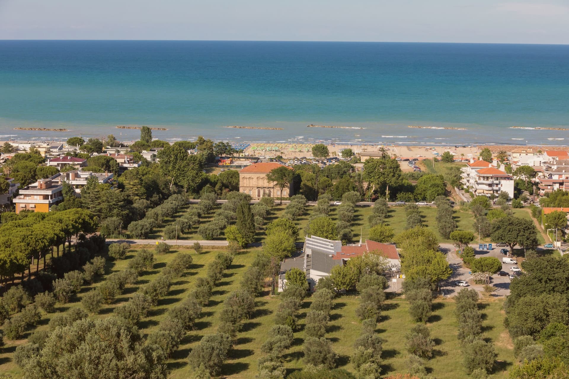
Roseto degli Abruzzi sits on the Adriatic between Giulianova and Pineto, with a flat lower town at sea level and the older nucleus of Montepagano on a hill 285 meters above. Ten kilometers of sand run continuously from the Tordino river south to the Vomano, divided into the historic lidos and the Cologna stretch.
The town carried the name Rosburgo until 1927, when it was changed because the Austrian-sounding form had become unpopular after the First World War. Rosburgo had been the local rebranding of the medieval Montepagano settlement that descended to the coast in the nineteenth century, taking its new name from the rose and oleander hedges that lined the new streets.
Roseto has held a Bandiera Blu Blue Flag every year since 1995 and is a Borgo Autentico d'Italia. The Riserva Naturale del Borsacchio, at the northern edge of town, protects the last dunes and Mediterranean scrub on this stretch of coast.
D.one Ristorante Diffuso (MICHELIN and Gambero Rosso), Vecchia Marina (MICHELIN and Slow Food), Manetta (Gambero Rosso) and 1 more place are listed in food guides.
What to see in Roseto degli Abruzzi
- Lungomare and lidos. Ten kilometers of low-rise sand from the Tordino to the Vomano, with the Lido delle Rose, Cologna, and free-beach sections.
- Montepagano. Original medieval village on a hill 285 meters above the coast, with walls, stone houses, and a panoramic terrace over the sea.
- Riserva Naturale del Borsacchio. Coastal nature reserve at the north end of town, protecting dunes, Mediterranean scrub, and the nesting site of the Kentish plover.
How to get to Roseto degli Abruzzi
It has its own railway station. Pescara is about 37 min away by road. The full route from Rome.
Our tip
May through September is the beach season. June and September are the best balance of warm sea and lower crowds. July and August fill the lidos, especially the weekends of Ferragosto in mid-August.
Why visit Vasto
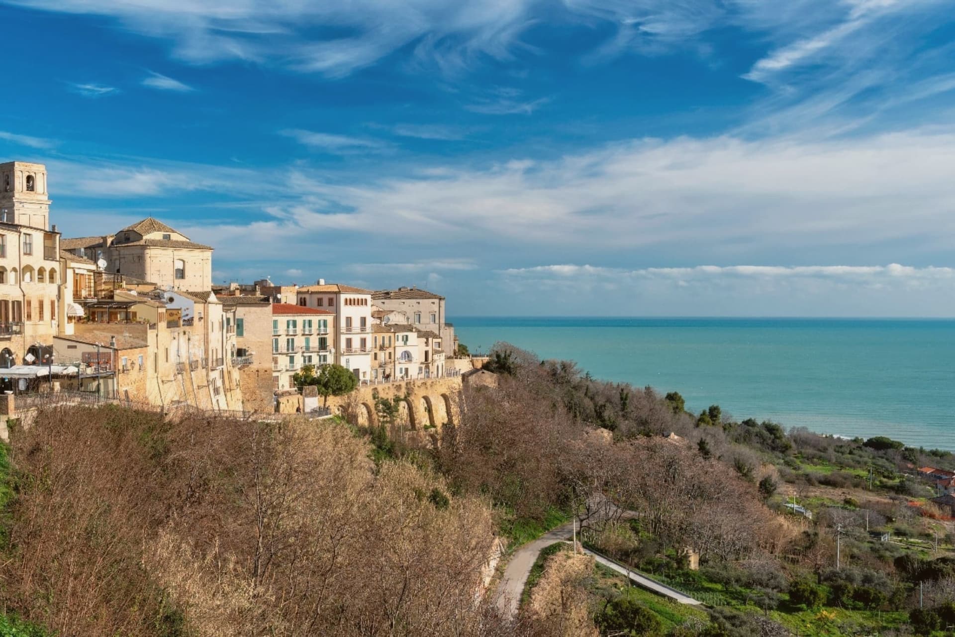
Vasto was the Roman Histonium, a name that predates the hill town's later medieval and Renaissance layers. It sits at 144 meters above the Adriatic, with the upper town, the castle and palace, set above the coast and the Punta Aderci reserve lying below to the north, cliffs and sandy beach against the built hill.
The coast running north from here to Ortona is the Costa dei Trabocchi, seventy kilometers of shoreline named for the wooden stilt-fishing platforms that still work its length. The brodetto alla vastese was invented, by tradition, in 1800 by the wife of a fisherman in the Trave district, who enriched the daily catch with tomato, parsley and garlic from her vegetable garden, a dish born of the same waters the trabocchi work.
The summer Capriccio festival fills the city with music in August. Upper town, reserve, and coast read as one arrangement: a hill settlement that has always faced the sea it feeds from and now also draws visitors to.
Hostaria del Pavone is listed in the MICHELIN Guide and Gambero Rosso.
What to see in Vasto
- Palazzo d'Avalos. The palace now houses the civic archaeological museum and the Gabriele Rossetti poetry library, its rooms given over to collections rather than court life.
- Castello Caldoresco. Burned by Ottoman forces in 1566 and rebuilt afterward, the castle still anchors the upper town, a scarred structure standing in place of the one that fell.
- Punta Aderci. A nature reserve north of the town with sandy beaches, cliffs, and a migratory bird stopover protected since 1998, lying below the hill the old town sits on.
How to get to Vasto
It has its own railway station. Pescara is about 59 min away by road.
Our tip
May through September is the season. June and September are the calm weeks before and after the August crowds. The water reaches its warmest in early August and the Punta Aderci reserve cliffs hold afternoon shade.
More from Anywhere Italy
- The best towns with a serious restaurant that you can reach by train within 90 minutes of PescaraNear Pescaraby trainwithin 90 minserious restaurant8 towns · smallest 12,760 residents · closest 26 min away
- The best beach towns in AbruzzoAbruzzoclean beach10 towns · smallest 511 residents
- The best coastal towns in AbruzzoAbruzzocoastal10 towns · smallest 2,276 residents
- The best coastal towns that eat well within 90 minutes of PescaraNear Pescaracoastalwithin 90 mineats well8 towns · smallest 2,276 residents · closest 26 min away
- The best hidden towns with a serious restaurant in AbruzzoAbruzzoserious restauranthidden10 towns · smallest 676 residents
- The best olive oil towns within 90 minutes of AnconaNear Anconawithin 90 minolive oil zone6 towns · smallest 2,192 residents · closest 75 min away