
Instead of Montepulciano
Instead of Montepulciano: hill towns within 75 minutes
Montepulciano sells Vino Nobile and a Renaissance main street, and in high summer the main street is the queue for the wine.
The Val di Chiana and the hills toward Umbria have the same tufa, the same cellars, and towns where the tasting room is somebody's front room.
Hill towns in our catalogue within 75 minutes of Montepulciano by road, ranked by outside recognition. Montepulciano itself and the other famous places are left out. 19 towns match; the 12 best-recognised are below.
Instead of Montepulciano
Montepulciano · 13,274 residents · Toscana
- LucignanoArezzo
Hill town · Borgo dei Borghi
- From Montepulciano
- 37m by car
- By train
- Reachable
- Residents
- 3,383
- When to go
- Apr–Oct
Hill town · Borghi più belli d'Italia
- From Montepulciano
- 49m by car
- Residents
- 1,500
- When to go
- All year
- MontalcinoSiena
Hill town · UNESCO
- From Montepulciano
- 51m by car
- By train
- Reachable
- Residents
- 5,611
- When to go
- Apr–Oct
- PanicalePerugia
Hill town · Borghi più belli d'Italia
- From Montepulciano
- 56m by car
- Residents
- 5,281
- When to go
- Apr–Oct
- CetonaSiena
Hill town · Borghi più belli d'Italia
- From Montepulciano
- 57m by car
- Residents
- 2,488
- When to go
- Apr–Oct
The 5 best-recognised of the 19 towns that match. Drive times measured by road from Montepulciano. More of them follow below.
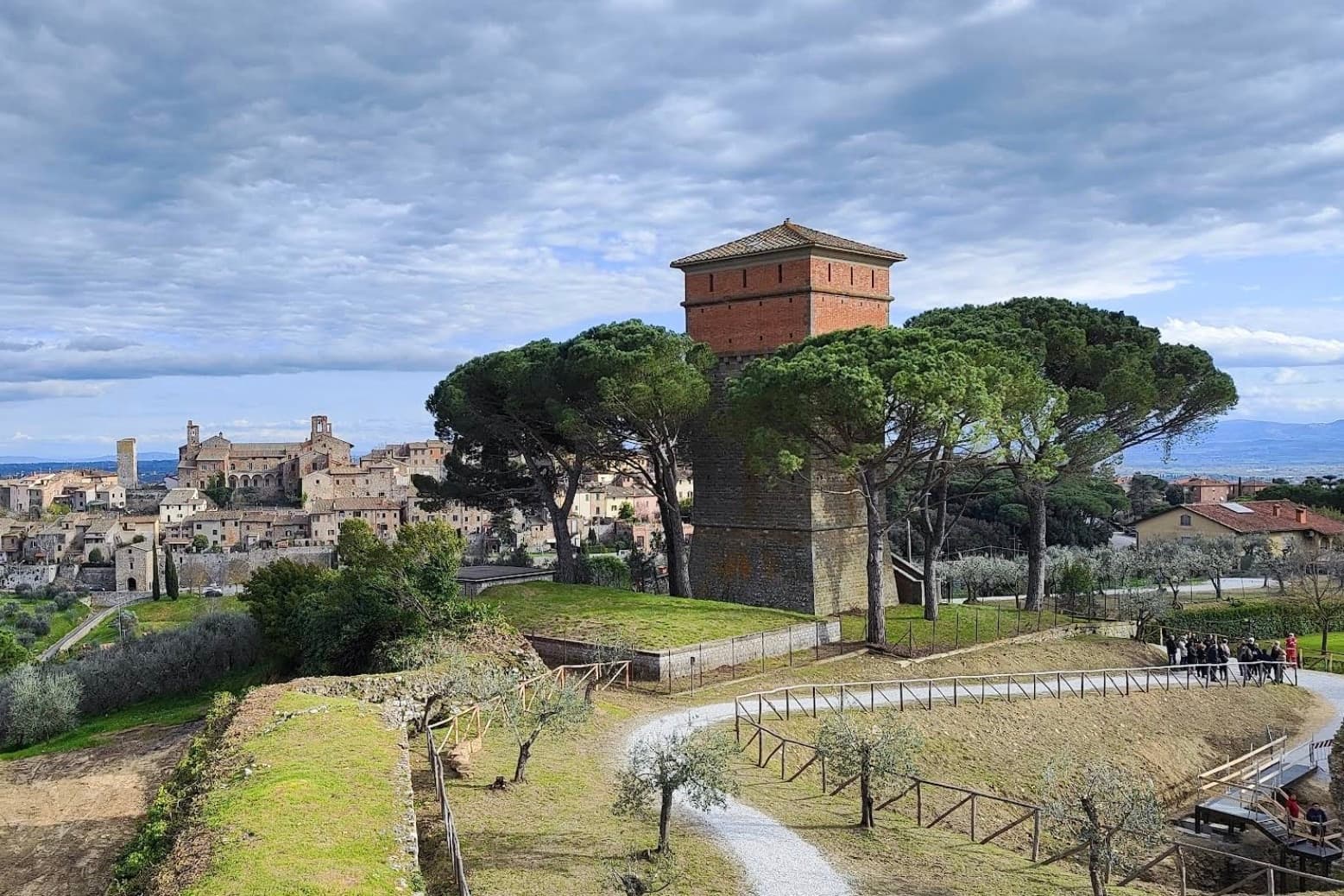
Lucignano
Province: Arezzo · 400 m
A walled elliptical hill town at 400 meters between Siena and Arezzo, planned in medieval concentric rings around the goldsmith's reliquary called the Tree of Life.
San Casciano dei Bagni
Province: Siena · 582 m
A hilltop borgo at 582 meters above 42 hot springs that produced the largest Etruscan bronze hoard of the last fifty years.
- ✷ We've been
Montalcino
Province: Siena · 564 m
A walled hill town at 564 meters above the Val d'Orcia, the last fortress to hold out for the Sienese Republic and the birthplace of Brunello.
Panicale
Province: Perugia · 431 m
A walled hill town at 431 meters on Monte Petrarvella, where a 1505 Perugino fresco covers the back wall of San Sebastiano.
Cetona
Province: Siena · 384 m
A medieval borgo at 384 meters, sold by Cosimo I to the Vitelli in 1556 and the centro storico still shaped by their fortress reconstruction.
- ✷ We've been
San Quirico d'Orcia
Province: Siena · 409 m
A walled stop on the Via Francigena at 409 meters in the UNESCO Val d'Orcia, where a twelfth-century Collegiata, a Renaissance garden and the Bagno Vignoni thermal pool sit within fifteen kilometers of each other.
- ✷ We've been
Castelnuovo Berardenga
Province: Siena · 351 m
A commune of 351 meters, the last castle Siena built against Florence, in 1366.
Acquapendente
Province: Viterbo · 420 m
The northernmost town in Lazio, at 420 meters above the Paglia, named in 964 for its waterfalls.
Paciano
Province: Perugia · 391 m
Walled hill town of 957 people at 391 meters above the lake, three parallel streets, eight towers and three medieval gates intact.
Città della Pieve
Province: Perugia · 508 m
A red-brick hill town at 508 meters above the Valdichiana, the birthplace of Perugino and the home of Italy's narrowest alley.
Deruta
Province: Perugia · 218 m
A hill town at 218 meters on the left bank of the Tiber, the maiolica capital of central Italy since the late thirteenth century.
Corciano
Province: Perugia · 408 m
A walled medieval castello at 408 meters eight kilometers west of Perugia, where Saint Francis stopped on his way back from a Lent spent fasting on the island in 1223.
Drive times measured by road from Montepulciano. A town with no time shown is one the router could not reach, usually because it is served by ferry. How this data is built.