
Sicily · Agrigento
Cammarata
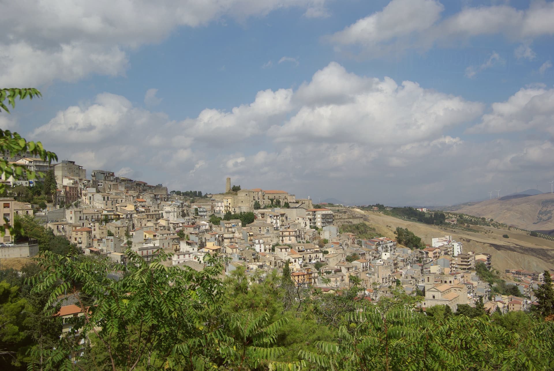
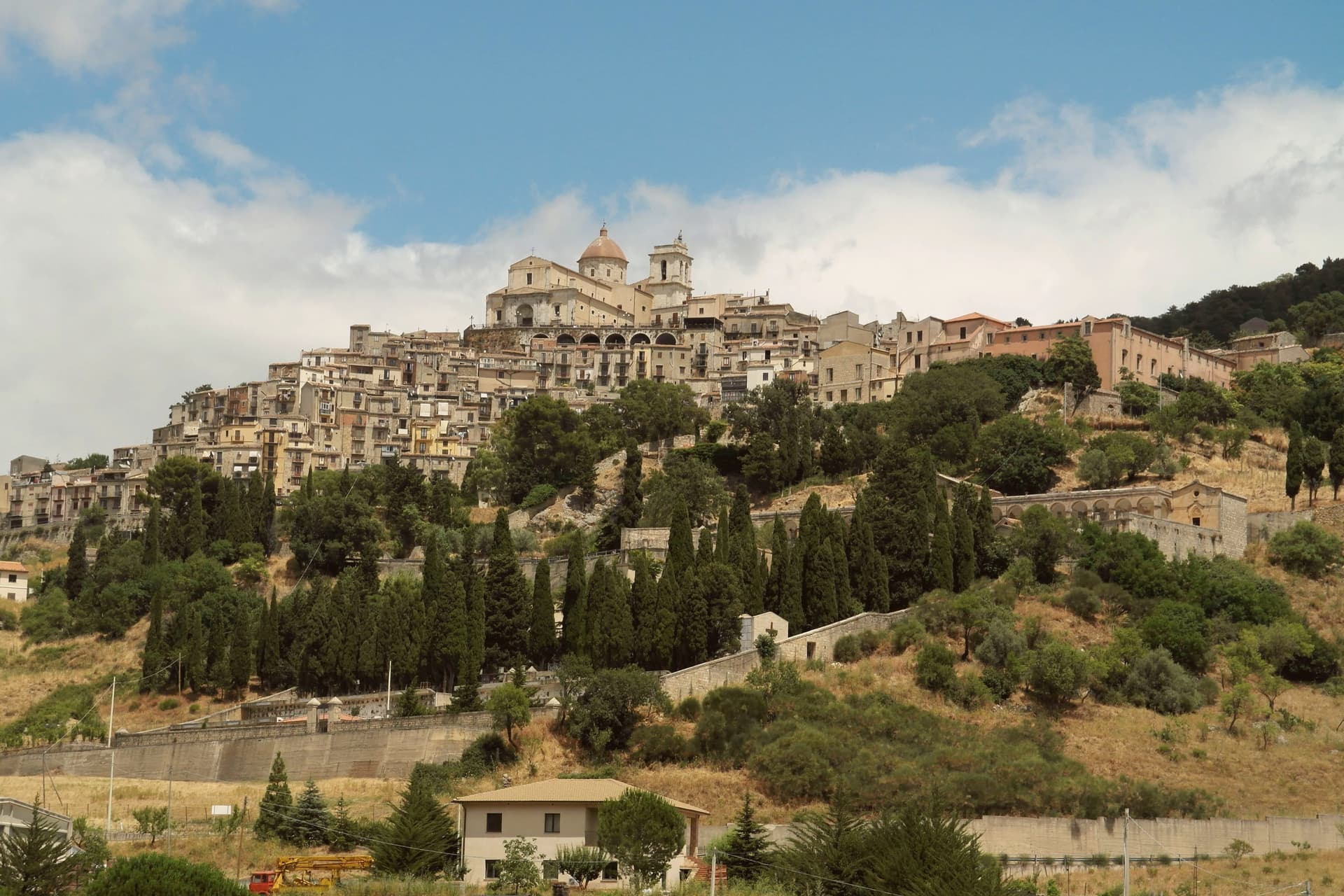
A Sicani town at 700 meters on the northeast slope of the peak that gives the comune its name and shape.
- Best time
- Apr–Jun, Sep–Nov
- By car
- 1 h 28 min from Palermo
- By train
- Station in the comune
- Population
- 5,896

Known for
MONTE CAMMARATA
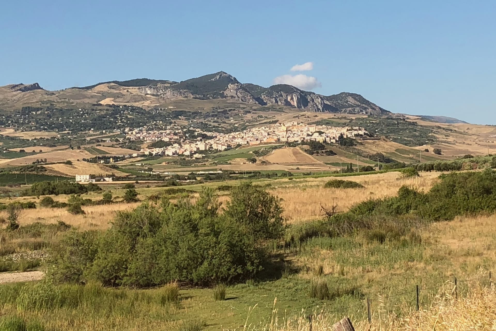
1,578-meter peak, the highest in the Sicani Mountains, a regional reserve with oak forest, golden eagles, and ridge trails.
LUCY OF HAUTEVILLE
Roger I laid siege in 1087 and gave the town to his relative Lucia di Cammarata, who took the Norman title from the conquered lands.
GRAIN AND SHEEP
The working hill economy of the inland Sicani: wheat, durum, hard cheese and lamb, with two pastoral fairs each year.
When to visit
Best · Apr–Jun, Sep–Nov
- J11°
- F12°
- M13°
- A17°
- M22°
- J29°
- J32°
- A31°
- S27°
- O22°
- N16°
- D12°
- Best
- Hot or crowded
- Quiet
- Mostly closed
Daytime averages, 2020–2024. Weather data by Open-Meteo.com.
The festa: Nicola di Bari, 6 December
Why come
The town sits at 700 meters on the northeastern flank of the mountain, and the name comes from the Greek kàmara, vaulted room, after the limestone caves that perforate the slopes. That geology sits under a settlement built up the incline in stepped lanes, so the town and the peak above it read as one continuous rise rather than two separate things.
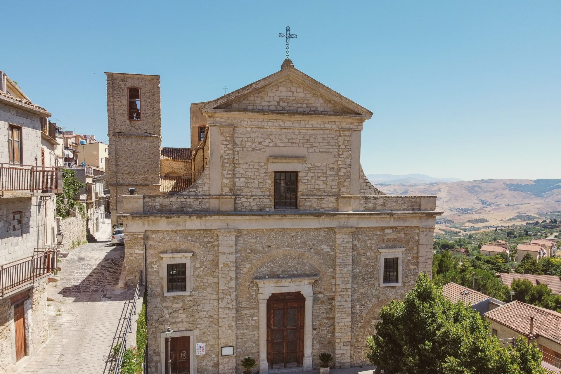
King Roger I laid siege in 1087 and gave the conquered town to his relative Lucy of Hauteville, who took the title Lucia di Cammarata. The Chiesa Madre, rebuilt in the seventeenth century on twelfth-century foundations, holds a Madonna della Catena by Pietro D'Asaro and a sixteenth-century organ, and the mountain itself carries a regional nature reserve of downy oak and holm oak forest, golden eagles, and ridge trails to the summit.
Cammarata is paired physically with San Giovanni Gemini next door. The two towns share the mountain as a watershed, a saint, and a working economy of grain, oil and sheep, which means the peak is not scenery at the edge of town but the shared resource that organizes both places, their water, their pasture, and their names.
The Sunday letter
Cammarata is on our list. Its letter is still to come.
We are writing about all 1,000 of these towns, one at a time, in a free letter every Sunday: the photo, the food, the festa. That is our mission. Sign up and you will be there when Cammarata comes up. By Peter & Sophia, from Pietrasanta.
Read on
Cammarata in our articles
 The best towns you can reach by train within 90 minutes of Palermo6 towns, Cammarata among them.
 The best hill towns within 90 minutes of Palermo8 towns, Cammarata among them.
 The 9 best towns inside a nature park that you can reach by train in Sicilia9 towns, Cammarata among them.
 The best small mountain towns in Italy above 500 metres, all of them213 towns, Cammarata among them.
How to get there
From Catania (CTA), about 2h 21m by car.
By car from the centre of Palermo 1h 28m.
There is a railway station in the comune, so you can arrive without a car.
Coming from Palermo?
Coming by train into Palermo Centrale? Cammarata is about 1h 25m away by road.
What to see
Chiesa Madre di San Nicolò di Bari
Seventeenth-century mother church on twelfth-century foundations, with a Madonna della Catena by Pietro D'Asaro and a sixteenth-century organ.
Monte Cammarata
Downy oak and holm oak cover the slopes below the summit, with ridge trails running up through the reserve and views over the Sicani range.
Ruderi del Castello
Remains of the medieval fortification on the rock above the centro storico, taken by Roger I in 1087.
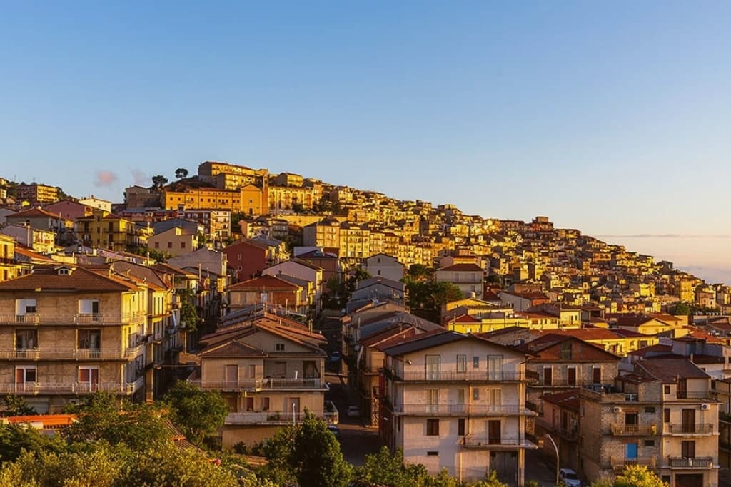
Centro storico
Stepped lanes climbing the slope, with stone houses, narrow piazzas, and the working economy still tied to grain and sheep.
Chiesa di Sant'Agostino
Convent church on the edge of the historic centre, founded in the fourteenth century and rebuilt after the 1693 earthquake.
The slow-trip planner
Building a trip? Find where Cammarata fits in a slow Italy circuit.
Answer five questions. We will shape a geographically coherent slow trip from the 1,000 Italian towns most travelers skip. Yours to save and share.
Living here
- Population 5,896
- Remotei
- Pharmacy in town
- High school within a 30-minute drive
- Train station in the comune
- Nearest airport Catania, 2 h 21 min drive
- Regional capital Palermo, 1 h 28 min drive
Common questions
- What is Cammarata known for?
- Cammarata is a Sicani town at 700 meters on the northeast slope of the peak that gives the comune its name and shape.
- Where is Cammarata?
- Cammarata is a comune in the province of Agrigento, in Sicily.
- What is the nearest airport to Cammarata?
- Catania (CTA), about 2h 21m by car.
- Can you get to Cammarata without a car?
- Yes. There is a railway station in the comune, so you can arrive by train.
- How long is the drive from Palermo to Cammarata?
- About 1h 28m by car.
- When is the best time to visit Cammarata?
- Best in Apr–Jun, Sep–Nov. July is the warmest month, averaging 32 degrees, and November the wettest, with about 11 rain days.
- Is there a sagra or a festival in Cammarata?
- The town keeps its patron saint's day: Nicola di Bari, 6 December.
- Which other towns are like Cammarata?
- Agira, Sambuca di Sicilia and Caltagirone.
- How many people live in Cammarata?
- 5,896 at the 2023 count.
Tags & datadesignations · numbers · sources
Recognised as
The numbers
- Elevation: 700 m
- Population: 5,896
- Surface area: 192.46 km²
These figures were compiled from public directories: ISTAT, OpenStreetMap and Wikidata, and from the official listings of the guides named on this page. Town details change; verify with official sources before you travel.
Similar
Towns like Cammarata
Agira
Province: Enna
both inland in Sicily · both between 3,000 and 10,000 people
Sambuca di Sicilia
Province: Agrigento
both inland in Sicily · both between 3,000 and 10,000 people
Caltagirone
Province: Catania
both inland in Sicily · both high up, between 600 and 1,000 metres
Calascibetta
Province: Enna
both inland in Sicily · both between 3,000 and 10,000 people
Padula
Province: Salerno
both between 3,000 and 10,000 people · both high up, between 600 and 1,000 metres
Lagonegro
Province: Potenza
both between 3,000 and 10,000 people · both high up, between 600 and 1,000 metres
💎 Borghi Autentici
More Borghi Autentici towns
Archi
Province: Chieti
A 492-meter rocky spur called the Terrazza sul Sangro, fief of del Balzo, Cantelmo, Colonna and Carafa, now Città del Tartufo and Città dell'Olio.
Balsorano
Province: L'Aquila
A pentagonal fortress above the Liri river that became a backdrop for 1970s Italian horror cinema.
Barrea
Province: L'Aquila
A 1,066-meter spur above an artificial lake at the heart of the Abruzzo National Park, with a Samnite necropolis and an 11th-century di Sangro castle.
Calascio
Province: L'Aquila
A village of 125 people under the highest castle in the Apennines, cast as the monk's refuge in Ladyhawke.
Campo di Giove
Province: L'Aquila
At 1,064 meters under the southwestern Maiella, the highest village in the park, named for a Roman temple to Jupiter.