
Molise · Isernia
Bagnoli del Trigno
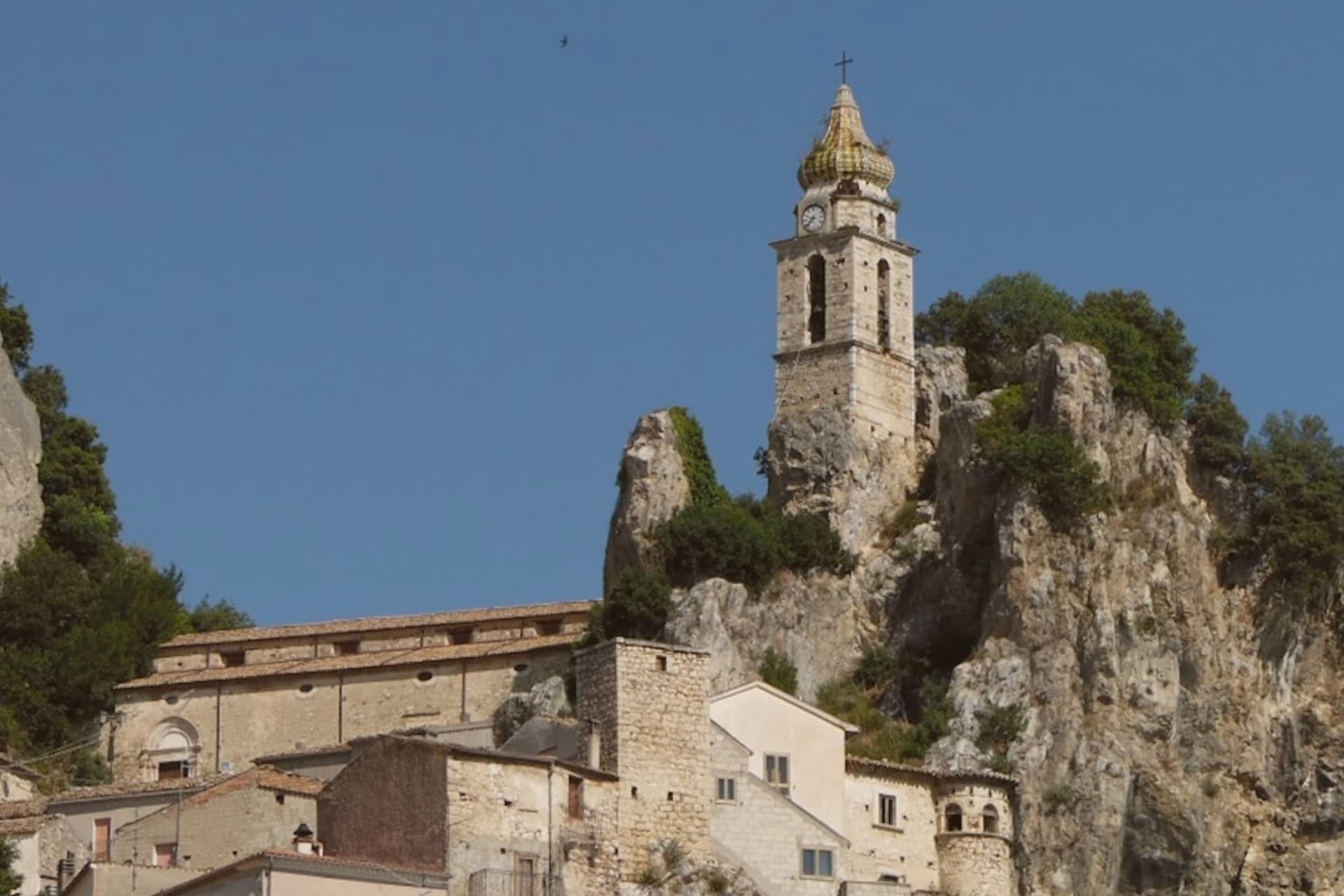
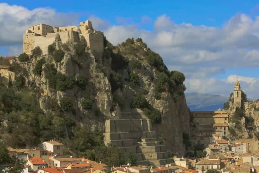
The 'Pearl of Molise', a 637-resident borgo built into and around a massive limestone outcrop above the Trigno valley, with a medieval castle rebuilt on its summit.
- Best time
- May–Sep
- By car
- 1 h 49 min from Pescara
- Population
- 637
Known for
PERLA DEL MOLISE
Built into a giant limestone outcrop above the Trigno valley, the most photogenic of the small Molise borghi, with the rock literally inside the church and under the castle.
ROCK-CARVED CHURCH
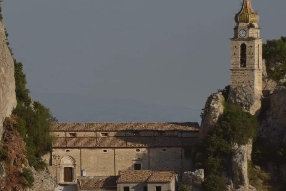
An 11th-century church whose side chapel is entirely hollowed from the same stone the borgo sits on.
RISERVA MAB ALTO MOLISE
Inside the UNESCO MAB biosphere reserve. Beech forests, transumanza shepherd routes, dark skies.
MOLISAN MOUNTAIN KITCHEN
Pampanella, caciocavallo, treccia cheese, pasta alla chitarra with wild boar, and the Trigno valley olive oil.
When to visit
Best · May–Sep
- J8°
- F11°
- M11°
- A14°
- M20°
- J26°
- J29°
- A29°
- S24°
- O19°
- N13°
- D10°
- Best
- Hot or crowded
- Quiet
- Mostly closed
Daytime averages, 2020–2024. Weather data by Open-Meteo.com.
Why come
The Trigno river cuts through the valley on the north side of the borgo, and the town itself has grown out of a limestone outcrop rising straight from the water's edge, houses stacked in a stone cascade down the flanks of the rock. The nickname 'Pearl of Molise' attaches itself the moment the outcrop comes into view from the valley road, rock and roofs read as a single mass with the castle sitting on the summit like a natural continuation of the stone. Upper and lower are one and the same here, since the borgo has no separate old and new quarter, only the outcrop itself, with the rock-carved church set into its face partway up and the fortress crowning it above, the two structures marking the bottom and top of the same geological event.
Bagnoli belongs to the Alto Molise, the upland zone covered by the Riserva MAB UNESCO 'Alto Molise': beech forest, transumanza shepherding routes, and the kind of dark sky that only comes from unpopulated Apennine valleys. The wooded Trigno valley continues north past the borgo, opening onto the wider Apennine landscape that the reserve protects. Population has fallen from 2,100 in 1951 to 637 today, and Bagnoli is one of Molise's many borghi working against depopulation: a handful of B&Bs and the summer festa at the church in early August are what keep the centro alive outside the season. The nearest town with services is Isernia, 35 km southwest. What the rock, the river, and the falling population add up to is a place whose geography built the town and whose isolation now empties it, a borgo still legible as a single object carved from and set on the same stone.
The Sunday letter
Bagnoli del Trigno is on our list. Its letter is still to come.
We are writing about all 1,000 of these towns, one at a time, in a free letter every Sunday: the photo, the food, the festa. That is our mission. Sign up and you will be there when Bagnoli del Trigno comes up. By Peter & Sophia, from Pietrasanta.
How to get there
From Naples / Salerno (NAP), about 2h 13m by car.
Bari / Brindisi (BRI) is about 3h 12m away.
By car from the centre of Pescara 1h 49m, Naples 2h 17m or Salerno 2h 41m.
What to see
Chiesa di San Silvestro (carved into the rock)
Partly carved into and partly built against the limestone outcrop, with a barrel-vaulted nave and a smaller chapel hollowed entirely from the stone. The set-piece of the borgo, seen against the rock face it grows out of.
Castello Sanfelice
Medieval fortress on top of the borgo's defining rock outcrop, rebuilt in the 16th century by the Sanfelice family on Lombard foundations. Open for visits, with a panoramic view over the whole valley.
Borgo + Riserva MAB Alto Molise
The stone-cascade borgo itself is the main sight; from here the beech forests, shepherd tratturi, and dark skies of the biosphere reserve begin.
Trigno valley + Apennine views
The Trigno river runs through wooded valleys to the north, with drives through Pietrabbondante (Samnite theatre) and Agnone (Marinelli pontifical bells).
The slow-trip planner
Building a trip? Find where Bagnoli del Trigno fits in a slow Italy circuit.
Answer five questions. We will shape a geographically coherent slow trip from the 1,000 Italian towns most travelers skip. Yours to save and share.
Living here
- Population 637
- In-betweeni
- Pharmacy in town
- High school within a 30-minute drive
- Nearest airport Naples / Salerno, 2 h 13 min drive
- Regional capital Campobasso, 51 min drive
Common questions
- What is Bagnoli del Trigno known for?
- Bagnoli del Trigno is the 'Pearl of Molise', a 637-resident borgo built into and around a massive limestone outcrop above the Trigno valley, with a medieval castle rebuilt on its summit.
- Where is Bagnoli del Trigno?
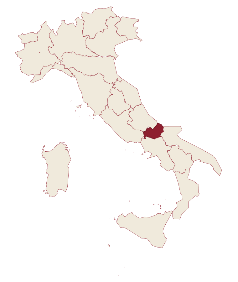
- Bagnoli del Trigno is a comune in the province of Isernia, in Molise, at 661 meters above sea level.
- What is the nearest airport to Bagnoli del Trigno?
- Naples / Salerno (NAP), about 2h 13m by car.
- How long is the drive from Pescara to Bagnoli del Trigno?
- About 1h 49m by car.
- When is the best time to visit Bagnoli del Trigno?
- Best in May–Sep. July is the warmest month, averaging 29 degrees, and May the wettest, with about 13 rain days.
- Which other towns are like Bagnoli del Trigno?
- Scapoli, Civitacampomarano and Macchiagodena.
- How many people live in Bagnoli del Trigno?
- 637 at the 2023 count.
Tags & datadesignations · numbers · sources
The numbers
- Elevation: 661 m
- Population: 637
- Surface area: 36.8 km²
These figures were compiled from public directories: ISTAT, OpenStreetMap and Wikidata, and from the official listings of the guides named on this page. Town details change; verify with official sources before you travel.
Similar
Towns like Bagnoli del Trigno
Scapoli
Province: Isernia
both inland in Molise · both under 1,000 people
Civitacampomarano
Province: Campobasso
both inland in Molise · both under 1,000 people
Macchiagodena
Province: Isernia
both inland in Molise · both high up, between 600 and 1,000 metres
Roccamandolfi
Province: Isernia
both under 1,000 people · both high up, between 600 and 1,000 metres
Sasso di Castalda
Province: Potenza
both under 1,000 people · both high up, between 600 and 1,000 metres
Civita d'Antino
Province: L'Aquila
both under 1,000 people · both high up, between 600 and 1,000 metres