
The 9 best wine towns that eat well within 90 minutes of Perugia
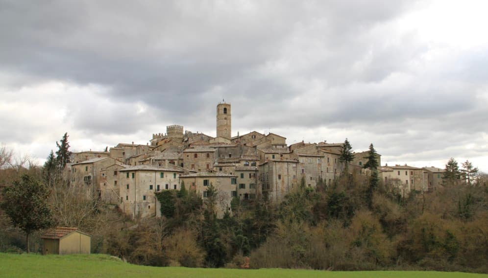
Umbria and its Tuscan border country make wine the way they make everything else here, slowly and with an eye on lunch. Sagrantino comes out of Montefalco's slopes dark and tannic, built for lentils and pigeon and the local pork; the Trasimeno side gives lighter reds and white Grechetto that goes with lake fish. The towns themselves are built from pale limestone and warm brick, with olive terraces running up to the walls and cellars cut into the rock below. Autumn is the season, when the presses are running, the new oil is greenish and peppery, and truffles start turning up grated over strangozzi.
Most people who come this way point the car at Assisi, and it earns the attention: the basilica, the frescoes, the view down over the plain. But the coach parks fill by mid morning, the streets funnel everyone along the same route between the two churches, and the restaurants nearest the sights cook for people who will not be back. Wine drinking in Assisi tends to happen standing up, in a hurry, before the next stop.
The vineyards do not stop at the edge of the famous itinerary. The same hills carry on south towards Montefalco and Trevi, west across the Val di Chiana, and down into the thermal country around the Tuscan border, and that is where these towns sit. Each one belongs to the national association of wine towns, and each has a table a dining guide thought worth naming. Fewer people go, and the bottle usually stays on the table longer.
Of the 41 communes we have mapped within 90 minutes of Perugia, 9 qualify as wine towns that eat well: each belongs to the national association of wine towns, and a dining guide has named a table in each. The smallest, San Casciano dei Bagni, has 1,500 residents.
Two more lists worth reading alongside this one: The best towns with a medieval festival that eat well within 90 minutes of Perugia and The best hidden towns you can reach by train that eat well within 90 minutes of Perugia.
San Casciano dei Bagni
Why visit San Casciano dei Bagni
San Casciano dei Bagni sits at 582 meters at the southern edge of the province of Siena, above 42 hot springs that average 42 degrees Celsius. The baths were used continuously from Etruscan through Roman times and again from the Renaissance, when visitors came from across Europe.
In 2022, an excavation that began in 2019 at the ancient sanctuary turned up 24 bronze votive statues protected by mud, with around 6,000 coins in gold, silver and bronze. The find was the largest of its kind in fifty years; most surviving Etruscan votive material is terracotta.
The 1,500 residents live on a basalt outcrop above the Roman thermal complex, in a centro storico of stone houses and three small churches. The borgo joined the Borghi più belli network in 2014 and remains one of the smallest communes in Toscana to carry both that label and Bandiera Arancione.
Daniela, Castello di Fighine have been named by a guide.
What to see in San Casciano dei Bagni
- Santuario Ritrovato. Etruscan-Roman thermal sanctuary excavated since 2019, where 24 bronze votives and around 6,000 coins were recovered in 2022.
- Bagno Grande. The principal natural pool of the 42 hot springs, used from the second century BC through the Renaissance and reopened to the public.
- Collegiata di San Leonardo. Romanesque parish church in the centro storico, restored in the seventeenth century, with a baptismal font carved from local travertine.
How to get to San Casciano dei Bagni
Perugia is roughly 68 minutes away by road.
Our tip
The thermal pools make the calendar different here. Winter is the season many visitors prefer, when the 42-degree water steams against cold air and snow occasionally dusts the basalt outcrop. April through June and September into October are the most balanced months: warm hill light, the dry-stone walls of the borgo at their best, the sanctuary excavations open to guided tours. Sagra del Ciaffagnone di San Casciano dei Bagni falls in June.
Cetona
Why visit Cetona
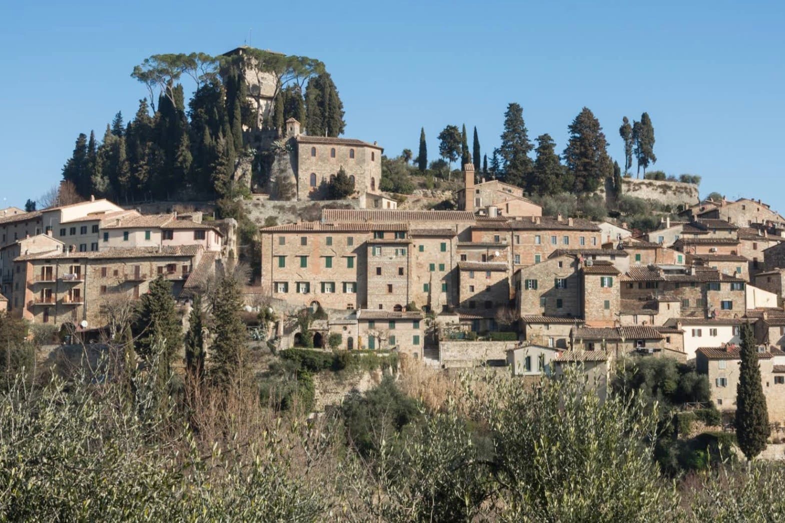
The town sits on the western flank of a ridge at the meeting point of Toscana, Umbria and Lazio, where the mountain divides the Val d'Orcia from the Val di Chiana. The medieval comune passed between Siena, Orvieto and Perugia before falling to Siena in the late fourteenth century, and it was Cosimo I who later sold it whole to a marchese.
The fortress at the top of the grid and the square laid out below it are two halves of the same Renaissance move: a private residence replacing a garrison at the summit, a flat civic stage opened up at the base. Above the town, in the woods, the hermitage and the caves belong to a much older layer, human use of the mountain reaching back to the Mesolithic, long before any comune or marchese laid claim to it.
What the town adds up to is a settlement built in tiers: a prehistoric mountain, a contested medieval center, and a Renaissance overlay that reorganized the base of the hill without touching what stood above it.
Da Nilo, Il Tiglio di Piazza da Nilo have been named by a guide.
What to see in Cetona
- Piazza Garibaldi. Elliptical square at the foot of the medieval grid, flat and open where the streets above it climb steeply. The civic stage of the borgo, still the first thing that orients a visitor.
- Rocca di Cetona. Fortress at the top of the centro storico, its walls and keep still standing though the interior became a private residence rather than a garrison.
- Convento di San Francesco. Franciscan convent below the borgo, founded in 1212, with a single-nave church and a small cloister still in religious use.
How to get to Cetona
Perugia is roughly 78 minutes away by road.
Our tip
April through June and September into October are the months Cetona keeps its calmest pace, the wooded slopes of Monte Cetona green or rust depending on the half. July and August are hot in the centro storico but the mountain trails above 800 meters stay cool. The Mostra del Tartufo, dedicated to the local white truffles, runs the second weekend of November in Piazza Garibaldi. Sagra del Bico di Cetona falls in June.
Bevagna
Why visit Bevagna
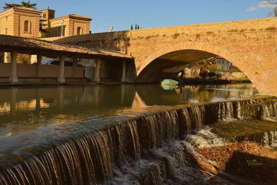
Bevagna sits on the floor of the Umbrian valley at 225 meters, where the Clitunno meets the Timia. Ancient Mevania, the name means she who stands in the middle, was a Roman mansio on the Via Flaminia, listed in the Antonine Itinerary.
A black-and-white mosaic of the 2nd century AD survives almost intact in the frigidarium of the Roman baths, twelve meters by seven, octopuses and dolphins in the center, tritons and sea-horses on the short sides. Piazza Silvestri at the heart of the centro storico holds two Romanesque churches that face each other at odd angles, San Michele Arcangelo and San Silvestro, built within years of each other in the late 12th century.
The Mercato delle Gaite each June turns the town into the year 1300 for ten days, four quarters competing on medieval trades and tavern menus, no anachronisms allowed. The Sagrantino slopes of Montefalco are nine kilometers up the road.
Serpillo, Ottavi Mare have been named by a guide.
What to see in Bevagna
- Piazza Silvestri. Twelfth-century civic square ringed by the Palazzo dei Consoli, the churches of San Silvestro and San Michele, and the fountain of 1896.
- Chiesa di San Michele Arcangelo. Romanesque collegiate church built by Binello and Rodolfo at the end of the 12th century, on the main square.
- Chiesa di San Silvestro. Romanesque parish church across the piazza, signed and dated 1195 by Binello, the same builder as San Michele.
How to get to Bevagna
Perugia is roughly 39 minutes away by road.
Our tip
April through June and September into October are the months for Bevagna. The valley fills with green, the Sagrantino vines run on the slopes above town, and the rose festival fills the gardens around the walls in May. The Mercato delle Gaite runs the second half of June and is the single most concentrated weekend on the Umbrian medieval calendar. Sagra della Lumaca falls in August.
Montepulciano
Why visit Montepulciano
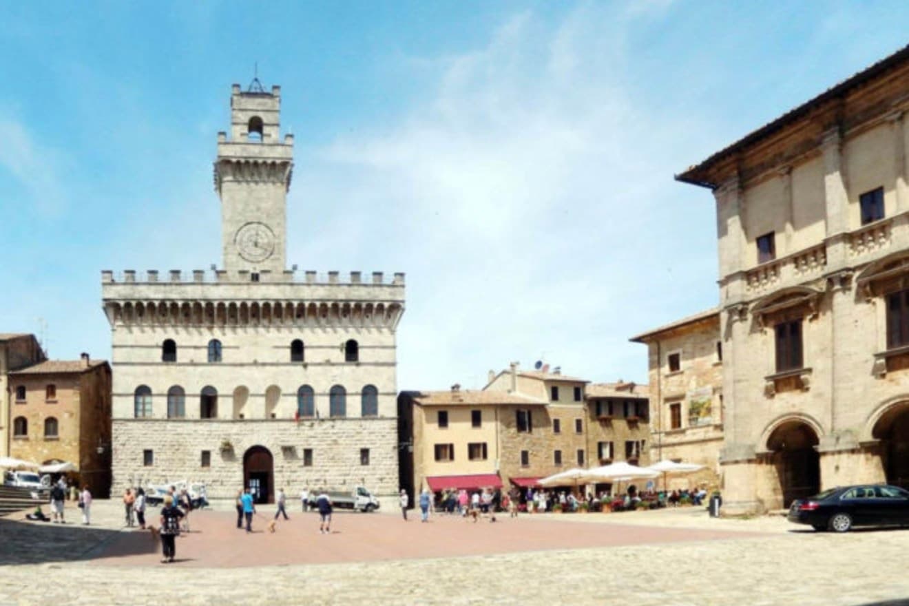
The ridge runs between the Val di Chiana and the Val d'Orcia, 70 kilometers southeast of Siena, and the town follows its spine uphill: streets climb from the gates toward the high point, where the main square sits ringed by the buildings that define the skyline from below. The origin predates the Renaissance fabric by centuries.
Etruscan tombs survive in the surrounding hills, though almost nothing of that period shows in the centro storico itself, which was rebuilt wholesale in the fifteenth and sixteenth centuries over whatever came before. The wine and the festival both use the climb as their setting rather than their subject: the cellars are cut into the rock beneath the palazzi, keeping a constant temperature for aging, and the barrel race each August sends two men from each of the eight contrade hauling an eighty-kilogram cask up the same gradient that every visitor covers on foot, only slower.
The steepness that shaped the defensive site nine centuries ago is still what a person feels first, in the legs, before the buildings register at all.
Ristorante Caffè Pasticceria Poliziano, Osmosi, Le Logge del Vignola and 3 more have been named by a guide.
What to see in Montepulciano
- Tempio di San Biagio. A 13-meter dome and travertine façade standing alone outside the walls, the ground falling away below it so the building reads as a single volume against the hillside.
- Piazza Grande. The high piazza at the top of the ridge, ringed by the Duomo, the Palazzo Comunale and the Palazzo Tarugi, all rebuilt in the fifteenth and sixteenth centuries.
- Palazzo Comunale. Town hall designed by Michelozzo in the fifteenth century, its tower offering a view over the Val di Chiana and Val d'Orcia.
How to get to Montepulciano
There is a railway station in the town, so you can arrive without a car and never need one while you are here. Perugia is roughly 57 minutes away by road.
✷ We have written about Montepulciano
“Now, the postcard itself, the towns, and here I have less to say than you would expect, because Pienza and Montepulciano have become, and I mean this precisely, the canteens of a theme park. They are where you go to park, walk a pretty street, use the toilet, refill the water, eat a plate of something, and buy a thing to take home. They are the food court between the rides.”
Read our piece on Montepulciano →Val d'Orcia | The Postcard Is Constructed
Our tip
April through June and September into October are the working months on the ridge: vine work in the surrounding hills, mild days, evening light that lingers over the Val d'Orcia. July and August push into the low thirties and the climb to Piazza Grande slows even the residents. The Bravìo delle Botti runs the last Sunday of August and fills the town. Calici di Stelle falls in July.
Rapolano Terme
Why visit Rapolano Terme
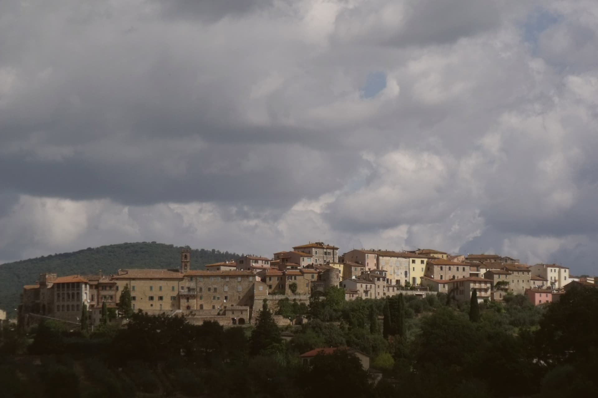
The comune sits at 334 meters on the eastern edge of the clay hills, twenty kilometers east of Siena. It was called simply Rapolano until 1949, when the spa industry pushed the name change, a shift that marks how thoroughly the waters came to define the place.
The thermal facilities and the quarry sit at some distance from each other within the comune: the springs rise near the centro and to its south, while the travertine beds lie in the Serre frazione three kilometers further out, a separate settlement built around the stone rather than the water. The medieval centro storico, meanwhile, holds no thermal or mineral history at all: a fortified perimeter, a Sienese-period castello on the highest point, and a parish church founded in the eleventh century, all predating the spa industry by centuries.
The clay-hill landscape spreads north and west of the comune, and draws most visitors past the spa itself. What emerges is a town built on two extractive industries, water and stone, wrapped around an older walled settlement that has little to do with either.
Osteria Il Granaio have been named by a guide.
What to see in Rapolano Terme
- Terme Antica Querciolaia. Six outdoor pools at 38 degrees, the older of the two facilities and the one tied to a general's convalescence.
- Terme San Giovanni. Thermal complex south of the centro among the clay hills of the Crete Senesi, with outdoor pools facing vineyards and olive groves.
- Cave di travertino di Serre. Active quarries in the Serre di Rapolano frazione three kilometers south, the source of the stone behind the Pienza Duomo's façade.
How to get to Rapolano Terme
There is a railway station in the town, so you can arrive without a car and never need one while you are here. Perugia is roughly 63 minutes away by road.
Our tip
Thermal towns work year-round and Rapolano is the rare Sienese commune where winter is a season. The pools at Antica Querciolaia and San Giovanni stay open through the cold months and the steam off the 38-degree water against the December clay hills is the postcard the spa industry sells. April through June and September into October are the wider best months, with the Crete Senesi at full color and the surrounding wine and olive harvests pulling traffic through the centro.
Montefalco
Why visit Montefalco
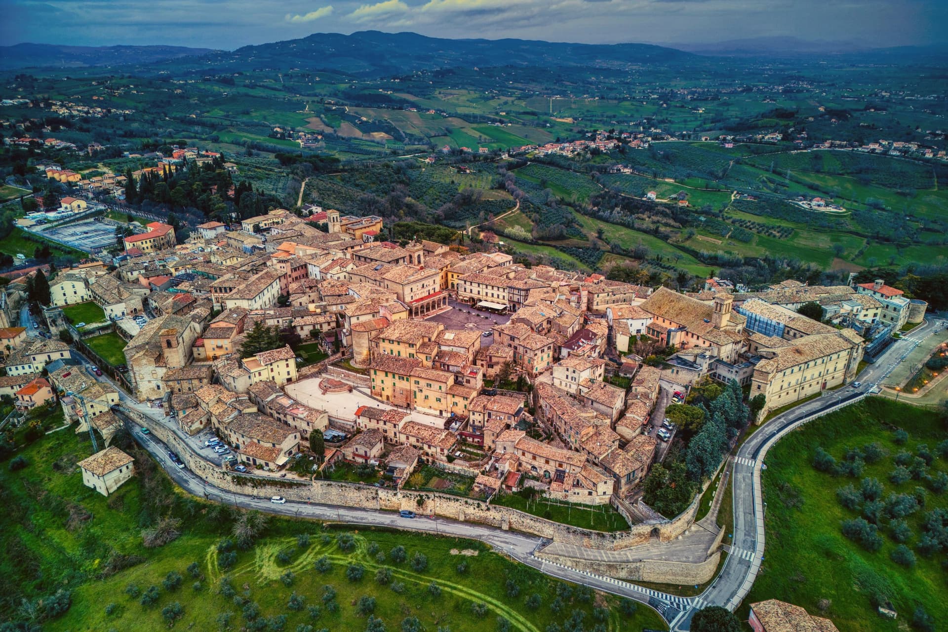
Montefalco sits on a hill above the Umbrian valley, its walls laid out in two concentric medieval circuits with five gates, the inner ring still complete and the outer ring added in the 14th century by the Trinci. At the top, the circular Piazza del Comune gathers four converging streets around the Palazzo Comunale, the high point from which the rest of the town falls away toward the walls and the vineyards beyond them.
The name Sagrantino belongs to the slopes right around those walls, where the grape has been traced back to the 1st century AD, and three of the largest producers, Caprai, Antonelli and Adanti, keep cellars within four kilometers of the centro storico. The harvest runs late September into October.
The fresco cycle Gozzoli painted in the apse of the former church of San Francesco is counted among his most complete surviving works, and the town's own name for itself, the railing of Umbria, describes the same eastern walls where the belvedere gathers seven hill towns into one view. Wine on the slopes, frescoes in the old church, a view of the valley from the walls: a hill town whose economy, art and setting all sit within walking distance of each other.
Camiano Piccolo, L' Alchimista, Locanda del Teatro and 2 more have been named by a guide.
What to see in Montefalco
- Museo Civico di San Francesco. Former Franciscan church holding Benozzo Gozzoli's fresco cycle, plus works of the Umbrian school, in a building that has stood as the town's museum since deconsecration.
- Piazza del Comune. Circular medieval square at the top of the hill, ringed by the Palazzo Comunale, the Oratorio di Santa Maria di Piazza and four converging streets.
- Belvedere of Umbria. Panoramic walk on the eastern walls that takes in Perugia, Assisi, Spello, Foligno, Trevi, Spoleto and Todi from a single viewpoint.
How to get to Montefalco
Perugia is roughly 54 minutes away by road.
Our tip
April through June and September into October are the months for Montefalco. The vineyards run their full work cycle, the harvest of Sagrantino starts in the last week of September, and the railing belvedere holds the long Umbrian light. Settimana Enologica in mid-September brings producers from across the territory onto Piazza del Comune. Enologica Montefalco falls in September.
Torgiano
Why visit Torgiano
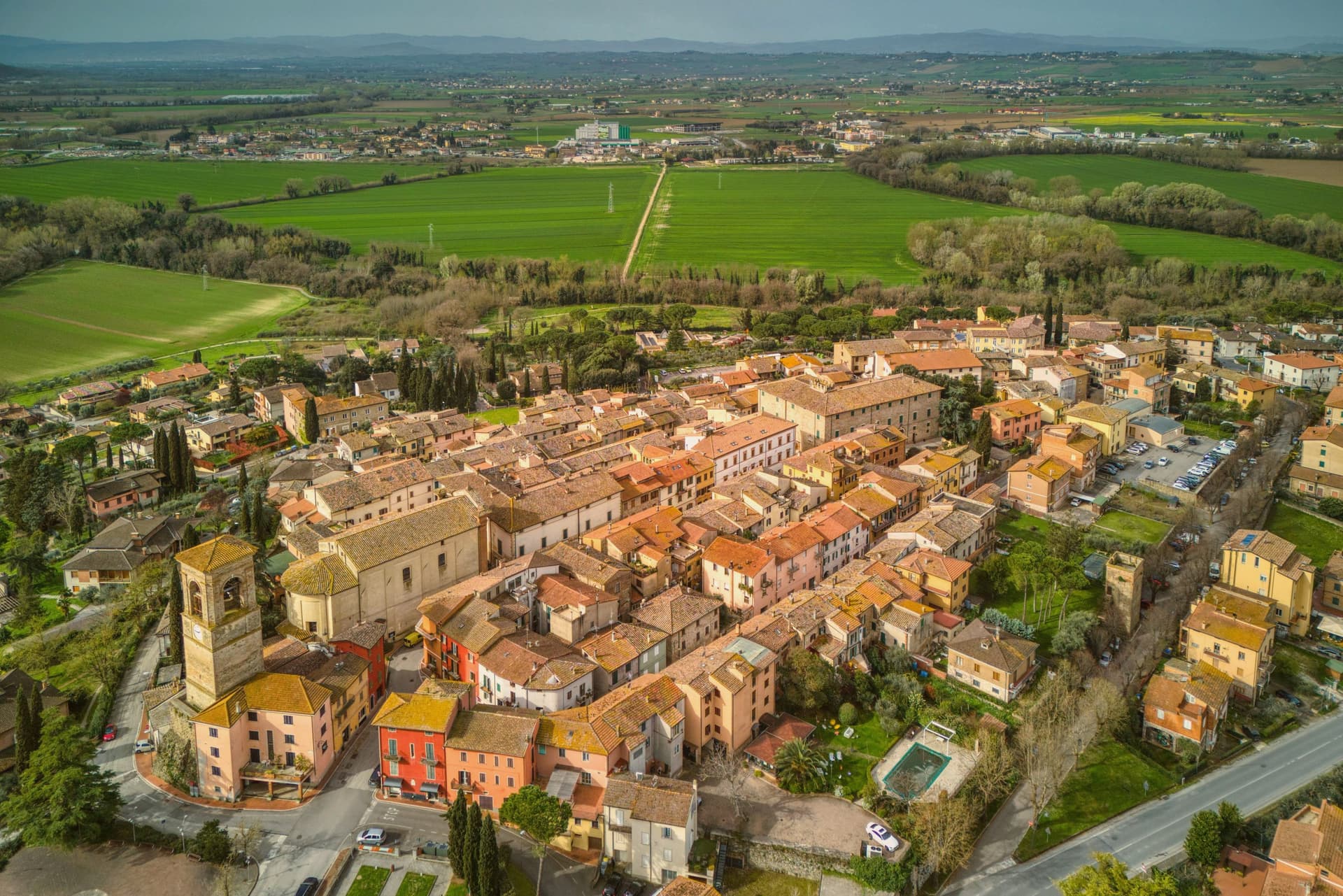
Torgiano sits at 219 meters at the point where the Chiascio joins the Tiber, ten kilometers south of Perugia. The Torre della Guardia, also called Torre Baglioni, was raised in 1274 to control the river customs traffic that moved up toward Rome from the Tiber valley.
Torgiano was the first Umbrian wine area to receive the DOC mark in 1968 and to be elevated to DOCG in 1990. Giorgio and Maria Grazia Lungarotti turned the wine economy of the town into a cultural project: the MUVIT, opened in 1974 inside the seventeenth-century Palazzo Graziani-Baglioni, holds three thousand pieces across twenty rooms documenting five thousand years of wine history.
The companion MOO, on the olive and oil, is inside a small medieval cluster within the castle walls. Both are managed by the Lungarotti Foundation.
The cantina itself, on the edge of the centro storico, has been the largest single Umbrian producer for half a century.
Elementi Fine Dining - Hotel Borgo Brufa, Olimpia Ristorante have been named by a guide.
What to see in Torgiano
- MUVIT Museo del Vino. Wine museum opened 1974 in 17th-century Palazzo Graziani-Baglioni, with 3,000 pieces across 20 rooms covering 5,000 years of wine history.
- MOO Museo dell'Olivo e dell'Olio. Olive and oil museum in a medieval cluster within the castle walls, managed alongside MUVIT by the Lungarotti Foundation.
- Torre della Guardia (Torre Baglioni). Defensive tower raised 1274 to control the Tiber-Chiascio customs traffic, the only standing element of the original river fortifications.
How to get to Torgiano
Perugia is roughly 26 minutes away by road.
Our tip
April through June and September into October are the working months. The vineyards run their full cycle on the slopes around the confluence, and MUVIT and MOO keep regular hours. The Banco di Assaggio dei Vini d'Italia is the historical late-summer tasting that put Torgiano on the wider Italian wine map. Vinarelli - Agosto Torgianese falls in August.
Trevi
Why visit Trevi
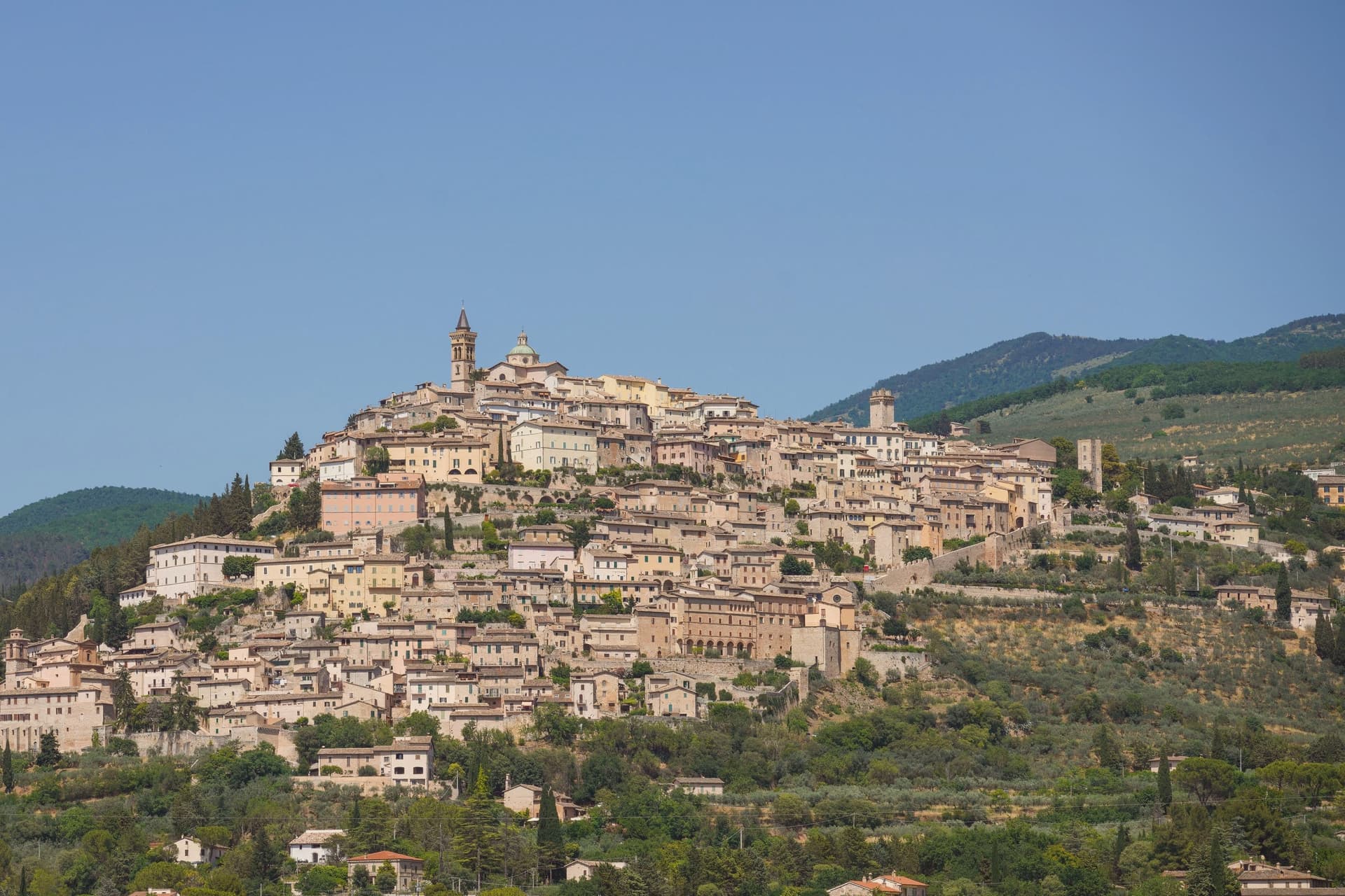
Trevi sits at 412 meters on a conical hill above the Spoleto valley, the centro storico still inside the Roman walls of the 1st century BC. The town stood on the Via Flaminia, the consular road from Rome to the Adriatic, and grew into a Guelph commune by the 12th century.
Olive oil is what people come for. Over 200,000 trees blanket the slopes below the walls on near-ideal calcareous, well-drained soils, and the Olivo di Sant'Emiliano near the abbey of the same name is about 1,700 years old, identified with the tree the bishop of Trevi was tied to in 304 before his martyrdom.
The Santuario della Madonna delle Lacrime, built in 1487 to mark a miracle, holds a fresco by Pietro Perugino. The centro storico runs in concentric rings up the hill, each ring older than the last, with the Palazzo Comunale and the Pinacoteca holding works by Lo Spagna at the top.
La Cucina di San Pietro a Pettine have been named by a guide.
What to see in Trevi
- Santuario della Madonna delle Lacrime. Built in 1487 after a Marian apparition wept tears of blood in 1485, with a fresco by Perugino in the Cappella dell'Adorazione.
- Chiesa di Sant'Emiliano. Romanesque parish church at the top of the centro storico, dedicated to the bishop martyred in 304, the patron saint of the town.
- Olivo di Sant'Emiliano. About 1,700-year-old olive tree near the eponymous church, nine meters tall, traditionally the tree to which the bishop was tied before martyrdom.
How to get to Trevi
There is a railway station in the town, so you can arrive without a car and never need one while you are here. Perugia is roughly 47 minutes away by road.
Our tip
April through June and September into October are the months for Trevi. The olive groves are in leaf or in harvest, the hill is green or silver-gold depending on the half, and the valley below holds the morning light. The Festa di Sant'Emiliano runs the last week of January with the Palio dei Terzieri, when the three quarters of the town compete.
Chiusi
Why visit Chiusi
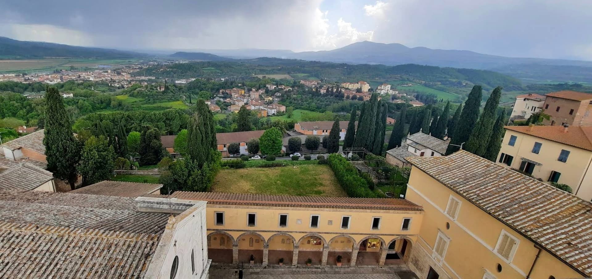
The hilltop stands above the Val di Chiana, the valley floor visible from the town at a height that made it defensible and gave it command of the surrounding farmland. The cathedral, the museums and the tunnel network are close enough to walk between within the old center, while the painted necropolis and the lake lie outside it, a few kilometers apart in different directions, one inland toward the tombs and the other north toward open water.
The tunnels themselves connect the upper town to what lies beneath it: built as drainage, later folded into legend by Pliny the Elder, who took them for part of a king's tomb. The cathedral's own columns, lifted from earlier Roman buildings, make the same point in stone that the tombs make in paint and the museum makes in bucchero and alabaster: this is a town built repeatedly on top of itself, each layer reusing what the last one left behind.
I Salotti, Il Grillo è Buoncantore, La Solita Zuppa have been named by a guide.
What to see in Chiusi
- Museo Nazionale Etrusco. Holds canopic urns, alabaster sarcophagi, bucchero pottery and grave goods pulled from the necropolises around the town.
- Duomo di San Secondiano. Cathedral built around 560 AD over an earlier basilica, renovated in the thirteenth century, nave and two aisles on antique marble columns from Roman buildings.
- Labirinto di Porsenna. Visited from the Museo della Cattedrale, the tunnels run beneath the streets at a scale that still reads as engineering rather than legend, whatever Pliny made of them.
How to get to Chiusi
There is a railway station in the town, so you can arrive without a car and never need one while you are here. Perugia is roughly 58 minutes away by road.
Our tip
April through June and September into October are the working months on the Val di Chiana edge: mild days, evening light over the lake, the wine and olive cycles below town. The Frittellata of San Giuseppe in mid-March and the Festa di San Mustiola in early June fill the centro storico with traditional kitchens. July and August push past thirty degrees and the basin below town holds the heat; the museums and the Labirinto stay cool. Tria Turris Medioevo e Palio delle Torri di Chiusi falls in June.
More from Anywhere Italy
- The best towns with a medieval festival that eat well within 90 minutes of Perugia
 The best hidden towns you can reach by train that eat well within 90 minutes of Perugia
- The best hidden hill towns with a serious restaurant within 90 minutes of Perugia
- The best olive oil towns that eat well in the province of Perugia
 The best hidden olive oil towns that eat well in Umbria
- The best towns worth staying overnight that eat well within 90 minutes of Perugia