
10 small towns in Italy where everyday life is a walk
91 towns visited, 909 to go. Follow along, free: Subscribe on Substack
In a small Italian town the morning errands make a loop. Bread first, then the pharmacy, a coffee standing at the bar, the newspaper, and home before the shutters come down for lunch. Whether that loop is ten minutes on foot or a drive out to a retail park on the ring road decides more about living somewhere than the view from the walls does.
So we measured it. For each of our 1,000 towns we read OpenStreetMap, the map that volunteers draw and anyone can check, and looked for ten everyday services within 500 meters of the town's center, about six minutes on foot: a grocer, a bar or cafe, a restaurant, a pharmacy, a doctor, a dentist, a hairdresser, a dry cleaner, a car repair shop and a hardware store.
These are towns of 5,000 to 20,000 residents, the size our own rules for living call the sweet spot, with at least nine of the ten on the map inside that circle. Levanto and Isola di Capo Rizzuto have all ten. The map misses things, so a town left off this list may still have every one of them. The towns on it have them on the map.
If you are still choosing, we have also written The 9 best towns you can get around without steps in Liguria and The 9 best hidden hill towns that eat well within 90 minutes of Terni.
Why visit Baselga di Pinè
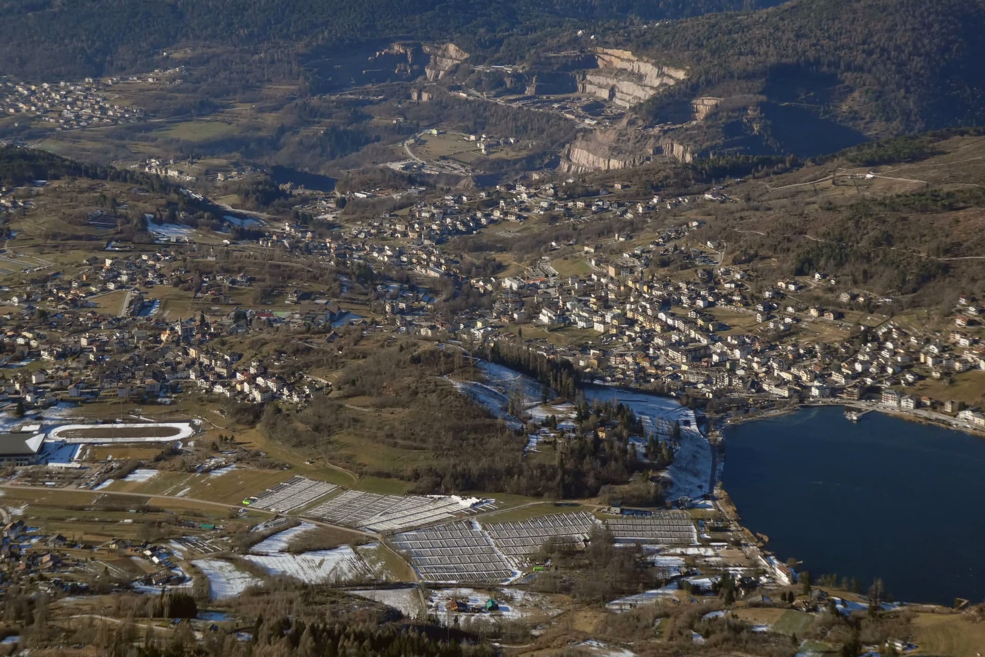
Baselga di Pinè is the main town of the Altopiano di Piné, a forested plateau at 964 meters northeast of Trento, between the Adige valley and the Val di Cembra. Its territory holds ten hamlets and three lakes: Serraia, Laghestel and part of Piazze.
Lake Serraia, at 974 meters, has been awarded the Bandiera Blu each year for the cleanliness of its waters, and freezes solid enough in winter to skate on. The Stadio del Ghiaccio di Piné in the hamlet of Miola is one of Italy's few outdoor speed skating ovals, hosting the Italian national team and the annual Piné 24 Hours endurance race.
The Santuario della Madonna di Pinè, in the hamlet of Montagnaga, was built in 1730 around a Marian apparition reported by the shepherdess Domenica Targa, and remains the most visited pilgrimage site in Trentino. The Church of San Mauro in the hamlet of San Mauro, documented in 1242, was the first pieve of the plateau.
Nine of the ten everyday services we look for, from a grocer to a pharmacy, are on the map within 500 meters of the center. The count is OpenStreetMap's, read in November 2026.
What to see in Baselga di Pinè
- Lago di Serraia. Blue Flag lake at 974 meters at the edge of Baselga, used for swimming, canoeing and sailing in summer and skating when the surface freezes.
- Santuario della Madonna di Pinè. Baroque Marian sanctuary in Montagnaga, built in 1730 after the reported 1729 apparition to the shepherdess Domenica Targa, the most visited pilgrimage site in Trentino.
- Stadio del Ghiaccio di Piné. Outdoor speed skating oval in the hamlet of Miola, training home of the Italian national team and venue for the Piné 24 Hours endurance race.
How to get to Baselga di Pinè
Trento is about 24 min away by road.
Our tip
May through October is the lake season: Serraia warms enough for swimming by mid-June, the sailing and canoeing clubs run from May, and the surrounding forests open for hiking and mushroom foraging into late October. June and July bring pilgrims to the Madonna di Pinè sanctuary, with the main feast on 26 May. November through March is the ice season: the speed skating oval runs at full schedule, the lakes freeze for natural-surface skating, and the Piné 24 Hours race takes place in winter.
Why visit Levanto
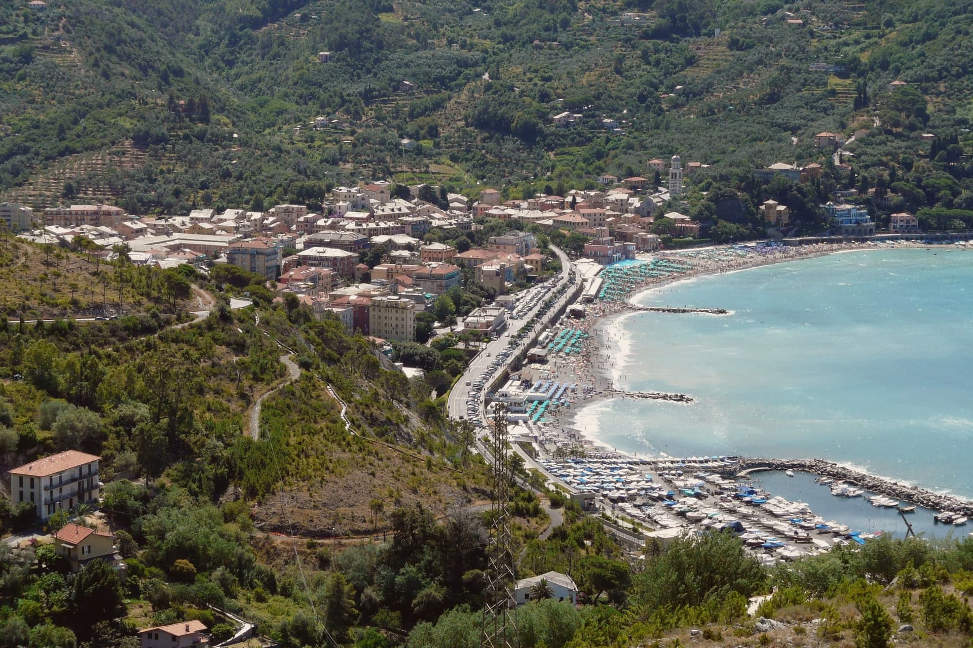
Levanto sits at sea level on the Ligurian coast, twenty kilometers northwest of La Spezia and just outside the Cinque Terre National Park. The Cinque Terre Express train stops here every half hour on its way to the five villages, but Levanto has the things they do not: a long sand-and-gravel beach with Bandiera Blu status, a flat centro storico, and a surf break that local guides classify as one of the few big-wave spots in Italy.
The Chiesa di Sant'Andrea, built in 1222, fronts the old town with horizontal bands of black and white marble and a large rose window. Casa Restani, on Via Grillo, is a surviving medieval merchant house with the ground floor where goods from the harbor were stored.
Levanto holds Cittaslow, Bandiera Blu, Parco Nazionale, and Città dell'Olio at once.
All ten everyday services we look for, from a grocer to a pharmacy, are on the map within 500 meters of the center. The count is OpenStreetMap's, read in November 2026.
What to see in Levanto
- Chiesa di Sant'Andrea. Parish church built in 1222 in Ligurian Gothic style, with horizontal bands of black and white marble and a large rose window over the main door.
- Castello di Levanto. Thirteenth-century defensive castle on the hillside, still intact but privately owned and closed to the public.
- Loggia Comunale. Thirteenth-century arcaded loggia on the main piazza, awarded a UNESCO title in 2007 as a monument of culture and peace.
How to get to Levanto
It has its own railway station. Genova is about 1 h 12 min away by road. The full route from Genoa.
Our tip
April through June and September into October are the dry months. The sea warms enough for swimming by late May. The surf builds in autumn and winter when Atlantic systems push swell into the gulf.
Why visit Loano
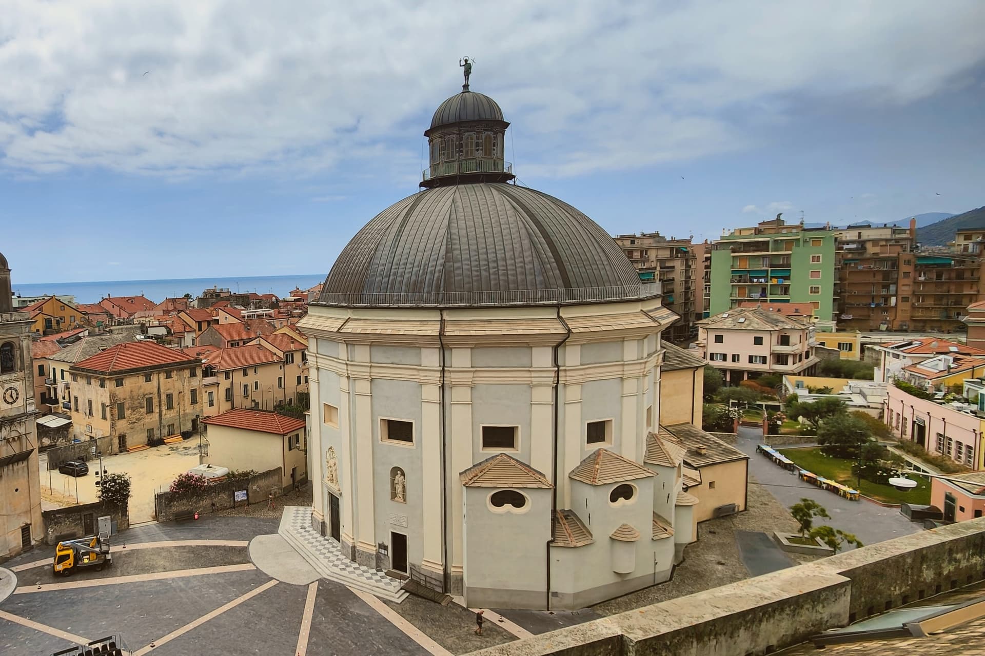
Loano lies sixty kilometers southwest of Genova, at the foot of the arc of mountains that shelters it from inland weather. The town was an imperial fief of the Doria family from the thirteenth century, and the family financed the major public buildings still in use today: the palace at the centro's heart, the loggia beside it where civic business was once conducted, and, indirectly, the church that stands nearer the harbor, built for the town's seafarers and still holding their votive offerings of brigantines and barques.
The old centro, with its palace, loggia and church, sits inland of the modern marina and the two kilometers of beach that run east from it. The mountain at Loano's back and the harbor at its front mark the two poles the town has always worked between: the Doria who governed from the hill and the sailors who prayed by the water.
Nine of the ten everyday services we look for, from a grocer to a pharmacy, are on the map within 500 meters of the center. The count is OpenStreetMap's, read in November 2026.
What to see in Loano
- Palazzo Doria. Considered one of the most representative civil Renaissance palaces in Liguria, its rooms now house the town's administrative offices, and the mosaic floor remains open to view on the main level.
- Chiesa di Sant'Agostino. Founded 1582 by Zenobia Del Carretto, rebuilt 1588-98; called the Madonnetta, the seafarers' church, with votive ship models inside.
- Marina di Loano. The Yachting Pages ranking sits alongside a working harbor east of the centro, with the beach running two kilometers of sand and gravel toward it.
How to get to Loano
It has its own railway station. Genova is about 1 h 16 min away by road. The full route from Genoa.
Our tip
April through June and September into October are the strongest months on the Loano front, with the marina full of boats and the beach manageable. July and August are warm, often 28 to 31 degrees, and the population doubles with families on long stays from Milano and Torino. November through March is the calmest stretch but the town stays open because 10,700 residents keep daily services running; the Madonnetta opens for the seafarers' mass on 8 December.
Why visit Castelnuovo Berardenga
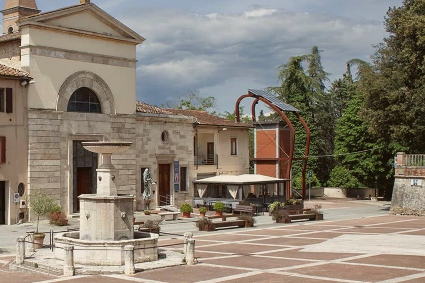
The commune sits east of Siena, where the hills give way to the clay swells of the Crete Senesi. The name comes from the Terra Berardinga, the area controlled in the tenth century by a Frankish nobleman named Berardo, and the borgo grew up around the castle walls the Sienese Republic raised against Florence.
The centro storico, the villa and gardens at its heart, and the surrounding zone of vineyards form one continuous pattern rather than separate parts: fortress town above, wine country falling away below it toward the clay hills. Across the wider territory, 13 castles, 70 churches and 200 farms record the medieval pattern of the Sienese contado, a scatter of small fortified points and parish churches administering land rather than one dominant center.
The place reads as a border post that outlived its military purpose and settled into agriculture and the arts, its castle now a clock tower, its noble villa now a music foundation, its walls now overlooking rows of Sangiovese.
Nine of the ten everyday services we look for, from a grocer to a pharmacy, are on the map within 500 meters of the center. The count is OpenStreetMap's, read in November 2026.
What to see in Castelnuovo Berardenga
- Villa Chigi Saracini. Eighteenth-century villa and Italian garden inside the centro storico, its park designed by the Sienese composer Guido Chigi Saracini, whose family foundation still runs the Accademia Musicale Chigiana in Siena.
- Torre dell'Orologio. Surviving tower of the fortress, now bearing the civic clock, the highest visible point of the centro storico.
- Chiesa dei Santi Giusto e Clemente. Eighteenth-century parish church with a neoclassical façade, built on the site of an earlier Romanesque pieve.
How to get to Castelnuovo Berardenga
Firenze is about 1 h 17 min away by road. The full route from Florence.
✷ We have written about Castelnuovo Berardenga
“The wine is the whole economy of these hills, every village with its own, the region’s name stamped on the most famous red in Italy. Tuscan food runs to cured and roasted meat, so the wine ran red to meet it, lighter than you expect, almost fruity, easy, made to sit beside a steak and not to be lectured about. Here is the only wine knowledge you need on this road: it is all good.”
Read our piece on Castelnuovo Berardenga →Road to Siena | The Long Way Is the Better Way
Our tip
April through June and September into October are the months Chianti Classico shows best, the green hills moving toward the gold of harvest. The Sagra del Vino runs the second weekend of September. July and August push past thirty and the centro storico empties between two and six; the cellars on the surrounding hills offer cool tastings and longer rentals.
Why visit Amelia
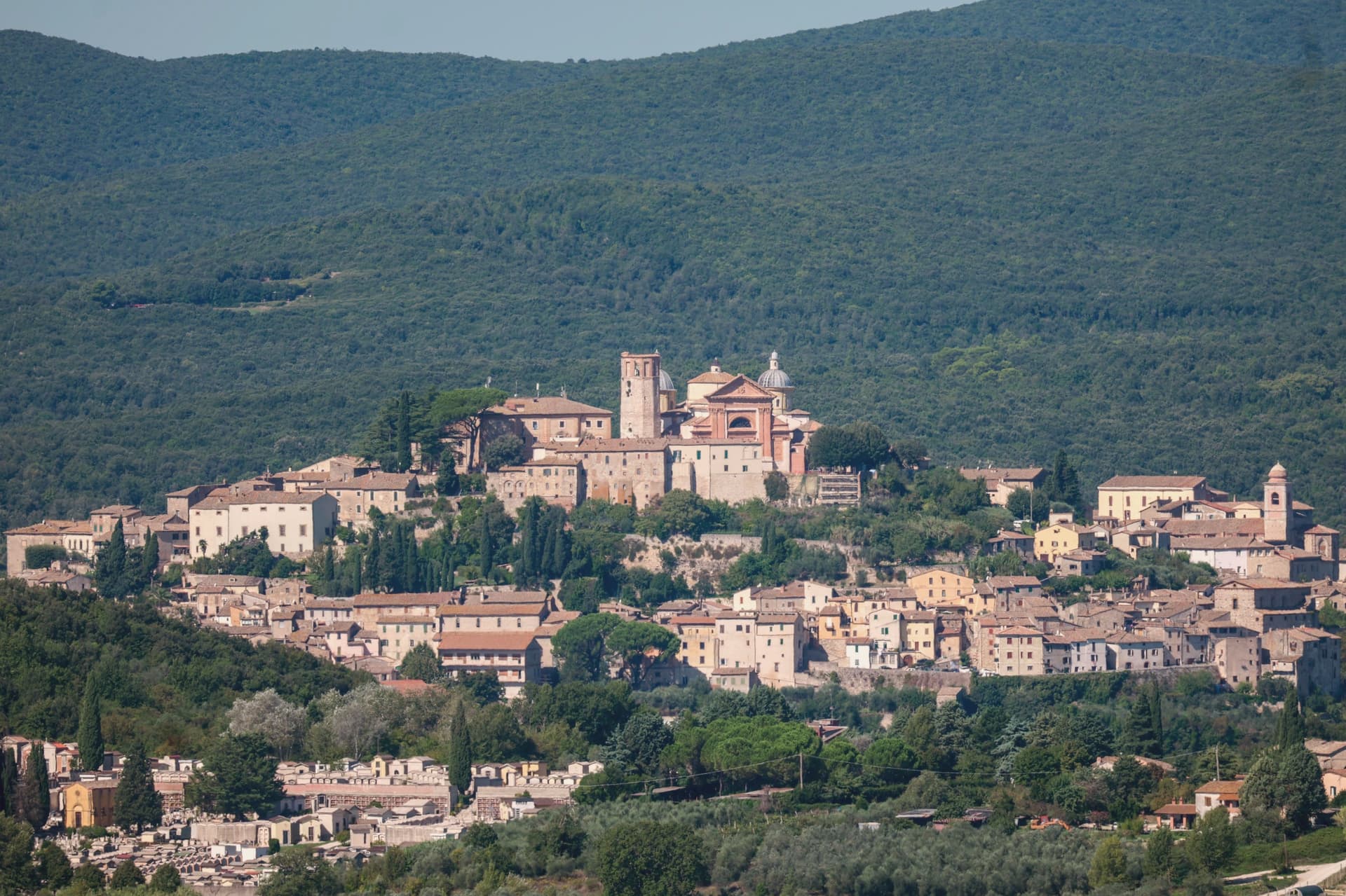
Amelia sits on a hill between the Tiber and the Nera, sixty kilometers south of Perugia and close to the Lazio border. The walls that ring the town predate the Roman conquest, and when Amelia later became a Roman municipium, the town built outward and downward at once: terraces and roads above ground, and below the main square, a system of parallel cisterns cut to hold the settlement's water.
The gate on the old Via Amerina still marks the approach from outside, its current travertine form the result of sixteenth-century rework. Just beyond it, a bronze cuirassed general over two meters tall lay buried until 1963, when it surfaced and was moved into the town's archaeological museum.
The cathedral at the upper end of the centro storico carries its own layer of history, re-dedicated in the ninth century under a pope, and stands apart from the defensive and civic works that dominate the rest of the town's fabric. Amelia joined the Cittaslow network in 2004, and each summer the chamber-music festival founded in 1968 turns the town's attention outward to a different country's repertoire.
The town's layers sit on top of each other rather than beside each other: pre-Roman defense, Roman engineering, medieval faith, and a modern festival calendar all occupying the same small hill in sequence.
Nine of the ten everyday services we look for, from a grocer to a pharmacy, are on the map within 500 meters of the center. The count is OpenStreetMap's, read in November 2026.
What to see in Amelia
- Mura poligonali. Up to 6 meters high in places, the blocks fitted without mortar along the line that still defines the edge of the old town.
- Cisterne romane. The chambers measure 57.5 by 19.6 meters and sit directly beneath the paving of Piazza Matteotti, invisible from the square above.
- Duomo di Santa Firmina. Cathedral re-dedicated to Saint Firmina around 872 under Pope Adrian II, at the upper end of the centro storico.
How to get to Amelia
Terni is about 33 min away by road.
✷ We have written about Amelia
“It is one of the best-preserved ancient towns in the area, ringed by massive pre-Roman walls built from huge fitted stones, with Roman cisterns under its main square. It takes an hour to walk around the historic center, perfect for stretching your legs. Amelia is one of the stops on our Umbrian Circle road trip.”
Read our piece on Amelia →The Umbrian Circle | Town Tasting in a Day
Our tip
April through June and September into October are the working months: dry air, light on the polygonal walls, evenings on the Cittaslow corso. July and August reach the mid-thirties; at 406 meters the centro storico breathes better than the Terni basin but afternoons still empty. The cisterns under Piazza Matteotti, opened on guided tours, stay at a constant cool.
Why visit Arona
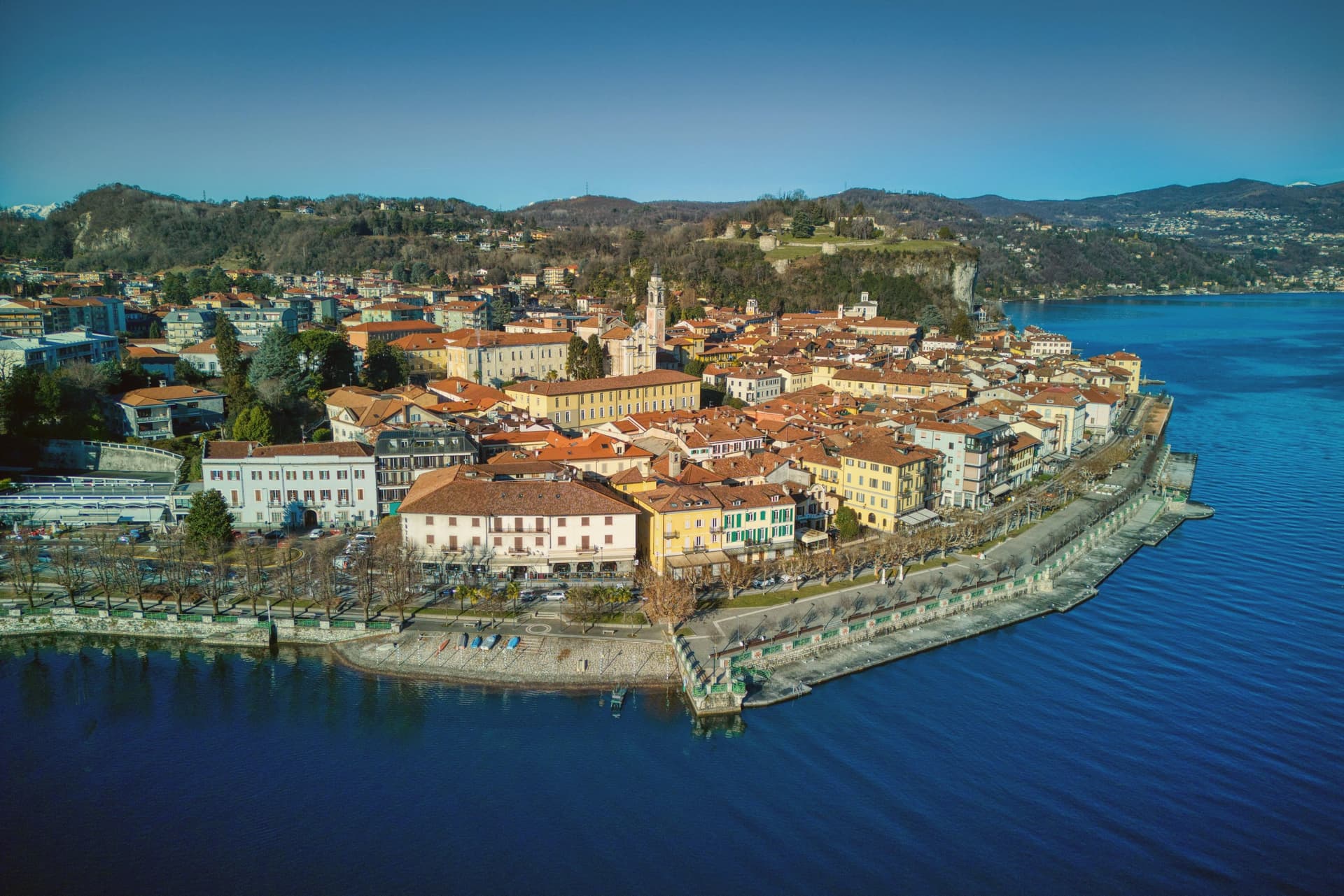
Arona sits ninety kilometers north of Milano, the first stop most travelers reach when they leave the city for the lakes. The town came under the Borromeo family in 1439 and stayed there for centuries: the castle on the hill above town was their stronghold, and the next hill over holds the statue raised in the family's honor, so the two high points of Arona both belong to the same lineage looking down on the water and on each other.
The lakefront below connects the two hills to the church on the shore and to the promenade that runs north with Angera visible across the water on the Lombard side. The natural park on the southern edge of the commune sits apart from this Borromeo core, its pile-dwelling remains far older than anything else in town and unconnected to the family's centuries of rule.
What the place adds up to is a town organized around one family's presence in stone and copper, with a much older, unrelated settlement preserved at its edge.
Nine of the ten everyday services we look for, from a grocer to a pharmacy, are on the map within 500 meters of the center. The count is OpenStreetMap's, read in November 2026.
What to see in Arona
- Sancarlone. Copper colossus of San Carlo Borromeo, designed by Il Cerano and built between 1614 and 1698, standing above the Sacro Monte.
- Rocca di Arona. Ruined fortress on the hill above town, the walls broken into towers since the demolition, with views over the water below.
- Collegiata di Santa Maria Nascente. Late medieval church on the lakefront, holding a polyptych by Gaudenzio Ferrari completed in 1511.
How to get to Arona
It has its own railway station. Novara is about 49 min away by road. The full route from Milan.
Our tip
April through June and September into October are the best months on the south shore of Lake Maggiore. The lake stays cool, the lungolago carries traffic without congestion, and the ferries run a full timetable to Angera and the Borromeo islands further north. July and August are warm and busy: ferry queues, full hotels, and the southern lake basin gathering most of the day-trip volume from Milano.
Why visit Brunico
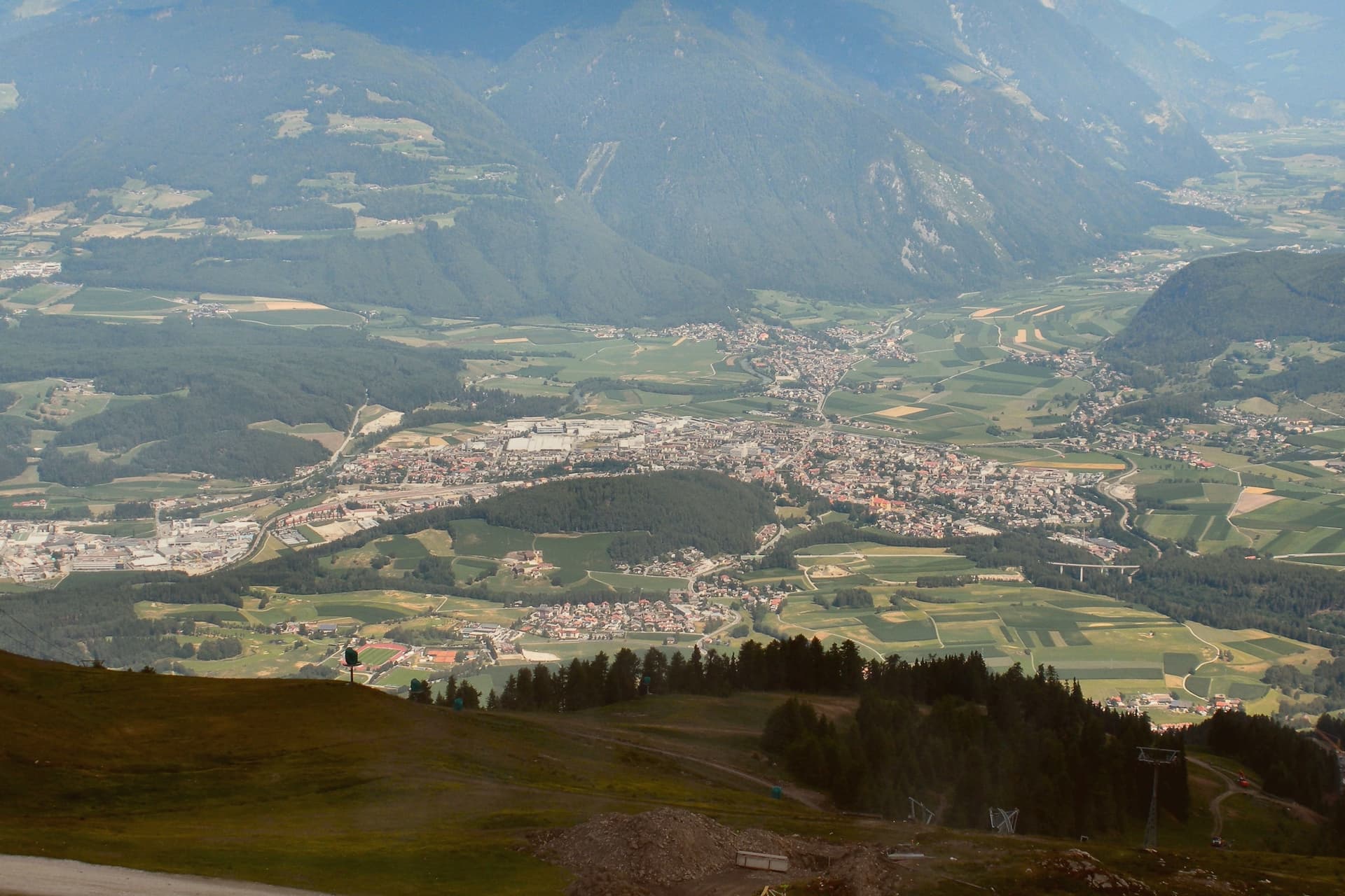
Brunico, Bruneck in German, sits at 838 meters in the eastern Alto Adige, in the Val Pusteria. The name comes from the castle built above the settlement, and the town below grew up around it rather than the other way round.
First documented as Bruneke in 1256, it received weekly market rights and the privilege of high justice, and grew rich in the fourteenth and fifteenth centuries on the Augsburg-Venice trade that ran across the valley, the same trade that filled the Stadtgasse with merchant houses. The town has three distinct layers that sit close together but answer different purposes: the castle above holding the seat of the former prince-bishops, the walled Stadtgasse below as the commercial spine between the four gates, and Teodone at the edge of town, where the Mair am Hof Residence and its rebuilt farmhouses preserve a rural way of life that the town center does not.
The mountain above the valley, reached from the town, adds a fourth register entirely, modern and built for a single striking structure rather than for defence or trade. Together these layers show a town shaped by three different economies in three different eras: episcopal power, alpine commerce, and now winter tourism, each leaving its own mark rather than replacing what came before.
Nine of the ten everyday services we look for, from a grocer to a pharmacy, are on the map within 500 meters of the center. The count is OpenStreetMap's, read in November 2026.
What to see in Brunico
- Castello di Brunico. The castle sits above the town as the former summer residence of the Brixen bishops. The museum inside occupies rooms that still read as a bishop's seat rather than a purpose-built gallery.
- Stadtgasse. Pedestrian street between the four gates, its townhouses carrying bay windows and ornate shop signs at close range, the kind of detail that only shows up on foot.
- Museo Etnografico Sudtirolese. South Tyrolean Folklore Museum in the Mair am Hof Residence at Teodone, built 1690-1700, with twenty-four rebuilt farmhouses from across the province in its open-air section.
How to get to Brunico
It has its own railway station. Bolzano is about 1 h 9 min away by road.
Our tip
May through October brings the warm months in the Pustertal, with the Stadtgasse and the castle terrace usable from early afternoon and Plan de Corones open for hiking and biking from late June. June and July are the cool alpine months, with long evenings in the historic center and the cable cars running up from the south side of town. September and October bring the autumn colors and the start of Törggelen, the South Tyrolean chestnut-and-new-wine season.
Why visit Isola di Capo Rizzuto
Isola di Capo Rizzuto is a promontory in the province of Crotone; despite the name, it has been joined to the mainland for centuries. The commune's population, around 17,000, spreads across more than fifteen frazioni, most set back from the cliffs on a flat agricultural plateau planted with olives and grain.
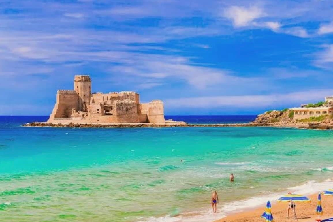
Le Castella is one of these frazioni, the one built around the castle on its islet, and it draws the eye that the inland villages do not. The sea is administered as the Area Marina Protetta Capo Rizzuto, stretching across both Isola and neighboring Crotone, its zones running along the Costa dei Saraceni from the cliffs at Capo Cimiti down to Praialonga.
The Saracen towers built along this same stretch, Torre Vecchia, Torre Scifo, Torre Marinella, mark the headlands where the coast was once watched for raids, a line of defense that runs parallel to the modern line of protected water. Inland farming, a fortified shoreline, and a marine reserve now share the same short stretch of coast: the plateau feeds the towns, the towers still stand as their old lookout, and the sea in front of them is protected rather than patrolled.
All ten everyday services we look for, from a grocer to a pharmacy, are on the map within 500 meters of the center. The count is OpenStreetMap's, read in November 2026.
What to see in Isola di Capo Rizzuto
- Castello Aragonese di Le Castella. The fortress sits apart from the coast on its own islet, reached by the sandbar underfoot; the walls close around a small courtyard, and the sea shows on every side.
- Area Marina Protetta Capo Rizzuto. Divers enter the integral zones under license, where the water is clearest and the rules strictest; the fishermen who work the general zones nearby operate under the same protected status.
- Spiagge della Costa dei Saraceni. Fine sand alternates with red cliffs along Capo Cimiti, Capo Bianco and Praialonga, the color of the rock changing the water's tone from one cove to the next.
How to get to Isola di Capo Rizzuto
Reggio Calabria is about 2 h 36 min away by road.
Our tip
May through September is the season the marine reserve was made for. Water clarity peaks in late May and June, before the high-summer crowds arrive in late July and August, when temperatures push past thirty-three degrees and the small coast road jams between Capo Rizzuto and Le Castella. September and early October are the better diving months, with warm water and emptier beaches.
Why visit Anguillara Sabazia
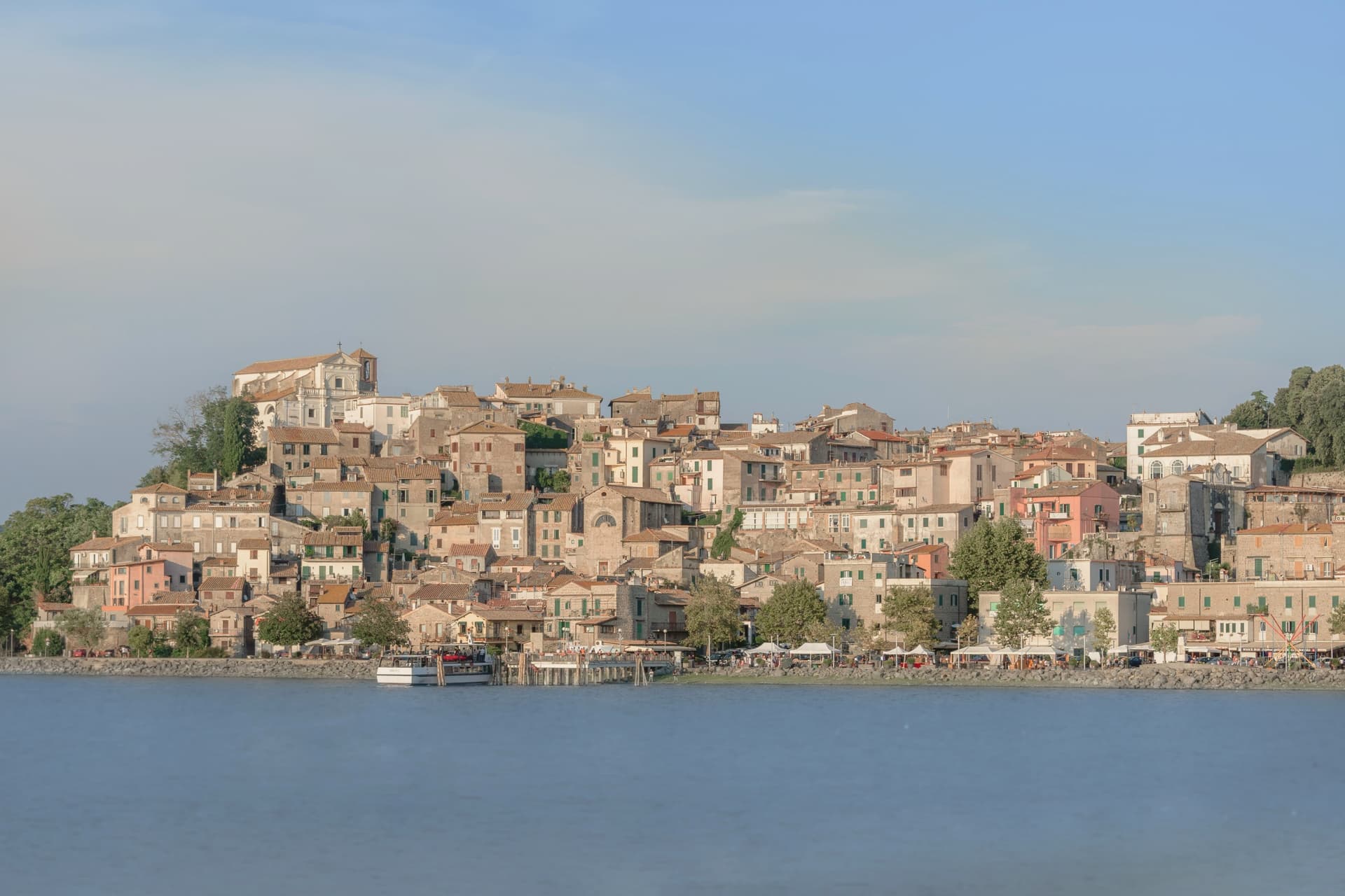
Anguillara Sabazia sits on a small volcanic cape that pushes into Lake Bracciano from the southern shore, twenty-five kilometers northwest of Rome. The medieval town climbs from the lake on stepped streets to the Porta Maggiore and the Collegiata di Santa Maria Assunta at the top.
The setting is older than the medieval town: La Marmotta, a few hundred meters offshore from the cape, is one of the oldest underwater archaeological sites in Europe, an Early Neolithic lakeshore village dated to 5700 BC, with preserved wooden canoes and grain stores in the lakebed mud. The Romans came later: Rutilia Polla, a Roman patrician, owned a villa on the cape in the first century BC, and the modern town name carries the surname of the medieval Anguillara family who took the place after the empire.
Anguillara is one of three communes on Lake Bracciano with Bracciano and Trevignano, and it is the closest to Rome of the three.
Nine of the ten everyday services we look for, from a grocer to a pharmacy, are on the map within 500 meters of the center. The count is OpenStreetMap's, read in November 2026.
What to see in Anguillara Sabazia
- Porta Maggiore e centro storico. Medieval gate and stepped town climbing from the lakefront on the volcanic cape, with stone streets converging on the upper piazza.
- Collegiata di Santa Maria Assunta. Main church at the top of the cape, rebuilt in the sixteenth century on earlier foundations, with views over the lake from the parvis.
- Lungolago e cape. Lakefront promenade and small beaches along the cape, with views east to Trevignano and west to Bracciano across the volcanic basin.
How to get to Anguillara Sabazia
It has its own railway station. Roma is about 50 min away by road. The full route from Rome.
Our tip
April through June and September through October are the strong months. The cape is exposed and the wind off the lake keeps the temperature mild even in warm weeks. July and August are hot, around thirty degrees, and the lakefront fills on weekends with Romans driving up for a swim and grilled coregone.
Why visit Giovinazzo
Giovinazzo sits on the Adriatic twenty kilometers northwest of Bari, between Molfetta and the Bari coastal belt, at 7 meters. The Romans called it Natolium, fortifying the site under Trajan in 102 AD on what may be the older Peucetian settlement of Netium.
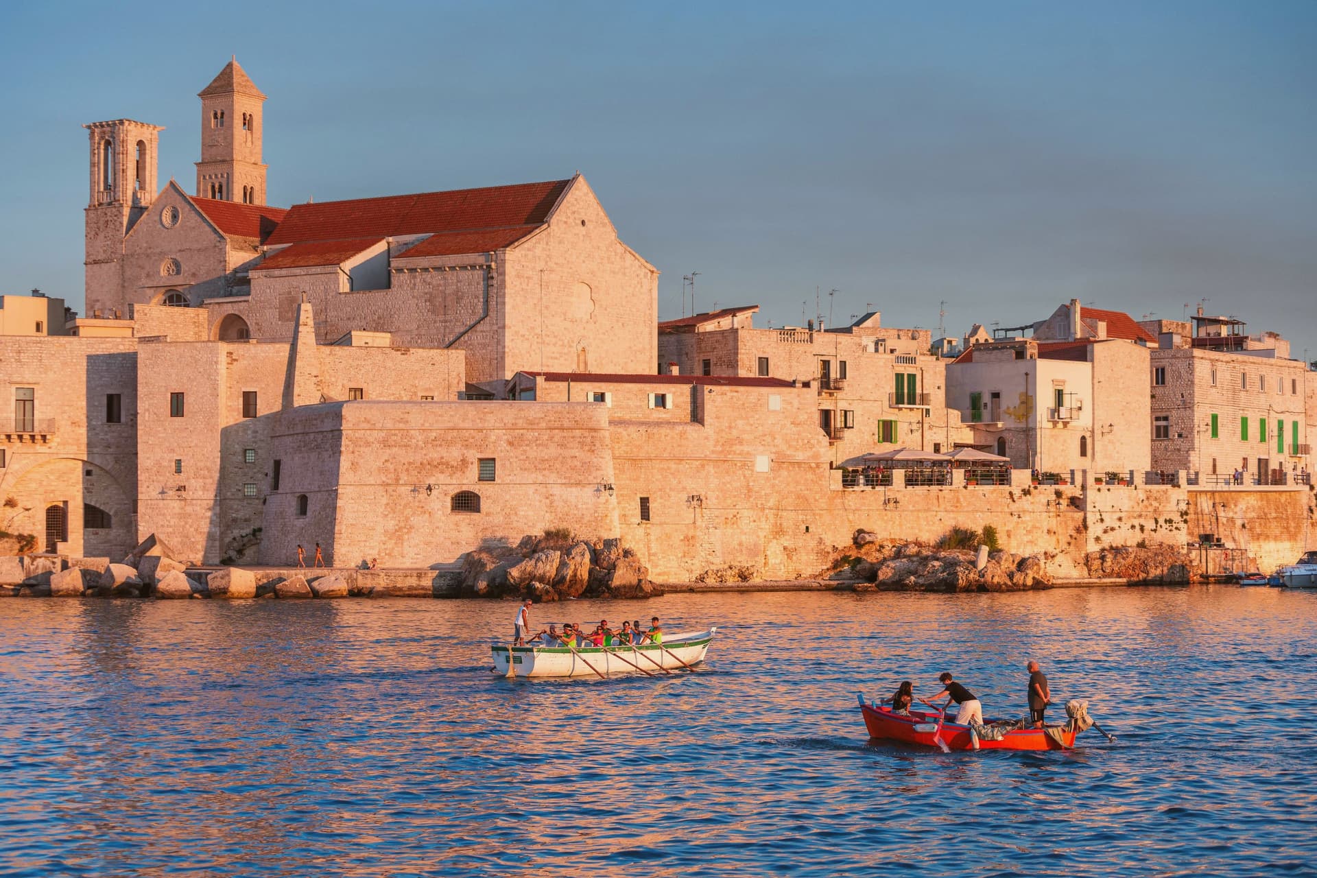
The Norman cathedral of Santa Maria Assunta was built between 1125 and 1180 in the Puglian Romanesque style and consecrated in 1283; it still holds the Byzantine icon of the Madonna of Corsignano, the patron, celebrated through August. The medieval centro storico runs in narrow stone lanes around the harbor, where the small fishing fleet still ties up below the sea wall.
Five kilometers inland, the Dolmen di San Silvestro is a Bronze Age funerary chamber from around 1500 BC, set in a grove of olive and carob, the agro that makes Giovinazzo a Città dell'Olio. The town hosts one of the few elite roller hockey clubs in Italy.
Nine of the ten everyday services we look for, from a grocer to a pharmacy, are on the map within 500 meters of the center. The count is OpenStreetMap's, read in November 2026.
What to see in Giovinazzo
- Concattedrale di Santa Maria Assunta. Norman cathedral of 1125-1180 in Puglian Romanesque, consecrated in 1283, with the Byzantine icon of the Madonna of Corsignano above the main altar.
- Centro storico. Medieval old town in narrow stone lanes wrapping the small port, walled on the seaward side and rebuilt after Norman reconquest in the eleventh century.
- Dolmen di San Silvestro. Bronze Age funerary dolmen from around 1500 BC, set on a Murgia terrace among olive and carob trees five kilometers inland from town.
How to get to Giovinazzo
It has its own railway station. Bari is about 31 min away by road. The full route from Bari.
Our tip
May through June and September are the best months on this stretch of Adriatic coast, with warm sea and mild evenings. July and August touch thirty-five degrees and the small harbor fills with weekenders from Bari; the centro storico stays cooler in the lanes than out on the wall. The festa for the Madonna of Corsignano runs through August.
If you only pick one
Which town is yours
One town for each kind of trip, and the reason in a line.
Without a car
Giovinazzo
The train stops in the commune, so you can arrive and leave without a car.
For everyday life on foot
Isola di Capo Rizzuto
All ten everyday services we look for, from a grocer to a pharmacy, are on the map within 500 meters of the center.
For the food
Castelnuovo Berardenga
Home of Chianti Classico DOCG. Southernmost Chianti Classico commune, reaching almost to the gates of Siena.
For a short trip
Baselga di Pinè
24 min by car from Trento, the shortest drive from a city on this list.
For a small town
Levanto
5,140 people, the smallest town on this list.
Read a sample letter
A detour with a fixed race
Letters from the towns we visit. Free.
The button takes you to the letter's own page on Substack, where you leave your email. About the letter
More from Anywhere Italy
- The 9 best towns you can get around without steps in LiguriaLiguriastep-free9 towns · smallest 4,977 residents
- The 9 best hidden hill towns that eat well within 90 minutes of TerniNear Ternihill townwithin 90 mineats wellhidden9 towns · smallest 905 residents · closest 16 min away
- The best hill towns with a serious restaurant within 90 minutes of TerniNear Ternihill townwithin 90 minserious restaurant7 towns · smallest 3,433 residents · closest 33 min away
- The best hot-spring towns within 90 minutes of PerugiaNear Perugiahot springswithin 90 min7 towns · smallest 1,428 residents · closest 54 min away
- The safest places to live in Italy: 10 small towns in the lowest-crime provincesCalabrialowest-crime provinces5,000 to 20,000 people10 towns · smallest 6,313 residents
- The best beach towns in the province of SavonaSavona provinceclean beach9 towns · smallest 1,705 residents