
The best hidden towns with a serious restaurant in Abruzzo
Abruzzo cooks like a mountain region that happens to own a coastline. Lamb comes off the grill on iron skewers, pasta is cut on the guitar-string frame called a chitarra, saffron from the Navelli plain goes into broths and risottos, and the cured ventricina from the Chieti hills is soft enough to spread. The towns behind the Adriatic are built of pale limestone quarried nearby, with barrel-vaulted alleys and stone door frames worn round at the corners. Autumn is the season that makes sense of the place: truffles, new oil, Montepulciano still cloudy in the demijohn, and the first cold coming down off the Maiella.
Most people arrive for the wilderness or the beach loungers, so the pressure lands on the Parco Nazionale d'Abruzzo around Pescasseroli, where the car parks fill by mid-morning in August and again over the New Year, and on the long resort strips at Vasto and Giulianova. Those are legitimate reasons to come. They are also where the menus start repeating themselves, printed in four languages and priced for people who will not return. The gap between what Abruzzo eats and what Abruzzo serves to visitors is at its widest in exactly those spots.
The mountains and the sand carry on well past them. The same shepherds' routes, the same limestone, the same lamb and saffron and chitarra continue into the smaller towns on the high plateaux and the quieter stretches of the Teramo coast, and that is where the region's serious kitchens actually sit, several of them run by families who have cooked in the same room for generations. Fewer people go, which mostly means you can get a table. Each town on this list holds a restaurant the toughest of the guides has thought worth naming.
Of the 73 communes we have mapped in Abruzzo, 14 qualify as towns with a serious restaurant: each holds a restaurant listed by the most demanding of the dining guides. This list is the hidden ones, 10 in all, ordered smallest first. The smallest, Rivisondoli, has 676 residents.
Two more lists worth reading alongside this one: The best hidden towns with a serious restaurant that eat well within 90 minutes of Pescara and The best hidden towns you can reach by train that have a serious restaurant in Abruzzo.
Rivisondoli
Why visit Rivisondoli
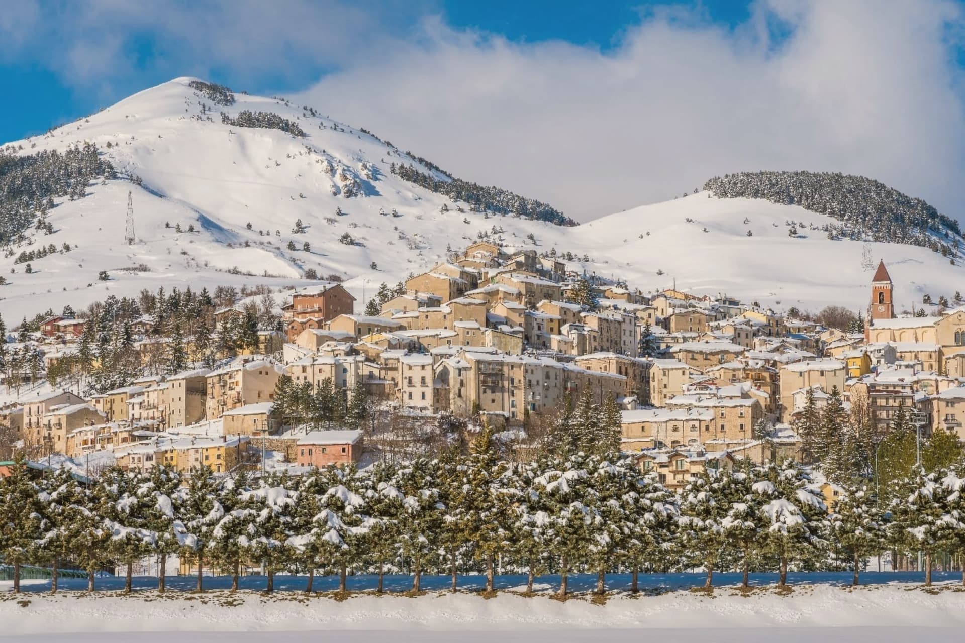
Rivisondoli sits on the flank of Monte Calvario, looking down at the plateau that runs north toward Roccaraso. The town was first recorded in 724 in a diploma of Grimoald II, Duke of Benevento, and grew in the 12th century along the Via degli Abruzzi, the military and trade route across the central Apennines.
It was once known for its weapons production. The 1792 fire destroyed most of the village, and the opening of the Sulmona-Isernia railway in the 19th century turned it toward tourism rather than trade.
The Italian royal family kept a residence here in 1913. Rivisondoli and Roccaraso face each other across the Cinque Miglia plateau, close enough that their ski slopes were joined into one domain and their names are now said together.
The older village, rebuilt twice, climbs one flank of the mountain while the plateau below stays open and treeless, the same ground that once slowed traders and caravans on the route through the Apennines. What began as a stop on a military road became, after fire and war remade the town twice, a place oriented instead toward winter visitors and a single night in January.
Da Giocondo have been named by a guide.
What to see in Rivisondoli
- Alto Sangro ski area. The lift network runs between 1,309 and 2,142 meters, joining Rivisondoli's slopes to Roccaraso's across the open plateau.
- Presepe Vivente. Hundreds of villagers in period costume take the hillside outside town for the performance, the cast spread across the open ground rather than a stage.
- Altopiano delle Cinque Miglia. Treeless and averaging 1,250 meters, the plateau in the Alto Sangro is prone to extreme winter winds, a stretch that historically caught travelers unprepared.
How to get to Rivisondoli
Pescara is roughly 89 minutes away by road.
Our tip
December through March is the season the town runs on. The Alto Sangro lifts open, weekend numbers multiply, and the Cinque Miglia plateau north of town becomes the cross-country skiing route. The January 5 Presepe Vivente draws the biggest single crowd of the year.
Pescocostanzo
Why visit Pescocostanzo
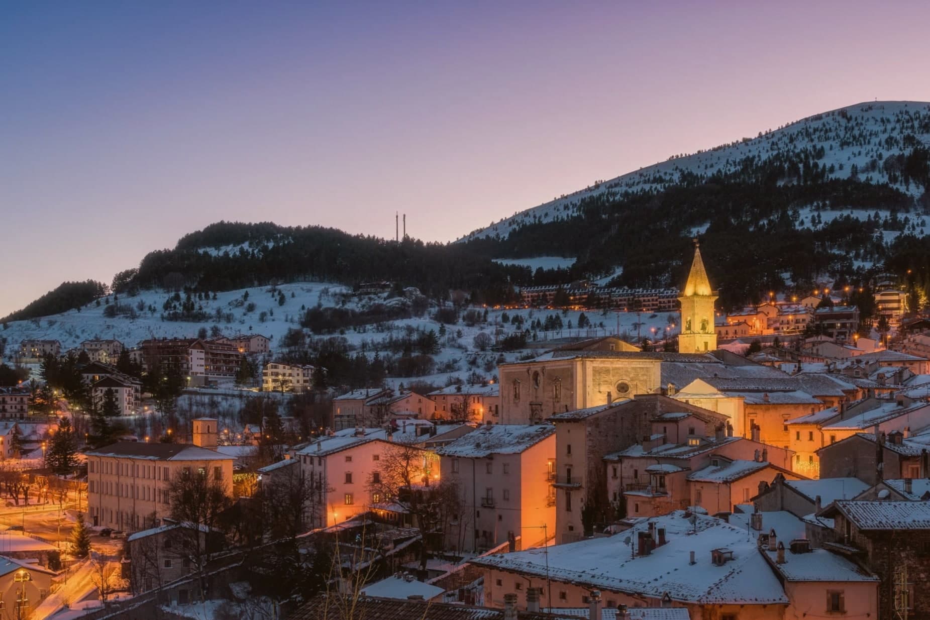
Pescocostanzo sits at 1,395 meters at the southern edge of the Quarto Grande plateau, the high karst basin above the Sangro valley. The town was reshaped between 1456 and the eighteenth century under the Capua family and a generation of Lombard masons who arrived to build for them.
The plan is unusually regular for a mountain commune: a grid of stone houses oriented to the wind, surrounded by woods and pasture. The Collegiata di Santa Maria del Colle, restructured by Cosimo Fanzago in the seventeenth century, is one of the rare five-nave churches in Abruzzo.
Its wrought iron Chapel of the Sacrament gate, made by Sante di Rocco between 1699 and 1707, is the masterpiece of local ironwork. Bobbin lace, merletto al tombolo, is still made here.
The Museo del Merletto a Tombolo inside Palazzo Fanzago shows the technique and the patterns. Filigree gold, carved wood, and lace are still sold on the Corso Roma.
La Corniola, Essentia have been named by a guide.
What to see in Pescocostanzo
- Collegiata di Santa Maria del Colle. Five-nave church begun in the late Middle Ages and remodeled by Cosimo Fanzago in the seventeenth century.
- Museo del Merletto a Tombolo. Inside Palazzo Fanzago, displays the local bobbin lace tradition with patterns, tools, and live demonstrations.
- Palazzo Fanzago. Designed by the baroque architect Cosimo Fanzago in 1624, the seat of the lace museum and civic offices.
How to get to Pescocostanzo
Pescara is roughly 84 minutes away by road.
Our tip
December through March brings snow and the ski season, with the Monte Calvario lifts linking to the Alto Sangro system at Roccaraso and Rivisondoli twenty minutes away. June through September is the second season. At 1,395 meters Pescocostanzo rarely crosses twenty-two degrees even in August, and the Bosco di Sant'Antonio offers beech-shaded walks.
Pacentro
Why visit Pacentro
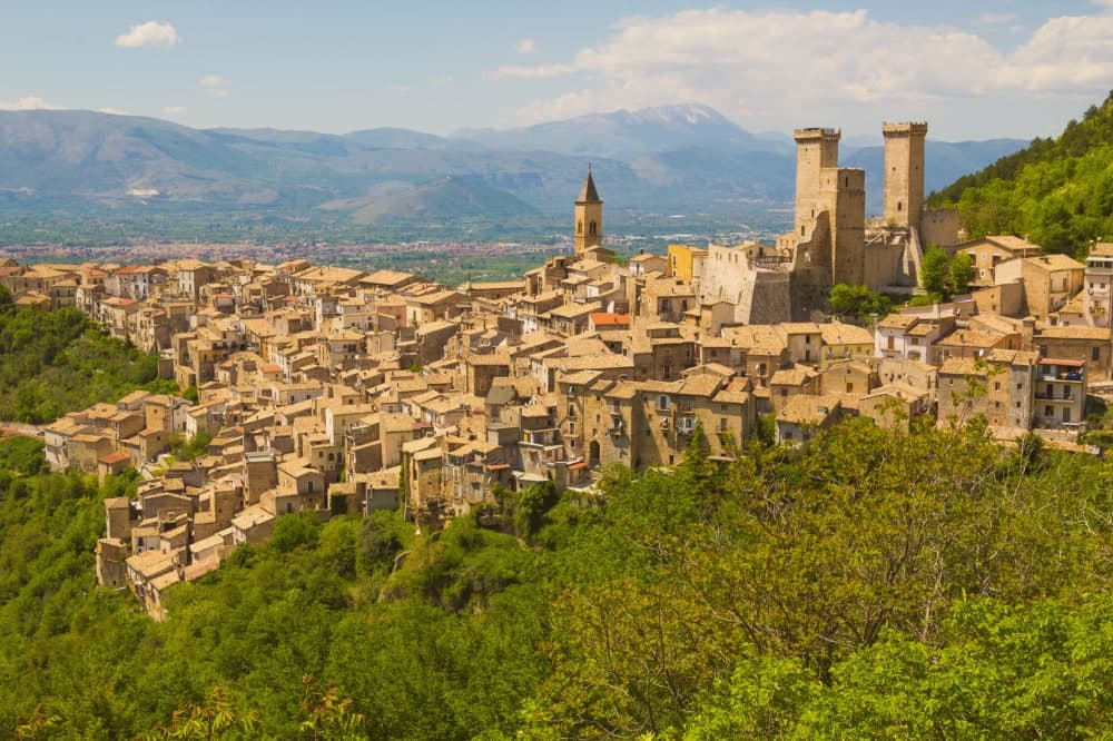
Pacentro sits at 650 meters on a hill spur in the Peligna valley, eight kilometers from Sulmona and inside the Maiella National Park. The Castello Caldora, with its three surviving square towers, dominates the village from the Colle Castello above.
The site has held a castle since the eleventh century; the structure visible today was begun by the Caldora-Cantelmo family in the late fourteenth century and bought by the comune in 1957 and restored. On the first Sunday of September, the Corsa degli Zingari sends barefoot runners down a rocky slope from Monte Ardinghi into the village in honor of the Madonna di Loreto.
The race is documented since the fifteenth century. The other thing people come for is the Ciccone house.
Madonna's paternal grandparents, Gaetano Ciccone and Michelina Di Iulio, emigrated from Pacentro in 1919. The pop singer visited in 2013.
Taverna dei Caldora have been named by a guide.
What to see in Pacentro
- Castello Caldora-Cantelmo. Late fourteenth-century fortress on the Colle Castello, three of its four corner towers still standing, restored after 1957.
- Borgo medievale. Stone houses arranged on terraces below the castle, listed among the Borghi più belli d'Italia, preserved in its medieval plan.
- Chiesa di Santa Maria Maggiore. Sixteenth-century parish church with a baroque interior, holding the Madonna di Loreto honored in the September race.
How to get to Pacentro
Pescara is roughly 69 minutes away by road.
Our tip
May through October is when Pacentro opens. The first Sunday of September brings the Corsa degli Zingari and the biggest crowd of the year, with runners descending barefoot from Monte Ardinghi and the village in procession by evening. July and August can be warm in the valley but the elevation keeps Pacentro itself cooler than Sulmona below.
Roccaraso
Why visit Roccaraso
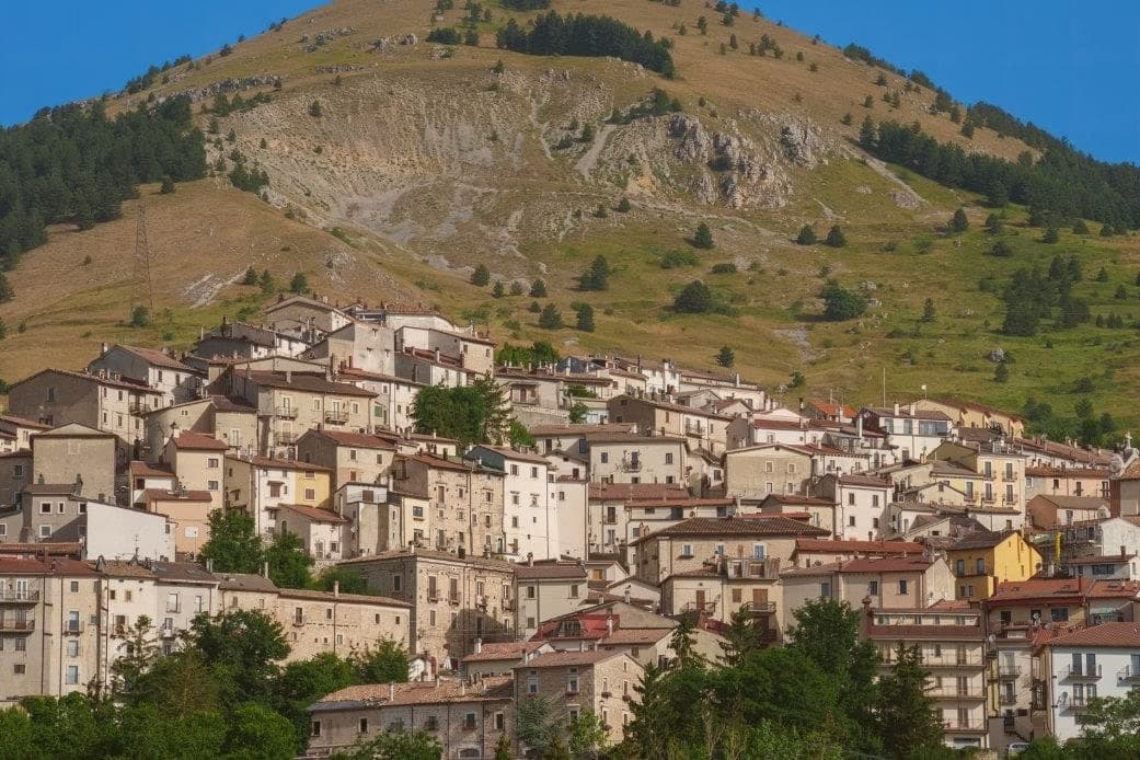
The town sits where the plateaus of Aremogna and Pizzalto meet the higher ground toward Monte Greco, the peak that anchors the whole range at 2,283 meters. The two plateaus are joined by lift, grazed and hiked in summer, cut into pistes in winter: the same trails serve both seasons under different cover.
Four kilometers uphill sits the older, smaller settlement, a medieval frazione that took the weight of the war the valley town below did not escape either. The Germans dug into the Gustav Line where it crossed through here, the Allies bombed in response, and the town below was leveled along with it.
What stands in Roccaraso now was rebuilt after that, stone by stone, from what the bombing left. The first ski lift on Monte Zurrone went up in 1936, years before any of it, and skiing resumed after the rebuilding and never really stopped.
The area has held its place as the south's ski capital since, though the snow line keeps rising: in January 2024 only twenty of Abruzzo's 122 pistes were open. A resort built twice, once by engineers before the war and once by survivors after it, still runs on the same slopes either way.
Chichibio have been named by a guide.
What to see in Roccaraso
- Chiesa di Santa Maria Assunta. Baroque travertine façade, gilded walnut pulpit in the shape of a Greek cross, painted and gilded wooden organs.
- Pietransieri. Medieval frazione where the Limmari Massacre took place; the Gold Medal of Military Valour recognizes what its people lost that winter.
- Piano Aremogna. High pasture and ski terrain at 1,650 meters, the eastern flank of the Alto Sangro ski domain.
How to get to Roccaraso
There is a railway station in the town, so you can arrive without a car and never need one while you are here. Pescara is roughly 94 minutes away by road.
Our tip
December through March is the season Roccaraso was built for. The Alto Sangro lifts open, the slopes fill, and the town doubles on weekends. June through September is the second season: 1,236 meters means temperatures rarely cross 23 degrees even in August, and the same plateaus that hold the lifts become hiking and pasture country.
Caramanico Terme
Why visit Caramanico Terme
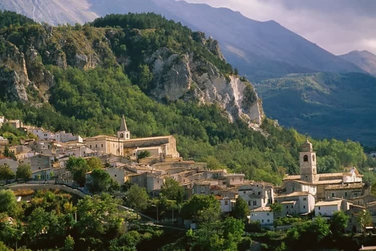
The name carries the Lombard arimannia, a settled clan of the late Middle Ages, and the town grew under the D'Aquino family in the fourteenth and fifteenth centuries, when the main religious buildings went up. Terme was added to the name in 1960, recognising what had been known and used since at least 1576, when the first chemical analyses of the local waters were recorded.
The village sits between Monte Morrone and the Majella, with the historic core on the hilltop above and the spa lower down, closer to the meeting of the two rivers. The abbey stands apart from both, five kilometers out, a separate outpost from the town it belongs to.
What holds the place together is the water: a medieval settlement, a fourteenth-century noble family's building program, and a twentieth-century name change all trace back to the same springs that first drew analysis in 1576.
Locanda del Barone have been named by a guide.
What to see in Caramanico Terme
- Abbazia di San Tommaso Becket. Romanesque, standing unfinished since work stopped, the walls left mid-build over the older pieve beneath. The distance from the centre keeps it apart from the rest of the town's sights, reached on its own.
- Chiesa di Santa Maria Maggiore. Fifteenth-century church with a Gothic exterior and an ogival portal showing the Coronation of the Virgin dated 1476.
- Terme di Caramanico. The spa complex built around the two springs, with treatment programs for respiratory, ENT, skin and joint conditions organized across the site today.
How to get to Caramanico Terme
Pescara is roughly 61 minutes away by road.
Our tip
The thermal baths run all year and pull a steady winter cure clientele. April through June and September into November are the best hiking months in the Orfento, with cool morning air through the beech wood and the river running fast. July and August are warm in the village but cool in the gorge; the spa's indoor pools are the summer escape. Mercato Settimanale Di Caramanico Terme falls in October.
Carsoli
Why visit Carsoli
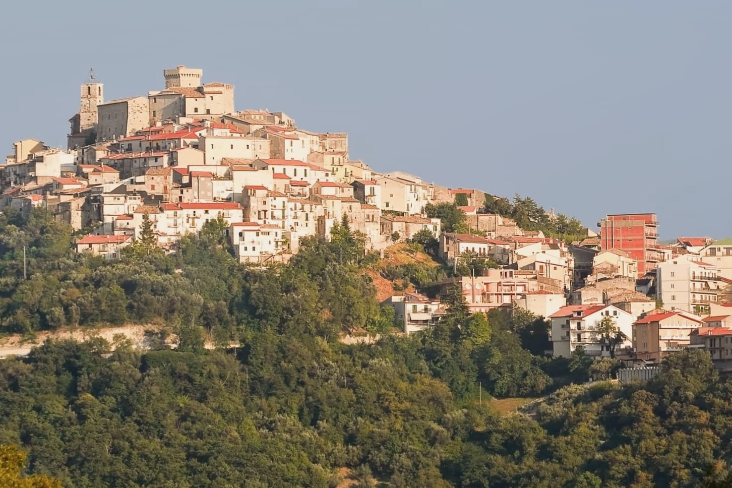
Carsoli sits at 616 meters in the Marsica, between the plain of the former Fucino lake and the valley of the Turano river, with Monte Velino and Monte Calvo both rising above 2,000 meters on its skyline. The modern town stands four kilometres northeast of Alba Fucens's neighbor Carsioli, the Roman colony founded between 302 and 298 BC as a stronghold to guard the road to Alba Fucens; walls and an aqueduct still stand at the locality of Muro Pertuso, surveyed in 1901 by the archaeologists Pfeiffer and Ashby.
The town's religious and military history sits closer to the modern centre than the Roman ruins do. The Castle of Colle Sant'Angelo, raised around the year 1000 by the Counts of the Marsi, stood until later wars, and ruins of its adjoining church remain near the site.
Carsoli's autumn season runs on chestnut and polenta fairs with deep peasant roots, and the patron-saint feast of Santa Vittoria fills the streets with procession and stalls. The town's layout traces its own history: a Roman garrison post relocated over centuries into a medieval and then modern settlement, so that walking from the modern centre outward means walking backward through the different periods that built it.
L'Angolo d'Abruzzo, V'Incanto Osteria Moderna have been named by a guide.
What to see in Carsoli
- Sito archeologico di Carsioli. The city walls and aqueduct still stand at the site, four km from the modern town, surveyed by archaeologists in 1901.
- Chiesa di Santa Maria in Cellis. The church stands on the edge of town, with a rose window set over the main portal.
- Chiesa di Sant'Antonio. 16th-century church inside the centro storico, used as a hospital and later as a nursery, with a frescoed altar inside.
How to get to Carsoli
There is a railway station in the town, so you can arrive without a car and never need one while you are here. Roma is roughly 60 minutes away by road.
Our tip
May through October is the strong window for Carsoli. Spring brings clear views toward Monte Velino and the high Marsica meadows in flower. June and September are the most comfortable months at 616 meters, with cool nights and dry days.
Castel di Sangro
Why visit Castel di Sangro
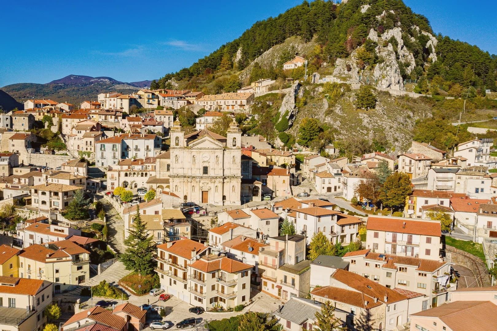
Castel di Sangro sits at 805 meters at the confluence of the Sangro and Zittola rivers, the main town of the Alto Sangro. Before the Romans it was Aufidena, a Samnite city, and the traces of that older settlement remain on the slopes outside the modern center, separate from the hill town that grew up later.
The town itself divides between the newer lower streets and Civita, the old quarter that climbs toward the monastery above. That geography decided the fighting in November 1943: the monastery's height over the town made it the objective, and the parachute battalion holding it had the advantage the attacking regiment could not overcome in a single night.
The same steep, isolated position that made the town hard to take in 1943 has shaped its more recent story too. A football club from a town of this size reaching Serie B, and a three-star restaurant opening in the countryside nearby, both read as the town periodically outgrowing what its size and location would predict.
Reale, Materia Prima, OlyaS have been named by a guide.
What to see in Castel di Sangro
- Basilica di Santa Maria Assunta. Rebuilt on a Greek-cross plan after the earthquake that destroyed its predecessor, the church stands as the national monument of a town otherwise remade by war and football.
- Civita. The oldest quarter, climbing the hill toward the former monastery that the Canadians tried and failed to take in a single night.
- Aufidena archaeological site. Necropolis and city remains on the slopes outside town, predating the medieval settlement by centuries; finds are held in the municipal archaeological museum.
How to get to Castel di Sangro
There is a railway station in the town, so you can arrive without a car and never need one while you are here. Pescara is roughly 113 minutes away by road.
Our tip
May through October is the open season at 805 meters in the Alto Sangro, with the Sangro running fast in May and the high meadows above town opening to walkers in June. July and August are warm during the day, cool at night. The first weekend of September brings the patronal feast of the Madonna del Lago.
Guardiagrele
Why visit Guardiagrele
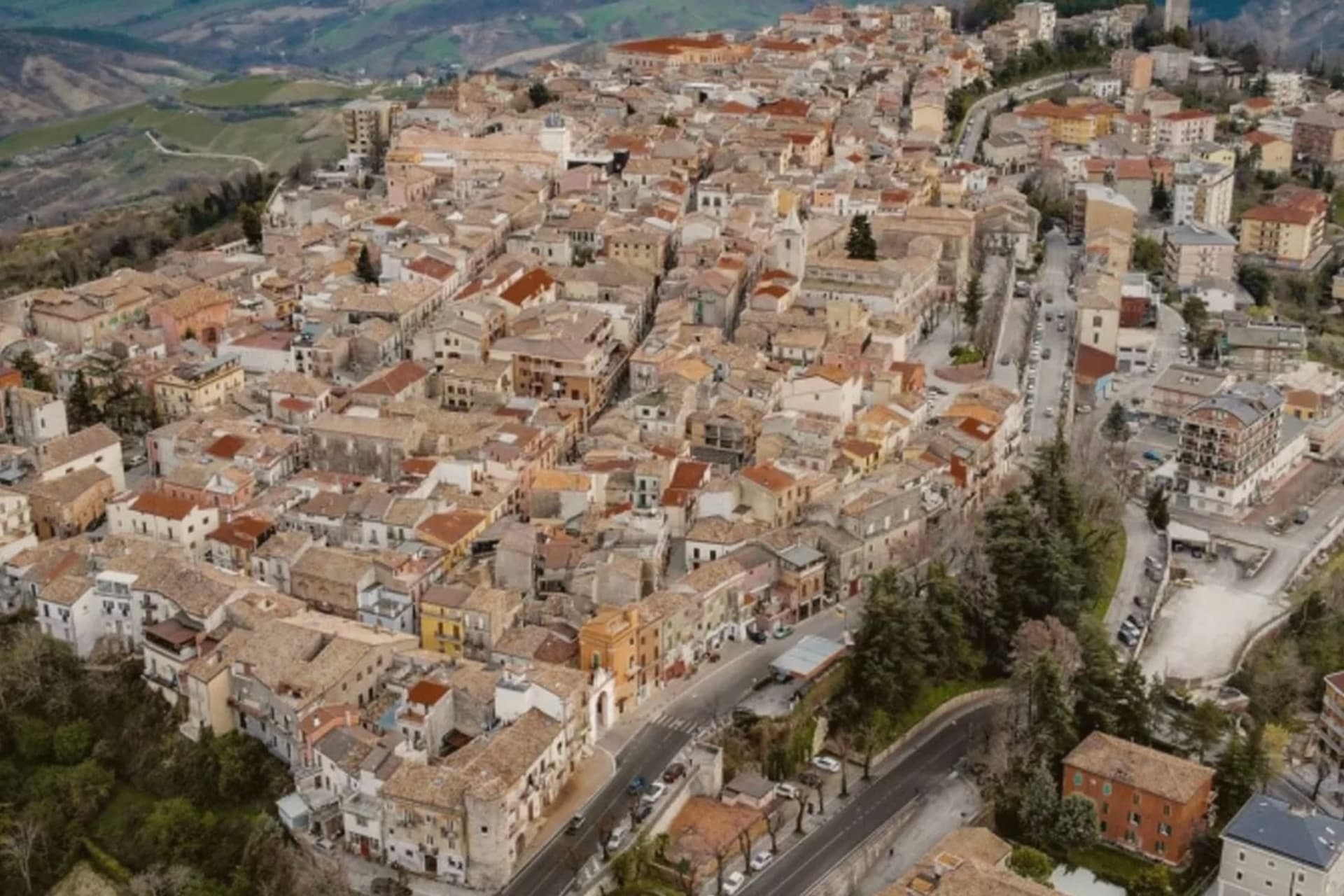
Guardiagrele sits at 576 meters on the eastern Majella foothills, thirty kilometers from Pescara. Gabriele D'Annunzio called it the terrazza d'Abruzzo for the views over the mountains and valleys from its piazzas.
Documented in an eleventh-century papal bull as a villa named Grele, the town grew through the fourteenth and fifteenth centuries as a stronghold of the Kingdom of Naples, with permission from the king to mint coins. It produced the late medieval goldsmith Nicola Gallucci, known as Nicola da Guardiagrele (c.1385-c.1462), trained on Gothic and Tuscan models including Lorenzo Ghiberti, who left work in cathedrals across Abruzzo.
The collegiate church of Santa Maria Maggiore, built at the start of the thirteenth century outside the walls and absorbed into the town in the centuries after, carries a fifteenth-century portal with a Coronation of the Virgin lunette by Nicola, now in the Duomo museum. Wrought-iron, copper and gold work still operate from workshops in the centro storico.
Villa Maiella, La Grotta dei Raselli have been named by a guide.
What to see in Guardiagrele
- Collegiata di Santa Maria Maggiore. Thirteenth-century collegiate church with a massive bell tower, fifteenth-century portal, and the Nicola da Guardiagrele Coronation lunette in its museum.
- Museo del Duomo. Cathedral museum holding Nicola da Guardiagrele's marble lunette, his goldwork, and liturgical objects from the surrounding Majella churches.
- Botteghe del rame e del ferro battuto. Active copper and wrought-iron workshops in the centro storico, the surviving craft tradition that produced Nicola Gallucci in the late fourteenth century.
How to get to Guardiagrele
There is a railway station in the town, so you can arrive without a car and never need one while you are here. Pescara is roughly 48 minutes away by road.
Our tip
April through October is the open season. May and September are the best months on the terrazza, with the Majella valleys in clear light and the copper workshops at full pace. July and August are warm but the elevation keeps the centro storico cooler than the coast.
Alba Adriatica
Why visit Alba Adriatica
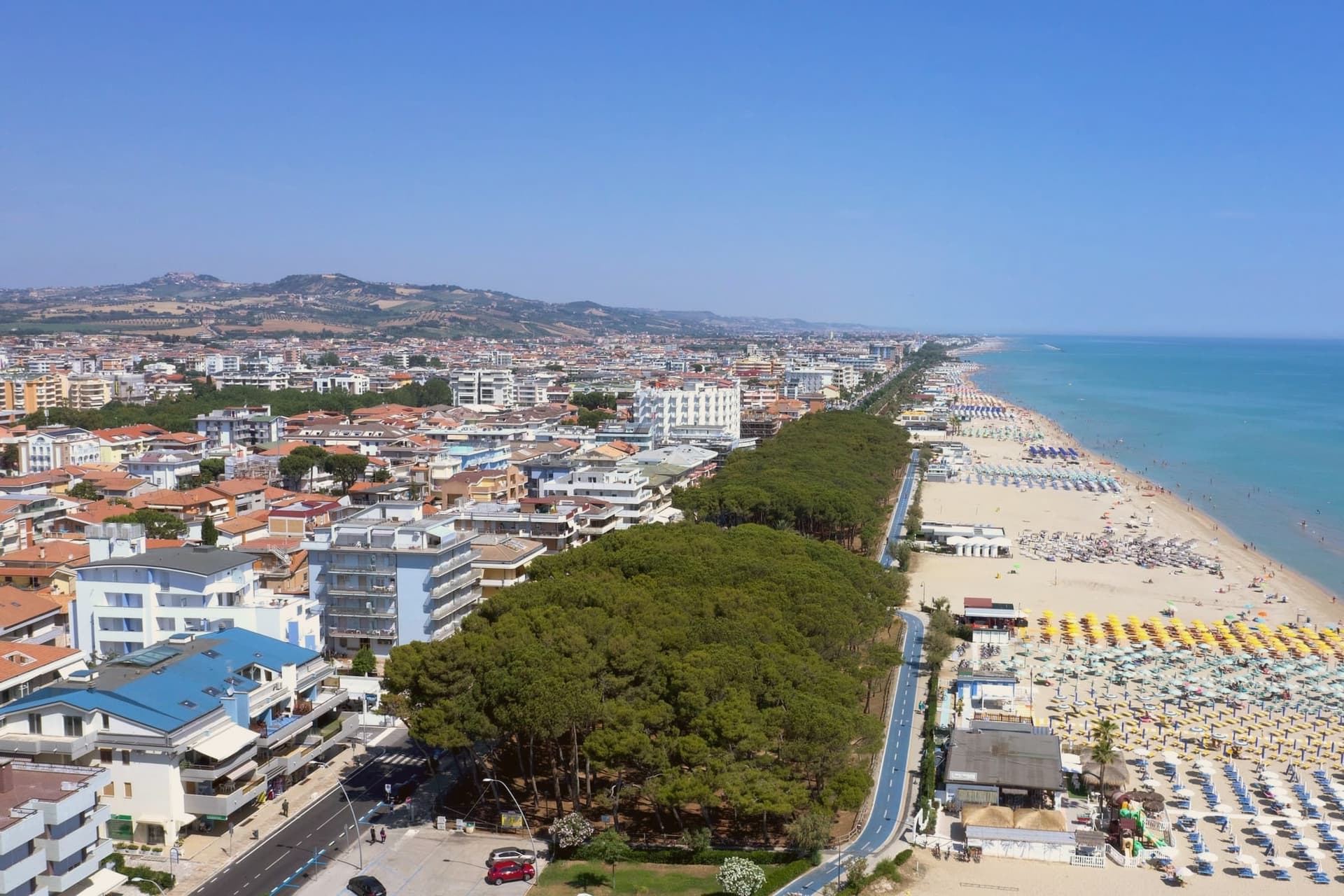
Alba Adriatica is the northernmost of the seven coastal communes of the province of Teramo, the chain of resort towns known collectively as the seven sisters. The commune did not exist before 1956: it was created by referendum that year when the coastal residents of Tortoreto voted for administrative autonomy.
The town's identity is its sand. The three-kilometer beach is called the Spiaggia d'Argento, the silver beach, for the fineness of its grains.
The Blue Flag flew here continuously from 2000 to 2013 and again in recent years. The lungomare runs the whole length of the commune, palm-lined and largely flat, joining the towns on either side without a clear visual break.
Inland from the beach, the town is laid out on a 20th-century grid, with no centro storico to speak of: the historic centers belong to the older inland communes. Alba Adriatica was built to be a beach.
Da Gianfranco, Il Palmizio have been named by a guide.
What to see in Alba Adriatica
- Spiaggia d'Argento. The three-kilometer fine-sand beach, gently sloped, Blue-Flag-rated for water quality continuously from 2000 to 2013 and after.
- Lungomare Marconi. Palm-lined promenade running the length of the commune, joining Tortoreto Lido to the north and Giulianova to the south.
- Chiesa Sant'Eufemia. Parish church set on the inland grid, a modest 20th-century construction reflecting the town's recent 1956 foundation date.
How to get to Alba Adriatica
There is a railway station in the town, so you can arrive without a car and never need one while you are here. Pescara is roughly 51 minutes away by road.
Our tip
May through September is the season. June and early September are the temperate weeks before and after the August crowds. July and August fill the beach and the boardwalks: temperatures sit in the low thirties, the water is warm by mid-July, and the lungomare runs late.
Pineto
Why visit Pineto
Pineto sits at sea level, one of the Sette Sorelle, the seven Adriatic resorts of the Teramo coast. The town was planned in the 1920s by Luigi Filiani as a beach resort under pine forest, and renamed Pineto in 1925 after Gabriele D'Annunzio's poem La Pioggia nel Pineto.
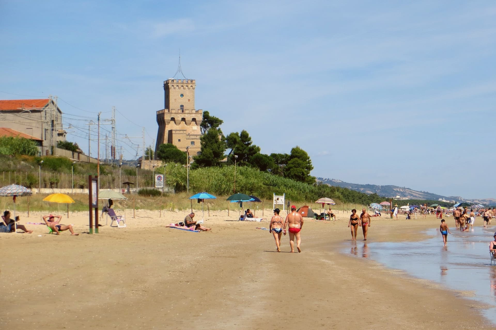
In 1929 it replaced Mutignano, the older hill village above, as the capoluogo of the comune. Two kilometers south of the centre stands the Torre del Cerrano, built around 1568 by Charles V as a watchtower against Ottoman raiders.
In 2010 the tower and the stretch of sea in front of it became Abruzzo's first marine protected area, 3,431 hectares of coast and shallow water. The beach has held a Blue Flag in most years since 2007.
The pine canopy, planted to hold the dunes, still shades the seafront promenade as far north as the Vibrata river.
Resilienza, La Conchiglia d'Oro, Bacucco d’Oro have been named by a guide.
What to see in Pineto
- Torre del Cerrano. Sixteenth-century watchtower built around 1568 under Charles V against Ottoman raids, now the gateway to Abruzzo's first marine reserve.
- Area Marina Protetta Torre del Cerrano. 3,431 hectares of protected coast and shallow Adriatic water established in 2010, the first marine reserve in the region.
- Pineta Catucci. Coastal pine forest planted in the early twentieth century to hold the dunes, shading the seafront promenade and the bike path.
How to get to Pineto
There is a railway station in the town, so you can arrive without a car and never need one while you are here. Pescara is roughly 26 minutes away by road.
Our tip
May through September is the season. June and September are the best beach months, warm but not hot, with the marine reserve open for guided snorkelling and the bike path along the pineta in full use. July and August bring Italian summer crowds, especially from Pescara, and the seafront fills.
More from Anywhere Italy
- The best hidden towns with a serious restaurant that eat well within 90 minutes of Pescara
- The best hidden towns you can reach by train that have a serious restaurant in Abruzzo
- The best hidden towns with a serious restaurant in the province of L'Aquila
- The best towns that eat well in the province of L'Aquila
- The 6 prettiest villages with a serious restaurant within 90 minutes of Pescara
 The best towns that live slowly in Abruzzo