
The best towns you can reach by train in the province of Siena
The province of Siena is built out of brick and travertine, and the colour changes with the light: warm red walls in the towns, pale stone around the doorways, and beyond them the clay ridges of the Crete Senesi going bald gold by June. Wine is the reason many people come, Brunello on one side of the Val d'Orcia and Vino Nobile on the other, poured alongside pici with garlic and breadcrumbs, wild boar cooked slowly, pecorino from Pienza aged under ash. Autumn brings the olive harvest and new oil so green it stains the bread. Winter brings fog in the valleys and empty piazzas, which is its own argument for going.
Most visitors arrive with a rental car and a plan that runs Florence to San Gimignano and back, because the towers photograph well and the coach parks are large. The result is a single street of ceramics shops moving at a shuffle from late morning until the buses leave, and a hill town best appreciated after dark, when the day trade has gone. The famous names in this part of Tuscany absorb a great deal of traffic in a small space, and the roads between them absorb the rest.
The same hills carry on past that circuit, and so does the railway. Lines run down the Valdichiana towards Chiusi, out east through Rapolano Terme and Asciano, and south into the Val d'Orcia, with local buses filling the last few kilometres up to the ridge towns. The places on this list sit on those routes, and we have checked each one can be reached without a car: fewer people go, the wine is the same wine, and the timetable does the driving.
Of the 20 communes we have mapped in the province of Siena, 10 qualify as towns you can reach by train: we have confirmed each is reachable without a car. The smallest, Trequanda, has 1,166 residents.
Two more lists worth reading alongside this one: The best hidden wine towns you can reach by train in the province of Siena and The best hidden olive oil towns you can reach by train within 90 minutes of Perugia.
Trequanda
Why visit Trequanda
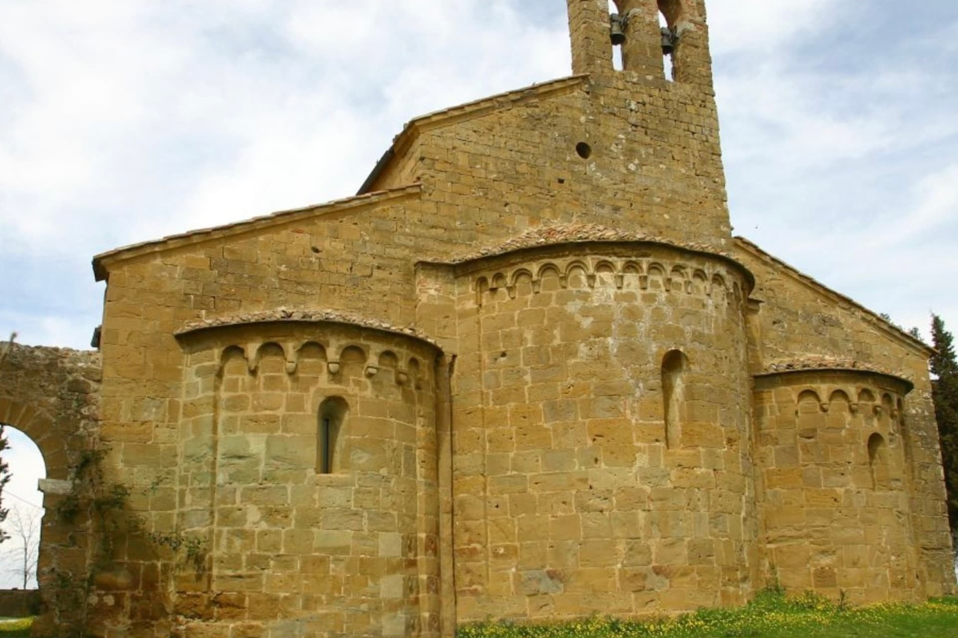
Trequanda is three villages in one comune: Trequanda itself at 453 meters, Castelmuzio, and Petroio at 486 meters, scattered across the hills southeast of Siena. The first written record dates to 1198, when the Cacciaconti of Scialenga held it as fief; in 1211 Emperor Otto IV gave them the right to collect tolls.
In 1553 the village was among the first to be annexed to the Grand Duchy of Tuscany. The Cacciaconti castle still anchors the centro storico, the Pieve dei Santi Pietro e Andrea next to it, built from 1327 in a Gothic-Romanesque mix and renovated in the Renaissance.
Petroio has produced fine ornamental terracotta since the early sixteenth century: lions and dogs and pineapples and chimney pots, the surface of half the gardens in central Tuscany. The municipality holds the Orange Flag from the Italian Touring Club and was inscribed in 2018 in the national register of historic rural landscapes.
We confirmed you can reach this one by train.
What to see in Trequanda
- Castello dei Cacciaconti. Medieval fortress at the center of Trequanda, seat of the Cacciaconti di Scialenga from the twelfth century.
- Pieve dei Santi Pietro e Andrea. Gothic-Romanesque parish church begun in 1327, expanded in the Renaissance, holding a fresco attributed to Sodoma.
- Castelmuzio. Walled hilltop frazione between Trequanda and Pienza, on the rural landscape register, the smallest of the three borghi.
How to get to Trequanda
There is a railway station in the town, so you can arrive without a car and never need one while you are here. Perugia is roughly 70 minutes away by road.
Our tip
April through June brings the green months across the Crete Senesi, the clay hills holding their color before the summer burn. September and October are dry and gold, the olive harvest running through November in the Petroio and Castelmuzio frantoi. July and August touch thirty-six degrees and the three borghi go quiet between four and seven in the afternoon.
Murlo
Why visit Murlo
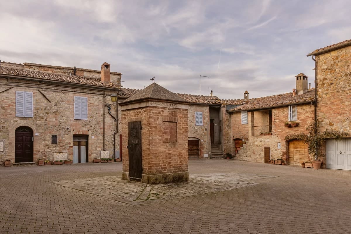
Murlo sits at 314 meters on a wooded ridge above the Crevole river, twenty kilometers south of Siena. The comune is scattered.
The town hall is in Vescovado, the modern center down on the valley road; the medieval castle of Murlo, walled and tower-anchored, is a kilometer up on the hill, mostly empty and given over to tourism. The bishops of Siena held this ground as a feudal lordship for centuries, which kept it outside the Sienese republic and gave it the unusual status of an episcopal fief.
The defining find is older. On Poggio Civitate, three kilometers north, archaeologists from 1966 onward uncovered an Etruscan princely palace of the seventh and sixth centuries BC, one of the most important Etruscan settlement complexes ever excavated.
The terracotta acroteria from the roof line included the Cappellone, a seated bearded male wearing a wide-brimmed hat, sixth century BC, now the symbol of the Antiquarium museum housed in the old Episcopal Palace at the center of the borgo.
We confirmed you can reach this one by train.
What to see in Murlo
- Antiquarium di Poggio Civitate. Archaeological museum in the medieval Palazzo Vescovile at the center of Murlo, holding the Cappellone and other finds from the Etruscan settlement on Poggio Civitate.
- Poggio Civitate. Etruscan princely palace complex of the seventh and sixth centuries BC, three kilometers north of the borgo, one of the most important sites in Etruria.
- Castello di Murlo. Twelfth-century walled village, the medieval seat of the bishops of Siena, with narrow streets converging on the Palazzo Vescovile.
How to get to Murlo
There is a railway station in the town, so you can arrive without a car and never need one while you are here. Firenze is roughly 104 minutes away by road.
Our tip
April through June and September into October are the months when the Crete Senesi south of Murlo sit at their gold-and-green best. The Antiquarium is open year-round but limited in winter hours. July and August push past thirty-three degrees and the castle empties between two and six.
Buonconvento
Why visit Buonconvento
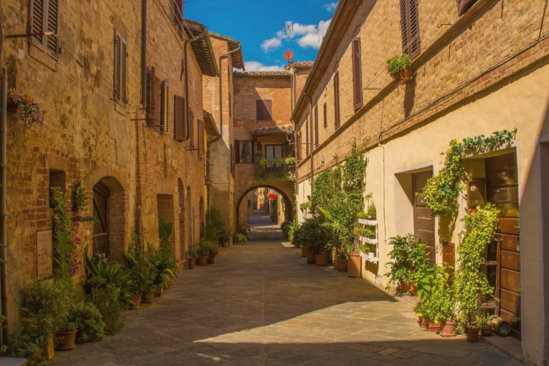
Buonconvento sits on the plain of the Via Cassia at 147 meters, where the Arbia meets the Ombrone, twenty-five kilometers south of Siena and the main town of the Crete Senesi. The name comes from bonus conventus, happy meeting place, recorded for the first time in 1100.
In August 1313 Emperor Henry VII of Luxembourg died here on his way to Rome, a death the Ghibellines blamed on poisoning. The Sienese walled the borgo in 1379: brick curtain walls with hanging arches, two gates called Porta Senese and Porta Romana.
Porta Romana was destroyed in 1944 by the retreating Germans, the same year the Allies came up the Via Cassia. The Palazzo Pretorio, fourteenth century, has twenty-five podestà coats of arms on its façade and a tower that echoes Siena's Torre del Mangia.
The Museo d'Arte Sacra della Val d'Arbia holds a Madonna by Duccio di Buoninsegna from the 1290s.
We confirmed you can reach this one by train.
What to see in Buonconvento
- Palazzo Pretorio. Fourteenth-century brick palace with twenty-five podestà coats of arms on its façade and a slender tower modeled on Siena's Torre del Mangia.
- Mura di Buonconvento. Brick curtain walls with hanging arches built by Siena in 1379, with Porta Senese to the north (Porta Romana lost in 1944).
- Museo d'Arte Sacra della Val d'Arbia. Sacred art collection in Palazzo Ricci Socini covering the Sienese school from the 13th to 19th centuries, including a Duccio Madonna.
How to get to Buonconvento
There is a railway station in the town, so you can arrive without a car and never need one while you are here. Perugia is roughly 99 minutes away by road.
Our tip
April through June paints the Crete green and the spring wheat is at full height by May. September and October are the Crete at their most photographed: bare hills back in clay color, low sun, long shadows. July and August touch the high thirties in the plain; the walls hold heat into the night.
Montalcino
Why visit Montalcino
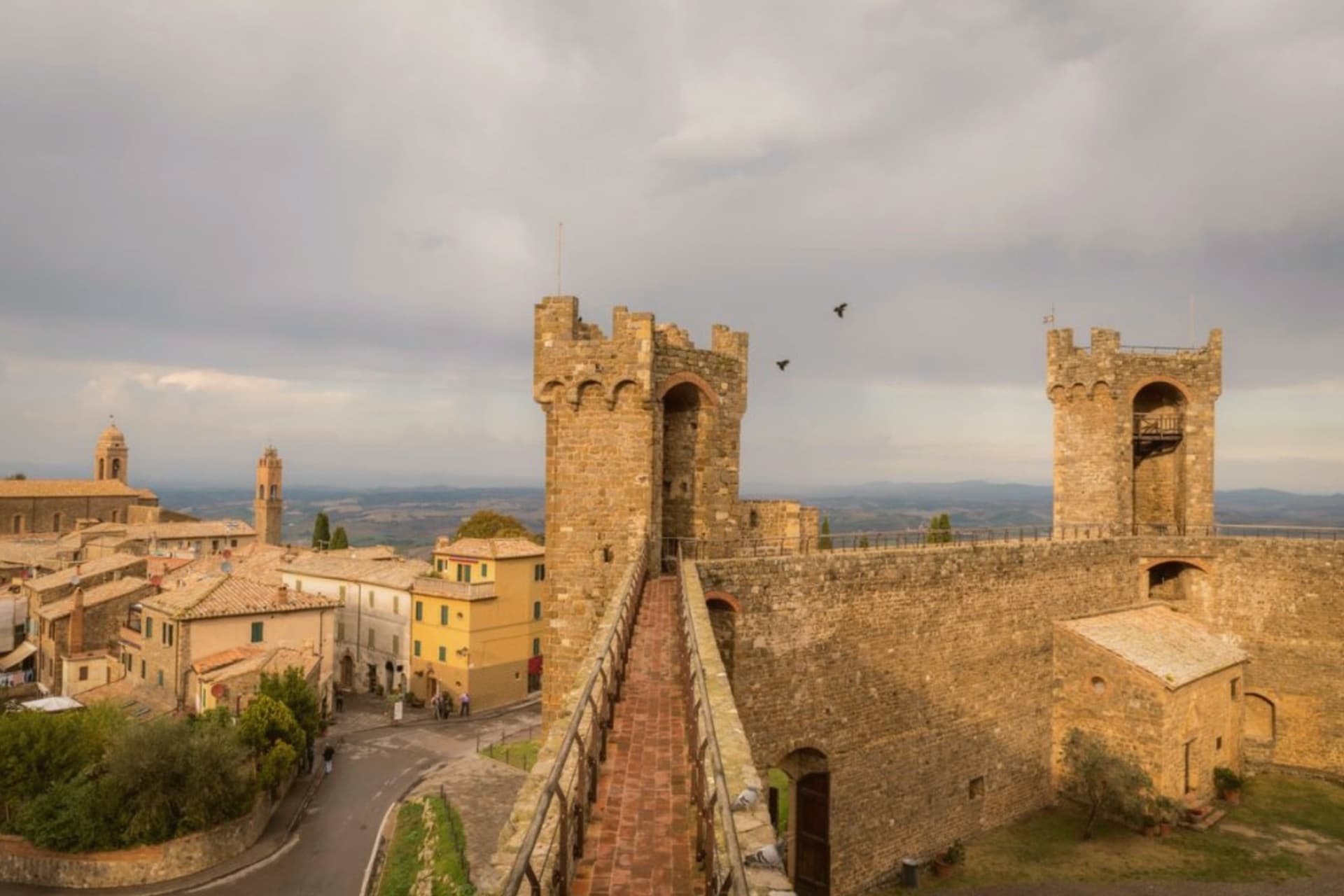
Montalcino sits at 564 meters on a hill south of Siena, the centro storico ringed by walls and crowned by a pentagonal fortress built in 1361. When Florence took Siena in 1555, the Sienese exiles regrouped here and held out for almost four years; the Rocca itself never fell.
That date matters less to most visitors than 1980, when Brunello di Montalcino was named one of the first four Italian wines to receive DOCG status. The vineyards run from the town at 600 meters down to plots at 200, on stony galestro soils that ripen Sangiovese Grosso into a wine that ages for decades.
The Abbey of Sant'Antimo, ten kilometers south, is a Romanesque church first documented in 814 and tied by local legend to a vow by Charlemagne. The town also produces miele, olio, and the white truffles of the surrounding woods.
It carries seven institutional signals at once, more than any other commune in this batch.
We confirmed you can reach this one by train.
What to see in Montalcino
- Rocca di Montalcino. Pentagonal fortress built in 1361 by Sienese architects Mino Foresi and Domenico di Feo, refuge of the Sienese Republic after 1555.
- Abbazia di Sant'Antimo. Romanesque abbey ten kilometers south, first documented in 814, set among olive groves below the town with Gregorian chant still sung.
- Palazzo dei Priori. Thirteenth-century town hall on Piazza del Popolo, slender tower attached, civic seat of the medieval commune.
How to get to Montalcino
There is a railway station in the town, so you can arrive without a car and never need one while you are here. Perugia is roughly 105 minutes away by road.
✷ We have written about Montalcino
“When the film industry needed a picture of heaven, of the fields a dead hero walks home to, they came and shot it here, and that is the truest thing anyone has ever said about the Val d'Orcia. It is not a place. It is the afterlife as imagined by people who lived in cities. It is how the country looks to men who never spent an hour in it, dreamed up by Florentine bankers five hundred years ago and maintained, beautifully, ever since.”
Read our piece on Montalcino →Val d'Orcia | The Postcard Is Constructed
Our tip
April through June and September into October are the months locals prefer. The hills are green or gold depending on the half, and the vineyards run their full work cycle. The Sagra del Tordo, a medieval archery contest between the four quarters of the town, takes place the last Sunday of October. Sagra del Cinghiale di Montalcino falls in the season.
Castelnuovo Berardenga
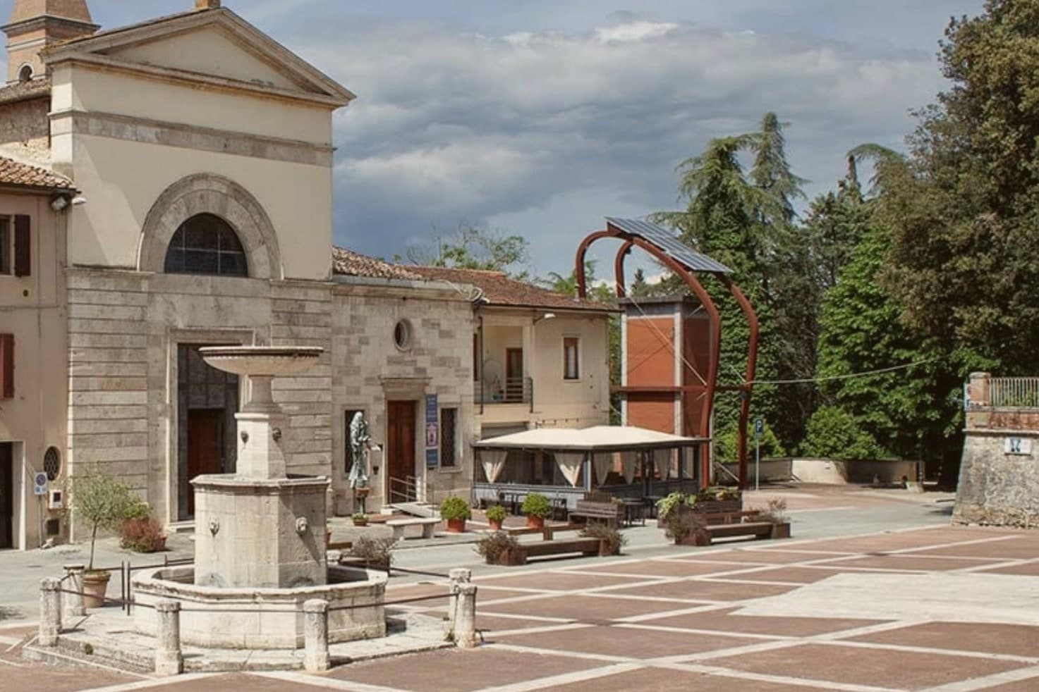
Why visit Castelnuovo Berardenga
The commune sits east of Siena, where the hills give way to the clay swells of the Crete Senesi. The name comes from the Terra Berardinga, the area controlled in the tenth century by a Frankish nobleman named Berardo, and the borgo grew up around the castle walls the Sienese Republic raised against Florence.
The centro storico, the villa and gardens at its heart, and the surrounding zone of vineyards form one continuous pattern rather than separate parts: fortress town above, wine country falling away below it toward the clay hills. Across the wider territory, 13 castles, 70 churches and 200 farms record the medieval pattern of the Sienese contado, a scatter of small fortified points and parish churches administering land rather than one dominant center.
The place reads as a border post that outlived its military purpose and settled into agriculture and the arts, its castle now a clock tower, its noble villa now a music foundation, its walls now overlooking rows of Sangiovese.
We confirmed you can reach this one by train.
What to see in Castelnuovo Berardenga
- Villa Chigi Saracini. Eighteenth-century villa and Italian garden inside the centro storico, its park designed by the Sienese composer Guido Chigi Saracini, whose family foundation still runs the Accademia Musicale Chigiana in Siena.
- Torre dell'Orologio. Surviving tower of the fortress, now bearing the civic clock, the highest visible point of the centro storico.
- Chiesa dei Santi Giusto e Clemente. Eighteenth-century parish church with a neoclassical façade, built on the site of an earlier Romanesque pieve.
How to get to Castelnuovo Berardenga
There is a railway station in the town, so you can arrive without a car and never need one while you are here. Firenze is roughly 77 minutes away by road.
✷ We have written about Castelnuovo Berardenga
“The wine is the whole economy of these hills, every village with its own, the region’s name stamped on the most famous red in Italy. Tuscan food runs to cured and roasted meat, so the wine ran red to meet it, lighter than you expect, almost fruity, easy, made to sit beside a steak and not to be lectured about. Here is the only wine knowledge you need on this road: it is all good.”
Read our piece on Castelnuovo Berardenga →Road to Siena | The Long Way Is the Better Way
Our tip
April through June and September into October are the months Chianti Classico shows best, the green hills moving toward the gold of harvest. The Sagra del Vino runs the second weekend of September. July and August push past thirty and the centro storico empties between two and six; the cellars on the surrounding hills offer cool tastings and longer rentals.
Monteriggioni
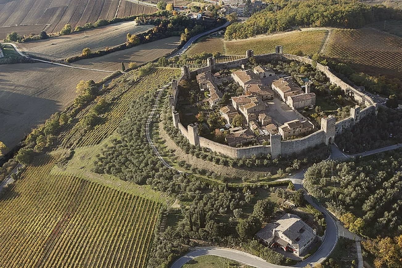
Why visit Monteriggioni
Monteriggioni sits at 274 meters on a natural hillock between Firenze and Siena, eleven kilometers from the Sienese gates. The walls were built between 1213 and 1219, when Siena ran them up as a frontline garrison facing Florentine expansion north.
They are still there. Fourteen square towers, 570 meters of curtain wall, ten meters tall, two gates: Porta Fiorentina to the north, Porta Romana to the south.
Dante used the towers in Inferno XXXI as the image for the giants ringing the central pit of Hell. The fortress was never breached by storm.
Inside, the village is a single irregular Piazza Roma, a Romanesque parish church of Santa Maria Assunta, a few streets that take fifteen minutes to walk end to end. The Via Francigena runs past the southern wall.
The town hosts a medieval festival in early July, when the population inside the walls multiplies for a weekend. The rest of the year, the silence inside the gates is the point.
We confirmed you can reach this one by train.
What to see in Monteriggioni
- Mura di Monteriggioni. Circular 570-meter wall built 1213-1219 by the Sienese, fourteen square towers on equidistant bases, ten meters high, intact.
- Piazza Roma. Single main square inside the walls, ringed by stone houses, with the Romanesque parish church on the north side.
- Chiesa di Santa Maria Assunta. Romanesque parish church on Piazza Roma, plain stone façade, single nave, the only significant religious building inside the walls.
How to get to Monteriggioni
There is a railway station in the town, so you can arrive without a car and never need one while you are here. Firenze is roughly 96 minutes away by road.
Our tip
April through June and September into October are the months when the walls and the Chianti ridge behind them sit at their best, before the heat closes in. The Festa Medievale takes the second weekend in July, three days of costumed reenactment and feasting inside Piazza Roma, when the village population multiplies. July and August are hot and the day-tripper buses from Firenze and Siena fill the gates between ten and four. Monteriggioni di torri si colora falls in July.
Montepulciano
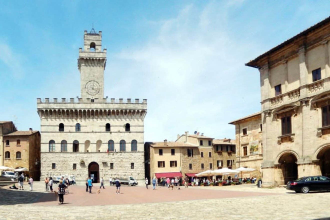
Why visit Montepulciano
The ridge runs between the Val di Chiana and the Val d'Orcia, 70 kilometers southeast of Siena, and the town follows its spine uphill: streets climb from the gates toward the high point, where the main square sits ringed by the buildings that define the skyline from below. The origin predates the Renaissance fabric by centuries.
Etruscan tombs survive in the surrounding hills, though almost nothing of that period shows in the centro storico itself, which was rebuilt wholesale in the fifteenth and sixteenth centuries over whatever came before. The wine and the festival both use the climb as their setting rather than their subject: the cellars are cut into the rock beneath the palazzi, keeping a constant temperature for aging, and the barrel race each August sends two men from each of the eight contrade hauling an eighty-kilogram cask up the same gradient that every visitor covers on foot, only slower.
The steepness that shaped the defensive site nine centuries ago is still what a person feels first, in the legs, before the buildings register at all.
We confirmed you can reach this one by train.
What to see in Montepulciano
- Tempio di San Biagio. A 13-meter dome and travertine façade standing alone outside the walls, the ground falling away below it so the building reads as a single volume against the hillside.
- Piazza Grande. The high piazza at the top of the ridge, ringed by the Duomo, the Palazzo Comunale and the Palazzo Tarugi, all rebuilt in the fifteenth and sixteenth centuries.
- Palazzo Comunale. Town hall designed by Michelozzo in the fifteenth century, its tower offering a view over the Val di Chiana and Val d'Orcia.
How to get to Montepulciano
There is a railway station in the town, so you can arrive without a car and never need one while you are here. Perugia is roughly 57 minutes away by road.
Our tip
April through June and September into October are the working months on the ridge: vine work in the surrounding hills, mild days, evening light that lingers over the Val d'Orcia. July and August push into the low thirties and the climb to Piazza Grande slows even the residents. The Bravìo delle Botti runs the last Sunday of August and fills the town. Calici di Stelle falls in July.
Siena
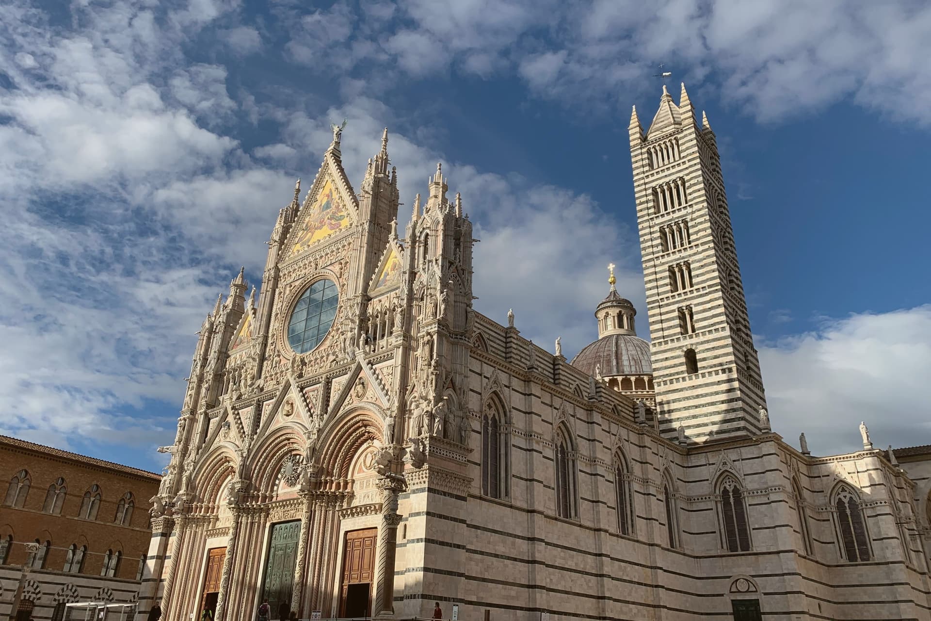
Why visit Siena
Siena sits at 322 meters on three hills fifty kilometers south of Florence, with which it fought a defining rivalry through the thirteenth and fourteenth centuries. The historic center has been UNESCO World Heritage since 1995, preserved as a medieval city that worked deliberately to differ from Florentine urban planning.
Piazza del Campo, the shell-shaped square at the meeting point of the three original hills, fans out toward the Palazzo Pubblico, whose construction began in 1297. The Torre del Mangia next to it, built between 1338 and 1348, stands 87 meters tall, the exact height of the Duomo, a deliberate equality between church and state.
The Duomo itself, marble-clad in horizontal black and white bands, holds the inlaid mosaic floor that Vasari called the most beautiful ever made, and sculptures by Donatello, the Pisano family and Michelangelo. The Palio runs twice a year, on 2 July and 16 August: bareback riders representing seventeen contrade circle the Campo three times in roughly ninety seconds.
We confirmed you can reach this one by train.
What to see in Siena
- Piazza del Campo. Shell-shaped medieval square at the meeting point of Siena's three hills, paved in 1349 in red brick divided into nine sectors for the Council of Nine.
- Palazzo Pubblico. Town hall begun in 1297, with the Sala dei Nove holding Lorenzetti's Allegory of Good and Bad Government from 1338-1339.
- Torre del Mangia. Brick tower built 1338-1348 next to the Palazzo Pubblico, 87 meters tall, set deliberately to match the height of the Duomo.
How to get to Siena
There is a railway station in the town, so you can arrive without a car and never need one while you are here. Firenze is roughly 73 minutes away by road.
✷ We have written about Siena
“Before Florence was the banking capital of the known world, the bench belonged to Siena. The word itself comes from the bench, the banco, where the money changers sat, and in the twelfth century, the Sienese ran some of the largest banking houses in Europe, moving the money of popes and kings while Florence was still finding its feet.”
Read our piece on Siena →Siena | What you are really here for
Our tip
April through June and September into October are the dry months in central Tuscany: mild days, full openings at the museums, the Campo busy but not packed. The Palio runs on 2 July and 16 August: the city stops for the four days around each race, the trial races fill the piazza twice a day, and accommodation books out a year ahead. July and August are otherwise hot and crowded with day-trippers from Florence. Palio della Madonna di Provenzano falls in July.
Rapolano Terme
Why visit Rapolano Terme
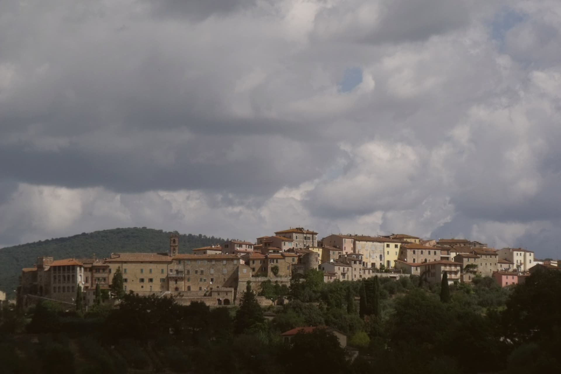
The comune sits at 334 meters on the eastern edge of the clay hills, twenty kilometers east of Siena. It was called simply Rapolano until 1949, when the spa industry pushed the name change, a shift that marks how thoroughly the waters came to define the place.
The thermal facilities and the quarry sit at some distance from each other within the comune: the springs rise near the centro and to its south, while the travertine beds lie in the Serre frazione three kilometers further out, a separate settlement built around the stone rather than the water. The medieval centro storico, meanwhile, holds no thermal or mineral history at all: a fortified perimeter, a Sienese-period castello on the highest point, and a parish church founded in the eleventh century, all predating the spa industry by centuries.
The clay-hill landscape spreads north and west of the comune, and draws most visitors past the spa itself. What emerges is a town built on two extractive industries, water and stone, wrapped around an older walled settlement that has little to do with either.
We confirmed you can reach this one by train.
What to see in Rapolano Terme
- Terme Antica Querciolaia. Six outdoor pools at 38 degrees, the older of the two facilities and the one tied to a general's convalescence.
- Terme San Giovanni. Thermal complex south of the centro among the clay hills of the Crete Senesi, with outdoor pools facing vineyards and olive groves.
- Cave di travertino di Serre. Active quarries in the Serre di Rapolano frazione three kilometers south, the source of the stone behind the Pienza Duomo's façade.
How to get to Rapolano Terme
There is a railway station in the town, so you can arrive without a car and never need one while you are here. Perugia is roughly 63 minutes away by road.
Our tip
Thermal towns work year-round and Rapolano is the rare Sienese commune where winter is a season. The pools at Antica Querciolaia and San Giovanni stay open through the cold months and the steam off the 38-degree water against the December clay hills is the postcard the spa industry sells. April through June and September into October are the wider best months, with the Crete Senesi at full color and the surrounding wine and olive harvests pulling traffic through the centro.
Chiusi
Why visit Chiusi
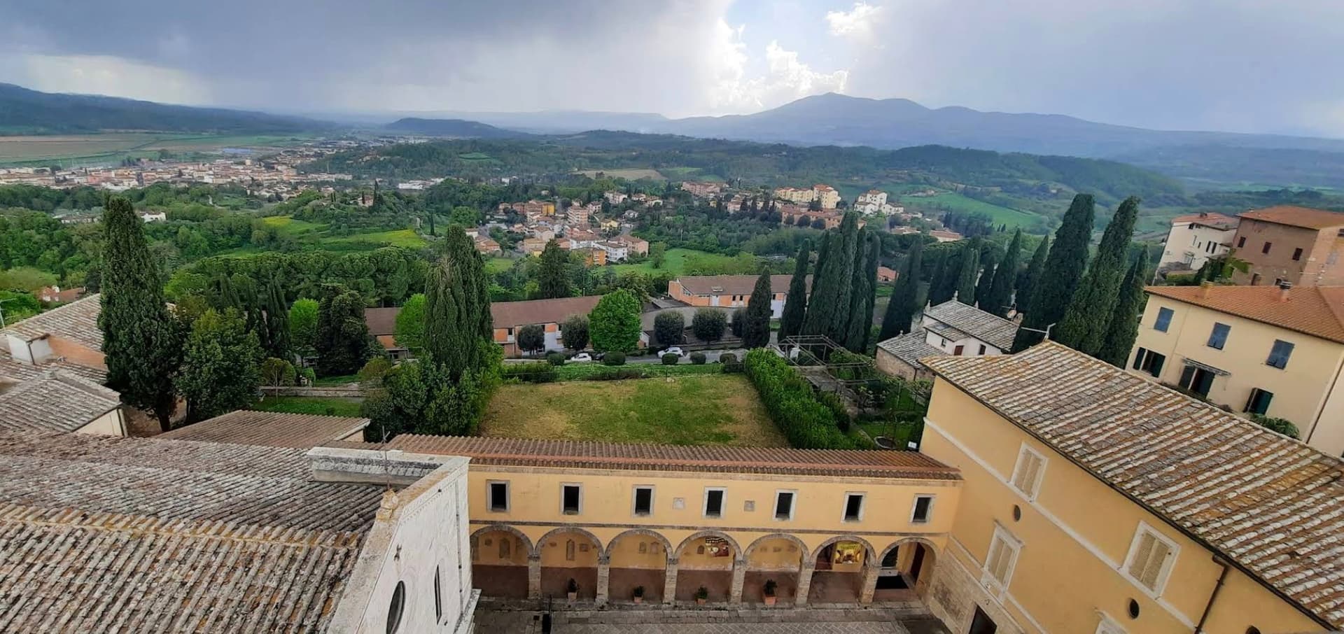
The hilltop stands above the Val di Chiana, the valley floor visible from the town at a height that made it defensible and gave it command of the surrounding farmland. The cathedral, the museums and the tunnel network are close enough to walk between within the old center, while the painted necropolis and the lake lie outside it, a few kilometers apart in different directions, one inland toward the tombs and the other north toward open water.
The tunnels themselves connect the upper town to what lies beneath it: built as drainage, later folded into legend by Pliny the Elder, who took them for part of a king's tomb. The cathedral's own columns, lifted from earlier Roman buildings, make the same point in stone that the tombs make in paint and the museum makes in bucchero and alabaster: this is a town built repeatedly on top of itself, each layer reusing what the last one left behind.
We confirmed you can reach this one by train.
What to see in Chiusi
- Museo Nazionale Etrusco. Holds canopic urns, alabaster sarcophagi, bucchero pottery and grave goods pulled from the necropolises around the town.
- Duomo di San Secondiano. Cathedral built around 560 AD over an earlier basilica, renovated in the thirteenth century, nave and two aisles on antique marble columns from Roman buildings.
- Labirinto di Porsenna. Visited from the Museo della Cattedrale, the tunnels run beneath the streets at a scale that still reads as engineering rather than legend, whatever Pliny made of them.
How to get to Chiusi
There is a railway station in the town, so you can arrive without a car and never need one while you are here. Perugia is roughly 58 minutes away by road.
Our tip
April through June and September into October are the working months on the Val di Chiana edge: mild days, evening light over the lake, the wine and olive cycles below town. The Frittellata of San Giuseppe in mid-March and the Festa di San Mustiola in early June fill the centro storico with traditional kitchens. July and August push past thirty degrees and the basin below town holds the heat; the museums and the Labirinto stay cool. Tria Turris Medioevo e Palio delle Torri di Chiusi falls in June.
More from Anywhere Italy
- The best hidden wine towns you can reach by train in the province of Siena
- The best hidden olive oil towns you can reach by train within 90 minutes of Perugia
- The 6 best hidden towns with a serious restaurant that you can reach by train within 90 minutes of Perugia
- The best hidden towns you can reach by train that eat well within 90 minutes of Perugia
 The best towns on a walking route in the province of Siena
- The best small towns you can reach by train in Toscana