
The best hidden olive oil towns you can reach by train within 90 minutes of Perugia
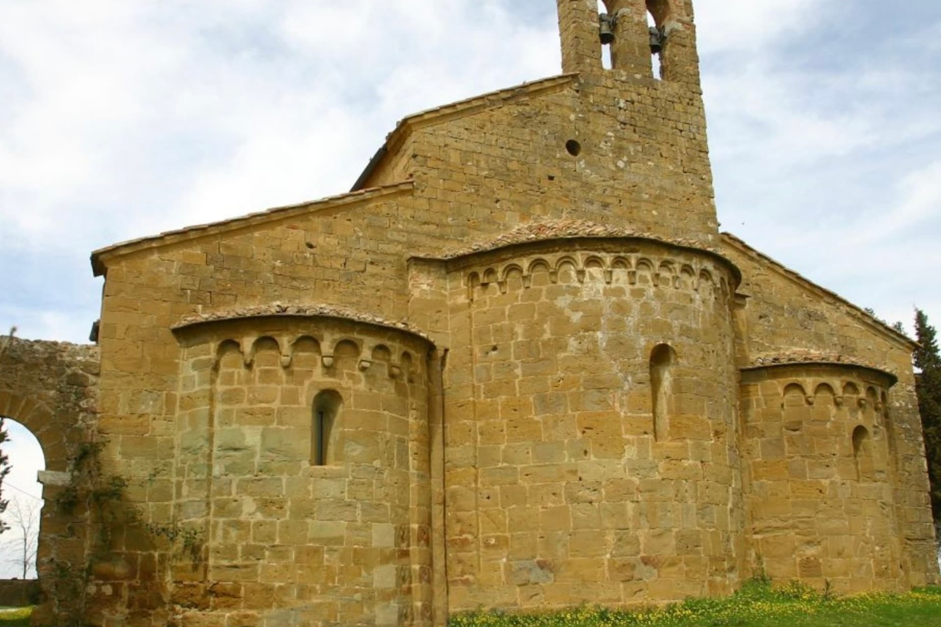
The olive belt that runs between Umbria and southern Tuscany is a landscape of terraced groves, dry stone walls and travertine or sandstone houses the colour of old bread. Harvest begins in late autumn, when nets go down under the trees and the mills work into the night, and the reward is olio nuovo: cloudy, grass-green, hot at the back of the throat. Eat it as the locals do, poured over toasted unsalted bread with a scrape of garlic, or on a bowl of farro soup. The same hills give pecorino, chianina beef, Sagrantino and Vino Nobile, and the regional trains run through nearly all of it.
Most people arriving in this part of Italy point themselves at Florence and Siena, then add a day trip to Assisi. Those places earn their crowds, but by mid-morning in high season the queues at the Uffizi and the buses circling the Assisi car parks make for a long day of standing. The olive oil sold in the shops there is often excellent and often not from anywhere nearby.
The groves do not stop where the tour buses turn around. They continue along the Perugia lines and the Val di Chiana, past station towns where the frantoio is a working building rather than a visitor attraction, and where a bottle bought in November came off a hill you can see from the platform. These are the smaller places on those routes, reachable without hiring a car, and fewer people get off there.
Of the 41 communes we have mapped within 90 minutes of Perugia, 11 qualify as olive oil towns you can reach by train: each belongs to the national association of olive-oil towns, and we have confirmed each is reachable without a car. This list is the hidden ones, 9 in all, ordered smallest first. The smallest, Trequanda, has 1,166 residents.
If you are still choosing, we have also written The best hidden towns you can reach by train that eat well within 90 minutes of Perugia and The 10 best towns you can reach by train that hold a food festival within 90 minutes of Perugia.
Trequanda
Why visit Trequanda
Trequanda is three villages in one comune: Trequanda itself at 453 meters, Castelmuzio, and Petroio at 486 meters, scattered across the hills southeast of Siena. The first written record dates to 1198, when the Cacciaconti of Scialenga held it as fief; in 1211 Emperor Otto IV gave them the right to collect tolls.
In 1553 the village was among the first to be annexed to the Grand Duchy of Tuscany. The Cacciaconti castle still anchors the centro storico, the Pieve dei Santi Pietro e Andrea next to it, built from 1327 in a Gothic-Romanesque mix and renovated in the Renaissance.
Petroio has produced fine ornamental terracotta since the early sixteenth century: lions and dogs and pineapples and chimney pots, the surface of half the gardens in central Tuscany. The municipality holds the Orange Flag from the Italian Touring Club and was inscribed in 2018 in the national register of historic rural landscapes.
We confirmed you can reach this one by train.
What to see in Trequanda
- Castello dei Cacciaconti. Medieval fortress at the center of Trequanda, seat of the Cacciaconti di Scialenga from the twelfth century.
- Pieve dei Santi Pietro e Andrea. Gothic-Romanesque parish church begun in 1327, expanded in the Renaissance, holding a fresco attributed to Sodoma.
- Castelmuzio. Walled hilltop frazione between Trequanda and Pienza, on the rural landscape register, the smallest of the three borghi.
How to get to Trequanda
There is a railway station in the town, so you can arrive without a car and never need one while you are here. Perugia is roughly 70 minutes away by road.
Our tip
April through June brings the green months across the Crete Senesi, the clay hills holding their color before the summer burn. September and October are dry and gold, the olive harvest running through November in the Petroio and Castelmuzio frantoi. July and August touch thirty-six degrees and the three borghi go quiet between four and seven in the afternoon.
Lucignano
Why visit Lucignano
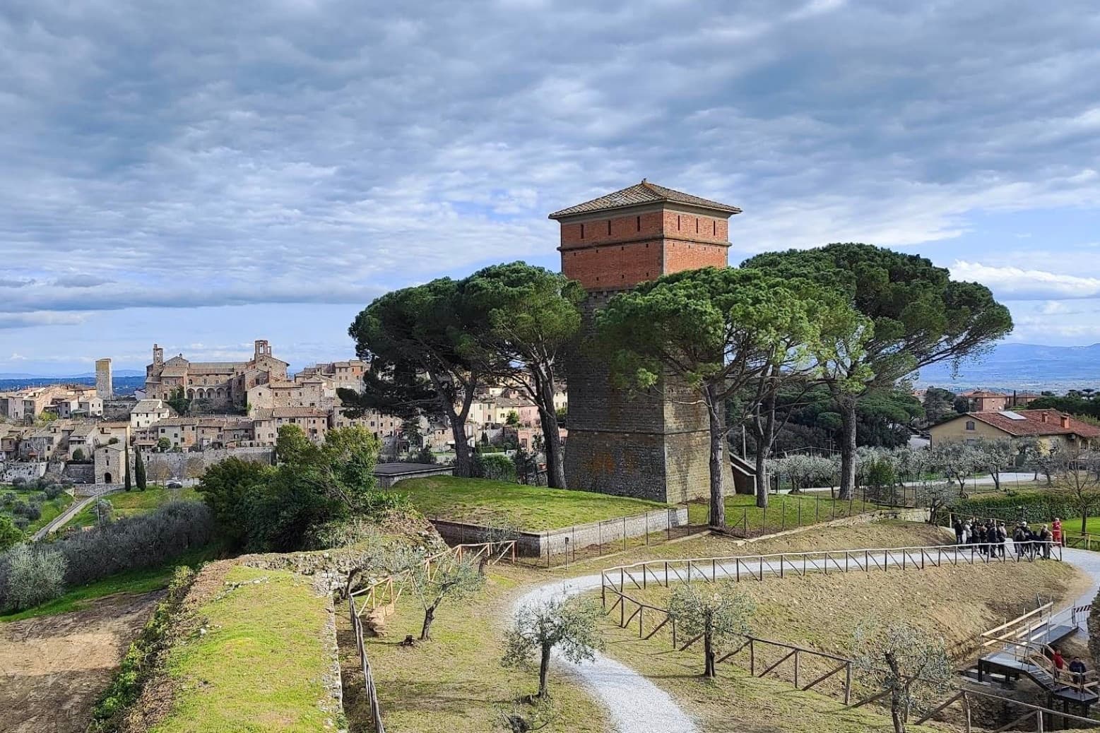
Lucignano sits at 400 meters on a hill in the Valdichiana, halfway between Siena and Arezzo, built on a tight elliptical plan of four concentric rings of streets. Its position made it one of the most contested settlements of medieval Toscana: Siena, Arezzo, Florence and Perugia all fought over it between 1200 and 1500.
The current walls and three gates date to a Sienese reconstruction of 1371. In the Museo Civico inside the Palazzo Comunale stands the Albero d'Oro, a 260-centimeter Gothic gold-and-coral reliquary in the shape of a tree, begun by Ugolino di Vieri in 1350 and finished by Gabriello d'Antonio in 1471.
Local tradition turned it into the Albero dell'Amore, a marriage charm. The Collegiata di San Michele Arcangelo dominates the highest ring of the borgo, and the elliptical plan is best read from the air, which is why drone footage of Lucignano keeps appearing in articles about medieval Tuscan urbanism.
We confirmed you can reach this one by train.
What to see in Lucignano
- Albero d'Oro. 260-cm Gothic reliquary in the shape of a tree, gold, coral and enamel, begun by Ugolino di Vieri in 1350 and completed by Gabriello d'Antonio in 1471.
- Centro storico ellittico. Four concentric rings of streets inside elliptical walls, the most complete example of medieval Tuscan elliptical town planning.
- Collegiata di San Michele Arcangelo. Eighteenth-century church on the highest ring of the borgo, with a Vasari façade adjustment and a baroque organ inside the medieval shell.
How to get to Lucignano
There is a railway station in the town, so you can arrive without a car and never need one while you are here. Perugia is roughly 65 minutes away by road.
Our tip
April through June and September into October are the months Lucignano keeps its balance, the Valdichiana green or gold depending on the half and the centro storico cool inside its elliptical walls. The Maggiolata, a flower festival between the four quarters of the borgo, runs across the last two Sundays of May. July and August push the valley past thirty and the centro storico thins after lunch. Sagra della Filiera del Tartufo Marzuolo falls in March.
Rapolano Terme
Why visit Rapolano Terme
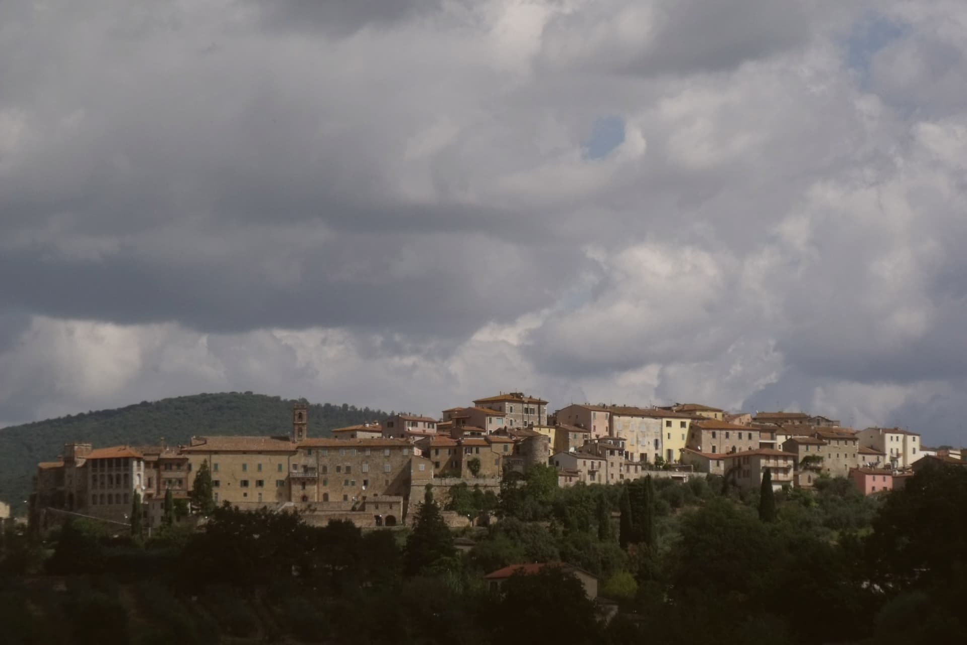
The comune sits at 334 meters on the eastern edge of the clay hills, twenty kilometers east of Siena. It was called simply Rapolano until 1949, when the spa industry pushed the name change, a shift that marks how thoroughly the waters came to define the place.
The thermal facilities and the quarry sit at some distance from each other within the comune: the springs rise near the centro and to its south, while the travertine beds lie in the Serre frazione three kilometers further out, a separate settlement built around the stone rather than the water. The medieval centro storico, meanwhile, holds no thermal or mineral history at all: a fortified perimeter, a Sienese-period castello on the highest point, and a parish church founded in the eleventh century, all predating the spa industry by centuries.
The clay-hill landscape spreads north and west of the comune, and draws most visitors past the spa itself. What emerges is a town built on two extractive industries, water and stone, wrapped around an older walled settlement that has little to do with either.
We confirmed you can reach this one by train.
What to see in Rapolano Terme
- Terme Antica Querciolaia. Six outdoor pools at 38 degrees, the older of the two facilities and the one tied to a general's convalescence.
- Terme San Giovanni. Thermal complex south of the centro among the clay hills of the Crete Senesi, with outdoor pools facing vineyards and olive groves.
- Cave di travertino di Serre. Active quarries in the Serre di Rapolano frazione three kilometers south, the source of the stone behind the Pienza Duomo's façade.
How to get to Rapolano Terme
There is a railway station in the town, so you can arrive without a car and never need one while you are here. Perugia is roughly 63 minutes away by road.
Our tip
Thermal towns work year-round and Rapolano is the rare Sienese commune where winter is a season. The pools at Antica Querciolaia and San Giovanni stay open through the cold months and the steam off the 38-degree water against the December clay hills is the postcard the spa industry sells. April through June and September into October are the wider best months, with the Crete Senesi at full color and the surrounding wine and olive harvests pulling traffic through the centro.
Montepulciano
Why visit Montepulciano
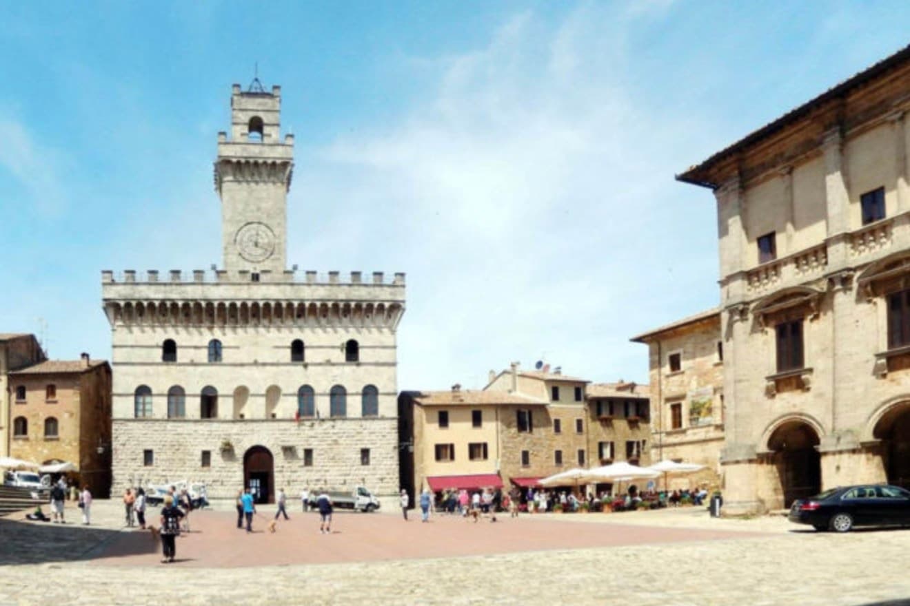
The ridge runs between the Val di Chiana and the Val d'Orcia, 70 kilometers southeast of Siena, and the town follows its spine uphill: streets climb from the gates toward the high point, where the main square sits ringed by the buildings that define the skyline from below. The origin predates the Renaissance fabric by centuries.
Etruscan tombs survive in the surrounding hills, though almost nothing of that period shows in the centro storico itself, which was rebuilt wholesale in the fifteenth and sixteenth centuries over whatever came before. The wine and the festival both use the climb as their setting rather than their subject: the cellars are cut into the rock beneath the palazzi, keeping a constant temperature for aging, and the barrel race each August sends two men from each of the eight contrade hauling an eighty-kilogram cask up the same gradient that every visitor covers on foot, only slower.
The steepness that shaped the defensive site nine centuries ago is still what a person feels first, in the legs, before the buildings register at all.
We confirmed you can reach this one by train.
What to see in Montepulciano
- Tempio di San Biagio. A 13-meter dome and travertine façade standing alone outside the walls, the ground falling away below it so the building reads as a single volume against the hillside.
- Piazza Grande. The high piazza at the top of the ridge, ringed by the Duomo, the Palazzo Comunale and the Palazzo Tarugi, all rebuilt in the fifteenth and sixteenth centuries.
- Palazzo Comunale. Town hall designed by Michelozzo in the fifteenth century, its tower offering a view over the Val di Chiana and Val d'Orcia.
How to get to Montepulciano
There is a railway station in the town, so you can arrive without a car and never need one while you are here. Perugia is roughly 57 minutes away by road.
✷ We have written about Montepulciano
“Now, the postcard itself, the towns, and here I have less to say than you would expect, because Pienza and Montepulciano have become, and I mean this precisely, the canteens of a theme park. They are where you go to park, walk a pretty street, use the toilet, refill the water, eat a plate of something, and buy a thing to take home. They are the food court between the rides.”
Read our piece on Montepulciano →Val d'Orcia | The Postcard Is Constructed
Our tip
April through June and September into October are the working months on the ridge: vine work in the surrounding hills, mild days, evening light that lingers over the Val d'Orcia. July and August push into the low thirties and the climb to Piazza Grande slows even the residents. The Bravìo delle Botti runs the last Sunday of August and fills the town. Calici di Stelle falls in July.
Magione
Why visit Magione
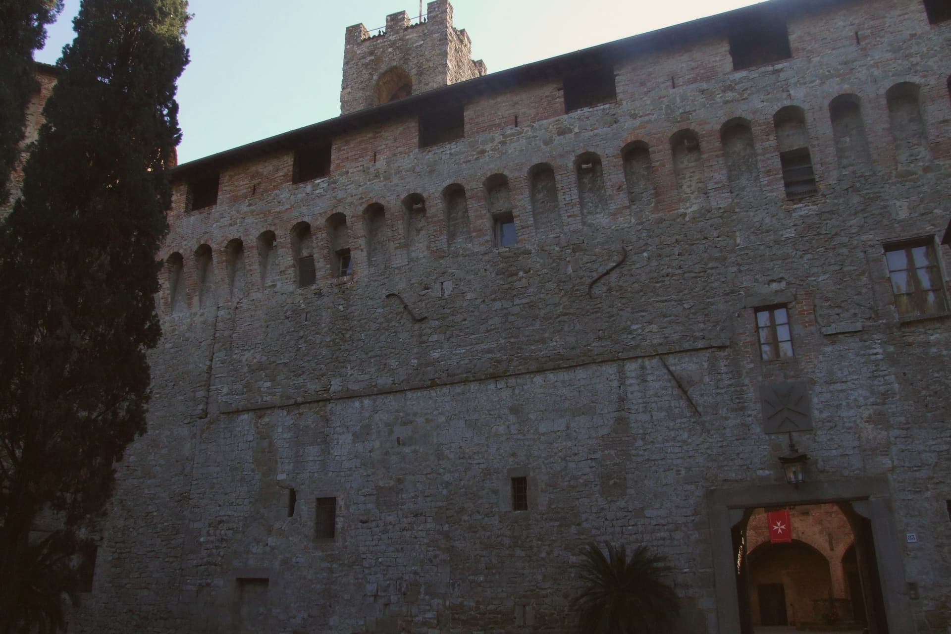
Magione sits at 299 meters on a hill east of Lake Trasimeno, fifteen kilometers from Perugia. The name comes from the Knights Hospitaller, who built a hospital here in the mid-twelfth century dedicated to Saint John the Baptist and called their convent Maison in their own language.
The original nucleus stood on the Perugia-Tuscany route and grew into the fortified base that still anchors the town today. The lower town is organized around two medieval poles: the castle complex near the old route, and the quadrangular tower rising thirty meters over the settlement, built in the same period by the same Order.
The vineyards on the surrounding hills lie between 250 and 350 meters above sea level, and the town's territory extends down to the lake's eastern shore. In October 1502, the castle hosted a plot against Cesare Borgia: his own captains and allies conspired against him inside its walls.
Niccolò Machiavelli, on diplomatic mission for Florence, learned the details and passed them to Borgia, who dismantled the conspirators within months. A hospital, a tower, and a plot against a Borgia: the town's history reads as a sequence of episodes gathered around the same fortified point on the road between Perugia and Tuscany.
We confirmed you can reach this one by train.
What to see in Magione
- Castello dei Cavalieri di Malta. The fortified complex built by the Knights Hospitaller stands as the town's anchor, its walls the setting where the Conspiracy of Magione was plotted against Cesare Borgia.
- Torre dei Lambardi. Thirty-meter quadrangular tower built between the twelfth and thirteenth centuries by the Gerosolimitani Knights, three floors and a summit terrace.
- Chiesa di San Giovanni Battista. Parish church inside the castle complex, dedicated to the saint of the original Hospitaller foundation.
How to get to Magione
There is a railway station in the town, so you can arrive without a car and never need one while you are here. Perugia is roughly 23 minutes away by road.
✷ We have written about Magione
“The lake is like a sanatorium compared to the sea. It’s relaxed. It’s calm. It’s silent. To find this level of almost disturbing quietness, you either go up into the mountains, or you really need to know your way around the sea to find that particular spot not overrun by vacationers and beach people. In Trasimeno, this is easy. Even the most popular towns like Castiglione or Passignano sit in quiet harmony with the stillness of the water.”
Read our piece on Magione →Lago Trasimeno | Never Compete with the Sea
Our tip
April through June and September into October are the working months on the eastern Trasimeno: clear lake light, olive groves on the hills above, evenings cool enough to walk between the Castello and the Torre. July and August reach the low thirties in the basin; the lake helps but weekends fill with Perugia and Florence day-trippers and the lakefront frazione of San Feliciano runs heavy. The olive harvest in late October and November turns the territory busy with frantoi at full capacity. Festa del Giacchio - Sagra del Pesce del Lago Trasimeno falls in July.
Trevi
Why visit Trevi
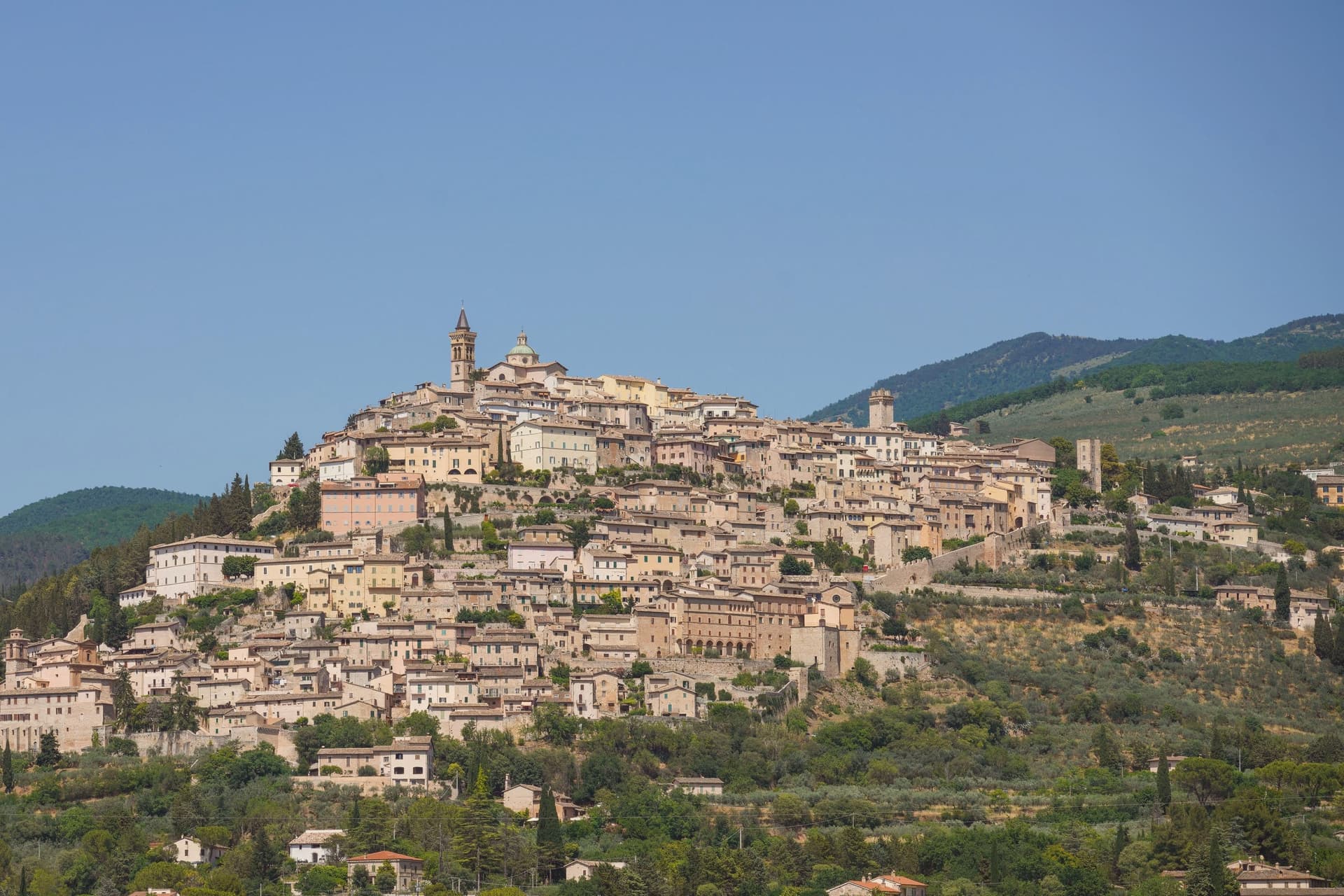
Trevi sits at 412 meters on a conical hill above the Spoleto valley, the centro storico still inside the Roman walls of the 1st century BC. The town stood on the Via Flaminia, the consular road from Rome to the Adriatic, and grew into a Guelph commune by the 12th century.
Olive oil is what people come for. Over 200,000 trees blanket the slopes below the walls on near-ideal calcareous, well-drained soils, and the Olivo di Sant'Emiliano near the abbey of the same name is about 1,700 years old, identified with the tree the bishop of Trevi was tied to in 304 before his martyrdom.
The Santuario della Madonna delle Lacrime, built in 1487 to mark a miracle, holds a fresco by Pietro Perugino. The centro storico runs in concentric rings up the hill, each ring older than the last, with the Palazzo Comunale and the Pinacoteca holding works by Lo Spagna at the top.
We confirmed you can reach this one by train.
What to see in Trevi
- Santuario della Madonna delle Lacrime. Built in 1487 after a Marian apparition wept tears of blood in 1485, with a fresco by Perugino in the Cappella dell'Adorazione.
- Chiesa di Sant'Emiliano. Romanesque parish church at the top of the centro storico, dedicated to the bishop martyred in 304, the patron saint of the town.
- Olivo di Sant'Emiliano. About 1,700-year-old olive tree near the eponymous church, nine meters tall, traditionally the tree to which the bishop was tied before martyrdom.
How to get to Trevi
There is a railway station in the town, so you can arrive without a car and never need one while you are here. Perugia is roughly 47 minutes away by road.
Our tip
April through June and September into October are the months for Trevi. The olive groves are in leaf or in harvest, the hill is green or silver-gold depending on the half, and the valley below holds the morning light. The Festa di Sant'Emiliano runs the last week of January with the Palio dei Terzieri, when the three quarters of the town compete.
Chiusi
Why visit Chiusi
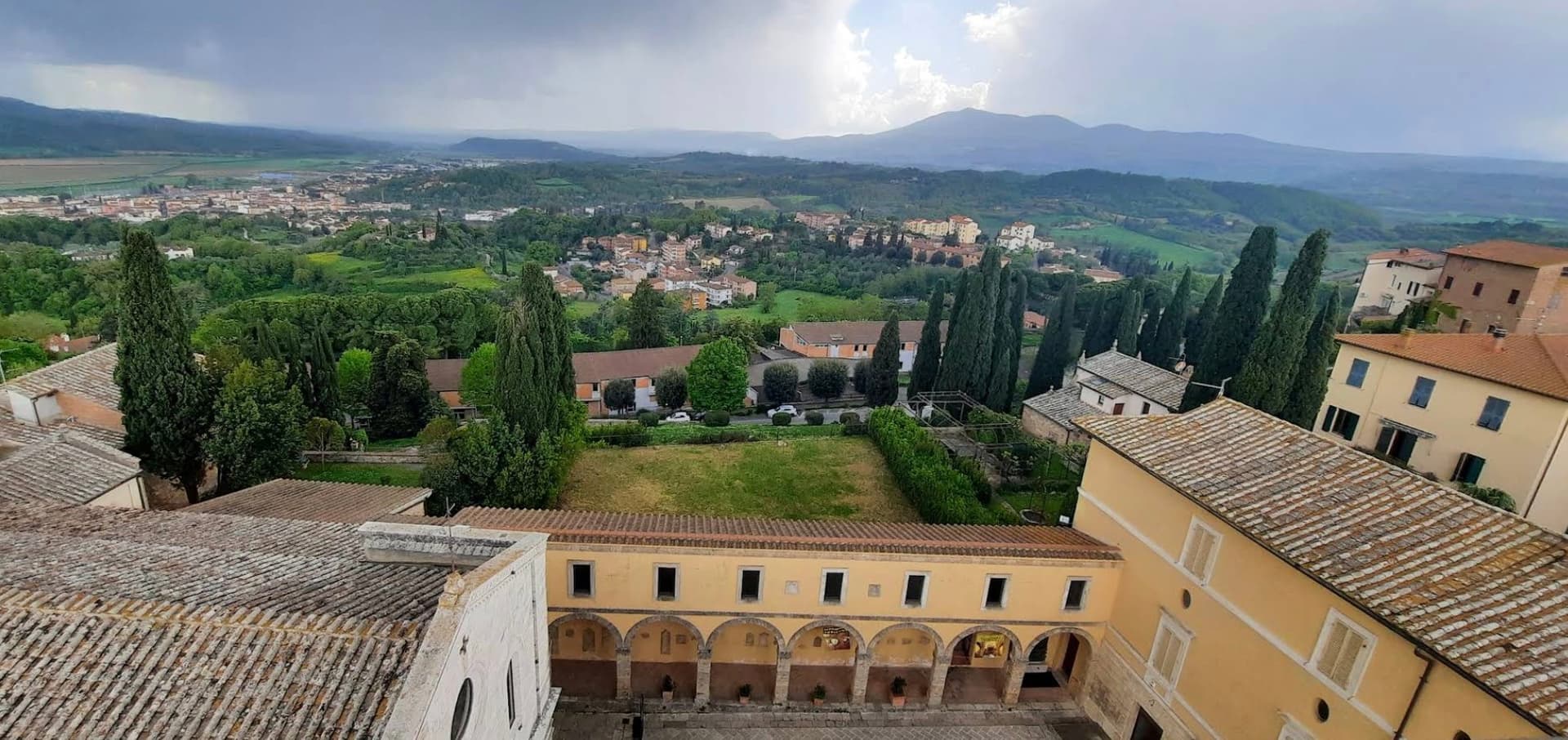
The hilltop stands above the Val di Chiana, the valley floor visible from the town at a height that made it defensible and gave it command of the surrounding farmland. The cathedral, the museums and the tunnel network are close enough to walk between within the old center, while the painted necropolis and the lake lie outside it, a few kilometers apart in different directions, one inland toward the tombs and the other north toward open water.
The tunnels themselves connect the upper town to what lies beneath it: built as drainage, later folded into legend by Pliny the Elder, who took them for part of a king's tomb. The cathedral's own columns, lifted from earlier Roman buildings, make the same point in stone that the tombs make in paint and the museum makes in bucchero and alabaster: this is a town built repeatedly on top of itself, each layer reusing what the last one left behind.
We confirmed you can reach this one by train.
What to see in Chiusi
- Museo Nazionale Etrusco. Holds canopic urns, alabaster sarcophagi, bucchero pottery and grave goods pulled from the necropolises around the town.
- Duomo di San Secondiano. Cathedral built around 560 AD over an earlier basilica, renovated in the thirteenth century, nave and two aisles on antique marble columns from Roman buildings.
- Labirinto di Porsenna. Visited from the Museo della Cattedrale, the tunnels run beneath the streets at a scale that still reads as engineering rather than legend, whatever Pliny made of them.
How to get to Chiusi
There is a railway station in the town, so you can arrive without a car and never need one while you are here. Perugia is roughly 58 minutes away by road.
Our tip
April through June and September into October are the working months on the Val di Chiana edge: mild days, evening light over the lake, the wine and olive cycles below town. The Frittellata of San Giuseppe in mid-March and the Festa di San Mustiola in early June fill the centro storico with traditional kitchens. July and August push past thirty degrees and the basin below town holds the heat; the museums and the Labirinto stay cool. Tria Turris Medioevo e Palio delle Torri di Chiusi falls in June.
Spello
Why visit Spello
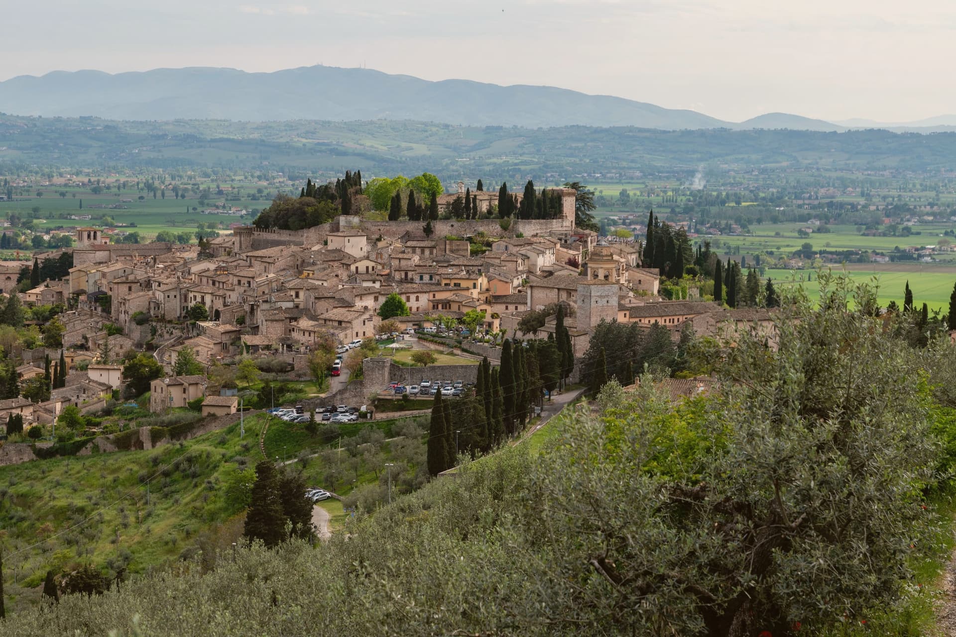
The centro storico climbs the lower southern flank of Monte Subasio, still contained within the circuit of walls raised when the town was renamed Splendidissima Colonia Julia by Augustus. Before that it was Hispellum under the Umbrians.
The Roman gates and stretches of wall from the Augustan period were not rebuilt over, so the line of the ancient town is still readable in the streets that climb from them today. The same streets carry the Infiorata each June and the fresco Pinturicchio completed for the chapel he painted in Santa Maria Maggiore, two things separated by roughly fifteen centuries but occupying the same short stretch of the old town: the chapel's Annunciation, Nativity and Christ Among the Doctors sit near the piazza the petal pictures are laid across.
A Roman villa with ten mosaic floors, found only in 2005 and left in place under cover, adds a third layer beneath the town that is still being uncovered rather than one that was always on view. The town's Roman skeleton, its painted chapel, and a floor uncovered within living memory all sit within the same small radius, which is unusual: most places show one era at a time, Spello keeps three in view at once.
We confirmed you can reach this one by train.
What to see in Spello
- Cappella Baglioni. The Cappella Bella, commissioned by Troilo Baglioni, with four sibyls ranged across the vault above the painted scenes below.
- Santa Maria Maggiore. Twelfth-century church on Piazza Matteotti, its interior built around the fresco cycle and the later panel it houses.
- Porta Venere e Torri di Properzio. First-century BC gate flanked by two dodecagonal towers, still standing at close to full height with the stonework legible course by course.
How to get to Spello
There is a railway station in the town, so you can arrive without a car and never need one while you are here. Perugia is roughly 33 minutes away by road.
Our tip
April through June and September into October are the months for Spello. The slopes of Monte Subasio above town carry wildflowers, Cammino di San Francesco walkers pass through, and the Infiorata weekend on Corpus Domini in late May or June is the most concentrated day on the calendar. July and August touch the mid-thirties on the valley floor; the centro storico at 280 meters stays a few degrees cooler in the upper streets, but most visitors come early or wait until after seven. Borgo diVino tour falls in October.
Castiglion Fiorentino
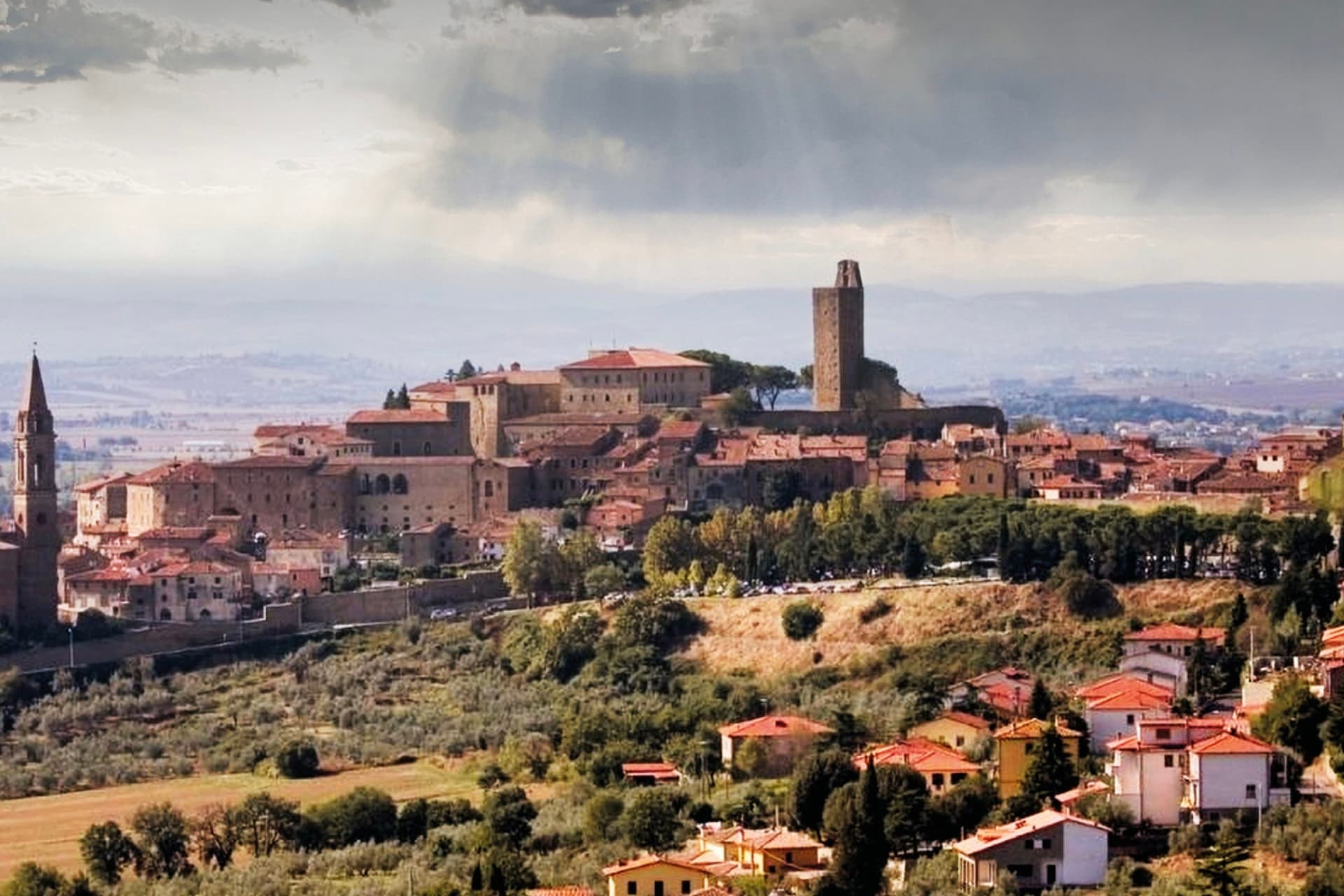
Why visit Castiglion Fiorentino
The hill stands between Arezzo and Cortona, above the fertile plain that gives the area its name. The centro storico is layered directly on what came before it: the medieval streets and the fortress at the summit sit on foundations from the fourth century BC, so walking from the lower gates to the top of the town is also a climb through the town's own construction history, one period built on the next rather than beside it.
The upper terrace holds the oldest religious building along with the fortress, while the main piazza lower down gathers the later additions, the parish church, the arcade, and the gallery, into a single civic space. The town carried allegiance first to Perugia, then to Florence from 1384, and was renamed at that moment, a change of name that marks the point where the additions to the skyline, the arcade among them, became possible.
What results is a town where the sightlines do the explaining: the arcade frames the plain because the plain was always the reason to build here, and the fortress crowns the hill because it was already fortified ground long before anyone called it that.
We confirmed you can reach this one by train.
What to see in Castiglion Fiorentino
- Cassero. Fortified core at the top of the town. The tower is reached by climbing through the streets of the centro storico, with the drop toward the plain opening out only at the top.
- Logge del Vasari. The three arches sit at the edge of Piazza del Municipio, so the arcade functions as a frame for the view rather than a monument to walk around. Below it, the Pinacoteca occupies the neighboring building.
- Pinacoteca Comunale. Civic gallery next to the Logge with works by Bartolomeo della Gatta, Margaritone d'Arezzo, Taddeo Gaddi and a notable bust reliquary in gilded silver.
How to get to Castiglion Fiorentino
There is a railway station in the town, so you can arrive without a car and never need one while you are here. Perugia is roughly 54 minutes away by road.
Our tip
April through June and September into October are the working months in the Val di Chiana: dry days, mild evenings, harvest of olives and Sangiovese into October. July and August push past thirty degrees and the plain below holds the heat; the town at 342 meters runs a few degrees cooler. The Palio dei Rioni in mid-June fills the streets with banners between the four historic quarters and a horse race in the Cassero square. Palio dei Rioni di Castiglion Fiorentino (Arezzo) falls in June.
More from Anywhere Italy
- The best hidden towns you can reach by train that eat well within 90 minutes of Perugia
 The 10 best towns you can reach by train that hold a food festival within 90 minutes of Perugia
- The 6 best hidden towns with a serious restaurant that you can reach by train within 90 minutes of Perugia
- The best towns with a medieval festival that you can reach by train within 90 minutes of Perugia
- The best towns you can reach by train that have a serious restaurant within 90 minutes of Perugia
 The best olive oil towns you can reach by train in the province of Perugia