
The best towns with a World Heritage site within an hour of Naples
The land around Naples is volcanic, which explains most of what grows and most of what got buried. Tomatoes ripen on the black slopes of Vesuvius, lemons hang over dry-stone terraces cut into the Amalfi cliffs, and anchovies come out of the water at the coastal villages salted in wooden barrels. The houses are lime-washed tufa and Vesuvian stone, roofed in barrel vaults, tiled in the majolica the Salerno kilns have fired for centuries. Spring and October are the sensible months, when the coast road moves and the excavations are not baking.
Almost everyone arriving does the same loop: Naples, then a boat or a bus to Capri and Sorrento, then a day squeezed into the ruins between them. It works, and it is why the hydrofoil queues in July run along the quay at Molo Beverello, and why the Sorrento peninsula road can take longer than the map suggests. The sites are extraordinary and the crowds are the price. Nobody who goes is wrong to go.
The listings, though, are scattered wider than the itinerary. The same coast that made the Amalfi terraces worth protecting keeps going east through fishing harbours and ceramic workshops and wine hamlets inland. The same volcanic ash that preserved the famous excavations preserved others, and the Bourbon kings built their palace and silk village on the plain behind. These towns hold World Heritage sites and see fewer people doing it.
Of the 19 communes we have mapped in a one-hour drive of Naples, 10 qualify as towns with a World Heritage site: each holds a site UNESCO has listed. The smallest, Conca dei Marini, has 664 residents.
Elsewhere in the catalogue: The best towns known for what they grow within an hour of Naples and The best towns with a World Heritage site within 45 minutes of Salerno.
Conca dei Marini
Why visit Conca dei Marini
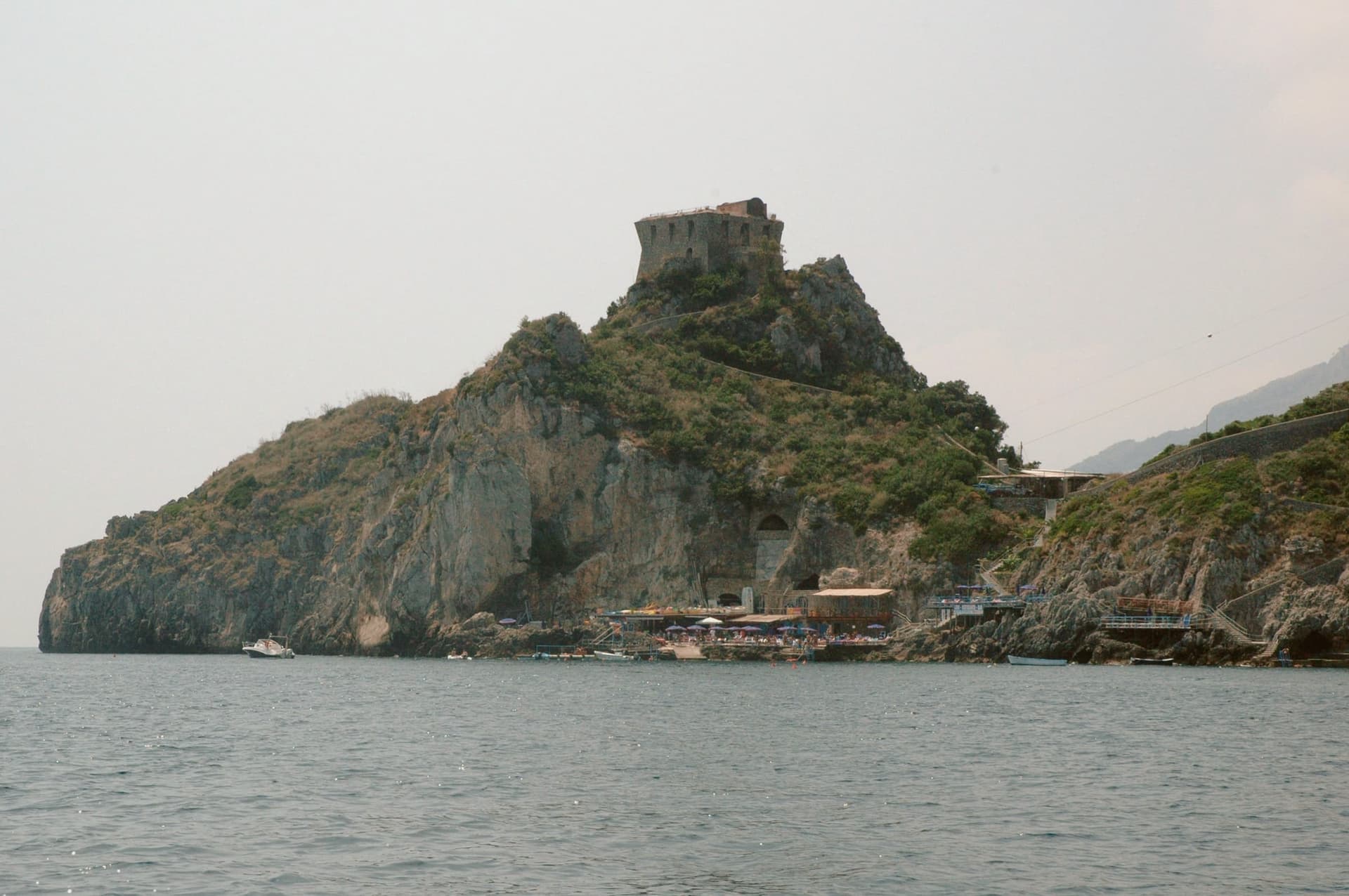
Conca dei Marini sits between Amalfi and Furore on the Tyrrhenian coast, a fold of stone houses around the marina and the promontory above it. According to local tradition the settlement was founded as Cossa by the Etruscans and taken by Rome in 272 BC.
The village divides between the clifftop, where the watchtower and the former monastery stand on their spur, and the water's edge, where the parish chapel sits on a rocky outcrop above the fishing cove. Below the road, accessible by stairs or by boat, the sea cave glows green from an underwater fissure.
The village has 664 residents and stays cooler than Amalfi in August. What holds the place together is the drop from cliff to water: a settlement built in a fold of stone that turned its isolation into a pantry, a lookout, and a hiding place for a green cave, and stayed small enough that all three remain within reach of each other.
What to see in Conca dei Marini
- Grotta dello Smeraldo. 45 by 32 meters of water surface, reached by stairs from the road or by boat from the marina below the village.
- Torre di Capo di Conca. On the promontory above the marina, part of the coastal defense network commissioned by the viceroy of Naples.
- Monastero di Santa Rosa. Former Dominican convent on a clifftop spur, founded 1681; the building is now a luxury hotel.
How to get to Conca dei Marini
Salerno is roughly 34 minutes away by road.
Our tip
May, June, September and October are the months to come. The sea is warm enough for the grotto boats to run reliably, the coastal road is open, and the Santa Rosa is celebrated on 2 August with a new sfogliatella reinterpretation each year by a guest pastry chef. July and August push the SS163 coastal road into single-file traffic from morning to night; locals walk between the marina and the upper village rather than driving.
Furore
Why visit Furore
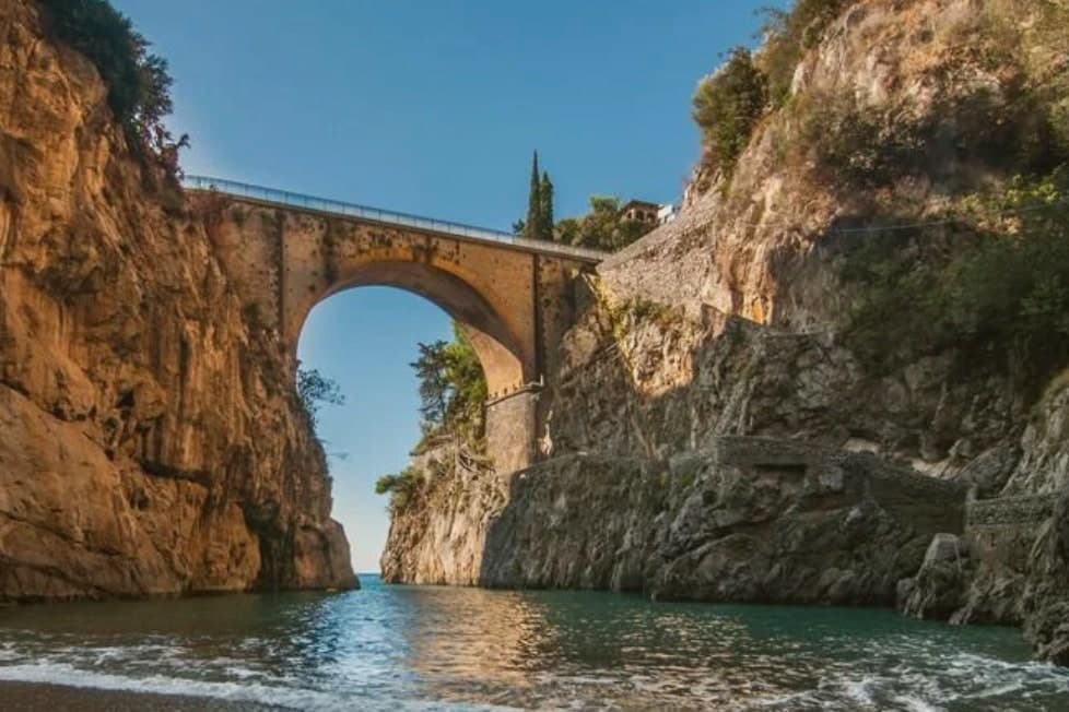
Furore stretches up the cliff between Praiano and Conca dei Marini on the UNESCO-listed Costiera Amalfitana, six hundred and eighty-eight people across houses that don't share a single piazza. The main settlement sits at 300 meters in the upper Vallone del Furore; the commune drops to sea level at the Fiordo di Furore, a narrow ria carved by the Schiato torrent that flows down from Agerola at 550 meters.
The historian Matteo Camera traced the name to the roar storms make through the gorge. Since the late 1980s the painter Silvio Vetrano's project Il Paese Dipinto has invited artists each September to paint murals on the village walls, which is why Furore is sometimes called the painted village or the village that doesn't exist.
The commune is a Borgo più bello d'Italia and a Città del Vino: the Fiorduva white from the Marisa Cuomo winery is grown on terraces above the fjord.
What to see in Furore
- Fiordo di Furore. Narrow ria cut by the Schiato torrent, southern Italy's only fjord, with a stone bridge crossed by the SS163 and a pebble beach below.
- Il Paese Dipinto. Open-air mural circuit started in 1980 by Silvio Vetrano, with new works added each September by invited Italian and international artists.
- Chiesa di Sant'Elia Profeta. Parish church on the upper part of the village, with a majolica-tiled dome and a small square overlooking the terraces below.
How to get to Furore
Salerno is roughly 36 minutes away by road.
Our tip
May, June, September and early October are the strongest months on this stretch of the Amalfi Coast. The sea climbs past twenty degrees, the SS163 buses run on a working timetable, and the Fiordo di Furore beach is accessible without a queue. July and August are full: the day-trippers come up from Amalfi and the small parking pockets on the SS163 fill before nine.
Cetara
Why visit Cetara
Cetara sits at the eastern end of the Amalfi Coast on a narrow inlet between Vietri sul Mare and Maiori, 17 kilometers from Salerno. Saracen pirates established a base here in 879 AD and made repeated raids west along the coast; in 1534 the corsair Sinan Pasha sacked the village and took roughly 300 inhabitants as slaves to North Africa.
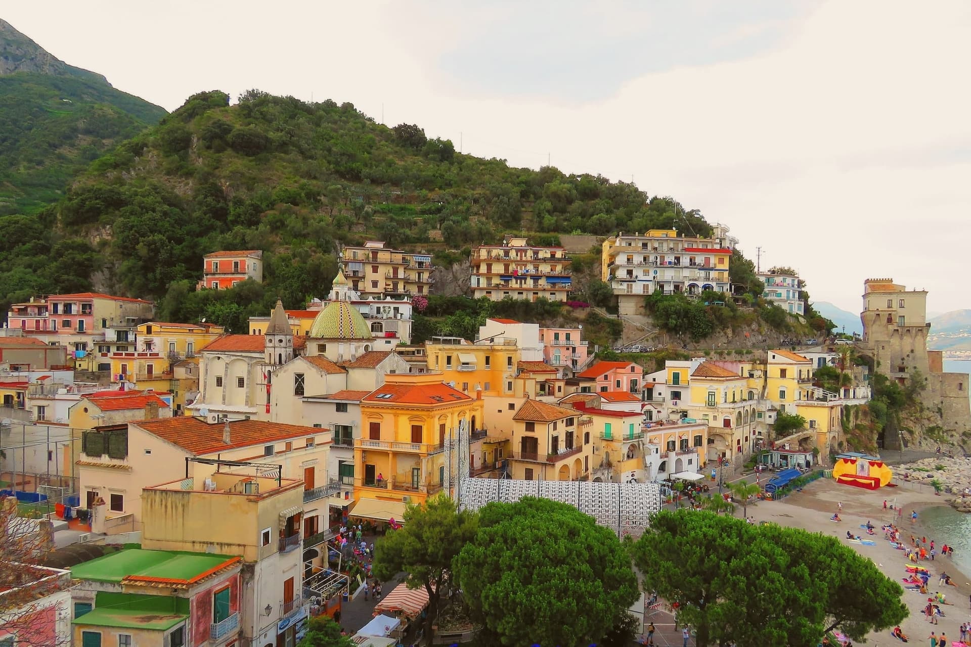
The viceregal watchtower above the beach, Torre di Cetara, was rebuilt in the 16th century as part of the coastal defense system commissioned from Naples; it now holds the civic museum of local painters known as the costaioli. Cetara remains the working fishing village of the coast, with a tuna and anchovy fleet still based in the small port.
Colatura di alici, the amber anchovy sauce descended from Roman garum and revived in the Middle Ages by local monks, is still aged in chestnut barrels in the cellars; it received DOP status in 2020. The Chiesa di San Pietro Apostolo on the marina, with its yellow majolica dome, is the visual signature of the village.
What to see in Cetara
- Torre Vicereale. Sixteenth-century viceregal watchtower rebuilt after the 1534 Saracen sack, restored in 2011 and now holding the civic museum of the costaioli painters.
- Chiesa di San Pietro Apostolo. Ninth-century parish church on the marina rebuilt in Baroque style, with a yellow majolica dome that signs the village from the sea.
- Convento di San Francesco. Fourteenth-century Franciscan convent above the port, with a small cloister and a sea-facing terrace, now used for civic events.
How to get to Cetara
Salerno is roughly 17 minutes away by road.
Our tip
May, June, September and October are the months Cetara reads best. The fleet runs daily, the festivals around the colatura and the tuna catch land in the warm shoulders, and the SS163 between Vietri and Maiori is open without high-summer queues. July and August fill the small marina and the pebble beaches to either side of the breakwater.
Tramonti
Why visit Tramonti
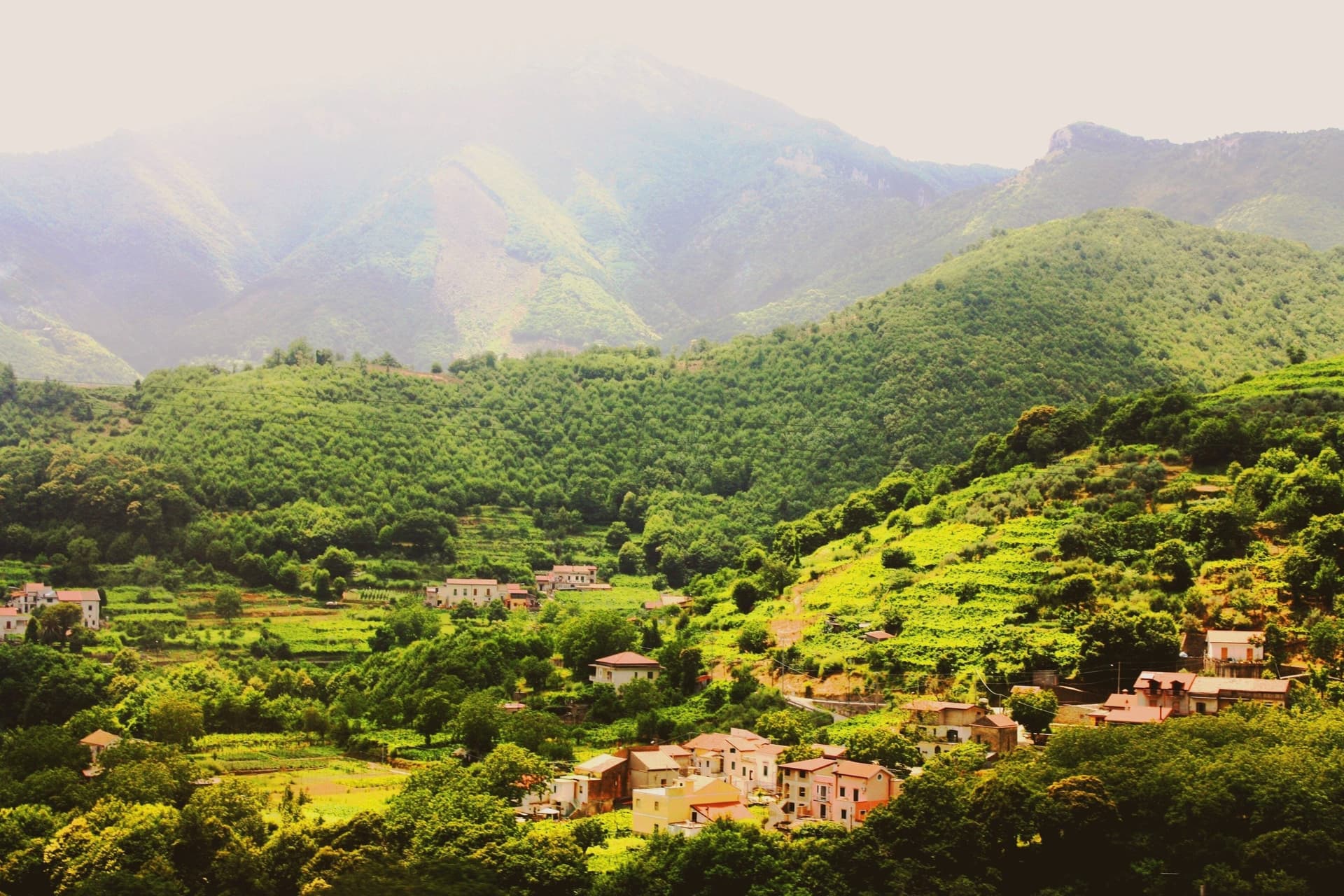
Tramonti is the Amalfi Coast that does not face the sea. The comune covers thirteen hamlets on the inland Lattari slopes above Maiori, with the seat of Polvica at 321 meters and the higher frazioni climbing past six hundred, each linked by old mule tracks rather than a single main street.
It was an important town of the Maritime Republic of Amalfi between 839 and around 1200, sitting on the inland side of the ridge that divides the coast from the Sorrento peninsula and, by way of the Valico di Chiunzi, from the Sarno valley beyond. Two exports carried the village name further than the village itself: fiordilatte mozzarella from the high pastures, and the long-fermented pizza dough that emigrants took north in the post-war years to found most of the historic pizzerias of Piedmont and Lombardy.
The slopes fall within the UNESCO Amalfi Coast site and the Monti Lattari Park, with chestnut forest and limoncello distilleries on every road. A comune this scattered, with its parishes on separate ridges and its produce known abroad before the place itself, reads less like one town than a federation of hamlets that happened to share a name.
What to see in Tramonti
- Convento di San Francesco. Fourteenth-century Franciscan convent at Polvica with cloister and a rare wooden Christ, founded by Beata Margherita Cigala in 1474.
- Costa d'Amalfi Tramonti DOC vineyards. Terraced parcels climbing the Lattari slopes at a pitch among the steepest viticultures in Italy, worked by hand where machinery cannot stand.
- Thirteen frazioni of Tramonti. Hamlets scattered up the ridges between 250 and 700 meters, each with its own parish and traditions, connected by old mule tracks.
How to get to Tramonti
Salerno is roughly 38 minutes away by road.
Our tip
May through September is the Amalfi calendar, with the inland Lattari side cooler than the coastal road and the vineyard work running into harvest in late September and October. July and August see day-trippers walking up from Maiori for cooler air and lunch; the road to Valico di Chiunzi takes the overflow from Ravello and Amalfi. The chestnut harvest falls in October and November and Pizza a Metro festivals happen in late summer.
Maiori
Why visit Maiori
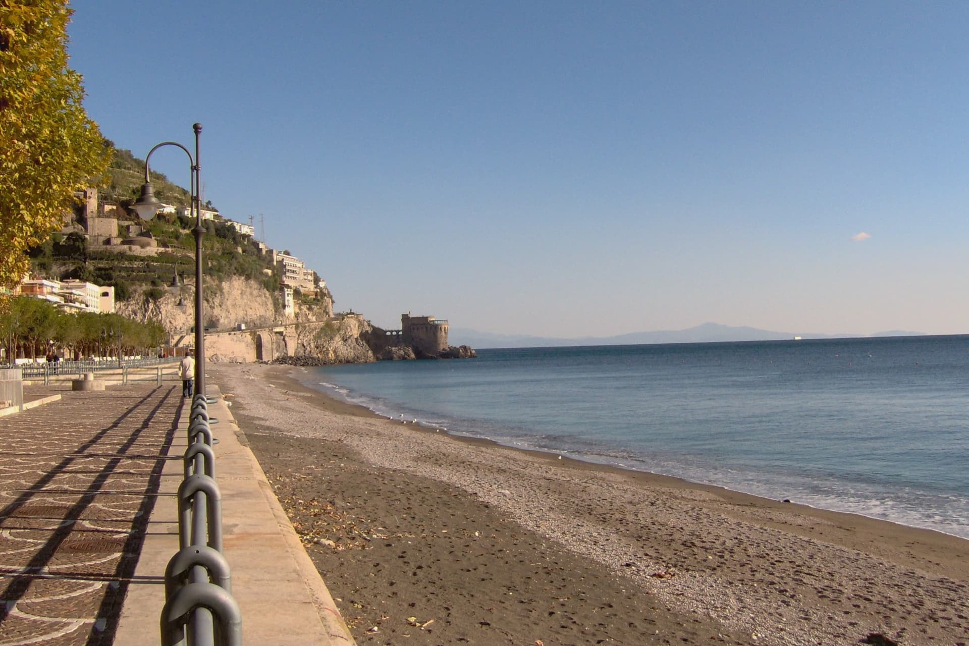
Maiori sits at the mouth of the Reginna torrent between Minori and Cetara, the widest valley on the Amalfi Coast and the only flat ground on the strip. A wall of medieval houses rose up the gorge until the night of 26 October 1954, when a freak storm dropped 500 millimeters of rain on the Lattari ridge in twelve hours.
The torrent swept the centro storico, the lemon terraces and several streets into the sea, killing over 80 people. The town was rebuilt with a rare straight grid behind a kilometer-long beach of volcanic sand, the longest on the coast.
The Castello di San Nicola de Thoro-Plano sits on the ridge above, 11th-century walls part-ruined since the Anjou siege. The Collegiata di Santa Maria a Mare, 13th-century with a green and yellow majolica dome, survived the flood and looks out from the hill.
Roberto Rossellini shot Paisà, Voyage in Italy and Il Miracolo here in the late 1940s.
What to see in Maiori
- Collegiata di Santa Maria a Mare. Thirteenth-century parish church on the hill, three-aisle neoclassical interior with gilded coffered ceiling and green-and-yellow majolica dome.
- Castello di San Nicola de Thoro-Plano. Eleventh-century fortress in partial ruin on the ridge above town, with views over the Reginna valley and the coast east to Capo d'Orso.
- Spiaggia di Maiori. Kilometer-long beach of volcanic sand, the longest on the Amalfi Coast, replanted with palms behind the seawall after the 1954 flood.
How to get to Maiori
Salerno is roughly 22 minutes away by road.
Our tip
May, June, September and early October are the months Maiori is set up for. The long beach absorbs more visitors than the cove towns nearby, the SITA bus connects west to Amalfi and east to Salerno, and the Sentiero dei Limoni is open without the heat. July and August fill the kilometer of sand and push every restaurant on the lungomare to two evening shifts.
Vietri sul Mare
Why visit Vietri sul Mare
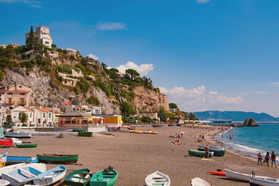
Vietri sul Mare sits at 80 meters at the eastern end of the Costiera Amalfitana, the most populous commune of the UNESCO-listed coastline, separated from the port of Salerno by a single harbour wall. The polychrome ceramics tradition is documented from the ninth century, with a generally agreed start around the fifteenth, and the industrial scale-up came in the 1920s and 1930s when a small group of German émigré artists settled in the workshops and brought the bestiary-and-floral pottery the town still produces.
The Chiesa di San Giovanni Battista, sixteenth century, has a green-and-yellow majolica dome that has become the town's signature image. Vietri is the only Amalfi Coast commune that holds Borghi più belli d'Italia and UNESCO together, and is a member of the Città della Ceramica network.
The marina at Marina di Vietri and the cliffside frazione of Raito and Albori sit below and above the centro on the same slope.
What to see in Vietri sul Mare
- Chiesa di San Giovanni Battista. Sixteenth-century parish church with a green-and-yellow majolica dome and a bell tower of polychrome tiles, the most photographed image of the town.
- Museo Provinciale della Ceramica. Ceramic museum in Villa Guariglia at Raito, with Vietri pieces from the seventeenth century through the German-period 1920s and after.
- Albori. Cliffside frazione above the centro, also a Borgo più bello d'Italia, with stone houses, lanes, and views over the Gulf of Salerno.
How to get to Vietri sul Mare
There is a railway station in the town, so you can arrive without a car and never need one while you are here. Salerno is roughly 16 minutes away by road.
Our tip
May, June, September and early October are the strongest months. The water along the Marina di Vietri climbs past twenty degrees, the SS163 west to Cetara and Maiori runs without the gridlock of high summer, and the ceramic workshops keep their full hours. July and August are full: day-trippers arrive from Salerno on the local train and the Marina parking fills before mid-morning.
Pompei
Why visit Pompei
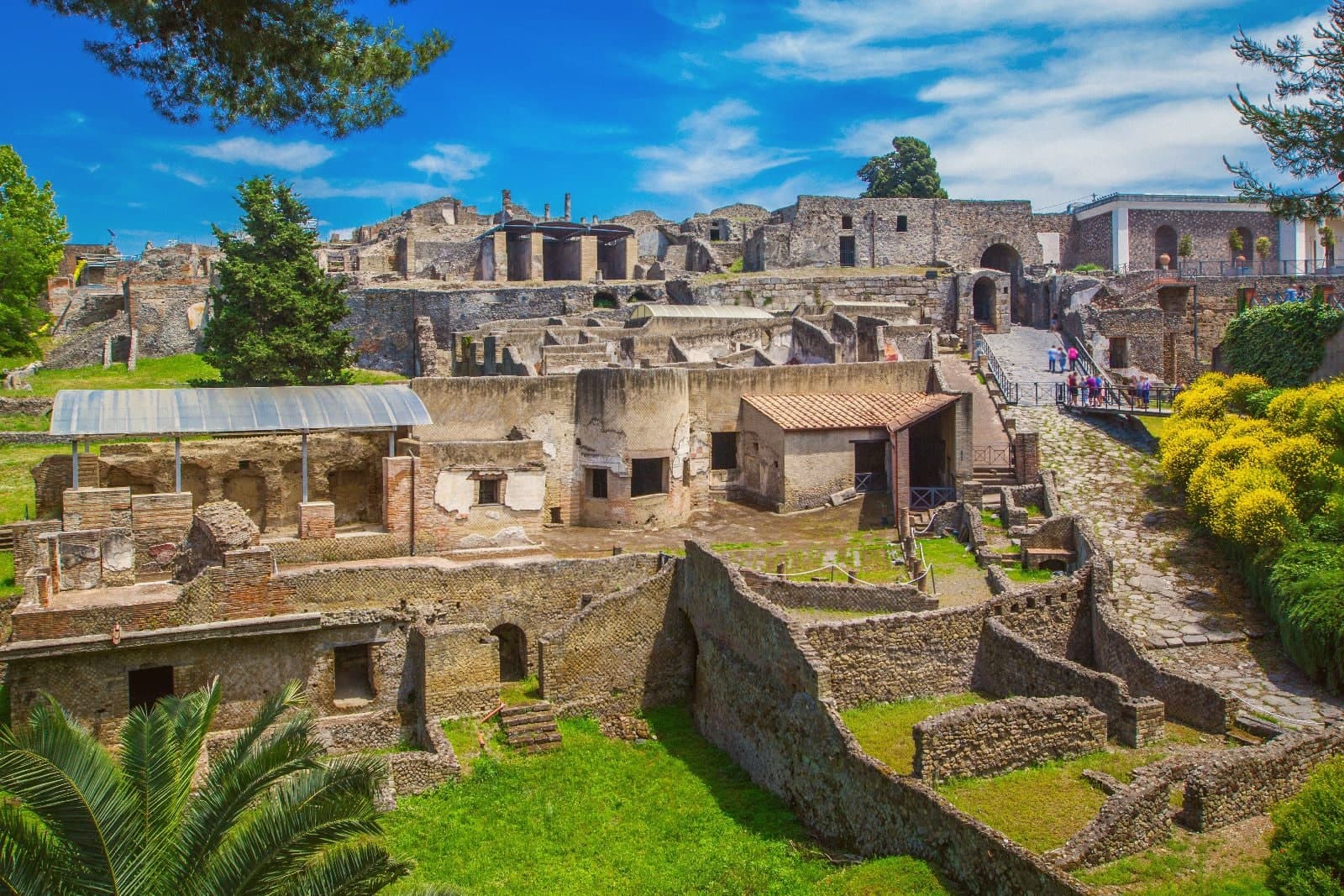
Pompei sits at 30 meters on a volcanic plateau on the south slope of Vesuvius, twenty kilometers from Naples and a hundred meters from where the Sarno meets the sea. The Roman city was buried under five to six meters of ash and lapilli when the volcano erupted on 24 October 79 AD, killing the part of the population that had not already left.
Excavations began in 1748 under the Bourbons and have never stopped; the site has been UNESCO-listed since 1997 alongside Herculaneum and Torre Annunziata, and is the third most visited archaeological site in the world. Modern Pompei was founded in 1881 by the lawyer Bartolo Longo, who built the Santuario della Beata Vergine del Rosario as a center for pilgrimage and social work.
The basilica with its 80-meter campanile and the surrounding grid of streets are entirely a creation of the 1880s, separate from the dig and laid over fields that had been farmland until then.
What to see in Pompei
- Parco Archeologico di Pompei. The Roman city buried in 79 AD and excavated since 1748, UNESCO-listed since 1997, with the Forum, the Villa dei Misteri and the Lupanare.
- Santuario della Beata Vergine del Rosario. Pontifical basilica built between 1876 and 1891 by the lawyer Bartolo Longo, the heart of modern Pompei and a pilgrimage site of four million a year.
- Casa del Fauno. Roman patrician house in the dig with a bronze faun at its center and the Alexander Mosaic floor depicting Issus, now in the Naples museum.
How to get to Pompei
There is a railway station in the town, so you can arrive without a car and never need one while you are here. Napoli is roughly 24 minutes away by road.
Our tip
May, June, September and early October are the strongest months for Pompei. The dig opens at nine and the Forum stays walkable before midday heat sets in. July and August are punishing: the site sits on volcanic plateau at thirty meters with no shade in the main streets, and afternoon temperatures cross thirty-five degrees.
Torre Annunziata
Why visit Torre Annunziata
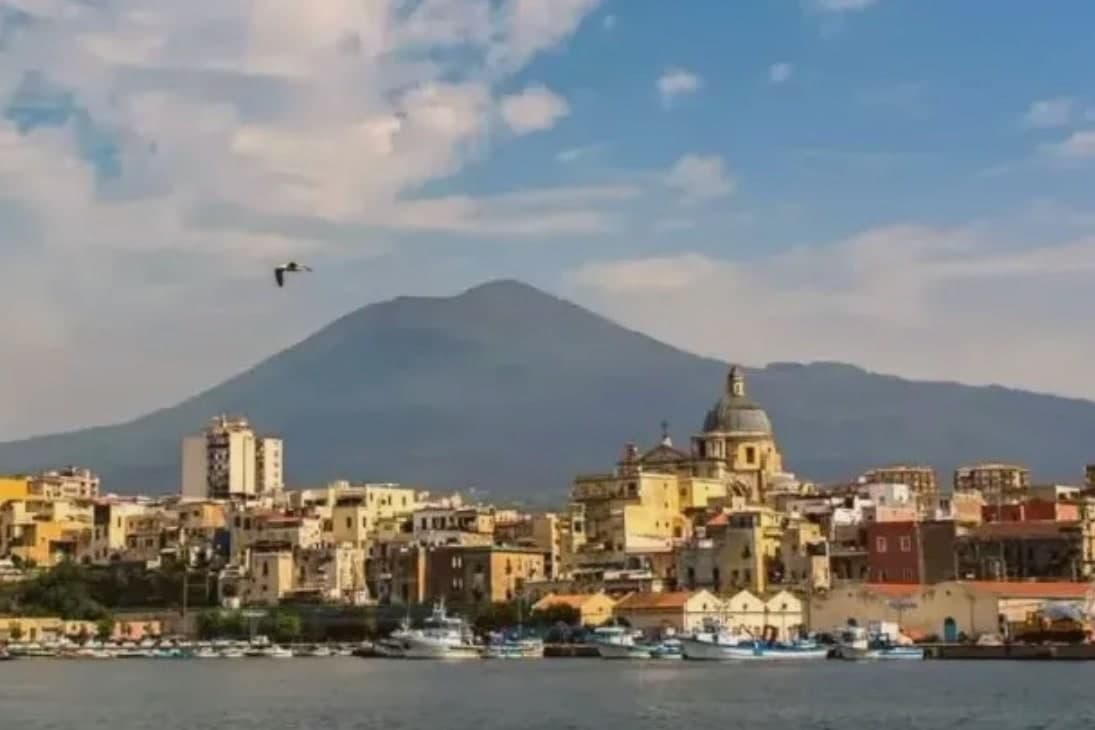
Torre Annunziata sits at 15 meters on the Bay of Naples, 20 kilometers south of the city at the western foot of Vesuvius, where the Sarno river meets the sea. The Roman town of Oplontis stood here before 79 AD; Villa A, called the Villa di Poppea after Nero's second wife who probably owned it, is the largest of the seafront villas buried by the eruption and the most completely excavated, listed by UNESCO in 1997 with Pompeii and Herculaneum.
The modern town is named for the 1319 watchtower and the chapel of the Annunziata built next to it. From the 17th century the Sarno was channelled to power flour and pasta mills, and by 1900 Torre Annunziata had more than sixty pastifici.
Together with Naples and Gragnano it was called the Capital of the White Art, the term for industrial dried pasta. Setaro and a handful of other small pastifici still produce by traditional bronze die and slow drying.
The town was hit hard by postwar industrial decline and the 1980 Irpinia earthquake.
What to see in Torre Annunziata
- Scavi di Oplontis - Villa di Poppea. Seafront Roman villa attributed to Nero's wife Poppaea, buried 79 AD, the largest and best-preserved of the Oplontis villas, UNESCO-listed 1997.
- Basilica della Madonna della Neve. Sixteenth-century shrine of the Madonna della Neve, the patron of the town, rebuilt after 18th-century earthquakes.
- Torre dell'Annunziata. Fourteenth-century watchtower for which the town is named, built 1319 to guard against Saracen raids on the Vesuvian coast.
How to get to Torre Annunziata
There is a railway station in the town, so you can arrive without a car and never need one while you are here. Napoli is roughly 22 minutes away by road.
Our tip
April through June and September through October are the workable months. The Villa di Poppea is open all year but the unshaded Roman peristyles get punishing in July and August, when the site temperature can push 35 degrees. The bay breeze cools the lungomare in the evenings.
Ercolano
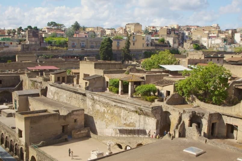
Why visit Ercolano
The eruption of AD 79 treated the two Roman towns differently. Pompeii took 3 to 4 metres of ash, hot enough to scorch organic material but not to seal it.
Herculaneum, closer to the mountain and down at the shore, was hit by repeated pyroclastic surges and ended up under a mud flow that cooled hard around everything it touched: roofs, furniture, scrolls, upper floors. That difference in burial is the reason one site kept its wood and the other did not: the carbonised wooden screen of the House of the Wooden Partition, the wooden bed in the House of the Carbonised Furniture, and the second-storey overhangs are all here because the mud sealed rather than scorched them.
The site was named UNESCO World Heritage in 1997, jointly with Pompeii and Torre Annunziata. The suburban villa attributed to Julius Caesar's father-in-law, Lucius Calpurnius Piso, once stood on the ancient seafront, now buried well inland under the weight of the deposit.
Inside it, roughly 1,800 carbonised papyrus scrolls were recovered, including the entire Epicurean philosophical library of Philodemus of Gadara. That find, the largest single ancient library ever recovered, is still being unrolled with multispectral imaging at the Officina dei Papiri Ercolanesi in Naples, and it is the building the J.
Paul Getty Museum in Malibu replicated 1:1 as its main structure. Along the old shoreline nearby, the arched boathouses hold the remains of 300 fugitives killed by the 500 degree pyroclastic surge while they waited for a rescue that never reached them, discovered in the 1980s and 1990s and now the most-photographed image of that moment.
The modern town sits directly on top of the ancient one, 50,000 people on the lower slopes of the volcano, with the excavated ruins sunk below current street level in a pit at the centre of things. Excavation has gone on since 1738, when Charles of Bourbon began it, and continues piecemeal now.
To the east, the ground rises toward the national park and the Gran Cono crater, reached by a half-day hike from the upper car park with reservation required. To the west, the road along the old Golden Mile strings 122 Bourbon-era villas, built between the 1730s and 1820s by the Naples aristocracy, toward the coast; Villa Campolieto, designed by Vanvitelli in 1763 and now a cultural centre, and Villa Favorita, a former royal residence, are the ones open to visitors.
Upper slope, buried town, and shoreline road are three bands of the same landscape, each shaped by proximity to the same mountain. The town's food follows the same geology: spaghetti alle vongole, mozzarella di bufala, pomodorino del piennolo del Vesuvio DOP grown on the volcanic slopes, and Lacryma Christi del Vesuvio DOC red and white from vineyards on the same soil.
What holds the place together is that the volcano is not backdrop here. It is the reason the ruins are intact, the reason the villas needed a gateway road, and the reason the food tastes the way it does.
What to see in Ercolano
- Parco Archeologico di Ercolano (UNESCO). Wooden screens, beds, and second-storey balconies stand in place, sealed by the mud rather than reduced by it. Walking the excavated streets means walking below the level of the modern town, which sits on top of what the mud buried.
- Villa dei Papiri. A 100m-long suburban villa attributed to Caesar's father-in-law, its rooms opening onto what was once the ancient seafront, now well inland of the shore under the weight of volcanic deposit.
- Boathouse skeletons. 300 fugitives killed while sheltering in the arches along the old shoreline, waiting for a rescue that the surge outran. Found in the 1980s, the arches are left much as they were uncovered.
How to get to Ercolano
There is a railway station in the town, so you can arrive without a car and never need one while you are here. Napoli is roughly 16 minutes away by road.
Our tip
Ercolano is best March–June and September–October — the archaeological park is open year-round but summer Naples heat (35°C+) is brutal on the unshaded site, and the Vesuvio crater hike is best before 10am or after 4pm in summer. Allow a full day for the site + the crater. Book Villa dei Papiri visit slots in advance — the substructure tours are limited capacity.
Caserta
Why visit Caserta
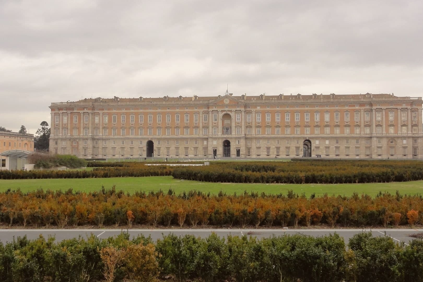
Caserta sits at 68 meters on the Campanian plain, 25 kilometers north of Naples at the foot of the Tifatini hills. The city exists because Charles III of Bourbon decided in 1750 to build a palace that would rival Versailles and the Royal Palace of Madrid, far enough inland to be safe from naval bombardment.
Luigi Vanvitelli laid the first stone in 1752: five floors, 1,200 rooms, 1,742 windows, 34 staircases. The gardens stretch three kilometers from the back façade to a cascade fed by the Carolino Aqueduct, also Vanvitelli's design.
The complex was listed by UNESCO in 1997 together with the silk village of San Leucio, the utopian industrial colony Ferdinand IV built on a hill four kilometers away. Up the road, Casertavecchia, the medieval village abandoned when the Bourbons moved everyone down to the plain, keeps its 12th-century Romanesque cathedral at 401 meters.
The modern city below is a working provincial capital, not a tourist town.
What to see in Caserta
- Reggia di Caserta. Bourbon royal palace begun in 1752 by Luigi Vanvitelli, five floors, 1,200 rooms, UNESCO-listed since 1997 with the park and the Carolino Aqueduct.
- Parco Reale e Giardino Inglese. Three-kilometer formal park ending in a cascade, with an English Garden added by Maria Carolina in 1786, the first of its kind in Italy.
- Casertavecchia. Medieval hilltop village at 401 meters, 10 km from the city, abandoned when the Bourbons relocated the population to the plain.
How to get to Caserta
There is a railway station in the town, so you can arrive without a car and never need one while you are here. Napoli is roughly 38 minutes away by road.
Our tip
April through June and September through October are the comfortable months on the plain. The Reggia gardens are at their best in May, when the parterres bloom and the cascade runs full. July and August push into the high thirties; Vanvitelli's three-kilometer walk from palace to cascade becomes a heat exposure rather than a pleasure, though the shuttle bus runs. Sagra della Mulignana Imbuttunata falls in September.
More from Anywhere Italy
- The best towns known for what they grow within an hour of Naples
- The best towns with a World Heritage site within 45 minutes of Salerno
- The best towns known for what they grow within 45 minutes of Salerno
- The best coastal towns within an hour of Naples
- The best towns you can reach by train within 45 minutes of Naples
- The best towns that eat well within 45 minutes of Naples