
The best towns known for what they grow within an hour of Naples
The land around Naples grows things that carry their own paperwork. Terraces held up by dry stone walls climb the Amalfi and Sorrento slopes, planted with the thick-skinned sfusato and ovale lemons that go into rind-heavy sweets and into the liqueur every family makes differently. Inland, the ash-dark fields under Vesuvius produce the small piennolo tomatoes hung in bunches on balconies through winter, and the plain towards Nola gives hazelnuts, walnuts and stone fruit. Spring brings artichokes and broad beans to the markets, late summer the tomato and fig harvest, and autumn the nuts and the pressing of olives on the hills behind the coast.
The vast majority of visitors take the coast road to Positano, park badly, photograph the vertical houses and leave. It is a beautiful place and the crowding is the predictable result: single-file traffic on the SS163 in July, ferry queues, and lemon groves that have become backdrops rather than working ground. The same happens at the Naples end, where the archaeological sites absorb whole coach fleets before lunch.
The terraces do not stop where the famous stretch does. The same lemon walls, the same volcanic soil and the same protected growing zones continue into the valleys behind the coast and out onto the plain, into towns where fewer people go and where the fruit is still sold by the people who picked it. These are the places inside those production boundaries, each one known for something it grows.
Of the 19 communes we have mapped in a one-hour drive of Naples, 11 qualify as towns known for what they grow: each sits inside the production zone of a protected fruit or vegetable. This list is 10 of them. The smallest, Conca dei Marini, has 664 residents.
Elsewhere in the catalogue: The best coastal towns within an hour of Naples and The best towns known for what they grow within 45 minutes of Salerno.
Conca dei Marini
Why visit Conca dei Marini
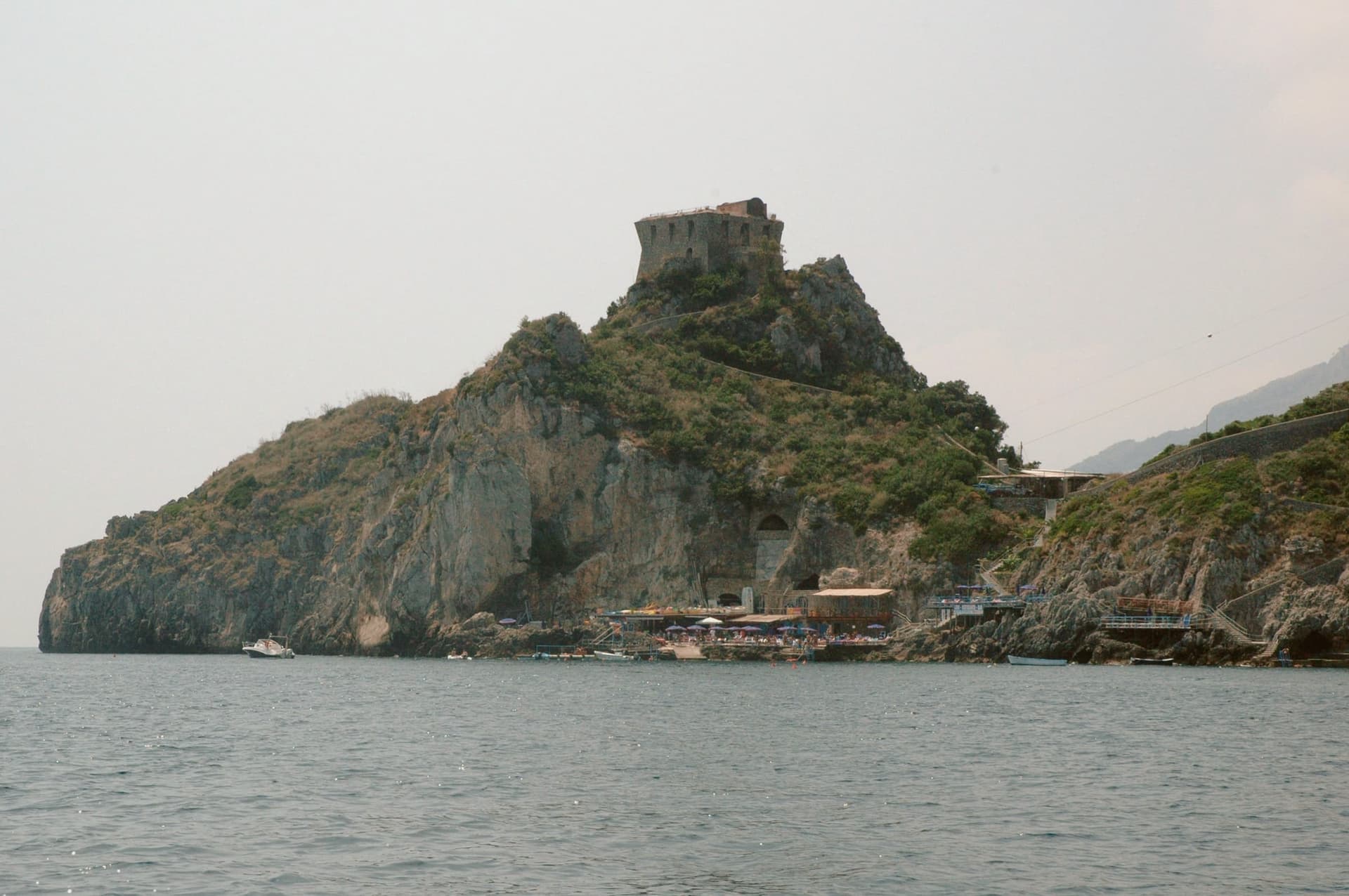
Conca dei Marini sits between Amalfi and Furore on the Tyrrhenian coast, a fold of stone houses around the marina and the promontory above it. According to local tradition the settlement was founded as Cossa by the Etruscans and taken by Rome in 272 BC.
The village divides between the clifftop, where the watchtower and the former monastery stand on their spur, and the water's edge, where the parish chapel sits on a rocky outcrop above the fishing cove. Below the road, accessible by stairs or by boat, the sea cave glows green from an underwater fissure.
The village has 664 residents and stays cooler than Amalfi in August. What holds the place together is the drop from cliff to water: a settlement built in a fold of stone that turned its isolation into a pantry, a lookout, and a hiding place for a green cave, and stayed small enough that all three remain within reach of each other.
Il Refettorio have been named by a guide.
What to see in Conca dei Marini
- Grotta dello Smeraldo. 45 by 32 meters of water surface, reached by stairs from the road or by boat from the marina below the village.
- Torre di Capo di Conca. On the promontory above the marina, part of the coastal defense network commissioned by the viceroy of Naples.
- Monastero di Santa Rosa. Former Dominican convent on a clifftop spur, founded 1681; the building is now a luxury hotel.
How to get to Conca dei Marini
Salerno is roughly 34 minutes away by road.
Our tip
May, June, September and October are the months to come. The sea is warm enough for the grotto boats to run reliably, the coastal road is open, and the Santa Rosa is celebrated on 2 August with a new sfogliatella reinterpretation each year by a guest pastry chef. July and August push the SS163 coastal road into single-file traffic from morning to night; locals walk between the marina and the upper village rather than driving.
Furore
Why visit Furore
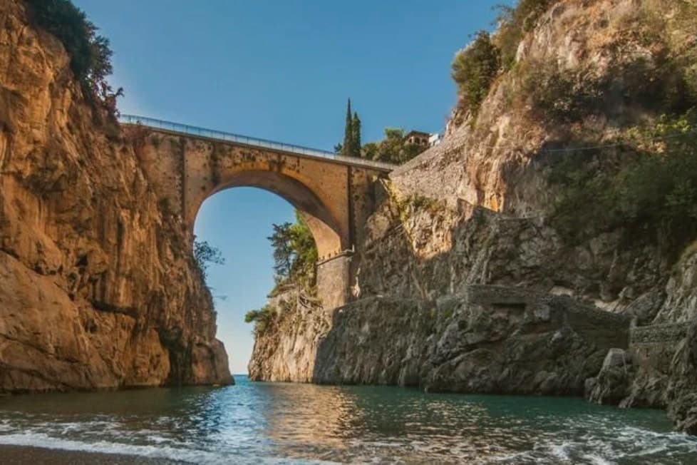
Furore stretches up the cliff between Praiano and Conca dei Marini on the UNESCO-listed Costiera Amalfitana, six hundred and eighty-eight people across houses that don't share a single piazza. The main settlement sits at 300 meters in the upper Vallone del Furore; the commune drops to sea level at the Fiordo di Furore, a narrow ria carved by the Schiato torrent that flows down from Agerola at 550 meters.
The historian Matteo Camera traced the name to the roar storms make through the gorge. Since the late 1980s the painter Silvio Vetrano's project Il Paese Dipinto has invited artists each September to paint murals on the village walls, which is why Furore is sometimes called the painted village or the village that doesn't exist.
The commune is a Borgo più bello d'Italia and a Città del Vino: the Fiorduva white from the Marisa Cuomo winery is grown on terraces above the fjord.
Bluh Furore, Hostaria Baccofurore, Melchiò have been named by a guide.
What to see in Furore
- Fiordo di Furore. Narrow ria cut by the Schiato torrent, southern Italy's only fjord, with a stone bridge crossed by the SS163 and a pebble beach below.
- Il Paese Dipinto. Open-air mural circuit started in 1980 by Silvio Vetrano, with new works added each September by invited Italian and international artists.
- Chiesa di Sant'Elia Profeta. Parish church on the upper part of the village, with a majolica-tiled dome and a small square overlooking the terraces below.
How to get to Furore
Salerno is roughly 36 minutes away by road.
Our tip
May, June, September and early October are the strongest months on this stretch of the Amalfi Coast. The sea climbs past twenty degrees, the SS163 buses run on a working timetable, and the Fiordo di Furore beach is accessible without a queue. July and August are full: the day-trippers come up from Amalfi and the small parking pockets on the SS163 fill before nine.
Tramonti
Why visit Tramonti
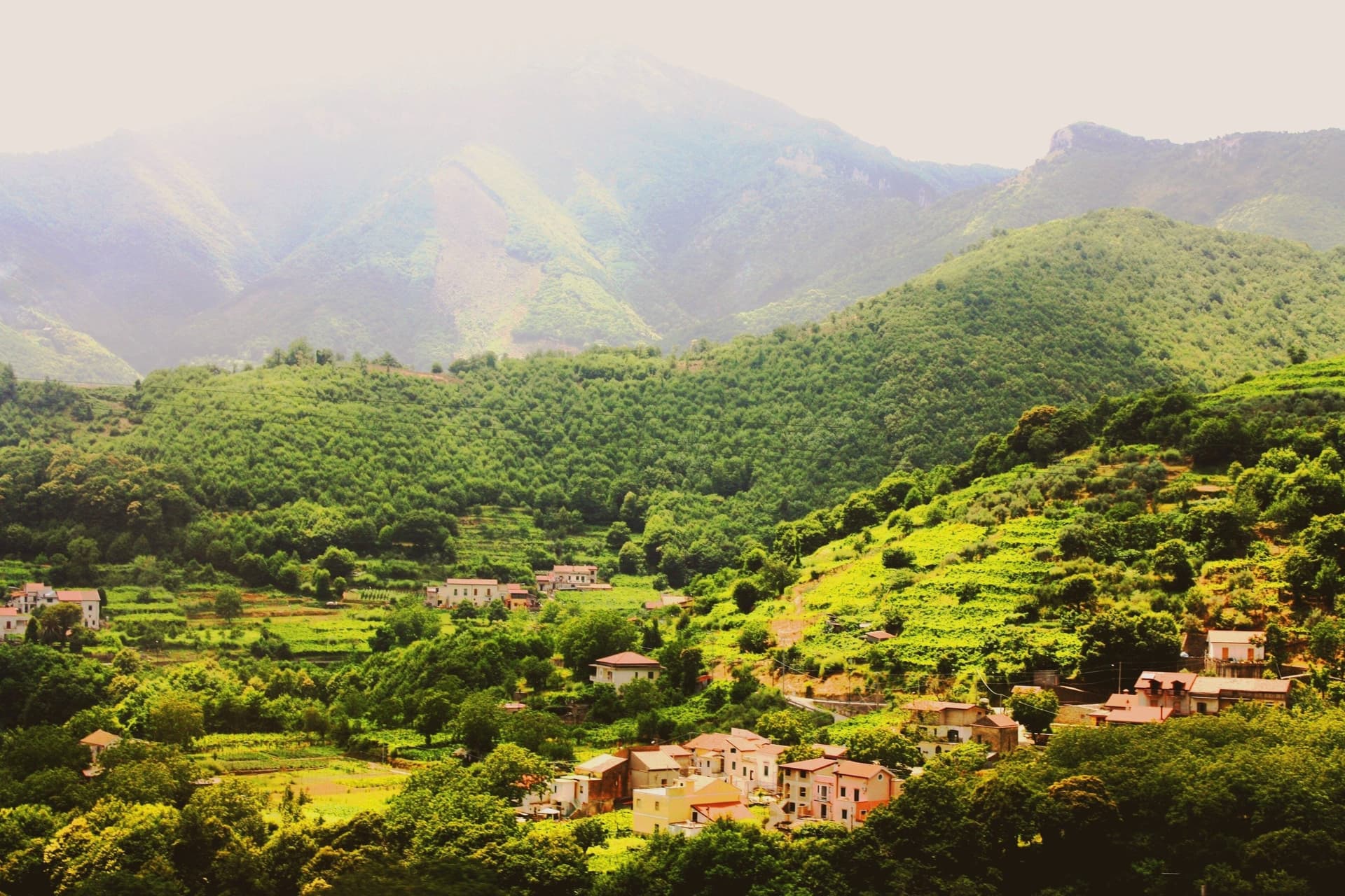
Tramonti is the Amalfi Coast that does not face the sea. The comune covers thirteen hamlets on the inland Lattari slopes above Maiori, with the seat of Polvica at 321 meters and the higher frazioni climbing past six hundred, each linked by old mule tracks rather than a single main street.
It was an important town of the Maritime Republic of Amalfi between 839 and around 1200, sitting on the inland side of the ridge that divides the coast from the Sorrento peninsula and, by way of the Valico di Chiunzi, from the Sarno valley beyond. Two exports carried the village name further than the village itself: fiordilatte mozzarella from the high pastures, and the long-fermented pizza dough that emigrants took north in the post-war years to found most of the historic pizzerias of Piedmont and Lombardy.
The slopes fall within the UNESCO Amalfi Coast site and the Monti Lattari Park, with chestnut forest and limoncello distilleries on every road. A comune this scattered, with its parishes on separate ridges and its produce known abroad before the place itself, reads less like one town than a federation of hamlets that happened to share a name.
What to see in Tramonti
- Convento di San Francesco. Fourteenth-century Franciscan convent at Polvica with cloister and a rare wooden Christ, founded by Beata Margherita Cigala in 1474.
- Costa d'Amalfi Tramonti DOC vineyards. Terraced parcels climbing the Lattari slopes at a pitch among the steepest viticultures in Italy, worked by hand where machinery cannot stand.
- Thirteen frazioni of Tramonti. Hamlets scattered up the ridges between 250 and 700 meters, each with its own parish and traditions, connected by old mule tracks.
How to get to Tramonti
Salerno is roughly 38 minutes away by road.
Our tip
May through September is the Amalfi calendar, with the inland Lattari side cooler than the coastal road and the vineyard work running into harvest in late September and October. July and August see day-trippers walking up from Maiori for cooler air and lunch; the road to Valico di Chiunzi takes the overflow from Ravello and Amalfi. The chestnut harvest falls in October and November and Pizza a Metro festivals happen in late summer.
Maiori
Why visit Maiori
Maiori sits at the mouth of the Reginna torrent between Minori and Cetara, the widest valley on the Amalfi Coast and the only flat ground on the strip. A wall of medieval houses rose up the gorge until the night of 26 October 1954, when a freak storm dropped 500 millimeters of rain on the Lattari ridge in twelve hours.
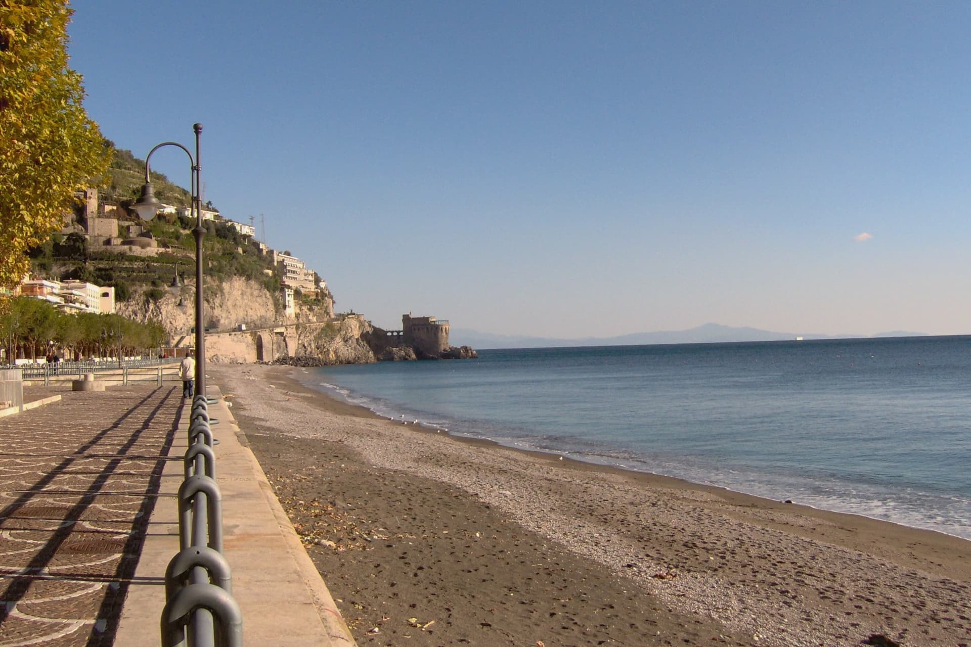
The torrent swept the centro storico, the lemon terraces and several streets into the sea, killing over 80 people. The town was rebuilt with a rare straight grid behind a kilometer-long beach of volcanic sand, the longest on the coast.
The Castello di San Nicola de Thoro-Plano sits on the ridge above, 11th-century walls part-ruined since the Anjou siege. The Collegiata di Santa Maria a Mare, 13th-century with a green and yellow majolica dome, survived the flood and looks out from the hill.
Roberto Rossellini shot Paisà, Voyage in Italy and Il Miracolo here in the late 1940s.
Oltremare have been named by a guide.
What to see in Maiori
- Collegiata di Santa Maria a Mare. Thirteenth-century parish church on the hill, three-aisle neoclassical interior with gilded coffered ceiling and green-and-yellow majolica dome.
- Castello di San Nicola de Thoro-Plano. Eleventh-century fortress in partial ruin on the ridge above town, with views over the Reginna valley and the coast east to Capo d'Orso.
- Spiaggia di Maiori. Kilometer-long beach of volcanic sand, the longest on the Amalfi Coast, replanted with palms behind the seawall after the 1954 flood.
How to get to Maiori
Salerno is roughly 22 minutes away by road.
Our tip
May, June, September and early October are the months Maiori is set up for. The long beach absorbs more visitors than the cove towns nearby, the SITA bus connects west to Amalfi and east to Salerno, and the Sentiero dei Limoni is open without the heat. July and August fill the kilometer of sand and push every restaurant on the lungomare to two evening shifts.
Vietri sul Mare
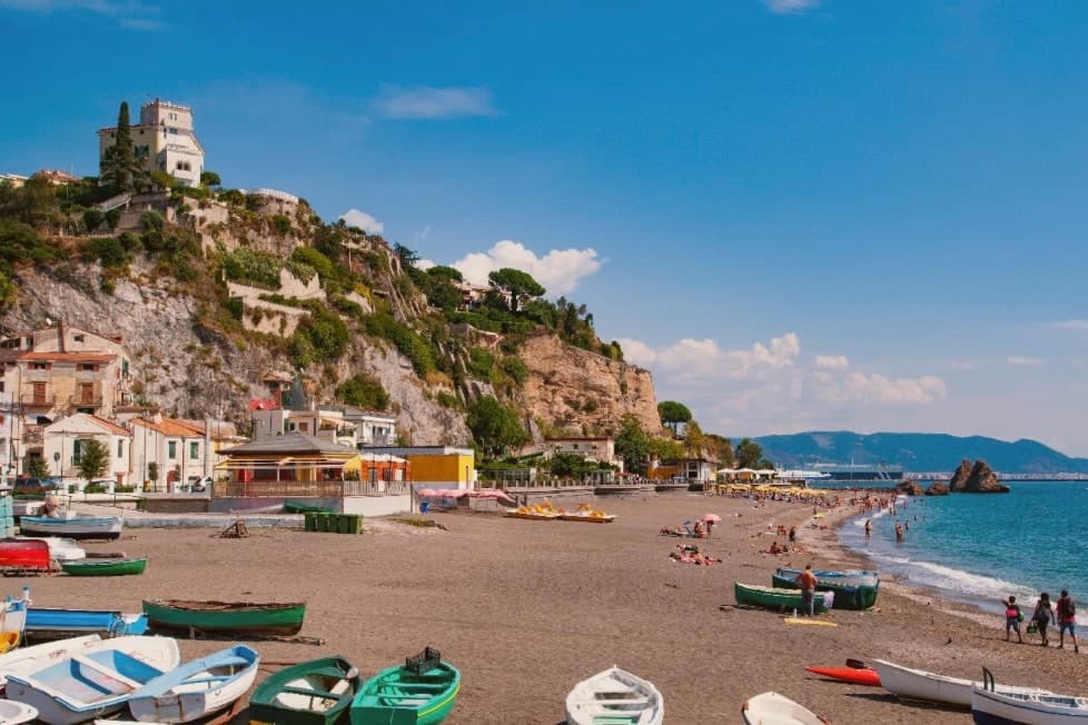
Why visit Vietri sul Mare
Vietri sul Mare sits at 80 meters at the eastern end of the Costiera Amalfitana, the most populous commune of the UNESCO-listed coastline, separated from the port of Salerno by a single harbour wall. The polychrome ceramics tradition is documented from the ninth century, with a generally agreed start around the fifteenth, and the industrial scale-up came in the 1920s and 1930s when a small group of German émigré artists settled in the workshops and brought the bestiary-and-floral pottery the town still produces.
The Chiesa di San Giovanni Battista, sixteenth century, has a green-and-yellow majolica dome that has become the town's signature image. Vietri is the only Amalfi Coast commune that holds Borghi più belli d'Italia and UNESCO together, and is a member of the Città della Ceramica network.
The marina at Marina di Vietri and the cliffside frazione of Raito and Albori sit below and above the centro on the same slope.
Volta del Fuenti by Michele De Blasio, Pascalò have been named by a guide.
What to see in Vietri sul Mare
- Chiesa di San Giovanni Battista. Sixteenth-century parish church with a green-and-yellow majolica dome and a bell tower of polychrome tiles, the most photographed image of the town.
- Museo Provinciale della Ceramica. Ceramic museum in Villa Guariglia at Raito, with Vietri pieces from the seventeenth century through the German-period 1920s and after.
- Albori. Cliffside frazione above the centro, also a Borgo più bello d'Italia, with stone houses, lanes, and views over the Gulf of Salerno.
How to get to Vietri sul Mare
There is a railway station in the town, so you can arrive without a car and never need one while you are here. Salerno is roughly 16 minutes away by road.
Our tip
May, June, September and early October are the strongest months. The water along the Marina di Vietri climbs past twenty degrees, the SS163 west to Cetara and Maiori runs without the gridlock of high summer, and the ceramic workshops keep their full hours. July and August are full: day-trippers arrive from Salerno on the local train and the Marina parking fills before mid-morning.
Piano di Sorrento
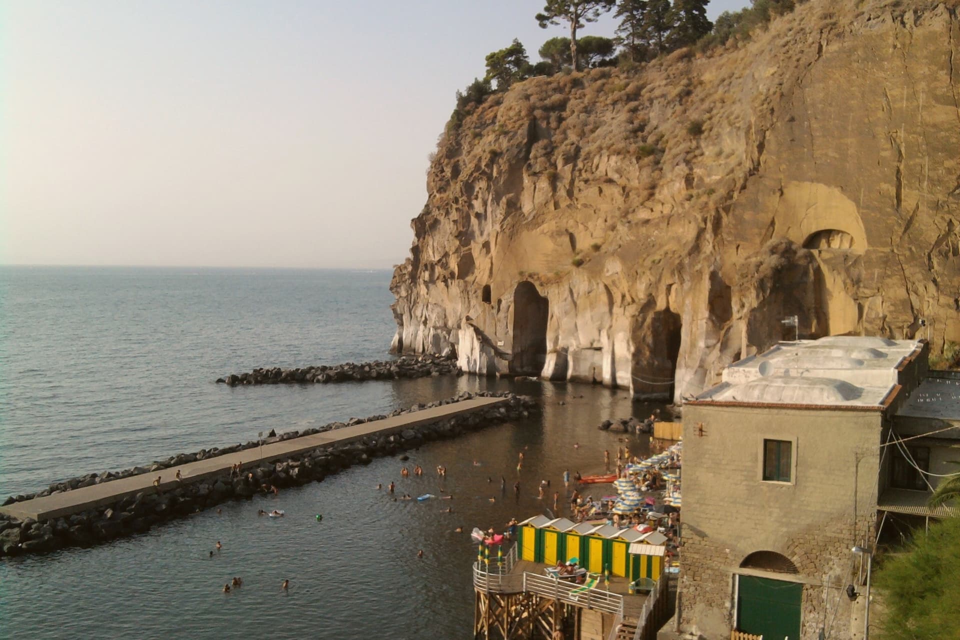
Why visit Piano di Sorrento
Piano di Sorrento sits at ninety-six meters on the tuff terrace of the Sorrentine peninsula, four kilometers east of Sorrento, thirty kilometers from Napoli. The upper plain has been inhabited since the second millennium BC: pottery and a necropolis from the Gaudo culture were excavated between the frazioni of Trinità and San Massimo.
The town was tied to Sorrento until 1808, when Joseph Bonaparte's reform separated it as an autonomous comune. The local name, Caruotto, comes from the Latin carottum, quarry, after the tuff pits that fed the building of the peninsula.
The Basilica di San Michele Arcangelo, ninth century in origin, was raised to papal basilica status by Benedict XV in 1914 and holds two large inlaid wooden doors. The Villa Fondi de Sangro, a neoclassical 1840 villa above the cliff, now houses the Georges Vallet archaeological museum and faces the Marina di Cassano below.
The marina has black volcanic sand, fishing boats and a small port that still works.
Le Tre Arcate have been named by a guide.
What to see in Piano di Sorrento
- Basilica di San Michele Arcangelo. Ninth-century church raised to papal basilica status in 1914 by Benedict XV, with large inlaid wooden doors and a baroque interior in the centro of Piano.
- Villa Fondi de Sangro. Neoclassical villa of 1840 above the cliff, now seat of the Museo Archeologico Georges Vallet, with finds from the Massa Lubrense and Sorrento peninsula excavations.
- Marina di Cassano. Small fishing port with black volcanic sand at the foot of the cliff, reached by a steep path from the upper town, still active for inshore fishing.
How to get to Piano di Sorrento
There is a railway station in the town, so you can arrive without a car and never need one while you are here. Napoli is roughly 49 minutes away by road.
Our tip
May through September is the working season for the Sorrentine peninsula, and Piano follows the same rhythm as Sorrento next door. June and September are the easiest months: warm sea, manageable crowds, full ferry schedules to Capri and Ischia. July and August are crowded with day-trippers; Marina di Cassano fills early and the upper town turns over to the lunch trade.
Sorrento
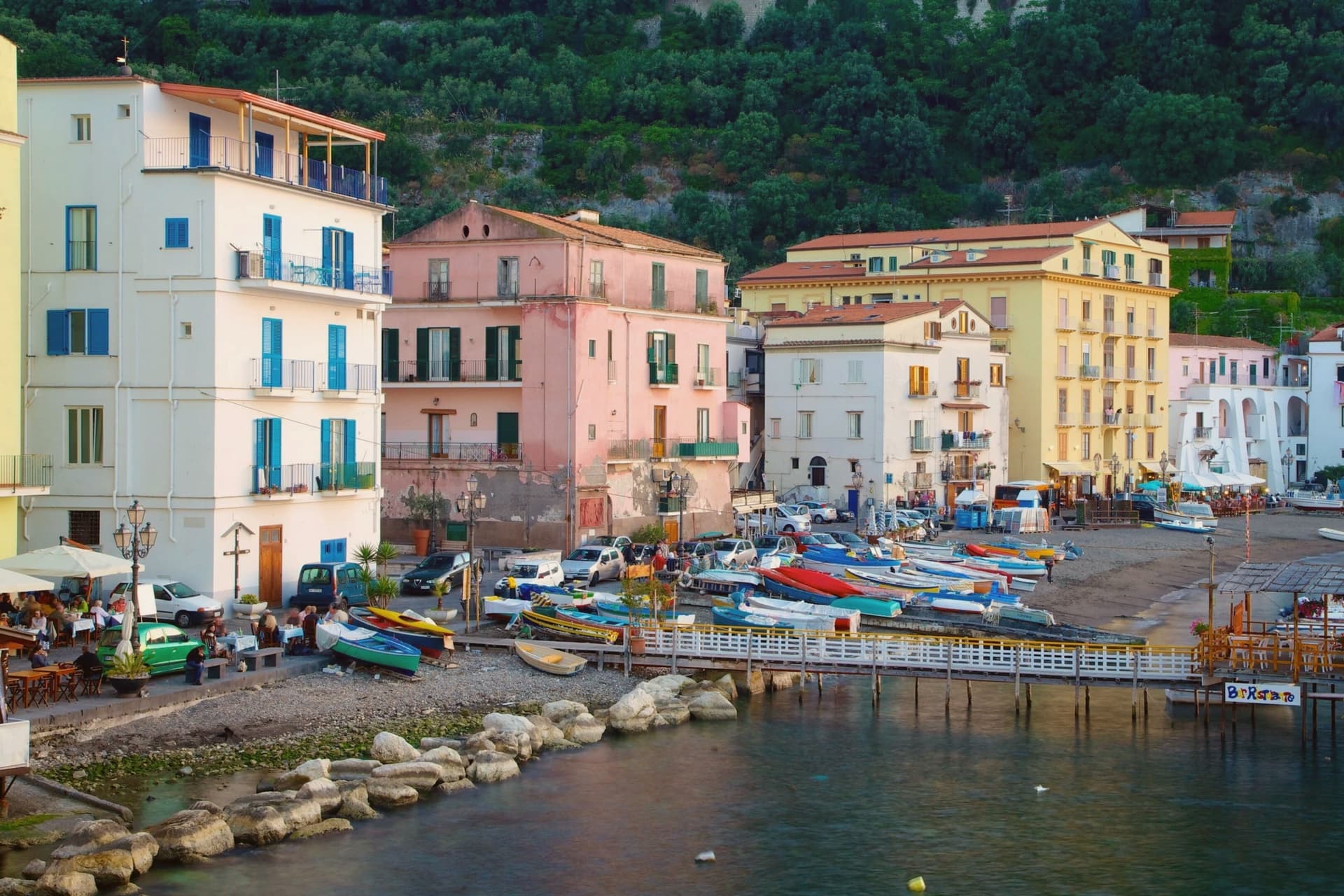
Why visit Sorrento
Sorrento sits on a block of tuff cliff fifty meters above the Bay of Napoli, thirty kilometers from the city by Circumvesuviana railway or ferry. The town began as a Greek foundation and became the Roman Surrentum, a resort favored by senators.
The current population is 15,407. The old town sits above, gathered around the Duomo and the cloister of San Francesco a few minutes apart, while Marina Grande lies below the cliff, reached through the ancient Greek gate, its harbor still working and its trattorie facing the bay.
Terraces of lemon groves ring the slopes above town, the same femminello sorrentino IGP fruit that supplies the limoncello sold through the centro storico. Piazza Tasso, at the head of the old town, is where Corso Italia begins and where the statue of Torquato Tasso stands; the poet was baptized in the cathedral below.
A cliff town facing the bay, its upper streets given to churches and squares, its lower shore to fishing and the harbor, and its surrounding slopes turned over entirely to the lemon that still funds much of what happens in between.
Ristorante O' Canonico 1898, Ristorante O' Parrucchiano, Terrazza Bosquet and 8 more have been named by a guide.
What to see in Sorrento
- Duomo di Sorrento. Eleventh-century cathedral rebuilt in Romanesque style in the fifteenth century, with a baroque interior and the baptistery where Torquato Tasso was christened.
- Chiostro di San Francesco. Fourteenth-century cloister of tuff arches and crossed columns, the marble façade redone in 1926, still used for civic weddings and chamber concerts.
- Museo Correale di Terranova. Decorative arts museum in a seventeenth-century villa opened in 1924, with Neapolitan porcelain, period furniture and seventeenth-century painting.
How to get to Sorrento
There is a railway station in the town, so you can arrive without a car and never need one while you are here. Napoli is roughly 57 minutes away by road.
Our tip
May, June, September and October are the months that work for Sorrento. The sea is warm enough to swim, the temperatures sit in the mid-twenties, and the centro storico is busy without being unworkable. July and August are crowded almost beyond use.
Vico Equense
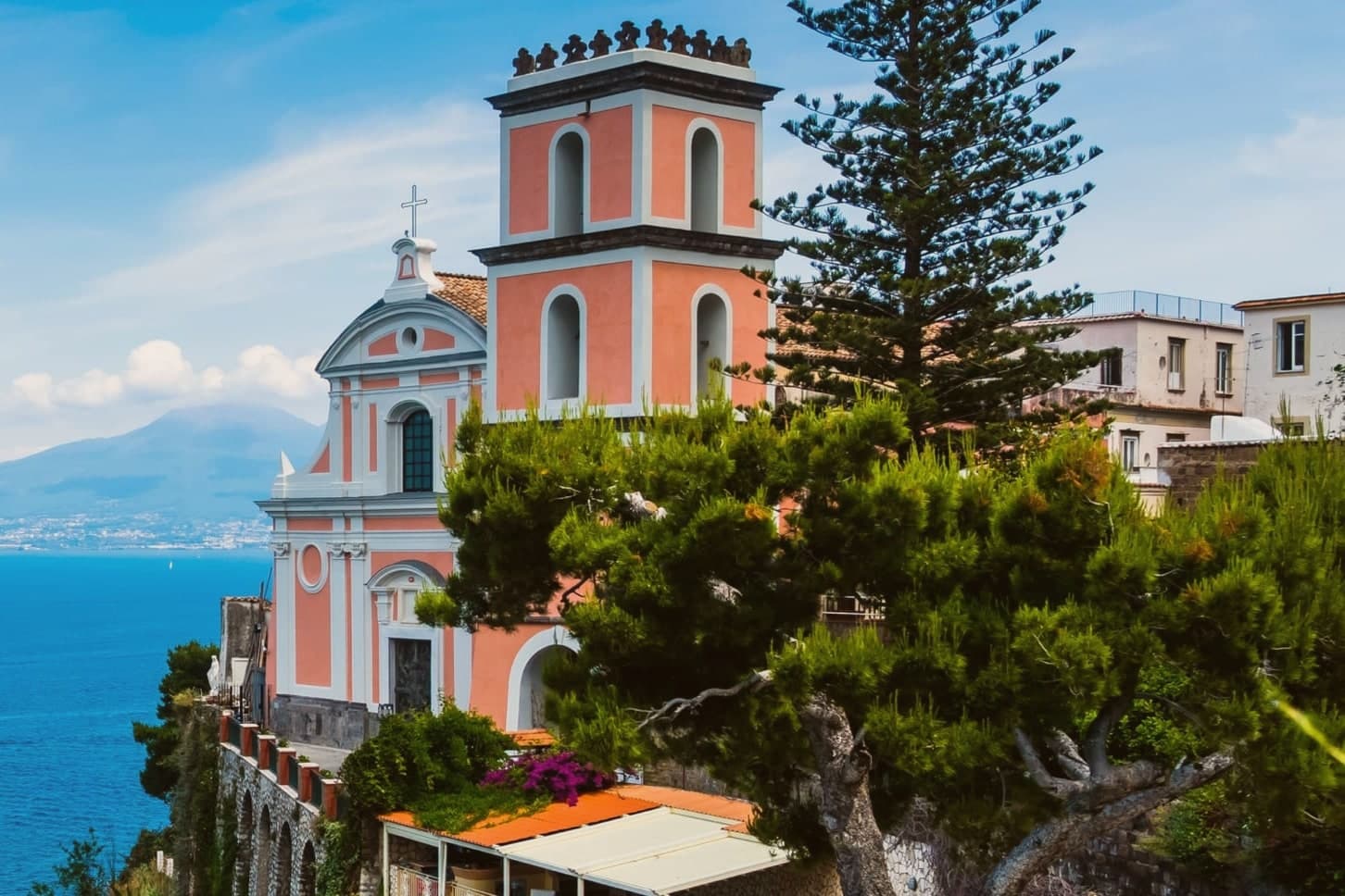
Why visit Vico Equense
Vico Equense sits on a block of tuff and limestone above the Bay of Napoli, twenty-five kilometers from the city and the first town on the Sorrento peninsula coming from the north. A seventh-century BC pre-Roman necropolis predates the Latin Aequana that Roman patricians built here for their villas, and the finds from that older settlement, funerary objects excavated in the 1960s and 1970s, sit now in a museum founded in 1966.
The medieval town that survives was walled by the Angevins after 1284, when Charles II ordered a fortress built on the cliff as both stronghold and residence, and the diocese's cathedral rose on a neighboring clifftop in the same century, before losing its status as a see in 1818. Behind the town, the limestone mass of the Lattari range closes off the land side, reached since 1952 by cable car from the coast at Castellammare.
Pizza by the meter, the town's best-known export, was invented here by Luigi Dell'Amura, called Gigino, in the 1930s, and his restaurant in the centro still serves it. What holds the town together is the sequence itself: a pre-Roman settlement, a Roman villa town, an Angevin fortress and a bishopric, and finally a twentieth-century dish, each layer built on a narrow shelf of rock between the mountain and the bay.
Torre del Saracino, Antica Osteria Nonna Rosa, Cannavacciuolo Countryside and 8 more have been named by a guide.
What to see in Vico Equense
- Chiesa dell'Annunziata. The church stands at the edge of the cliff, its Gothic interior at odds with the Baroque face it was given later. The old cathedral of a diocese that no longer has a seat here.
- Castello Giusso. Angevin castle built between 1284 and 1289 at the order of Charles II of Anjou, with a Renaissance residential wing and gardens above the bay.
- Antiquarium Silio Italico. Archaeological museum founded in 1966, with funerary objects from a seventh-century BC pre-Roman necropolis excavated in the 1960s and 1970s.
How to get to Vico Equense
There is a railway station in the town, so you can arrive without a car and never need one while you are here. Napoli is roughly 55 minutes away by road.
Our tip
May through September is the working season for Vico Equense. June and September are the best months: warm sea, fewer day-trippers than July and August, and the Monte Faito cable car operating on a full schedule. July and August are crowded and hot at sea level, though the Faito plateau stays cooler at around twenty-two degrees. Sagra del Riavulillo falls in the season.
Pompei
Why visit Pompei
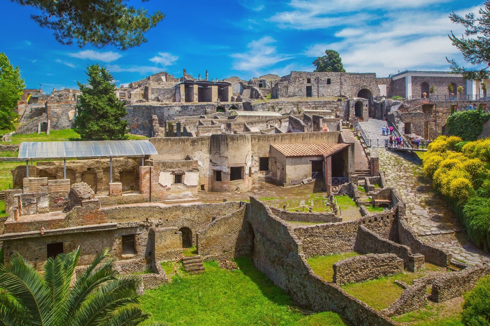
Pompei sits at 30 meters on a volcanic plateau on the south slope of Vesuvius, twenty kilometers from Naples and a hundred meters from where the Sarno meets the sea. The Roman city was buried under five to six meters of ash and lapilli when the volcano erupted on 24 October 79 AD, killing the part of the population that had not already left.
Excavations began in 1748 under the Bourbons and have never stopped; the site has been UNESCO-listed since 1997 alongside Herculaneum and Torre Annunziata, and is the third most visited archaeological site in the world. Modern Pompei was founded in 1881 by the lawyer Bartolo Longo, who built the Santuario della Beata Vergine del Rosario as a center for pilgrimage and social work.
The basilica with its 80-meter campanile and the surrounding grid of streets are entirely a creation of the 1880s, separate from the dig and laid over fields that had been farmland until then.
President, Cosmo Restaurant, Capasanta and 1 more have been named by a guide.
What to see in Pompei
- Parco Archeologico di Pompei. The Roman city buried in 79 AD and excavated since 1748, UNESCO-listed since 1997, with the Forum, the Villa dei Misteri and the Lupanare.
- Santuario della Beata Vergine del Rosario. Pontifical basilica built between 1876 and 1891 by the lawyer Bartolo Longo, the heart of modern Pompei and a pilgrimage site of four million a year.
- Casa del Fauno. Roman patrician house in the dig with a bronze faun at its center and the Alexander Mosaic floor depicting Issus, now in the Naples museum.
How to get to Pompei
There is a railway station in the town, so you can arrive without a car and never need one while you are here. Napoli is roughly 24 minutes away by road.
Our tip
May, June, September and early October are the strongest months for Pompei. The dig opens at nine and the Forum stays walkable before midday heat sets in. July and August are punishing: the site sits on volcanic plateau at thirty meters with no shade in the main streets, and afternoon temperatures cross thirty-five degrees.
Nola
Why visit Nola
Nola sits at 34 meters on the plain between Vesuvius and the Apennines, twenty kilometers east of Napoli. It was an Oscan and Samnite town before Rome, and the place where Augustus died in AD 14, in the same house his father had died in.
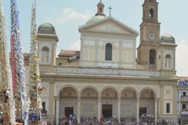
Giordano Bruno was born here in 1548, the Nolano who called his philosophy nolana before he was burned at the Campo de' Fiori in 1600. The town is best known today for the Festa dei Gigli, a UNESCO Intangible Heritage celebration on the Sunday before June 22 in which eight twenty-five-meter wooden obelisks, each weighing over a ton, are carried through the streets by teams of one hundred bearers.
The festival honors Paolino di Nola, the fifth-century bishop whose return from captivity in North Africa it commemorates. Outside the festival, Nola is a working town of warehouses and commerce.
Re Santi e Leoni, Le Baccanti, Rear Restaurant and 2 more have been named by a guide.
What to see in Nola
- Cattedrale di Nola. Cathedral of the Assunta and San Paolino, twentieth-century rebuilt after fire, with relics of the patron bishop who returned from Africa.
- Festa dei Gigli. UNESCO Intangible Heritage festival in June: eight 25-meter wooden obelisks carried through the streets by teams of one hundred bearers.
- Anfiteatro Romano di Nola. Roman amphitheater excavated on the southern edge of town, where Augustus was honored with funeral games in AD 14.
How to get to Nola
There is a railway station in the town, so you can arrive without a car and never need one while you are here. Napoli is roughly 28 minutes away by road.
Our tip
April through June covers the green months and culminates in the Festa dei Gigli on the Sunday before June 22, the one weekend when Nola fills with hundreds of thousands of visitors. September and October are warm and quieter, with the wine and hazelnut harvests in nearby Irpinia bringing activity to the markets. July and August are hot and humid on the plain.
More from Anywhere Italy
- The best coastal towns within an hour of Naples
- The best towns known for what they grow within 45 minutes of Salerno
- The best towns with a World Heritage site within an hour of Naples
- The 9 best towns you can reach by train in the province of Napoli
 The best towns with a serious restaurant that you can reach by train in Campania
- The prettiest villages that eat well in Campania