
The prettiest villages you can reach by train within 90 minutes of Udine
Friuli Venezia Giulia sits where the Alps drop onto a gravel plain, and the villages between the two are built from pale river stone and Istrian limestone, with terracotta roofs and porticoes that hold the shade through a humid August. This is Friulano and Ribolla Gialla country, and the tables serve frico, cjarsons, boiled meats and San Daniele ham cut by hand. Autumn is the season most worth planning around, when the vineyards colour and the mountain air comes down the Tagliamento valley. The regional trains out of Udine are slow, cheap and frequent, which makes the whole plain reachable without hiring anything.
People arriving in the region mostly point themselves at Trieste, with its Habsburg squares and coffee houses on the Adriatic, or spend the day in Venice a couple of hours down the line. Both are worth the time and both are busy, particularly in summer when the cruise traffic and the coastal resorts of Grado and Lignano fill every seat and every terrace. Udine itself absorbs the rest, its Tiepolo ceilings and Piazza Libertà doing steady trade.
The same railway keeps going, though, and the villages along it are quieter for no better reason than that fewer people get off. Star-shaped fortress towns, an abbey with Lombard frescoes, a walled Venetian outpost on the Isonzo, a stone village rebuilt after an earthquake using its own numbered fragments. These are the ones on this list, all of them recognised nationally for how they look, and all of them reachable on a ticket from Udine station.
Of the 20 communes we have mapped within 90 minutes of Udine, 6 qualify as prettiest villages you can reach by train: each has passed the national assessment of Italy's most beautiful villages, and we have confirmed each is reachable without a car. The smallest, Venzone, has 1,939 residents.
Elsewhere in the catalogue: The best hidden towns you can reach by train in Friuli-Venezia Giulia and The 6 best towns you can reach by train in the province of Udine.
Venzone
Why visit Venzone
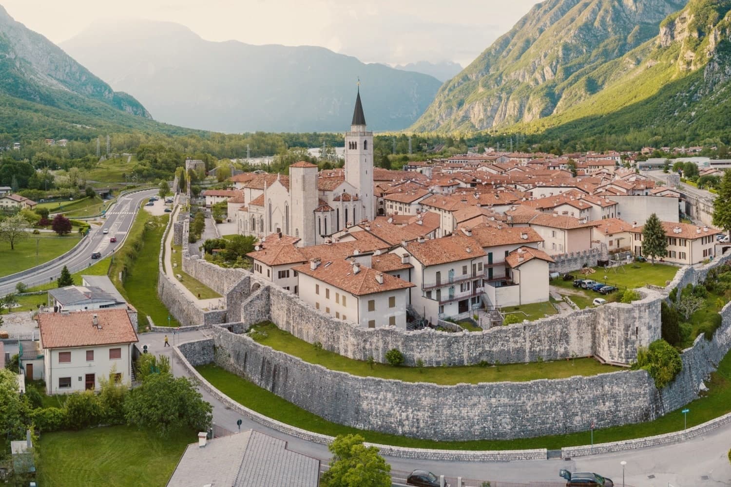
Venzone sits at 230 meters in the upper Tagliamento valley, ninety kilometers northwest of Trieste. The hexagonal walls, double-built and eight meters high, were started in 1258 by Glizoio of Mels and circled by a moat and fifteen towers.
The town survived intact into the twentieth century, the best-preserved walled town in Friuli. On 6 May 1976 the Friuli earthquake leveled it: forty-seven residents died, the duomo collapsed, almost every house came down.
The reconstruction took the rare path of anastilosis, recovering each fallen stone and putting it back where it had been. The Duomo di Sant'Andrea Apostolo, erected in 1308, was reassembled by 1990.
In the crypt of the San Michele Chapel are five of the mummies of Venzone, naturally preserved corpses found from the 1600s onward, their preservation still unexplained. The town was voted Borgo dei Borghi 2017 by the RAI program Kilimangiaro.
We confirmed you can reach this one by train.
What to see in Venzone
- Duomo di Sant'Andrea Apostolo. Cathedral built in 1308, destroyed by the 1976 earthquake and reassembled stone by stone by 1990 using the original blocks.
- Cinta muraria. Hexagonal double walls eight meters high, started in 1258 by Glizoio of Mels, surrounded by moat and fifteen defensive towers.
- Mummie di Venzone. Five naturally mummified bodies preserved in the crypt of the San Michele Chapel, found from the 1600s onward, cause of preservation still unknown.
How to get to Venzone
There is a railway station in the town, so you can arrive without a car and never need one while you are here. Udine is roughly 41 minutes away by road.
Our tip
May through October is the window when the Tagliamento valley is reliably warm and the walls show best against green slopes; winter brings cold air sinking off the Carnic Alps and shortened hours at the duomo and mummy crypt. The Festa della Zucca in late October stages the centro storico as a medieval village and draws crowds from across Friuli. July and August can be hot at midday; the valley cools sharply after sundown.
Palmanova
Why visit Palmanova
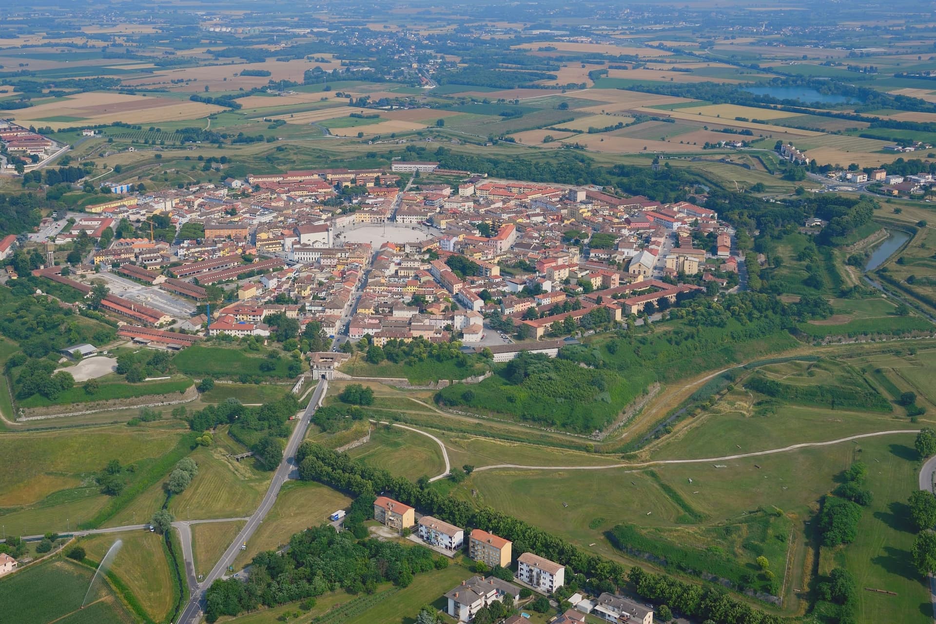
Palmanova stands at 26 meters on the Friuli plain, between Udine and the Adriatic, on ground that in 1593 was open country twenty kilometers from the Habsburg border. The Venetian Republic chose the feast of Santa Giustina to found it, and built the geometry on Marcantonio Barbaro's design: nine points radiating from a six-sided center, three ring streets running concentric to the walls, ramparts angled so each point covers the one beside it.
The town has no separate old and new quarter, no upper and lower half. It is one plan, laid down whole and then filled in slowly: the piazza paved in 1602, the first ring of bastions closed in 1623, the second between 1658 and 1690, the third under a different army entirely between 1806 and 1813.
Venice began the design, an emperor finished it, and the interval between the two is longer than most towns take to form by accident. The city never had to defend itself in earnest.
What was built as a machine for war became, over three centuries and two occupations, simply a shape. Everything the town now shows a visitor, the star, the gates, the ring roads, is the residue of a defense that was never used.
We confirmed you can reach this one by train.
What to see in Palmanova
- Piazza Grande. Hexagonal square laid out in 1602, six sides facing six radiating streets, ringed by the Duomo Dogale, the Loggia della Gran Guardia, and six bronze statues of the founding Provveditori.
- Duomo Dogale. Commissioned 1603, finished 1636, attributed to Scamozzi and Longhena. Baroque facade fronting a single Venetian nave, standing at the piazza's edge.
- Cinta muraria. The rings can still be walked in sequence: the 1623 line, the 1690 line, and the outer 1813 line, each built to a different generation of cannon range.
How to get to Palmanova
There is a railway station in the town, so you can arrive without a car and never need one while you are here. Udine is roughly 29 minutes away by road.
Our tip
April through June and September into October are the months Palmanova rewards. The fortress walls and the glacis around them are walkable in the cool, the Piazza Grande sits in shade by mid-afternoon, and the historical reenactment A.D. 1615 fills the centro in early September with Venetian-era costume drills. July and August push past thirty-three degrees on the open plain and the hexagonal piazza, fully exposed, becomes one of the hotter squares in the region between noon and four. Palmanova torna al 1615 falls in the season.
Sesto al Reghena
Why visit Sesto al Reghena
Sesto al Reghena sits at 13 meters on the Friuli-Venetian plain, between the Tagliamento and the Reghena, a small river bordered by linden trees that runs through the centro. The name records the sixth Roman mile out of Concordia Sagittaria on the road to Iulia Augusta.
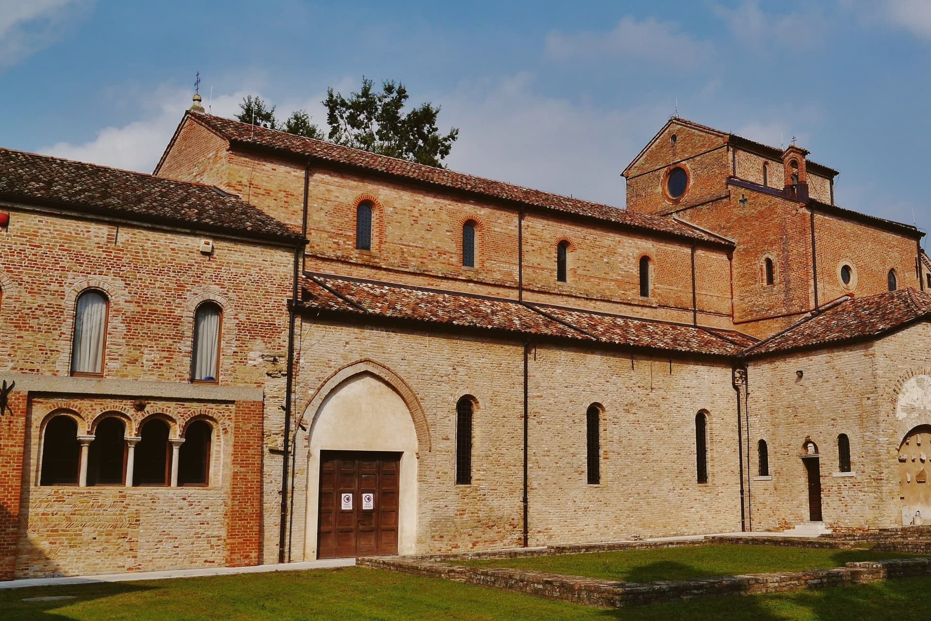
The town is one place: the Abbazia di Santa Maria in Sylvis, founded by the Lombard nobles Erfo, Marco, and Anto between 730 and 735, occupied by Benedictines until 762, sacked by a Magyar raid in 899, and refortified with walls and a moat in the tenth century. The abbey crypt is supported by twenty columns, several of them Roman spolia.
At the center stands the Urn of St. Anastasia, a single block of Greek marble carved by Cividale masters in the eighth century, with rose, cross, and arched motifs.
The abbey complex is the current town hall, the only commune in Italy headquartered inside a fortified Benedictine monastery. In Friulian, the village is called Siest.
We confirmed you can reach this one by train.
What to see in Sesto al Reghena
- Abbazia di Santa Maria in Sylvis. Eighth-century Benedictine abbey, refortified after the 899 Magyar sack, with a crypt of twenty columns and Carolingian-era frescoes; now the town hall.
- Urna di Sant'Anastasia. Single block of Greek marble in the abbey crypt, carved by Cividale masters in the eighth century with roses, crosses, arches, and rosettes.
- Torre Grimani. Surviving gate-tower of the medieval abbey defenses, named for the Venetian commendatory abbots who held the monastery in the sixteenth century.
How to get to Sesto al Reghena
There is a railway station in the town, so you can arrive without a car and never need one while you are here. Udine is roughly 53 minutes away by road.
Our tip
April through June and September into October are the months Sesto reads best. The Reghena banks are walkable, the abbey courtyard catches afternoon sun, and the Lison-Pramaggiore vineyards south of town are in their working seasons. July and August push past thirty-three degrees with the heavy humidity of the lower Friulian plain, and the abbey's crypt becomes the coolest room in the comune.
Gradisca d'Isonzo
Why visit Gradisca d'Isonzo
Gradisca d'Isonzo sits at 32 meters on the right bank of the Isonzo, ten kilometers downriver from Gorizia. The Venetian Republic built it from scratch starting in 1479 as a frontier bastion against Ottoman raids that had reached Friuli the previous decade.
The fortification consumed twenty years and the advice of Leonardo da Vinci, sent here by the Senate in 1500 to redesign the artillery defenses. The result was a walled town twenty meters high, ringed by seven towers and a wide moat, with the river itself diverted into the defenses.
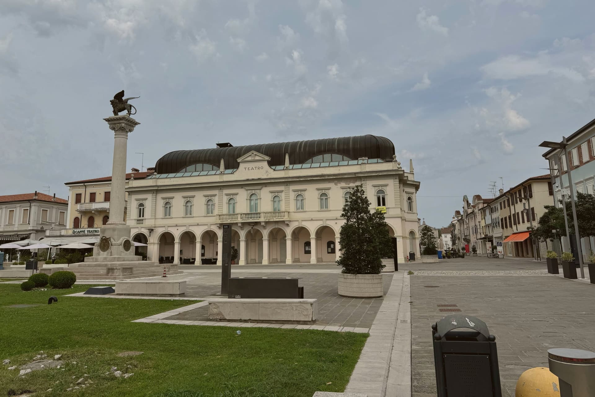
Maximilian I took it for the Habsburgs in 1511 during the War of the League of Cambrai, and it stayed in Austrian hands as the seat of the Principesca Contea di Gorizia e Gradisca for the next four centuries. The town that grew inside the walls is Baroque: the Palazzo Torriani, the Loggia dei Mercanti, the Casa de Fin, all built under the Habsburgs.
Casanova passed through in 1773. Today the walls, towers, and grid still hold.
We confirmed you can reach this one by train.
What to see in Gradisca d'Isonzo
- Fortezza Veneziana. Walled town from 1479, twenty meters high, ringed by seven towers and a wide moat, designed in part by Leonardo da Vinci in 1500.
- Torre di San Giorgio. Northwest bastion tower of the Venetian wall, the most complete of the seven and the symbol of the borgo.
- Palazzo Torriani. Sixteenth-century palazzo of the Della Torre family, later the residence of the Austrian Capitano, now the Town Hall on Via Roma.
How to get to Gradisca d'Isonzo
There is a railway station in the town, so you can arrive without a car and never need one while you are here. Udine is roughly 34 minutes away by road.
Our tip
April through June and September into October are the best months for Gradisca. The Isonzo runs blue-green from the Julian Alps snowmelt, the cycle path along the river opens, and the Saturday market fills the Spianata. July and August bring the heat the Friuli plain is known for, often above thirty-three degrees with high humidity, and the centro storico empties from two until six.
Cividale del Friuli
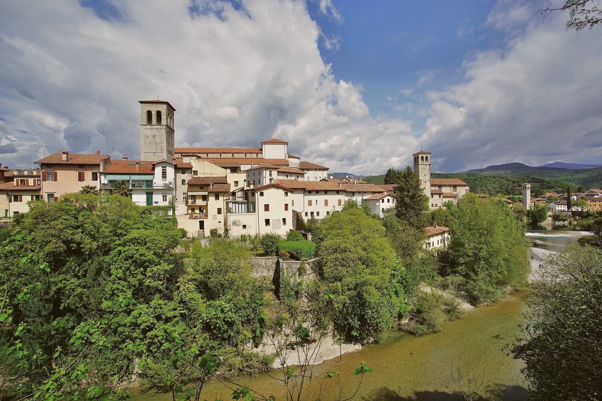
Why visit Cividale del Friuli
Cividale del Friuli sits at 138 meters on the right bank of the Natisone, fifteen kilometers from Udine and close enough to the Slovenian border that the river marks it. Julius Caesar founded the place as Forum Iulii in the first century BC, the name that eventually gave Friuli its own.
In 568 the Lombard king Alboin made it the capital of his first Italian duchy, and the Patriarchate of Aquileia later moved its seat here for four centuries. The Tempietto Longobardo, an eighth-century palatine chapel, holds six stucco female saints carved around 760, the best-preserved sculpture of the Lombard age in Europe.
It is one of seven sites in the UNESCO serial nomination Longobardi in Italia. The Ponte del Diavolo, begun in 1442, spans the Natisone gorge in two asymmetrical arches.
The Palio di San Donato fills the streets in late August, and Mittelfest brings Central European theater and music to the piazzas every July.
We confirmed you can reach this one by train.
What to see in Cividale del Friuli
- Tempietto Longobardo. Eighth-century palatine chapel in the Monastero di Santa Maria in Valle, with six stucco female saints in high relief, UNESCO-listed since 2011.
- Ponte del Diavolo. Stone bridge over the Natisone gorge, begun in 1442 on two asymmetrical arches resting on a central rock outcrop.
- Duomo di Santa Maria Assunta. Fifteenth-century cathedral with the Pala di Pellegrino II, a twelfth-century gilded silver altarpiece, and an attached Museo Cristiano.
How to get to Cividale del Friuli
There is a railway station in the town, so you can arrive without a car and never need one while you are here. Udine is roughly 26 minutes away by road.
Our tip
April through June and September into October are the months when the Natisone valley shows best, with green hills, mild evenings, and the Slovenian border country open for walking. July brings Mittelfest and August the Palio di San Donato, so the centro storico fills with theater crowds and historical pageant. Both months can push past thirty degrees, though 138 meters of elevation and the river keep nights cooler than the Friulian plain. Palio di San Donato falls in August.
Cervignano del Friuli
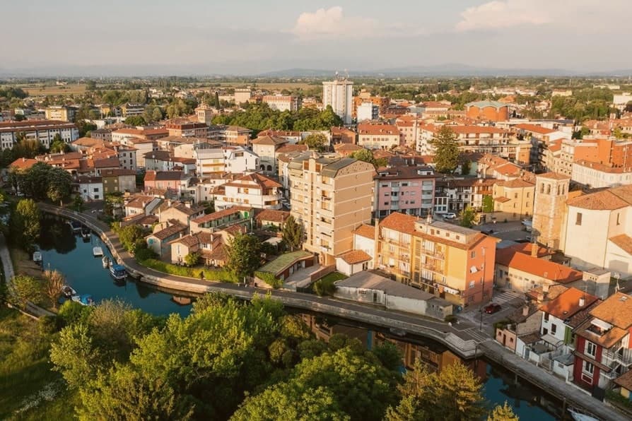
Why visit Cervignano del Friuli
Cervignano del Friuli sits at five meters on the lower Friuli plain, eight kilometers north of Aquileia and forty from Trieste. The town's origin is tied to Aquileia's founding in 181 BC: the Ausa, a short river that rises in karst springs and reaches the lagoon, served as a service port for the Roman colony, and the anchor in the comune's coat of arms still records that function.
The eleventh-century abbey dedicated to San Michele Arcangelo placed the village under the monastery of Aquileia. Venice took it in 1420, the Habsburgs retook it in 1521 with the Treaty of Worms, and it remained Austrian until World War I.
The railway to Trieste opened in 1860 and the station became one of the principal stops on the Vienna-Trieste line, which is why Cervignano grew faster than the older centers around it. Today, with 13,573 residents, it is the largest commune of the Bassa and the administrative anchor between Palmanova, Aquileia, and Grado.
We confirmed you can reach this one by train.
What to see in Cervignano del Friuli
- Duomo dei Santi Michele e Adalberto. Modern cathedral consecrated in 1964 on the site of the medieval abbey church, dedicated to the archangel and to the missionary saint of Prague.
- Chiesa di San Michele Arcangelo. 1780 parish church on the former Benedictine abbey footprint, with a single nave and a Baroque altar from the eighteenth century.
- Fiume Ausa. Short spring-fed river running through the centro, the historic inland port that linked Cervignano to Aquileia and the Adriatic in Roman times.
How to get to Cervignano del Friuli
There is a railway station in the town, so you can arrive without a car and never need one while you are here. Udine is roughly 31 minutes away by road.
Our tip
April through June is the right window in Cervignano. The plain is green, the cycle path along the Ausa runs all the way to Grado, and the temperature still leaves the centro walkable at three in the afternoon. July and August push into thirty-three degrees with high humidity coming off the lagoon; the centro empties between two and six.
More from Anywhere Italy
- The best hidden towns you can reach by train in Friuli-Venezia Giulia
- The 6 best towns you can reach by train in the province of Udine
 The best hidden wine towns you can reach by train within 90 minutes of Udine
 The prettiest villages in the province of Udine
- The best wine towns in Friuli-Venezia Giulia
- The best towns you can reach by train within an hour of Trieste