
The prettiest villages with a serious restaurant in Liguria
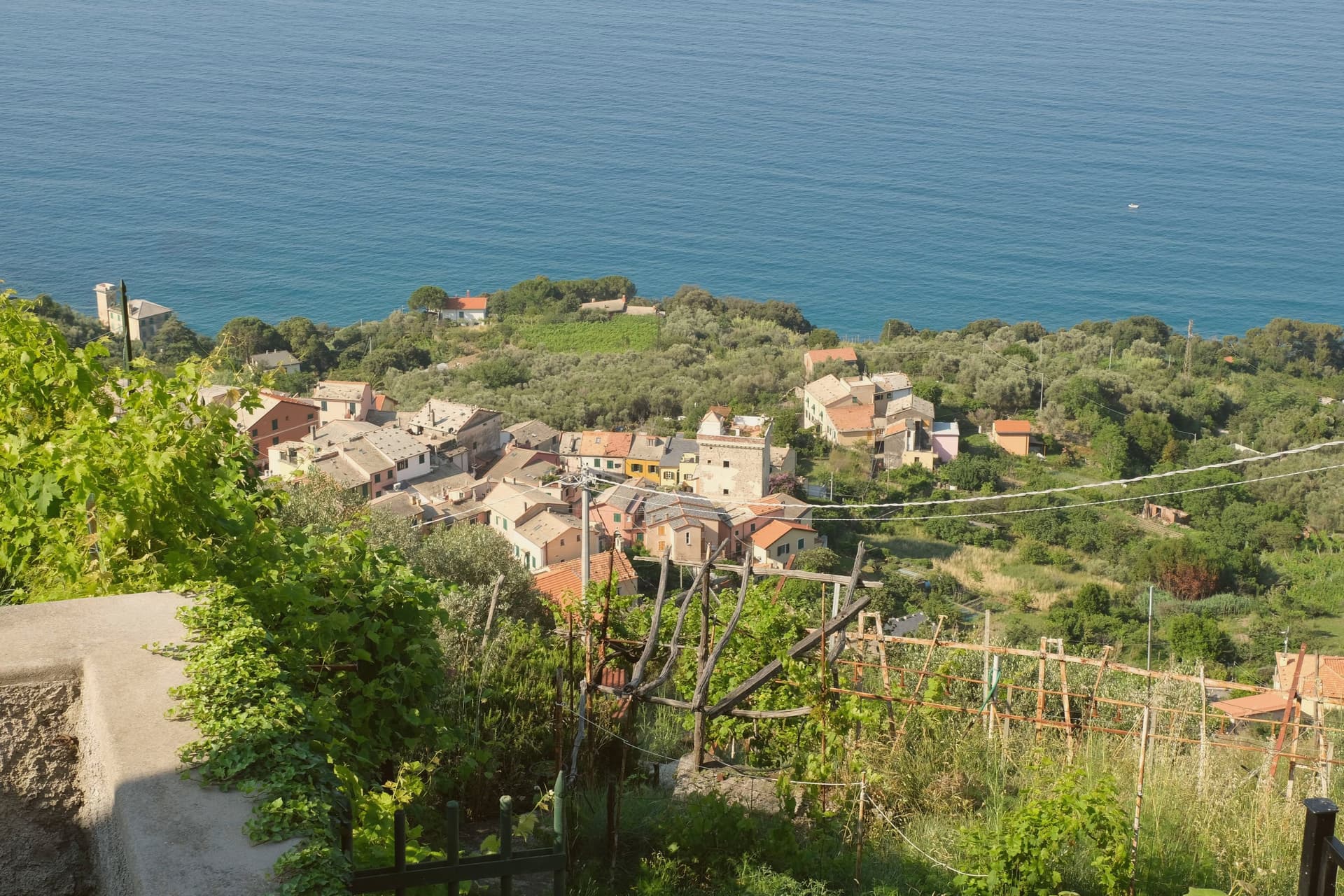
Liguria is a thin strip of rock, vines and olives pressed between the Apennines and the sea, and its villages are built accordingly: tall, narrow houses in ochre and rose, slate lintels, stairs instead of streets, laundry over an alley barely wide enough for a scooter. The cooking follows the same logic of scarcity, herbs from the hillside, anchovies and sardines from the boats, chickpea flour, basil pounded with pine nuts and pecorino into pesto that tastes of the specific hill it grew on. Spring brings wild greens into the pansotti and the walnut sauce that goes over them; autumn brings mushrooms down from the interior and the last of the Vermentino and Pigato harvest. It is a coast where a village of a few hundred people can hold a kitchen serious enough to justify the drive down from the motorway.
The Cinque Terre absorbs most of the attention and most of the visitors, five villages on a stretch of cliff reachable by a single railway line and walking path, photographed constantly, full from Easter until October. The appeal is real, the colours are real, and so are the queues at the station and the fixed-price fried fish in paper cones. Portofino and its harbour do the same job further west, at a higher price.
The same coast, the same slate and stucco, the same pesto and anchovies carry on in both directions and inland up the river valleys, and that is where these villages sit. Some are on the water with a beach and a fishing quay, some are up behind it among olive terraces and stone bridges. Each has been through the national assessment of Italy's most beautiful villages, and each has a restaurant that the most demanding guide in Italy has thought worth naming. Fewer people make the detour, which is largely a matter of the train not stopping there.
Of the 54 communes we have mapped in Liguria, 10 qualify as prettiest villages with a serious restaurant: each has passed the national assessment of Italy's most beautiful villages, and each holds a restaurant listed by the most demanding of the guides. The smallest, Framura, has 577 residents.
Two more lists worth reading alongside this one: The prettiest small villages that eat well in Liguria and The best small coastal towns with a serious restaurant in Liguria.
Framura
Why visit Framura
Framura is not one village but five: Anzo on the water, Setta and Ravecca on the slope, Costa above them, and Castagnola at roughly 300 meters with views back down to the coast. The commune spans from the rocky shoreline to 845 meters inland on the ridge that separates the Cinque Terre coast from the Vara valley.
Byzantine settlers built the original circular watchtowers here against Saracen raids, three of them still standing on the coast and inland. The hamlets remained agricultural until the Genova-La Spezia railway tunneled through in the late nineteenth century, opening the commune to summer visitors.
The seafront below Anzo, reached by a converted railway tunnel turned cycle path, carries the Bandiera Blu, and the same path runs north toward Bonassola and Levanto. Framura is the quiet outlier on this coast: the closest Borghi più belli village to Monterosso al Mare without being in the Cinque Terre national park.
L'Agave have been named by a guide.
What to see in Framura
- Torri bizantine. Three surviving Byzantine watchtowers on the coast and ridge, built to defend the village from Saracen incursions.
- Castagnola. Highest of the five hamlets at around 300 meters, with views over the lower frazioni and the Riviera di Levante.
- Anzo waterfront. Coastal hamlet at sea level with the Bandiera Blu beach access, the lowest of Framura's five settlements.
How to get to Framura
There is a railway station in the town, so you can arrive without a car and never need one while you are here. Genova is roughly 59 minutes away by road.
Our tip
April through October fits Framura, with the cycle path open and the coast walkable in any direction. May, June and September are the best for combining sea and hiking; mid-summer brings the strongest beach traffic but the upper hamlets stay calm. The Bandiera Blu beachfront below Anzo is small and fills early on August weekends.
Badalucco
Why visit Badalucco
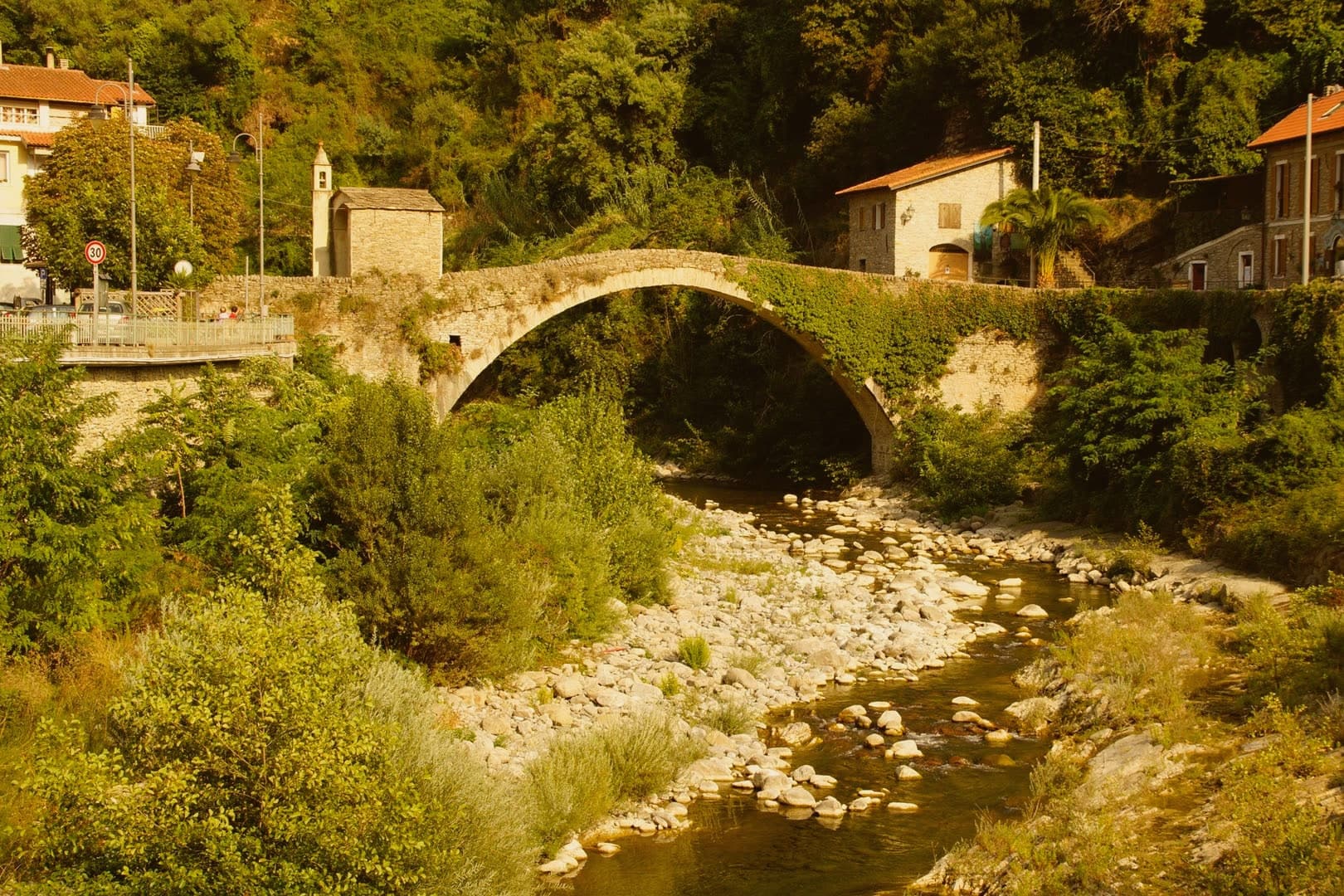
Badalucco sits at 179 meters in the middle Valle Argentina, fifteen kilometers north of Imperia. The torrent that gives the valley its name runs in a wide bend below the village.
The site changed hands between Ligures and Rome in 181 BC, became a fief of the Counts of Ventimiglia, and passed to the Republic of Genova in 1259. The seventeenth century rebuilt the parish Chiesa di Santa Maria Assunta e San Giorgio in full Baroque, with a square bell tower and a fifteenth-century polyptych attributed to Giovanni Canavesio.
The caruggi of stone houses are painted with contemporary murals and trompe-l'oeil, a more recent layer over the medieval shell. The Rundin bean, an indigenous variety grown on the terraces, is a Slow Food Presidium.
Stoccafisso alla badalucchese, stockfish stewed in tomato and olives, is the dish: the third Sunday of September brings the Stockfish Festival to the square.
Umami, Cian de Bià have been named by a guide.
What to see in Badalucco
- Chiesa di Santa Maria Assunta e San Giorgio. Seventeenth-century Baroque parish church with a square bell tower, holding a fifteenth-century polyptych attributed to Giovanni Canavesio and a seventeenth-century wooden crucifix.
- Chiesa di San Niccolò. Hilltop church above the old village, on the site of a former noble castle that served as a lookout over the valley.
- Ponte sull'Argentina. Stone bridge across the torrent that wraps the village, connecting the centro storico to the valley road.
How to get to Badalucco
Genova is roughly 122 minutes away by road.
Our tip
April through June and September into October are the dry months in the Argentina Valley. The terraces above the village hold olive groves, the Rundin bean, and pockets of grapevine. July and August push into the low thirties, but the valley keeps a few degrees cooler than the coast. Festival dello Stoccafisso falls in September.
Laigueglia
Why visit Laigueglia
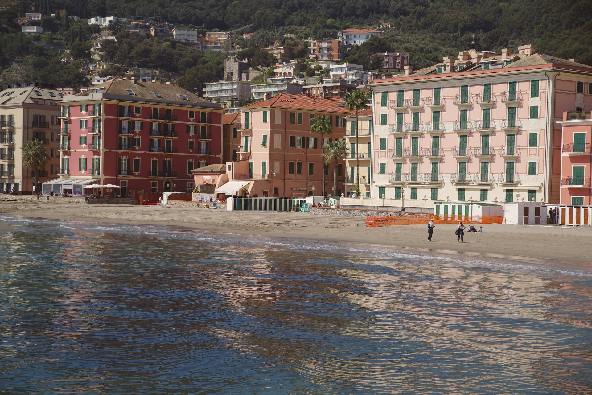
Laigueglia sits at six meters on the Riviera di Ponente, sheltered between the two headlands that frame the bay. The name comes from Aquilia, a reference to the Roman eagle standards, and the village grew from a settlement of fishermen who came over from neighboring Andora.
Genoa bought the borough in 1609. Through the seventeenth century the economy ran on shipbuilding and the coral trade, which drew Catalan fishermen to settle in numbers and left behind the Baroque churches that anchor the centro storico today: the parish church with its curved front, and the confraternity oratory with its carved choir and Piola altarpiece.
Behind the beach, the fishermen's grid still reads as caruggi, small squares opening to the sea, houses in pale violet and ochre, the seafront watchtowers standing at the edge where the town once kept watch for raiders by sea. What the coral money built, the town has simply gone on living inside.
Savô have been named by a guide.
What to see in Laigueglia
- Chiesa di San Matteo. The curved façade fronts a Baroque interior where the three altarpieces hang alongside furnishings paid for in the coral years, when the parish stood as the visible return on the fishery's money.
- Oratorio di Santa Maria Maddalena. 1616 oratory of the Confraternita dei Disciplinanti, with a carved wooden choir and an altarpiece by Domenico Piola.
- Centro storico. Fishermen's grid of caruggi behind the beachfront, with houses painted in the pale lilac and ochre traditional to the Ponente coast.
How to get to Laigueglia
There is a railway station in the town, so you can arrive without a car and never need one while you are here. Genova is roughly 85 minutes away by road.
Our tip
May through June and September through October are the calmer summer-edge months on this coast. The Bandiera Blu beach is open, the sea is warm enough from June onward, and the centro storico is not yet packed. July and August bring crowds, especially from Piedmont and Lombardy, and the litoraneo fills shoulder-to-shoulder. Il Salto Dell'Acciuga falls in October.
Ameglia
Why visit Ameglia
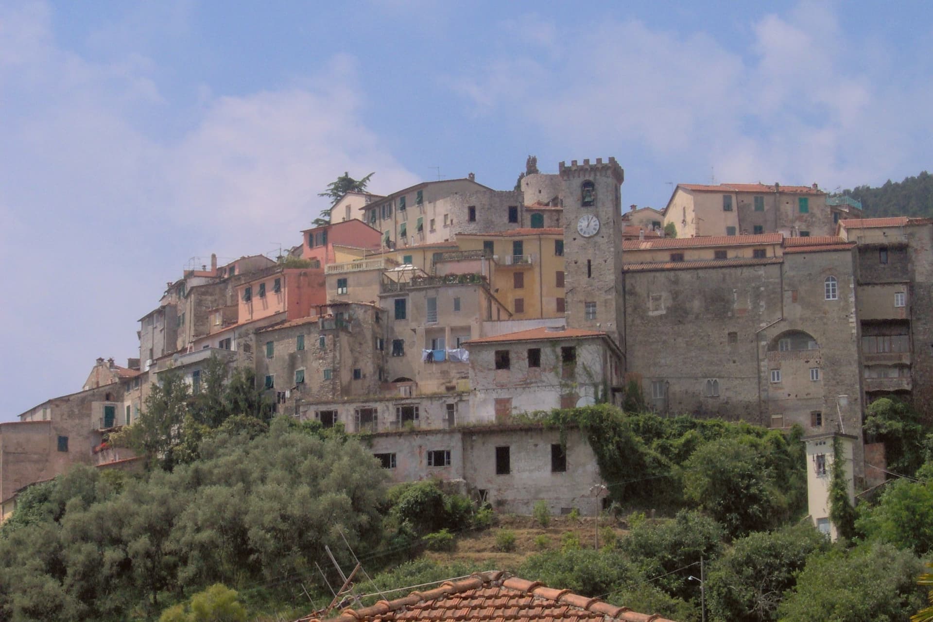
The Magra was the Roman Macra, the eastern boundary of Liguria, and the hill at Ameglia stands on the border between Lunigiana and the Riviera where that river reaches the sea. Genoa bought part of the fief in 1141, the bishops took it back by 1284, and Castruccio Castracani of Lucca conquered it in 1321: a small fortress passed between larger powers for three and a half centuries before it settled into the shape it now has.
The marina at the river mouth is a separate world from the hill town above it. Where the castle and its concentric streets sit on the summit, the frazione at the water is a former fishing village, flat, tied to the tide and to summer moorings rather than to the bishops who once held the heights.
The two headlands south of that marina are reachable only by boat or steep footpath, cut off from the estuary settlement by their own geography rather than by distance. The town, in effect, is two places joined by the same river: a fortified height that answered to Luni and Genoa, and a working shoreline that answered to the sea.
Pescarino-Sapori di Terra e di Mare, LUV Ristorante have been named by a guide.
What to see in Ameglia
- Castello di Ameglia. Rebuilt in 1174 on a tenth-century footprint, episcopal fortress of the bishops of Luni, cylindrical keep above the Magra estuary.
- Centro storico di Ameglia. Concentric medieval streets around the castle, twelfth and thirteenth-century houses with stone arches and external staircases.
- Bocca di Magra. Old fishing village and marina at the river mouth, summer mooring for small craft, departure point for Punta Corvo by sea.
How to get to Ameglia
Pisa is roughly 60 minutes away by road.
✷ We have written about Ameglia
“It has the best panorama in Liguria, full stop, and I do not think it is close. The reasons are two. The first is the obvious one. You are 266 meters up, the cliff is high enough that there is no rocky beach below to draw a crowd, the sea on one side is the Gulf of La Spezia with Portovenere across the water and the Cinque Terre fading north, and the view on the other side is the Magra running into its delta with the white Apuane behind it and Tuscany beyond.”
Read our piece on Ameglia →Magra Delta Roadtrip | A Tagine, a Lighthouse, and a Dead Roman City
Our tip
April through June and September to October bring the river's best months: clear estuary water, the headland walks down to Punta Corvo manageable, marinas at Bocca di Magra not yet at summer capacity. July and August fill the river mouth with summer boats from across the Gulf of Poets, and the road down from the borgo backs up on weekends. The Sagra del Pesce in mid-August draws thousands. Mercato Settimanale Di Ameglia falls in August.
Lerici
Why visit Lerici
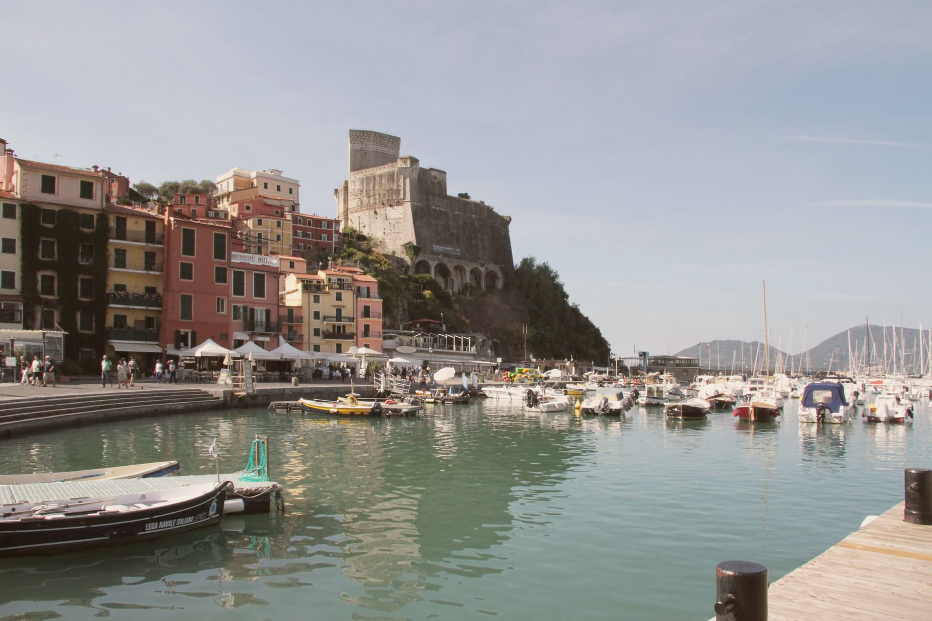
The Gulf of La Spezia takes its eastern shore here, and English Romantics renamed that shore the Bay of Poets after Byron and Shelley made it their address in the early 19th century. The fortress that defines the harbour was begun by the Pisans in 1152 to control the gulf, captured by the Genoese in 1256, and rebuilt in its present pentagonal form through the 14th and 15th centuries; it now holds a paleontology museum with Jurassic dinosaur tracks recovered from the local sandstone.
Shelley lived at a house in nearby San Terenzo in 1822, he drowned that summer sailing from Livorno, and Byron swam across the bay from Portovenere on his way to visit him. Beyond the historic harbour the commune stretches south past a colourful frazione perched on a rocky promontory above the sea, a member of the Borghi più belli d'Italia network in its own right; a coastal trail links the two through olive terraces and pine woods.
The town beach holds a Bandiera Blu and the harbour fills with sailing dinghies all summer. Upper fortress and lower water, working harbour and outlying fishing hamlet: the whole gulf edge here reads as one address that two poets happened to share, and the parts of the commune as its castle, its beach, and its outpost on the rocks.
Il Fico trentacareghe, La Barca have been named by a guide.
What to see in Lerici
- Castello di Lerici. Begun by the Pisans in 1152, captured by Genoa in 1256, rebuilt in its present form in the 14th-15th centuries. The pentagonal walls still hold the harbour under them, and the paleontology museum inside keeps the Jurassic tracks pulled from the local sandstone.
- Bay of Poets / Casa Magni. The Casa Magni at San Terenzo, a Lerici frazione, was Shelley's residence in 1822, the year he drowned in the bay. The house still stands on the shore that gave the Bay of Poets its name.
- Tellaro. Pastel-coloured fishing frazione clinging to a rocky promontory at the southern edge of the bay. Linked to Lerici by the coastal Castelnuovo trail.
How to get to Lerici
Pisa is roughly 61 minutes away by road.
✷ We have written about Lerici
“We know the steep streets above the castle by heart. We know which restaurant is for the view and which is for the dinner. We know that the gelato in San Terenzo, made at a place called La Rana Golosa, is worth the half-hour walk along the sea to find. We know the underpass that takes you to the small free beach under the castle, the rocks at the back of it, and the bench halfway along the promenade to San Terenzo where, on a good day, the wind off the Gulf has the precise temperature of being alive.”
Read our piece on Lerici →Lerici | An Old Friend on the Gulf of Poets
Our tip
April through October is the open season in the Bay of Poets — warm coastal days, calm seas from late spring, and the sailing fleet active all summer. June and September are the best months: warm sea, longer light, fewer crowds than July-August. The castle is open year-round (paleontology museum included) and Tellaro is best in October-November when the colours go warm. Mytiliade a Lerici falls in September.
Borgio Verezzi
Why visit Borgio Verezzi
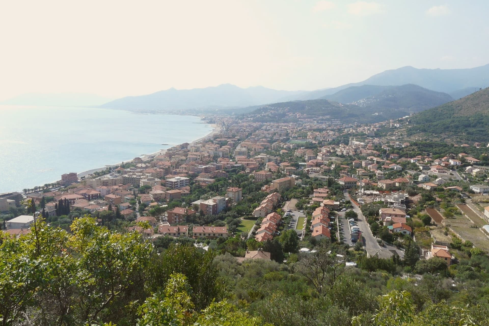
Borgio Verezzi is two settlements stitched together in 1933 under a single comune in the province of Savona. Borgio sits on the coast at the mouth of the Bottassano stream.
Verezzi rises 200 meters up the Orera hill above it, four old boroughs of stone houses in the warm-pink local rock: Piazza, Roccaro, Crosa, and Poggio, each a cluster rather than a single center. The beach below has held the Bandiera Blu without interruption since 1989.
The two halves of the town read as coast and height rather than old and new: the lower village handles the shoreline and the flag it has kept for decades, the upper village keeps its stone streets and its square turned toward the sea view. What the pairing adds up to is a comune built from two working parts, a beach town below and a hill village above, joined by administration in 1933 but still legible as separate places.
Doc have been named by a guide.
What to see in Borgio Verezzi
- Grotte di Valdemino. Dated to 1933, the caves run through chambers where small underground lakes sit beneath the karst rock, the route winding through passages carved out over time.
- Piazza Sant'Agostino. Main square of Verezzi, framed by pink-stone houses with a view down to the sea. The village skyline serves as backdrop for the festival's summer stage.
- Chiesa di San Pietro Apostolo. Neoclassical parish church built in 1789 on the foundations of the medieval Burgum Albinganeum castle, with a white façade and two bell towers.
How to get to Borgio Verezzi
There is a railway station in the town, so you can arrive without a car and never need one while you are here. Genova is roughly 69 minutes away by road.
Our tip
April through June and September into October are the dry months on this stretch of the Riviera di Ponente. The beach at Borgio holds Bandiera Blu and the water warms into May. July and August are full: the coast road slows, the spiaggia fills with weekenders from Genova and Torino, and the theater festival runs in Piazza Sant'Agostino from early July to mid-August. Sagra della Lumaca falls in August.
Noli
Why visit Noli
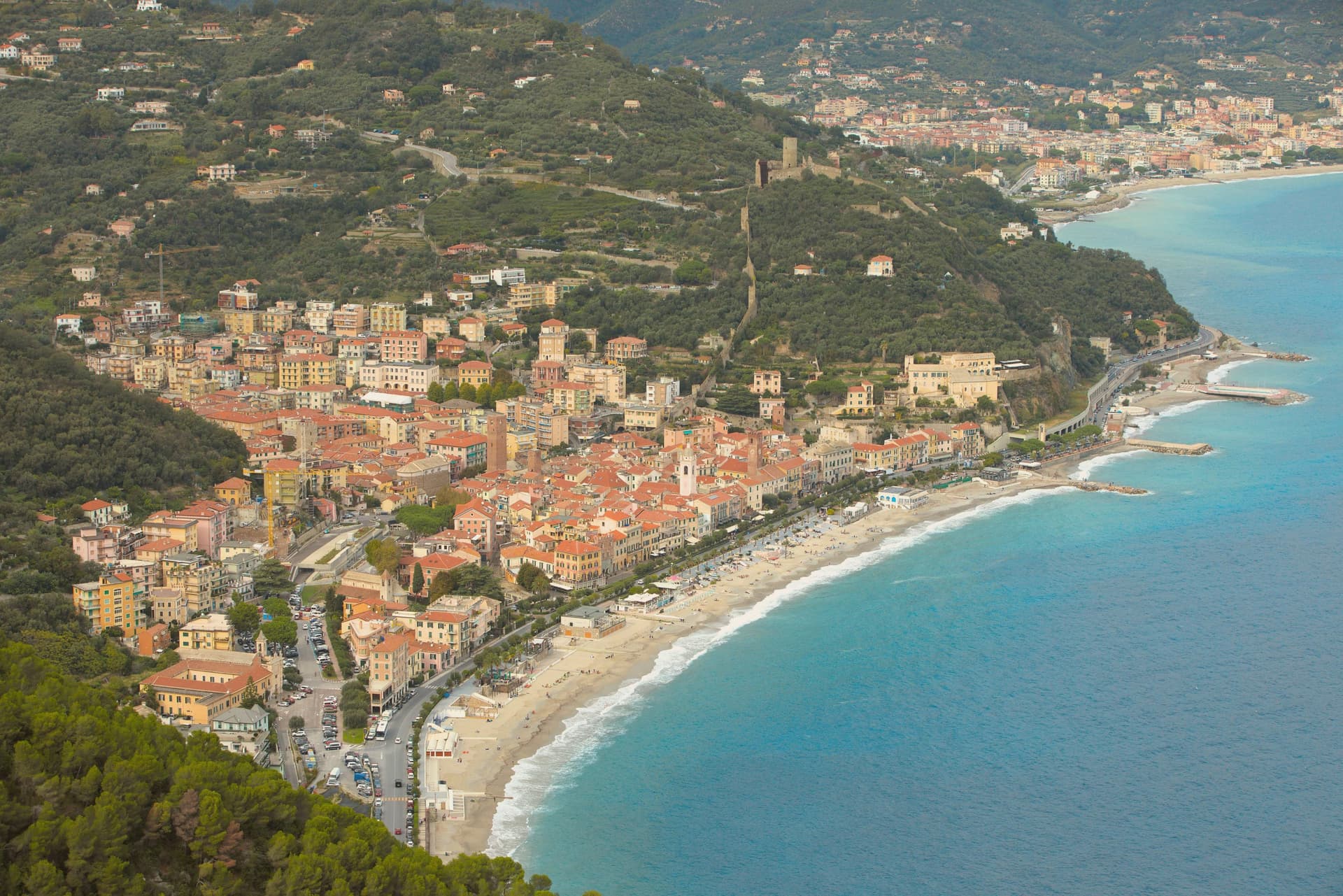
Noli sits at four meters on the Riviera di Ponente, fifty kilometers southwest of Genoa. From 1192 to 1797 it was an independent maritime republic, the fifth alongside Genova, Pisa, Venezia and Amalfi, holding the Capo Noli headland and a stretch of coast under its own flag and protected by alliance with Genoa.
The medieval walls still ring the centro storico, and the survivors of an original eight defensive towers still rise above the rooftops, including the Torre dei Quattro Canti and the Torre Papone. Outside the walls stands the Basilica di San Paragorio, an eleventh-century Romanesque church and one of the most important early medieval buildings in Liguria, with a wooden crucifix from the twelfth century and a bishop's throne carved into a single block of stone.
The Capo Noli cliffs end the bay to the south, with footpaths leading to grottos and a hermitage in the rock. The litoraneo carries the Bandiera Blu.
Vescovado, Il Vescovado have been named by a guide.
What to see in Noli
- Basilica di San Paragorio. Eleventh-century Romanesque church outside the walls, with a twelfth-century wooden crucifix and a bishop's throne carved from a single block.
- Torre dei Quattro Canti. Surviving medieval defensive tower inside the walled centro storico, one of eight that originally ringed the maritime republic.
- Torre Papone. Second medieval tower of the original defensive ring, still standing above the rooftops of the centro storico.
How to get to Noli
There is a railway station in the town, so you can arrive without a car and never need one while you are here. Genova is roughly 58 minutes away by road.
Our tip
May through June and September through October are the right months for Noli. The sea is warm enough from late May, the walls of the centro storico keep the streets shaded, and the coastal path to Capo Noli is walkable without midday heat. July and August fill the beach and the limited parking on the coastal road; the rest of the village stays calmer than the Bandiera Blu litoraneo. La Repubblica del Gusto falls in June.
Millesimo
Why visit Millesimo
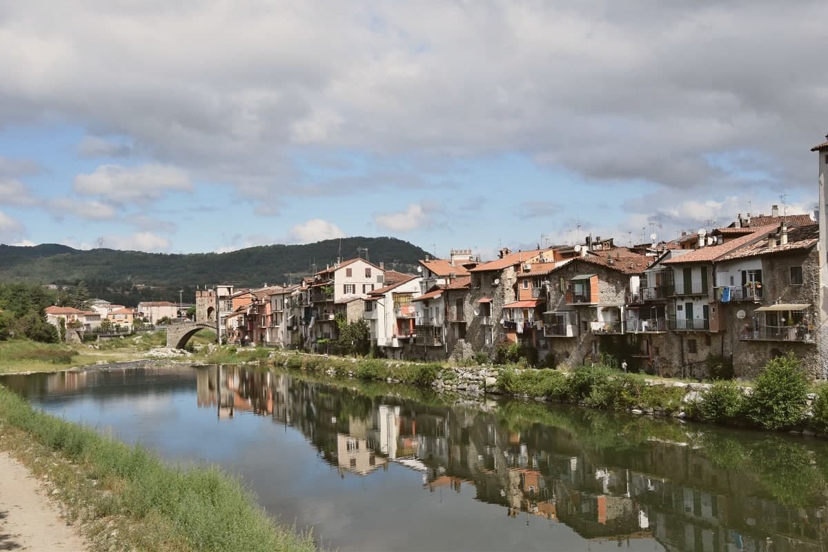
Millesimo sits sixty kilometers inland from Genoa, over the Apennine watershed, in the upper reaches of the valley that gives the wider area its name. Enrico II Del Carretto turned the village into a fortified borgo in 1206, and his successors raised the castle later in the same century on the high ground above the settlement.
The town itself grew on the right bank of the river below that castle, its stone houses laid out in a triangle around the central piazza, with the fortified bridge carrying the crossing at the valley floor and the pilgrimage sanctuary set apart on the outskirts as the valley's separate religious focus. More than three thousand casualties fell on each side when Napoleon Bonaparte defeated the combined Austro-Sardinian forces here on 13-14 April 1796, directing the campaign from the Del Carretto palazzo on the piazza that now serves as the town hall.
The pattern is one of a small defensive settlement whose river crossing, castle and family seat all sit within sight of each other, later put to use for a battle whose scale had nothing to do with the size of the place that hosted it.
Locanda dell'Angelo have been named by a guide.
What to see in Millesimo
- Ponte della Gaietta. The old fortified body still spans the river below the village, narrow enough that its defensive purpose is obvious from either bank.
- Castello Del Carretto. Tower, keep and east wall stand above the village on the high ground, the stronghold that gave the marquis line command of the valley approach.
- Palazzo Del Carretto. The family palazzo faces the central piazza and now serves as the town hall, its rooms the setting for the 1796 headquarters rather than a battlefield relic.
How to get to Millesimo
Genova is roughly 73 minutes away by road.
Our tip
April through June and September through October are the dry months in the upper Val Bormida. The interior of Liguria runs cooler than the coast at this elevation, with mild days and chilly evenings; the rivers run higher in spring after the watershed melt. July and August warm up but Millesimo's 429 meters stay tolerable. XXXIV Festa nazionale del tartufo della Val Bormida a Millesimo falls in October.
Celle Ligure
Why visit Celle Ligure
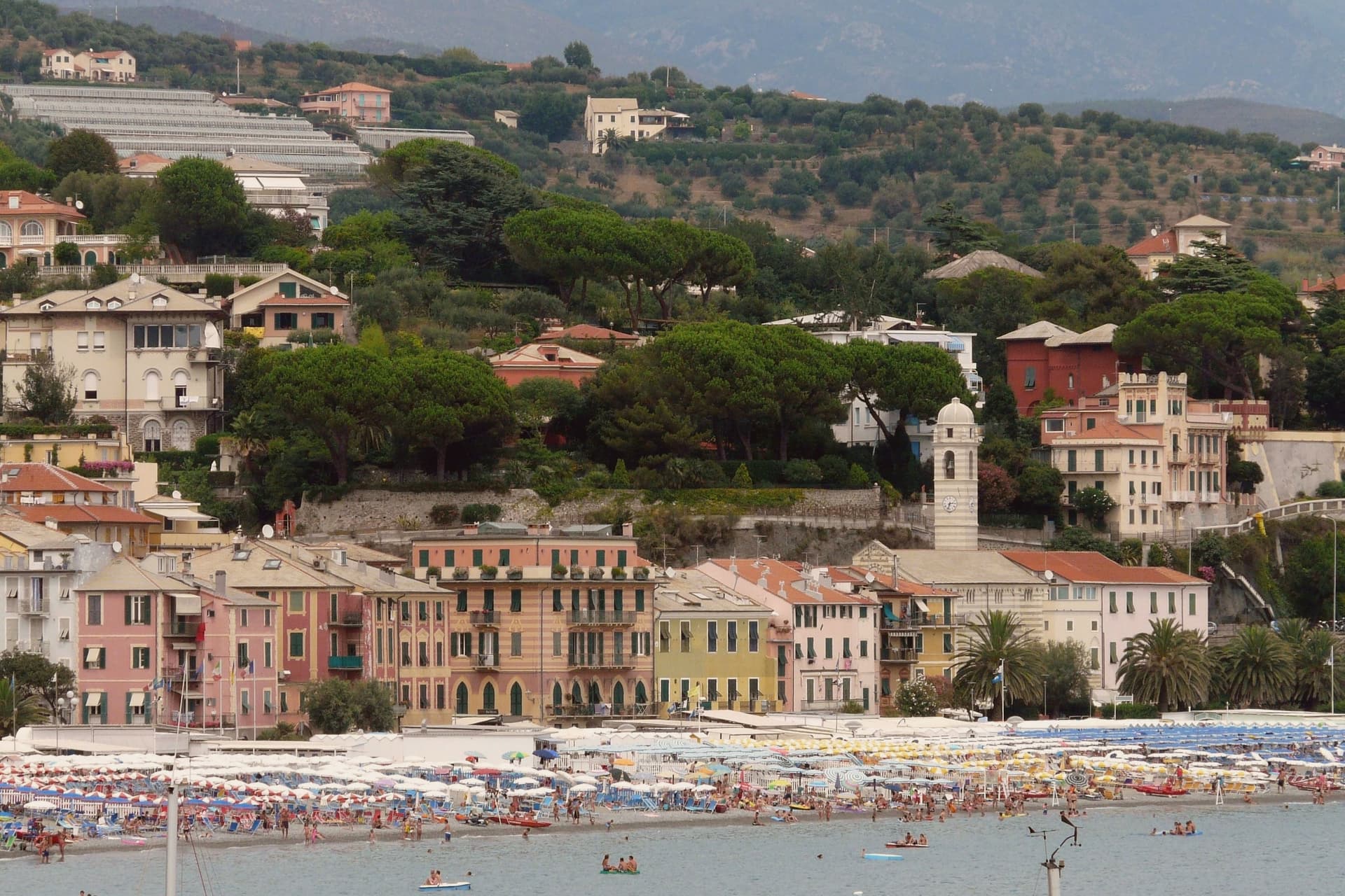
Celle Ligure sits at sea level on the Riviera di Ponente, ten kilometers west of Savona. The Aleramici marquises gave the lands to a Piedmontese monastery in 1014; the Genovese families took them over within a generation.
Pope Sixtus IV's family came from here. The lower town runs along the lungomare, with Piazza dei Mille at its center, while the centro storico sits behind it as a borgo of narrow caruggi, one of the Borghi più belli d'Italia.
A handful of artisan kilns still work these streets, ceramic shop signs marking the buildings where the trade continues. The parish church stands within this old town, its façade carrying the ceramic Assumption by Lucio Fontana, San Michele defeating the dragon rendered in the same medium the town has fired since the seventeenth century.
The pieces read as one place rather than several: a fishing and beach economy along the shore, a ceramic trade worked into the old quarter behind it, and a native artist's public commission set into the church that anchors both.
Meta Ristorante have been named by a guide.
What to see in Celle Ligure
- Chiesa di San Michele Arcangelo. Inside, a Via Crucis by Caminati hangs alongside ceramic stations by Emanuele Luzzati, a pairing of local ceramic craft with the Fontana work on the façade outside.
- Centro storico. Borgo of narrow caruggi behind the lungomare, with active artisan ceramic workshops and ceramic shop signs on the buildings themselves.
- Spiaggia di Celle Ligure. Sand and gravel beach that forms the basis of the town's summer economy, backed by the lungomare and the old town behind it.
How to get to Celle Ligure
There is a railway station in the town, so you can arrive without a car and never need one while you are here. Genova is roughly 40 minutes away by road.
Our tip
April through June and September into October are the dry months on this stretch of the Ponente. The sea warms enough for swimming by late May. July and August are full: the lungomare slows, the beach establishments fill with weekenders from Torino, and the Aurelia stays clogged from Albisola to Varazze on Friday afternoons. Acciugalonga falls in September.
Finale Ligure
Why visit Finale Ligure
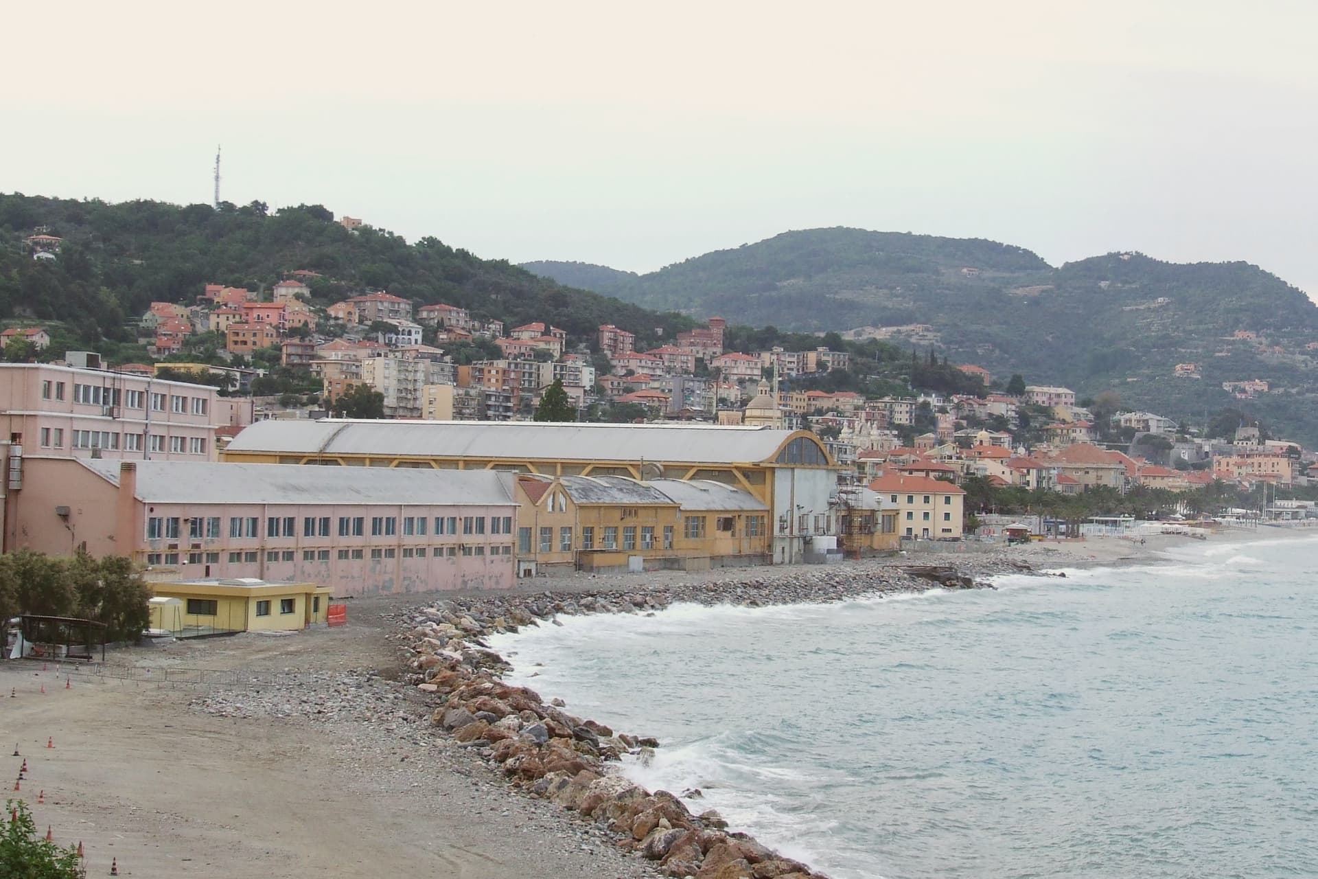
Finale Ligure spans three boroughs and the slope above them: Finalmarina and Finalpia on the coast, the walled inland borough set back at the junction of the Aquila and Pora streams. The two coastal quarters face the water and carry the beachfront trade; the inland borough, built as the seat of the marquisate under the Del Carretto from the late twelfth century onward, kept the family's fortifications and its street plan intact behind the walls rather than along the shore.
The stronghold above the borgo passed through building, wartime destruction, and rebuilding before the Genoese conquest left it largely dismantled in 1715, and the Spanish fort on the ridge above continued to ring the town after that conquest was complete. The coastal stretch below carries the Bandiera Blu and now serves as the starting point for the karst climbing and mountain-biking circuit that has drawn outdoor sport to Finale since the 1990s.
The arrangement is a working division rather than a coincidence: the fortified marquisate seat set inland and upslope, the modern leisure economy running along the water below it.
Ai Torchi, Muraglia - Conchiglia d'Oro, Rosita and 2 more have been named by a guide.
What to see in Finale Ligure
- Castel Gavone. Del Carretto stronghold built by Enrico II in 1181, destroyed in the wars with Genoa, rebuilt in 1451-52 and dismantled by the Genoese in 1715, leaving the diamond-faceted Torre dei Diamanti standing.
- Castel San Giovanni. Seventeenth-century Spanish fort on a higher ridge above Finalborgo, still ringing the walled town.
- Finalborgo. Walled medieval borough at the junction of the Aquila and Pora streams, listed among the Borghi più belli d'Italia.
How to get to Finale Ligure
There is a railway station in the town, so you can arrive without a car and never need one while you are here. Genova is roughly 71 minutes away by road.
Our tip
May through June and September through October are the easy months: warm sea, dry rock for climbing on the karst above the town, mild evenings in Finalborgo. July and August bring summer beach traffic; the coastal road clogs and Finalmarina fills, while Finalborgo two kilometers inland stays calmer. Winter is mild on this exposure and the climbing and mountain-biking seasons continue through it; many international visitors come specifically between November and March for the limestone routes. Ecosagra Delle Melanzane Ripiene falls in August.
More from Anywhere Italy
- The prettiest small villages that eat well in Liguria
- The best small coastal towns with a serious restaurant in Liguria
- The prettiest villages that eat well within 90 minutes of Genova
- The best small towns with a serious restaurant that eat well within 90 minutes of Genova
- The best hidden beach towns in Liguria
- The 10 best hidden beach towns with a food festival in Liguria