
The prettiest villages inside a nature park in Liguria
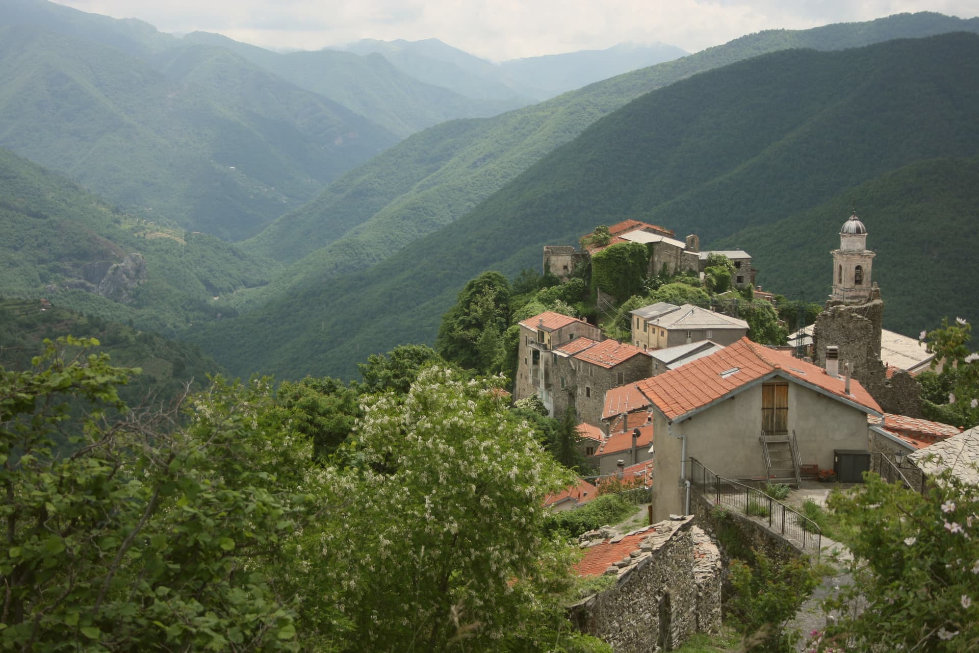
Liguria narrows fast. Behind the beach huts the land climbs into chestnut and beech woods, terraces of olive held up by dry stone, and villages built from the grey slate and river cobble that the valleys gave them. In autumn there are porcini and chestnut flour, testaroli cooked on hot terracotta, and mushroom sauces served in places that shut when the season ends. Spring brings the wild herb pies, and the high inland air stays cool through August when the coast does not.
Almost everyone comes for the Cinque Terre. The five villages on the cliff between Levanto and Portovenere are the reason the regional trains run full from March onwards, and the coastal path is metered, ticketed and shoulder to shoulder in summer for good reason: they are extraordinary. What that does is concentrate an entire region's visitors onto a few kilometres of terraced coast.
The same slate, the same chestnut woods and the same salted anchovies carry on well past that stretch, up the Vara, into the Ligurian Alps, along the Bormida and down to where the Magra meets the sea. The villages here sit inside regional nature parks, which is why the woods around them are still woods. Fewer people go, and the ones who do tend to be walking.
Of the 54 communes we have mapped in Liguria, 6 qualify as prettiest villages inside a nature park: each has passed the national assessment of Italy's most beautiful villages, and each sits inside a regional nature park. The smallest, Triora, has 373 residents.
Elsewhere in the catalogue: The best small towns inside a nature park in Liguria and The best towns inside a nature park that eat well in Liguria.
Triora
Why visit Triora
Triora sits at 776 meters in the upper Valle Argentina, the last comune before the Alpi Liguri turn into French territory. The site was a Genovese stronghold from the thirteenth century, fortified with five castles, three of which still leave traces.
Between 1587 and 1589, after two years of failed harvests and famine, the council of elders blamed a group of women living in seclusion in La Cabotina, the poorest quarter, and called in the Inquisition. Around 200 women were accused, many tortured, some died in custody.
Genova intervened to slow the trials; the survivors were eventually freed. The Museo Etnografico e della Stregoneria, in the former prison, holds the documents and reconstructs the herbalism, the famine, and the trial process.
The Pane di Triora is a slow-rising rustic bread baked in wood ovens that keeps for two weeks. Wolves and chamois return to the surrounding ridges.
What to see in Triora
- Museo Etnografico e della Stregoneria. Witchcraft and ethnography museum in the former village prison, with trial documents, herbal knowledge, and a reconstruction of La Cabotina.
- La Cabotina. The poorest quarter at the edge of the village, where the women accused of witchcraft in 1587-1589 lived, now a marked walking circuit.
- Collegiata di Nostra Signora Assunta. Parish church with a fourteenth-century Baptism of Christ by Taddeo di Bartolo, the oldest dated work in Liguria.
How to get to Triora
Genova is roughly 148 minutes away by road.
Our tip
May through October are the months Triora is fully open. The Argentina valley greens in spring and holds color into autumn. The witchcraft museum, the Cabotina circuit, and the Saccarello trails are accessible from late spring through early autumn. Processione Del Monte falls in April.
Campo Ligure
Why visit Campo Ligure
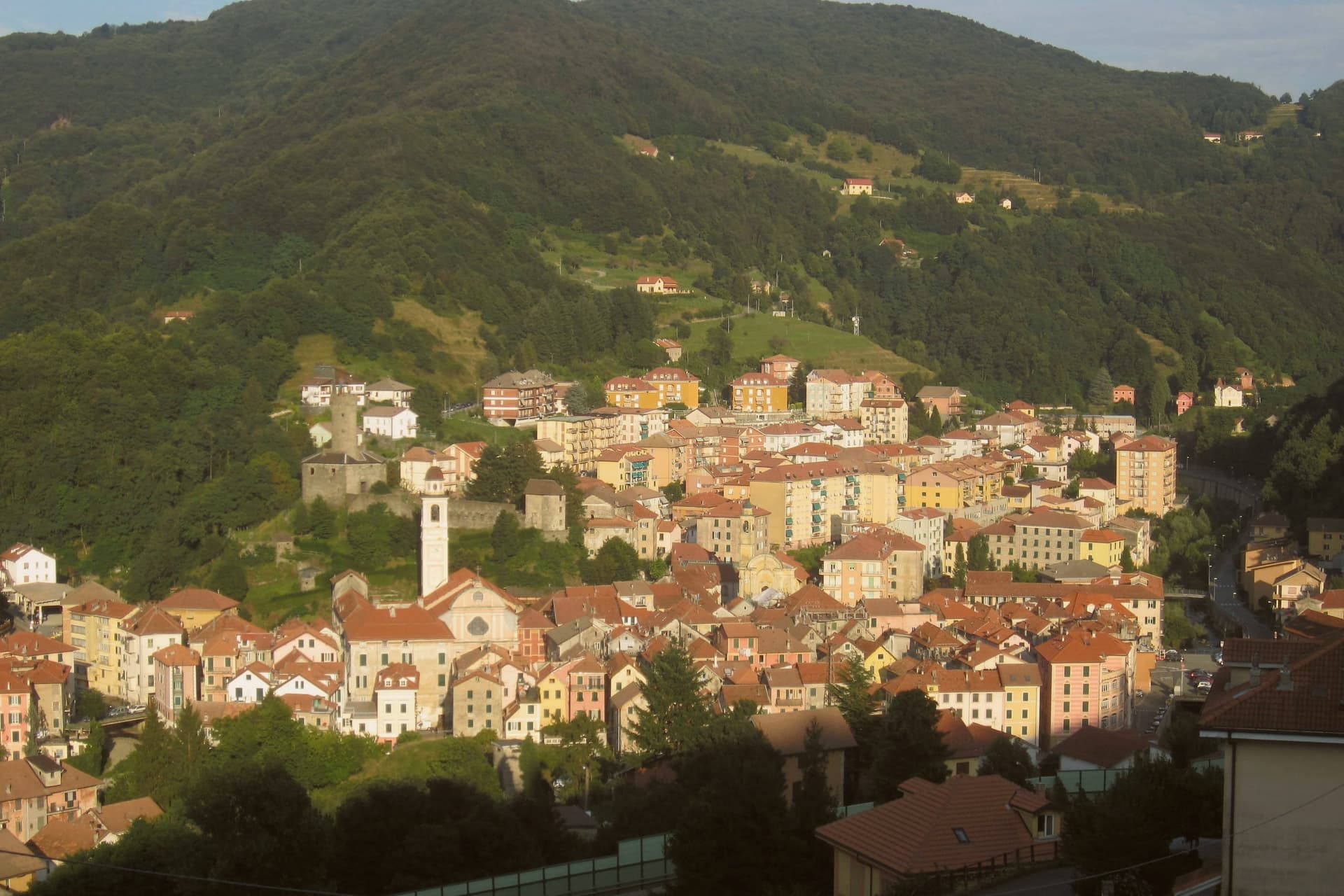
Campo Ligure sits on the right bank of the Stura at 342 meters, twenty-five kilometers north of Genoa where the Apennines start to climb. The Spinola family took the fief in the thirteenth century and built the hexagonal castle on the hill above the village; the cylindrical tower is more than twenty-two metres tall and six across.
The first filigree workshop opened in 1884. Within a generation Campo Ligure had become the national centre for the craft, fine gold and silver threads twisted with pliers called bruscelle and welded under a torch.
It remains the only working filigree centre in Italy. The Museo della Filigrana, founded in 1984 around the Pietro Carlo Bosio collection, holds filigree work from across the world.
A medieval stone bridge over the Stura, originally ninth-century and rebuilt several times from the eighteenth century onward, anchors the lower end of the borgo.
What to see in Campo Ligure
- Castello Spinola. Twelfth and thirteenth-century hexagonal fortress on the hill above the village, cylindrical tower 22 metres tall, residence of the Spinola fief.
- Museo della Filigrana Pietro Carlo Bosio. Founded 1984 around the Bosio collection, filigree work from across the world, the only museum of its kind in Italy.
- Ponte medievale sullo Stura. Stone bridge over the Stura with ninth-century origins, rebuilt several times from the eighteenth century, marks the southern entrance to the borgo.
How to get to Campo Ligure
There is a railway station in the town, so you can arrive without a car and never need one while you are here. Genova is roughly 41 minutes away by road.
Our tip
May through October is the working window: the Stura runs clear, the trail network up into the Parco del Beigua opens, the filigree workshops keep their doors open for visitors. The Mostra della Filigrana in late August is the year's main draw, three days of open studios and demonstrations. July and August can touch 30 degrees in the valley but the 342-metre elevation keeps evenings cool.
Millesimo
Why visit Millesimo
Millesimo sits sixty kilometers inland from Genoa, over the Apennine watershed, in the upper reaches of the valley that gives the wider area its name. Enrico II Del Carretto turned the village into a fortified borgo in 1206, and his successors raised the castle later in the same century on the high ground above the settlement.
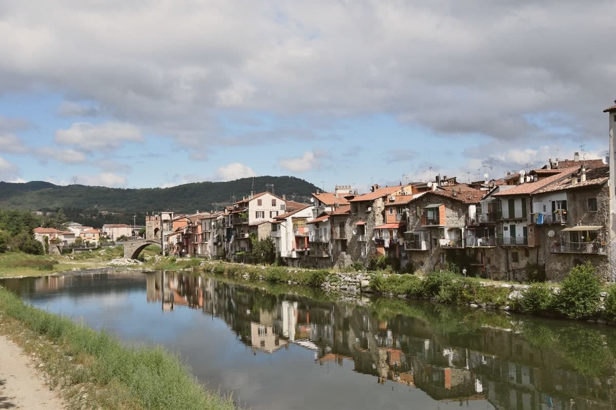
The town itself grew on the right bank of the river below that castle, its stone houses laid out in a triangle around the central piazza, with the fortified bridge carrying the crossing at the valley floor and the pilgrimage sanctuary set apart on the outskirts as the valley's separate religious focus. More than three thousand casualties fell on each side when Napoleon Bonaparte defeated the combined Austro-Sardinian forces here on 13-14 April 1796, directing the campaign from the Del Carretto palazzo on the piazza that now serves as the town hall.
The pattern is one of a small defensive settlement whose river crossing, castle and family seat all sit within sight of each other, later put to use for a battle whose scale had nothing to do with the size of the place that hosted it.
What to see in Millesimo
- Ponte della Gaietta. The old fortified body still spans the river below the village, narrow enough that its defensive purpose is obvious from either bank.
- Castello Del Carretto. Tower, keep and east wall stand above the village on the high ground, the stronghold that gave the marquis line command of the valley approach.
- Palazzo Del Carretto. The family palazzo faces the central piazza and now serves as the town hall, its rooms the setting for the 1796 headquarters rather than a battlefield relic.
How to get to Millesimo
Genova is roughly 73 minutes away by road.
Our tip
April through June and September through October are the dry months in the upper Val Bormida. The interior of Liguria runs cooler than the coast at this elevation, with mild days and chilly evenings; the rivers run higher in spring after the watershed melt. July and August warm up but Millesimo's 429 meters stay tolerable. XXXIV Festa nazionale del tartufo della Val Bormida a Millesimo falls in October.
Brugnato
Why visit Brugnato
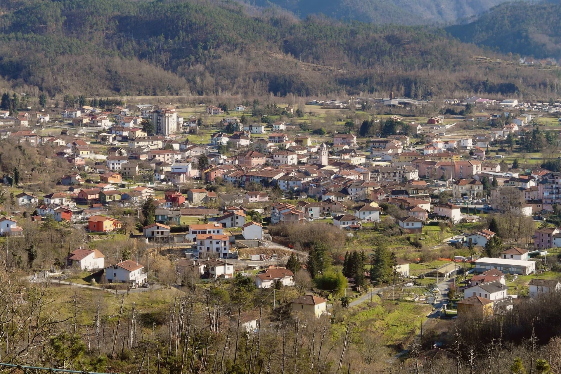
Brugnato sits at 115 meters in the Val di Vara, the broad inland valley that runs from the Apennine ridge down toward the La Spezia coast. The town grew around a monastery dedicated to Saint Columbanus, the Irish missionary who founded Bobbio in 614, and the settlement that formed around it took its shape from the monks' presence long before it took its later civic form.
The centro storico is laid out on a rare medieval grid for Liguria, straight lanes of pastel houses inside a walled perimeter, set on a low rise inside a meander of the river. The layout and the site both point back to the same origin: a religious foundation that outgrew its walls and organized a town around itself, one that later carried authority over the surrounding valley as a bishopric until 1820.
Brugnato holds Borghi più belli, Bandiera Arancione, and Infioritalia, the last for the Corpus Domini flower-petal carpets that cover the streets each June. The town's present character, an inland valley seat with a monastic and diocesan past now expressed mostly through architecture and a single yearly ritual, follows directly from that founding order having outlasted the institutions that built it.
What to see in Brugnato
- Concattedrale dei Santi Pietro, Lorenzo e Colombano. The building rises over the foundations of the older monastery, its eleventh and twelfth century stonework the visible layer above what the monks left underneath.
- Museo Diocesano. Diocesan museum housed in the former Episcopal Palace next to the cathedral, with sacred art and documents from the long bishopric.
- Centro storico. Walled medieval grid of pastel houses, a rare orthogonal layout in Liguria, set on a low rise inside a meander of the river.
How to get to Brugnato
Genova is roughly 62 minutes away by road.
✷ We have written about Brugnato
“You walk in expecting a town, and the town never arrives. You get the coil, the colors, the empty windows, the church waiting in the middle like a spider that stopped being hungry centuries ago. Somewhere under the cathedral floor, the diocese says, lie the remains of a Roman post and two older churches, layer under layer under layer, the whole history of the place stacked vertically because the plan never allowed it to spread.”
Read our piece on Brugnato →Brugnato | The Town With No Piazza
Our tip
April through June and September into October are the right months in the Val di Vara. The valley turns green in spring, holds its color into early summer, and dries to gold in autumn. Corpus Domini, late May or early June depending on the year, brings the Infiorata to the streets of the centro storico.
Ameglia
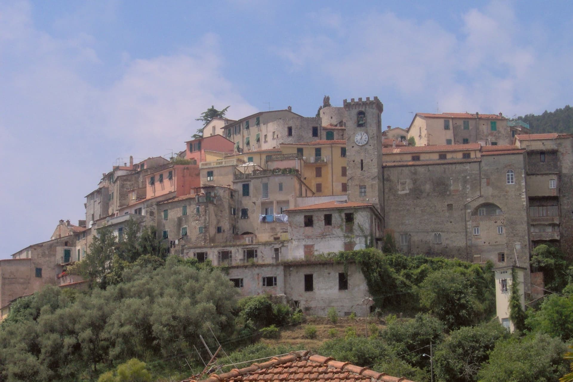
Why visit Ameglia
The Magra was the Roman Macra, the eastern boundary of Liguria, and the hill at Ameglia stands on the border between Lunigiana and the Riviera where that river reaches the sea. Genoa bought part of the fief in 1141, the bishops took it back by 1284, and Castruccio Castracani of Lucca conquered it in 1321: a small fortress passed between larger powers for three and a half centuries before it settled into the shape it now has.
The marina at the river mouth is a separate world from the hill town above it. Where the castle and its concentric streets sit on the summit, the frazione at the water is a former fishing village, flat, tied to the tide and to summer moorings rather than to the bishops who once held the heights.
The two headlands south of that marina are reachable only by boat or steep footpath, cut off from the estuary settlement by their own geography rather than by distance. The town, in effect, is two places joined by the same river: a fortified height that answered to Luni and Genoa, and a working shoreline that answered to the sea.
What to see in Ameglia
- Castello di Ameglia. Rebuilt in 1174 on a tenth-century footprint, episcopal fortress of the bishops of Luni, cylindrical keep above the Magra estuary.
- Centro storico di Ameglia. Concentric medieval streets around the castle, twelfth and thirteenth-century houses with stone arches and external staircases.
- Bocca di Magra. Old fishing village and marina at the river mouth, summer mooring for small craft, departure point for Punta Corvo by sea.
How to get to Ameglia
Pisa is roughly 60 minutes away by road.
✷ We have written about Ameglia
“It has the best panorama in Liguria, full stop, and I do not think it is close. The reasons are two. The first is the obvious one. You are 266 meters up, the cliff is high enough that there is no rocky beach below to draw a crowd, the sea on one side is the Gulf of La Spezia with Portovenere across the water and the Cinque Terre fading north, and the view on the other side is the Magra running into its delta with the white Apuane behind it and Tuscany beyond.”
Read our piece on Ameglia →Magra Delta Roadtrip | A Tagine, a Lighthouse, and a Dead Roman City
Our tip
April through June and September to October bring the river's best months: clear estuary water, the headland walks down to Punta Corvo manageable, marinas at Bocca di Magra not yet at summer capacity. July and August fill the river mouth with summer boats from across the Gulf of Poets, and the road down from the borgo backs up on weekends. The Sagra del Pesce in mid-August draws thousands. Mercato Settimanale Di Ameglia falls in August.
Lerici
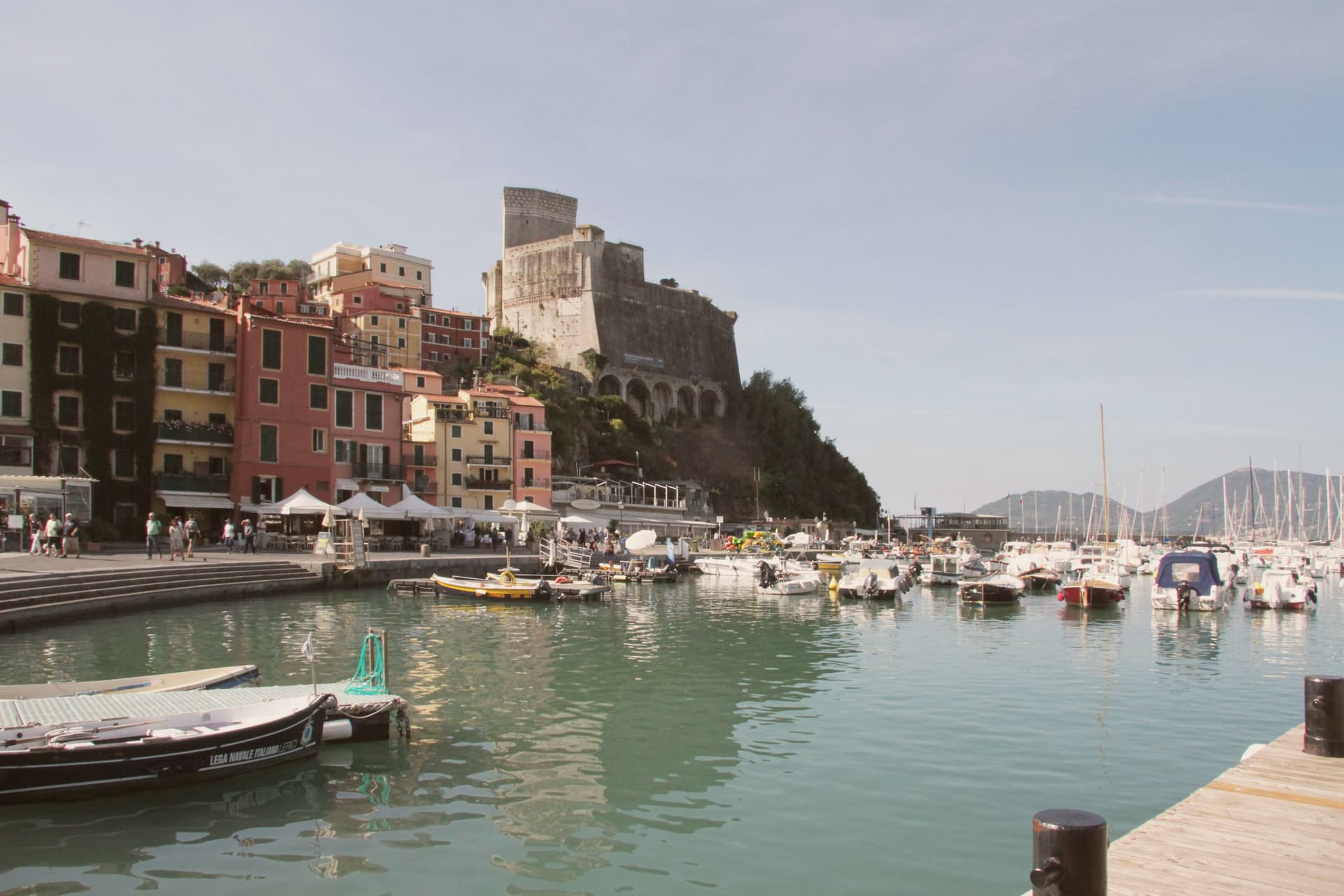
Why visit Lerici
The Gulf of La Spezia takes its eastern shore here, and English Romantics renamed that shore the Bay of Poets after Byron and Shelley made it their address in the early 19th century. The fortress that defines the harbour was begun by the Pisans in 1152 to control the gulf, captured by the Genoese in 1256, and rebuilt in its present pentagonal form through the 14th and 15th centuries; it now holds a paleontology museum with Jurassic dinosaur tracks recovered from the local sandstone.
Shelley lived at a house in nearby San Terenzo in 1822, he drowned that summer sailing from Livorno, and Byron swam across the bay from Portovenere on his way to visit him. Beyond the historic harbour the commune stretches south past a colourful frazione perched on a rocky promontory above the sea, a member of the Borghi più belli d'Italia network in its own right; a coastal trail links the two through olive terraces and pine woods.
The town beach holds a Bandiera Blu and the harbour fills with sailing dinghies all summer. Upper fortress and lower water, working harbour and outlying fishing hamlet: the whole gulf edge here reads as one address that two poets happened to share, and the parts of the commune as its castle, its beach, and its outpost on the rocks.
What to see in Lerici
- Castello di Lerici. Begun by the Pisans in 1152, captured by Genoa in 1256, rebuilt in its present form in the 14th-15th centuries. The pentagonal walls still hold the harbour under them, and the paleontology museum inside keeps the Jurassic tracks pulled from the local sandstone.
- Bay of Poets / Casa Magni. The Casa Magni at San Terenzo, a Lerici frazione, was Shelley's residence in 1822, the year he drowned in the bay. The house still stands on the shore that gave the Bay of Poets its name.
- Tellaro. Pastel-coloured fishing frazione clinging to a rocky promontory at the southern edge of the bay. Linked to Lerici by the coastal Castelnuovo trail.
How to get to Lerici
Pisa is roughly 61 minutes away by road.
✷ We have written about Lerici
“We know the steep streets above the castle by heart. We know which restaurant is for the view and which is for the dinner. We know that the gelato in San Terenzo, made at a place called La Rana Golosa, is worth the half-hour walk along the sea to find. We know the underpass that takes you to the small free beach under the castle, the rocks at the back of it, and the bench halfway along the promenade to San Terenzo where, on a good day, the wind off the Gulf has the precise temperature of being alive.”
Read our piece on Lerici →Lerici | An Old Friend on the Gulf of Poets
Our tip
April through October is the open season in the Bay of Poets — warm coastal days, calm seas from late spring, and the sailing fleet active all summer. June and September are the best months: warm sea, longer light, fewer crowds than July-August. The castle is open year-round (paleontology museum included) and Tellaro is best in October-November when the colours go warm. Mytiliade a Lerici falls in September.
More from Anywhere Italy
- The best small towns inside a nature park in Liguria
- The best towns inside a nature park that eat well in Liguria
- The best small towns inside a nature park that eat well in Liguria
- The best towns inside a nature park that have a serious restaurant in Liguria
 The best coastal towns inside a nature park in Liguria
 The prettiest villages in the province of La Spezia