
The best high-altitude villages within 90 minutes of Pescara
Leave the Adriatic behind at Pescara and the land climbs quickly. Within an hour and a half the road is among bare limestone ridges, beech forest and high pasture, and the villages there are built of the same grey stone as the mountain behind them, roofs tight against winter, alleys narrow enough to hold shade at midday. This is saffron country and lentil country, with mutton stewed slowly, pecorino aged in the cold, and confetti from the sugar towns sold in paper cones. Summer stays cool up here when the coast is airless. Autumn brings mushrooms, chestnuts and the first snow on the peaks above.
Most people heading into the Abruzzo highlands aim straight for the Gran Sasso and the Campo Imperatore plateau, and in high summer the road up is a queue of cars looking for the same photograph of the same empty grassland. It is a fine landscape and worth seeing. It is also the one stop on every itinerary written about the region, so the car parks fill early and the few bars along it work at a pace they were never built for.
The mountains do not stop at the famous plateau. The same limestone runs south through the Maiella and the Sirente, past sheep tracks that have carried flocks for centuries, into towns high enough to keep their winters long and their populations small. The villages in this list all sit well above the plain, some on ridges, some at the head of valleys, some beside lakes filled with snowmelt. Fewer people go, and the drive from Pescara is short enough to make any of them a day.
Of the 61 communes we have mapped within 90 minutes of Pescara, 10 qualify as high-altitude villages: each sits at 800 metres or higher. The smallest, Monteferrante, has 106 residents.
If you are still choosing, we have also written The best mountain towns inside a national park within 90 minutes of Pescara and The best small ski towns in the province of L'Aquila.
Monteferrante
Why visit Monteferrante
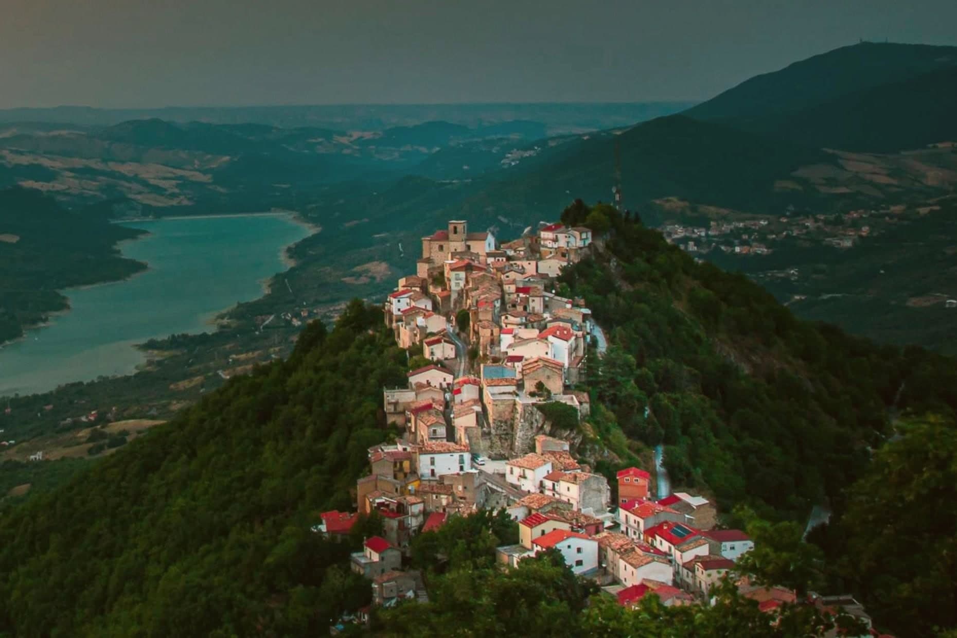
Monteferrante sits in the Chieti hinterland between the Maiella and the Adriatic, on a terrace above the middle Sangro valley. The village is first documented in the 12th century, when the feud was assigned to Roberto di Monteferrante, a vassal of Count Simone di Sangro.
That early feudal grant explains the shape of the place: a small fortified seat controlling its stretch of the valley rather than a settlement built for trade or transit. The historical center, where the parish church stands, occupies the terrace itself.
The Marian sanctuary lies apart from it, in the woods on the slope below, a separate point of reference outside the built-up village. The two churches mark the poles of the settlement: one at the center of daily life, one at the edge of the forest that surrounds it.
What these facts add up to is a village whose whole layout, from feudal grant to church placement, was shaped by its position on a defensible terrace above the valley, rather than by any role in wider trade or travel.
The village sits at 800 metres.
What to see in Monteferrante
- Chiesa di San Giovanni Battista Decollato. Parish church in the historical center, standing after repeated rebuilds across the centuries.
- Chiesa di Santa Maria del Monte. Forest church set in the woods outside the village, a small Marian sanctuary on the slope above the Sangro.
- Belvedere sulla Valle del Sangro. Village terrace with a panorama from Lake Bomba in the south to the Maiella massif to the west.
How to get to Monteferrante
Pescara is roughly 81 minutes away by road.
Our tip
May through October is the open window. At 800 meters the village stays cool through July and August when the lower Sangro valley climbs into the thirties, and the woods around the village hold their cover into late October. June and September are the cleanest months for walking the trails toward Santa Maria del Monte and the surrounding ridge.
Castelvecchio Calvisio
Why visit Castelvecchio Calvisio
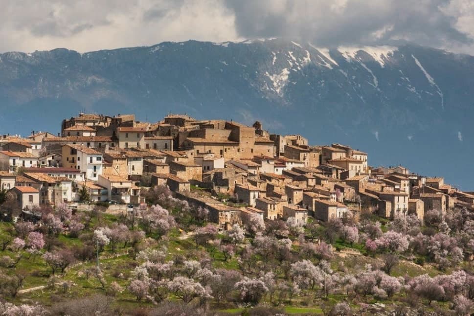
Castelvecchio Calvisio sits at 1,067 meters on a ridge above the Tirino valley, in the Gran Sasso e Monti della Laga National Park. The medieval village has a rare and distinctive form: a fortified ellipse of stone walls, with houses built into the walls themselves, and internal alleys laid out orthogonal to the perimeter.
The barbacani, broad external stone staircases climbing the houses, mark each level of the multi-storey dwellings. Narrow streets pass under vaulted arches; the steps of the alley stairs widen as they rise.
The population sits at 118, one of the smallest in the province. The Church of San Giovanni Battista, with its bell tower above the rooftops, stands at the centre of the elliptical plan.
The Church of Santa Maria delle Grazie is just below. Ruins of the original castle survive on the highest point of the settlement, the defensive watchtower from which the village grew.
The village has been part of the Borghi Autentici network for over a decade, anchored on conservation of its medieval form.
The village sits at 1067 metres.
What to see in Castelvecchio Calvisio
- Borgo fortificato (centro storico). Fortified elliptical village with houses built into the perimeter walls, orthogonal alleys, vaulted passages, and external stone staircases called barbacani.
- Chiesa di San Giovanni Battista. Parish church at the centre of the elliptical plan, with its bell tower the only structure rising above the rooflines of the village.
- Chiesa di Santa Maria delle Grazie. Second medieval church of the village, just below the centre, with architectural elements that mark the original Romanesque-Gothic transition.
How to get to Castelvecchio Calvisio
Pescara is roughly 70 minutes away by road.
Our tip
June through September is the strong window for Castelvecchio Calvisio. The Tirino valley is dry, the trails to Calascio and Campo Imperatore are clear, and the elliptical borgo opens for visitors. The village hosts a small summer festival in August.
Calascio
Why visit Calascio
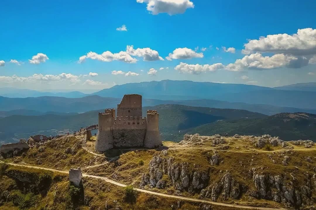
Calascio sits at 1,200 meters in the Gran Sasso e Monti della Laga National Park, the lower stone village where the shepherds who stayed after the transhumance ended made their houses. The fortress above it began around the year 1000 as a watchtower controlling the routes that ran 250 kilometers down from L'Aquila to the Tavoliere delle Puglie, and it was this wool wealth that built the village below.
Wool from these flocks was prized enough that the Medici came north to buy it. The upper village beside the castle emptied when the transhumance ended in the 1850s and has been under slow restoration since, stonemasons working with original materials under the Borgo Autentici designation, while the lower village kept its 125 residents and its parish church.
From the castle the view runs across Campo Imperatore, the high plateau immediately to the north, toward the Gran Sasso peaks. The two settlements read as before and after: the upper one preserved in its abandonment, the lower one still lived in because it held the people the transhumance left behind.
The village sits at 1200 metres.
What to see in Calascio
- Rocca Calascio. Highest fortress in the Apennines at 1,460 meters, watchtower for transhumance routes from L'Aquila to Puglia, film location for Ladyhawke and The Name of the Rose.
- Chiesa di Santa Maria della Pietà. Octagonal Renaissance chapel below the fortress, built on the site of a 1456 battle won by local farmers against bandits, with painted interior.
- Borgo di Rocca Calascio. Partly abandoned upper village beside the castle, slowly restored by stonemasons, with the Rifugio della Rocca offering rooms in stone houses.
How to get to Calascio
Pescara is roughly 76 minutes away by road.
Our tip
June through September is high season at Calascio: the Rocca trail is dry, the Campo Imperatore plateau is open for hiking, and the air at 1,200 meters stays cool through August afternoons. December through March is the second season, when ski traffic to Campo Imperatore brings winter visitors and the Rocca in snow becomes the picture everyone wants. The village empties on weekdays from November to April and the road up to the Rocca closes after heavy snow.
Castel del Monte
Why visit Castel del Monte
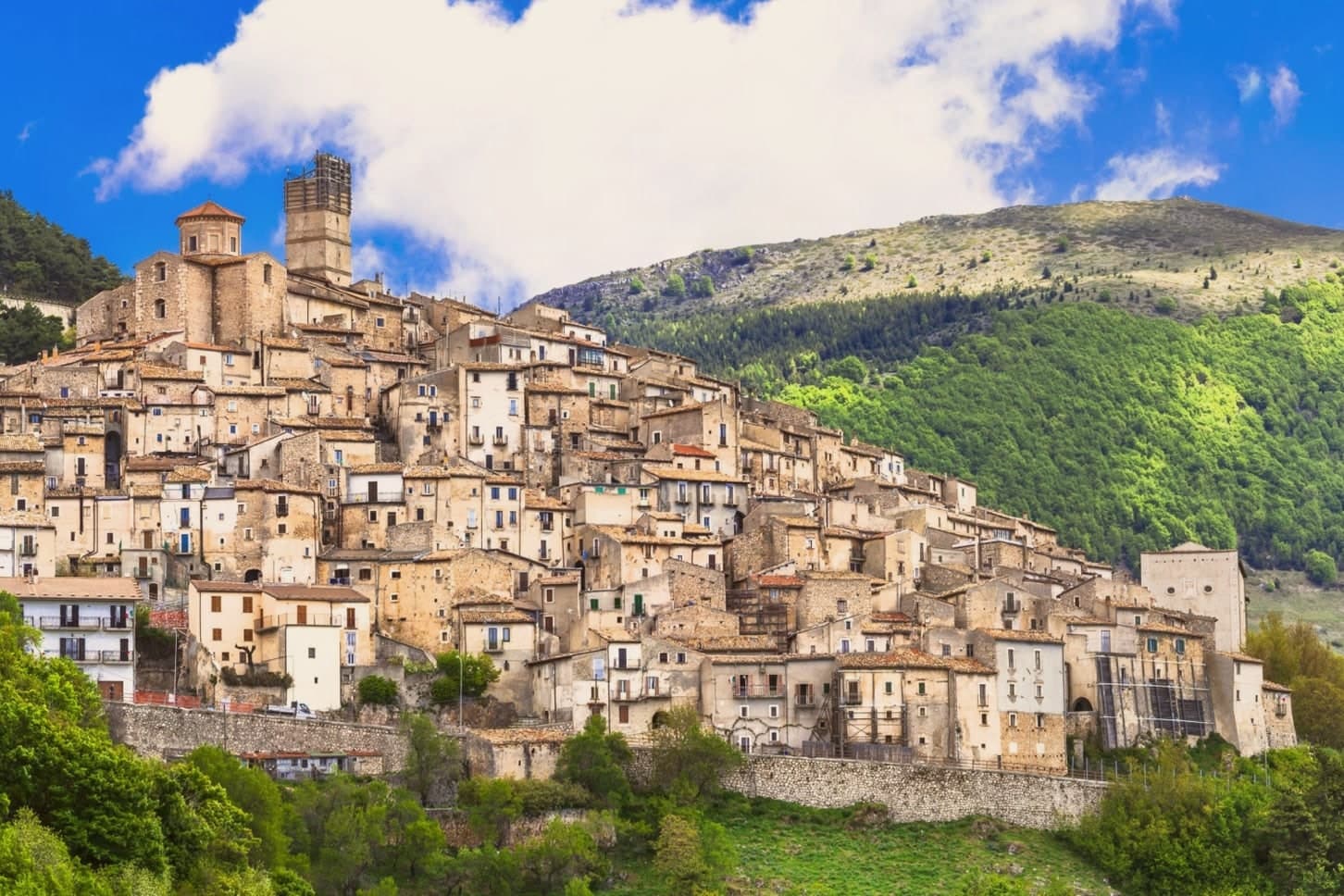
The village sits in the Gran Sasso e Monti della Laga National Park, on the southern slope of Monte Bolza, with Rocca Calascio facing it across the valley and Campo Imperatore stretching north. It descends from the pre-Roman Vestini; finds from an 11th-century BC necropolis lie in the valley below, long before any wool trade or Medici buyer arrived.
The upper village, its stone core threaded with tunnels and vaulted passages, once housed the shepherds who drove flocks south to Puglia and returned to a cluster of churches built for their safekeeping and their thanks. That world ended in the 1850s, and the population emptied with it: 431 people remain where a wool trade once drew merchants from the Medici's own city.
What is left is performed rather than lived at scale, in the symbolic transhumance and in the August gathering that briefly fills the same streets and tunnels the shepherds once used. The place now runs on memory of the trade that built it, kept alive one night a year and in a cheese still made from spring pastures.
The village sits at 1346 metres.
What to see in Castel del Monte
- Chiesa Matrice di San Marco. Baroque interior; holds the patron-saint statue carried through the village in the August procession.
- Chiesa di San Donato Fuori le Mura. Romanesque church just outside the medieval walls, among the oldest religious buildings in the village, with a small square in front used for festivals.
- Chiesa della Madonna del Suffragio (dei Pastori). Devotional centre of the transhumance, hung with ex-votos left by herders for safe return from Puglia.
How to get to Castel del Monte
Pescara is roughly 90 minutes away by road.
Our tip
June through September is when Castel del Monte runs at full strength. Campo Imperatore opens for hiking, the Canestrato cheese makers receive visitors, and La Notte delle Streghe in mid-August packs every alley with thousands of people. December through March is the second season for skiers heading to Campo Imperatore and Prati di Tivo, with the village in deep snow. Rassegna degli Ovini di Campo Imperatore falls in August.
Villalago
Why visit Villalago
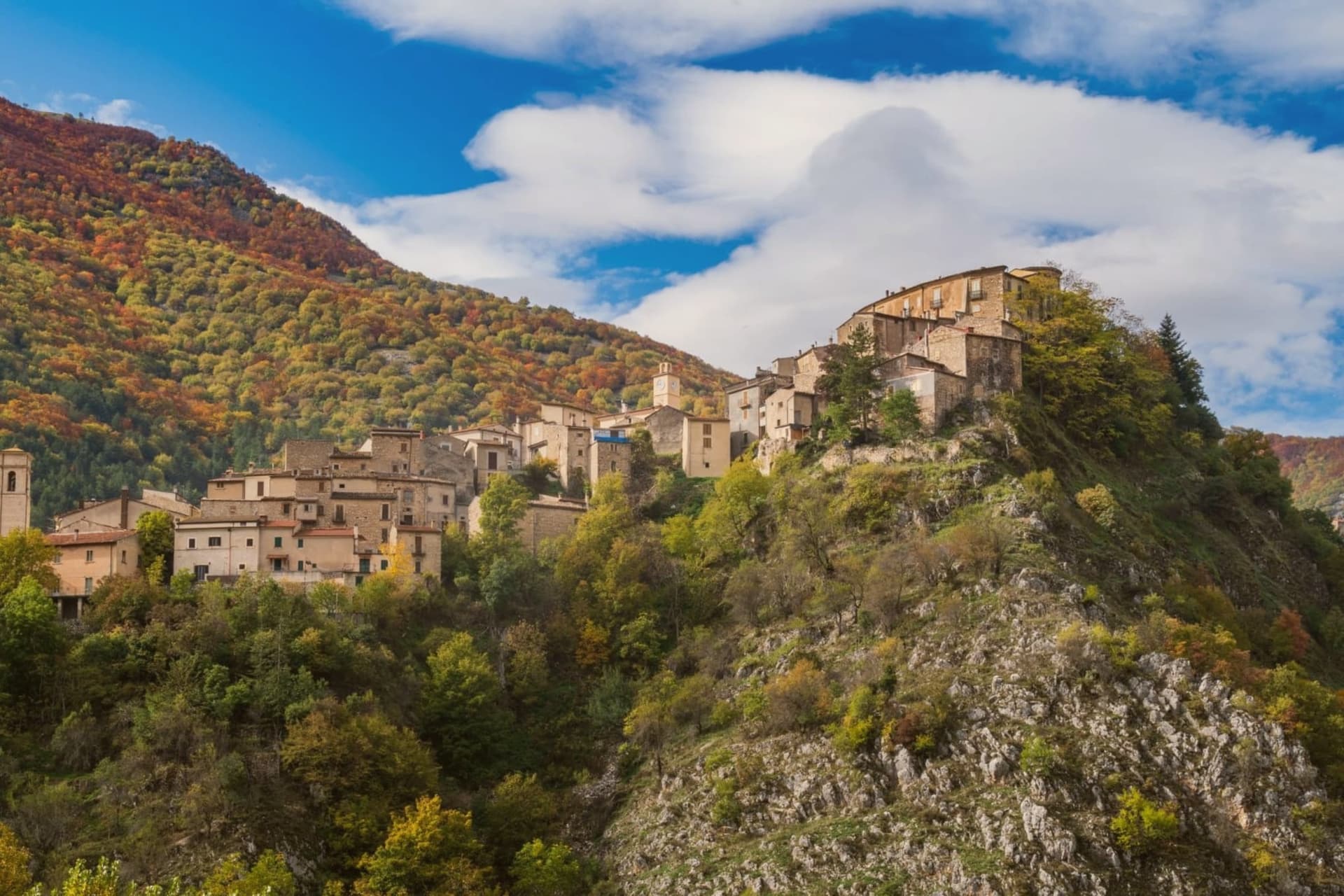
Villalago sits at 930 meters in the Sagittario valley between Scanno and Anversa degli Abruzzi, inside the Parco Nazionale d'Abruzzo, Lazio e Molise. The name comes from the vulgar Latin valle de lacu, the valley of the lake, a reference to the nine natural lakes once present in the territory, most now gone.
Three remain: Lago Pio for swimming, Lago di Scanno to the south with its famous heart shape, and Lago di San Domenico to the north, the artificial reservoir completed in 1929 by the State Railways to electrify the Rome-Sulmona line. On the lake's edge stands the Eremo di San Domenico, a small church built into a cave where, around the year 1000, the Benedictine monk Domenico di Sora lived.
The actual chapel went up in the 1400s, the portico in the 1600s. The parish church holds an altar to the saint carved in stone in the 12th century.
Villalago has been a Borgo dei Borghi finalist on RAI and is one of only three Bandiera Blu lake towns in Abruzzo.
The village sits at 930 metres.
What to see in Villalago
- Eremo di San Domenico. Hermitage on the lake's edge, built into a cave where Saint Dominic of Sora lived around the year 1000, with the chapel added in the 15th century.
- Lago di San Domenico. Artificial reservoir completed in 1929 to power the Rome-Sulmona railway, fed by the Sagittario gorge and held by a dam at the village's edge.
- Centro storico. Stone-built medieval core at 930 meters with the parish church preserving a 1521 Madonna del Rosario and a 12th-century stone altar to San Domenico.
How to get to Villalago
Pescara is roughly 75 minutes away by road.
Our tip
May through October is the window. The lakes warm enough for swimming from June, and the trails through the Gole del Sagittario stay clear until late October. July and August fill with Italian summer visitors but at 930 meters the air remains cool by evening.
Rivisondoli
Why visit Rivisondoli
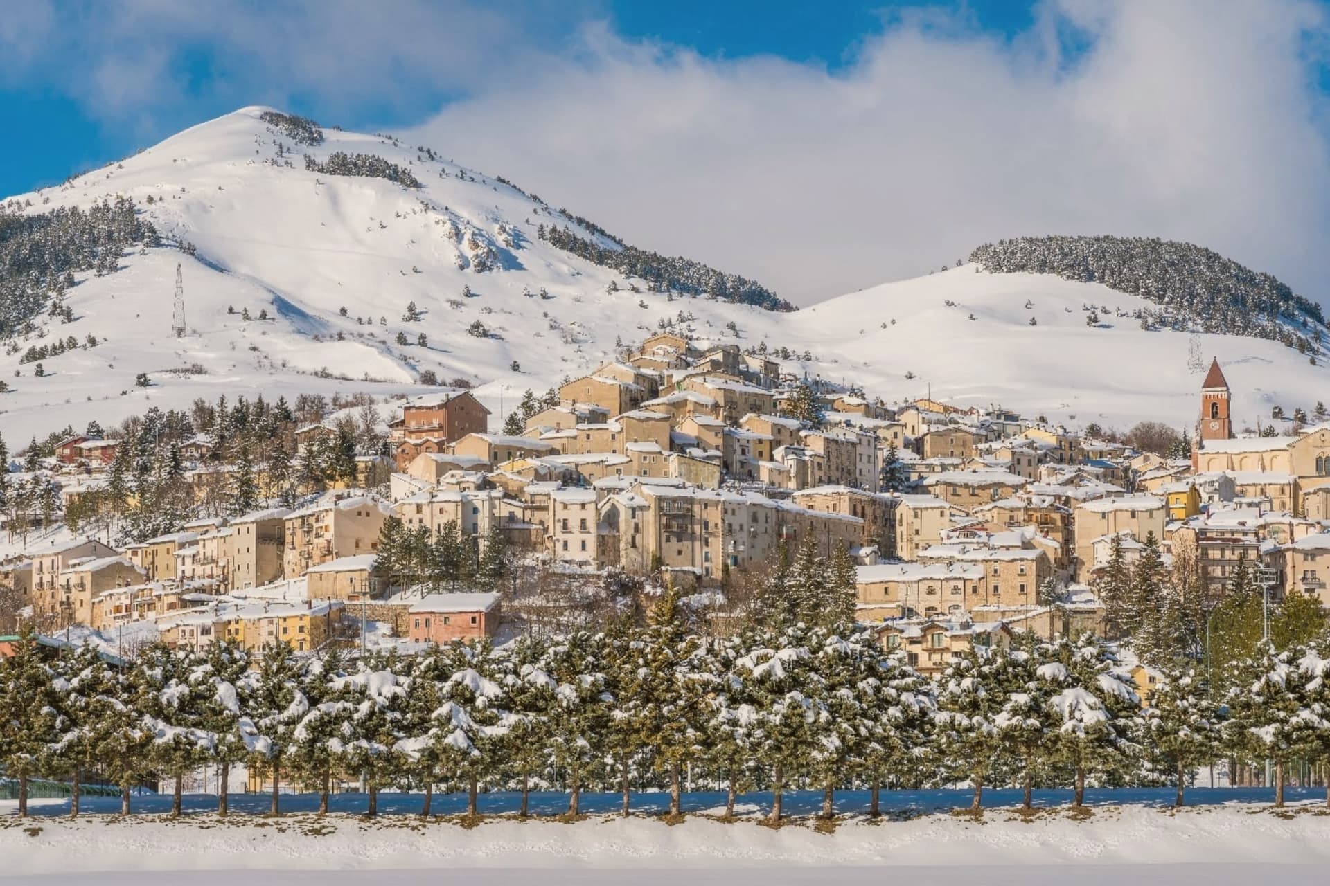
Rivisondoli sits on the flank of Monte Calvario, looking down at the plateau that runs north toward Roccaraso. The town was first recorded in 724 in a diploma of Grimoald II, Duke of Benevento, and grew in the 12th century along the Via degli Abruzzi, the military and trade route across the central Apennines.
It was once known for its weapons production. The 1792 fire destroyed most of the village, and the opening of the Sulmona-Isernia railway in the 19th century turned it toward tourism rather than trade.
The Italian royal family kept a residence here in 1913. Rivisondoli and Roccaraso face each other across the Cinque Miglia plateau, close enough that their ski slopes were joined into one domain and their names are now said together.
The older village, rebuilt twice, climbs one flank of the mountain while the plateau below stays open and treeless, the same ground that once slowed traders and caravans on the route through the Apennines. What began as a stop on a military road became, after fire and war remade the town twice, a place oriented instead toward winter visitors and a single night in January.
The village sits at 1320 metres.
What to see in Rivisondoli
- Alto Sangro ski area. The lift network runs between 1,309 and 2,142 meters, joining Rivisondoli's slopes to Roccaraso's across the open plateau.
- Presepe Vivente. Hundreds of villagers in period costume take the hillside outside town for the performance, the cast spread across the open ground rather than a stage.
- Altopiano delle Cinque Miglia. Treeless and averaging 1,250 meters, the plateau in the Alto Sangro is prone to extreme winter winds, a stretch that historically caught travelers unprepared.
How to get to Rivisondoli
Pescara is roughly 89 minutes away by road.
Our tip
December through March is the season the town runs on. The Alto Sangro lifts open, weekend numbers multiply, and the Cinque Miglia plateau north of town becomes the cross-country skiing route. The January 5 Presepe Vivente draws the biggest single crowd of the year.
Campo di Giove
Why visit Campo di Giove
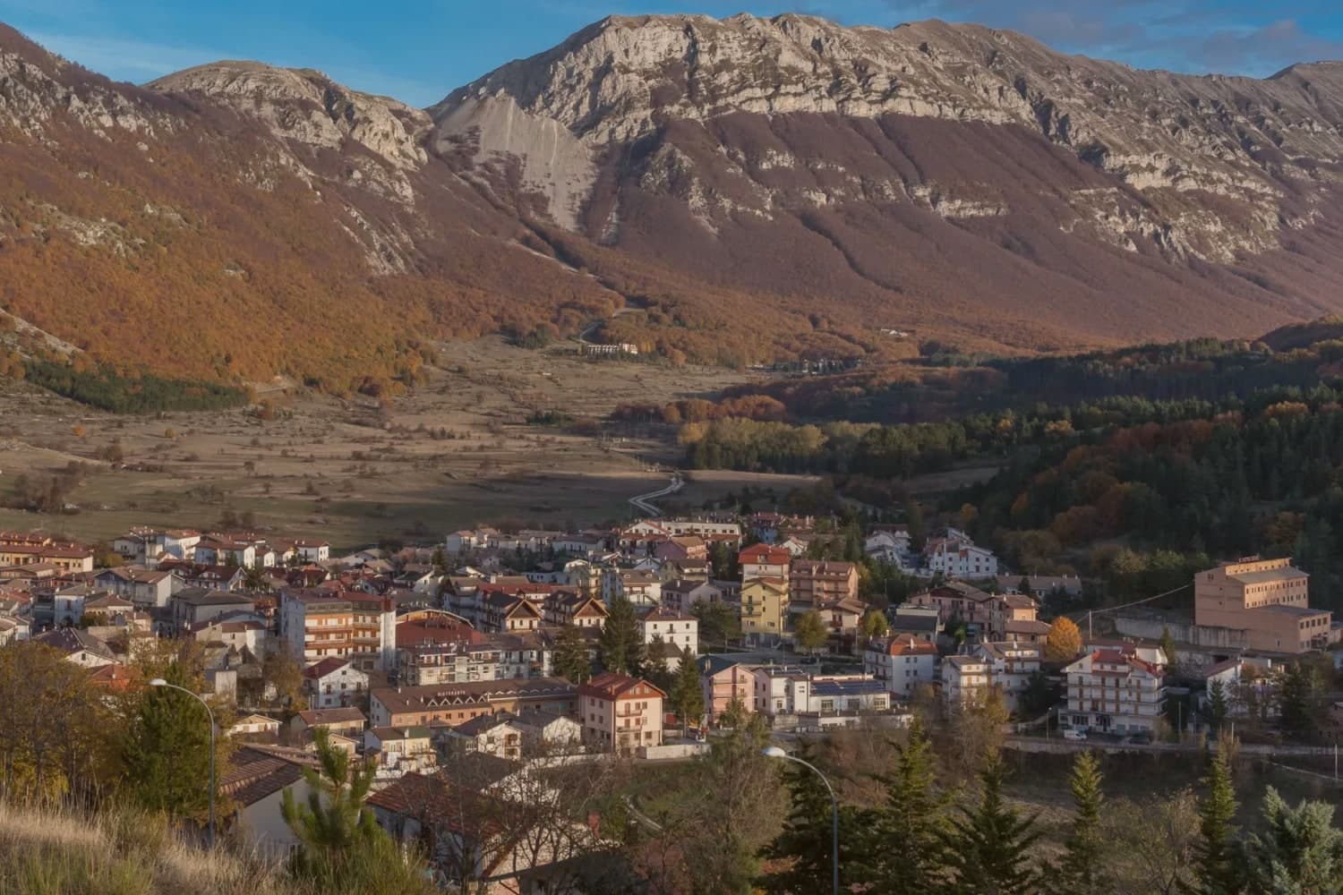
Campo di Giove sits at 1,064 meters at the foot of the southwestern Maiella, the highest commune inside the Maiella National Park. The name is documented as Campo Jovis from the 4th century AD, with local tradition claiming a Roman temple to Jupiter on the site after a victory over the Paeligni.
A villager called Odorisio appears in a document from January 1136. In the 14th century the village was a Cantelmo stronghold; it then passed to the Caldora, the Belprato, the Pignatelli, and finally the Recupito.
Above the village, the ski station operates between 1,150 and 2,360 meters, the highest piste in Abruzzo. The mother church of Sant'Eustachio holds the statue of the patron saint.
Sant'Antonino was one of the sixteen convents founded by Fra Pietro da Morrone, the hermit who would become Pope Celestine V. The Master of Campo di Giove, an anonymous 15th-century painter named for the polyptych he made for the village church, is on display at the Museo Nazionale d'Abruzzo in L'Aquila.
The village sits at 1064 metres.
What to see in Campo di Giove
- Chiesa Madre di Sant'Eustachio. Parish church of the village patron, with the statue of Sant'Eustachio, the saint celebrated each September with the village feast.
- Convento di Sant'Antonino. One of the sixteen convents founded by Fra Pietro da Morrone, the hermit who became Pope Celestine V, documented in a 1274 papal bull.
- Palazzo delle Logge. 16th-century palazzo with arched loggia on the main piazza, one of several Renaissance buildings from the Caldora and Pignatelli periods.
How to get to Campo di Giove
There is a railway station in the town, so you can arrive without a car and never need one while you are here. Pescara is roughly 82 minutes away by road.
Our tip
Campo di Giove runs on two seasons. December through March, the Maiella ski lifts run from the village edge to 2,360 meters, the highest piste in Abruzzo. June through September is the second season: temperatures stay below 25 even in August at 1,064 meters, and the Sentiero della Libertà hike, retracing the WWII escape route over the Maiella, draws walkers.
Pescocostanzo
Why visit Pescocostanzo
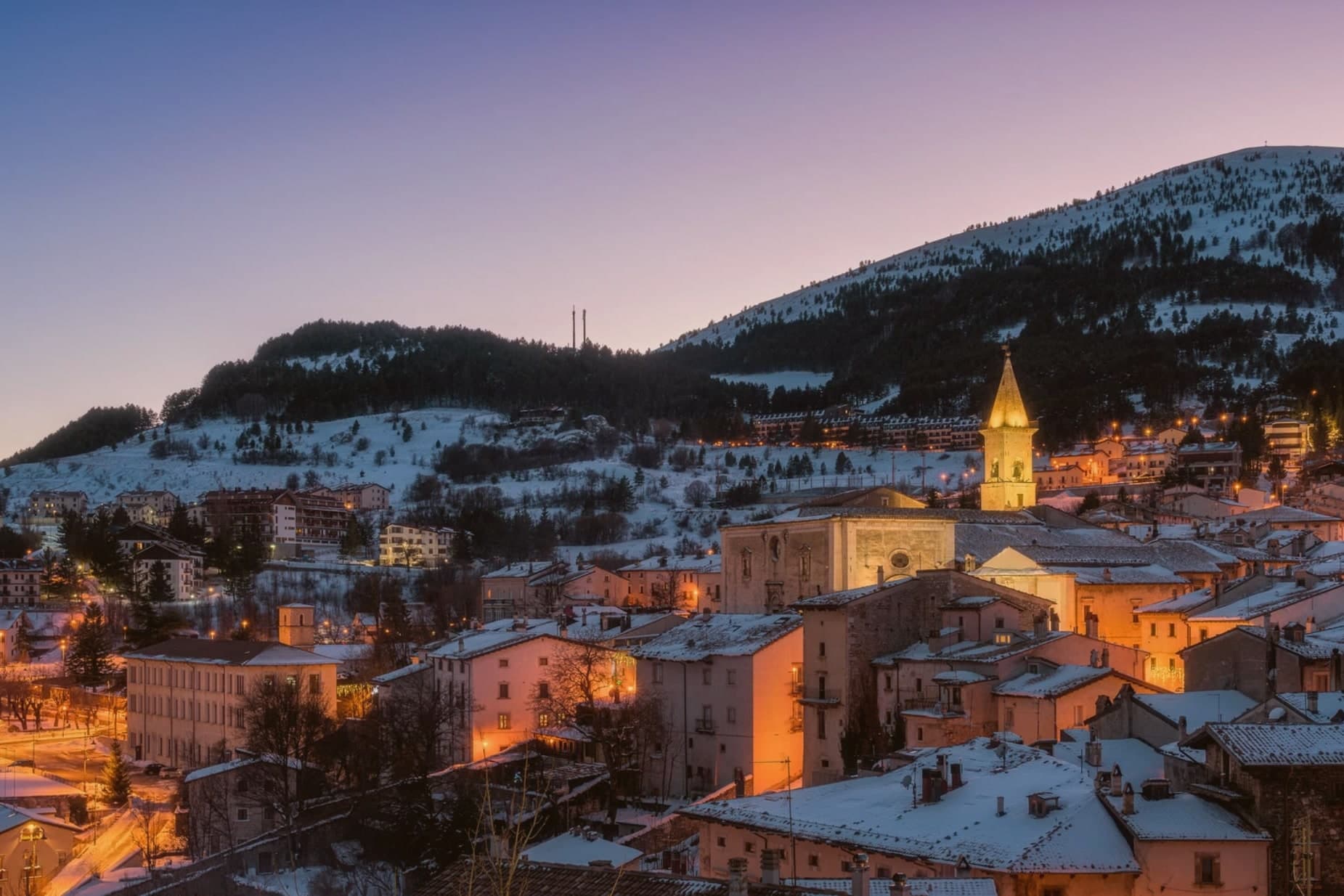
Pescocostanzo sits at 1,395 meters at the southern edge of the Quarto Grande plateau, the high karst basin above the Sangro valley. The town was reshaped between 1456 and the eighteenth century under the Capua family and a generation of Lombard masons who arrived to build for them.
The plan is unusually regular for a mountain commune: a grid of stone houses oriented to the wind, surrounded by woods and pasture. The Collegiata di Santa Maria del Colle, restructured by Cosimo Fanzago in the seventeenth century, is one of the rare five-nave churches in Abruzzo.
Its wrought iron Chapel of the Sacrament gate, made by Sante di Rocco between 1699 and 1707, is the masterpiece of local ironwork. Bobbin lace, merletto al tombolo, is still made here.
The Museo del Merletto a Tombolo inside Palazzo Fanzago shows the technique and the patterns. Filigree gold, carved wood, and lace are still sold on the Corso Roma.
The village sits at 1395 metres.
What to see in Pescocostanzo
- Collegiata di Santa Maria del Colle. Five-nave church begun in the late Middle Ages and remodeled by Cosimo Fanzago in the seventeenth century.
- Museo del Merletto a Tombolo. Inside Palazzo Fanzago, displays the local bobbin lace tradition with patterns, tools, and live demonstrations.
- Palazzo Fanzago. Designed by the baroque architect Cosimo Fanzago in 1624, the seat of the lace museum and civic offices.
How to get to Pescocostanzo
Pescara is roughly 84 minutes away by road.
Our tip
December through March brings snow and the ski season, with the Monte Calvario lifts linking to the Alto Sangro system at Roccaraso and Rivisondoli twenty minutes away. June through September is the second season. At 1,395 meters Pescocostanzo rarely crosses twenty-two degrees even in August, and the Bosco di Sant'Antonio offers beech-shaded walks.
Ovindoli
Why visit Ovindoli
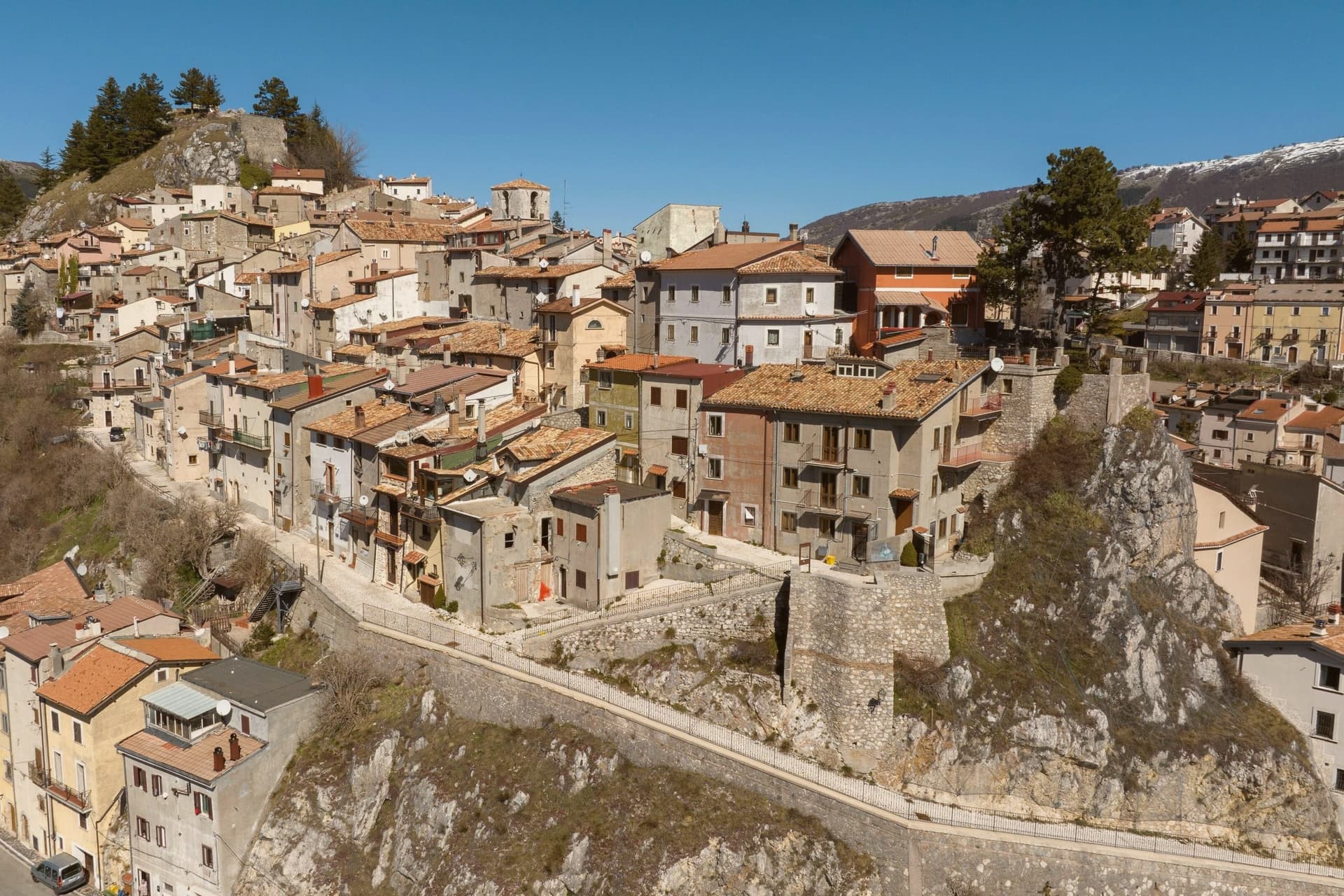
Ovindoli sits at 1,375 meters on the southern edge of the Altopiano delle Rocche, the karst plateau shared with Rocca di Mezzo, Rocca di Cambio and Rovere, inside the Sirente-Velino regional park. The town built itself around skiing.
Downhill became a serious draw after World War I, but the modern resort was organized in 1959 under the name Valturvema. Lifts opened in the 1961-62 season and the trails were expanded.
In 1994, new management renamed the operation Monte Magnola and modernized the lifts, the snowmaking, and the network. The ski area now runs from the village at 1,413 meters to the top of Monte Magnola at 2,056 meters, with about 30 kilometers of downhill, three triple chairlifts, two chairlifts, one cable car, four magic carpets and one drag lift.
It is part of the Skipass dei Parchi consortium with Campo Felice, Campo Imperatore and Grotte di Stiffe. Summer is hiking, mountain biking and horse-riding country.
Population is 1,167.
The village sits at 1375 metres.
What to see in Ovindoli
- Monte Magnola. Ski station from 1,413 to 2,056 meters, 30 kilometers of downhill terrain on the slopes above Ovindoli, modernized in 1994.
- Altopiano delle Rocche. Karst plateau at 1,300-1,400 meters shared with Rocca di Mezzo, Rocca di Cambio and Rovere, the central terrain of the Sirente-Velino park.
- Parco Naturale Regionale Sirente-Velino. Regional park that surrounds the town, with high meadows, beech forests and trails toward the Sirente and Velino summits.
How to get to Ovindoli
Pescara is roughly 78 minutes away by road.
Our tip
December through March is the ski season, the months Ovindoli was built around. The Monte Magnola lifts run, the town hotels fill on weekends, and the Skipass dei Parchi makes the village a hub for the four-station consortium. June through September is the second draw: at 1,375 meters the village stays cool through August, and the same plateaus that hold the skiers become trail-running, hiking and grazing country.
Scanno

Why visit Scanno
Scanno sits in the Sagittario valley, ringed by the Majella foothills and the Marsicano massif. The lake lies three kilometers down the valley from the town, at a lower elevation, so the walk between them moves from stone alleys to open water framed by the same slopes that produced it: a landslide off the mountain dammed the Tasso river and left the basin behind.
The town's isolation, closed in by the surrounding massifs, is what let the older costume and its headdress survive into the era of the camera, and it is what drew photographers to record it rather than something they invented. The goldsmiths' filigree, made in the same stone streets the women walked, belongs to the same thread: a village shaped by its enclosure in the mountains, still making by hand what it has always made.
The village sits at 1057 metres.
What to see in Scanno
- Lago di Scanno. Seen from above, the water reads as a clean heart shape against the valley walls.
- Centro storico. Stone-alley medieval centre where the black costume, with its folded headdress some historians trace to Balkan or Eastern origins, is still worn by older women against limewashed walls.
- Chiesa di Santa Maria della Valle. Parish church first documented in the eleventh century, rebuilt in the seventeenth, with a Renaissance portal and Baroque interior.
How to get to Scanno
Pescara is roughly 80 minutes away by road.
Our tip
June through September is the summer window: trails open in the national park, the lake holds a Blue Flag for swimming, and the centro fills with photographers chasing the Giacomelli setups. December through March is the second season for snow, with skiing on Monte Rotondo and Passo Godi nearby. April, May, October and November are quiet, with many family-run hotels closed and the lake side restaurants shuttered.
More from Anywhere Italy
- The best mountain towns inside a national park within 90 minutes of Pescara
 The best small ski towns in the province of L'Aquila
- The 6 best small towns that eat well in the province of L'Aquila
 The 10 prettiest small villages in the province of L'Aquila
- The best towns that eat well in the province of L'Aquila
- The prettiest villages inside a national park within 90 minutes of Pescara