
The best olive oil towns in the province of Imperia
Olive oil in the province of Imperia means one variety above all, the taggiasca, a small dark olive that gives a pale gold oil with almost no bitterness and a finish like almond skin. The groves climb the Argentina, Nervia and Arroscia valleys on dry stone terraces built by hand, held up by walls of grey local stone that also went into the village houses, the vaults, the arcaded lanes. Harvest runs through the cold months, when nets go down under the trees and the frantoi work late, and the new oil turns up in the shops and on the bar counters in unlabelled tins. Eat it as the valleys do: on chickpea flour, over stockfish stewed with pine nuts, poured on rabbit cooked with olives and thyme, or simply with the bread and the sharp local wine.
Most people meet this coast at Sanremo, with its casino and its flower market and its seafront promenade, or they push on to Ventimiglia for the Friday market and the French border. In high summer the Riviera dei Fiori fills to the edges, and the towns along the Aurelia become one continuous line of parked cars, beach umbrellas and gelato queues. It is a good coast and the reputation is earned, but the interest there is the sea, not the crop that made the region's money for centuries.
The oil country is inland, up the valleys that open behind those resorts, and it is quieter for the plain reason that fewer people drive up them. Half an hour from the water there are villages of stacked stone with covered passages and mills still turning, medieval bridges over green rivers, arcades built for wool and oil trade, castles above the vines. The towns below all belong to the national association of olive-oil towns, which is the useful signal that the groves, the presses and the cooking are still local rather than decorative. Go in autumn or winter, when the harvest is on and the coast has emptied.
Of the 13 communes we have mapped in the province of Imperia, 9 qualify as olive oil towns: each belongs to the national association of olive-oil towns. The smallest, Apricale, has 626 residents.
If you are still choosing, we have also written The prettiest small villages in the province of Imperia and The best hill towns in the province of Imperia.
Apricale
Why visit Apricale
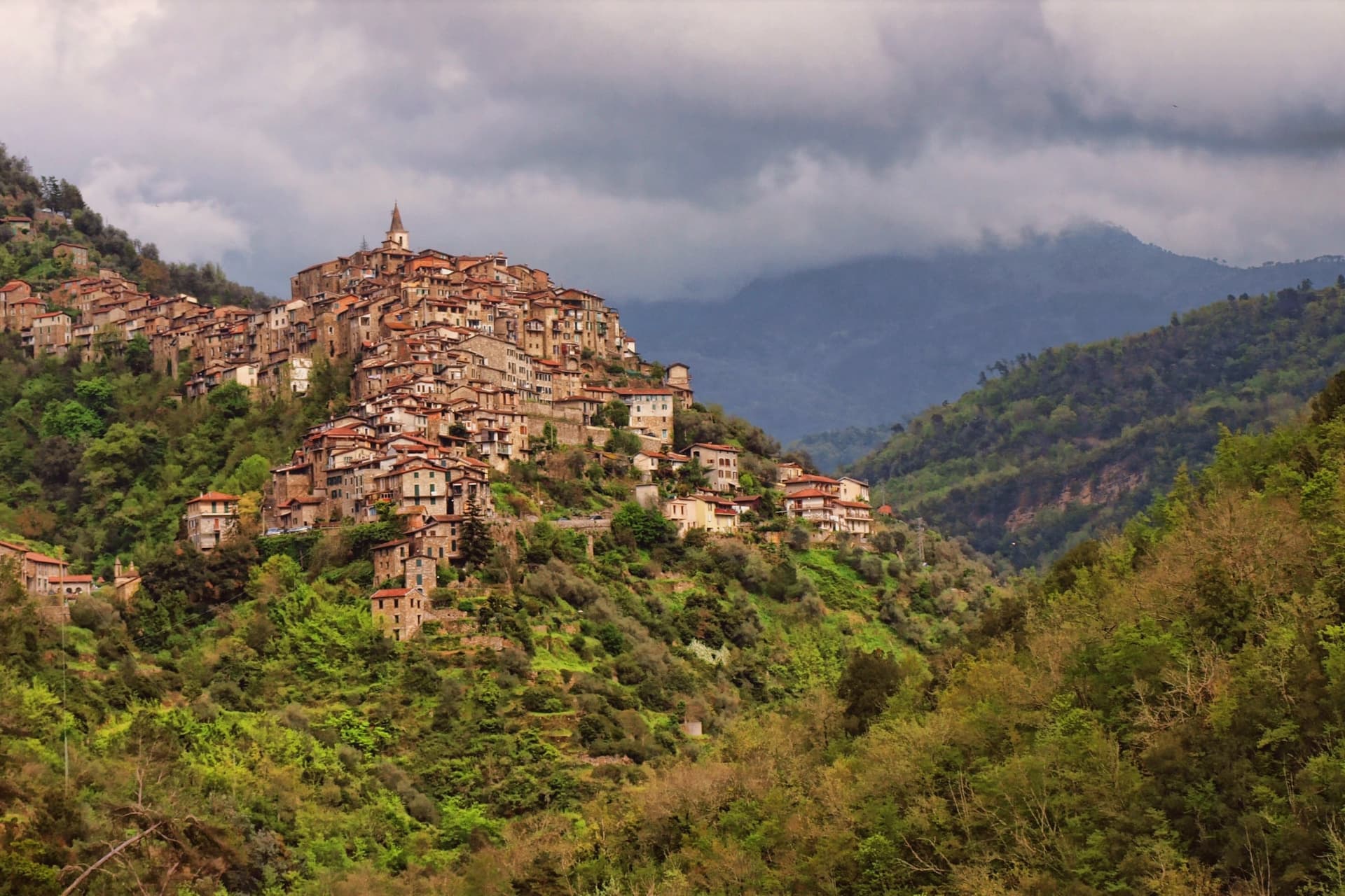
Apricale sits at 273 meters on a rocky spur in the Val Nervia, thirty kilometers west of Imperia and a few kilometers inland from the French border. The name comes from apricus, the Latin word for sunny: the village faces south on a ridge that catches light most of the day.
The Counts of Ventimiglia built the Castello della Lucertola here in the tenth century, called the Lizard Castle because its outline matches the silhouette of the village along the rock. From 1270 the borgo passed to the Doria of Dolceacqua.
The houses cascade down the slope in stone tiers, connected by alleys and stairs rather than streets. The village holds Borghi più belli, Bandiera Arancione, and Città dell'Olio.
Below the centro storico, the Chiesa di Santa Maria degli Angeli dates to the thirteenth century. The Sagra della Pansarola each September celebrates the local sweet fritter eaten with zabaglione.
What to see in Apricale
- Castello della Lucertola. Tenth-century castle of the Counts of Ventimiglia, named for its lizard-shaped outline on the rock, now housing the village museum.
- Chiesa di Santa Maria degli Angeli. Thirteenth-century church at the foot of the village, the oldest religious building in Apricale.
- Chiesa della Purificazione di Maria. Parish church on Piazza Torracca, with a neo-Romanesque façade rebuilt in the nineteenth century.
How to get to Apricale
Genova is roughly 144 minutes away by road.
Our tip
April through June and September into October are the right months. The terraces are green, the olive harvest runs from October into December, and the light on the south-facing rock matches the Latin name. July and August push into the low thirties; the stone holds heat and the village empties between two and five.
Perinaldo
Why visit Perinaldo
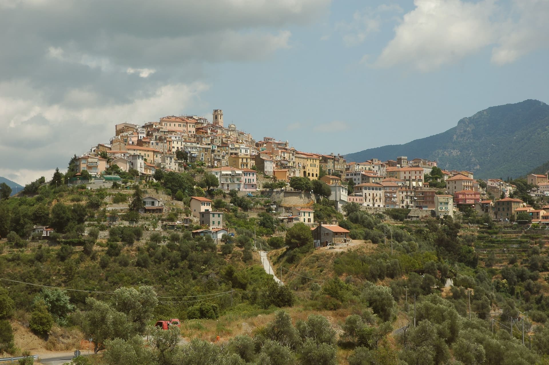
Perinaldo sits seven kilometers inland from Bordighera and the French border, on a ridge above the Val Nervia. The medieval centro storico is built in concentric rings around the old castle, a compact plan that ties church, castle, and town hall together within a short walk of each other.
The astronomer left for Bologna and then for the court of Louis XIV in Paris, where he directed the new Royal Observatory. He did not return, but he sent a canvas back to the Suffragio altar of the parish church in 1672, and the meridian his calculations helped fix is still marked on the sundial of the smaller church on the ridge.
The terraces below the village grow Taggiasca olives, the basis of its Città dell'Olio standing. Perinaldo also holds Borghi più belli and Bandiera Arancione recognition.
The village's shape, ring upon ring around a single high point, mirrors the way its history keeps circling back to one native mind that left for Paris and never stopped sending word home.
What to see in Perinaldo
- Osservatorio Astronomico G. D. Cassini. A dome rises from the inner courtyard of the town hall. On observation evenings the working instrument inside is put to the same sky Cassini once charted from far greater distance, in Paris.
- Chiesa di San Nicola da Bari. Parish church built in 1489, holding a fifteenth-century wooden crucifix and, on the Suffragio altar, a canvas sent back from Paris by its most famous native son.
- Chiesa della Visitazione. Smaller church on the ridge, fitted with a meridian sundial calibrated using the astronomical methods developed by the town's native astronomer.
How to get to Perinaldo
Genova is roughly 132 minutes away by road.
Our tip
April through June and September into October are the right months on this ridge above the Val Nervia. The terraces green in spring, the olive harvest runs from October into December, and the sky at 572 meters clears most evenings. The observatory schedules its public sessions through spring, summer and early autumn.
Badalucco
Why visit Badalucco
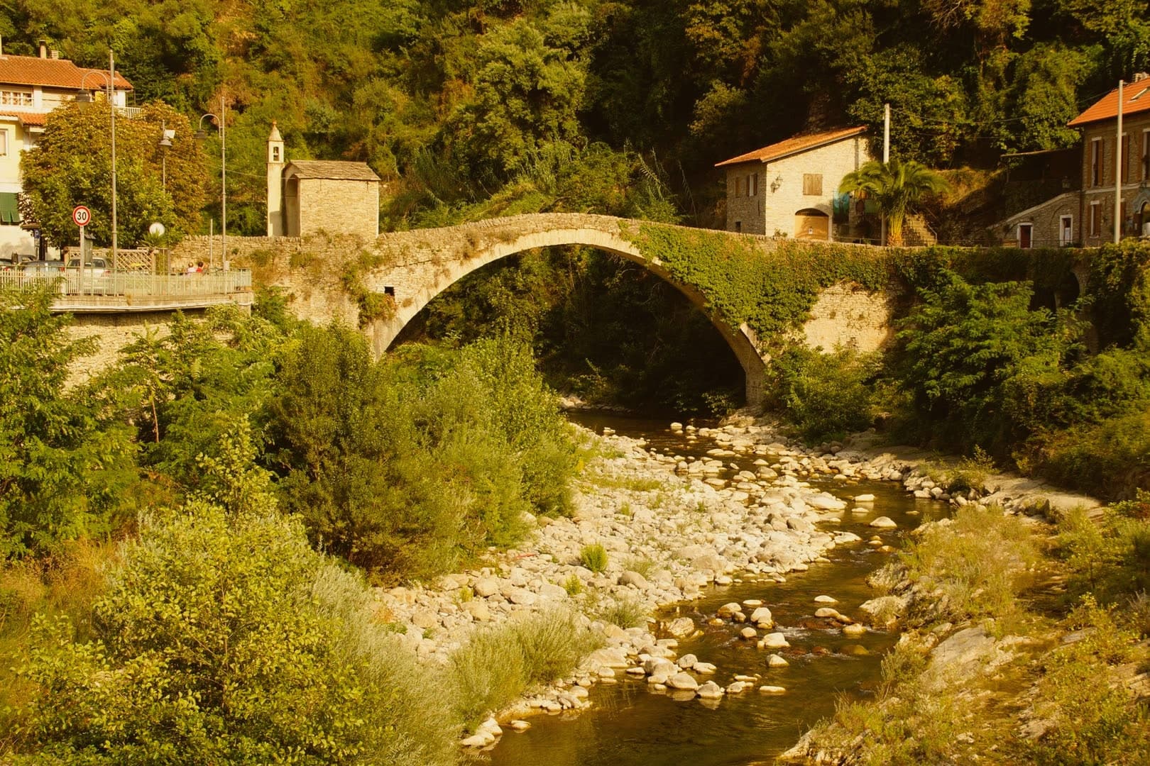
Badalucco sits at 179 meters in the middle Valle Argentina, fifteen kilometers north of Imperia. The torrent that gives the valley its name runs in a wide bend below the village.
The site changed hands between Ligures and Rome in 181 BC, became a fief of the Counts of Ventimiglia, and passed to the Republic of Genova in 1259. The seventeenth century rebuilt the parish Chiesa di Santa Maria Assunta e San Giorgio in full Baroque, with a square bell tower and a fifteenth-century polyptych attributed to Giovanni Canavesio.
The caruggi of stone houses are painted with contemporary murals and trompe-l'oeil, a more recent layer over the medieval shell. The Rundin bean, an indigenous variety grown on the terraces, is a Slow Food Presidium.
Stoccafisso alla badalucchese, stockfish stewed in tomato and olives, is the dish: the third Sunday of September brings the Stockfish Festival to the square.
Umami, Cian de Bià have been named by a guide.
What to see in Badalucco
- Chiesa di Santa Maria Assunta e San Giorgio. Seventeenth-century Baroque parish church with a square bell tower, holding a fifteenth-century polyptych attributed to Giovanni Canavesio and a seventeenth-century wooden crucifix.
- Chiesa di San Niccolò. Hilltop church above the old village, on the site of a former noble castle that served as a lookout over the valley.
- Ponte sull'Argentina. Stone bridge across the torrent that wraps the village, connecting the centro storico to the valley road.
How to get to Badalucco
Genova is roughly 122 minutes away by road.
Our tip
April through June and September into October are the dry months in the Argentina Valley. The terraces above the village hold olive groves, the Rundin bean, and pockets of grapevine. July and August push into the low thirties, but the valley keeps a few degrees cooler than the coast. Festival dello Stoccafisso falls in September.
Cervo
Why visit Cervo
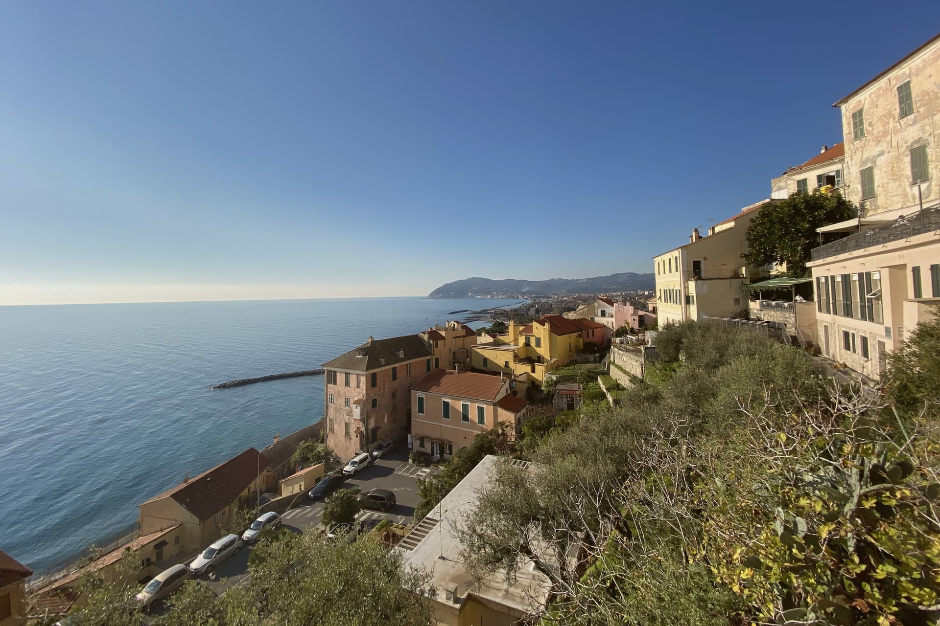
Cervo sits at 66 meters on a hill that drops straight to the Riviera di Ponente, between Imperia and Albenga. The settlement began as a Roman roadhouse on the Via Julia Augusta and grew into a medieval fief of the Marchesi di Clavesana, loyal vassals of the Republic of Genoa.
The sixteenth-century towers and ramparts that ring the upper village were built when Saracen incursions still threatened the coast, and the fortified high point where the marquis line once held power is now given over to a museum of the coral trade that shaped the town below. The lower streets run down toward the church square, where the coral money that built the parish church also paid, centuries later, for the open-air stage where the summer concerts are heard.
The two high points of the village, the castle above and the churchyard below, mark the two economies that built Cervo: a defensive fief guarding the coast, and a fishing community whose earnings from distant waters ended up carved into Baroque stone. What the hill preserves, in effect, is the record of both: a fortified lookout turned museum, and a merchant church turned concert hall.
What to see in Cervo
- Chiesa di San Giovanni Battista. Known as the Chiesa dei Corallini. Its concave Baroque façade faces the sea and gives the small square in front of it the acoustics that host the festival each summer.
- Castello dei Clavesana. Sits at the top of the village with walls that once looked out for Saracen ships. The Ethnographic Museum of Western Liguria now occupies its rooms, with displays on the coral trade and the fishing life that funded the church below.
- Oratorio di Santa Caterina. Small Romanesque oratory with eighteenth-century frescoes, set into the old defensive walls.
How to get to Cervo
Genova is roughly 89 minutes away by road.
Our tip
April through June and September through October are the right months for Cervo. The Riviera di Ponente is dry, the centro storico keeps its sea breeze, and the sagrato of San Giovanni hosts concerts from July into early August during the Festival Internazionale di Musica da Camera. Mid-summer is hot at sea level and the village fills with festival-goers; book accommodation well ahead.
Ceriana
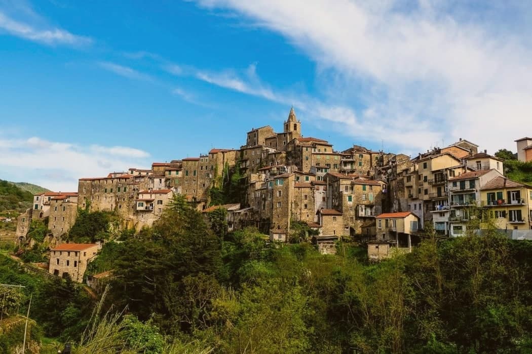
Why visit Ceriana
Ceriana sits at 369 meters in the Valle Armea, twenty kilometers west of Imperia and a short climb inland from Sanremo. The Romans built a garrison here called Castrum Coelianae, a watchtower with permanent quarters for legionaries; the name shortened to Ceriana over the centuries.
The town took its present shape in the eleventh and twelfth centuries, passing from the Counts of Ventimiglia to the Mari family in 1297 and to the Republic of Genoa in 1359. The parish church of Santi Pietro e Paolo is reached by climbing the caruggi, narrow Ligurian alleys roofed in places by overpassing houses; inside, an anonymous wooden Virgin from the thirteenth century and a 1526 polyptych of San Pietro in cattedra.
Three confraternities still keep their oratories in town: the Rossi at Santa Caterina, the Azzurri at the Visitazione, and the Neri at the Addolorata. Olive oil from the surrounding terraces carries the Città dell'Olio mark.
What to see in Ceriana
- Chiesa dei Santi Pietro e Paolo. Parish church at the top of the caruggi, with a thirteenth-century anonymous wooden Virgin and a 1526 polyptych of San Pietro in cattedra.
- Oratorio di Santa Caterina. Seventeenth-century oratory of the Confraternita dei Rossi, built under the protection of the Senate of Genoa.
- Oratorio della Visitazione. Seat of the Confraternita degli Azzurri, the second of three colour-coded brotherhoods that still organize the town's processions.
How to get to Ceriana
Genova is roughly 121 minutes away by road.
Our tip
April through June brings the olive flowering on the terraces below the village and warm afternoons that don't yet burn. September and October are the dry months, with the harvest ramping up and pressing beginning in November. Summer is hotter but the 369 meters of elevation keep nights cool enough to sleep; the caruggi stay shaded most of the day. Sagra Della Salsiccia Di Ceriana falls in August.
Pieve di Teco
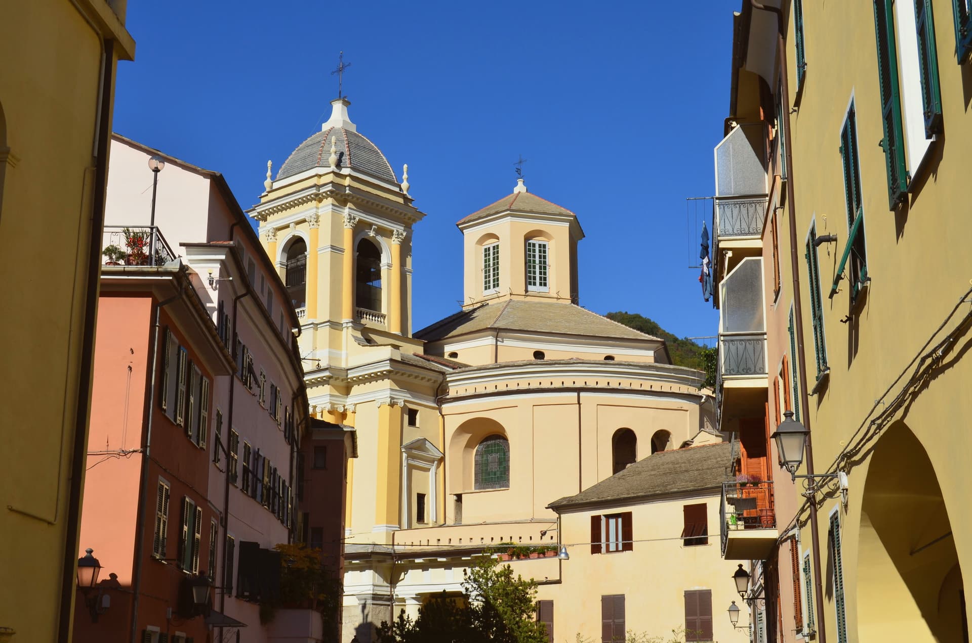
Why visit Pieve di Teco
Pieve di Teco sits at 240 meters in the middle Arroscia valley, twenty kilometers northwest of Imperia. The town was not a slow medieval accretion: it was deliberately founded in 1233 around a parish church, a mill and a well, on a flat stretch where the main roads of the upper valley converged, with the explicit purpose of running a market.
Manufactures followed of paper, leather, soap, ropes, cloth and footwear. The Clavesana family held it until 1386, when it passed to Genoa, and it changed hands repeatedly through the wars that crossed the Ligurian Apennines.
The Corso Mario Ponzoni, porticoed since the sixteenth century, runs the length of the original market layout, and the eighteenth-century Collegiata di San Giovanni Battista anchors one of its squares. The Teatro Salvini, with around a hundred seats, is the second-smallest functioning theater in Italy.
The commune is the seat of the Unione dei Comuni della Valle Arroscia.
What to see in Pieve di Teco
- Corso Mario Ponzoni. Porticoed market street running the length of the original 1233 town plan, with two-storey houses above the sixteenth-century arcades.
- Collegiata di San Giovanni Battista. Eighteenth-century collegiate church overlooking one of the squares on the Corso, the religious anchor of the upper Arroscia valley.
- Teatro Salvini. Roughly one hundred seats, the second-smallest functioning theater in Italy, still in regular use for chamber-scale productions.
How to get to Pieve di Teco
Genova is roughly 94 minutes away by road.
Our tip
April through June and September through October work well for Pieve di Teco. The Arroscia valley at 240 meters runs cooler than the coast through summer; July and August are warm but tolerable, with the porticoed Corso providing continuous shade. The autumn harvest brings the Taggiasca olive picking and the first pressings. Expo Valle Arroscia falls in September.
Dolceacqua
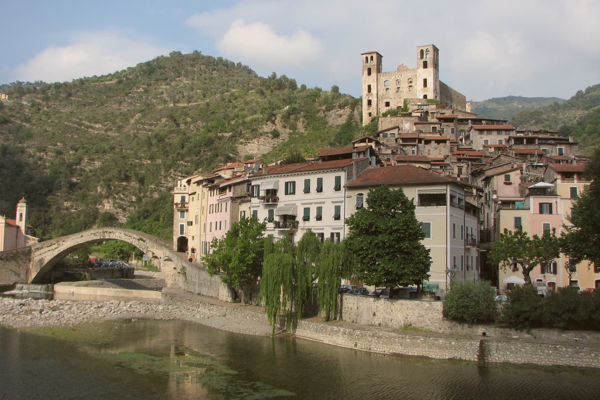
Why visit Dolceacqua
The village sits twenty kilometers from the French border and nine inland from Bordighera, in the Val Nervia. The river of the same name splits it into two: the older Terra on the left bank, its lanes stepping up toward the castle, and the newer Borgo on the right, where the parish church stands.
The bridge is what makes the two halves legible as one village rather than two settlements facing each other across water. The Doria held the fief from 1270, traded it with the Savoy, the French and the Spanish, and let the castle go by the mid-eighteenth century, so what remains above the rooftops is a ruin rather than a seat of power.
The surrounding hills still work, producing Rossese di Dolceacqua. In January, the Festa di San Sebastiano carries a laurel tree hung with consecrated wafers through the lanes of both banks.
The village, in other words, is still organized exactly as Monet found it in 1884: a river, two banks, and a bridge between them, with the working hillside and the ruined fortress as the constants either side of the water.
CASAeBOTTEGA, A Viassa, Casa e Bottega have been named by a guide.
What to see in Dolceacqua
- Ponte Vecchio. Thirty-three meters across the river, the span that carried Monet's eye from the water up to the fortress above. It is what joins the village's two banks into one place.
- Castello dei Doria. Ruined above the rooftops, with a partial restoration underway. The climb up through the old quarter ends at its walls, looking back down over both halves of the village.
- Terra. Older half of the village on the left bank, a vertical network of carruggi climbing under arched passageways to the castle.
How to get to Dolceacqua
Genova is roughly 130 minutes away by road.
Our tip
April through June brings green hills, mild evenings, and the first Rossese tastings in the cellars along the road to Apricale. July and August are warmer than the coast, often 30 degrees in the riverbed; the village stays cool inside the carruggi but full of day-trippers from Bordighera and Ventimiglia. September is dry and clear, the best month for the bridge in the afternoon light.
Diano
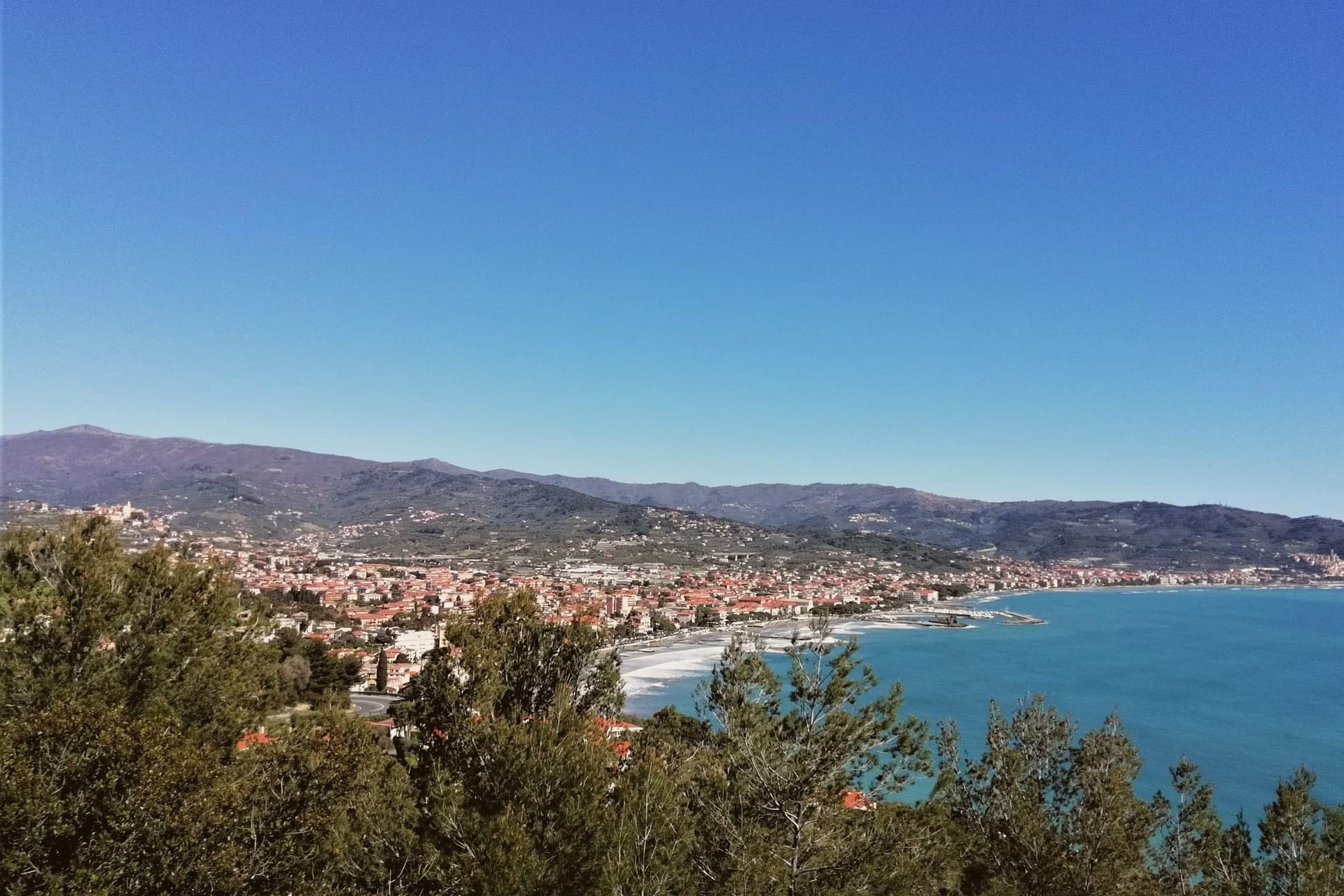
Why visit Diano
The hilltop and the coast were one commune until the seaside half was made independent in 1923, and the two still read as a single place split in two: a fortified settlement set back from the water, and the town it produced at sea level once the shoreline could be settled safely. The name of the upper town traces to the Latin Dianum, a temple to Diana, which places the site's origin well before the medieval walls that now define it.
Both halves sit on the same bay and draw on the same valley behind them, where the Taggiasca olive has been grown long enough to anchor the local Città dell'Olio membership shared by both. The bay itself is sheltered and south-facing, which gives the coastal half one of the milder climates on the Italian Riviera and explains why the beach resort grew where it did, directly below the older settlement rather than at any distance from it.
What Diano amounts to, then, is a single valley economy, olives above, sand below, that split administratively in the twentieth century without ever splitting geographically.
What to see in Diano
- Diano Castello — centro storico. Vaulted alleys and stone staircases climb through the old town to the parish church of San Nicola di Bari. The walls that ring the settlement still trace their full course, and the streets keep the tight, defensive layout of a hill settlement built for lookout rather than commerce.
- Diano Marina — Bandiera Blu beach. The seafront runs the length of the resort under a line of palms, with the flat, easy sand that makes it a family destination. Summer markets fill the promenade, and the town's calendar turns on the mid-August Madonna del Rosario procession.
- Museo dell'Olivo (Diano Marina). The exhibits move from Roman amphorae through medieval monastic cultivation to present-day production, tracing the Taggiasca olive's long presence in the valley. The museum was founded by the Carli oil family.
How to get to Diano
There is a railway station in the town, so you can arrive without a car and never need one while you are here. Genova is roughly 94 minutes away by road.
Our tip
April through October is the open season for both Dianos — warm coastal days, calm Mediterranean sea by late spring, and the Diano Marina beach packed from mid-June through August. The Sant'Antonio procession runs the second week of August. Diano Castello stays alive year-round (the medieval old town is residential) but the most pleasant months for the hilltop are May-June and September-October.
Taggia
Why visit Taggia
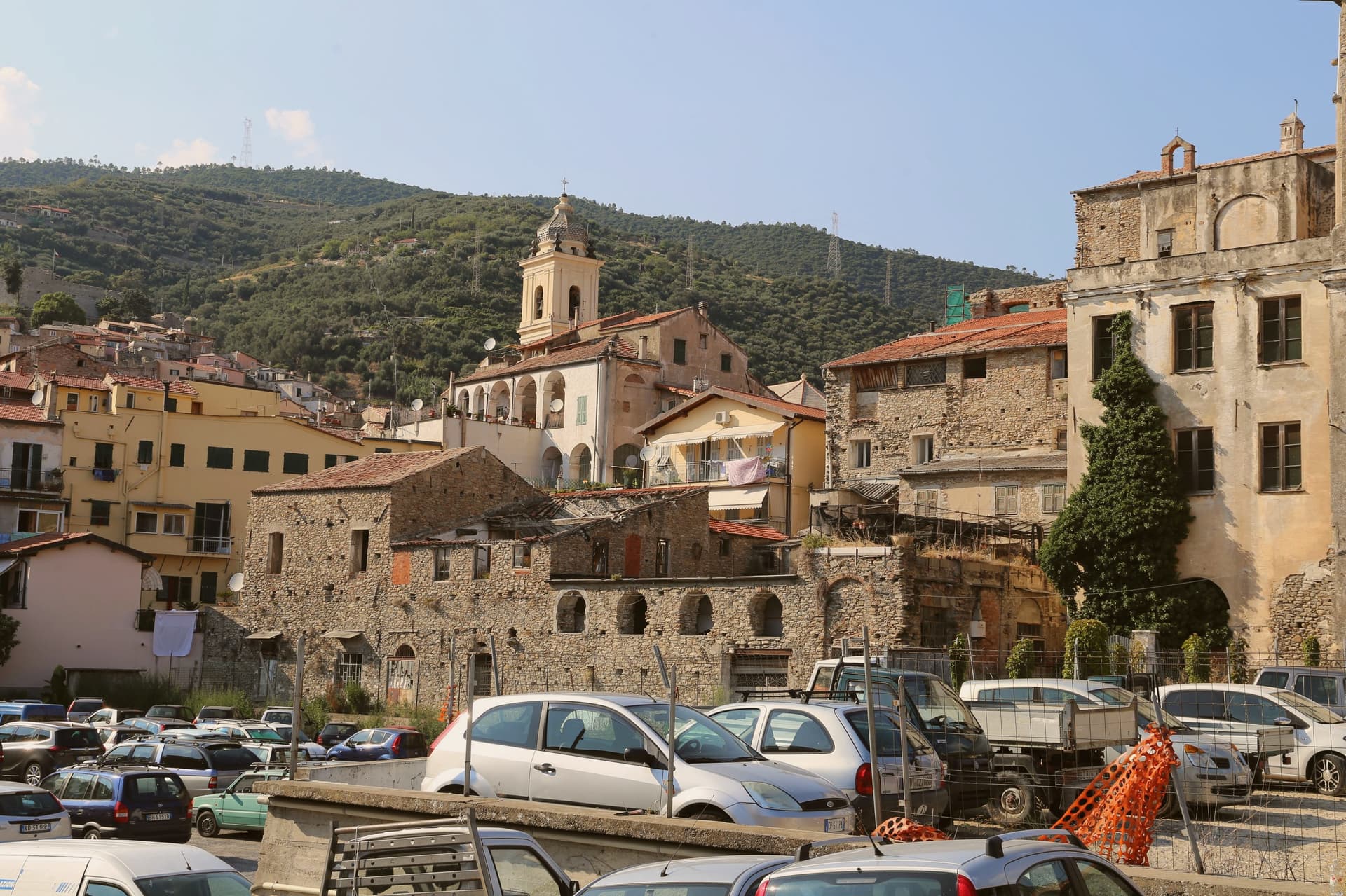
Taggia sits where the Argentina valley narrows toward the Ligurian coast, fifteen kilometers west of Imperia. Iron Age tombs have been found in the territory, and the small port at the mouth was called Costa Balenae in antiquity, a coastal settlement distinct from the medieval town that grew up along the river above it.
The Benedictine monks of Lérins came in the seventh and eighth centuries and, by tradition, brought the olive cultivar that took the town's name and now covers most of western Liguria's hillsides. The medieval centro storico runs along three parallel streets above the river, and sixteenth-century walls fortified the town against Ottoman raids that struck the coast in 1560 and 1564, the same period that produced the bridge's later arches and the walled gates still standing.
Taggia carries the Borghi più belli badge and the Città dell'Olio designation as the source of the Taggiasca name. The valley town, the coastal port, and the olive-covered hillsides are really one settlement pattern read at three scales: a river crossing fortified against the sea, feeding an oil that carried the name outward long after the raids stopped.
La Conchiglia have been named by a guide.
What to see in Taggia
- Convento di San Domenico. Founded in 1490. The Brea panels hang alongside works of the Nice school, four centuries of west-Ligurian painting gathered in one cloister.
- Ponte Antico. The arches step unevenly across the river, the earliest sections centuries older than the latest, a bridge built by accretion rather than plan.
- Centro storico di Taggia. Three parallel medieval streets above the river, sixteenth-century walls and gates intact from the era of Saracen and Ottoman raids.
How to get to Taggia
There is a railway station in the town, so you can arrive without a car and never need one while you are here. Genova is roughly 116 minutes away by road.
Our tip
April through June and September to October bring the best windows: olive groves still green or in harvest, the Argentina valley walkable, evenings on the centro storico stones below 25 degrees. Taggia's olive harvest, the Olioliva festival down the coast in Imperia, runs through November. July and August push 30 to 32 degrees and bring weekend traffic from Sanremo, ten kilometers west.
More from Anywhere Italy
 The prettiest small villages in the province of Imperia
- The best hill towns in the province of Imperia
- The best coastal towns in the province of Imperia
- The best olive oil towns that eat well in Liguria
 The best olive oil towns you can reach by train in Liguria
 The best small towns with a food festival in Liguria