
The best wine towns in Calabria
Calabria makes wine in hard country. The vines sit on terraces of clay and limestone between the Pollino massif and the Ionian, in air that carries salt one hour and mountain cold the next, and the grapes are ones you will not have drunk much of: Gaglioppo, thin-skinned and pale for a red, Magliocco with its darker fruit, Greco Bianco and the dried Moscato that becomes a syrupy amber dessert wine. The towns above the vineyards are built of local stone and rendered brick, tight lanes climbing to a castle or a Norman church, and the harvest runs from late summer into autumn when the roads smell of must and woodsmoke. Eat with it: pork sausage heavy with chilli, pecorino crotonese, swordfish, tonnarelli with sardella. Winter brings the mountain versions of the same table, chestnuts and beans and lamb.
There is a reason most visitors never see any of this. Calabria's reputation lives on the water, on Tropea and its cliff of ochre houses over a beach the colour of a swimming pool, and in August the town centre moves at the pace of the queue for a gelato. Coach parties come, the coastline round Capo Vaticano fills, and the wine on the table is whatever the beach bar stocks. The interior, which is where the vines actually are, stays empty because nobody drives inland from a beach holiday.
The same hills that back those beaches keep going, up through the Pollino foothills, along the Ionian bluffs, and onto the Sila plateau, and the wine goes with them. The towns in this list all belong to the national association of wine-producing towns, which is Italy's way of marking a place where the vineyard is part of the municipal economy rather than a sideline. Fewer people go, and the cellars are small enough that a visit means talking to whoever pressed the fruit. It is worth the detour inland.
Of the 45 communes we have mapped in Calabria, 6 qualify as wine towns: each belongs to the national association of wine-producing towns. The smallest, Montegiordano, has 1,566 residents.
Two more lists worth reading alongside this one: The best high-altitude villages in Calabria and The best small towns you can reach by train in Calabria.
Montegiordano
Why visit Montegiordano
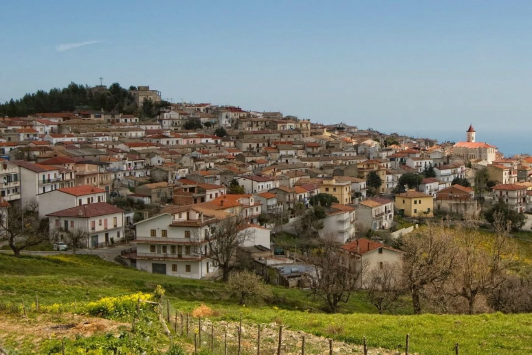
The commune sits on a ridge above the Ionian in the Alto Jonio Cosentino, with the Pollino massif behind it. It has two centres, the hill town at 619 meters and the marina on the coast below, joined by the road that passes the small chapel on the plain.
Records of settlement here go back to the fourth century BC. The castle stands in the Piano delle Rose locality, built by the Pignone del Carretto as a winter residence and hunting lodge; the de Martino family later ruled the feudo from 1748 until the abolition of feudalism in 1806.
The commune carries the designations Borgo Autentico, Spiga Verde and Città del Vino. What holds the two centres and the centuries together is the sense of a working village rather than a preserved one: a hill town still occupied and repainted, a castle still standing over its own courtyard, a marina still adding beach length, and a plain between them still crossed on the old route from residence to coast.
The comune belongs to the national association of wine-producing towns.
What to see in Montegiordano
- Castello Pignone del Carretto. Four kilometers from the marina, built as a winter residence by the Neapolitan Pignone del Carretto family who held the feudo from the seventeenth century.
- Centro storico dei murales. The hilltop old town itself, its walls and lanes given over entirely to the mural project, each one telling a piece of the village story rather than standing as decoration alone.
- Cappella Madonna del Carmine. Small chapel on the plain near the castle, a few hundred meters from the Pignone residence, on the road between hill and marina.
How to get to Montegiordano
There is a railway station in the town, so you can arrive without a car and never need one while you are here. Taranto is roughly 88 minutes away by road.
Our tip
April through June and September into October are the right months to walk Montegiordano's mural-painted alleys and look from the 619-meter ridge over the Ionian. July and August are hot on the coast but the hill stays at workable temperatures and catches the sea breeze in the evening. November through March is quiet: most of the marina lidi close, the castle keeps limited hours, and the cantine work but visit by appointment.
Roseto Capo Spulico
Why visit Roseto Capo Spulico
Roseto Capo Spulico sits at the northern edge of Calabria's Ionian coast, the last commune before the Basilicata border, with the Pollino massif rising behind it. The village began as a Magna Graecia satellite of Sybaris, its name tied to the roses once cultivated to fill the mattresses of the Sybarite elite.
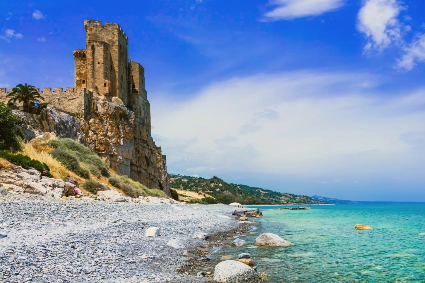
The castle above the water was requisitioned from the Templars in 1229 after their conduct during the Sixth Crusade, an episode that also carries a Shroud legend. The old town sits on the ridge above the marina, its stone houses and lanes looking down over the castle rock and the sea beyond it, while the beach runs along the shore directly below.
Inland, vineyards climb toward the Pollino slopes, and the commune holds recognition as a Borgo Autentico d'Italia and a Spiga Verde. The village reads as a settlement built in layers, from Sybarite outpost to fortress town to a place whose seafront, hilltop and inland farmland still sit visibly stacked, one above the other, along the same short stretch of coast.
The comune belongs to the national association of wine-producing towns.
What to see in Roseto Capo Spulico
- Castello Federiciano di Roseto Capo Spulico. Trapezoidal fortress with three towers, one taller and crenellated, standing directly on the sea. Built under Robert Guiscard and rebuilt by Frederick II after he took it from the Templars.
- Spiaggia del Castello. Pebbled Bandiera Blu beach directly below the castle rock, with clear water and small coves along the Costa degli Achei.
- Chiesa di Santa Maria delle Grazie. Sixteenth-century mother church in the centro storico, rebuilt after earthquake damage and dedicated to the patron of the village.
How to get to Roseto Capo Spulico
There is a railway station in the town, so you can arrive without a car and never need one while you are here. Taranto is roughly 93 minutes away by road.
Our tip
May through September are the months the Ionian beach is open and the castle promontory fills with day-trippers from Sibari and Basilicata. July and August push past thirty-five degrees and the marina rentals fully book; the centro storico on the ridge above stays quieter and cooler. April and October are dry and mild, the right time to walk the castle path and the Pollino foothills inland without sweat.
Santa Severina
Why visit Santa Severina
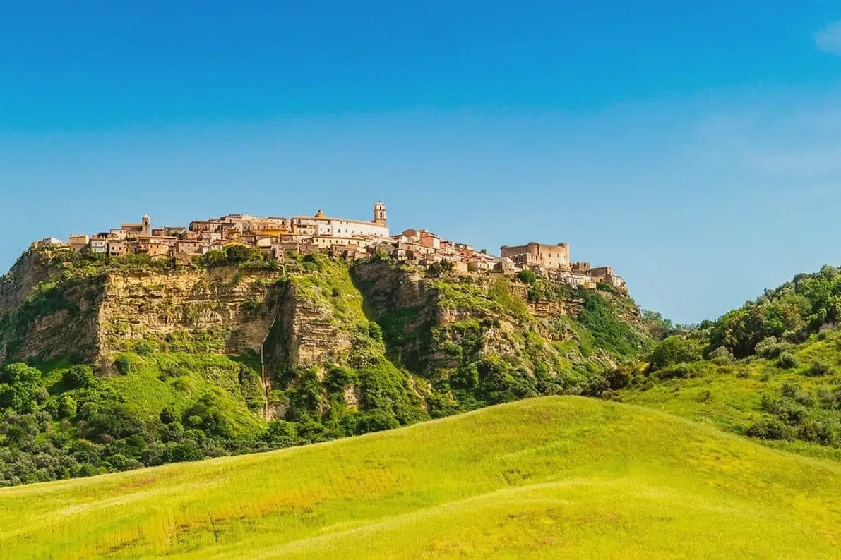
The hill at Santa Severina rises 326 meters above the Neto valley, roughly midway between the Sila mountains and the Ionian Sea, and the tufa platform beneath the borgo has been read as the hull of a ship riding over the valley floor. The site was inhabited from the Bronze Age and passed through a Greek and then Roman phase as Siberene before becoming one of the most important Byzantine centers in southern Italy, a status it held until 1076, when the Normans took it.
That sequence still reads in the layout: the castle occupies the high end of the ridge where a fortified center would sit, the cathedral and baptistery stand together lower down at the piazza, and the vineyards spread across the slopes below the whole formation. The commune holds the Città del Vino badge and has been listed among Italy's most beautiful villages since 2006.
What survives is a town whose Byzantine, Norman and agricultural layers sit stacked on top of each other rather than replacing one another, each still visible from the ridge down to the valley floor.
The comune belongs to the national association of wine-producing towns.
What to see in Santa Severina
- Castello di Santa Severina. Fortress on the high end of the tufa ridge, now a museum of Byzantine and Norman finds recovered from the town and surrounding area.
- Cattedrale di Santa Anastasìa. Cathedral on the main piazza, named for the saint whose relics the town claims as patroness.
- Battistero bizantino. Octagonal baptistery next to the cathedral, its mosaic floor and frescoes set against bare tufa walls at the edge of the piazza.
How to get to Santa Severina
Reggio Calabria is roughly 175 minutes away by road.
Our tip
April through June and September into October are the months Santa Severina rewards. The Val di Neto turns green, the tufa walls hold the morning light, and the castle terrace gives a clean view from the Sila to the Ionian on dry days. July and August push past thirty-five degrees; the borgo empties from one to five in the afternoon.
Mormanno
Why visit Mormanno
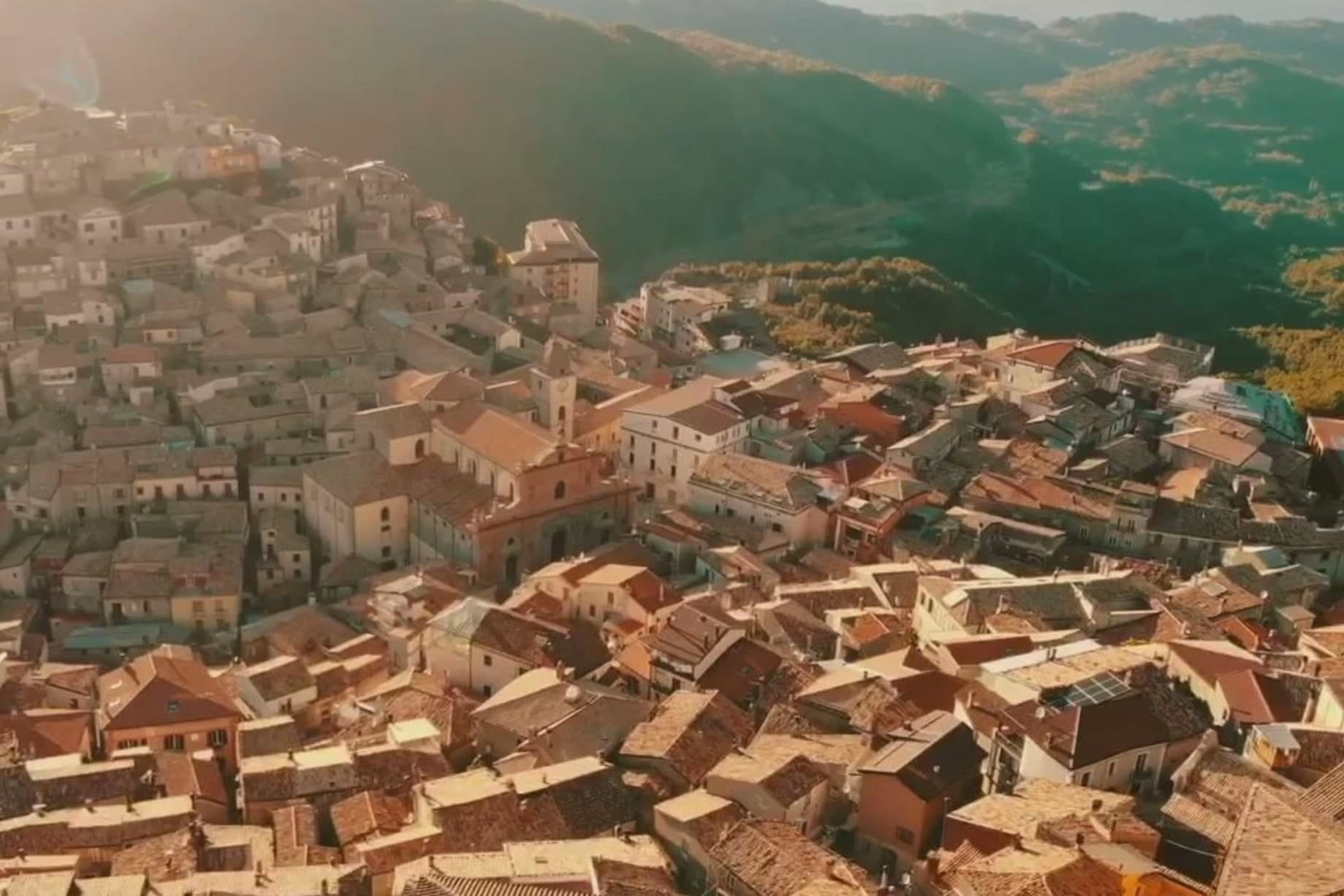
Mormanno sits at 840 meters in Pollino National Park, in the Calabrian half of the massif, between the opposing ridges of Costa and Vernita and within reach of the Lao river valley. The Pellegrino group rises immediately above the town, Monte Palanuda at 1,632 meters and Monte Cerviero at 1,443.
Local historians read its origins back to the Lombard era; the first surviving document, a Greek-language deed of donation, dates to 1092. The Sanseverino of Bisignano held the fief until 1612.
The eighteenth-century Neapolitan-Baroque cathedral sits at the center of a historic plan organized into four quarters: Costa to the west, Capo lo Serro to the east, Casalicchio south, Torretta north. The town is in the Città del Vino network and is known across Calabria for two products: white poverelli beans and lentils grown on the surrounding slopes, and the bocconotto di Mormanno, a single-bite shortcrust pastry filled with mostarda or grape jam.
The comune belongs to the national association of wine-producing towns.
What to see in Mormanno
- Cattedrale di Santa Maria del Colle. Eighteenth-century Neapolitan-Baroque cathedral on the high point of the borgo, the architectural anchor of the historic plan.
- Centro storico. Historic plan organized into four named quarters, Costa, Capo lo Serro, Casalicchio and Torretta, each named for its position around the cathedral.
- Parco Nazionale del Pollino. Calabrian sector of Italy's largest national park surrounds the town, with the Pellegrino massif rising directly above the houses.
How to get to Mormanno
Salerno is roughly 100 minutes away by road.
Our tip
May through October is the season. At 840 meters, summers stay comfortable while the coast bakes; the Pollino trails around Mormanno are walkable from late spring through autumn. June and September are the easier months, the high meadows in flower or going dry, the bocconotto bakeries open without the August queue.
Saracena
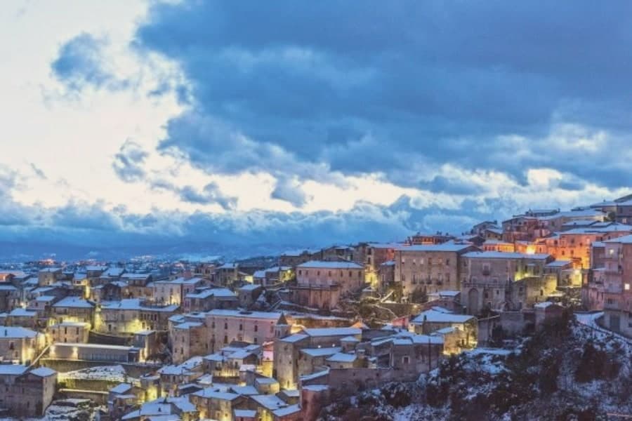
Why visit Saracena
Saracena sits at 606 meters on the eastern slopes of the Orsomarso mountains, inside the Pollino National Park, fifty-five kilometers north of Cosenza. The town gets its name from the Saracens who conquered it around 900 AD; like Palermo and Tropea it kept a souk through the Arab-Sicilian and early Norman centuries, and the Byzantine army eventually retook it.
The mother monument is the twelfth-century Chiesa di San Leone, a Byzantine foundation that still holds the patron's relics. What carries the village now is wine: Moscato di Saracena, a passito blended from Guarnaccia, Malvasia, Odoacra and Moscatello, fermented slowly into an amber dessert wine first documented in the sixteenth century.
The production sits under a Slow Food Presidium, and a Casa del Moscato opened in the former town hall in May 2026. Olives, truffles and Pollino trekking fill the rest of the calendar.
The comune belongs to the national association of wine-producing towns.
What to see in Saracena
- Chiesa di San Leone. Twelfth-century Byzantine church dedicated to the patron San Leone di Catania, celebrated twice a year, in spring and late summer.
- Castello baronale. Ruins of the baronial castle around which the historic centre rises, a vantage point over the Pollino slopes and the Esaro valley.
- Casa del Moscato di Saracena. Visitor centre opened in May 2026 in the former town hall, dedicated to the production method of the Slow Food Presidium passito.
How to get to Saracena
Salerno is roughly 170 minutes away by road.
Our tip
April through June and September into October are the dry months that Saracena was built for, when the Pollino slopes are walkable and the moscato grapes either flower or come in. July and August touch the mid-thirties; the old town shaded alleys hold up but the trails climb above eight hundred meters to stay comfortable. November through March is quiet, with snow possible on the Orsomarso ridges and several cantine closed to visitors.
San Giovanni in Fiore
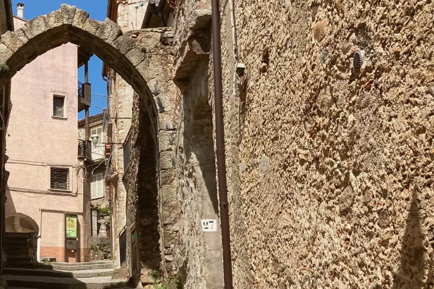
Why visit San Giovanni in Fiore
San Giovanni in Fiore sits at 1,049 meters at the center of Sila Grande, inside Sila National Park, the largest mountain commune in Italy by population above 1,000 meters altitude. The town grew from the abbey founded here in 1188 by the Calabrian monk and medieval theologian whom many historians consider the most influential apocalyptic thinker of the Middle Ages.
The abbey gave the settlement its shape: the old town climbs Monte Difesa around the complex, and the built-up core still reads as a place that grew outward from a religious house rather than a market or a port. The municipal territory reaches well beyond that core, stretching across the Sila plateau to take in Lorica, the lake village at 1,314 meters, so that a single commune holds both a mountain town built around a medieval abbey and a lake station given over to hiking and skiing.
The town is in the Città del Vino network. Calabrian emigration history has its capital here, the population of half a century ago halved by departures to Argentina, North America and northern Italy.
A place, then, that reached its greatest size as a religious and demographic center and has spent the decades since sending its people elsewhere while its territory grew to include a second, quite different kind of settlement at altitude.
The comune belongs to the national association of wine-producing towns.
What to see in San Giovanni in Fiore
- Abbazia Florense. Founded by Gioacchino da Fiore in 1188, the abbey burned in 1214 and was rebuilt by 1230. The Latin-plan complex survives with a large central cloister ringed by ogival arches.
- Centro Internazionale di Studi Gioachimiti. Housed in the abbey complex, the center for Joachimist Studies holds a medieval library and the working archive on Gioacchino's writings.
- Lorica. Sila lake village at 1,314 meters within the municipality, a year-round mountain station on Lago Arvo with summer hiking and winter skiing.
How to get to San Giovanni in Fiore
There is a railway station in the town, so you can arrive without a car and never need one while you are here. Reggio Calabria is roughly 176 minutes away by road.
Our tip
June through September is the green season in Sila Grande. The lakes around Lorica fill with Calabrian families escaping the coastal heat, the high pastures bloom, and the abbey is at its quietest in the early mornings. December through March is the second season: snow on the plateau, skiing at Lorica and Camigliatello, the town transformed from a mountain capital into a winter destination.
More from Anywhere Italy
 The best high-altitude villages in Calabria
 The best small towns you can reach by train in Calabria
- The best hidden towns inside a national park in the province of Cosenza
- The best hidden towns you can reach by train in the province of Cosenza
 The best hill towns in the province of Cosenza
- The best mountain towns in the province of Cosenza