
The best hidden hot spring towns that eat well in Tuscany
90 towns visited, 910 to go. Follow along, free: Subscribe on Substack
Southern Tuscany sits on hot rock, and the water comes up through it warm all year, faintly sulphurous, pale blue where it has left travertine behind. The towns above these springs are built from that same stone, or from tufo the color of ash and honey, and they turn their kitchens toward the seasons that surround the baths: pici with garlic in autumn, Chianina beef over embers, pecorino aged in walnut leaves, wild boar in winter, artichokes and broad beans in spring. Bathing here is a cold-weather habit as much as a summer one, because steam is better in November. A dining guide has named a table in each of these towns, which is the reason they are together on one page.
Most people who come for thermal Tuscany go to Saturnia, where the Cascate del Mulino fall in white terraces beside a road that fills with cars from morning onward. It is beautiful and free, which is why it is also full, with wet towels on every rock and a queue for the good pools. The reputation of the region has concentrated there, and around the larger spa resorts near Siena, to the point where many visitors assume that is where the hot water stops.
It does not. The same geothermal belt runs north through the crete senesi and south toward the Maremma and the lagoon, and the towns strung along it have springs, bath houses, and kitchens worth planning a night around. Fewer people go to them, partly because they are small and partly because they ask you to stay for dinner rather than stop for a photograph. That combination, warm water and a good table in the same evening, is what this list is for.
Of the 84 communes we have mapped in Toscana, 12 qualify as hot spring towns that eat well: each has natural thermal water, and a dining guide has named a table in each. This list is the hidden ones, 8 in all. The smallest, San Casciano dei Bagni, has 1,500 residents.
Two more lists worth reading alongside this one: The best hot spring towns with a serious restaurant in Tuscany and The best hot spring towns worth staying overnight in Tuscany.
Why visit San Casciano dei Bagni
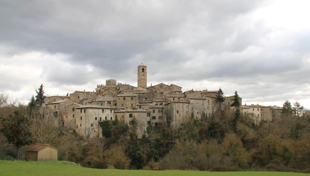
San Casciano dei Bagni sits at 582 meters at the southern edge of the province of Siena, above 42 hot springs that average 42 degrees Celsius. The baths were used continuously from Etruscan through Roman times and again from the Renaissance, when visitors came from across Europe.
In 2022, an excavation that began in 2019 at the ancient sanctuary turned up 24 bronze votive statues protected by mud, with around 6,000 coins in gold, silver and bronze. The find was the largest of its kind in fifty years; most surviving Etruscan votive material is terracotta.
The 1,500 residents live on a basalt outcrop above the Roman thermal complex, in a centro storico of stone houses and three small churches. The borgo joined the Borghi più belli network in 2014 and remains one of the smallest communes in Toscana to carry both that label and Bandiera Arancione.
Daniela (MICHELIN) and Castello di Fighine (Gambero Rosso) are listed in food guides.
What to see in San Casciano dei Bagni
- Santuario Ritrovato. Etruscan-Roman thermal sanctuary excavated since 2019, where 24 bronze votives and around 6,000 coins were recovered in 2022.
- Bagno Grande. The principal natural pool of the 42 hot springs, used from the second century BC through the Renaissance and reopened to the public.
- Collegiata di San Leonardo. Romanesque parish church in the centro storico, restored in the seventeenth century, with a baptismal font carved from local travertine.
How to get to San Casciano dei Bagni
Perugia is about 1 h 8 min away by road.
Our tip
The thermal pools make the calendar different here. Winter is the season many visitors prefer, when the 42-degree water steams against cold air and snow occasionally dusts the basalt outcrop. April through June and September into October are the most balanced months: warm hill light, the dry-stone walls of the borgo at their best, the sanctuary excavations open to guided tours.
Why visit Montaione
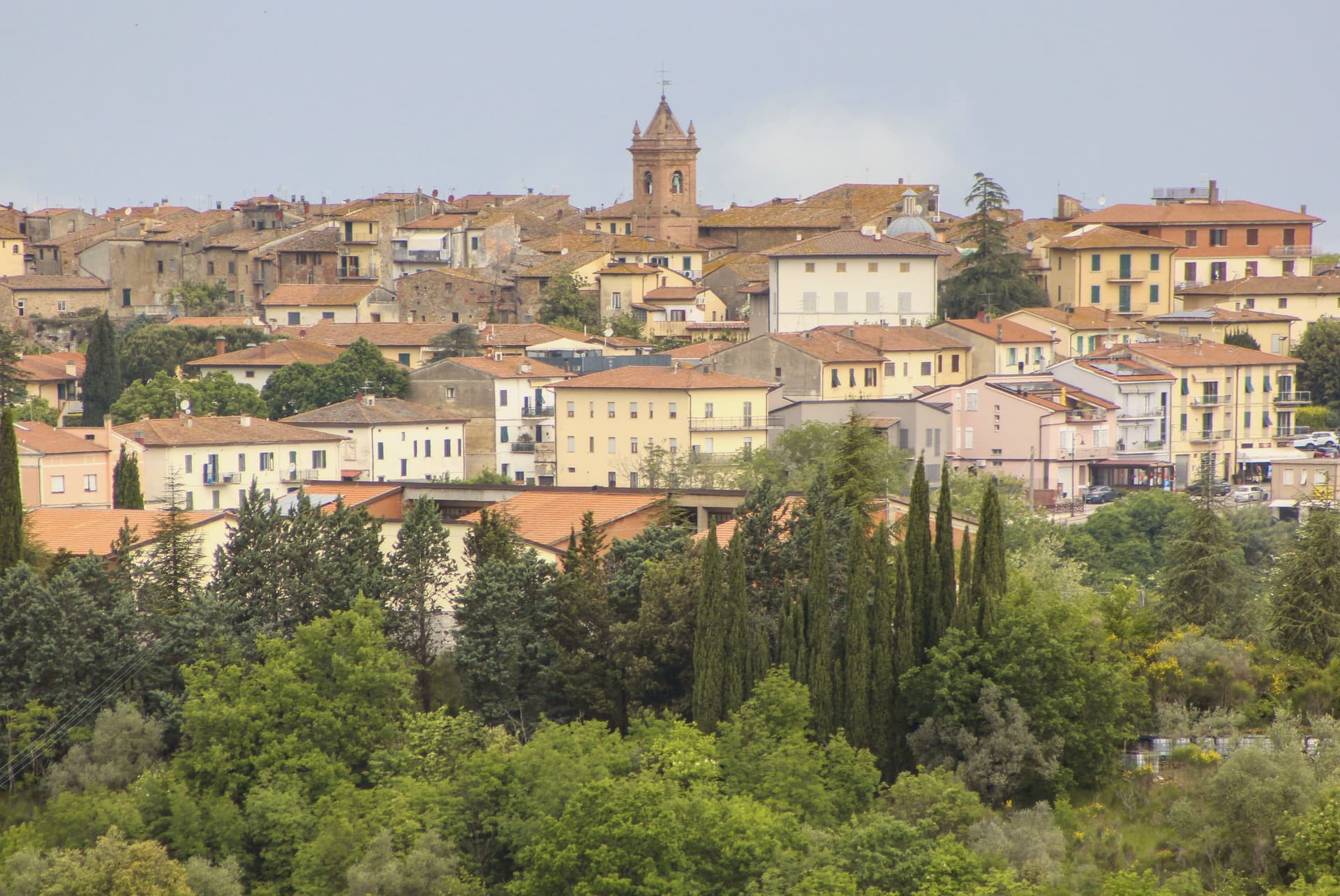
Montaione sits at 341 meters on a ridge above the Valdelsa, in the wooded hills west of Florence on the road toward Volterra. Etruscan and Roman finds at Poggio all'Aglione, Bellafonte and Iano confirm continuous occupation across the territory, material now held in the town's archaeological museum.
The medieval castello was the seat of an autonomous comune from 1256 and passed to Florence in 1369. From the early fourteenth century, glassmaking ran in the surrounding woods, and an eighteenth-century decree by the Grand Duke required master glassmakers to teach the craft to their fellow citizens.
The town joined Borghi più belli in 2007. The territory spreads well beyond the ridge itself.
Five kilometers west, a Franciscan convent founded in 1500 stands in the woods, its chapels laid out as a walkable replica of Jerusalem's holy sites. Ten kilometers south, Castelfalfi carries a separate, older Lombard origin, now a resort with its own vineyards and church.
Between them, the centro storico keeps the civic core: the tower, the palace, the parish church rebuilt on twelfth-century foundations. The comune, in effect, holds three distinct centuries of settlement at once: an ancient scatter of finds, a fourteenth-century craft economy, and a devotional complex from the 1500s, spread across ridge, castle and wood rather than gathered in one place.
La Rocca di Castelfalfi is listed in Gambero Rosso.
What to see in Montaione
- Sacro Monte di San Vivaldo. Complex five kilometers west of the borgo. Seventeen chapels stand among oak woods, each holding a scene built as part of the topographical replica, still reached on foot along the paths between them.
- Castelfalfi. Lombard-origin castle and frazione ten kilometers south, restored as a private resort with vineyards and a Romanesque church of San Floriano.
- Centro storico. Medieval grid on the ridge, with the Palazzo Pretorio, the Torre del Cassero and the Chiesa di San Regolo restored after 1118 foundations.
How to get to Montaione
Firenze is about 1 h 7 min away by road.
Our tip
April through June and September into October are the months Montaione shows best, the Valdelsa light low on the wooded ridges and the San Vivaldo chapels in their full October ochre. The Mostra del Tartufo Bianco runs the last weekend of October and the first of November. July and August push past thirty in the valley but the centro storico at 341 meters stays manageable.
Why visit Rapolano Terme
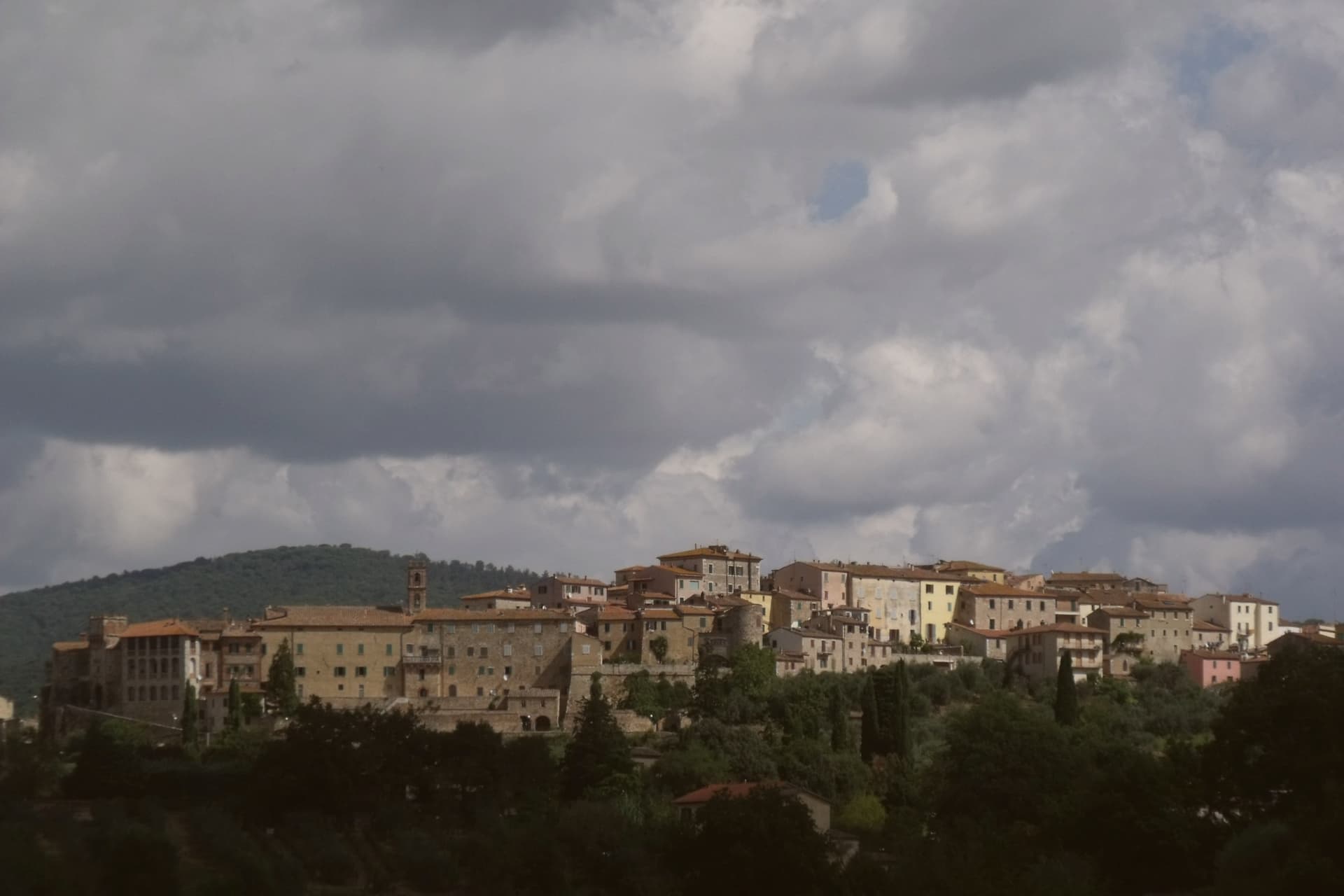
The comune sits at 334 meters on the eastern edge of the clay hills, twenty kilometers east of Siena. It was called simply Rapolano until 1949, when the spa industry pushed the name change, a shift that marks how thoroughly the waters came to define the place.
The thermal facilities and the quarry sit at some distance from each other within the comune: the springs rise near the centro and to its south, while the travertine beds lie in the Serre frazione three kilometers further out, a separate settlement built around the stone rather than the water. The medieval centro storico, meanwhile, holds no thermal or mineral history at all: a fortified perimeter, a Sienese-period castello on the highest point, and a parish church founded in the eleventh century, all predating the spa industry by centuries.
The clay-hill landscape spreads north and west of the comune, and draws most visitors past the spa itself. What emerges is a town built on two extractive industries, water and stone, wrapped around an older walled settlement that has little to do with either.
Osteria Il Granaio is listed in the MICHELIN Guide and Gambero Rosso.
What to see in Rapolano Terme
- Terme Antica Querciolaia. Six outdoor pools at 38 degrees, the older of the two facilities and the one tied to a general's convalescence.
- Terme San Giovanni. Thermal complex south of the centro among the clay hills of the Crete Senesi, with outdoor pools facing vineyards and olive groves.
- Cave di travertino di Serre. Active quarries in the Serre di Rapolano frazione three kilometers south, the source of the stone behind the Pienza Duomo's façade.
How to get to Rapolano Terme
It has its own railway station. Perugia is about 1 h 3 min away by road. The full route from Florence.
Our tip
Thermal towns work year-round and Rapolano is the rare Sienese commune where winter is a season. The pools at Antica Querciolaia and San Giovanni stay open through the cold months and the steam off the 38-degree water against the December clay hills is the postcard the spa industry sells. April through June and September into October are the wider best months, with the Crete Senesi at full color and the surrounding wine and olive harvests pulling traffic through the centro.
Why visit San Quirico d'Orcia
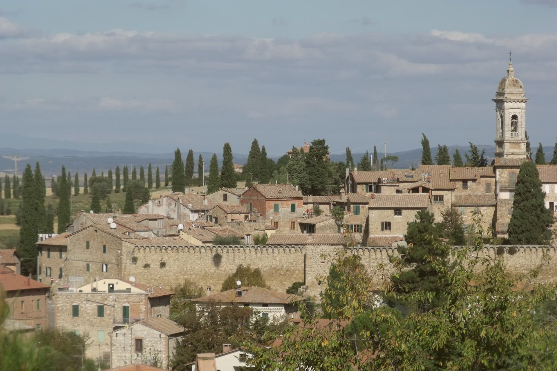
San Quirico d'Orcia sits at 409 meters on a low rise in the Val d'Orcia, the rolling clay-and-tufa landscape inscribed by UNESCO in 2004 as a cultural landscape shaped by fourteenth and fifteenth-century Sienese governance. The town was a stage on Sigeric the Serious's tenth-century Via Francigena from Canterbury to Rome and has remained a working stop on the route ever since.
The Collegiata dei Santi Quirico e Giulitta was built at the end of the twelfth century over an eighth-century baptistery; the lateral portal added in 1288 is attributed to Giovanni Pisano, then working on the Siena cathedral. The Horti Leonini, the geometric boxwood garden laid out by Diomede Leoni around 1580 inside the town walls, hosts the Forme nel Verde sculpture exhibition every summer since 1971.
Bagno Vignoni, the frazione five kilometers down the road, has a thermal pool at the center of its piazza, used since Etruscan times. Few comuni this small carry UNESCO, thermal and Francigena signals at once.
Trattoria Toscana al Vecchio Forno (MICHELIN) and Da Ciacco (MICHELIN) are listed in food guides.
What to see in San Quirico d'Orcia
- Collegiata dei Santi Quirico e Giulitta. Romanesque parish church built late twelfth century over an eighth-century baptistery, with the 1288 lateral portal attributed to Giovanni Pisano.
- Horti Leonini. Italianate boxwood garden laid out by Diomede Leoni around 1580 inside the town walls, hosting the Forme nel Verde sculpture exhibition since 1971.
- Bagno Vignoni. Frazione five kilometers south, with a sixteenth-century thermal pool at the center of its piazza, fed by springs used since Etruscan times.
How to get to San Quirico d'Orcia
Perugia is about 1 h 36 min away by road.
✷ We have written about San Quirico d'Orcia
“When the film industry needed a picture of heaven, of the fields a dead hero walks home to, they came and shot it here, and that is the truest thing anyone has ever said about the Val d'Orcia. It is not a place. It is the afterlife as imagined by people who lived in cities. It is how the country looks to men who never spent an hour in it, dreamed up by Florentine bankers five hundred years ago and maintained, beautifully, ever since.”
Read our piece on San Quirico d'Orcia →Val d'Orcia | The Postcard Is Constructed
Our tip
April through June and September into October are the gold months in the Val d'Orcia: green wheat in spring, ochre stubble by autumn, low light that defines the cypress ridges. The Festa del Barbarossa runs the third Sunday of June with archery, jousts and crossbow contests between the town quarters. July and August are hot and busy; the centro storico fills with day-trippers from Pienza and Montalcino.
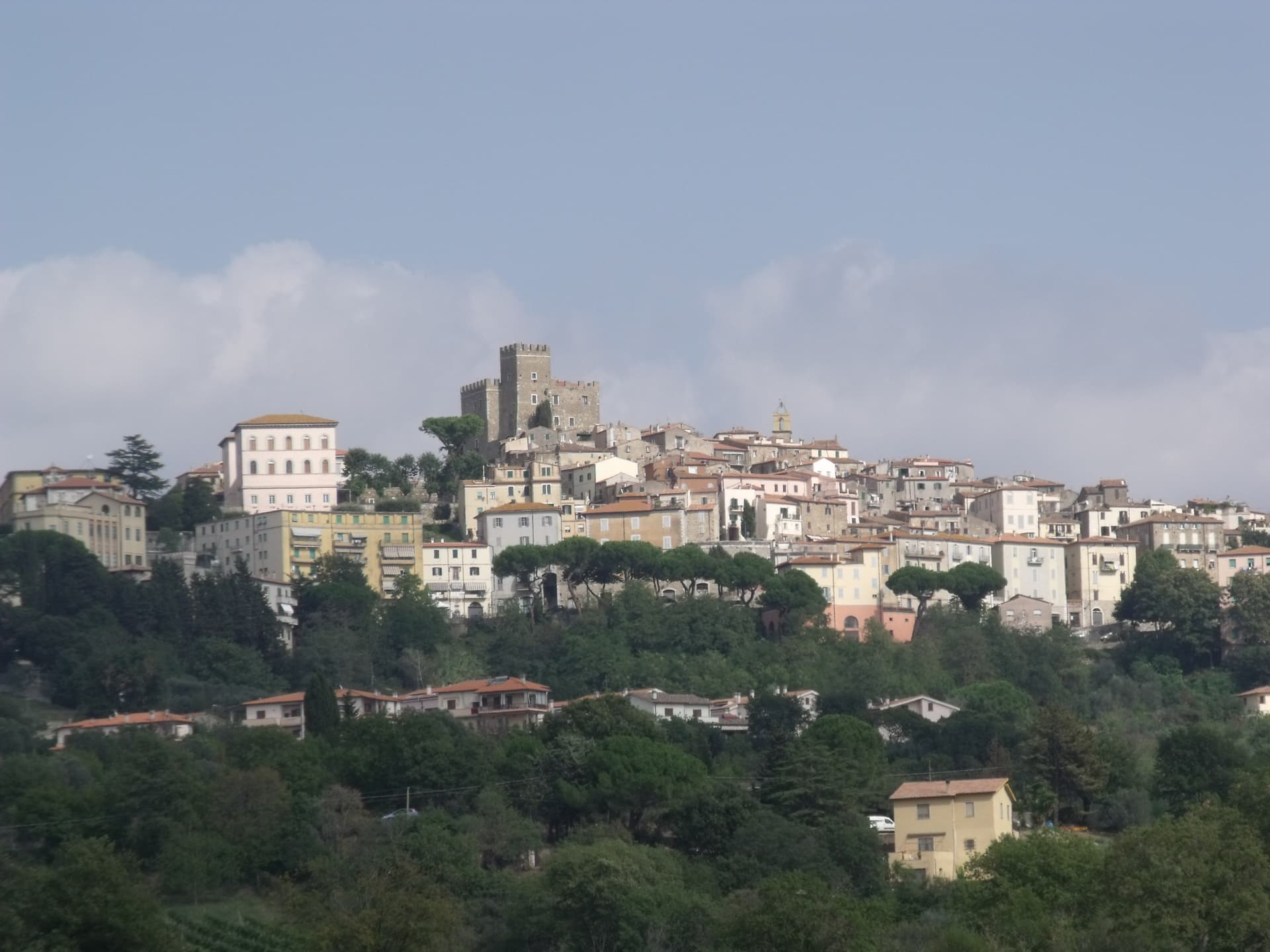
Why visit Manciano
Manciano sits at 444 meters on a hill in the southern Maremma grossetana, with a 360-degree view that runs from Monte Amiata north to the Tyrrhenian coast. The Aldobrandeschi held the original stronghold from the twelfth century.
Siena occupied the town between 1419 and 1455 and built the Rocca that still dominates the centro storico, a square keep with battlements on a shoe-base. After 1455 it returned to local rule and passed eventually to the Medici Grand Duchy.
The comune is large by Toscana standards and includes some of the best-known places of the southern Maremma: Saturnia, the Etruscan town built around its sulphurous hot springs, and Montemerano, a small walled borgo on the road to the Lago di Bolsena. The Albegna and Fiora valleys, which the town once served as a regional market, still meet at its foot.
Wine, olive oil and wild boar work the territory in roughly the order they sit on a Maremmano menu.
Caino (MICHELIN and La Liste), I Due Cippi dal 1976 (MICHELIN and Gambero Rosso), La Filanda (MICHELIN) and 1 more place are listed in food guides.
What to see in Manciano
- Rocca Aldobrandesca. Sienese fortress of 1424 on Aldobrandeschi foundations, square keep, walls with battlements and a solid shoe-base, dominating the centro storico.
- Saturnia. Etruscan town and frazione south of Manciano, with medieval walls, remains of a Roman road and the sulphurous hot springs used since antiquity.
- Montemerano. Small walled borgo east of Manciano, three concentric circles of streets and a fifteenth-century Madonna della Gattaiola in the parish church.
How to get to Manciano
Terni is about 2 h 12 min away by road.
✷ We have written about Manciano
“Everyone driving from Florence down to Rome crosses the Maremma without noticing, because there is nothing on that stretch to make them slow down. The hills give out. The cypresses stop. What opens up instead is flat open country, wheat and grass running off to a few low rises, the least Tuscan-looking part of Tuscany, a landscape you would call dull if you were being honest and which most guidebooks solve by leaving out.”
Read our piece on Manciano →Maremma | The Last Cowboys of Tuscany
Our tip
April through June and September into October are the months Manciano shows the southern Maremma at its best, the territory dry but green, the Saturnia pools warm against cool mornings. The Sagra dell'Anatra runs in mid-August. July and August are hot at 444 meters but easier than the coast; afternoons in the centro storico empty between two and six.
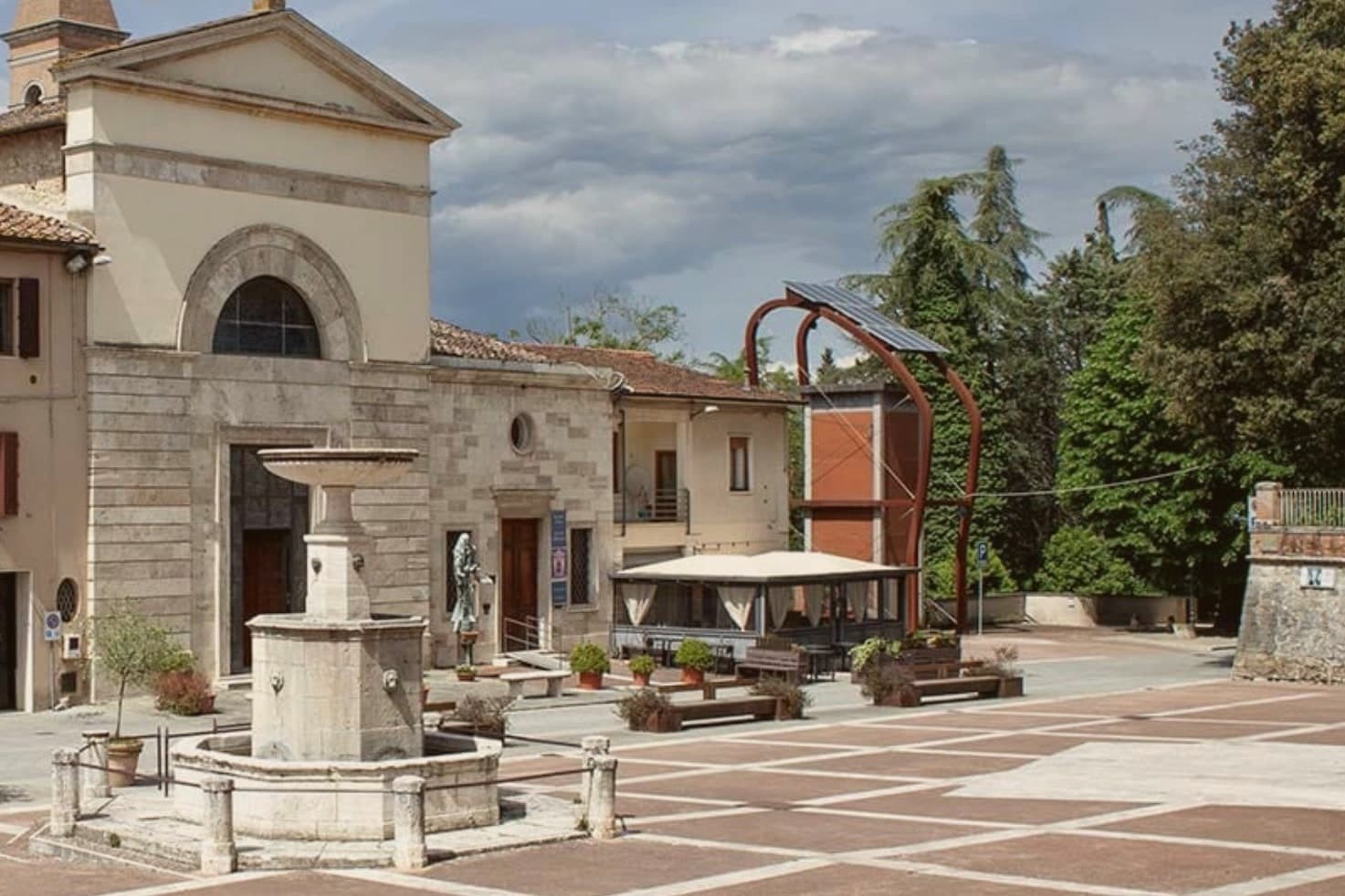
Why visit Castelnuovo Berardenga
The commune sits east of Siena, where the hills give way to the clay swells of the Crete Senesi. The name comes from the Terra Berardinga, the area controlled in the tenth century by a Frankish nobleman named Berardo, and the borgo grew up around the castle walls the Sienese Republic raised against Florence.
The centro storico, the villa and gardens at its heart, and the surrounding zone of vineyards form one continuous pattern rather than separate parts: fortress town above, wine country falling away below it toward the clay hills. Across the wider territory, 13 castles, 70 churches and 200 farms record the medieval pattern of the Sienese contado, a scatter of small fortified points and parish churches administering land rather than one dominant center.
The place reads as a border post that outlived its military purpose and settled into agriculture and the arts, its castle now a clock tower, its noble villa now a music foundation, its walls now overlooking rows of Sangiovese.
Il Visibilio (MICHELIN and Gambero Rosso), Poggio Rosso (MICHELIN and Gambero Rosso), L'Asinello (MICHELIN and L'Espresso) and 4 more places are listed in food guides.
What to see in Castelnuovo Berardenga
- Villa Chigi Saracini. Eighteenth-century villa and Italian garden inside the centro storico, its park designed by the Sienese composer Guido Chigi Saracini, whose family foundation still runs the Accademia Musicale Chigiana in Siena.
- Torre dell'Orologio. Surviving tower of the fortress, now bearing the civic clock, the highest visible point of the centro storico.
- Chiesa dei Santi Giusto e Clemente. Eighteenth-century parish church with a neoclassical façade, built on the site of an earlier Romanesque pieve.
How to get to Castelnuovo Berardenga
Firenze is about 1 h 17 min away by road. The full route from Florence.
✷ We have written about Castelnuovo Berardenga
“The wine is the whole economy of these hills, every village with its own, the region’s name stamped on the most famous red in Italy. Tuscan food runs to cured and roasted meat, so the wine ran red to meet it, lighter than you expect, almost fruity, easy, made to sit beside a steak and not to be lectured about. Here is the only wine knowledge you need on this road: it is all good.”
Read our piece on Castelnuovo Berardenga →Road to Siena | The Long Way Is the Better Way
Our tip
April through June and September into October are the months Chianti Classico shows best, the green hills moving toward the gold of harvest. The Sagra del Vino runs the second weekend of September. July and August push past thirty and the centro storico empties between two and six; the cellars on the surrounding hills offer cool tastings and longer rentals.
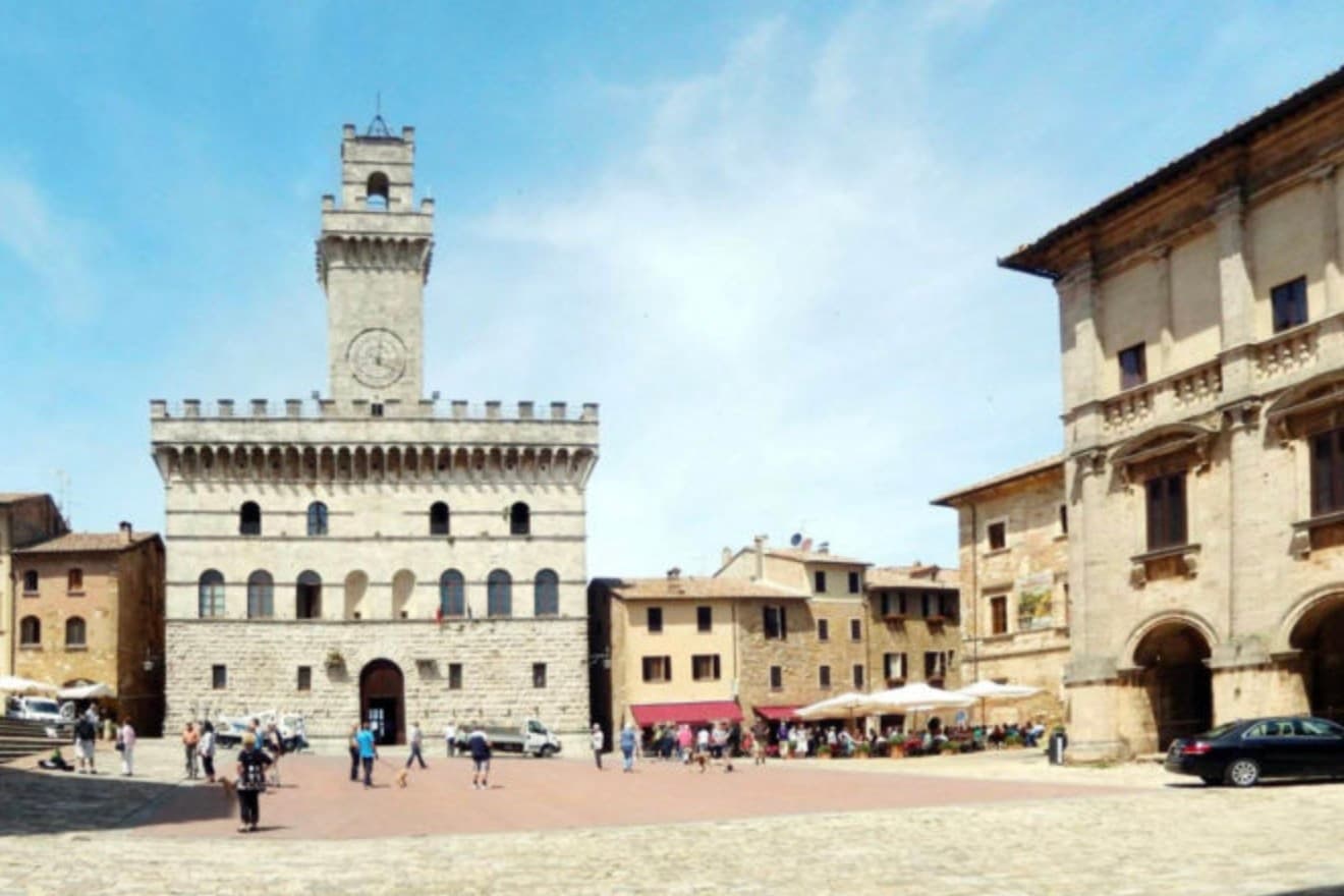
Why visit Montepulciano
The ridge runs between the Val di Chiana and the Val d'Orcia, 70 kilometers southeast of Siena, and the town follows its spine uphill: streets climb from the gates toward the high point, where the main square sits ringed by the buildings that define the skyline from below. The origin predates the Renaissance fabric by centuries.
Etruscan tombs survive in the surrounding hills, though almost nothing of that period shows in the centro storico itself, which was rebuilt wholesale in the fifteenth and sixteenth centuries over whatever came before. The wine and the festival both use the climb as their setting rather than their subject: the cellars are cut into the rock beneath the palazzi, keeping a constant temperature for aging, and the barrel race each August sends two men from each of the eight contrade hauling an eighty-kilogram cask up the same gradient that every visitor covers on foot, only slower.
The steepness that shaped the defensive site nine centuries ago is still what a person feels first, in the legs, before the buildings register at all.
Ristorante Caffè Pasticceria Poliziano (Locali Storici), Osmosi (MICHELIN and Gambero Rosso), Le Logge del Vignola (MICHELIN) and 3 more places are listed in food guides.
What to see in Montepulciano
- Tempio di San Biagio. A 13-meter dome and travertine façade standing alone outside the walls, the ground falling away below it so the building reads as a single volume against the hillside.
- Piazza Grande. The high piazza at the top of the ridge, ringed by the Duomo, the Palazzo Comunale and the Palazzo Tarugi, all rebuilt in the fifteenth and sixteenth centuries.
- Palazzo Comunale. Town hall designed by Michelozzo in the fifteenth century, its tower offering a view over the Val di Chiana and Val d'Orcia.
How to get to Montepulciano
It has its own railway station. Perugia is about 57 min away by road. The full route from Florence.
Our tip
April through June and September into October are the working months on the ridge: vine work in the surrounding hills, mild days, evening light that lingers over the Val d'Orcia. July and August push into the low thirties and the climb to Piazza Grande slows even the residents. The Bravìo delle Botti runs the last Sunday of August and fills the town.
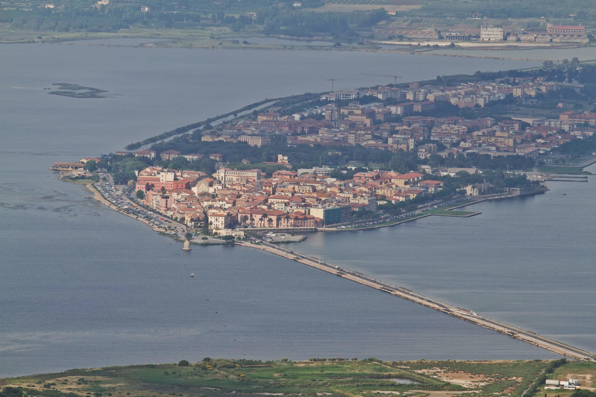
Why visit Orbetello
The isthmus runs out into the lagoon and splits it into two basins, Ponente and Levante. Two sand tombolos close the shape from either side: Giannella to the north, Feniglia to the south, both reaching toward the Monte Argentario promontory and meeting it at either end.
The Etruscans settled the site first, the Romans followed with their colony of Cosa nearby, and centuries later the Spanish took the isthmus as the seat of their coastal enclave, leaving the Governor's Palace on the main square where it still stands. Of the nine Sienese windmills once built out in the water, one remains in place, the only Italian water-and-wind mill of its type still fixed where it was built.
The lagoon that once carried Balbo's flying boats out toward Rio and Chicago now carries a WWF reserve and the nets of a bottarga and eel cooperative working the same waters since 1965. A town built on the water it is named for, held between two arms of sand and one mountain it never quite touches.
L'Oste Dispensa (MICHELIN and Slow Food) and Osteria Bolle (Gambero Rosso) are listed in food guides.
What to see in Orbetello
- Duomo di Santa Maria Assunta. Fourteenth-century cathedral with a Gothic travertine façade, rebuilt over an earlier Etruscan-Roman temple foundation.
- Fortificazioni Spagnole. The bastions and the Polveriera Guzman magazine, still standing along the edges of the historic center.
- Laguna di Orbetello. The brackish water splits into two basins and is now a WWF reserve and Ramsar wetland.
How to get to Orbetello
It has its own railway station. Roma is about 2 h 4 min away by road. The full route from Rome.
Our tip
May through September is when the lagoon and the Feniglia and Giannella beaches do their work. June brings the migratory bird count back up: flamingos, herons, avocets. July and August push temperatures over thirty degrees and the tombolos fill with Roman day-trippers, so the lagoon path on the Ponente side stays the quieter option.
More from Anywhere Italy
- The best hot spring towns with a serious restaurant in TuscanyTuscanyhot springsserious restaurant10 towns · smallest 1,500 residents
- The best hot spring towns worth staying overnight in TuscanyTuscanyhot springsworth staying overnight7 towns · smallest 1,500 residents
- The best hot spring towns in the province of SienaSiena provincehot springs6 towns · smallest 1,500 residents
- The best hot-spring towns within 75 minutes of SienaNear Sienahot springswithin 75 min6 towns · smallest 2,572 residents · closest 24 min away
- The best hot-spring towns within 90 minutes of FlorenceNear Florencehot springswithin 90 min7 towns · smallest 3,492 residents · closest 46 min away
- The best hot-spring towns within 90 minutes of PerugiaNear Perugiahot springswithin 90 min7 towns · smallest 1,428 residents · closest 54 min away