
The best hot-spring towns within 75 minutes of Siena
The hills south and east of Siena leak warm water. It comes up at bath temperature through travertine and volcanic rock, faintly sulphurous, and the stone the springs deposited is the same stone the houses and church fronts are cut from, a pale honey-coloured travertine that holds the light late. Autumn and winter are the seasons for it, when the vapour stands over the pools in the cold and the vineyards are bare, and lunch afterwards runs to pici with garlic and tomato, wild boar, pecorino from the Crete Senesi, a glass of something local and serious. Cypress ridges, clay badlands, oak woods above the Ombrone. The bathing here is not a spa idea bolted onto a town, it is why several of these towns exist.
The default is the Cascate del Mulino at Saturnia, where the hot stream drops through limestone basins for free and the car parks fill by mid-morning most weekends of the year. It deserves its reputation, and it is also a long drive from Siena for a queue, a crowded terrace of strangers and nowhere to leave your things. Coach groups and Rome day-trippers arrive together. The photographs on your phone will look like everyone else's photographs.
The same geology carries on well past it. Travertine springs run right up to the edge of the Crete Senesi and out towards the Valdelsa, and the Val d'Orcia and Maremma both hold thermal towns with municipal baths, small hotels, sulphur pools and a Tuesday market, all inside a comfortable drive of Piazza del Campo. These are the towns on that water, closer to Siena than the famous waterfall and used mainly by the people who live nearby.
Of the 24 communes we have mapped in a 75-minute drive of Siena, 6 qualify as hot-spring towns: each has thermal water a town has been built around. The smallest, San Quirico d'Orcia, has 2,572 residents.
If you are still choosing, we have also written The best hot-spring towns within 90 minutes of Florence and The best hidden hot spring towns you can reach by train in Toscana.
Montaione
Why visit Montaione
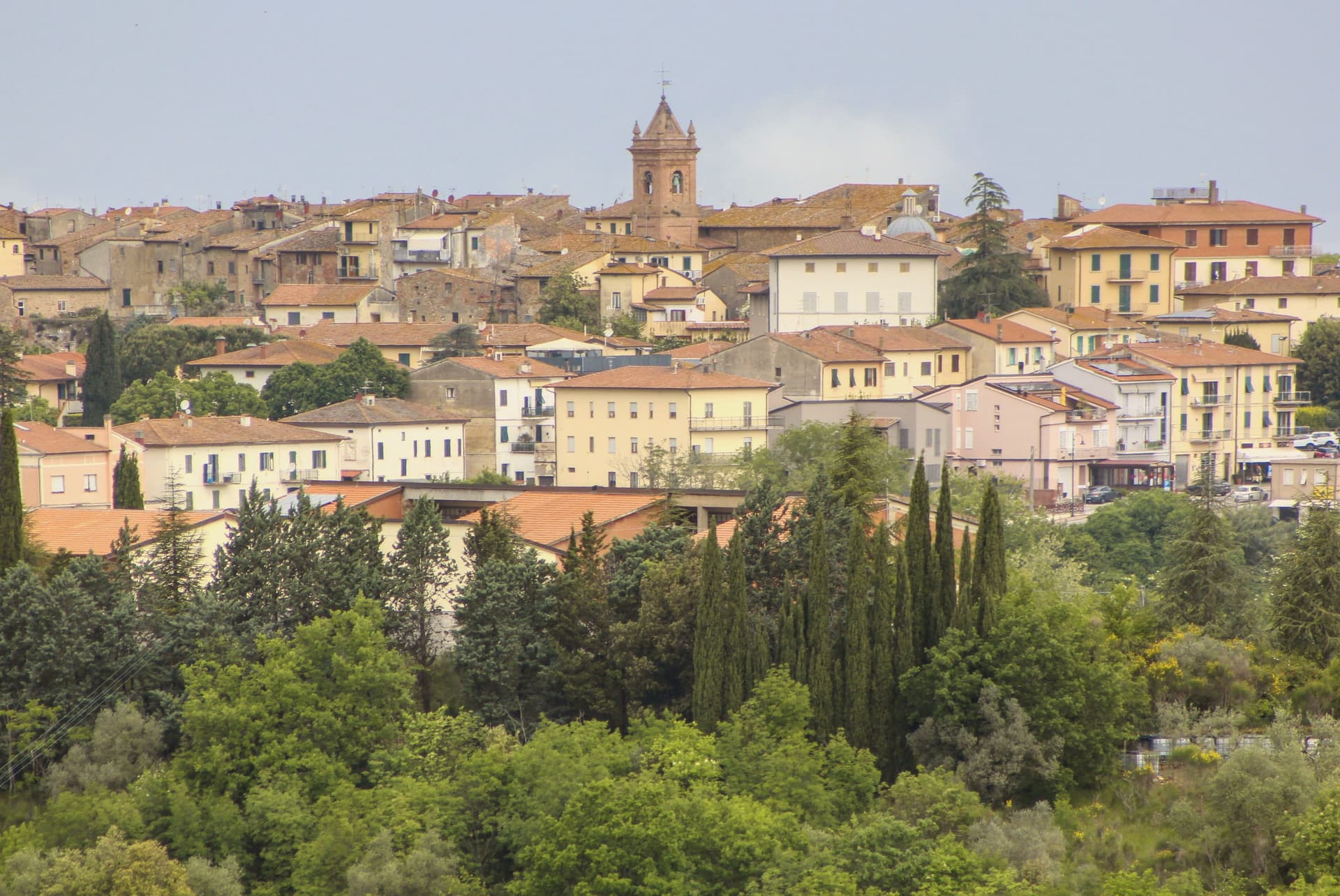
Montaione sits at 341 meters on a ridge above the Valdelsa, in the wooded hills west of Florence on the road toward Volterra. Etruscan and Roman finds at Poggio all'Aglione, Bellafonte and Iano confirm continuous occupation across the territory, material now held in the town's archaeological museum.
The medieval castello was the seat of an autonomous comune from 1256 and passed to Florence in 1369. From the early fourteenth century, glassmaking ran in the surrounding woods, and an eighteenth-century decree by the Grand Duke required master glassmakers to teach the craft to their fellow citizens.
The town joined Borghi più belli in 2007. The territory spreads well beyond the ridge itself.
Five kilometers west, a Franciscan convent founded in 1500 stands in the woods, its chapels laid out as a walkable replica of Jerusalem's holy sites. Ten kilometers south, Castelfalfi carries a separate, older Lombard origin, now a resort with its own vineyards and church.
Between them, the centro storico keeps the civic core: the tower, the palace, the parish church rebuilt on twelfth-century foundations. The comune, in effect, holds three distinct centuries of settlement at once: an ancient scatter of finds, a fourteenth-century craft economy, and a devotional complex from the 1500s, spread across ridge, castle and wood rather than gathered in one place.
What to see in Montaione
- Sacro Monte di San Vivaldo. Complex five kilometers west of the borgo. Seventeen chapels stand among oak woods, each holding a scene built as part of the topographical replica, still reached on foot along the paths between them.
- Castelfalfi. Lombard-origin castle and frazione ten kilometers south, restored as a private resort with vineyards and a Romanesque church of San Floriano.
- Centro storico. Medieval grid on the ridge, with the Palazzo Pretorio, the Torre del Cassero and the Chiesa di San Regolo restored after 1118 foundations.
How to get to Montaione
Firenze is roughly 67 minutes away by road.
Our tip
April through June and September into October are the months Montaione shows best, the Valdelsa light low on the wooded ridges and the San Vivaldo chapels in their full October ochre. The Mostra del Tartufo Bianco runs the last weekend of October and the first of November. July and August push past thirty in the valley but the centro storico at 341 meters stays manageable.
Rapolano Terme
Why visit Rapolano Terme
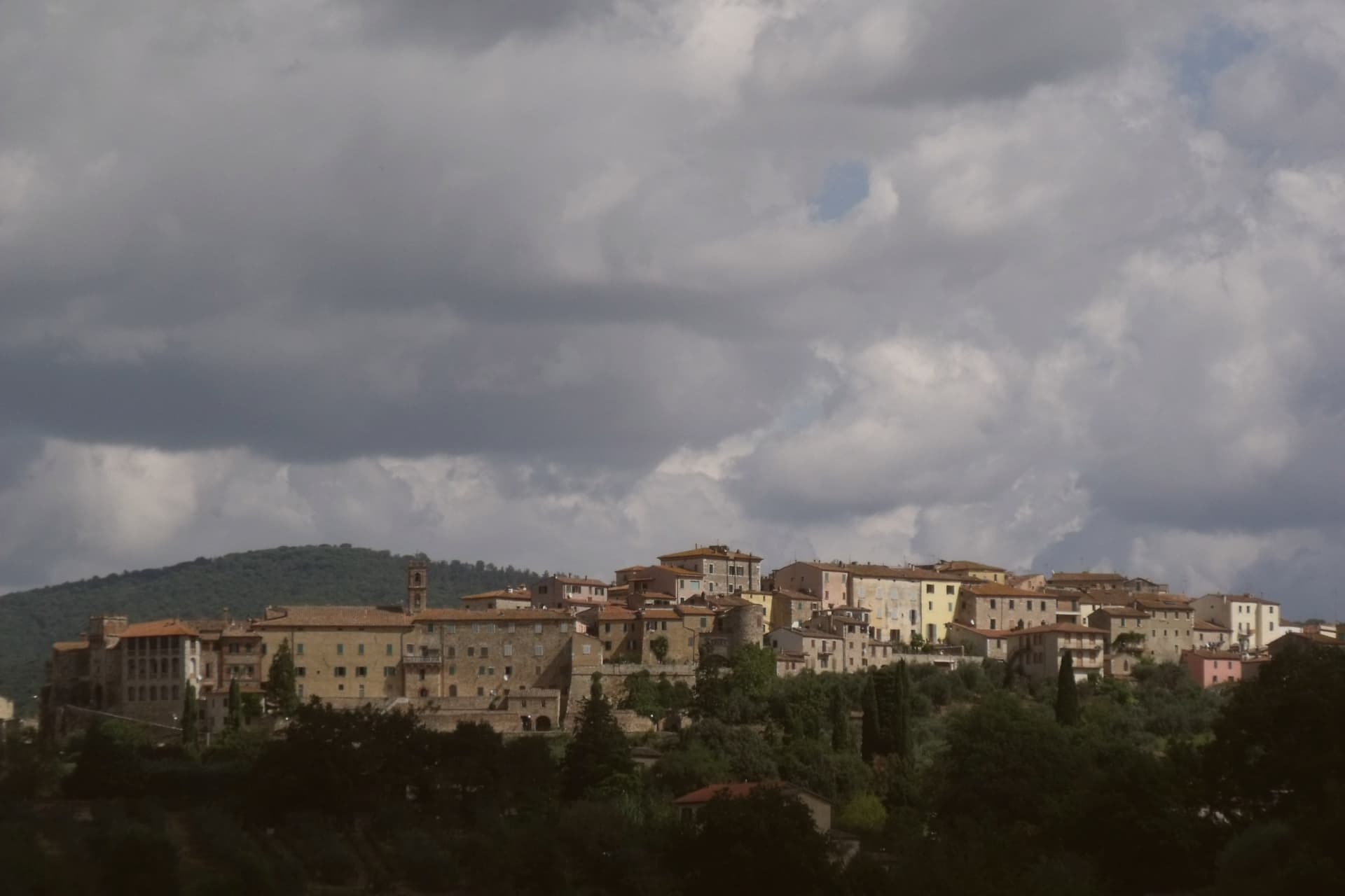
The comune sits at 334 meters on the eastern edge of the clay hills, twenty kilometers east of Siena. It was called simply Rapolano until 1949, when the spa industry pushed the name change, a shift that marks how thoroughly the waters came to define the place.
The thermal facilities and the quarry sit at some distance from each other within the comune: the springs rise near the centro and to its south, while the travertine beds lie in the Serre frazione three kilometers further out, a separate settlement built around the stone rather than the water. The medieval centro storico, meanwhile, holds no thermal or mineral history at all: a fortified perimeter, a Sienese-period castello on the highest point, and a parish church founded in the eleventh century, all predating the spa industry by centuries.
The clay-hill landscape spreads north and west of the comune, and draws most visitors past the spa itself. What emerges is a town built on two extractive industries, water and stone, wrapped around an older walled settlement that has little to do with either.
What to see in Rapolano Terme
- Terme Antica Querciolaia. Six outdoor pools at 38 degrees, the older of the two facilities and the one tied to a general's convalescence.
- Terme San Giovanni. Thermal complex south of the centro among the clay hills of the Crete Senesi, with outdoor pools facing vineyards and olive groves.
- Cave di travertino di Serre. Active quarries in the Serre di Rapolano frazione three kilometers south, the source of the stone behind the Pienza Duomo's façade.
How to get to Rapolano Terme
There is a railway station in the town, so you can arrive without a car and never need one while you are here. Perugia is roughly 63 minutes away by road.
Our tip
Thermal towns work year-round and Rapolano is the rare Sienese commune where winter is a season. The pools at Antica Querciolaia and San Giovanni stay open through the cold months and the steam off the 38-degree water against the December clay hills is the postcard the spa industry sells. April through June and September into October are the wider best months, with the Crete Senesi at full color and the surrounding wine and olive harvests pulling traffic through the centro.
San Quirico d'Orcia
Why visit San Quirico d'Orcia
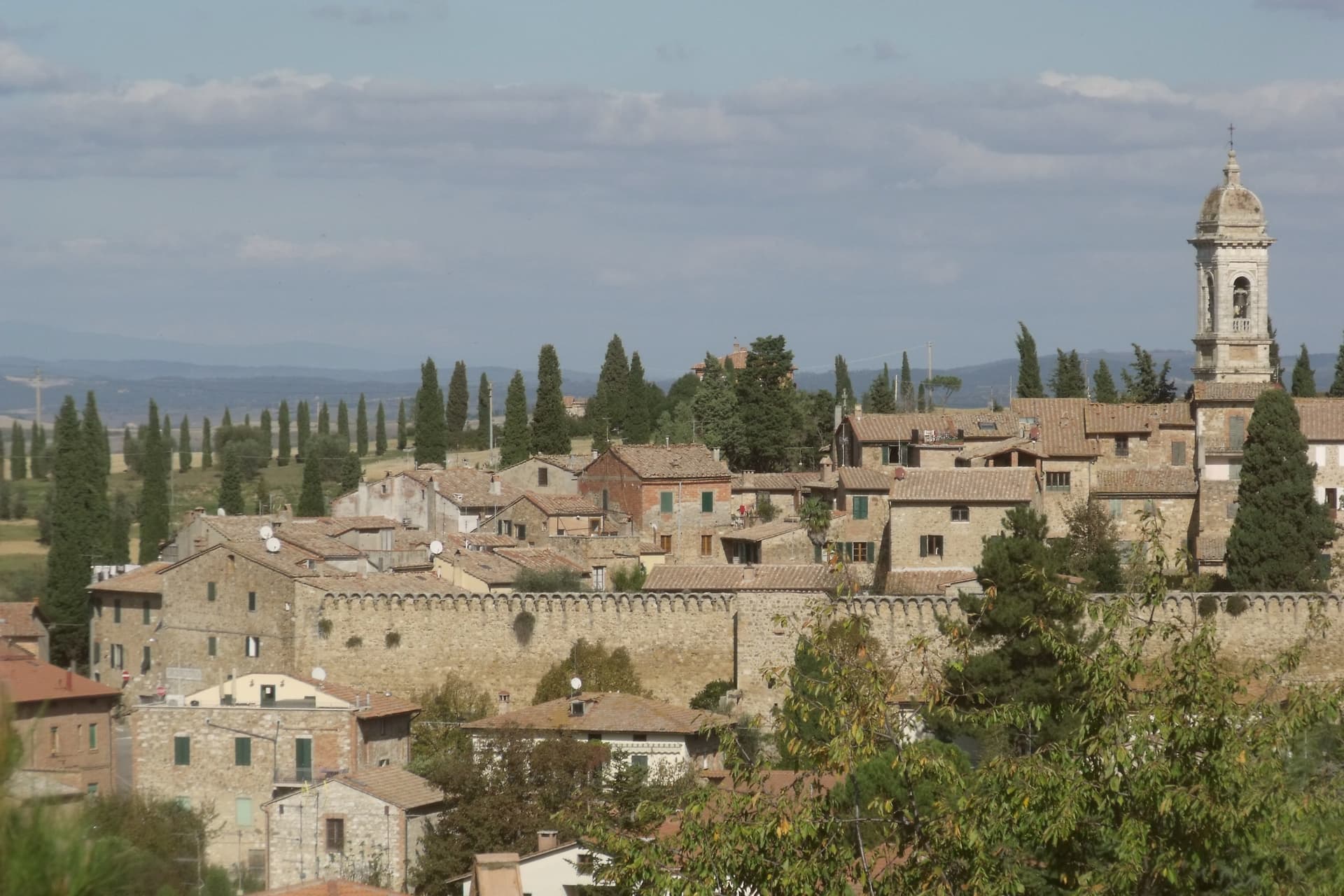
San Quirico d'Orcia sits at 409 meters on a low rise in the Val d'Orcia, the rolling clay-and-tufa landscape inscribed by UNESCO in 2004 as a cultural landscape shaped by fourteenth and fifteenth-century Sienese governance. The town was a stage on Sigeric the Serious's tenth-century Via Francigena from Canterbury to Rome and has remained a working stop on the route ever since.
The Collegiata dei Santi Quirico e Giulitta was built at the end of the twelfth century over an eighth-century baptistery; the lateral portal added in 1288 is attributed to Giovanni Pisano, then working on the Siena cathedral. The Horti Leonini, the geometric boxwood garden laid out by Diomede Leoni around 1580 inside the town walls, hosts the Forme nel Verde sculpture exhibition every summer since 1971.
Bagno Vignoni, the frazione five kilometers down the road, has a thermal pool at the center of its piazza, used since Etruscan times. Few comuni this small carry UNESCO, thermal and Francigena signals at once.
What to see in San Quirico d'Orcia
- Collegiata dei Santi Quirico e Giulitta. Romanesque parish church built late twelfth century over an eighth-century baptistery, with the 1288 lateral portal attributed to Giovanni Pisano.
- Horti Leonini. Italianate boxwood garden laid out by Diomede Leoni around 1580 inside the town walls, hosting the Forme nel Verde sculpture exhibition since 1971.
- Bagno Vignoni. Frazione five kilometers south, with a sixteenth-century thermal pool at the center of its piazza, fed by springs used since Etruscan times.
How to get to San Quirico d'Orcia
Perugia is roughly 96 minutes away by road.
Our tip
April through June and September into October are the gold months in the Val d'Orcia: green wheat in spring, ochre stubble by autumn, low light that defines the cypress ridges. The Festa del Barbarossa runs the third Sunday of June with archery, jousts and crossbow contests between the town quarters. July and August are hot and busy; the centro storico fills with day-trippers from Pienza and Montalcino. Festa del Barbarossa a San Quirico d'Orcia falls in June.
Castelnuovo Berardenga
Why visit Castelnuovo Berardenga
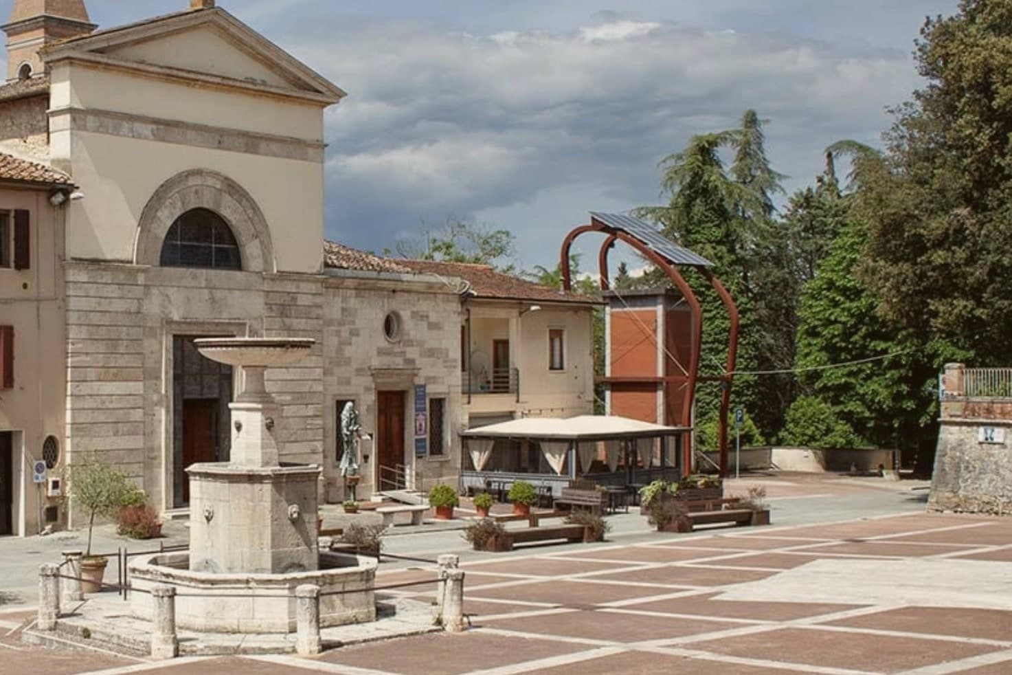
The commune sits east of Siena, where the hills give way to the clay swells of the Crete Senesi. The name comes from the Terra Berardinga, the area controlled in the tenth century by a Frankish nobleman named Berardo, and the borgo grew up around the castle walls the Sienese Republic raised against Florence.
The centro storico, the villa and gardens at its heart, and the surrounding zone of vineyards form one continuous pattern rather than separate parts: fortress town above, wine country falling away below it toward the clay hills. Across the wider territory, 13 castles, 70 churches and 200 farms record the medieval pattern of the Sienese contado, a scatter of small fortified points and parish churches administering land rather than one dominant center.
The place reads as a border post that outlived its military purpose and settled into agriculture and the arts, its castle now a clock tower, its noble villa now a music foundation, its walls now overlooking rows of Sangiovese.
What to see in Castelnuovo Berardenga
- Villa Chigi Saracini. Eighteenth-century villa and Italian garden inside the centro storico, its park designed by the Sienese composer Guido Chigi Saracini, whose family foundation still runs the Accademia Musicale Chigiana in Siena.
- Torre dell'Orologio. Surviving tower of the fortress, now bearing the civic clock, the highest visible point of the centro storico.
- Chiesa dei Santi Giusto e Clemente. Eighteenth-century parish church with a neoclassical façade, built on the site of an earlier Romanesque pieve.
How to get to Castelnuovo Berardenga
There is a railway station in the town, so you can arrive without a car and never need one while you are here. Firenze is roughly 77 minutes away by road.
✷ We have written about Castelnuovo Berardenga
“The wine is the whole economy of these hills, every village with its own, the region’s name stamped on the most famous red in Italy. Tuscan food runs to cured and roasted meat, so the wine ran red to meet it, lighter than you expect, almost fruity, easy, made to sit beside a steak and not to be lectured about. Here is the only wine knowledge you need on this road: it is all good.”
Read our piece on Castelnuovo Berardenga →Road to Siena | The Long Way Is the Better Way
Our tip
April through June and September into October are the months Chianti Classico shows best, the green hills moving toward the gold of harvest. The Sagra del Vino runs the second weekend of September. July and August push past thirty and the centro storico empties between two and six; the cellars on the surrounding hills offer cool tastings and longer rentals.
Montepulciano
Why visit Montepulciano
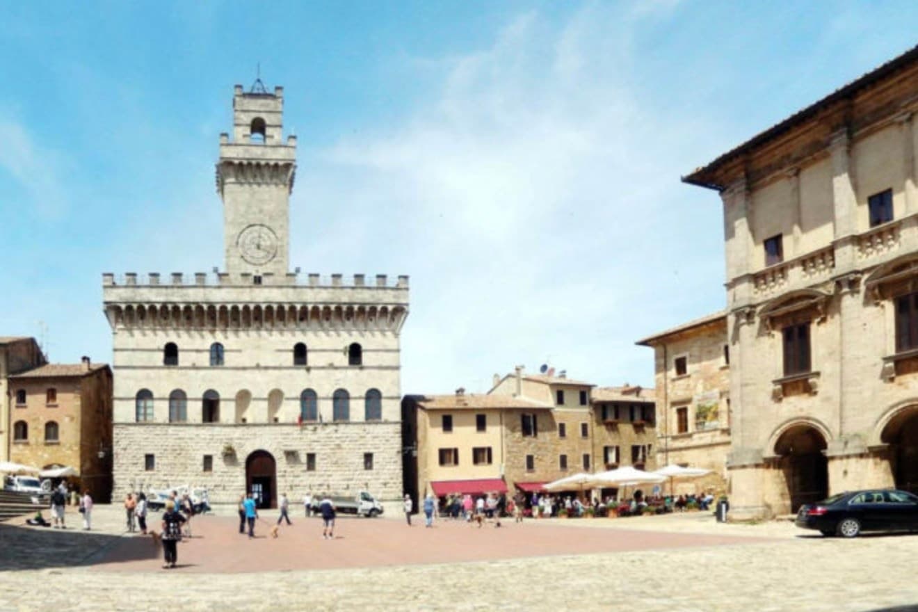
The ridge runs between the Val di Chiana and the Val d'Orcia, 70 kilometers southeast of Siena, and the town follows its spine uphill: streets climb from the gates toward the high point, where the main square sits ringed by the buildings that define the skyline from below. The origin predates the Renaissance fabric by centuries.
Etruscan tombs survive in the surrounding hills, though almost nothing of that period shows in the centro storico itself, which was rebuilt wholesale in the fifteenth and sixteenth centuries over whatever came before. The wine and the festival both use the climb as their setting rather than their subject: the cellars are cut into the rock beneath the palazzi, keeping a constant temperature for aging, and the barrel race each August sends two men from each of the eight contrade hauling an eighty-kilogram cask up the same gradient that every visitor covers on foot, only slower.
The steepness that shaped the defensive site nine centuries ago is still what a person feels first, in the legs, before the buildings register at all.
What to see in Montepulciano
- Tempio di San Biagio. A 13-meter dome and travertine façade standing alone outside the walls, the ground falling away below it so the building reads as a single volume against the hillside.
- Piazza Grande. The high piazza at the top of the ridge, ringed by the Duomo, the Palazzo Comunale and the Palazzo Tarugi, all rebuilt in the fifteenth and sixteenth centuries.
- Palazzo Comunale. Town hall designed by Michelozzo in the fifteenth century, its tower offering a view over the Val di Chiana and Val d'Orcia.
How to get to Montepulciano
There is a railway station in the town, so you can arrive without a car and never need one while you are here. Perugia is roughly 57 minutes away by road.
✷ We have written about Montepulciano
“Now, the postcard itself, the towns, and here I have less to say than you would expect, because Pienza and Montepulciano have become, and I mean this precisely, the canteens of a theme park. They are where you go to park, walk a pretty street, use the toilet, refill the water, eat a plate of something, and buy a thing to take home. They are the food court between the rides.”
Read our piece on Montepulciano →Val d'Orcia | The Postcard Is Constructed
Our tip
April through June and September into October are the working months on the ridge: vine work in the surrounding hills, mild days, evening light that lingers over the Val d'Orcia. July and August push into the low thirties and the climb to Piazza Grande slows even the residents. The Bravìo delle Botti runs the last Sunday of August and fills the town. Calici di Stelle falls in July.
Grosseto
Why visit Grosseto
Grosseto sits on the right bank of the Ombrone, ten meters above sea level and twelve kilometers inland from the Tyrrhenian. The Roman city of Roselle was destroyed in 935 by Saracen pirates; refugees regrouped on the plain below and Grosseto inherited the bishopric.
From 1336 it was Sienese; in 1559 it passed to the Medici after the battle of Montalcino. Cosimo I commissioned Baldassarre Lanci to replace the medieval walls with a hexagonal bastioned circuit, begun in 1565 and finished a decade later.
The walls are intact. Six bastions, two main gates, a continuous earthwork four kilometers around, now planted and used as the city's promenade.
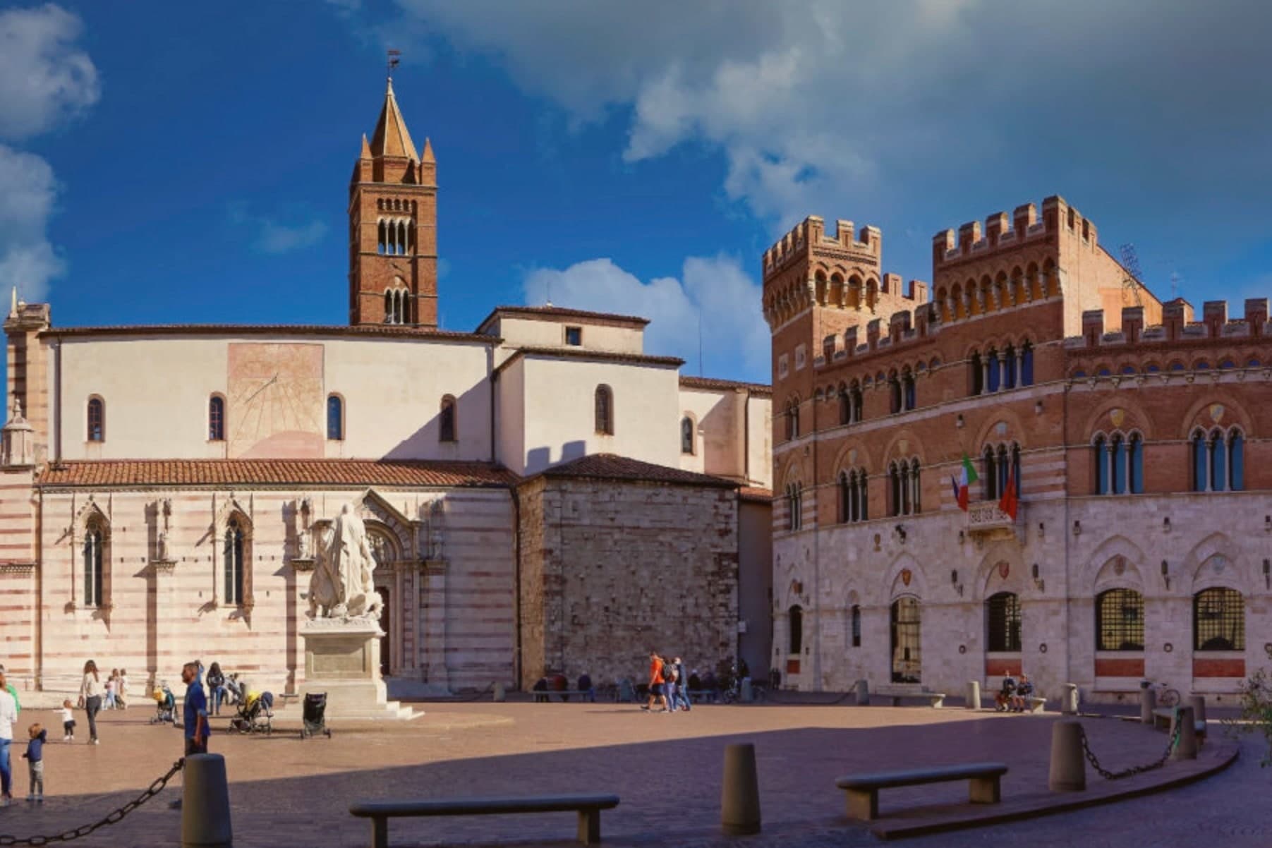
Inside, the Duomo di San Lorenzo holds a Romanesque-Gothic façade in alternating white and pink marble. The Cassero Senese, the Sienese fortress of 1345 swallowed into the later Medici walls, anchors the southeast corner.
Grosseto is the largest city of southern Toscana and the working capital of the Maremma.
What to see in Grosseto
- Mura Medicee. Hexagonal bastioned circuit commissioned by Cosimo I in 1564, designed by Baldassarre Lanci, intact and walkable for the full four kilometers.
- Duomo di San Lorenzo. Thirteenth-century cathedral with a façade in alternating white and pink marble, Latin-cross plan, semicircular apse over the nave.
- Cassero Senese. Travertine-clad Sienese fortress completed in 1345, incorporated into the southeast corner of the Medici walls, now used for exhibitions.
How to get to Grosseto
There is a railway station in the town, so you can arrive without a car and never need one while you are here. Livorno is roughly 110 minutes away by road.
✷ We have written about Grosseto
“Everyone driving from Florence down to Rome crosses the Maremma without noticing, because there is nothing on that stretch to make them slow down. The hills give out. The cypresses stop. What opens up instead is flat open country, wheat and grass running off to a few low rises, the least Tuscan-looking part of Tuscany, a landscape you would call dull if you were being honest and which most guidebooks solve by leaving out.”
Read our piece on Grosseto →Maremma | The Last Cowboys of Tuscany
Our tip
May, September and October are the Maremma months. The walls and the Parco Regionale are open without the heat, the umbrella pines hold their shade, and the wild horses are visible at dawn near the Ombrone mouth. July and August push past thirty-five degrees and the city empties between one and six in the afternoon.
More from Anywhere Italy
- The best hot-spring towns within 90 minutes of Florence
- The best hidden hot spring towns you can reach by train in Toscana
 The best hot-spring towns within 90 minutes of Perugia
 The best hidden wine towns you can reach by train in the province of Siena
 The best towns you can reach by train in the province of Siena
 The best hidden towns with a medieval festival in the province of Siena