
Aosta Valley · Aosta Valley
Châtillon
The Aosta Valley's three-castle commune, a 4,358-resident town at 549m at the mouth of the Valtournenche where it meets the main valley, with direct access up the road to the Cervino/Matterhorn at Cervinia 26 km north.
- Best time
- Apr–Jun, Sep–Oct
- By car
- 1 h 17 min from Turin
- By train
- Station in the comune
- Population
- 4,358
Known for
CASTELLO GAMBA ART MUSEUM
Regional contemporary art collection in a neo-Gothic castle: Casorati, Burri, Fontana, Pomodoro. The largest single regional contemporary-art museum in the Western Alps.
THREE-CASTLE COMMUNE
Castello Gamba, Castello di Ussel and Castello Passerin d'Entrèves: more castles per capita than any other Aostan commune. Strategic crossing of the Valtournenche and main valley.
CERVINIA/MATTERHORN GATEWAY
Châtillon is the SS406 base for the road up the Valtournenche to the famous Cervino/Matterhorn ski and mountain resort, 26 km north.
ACQUA CHÂTILLON SINCE 1859
The local mineral water source has been bottled commercially since 1859: one of the oldest commercial mineral water operations in Italy.
When to visit
Best · Apr–Jun, Sep–Oct
- J8°
- F11°
- M12°
- A15°
- M20°
- J25°
- J28°
- A28°
- S23°
- O19°
- N13°
- D9°
- Best
- Hot or crowded
- Quiet
- Mostly closed
Daytime averages, 2020–2024. Weather data by Open-Meteo.com.
The festa: Pietro, 29 June
Why come
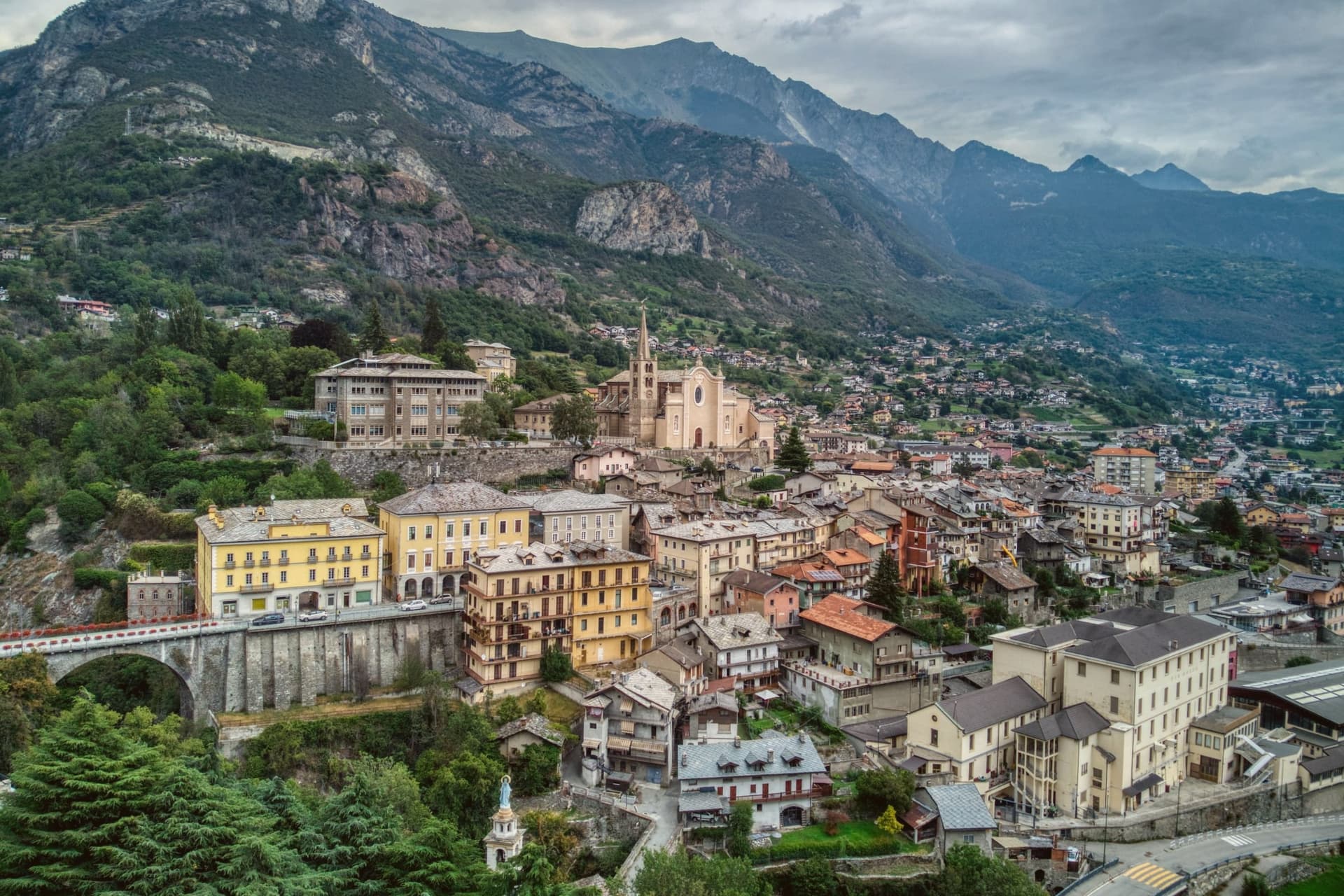
Châtillon sits at one of the strategic geographic junctions of the Aosta Valley, the point on the main Aosta-Turin road (SS26) where the Valtournenche side-valley enters the main Dora Baltea trench. That position made the town a controlled crossing in every period of Aostan history and gave it three surviving castles, more per capita than any other commune in the region. The town is at 549m altitude, 26 km east of Aosta along the SS26, with the Marmore stream cutting through the middle of the centro and the three fortifications arranged on the surrounding ridges: the neo-Gothic art museum on the south-facing slope, the medieval monoblock fortress that served as a design model for other Aostan castles, and the private Renaissance residence partially visible from the road. Each occupies its own piece of high ground, so the town reads less as a single settlement than as a crossing point ringed by watch-points, one for every approach.
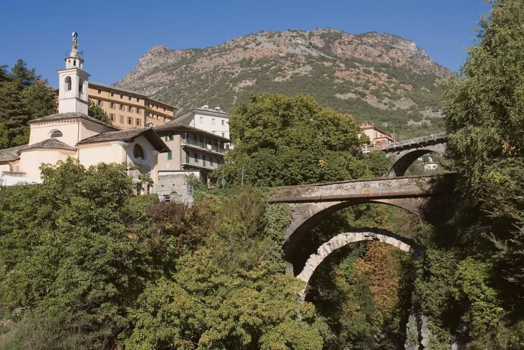
The centro itself, down by the stream, is quietly handsome with the parish church of San Pietro (15th-c, with later restorations and an 18th-c bell tower), the Roman-era stone bridge over the Marmore, still used for pedestrian traffic, and the 19th-c thermal-water-pumping installations drawing on the same source bottled since 1859 as Acqua Châtillon. The town is the natural base for visits to Cervinia up the Valtournenche, the Lago di Lod thermal lake 5 km north, and the surrounding upper Valtournenche villages. The food is Valdostan-Alpine: fontina, seuppa à la valpellinentse, mocetta, polenta concia, and the local Petit Rouge red and Müller Thurgau white from the south-facing vineyards along the Dora Baltea. The Marché aux Vins Valdôtains every February, held in Aosta but with major Châtillon producer presence, and the Festa di San Pietro on 29 June are the year's main fixed events. Set against each other, the castles on the ridges and the bridge and water works down in the centro tell the same story from two elevations: a valley junction where every era left something built to control or draw from the crossing, rather than simply to live beside it.
The Sunday letter
Châtillon is on our list. Its letter is still to come.
We are writing about all 1,000 of these towns, one at a time, in a free letter every Sunday: the photo, the food, the festa. That is our mission. Sign up and you will be there when Châtillon comes up. By Peter & Sophia, from Pietrasanta.

How to get there
From Turin (TRN), about 1h 14m by car.
Milan (BGY) is about 2h 29m away.
By car from the centre of Genoa 2h 38m.
There is a railway station in the comune, so you can arrive without a car.
Coming by train into Torino Porta Susa? Châtillon is about 1h 14m away by road.
What to see
Castello Gamba (Pinacoteca della Valle d'Aosta)
Built 1900-1903 for Baron Carlo Maurizio Gamba by the architect Cesare Saroldi, on the south-facing slope above the centro. Donated to the Region in 1982 and reopened in 2012. Holdings extend to Carrà, De Pisis and Manzù alongside the better-known names.
Castello di Ussel
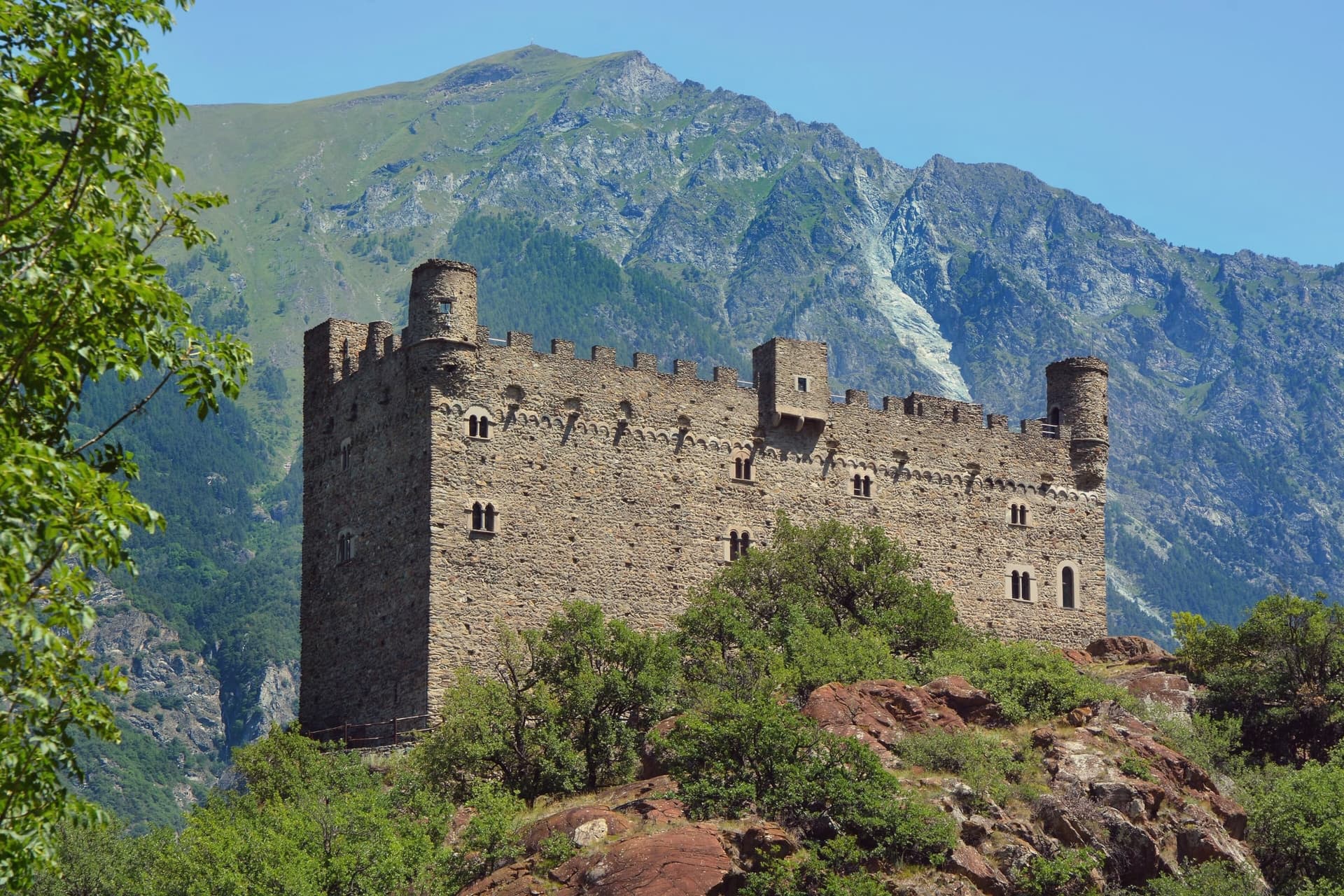
14th-c prototype monoblock castle, the architectural model that influenced Fénis and other 14th-c Aostan fortresses. Restored in the 1990s, now hosts temporary exhibitions.
Castello Passerin d'Entrèves
17th-c castle, still in private family ownership. Partially visible from the SS26, the third point of the town's unusual three-castle ensemble.
Ponte Romano sul Marmore
Roman-era stone bridge over the Marmore stream, still in use for pedestrian traffic. The original crossing that gave the town its strategic importance.
Cervinia/Matterhorn gateway
The road up the Valtournenche climbs from here to Cervinia, the resort at the foot of the Cervino/Matterhorn.
The slow-trip planner
Building a trip? Find where Châtillon fits in a slow Italy circuit.
Answer five questions. We will shape a geographically coherent slow trip from the 1,000 Italian towns most travelers skip. Yours to save and share.
Through the year
What happens here
Feasts and festivals that come back year after year. We give the month rather than the date, because the date moves and the month rarely does. Check with the source before you plan a journey around one.
Color Run e Notte Gialla e Nerapatron saint's feast
usually held in August. Aostaoggi.it - Eventi in Valle d'Aosta
Festa del Perdono di Assisipatron saint's feast
usually held in August. AostaSera - Eventi
Honey and its derivatives festivalfood festival
usually held in October. sagritaly.com
Sagra del miele di Châtillonfood festival
usually held in October. Sagr.it - Sagre ed eventi in Valle d'Aosta
Living here
- Population 4,358
- Commuter belti
- Pharmacy in town
- High school within a 30-minute drive
- Train station in the comune
- Nearest airport Turin, 1 h 14 min drive
- Regional capital Aosta, 28 min drive
Common questions
- What is Châtillon known for?
- Châtillon is the Aosta Valley's three-castle commune, a 4,358-resident town at 549m at the mouth of the Valtournenche where it meets the main valley, with direct access up the road to the Cervino/Matterhorn at Cervinia 26 km north.
- Where is Châtillon?
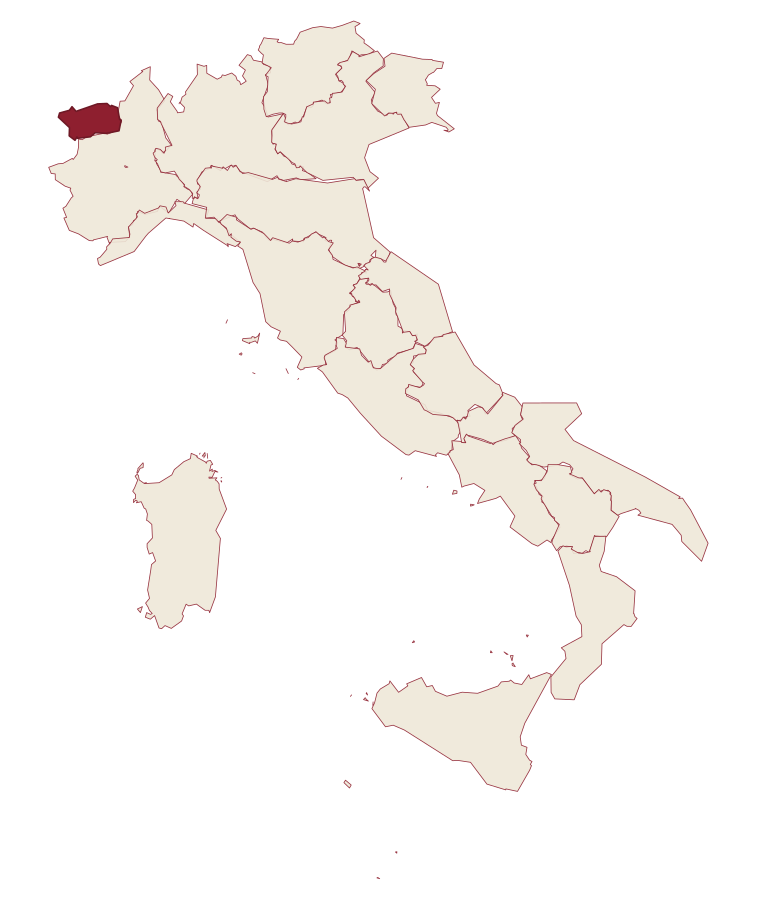
- Châtillon is a comune in the province of Aosta Valley, in Aosta Valley.
- What is the nearest airport to Châtillon?
- Turin (TRN), about 1h 14m by car.
- Can you get to Châtillon without a car?
- Yes. There is a railway station in the comune, so you can arrive by train.
- How long is the drive from Genoa to Châtillon?
- About 2h 38m by car.
- When is the best time to visit Châtillon?
- Best in Apr–Jun, Sep–Oct. August is the warmest month, averaging 28 degrees, and May the wettest, with about 19 rain days.
- Is there a sagra or a festival in Châtillon?
- Yes. Color Run e Notte Gialla e Nera, Festa del Perdono di Assisi and Honey and its derivatives festival, and 1 more we hold a source for. August is when the first of them falls.
- Which other towns are like Châtillon?
- Saint-Vincent, Castagnole delle Lanze and Cherasco.
- How many people live in Châtillon?
- 4,358 at the 2023 count.
Tags & datadesignations · numbers · sources
The numbers
- Elevation: 549 m
- Population: 4,358
- Surface area: 39.68 km²
These figures were compiled from public directories: ISTAT, OpenStreetMap and Wikidata, and from the official listings of the guides named on this page. Town details change; verify with official sources before you travel.
Similar
Towns like Châtillon
Saint-Vincent
Province: Aosta Valley
both in the Aosta valley · both between 3,000 and 10,000 people
Castagnole delle Lanze
Province: Asti
both between 3,000 and 10,000 people · both hill towns
Cherasco
Province: Cuneo
both between 3,000 and 10,000 people · both hill towns
Racconigi
Province: Cuneo
both between 3,000 and 10,000 people · both hill towns
Fénis
Province: Aosta Valley
both in the Aosta valley · both hill towns
Nocera Umbra
Province: Perugia
both between 3,000 and 10,000 people · both hill towns