
The best wine towns within two hours of Pisa
Wine here is a matter of soil you can see from the road. Inland, the hills between Florence and Siena break into pale galestro and clay, terraced with Sangiovese and stitched with cypress and olive; nearer the sea, in the Val di Cornia and the Maremma, the vines run flatter and warmer, and the reds come out darker and softer. The towns are built of the same stone as the walls holding up the vineyards, with cellar doors set straight into the street and a bar that opens before the tractors do. Come in September or October for the harvest, or in late spring when the new vintage is poured in the piazza and the wild boar is still on the menu.
Most visitors do this from Florence or Siena, on a bus that stops at a couple of big estates and a hilltop town with a view. Montalcino gets the heaviest traffic, because Brunello is the name people already know, and its enoteche fill from mid-morning until the coaches leave. Chianti Classico between the two cities is similarly well travelled, with tasting rooms priced accordingly and car parks that fill by eleven. None of it is a fraud. It is simply the busiest possible way to drink Tuscan wine.
The vineyards do not stop where the tour route does. The same protected zones stretch north towards Prato, south into the Maremma and west to the iron hills above the coast, and inside those boundaries are towns with working cellars, a couple of tables and far fewer people at them. All of these sit within about a two-hour drive of Pisa, each inside the production zone of a protected wine, which is the plainest evidence we have that what is poured there belongs to the place.
Of the 75 communes we have mapped in a 120-minute drive of Pisa, 9 qualify as wine towns: each sits inside the production zone of a protected wine. The smallest, Castellina in Chianti, has 2,651 residents.
If you are still choosing, we have also written The best wine towns within 90 minutes of Florence and The best coastal towns within two hours of Siena.
Carmignano
Why visit Carmignano
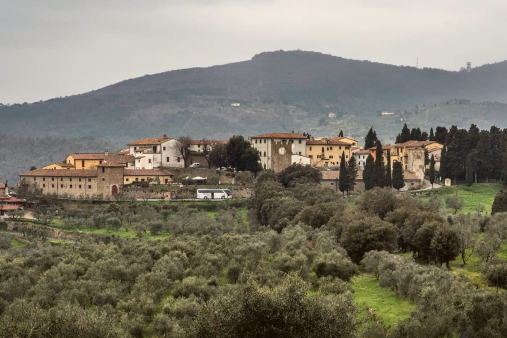
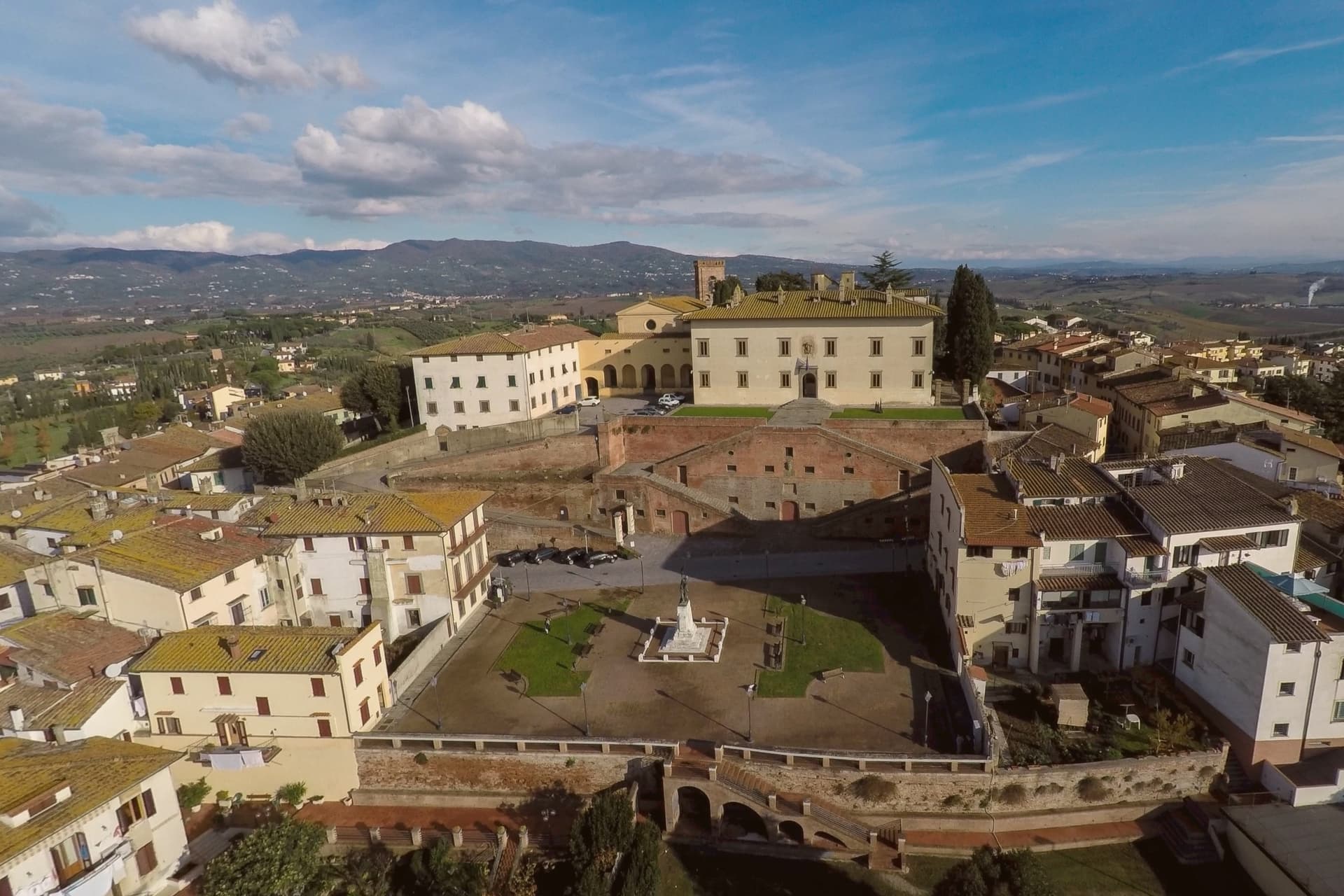
Carmignano sits at 189 meters on the Montalbano hills, twenty kilometers west of Florence and ten southwest of Prato. The commune is built from separate frazioni rather than a single center: Artimino occupies the ridge above, Comeana lies apart with its own tombs, and the town itself holds the parish church at the lower elevation.
This layout puts a Renaissance villa, a pair of seventh-century BC tombs and a working wine appellation within the same small commune without any of them sitting next to each other. The vines of the Carmignano DOCG cover the same Montalbano slopes that were occupied first by the people who built the tombs at Comeana and later by the Medici, so the landscape reads as continuous use of one hillside across the centuries rather than as separate attractions laid on top of it.
Few communes this size hold a Medici villa, a seventh-century BC necropolis and a wine appellation across three distinct frazioni, each still doing what it was built or planted for.
Da Delfina have been named by a guide.
What to see in Carmignano
- Visitazione di Pontormo. Painted for the Pinadori family and still in place in the parish church of San Michele e San Francesco, the panel hangs where it was installed, a late Mannerist work seen in the setting it was made for rather than in a museum.
- Villa Medicea La Ferdinanda. The villa sits on the ridge above Artimino, its roofline broken by the chimneys that give it its nickname, looking out over the same slopes planted with vines below.
- Tumulo di Montefortini. Monumental Etruscan tomb at Comeana from the seventh century BC, 11 meters high and 60 in diameter, with two intact chambers visited through a corridor.
How to get to Carmignano
Prato is roughly 25 minutes away by road.
Our tip
April through June and September into October are the working months on the Montalbano: vine work in the surrounding hills, mild days, evening light over the Arno plain. Harvest runs from mid-September through October. July and August push into the low thirties and Florence twenty kilometers east bakes harder than the ridges here. Festa di San Michele a Carmignano falls in September.
Sasso Marconi
Why visit Sasso Marconi
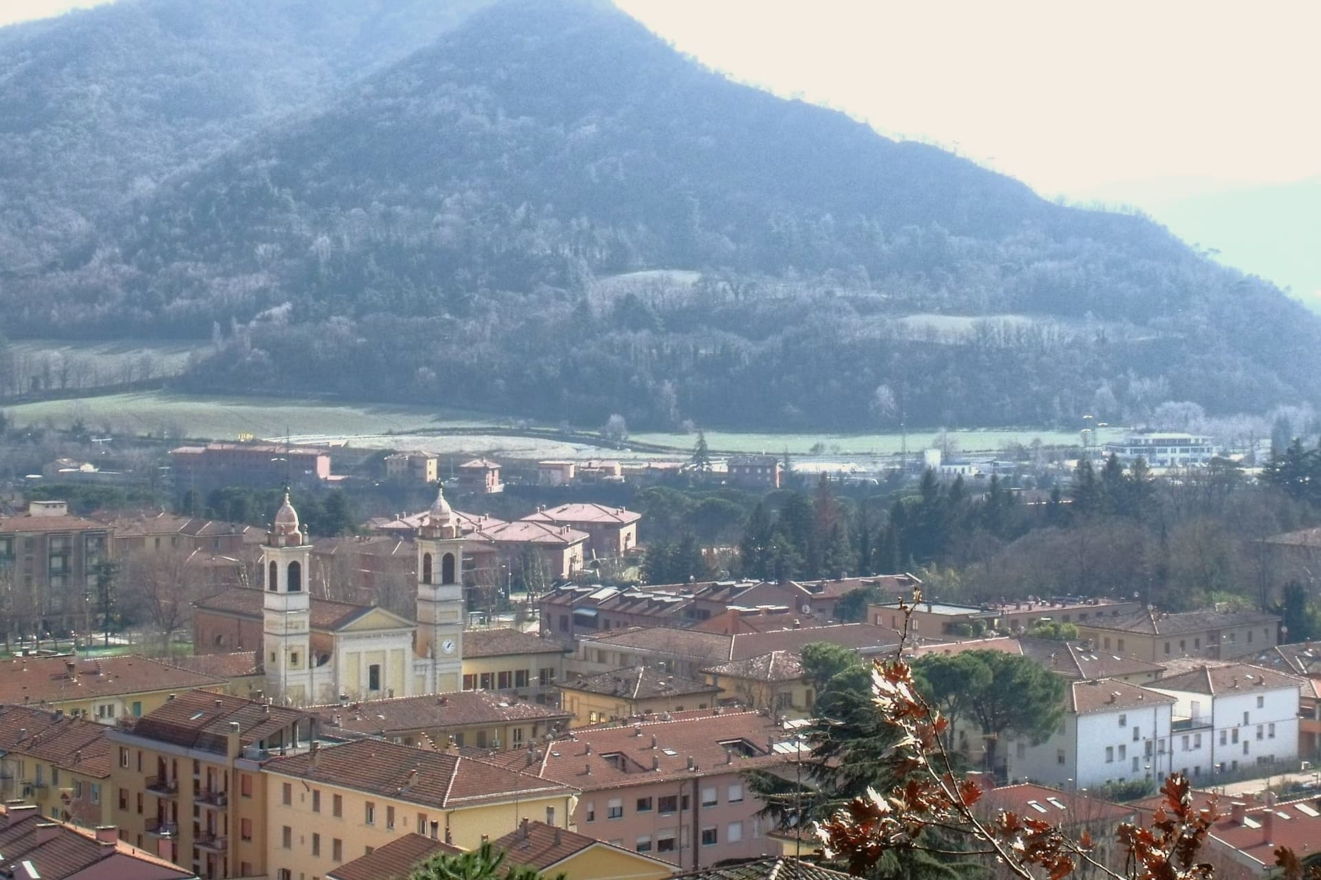
The Setta and Reno rivers meet below the rock that gives the town its name, at the point where the pre-Apennine hills begin their climb south of Bologna. The Sasso della Glosina dominates the bend, a Pliocene formation old enough to have shaped how the crossing below it was used long before the valley took its modern name.
The town itself was called Sasso Bolognese until 1938, when it was renamed for the family whose estate lies in the frazione of Pontecchio, on the valley floor rather than on the rock itself. The territory reaches from that river confluence up into the Apennine slopes, and the change in elevation shows in what the land produces: white truffle from the valley floor near the Reno, and vineyards on the hills around Pieve del Pino and Mongardino, recognition earned on two different registers of the same ground.
The lower town, built around the rivers and the old road to Pistoia, and the upper slopes, given to woods and terraced vines, read as one territory doing two different kinds of work.
Casa Mazzucchelli, Antica Trattoria la Grotta dal 1918 have been named by a guide.
What to see in Sasso Marconi
- Villa Griffone - Museo Marconi. Marconi family villa in the frazione of Pontecchio. The mausoleum sits alongside the attic laboratory, and the museum holds working reproductions of his early apparatus.
- Sasso della Glosina. The rock rises directly over the river bend, its bulk visible from the crossing below and from much of the surrounding valley.
- Confluenza Setta-Reno. Meeting of the two valleys at the foot of the rock, with the historic crossing of the Via Porrettana toward Pistoia.
How to get to Sasso Marconi
There is a railway station in the town, so you can arrive without a car and never need one while you are here. Bologna is roughly 26 minutes away by road.
Our tip
April through October is the working season in Sasso Marconi. Spring and early autumn are best on the Reno valley trails and at Villa Griffone, with mild temperatures and the Apennine foothills green or autumn-coloured. July and August can touch thirty-five degrees in the valley, though the higher frazioni stay cooler; many visitors come up from Bologna for a day on a weekend. Fira di Sdaz di Sasso Marconi falls in September.
Castellina in Chianti
Why visit Castellina in Chianti
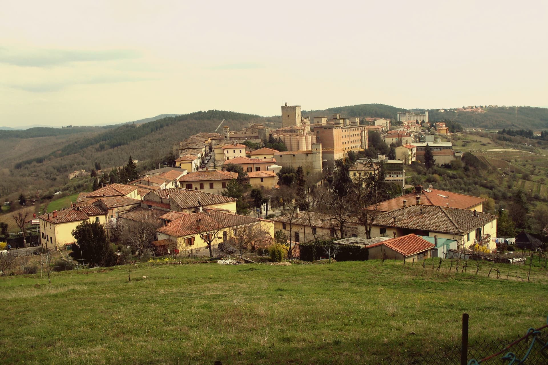
Castellina in Chianti sits at 578 meters on the watershed between the Arno and Ombrone basins, fifteen kilometers northwest of Siena and thirty-five south of Florence. Its position on the historic frontier between the two republics shaped the town: it was a Sienese border fortification reinforced in the fifteenth century by Filippo Brunelleschi and Giuliano da Sangallo against firearm warfare.
The Rocca with its fifteenth-century tower dominates the centro storico and now houses the Museo Archeologico del Chianti Senese, opened in 2006. The Via delle Volte runs the length of the eastern wall: an original ancient pomerium, once open to the sky, gradually built over by private houses against the wall and now a covered arcaded passage lined with workshops and trattorie.
The Tumulo Etrusco di Montecalvario, a sixth-century BC tomb with four burial chambers carved on the cardinal axes, sits a kilometer from the centro storico. The Gallo Nero of Chianti Classico DOCG is grown on the slopes below.
Albergaccio di Castellina, Osteria di Fonterutoli, Passo dopo Passo Osteria have been named by a guide.
What to see in Castellina in Chianti
- Rocca di Castellina. Fifteenth-century fortification with imposing keep, now housing the Museo Archeologico del Chianti Senese, opened in 2006.
- Via delle Volte. Covered arcaded walkway along the eastern wall, once an open pomerium, built over by houses pressing against the fortifications and now lined with workshops.
- Tumulo di Montecalvario. Sixth-century BC Etruscan tomb a kilometer from town, with four burial chambers carved on the cardinal compass points, excavated in the early 1900s.
How to get to Castellina in Chianti
Firenze is roughly 63 minutes away by road.
Our tip
April through June and September into October are the working months on the Chianti watershed: vine work, harvest from mid-September, mild days at 578 meters. The Festa del Vino in the second half of September fills the centro storico for a long weekend. July and August are warmer but stay below the inland Maremma heat, and the Via delle Volte is reliably cool.
Suvereto
Why visit Suvereto
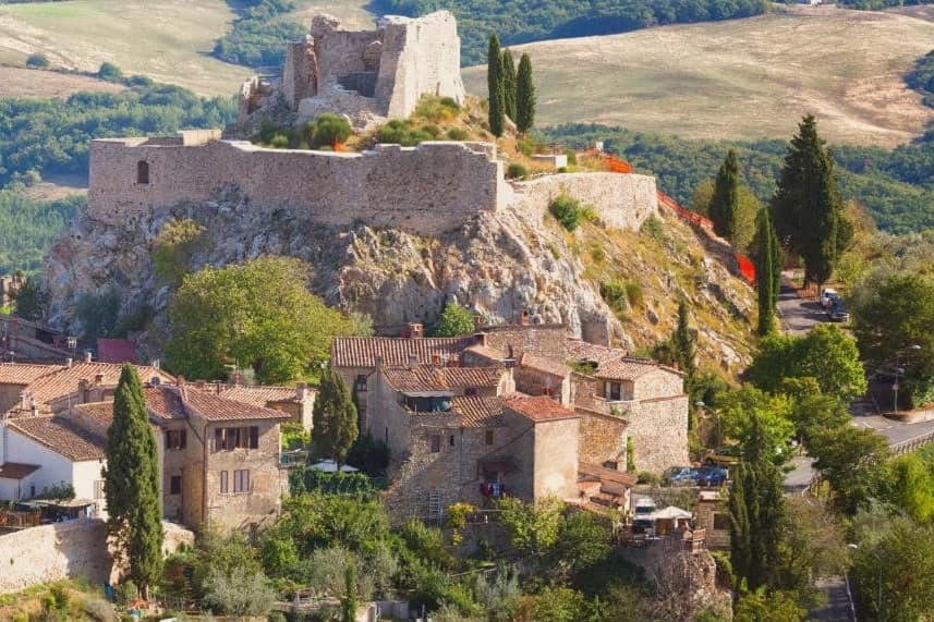
Suvereto sits at 127 meters on the inland edge of the Val di Cornia, twelve kilometers from the Tyrrhenian coast. The name comes from the Latin suberetum, a wood of cork oaks, and the surrounding forests still hold them.
The Rocca Aldobrandesca, first documented in 973, occupies the highest point of the borgo; the Aldobrandeschi family who controlled it also ruled large sections of southern Toscana and the Maremma. The town reached its golden age in the thirteenth century, when Frederick II granted it a charter of freedoms in 1216 and the Palazzo Comunale was built.
The centro storico is a tight grid of stone vicoli that runs uphill from the Romanesque Pieve di San Giusto to the fortress. Suvereto carries five institutional signals at once, a rare combination in the province of Livorno, and the surrounding wine country falls under the Val di Cornia DOC and Suvereto DOCG appellations.
I’ Ciocio have been named by a guide.
What to see in Suvereto
- Rocca Aldobrandesca. Fortress at the highest point of the borgo, documented from 973, expanded in the twelfth century and partly restored as an open archaeological site.
- Pieve di San Giusto. Eleventh-century Romanesque parish church at the foot of the borgo, with a sandstone façade and a single nave divided by stone columns.
- Palazzo Comunale. Thirteenth-century town hall with a double external staircase and Ghibelline merlons, one of the earliest surviving civic palaces of the Maremma.
How to get to Suvereto
Livorno is roughly 84 minutes away by road.
✷ We have written about Suvereto
“That is the thing the young man on the beach did not see, and the man who lives here cannot stop seeing. This is an industrial coast wearing a beach towel. Run it back far enough and the whole of it, the swamp and the steel and the slag and the white water, is one long story about iron, and the holiday is the costume the story put on after the work ran out.”
Read our piece on Suvereto →The Iron Coast | The Wrong Sea
Our tip
April through June and September into October are the dry months in the Val di Cornia, when the cork forests behind the town hold their light and the wine harvest runs in September. The Sagra del Cinghiale, celebrating the wild boar of the surrounding hills, runs across two weekends in December and draws a different crowd. July and August are hot at 127 meters and most visitors descend to the Tyrrhenian coast in the afternoon. Palio dell'Imperatore falls in August.
San Gimignano
Why visit San Gimignano
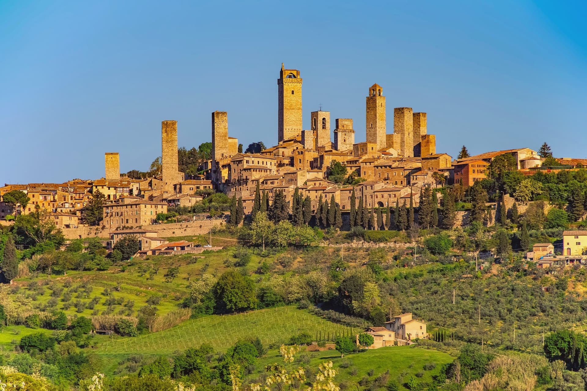
San Gimignano sits at 334 meters in the Val d'Elsa, halfway between Firenze and Siena on the medieval pilgrim road to Rome. Patrician families built 72 tower-houses in the twelfth and thirteenth centuries as proofs of wealth and platforms for vendettas; 14 still stand, the tallest being the Torre Grossa at 54 meters.
The town declared independence from the bishops of Volterra in 1199 and grew rich on saffron and Vernaccia, the white wine grown on the surrounding hills and praised since Dante. The Black Death of 1348 broke the boom; San Gimignano lost more than half its population and submitted to Florence.
That collapse is the reason the medieval skyline survived. UNESCO listed the historic centre in 1990 as a complete record of feudal architecture.
Roughly three million visitors come each year, more than 400 times the resident population, and the centro storico empties into the surrounding olive groves once the day-trippers leave.
Linfa, Da Pode, San Martino 26 have been named by a guide.
What to see in San Gimignano
- Torre Grossa. Fifty-four meter civic tower attached to the Palazzo Comunale, the tallest of the surviving 14, open for the climb to the panoramic terrace.
- Piazza della Cisterna. Triangular medieval square paved in brick around an octagonal well of 1287, lined by tower houses and Romanesque palaces.
- Collegiata di Santa Maria Assunta. Romanesque parish church on Piazza Duomo, walls covered by Bartolo di Fredi and Lippo Memmi frescoes of Old and New Testament scenes.
How to get to San Gimignano
Firenze is roughly 61 minutes away by road.
✷ We have written about San Gimignano
“We arrived in the afternoon, into the second half of the day’s crowd. Off-season meant it was groups and guides rather than a flood, but the shops were open and doing their worst, the same garbage souvenirs, the same pasta no one local would eat, and we walked through it the way you walk through a thing you have decided not to let ruin your evening. The towers stood over all of it, indifferent, which is their whole talent.”
Read our piece on San Gimignano →San Gimignano | The Town After Seven
Our tip
April through June and September into October are the months the town is worth a full day rather than three hours. The buses still come, but late afternoon empties the piazzas and lets the towers take their light. July and August push temperatures past thirty and the centro storico becomes uncomfortable between two and six, when the stone radiates heat. Fiere delle Messi di San Gimignano falls in June.
Campiglia Marittima
Why visit Campiglia Marittima
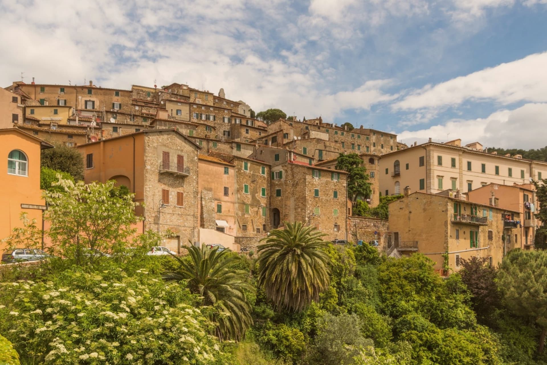
Campiglia Marittima sits at 231 meters on the last slopes of the Colline Metallifere above the Val di Cornia, eight kilometers inland from the Tyrrhenian coast and 60 kilometers southeast of Livorno. The Rocca occupies the highest point at 281 meters, a fortified semicircle whose 14th-century tower and town walls trace the medieval defensive line.
The territory has been mined since the Etruscans: copper, silver, lead and tin from the hills behind town, worked continuously until the last galleries closed in 1976. The Parco Archeominerario di San Silvestro, opened in 1996 on 450 hectares behind the town, centers on Rocca San Silvestro, a tenth and eleventh-century miners' village abandoned in the fourteenth century and excavated since 1984.
Visitors enter through restored galleries on a small electric train. Down on the plain the DOC Val di Cornia produces Sangiovese and Cabernet, and the thermal springs at Venturina, the frazione south of town, have flowed since Roman use as Aquae Populoniae.
What to see in Campiglia Marittima
- Rocca di Campiglia. Fortified semicircle at 281 meters with the 14th-century tower, walls and the Pieve di San Giovanni, the highest point of the town.
- Parco Archeominerario di San Silvestro. 450-hectare park behind town, opened 1996, with restored mining galleries, a small electric train, and the abandoned medieval miners' village of Rocca San Silvestro.
- Centro storico. Walled hilltop borgo of stone houses, with Piazza della Repubblica at its center, the medieval gates Porta a Mare and Porta Fiorentina still intact.
How to get to Campiglia Marittima
There is a railway station in the town, so you can arrive without a car and never need one while you are here. Livorno is roughly 67 minutes away by road.
Our tip
May through September is the season on the Val di Cornia: warm days, sea breezes that climb the hill, harvest of Sangiovese and Vermentino from late August. The beaches at San Vincenzo and Baratti are eight to fifteen kilometers away and pull the day-traffic. July and August are hot and busy on the coast; the borgo on the hill stays a few degrees cooler.
Greve in Chianti
Why visit Greve in Chianti
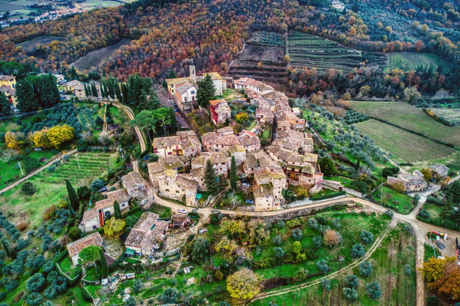
Greve sits at 236 meters in the Val di Greve, thirty-one kilometers south of Firenze and forty-two north of Siena, on the small fast river that gave the town its name. The valley narrows here enough that the road to Firenze runs past the castle estates on the slopes to the north before dropping into the town itself, and the walled hamlet above Greve looks down on the piazza from its kilometer of higher ground, a settlement some centuries older than the square below it, its tenth-century walls predating the piazza's sixteenth-century arcades.
The piazza is the point around which the rest of the town organizes itself: shops and a market under the arcades, a rebuilt church closing its south end, and the roads out toward the castles and the hamlet all beginning at its edges. The Saturday market fills the piazza.
The wine festival in early September empties the surrounding cellars into glasses for three days. What holds the place together is the geography more than any single monument: a market town at a river crossing, ringed by the vineyard slopes and the older hill settlement that all feed into the same triangular square.
Enoteca Baldi, Castello Vicchiomaggio, Officina della Bistecca and 2 more have been named by a guide.
What to see in Greve in Chianti
- Piazza Matteotti. The arcades shelter wine shops, butchers and pasticcerie, wrapped around the irregular triangle of paving with the navigator's bronze figure watching the center.
- Chiesa di Santa Croce. Neoclassical parish church on the south point of the piazza, rebuilt in the nineteenth century after earthquake damage.
- Castello di Verrazzano. Vineyard estate on the hills north of town, producing Chianti Classico on slopes tied to the family name that reached New York Bay.
How to get to Greve in Chianti
Firenze is roughly 44 minutes away by road.
✷ We have written about Greve in Chianti
“The wine is the whole economy of these hills, every village with its own, the region’s name stamped on the most famous red in Italy. Tuscan food runs to cured and roasted meat, so the wine ran red to meet it, lighter than you expect, almost fruity, easy, made to sit beside a steak and not to be lectured about. Here is the only wine knowledge you need on this road: it is all good.”
Read our piece on Greve in Chianti →Road to Siena | The Long Way Is the Better Way
Our tip
April through June and September into October are the months when the Chianti hills are at their best, green or gold depending on the harvest. July and August push past thirty degrees and the piazza empties between two and five. The wine harvest runs late September and the cellars open in turns. Expo Chianti Classico falls in September.
Piombino
Why visit Piombino
Piombino sits on a triangular promontory pointing southeast into the Tyrrhenian, at the northern edge of the Maremma. The town was founded in the ninth century by refugees from the Etruscan port after Greek pirates attacked the city; they called the new settlement Populino, small Populonia, and the name shortened over time to what it is now.
The old city, now a frazione north on the coast, became the source of the newer town's name rather than the other way round. In the medieval period Piombino became an independent signoria under the Appiani, who ruled from here over a small state that reached out to the islands across the water.
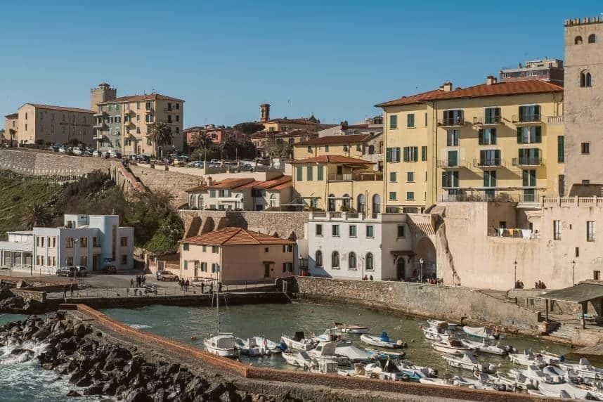
The castle at the seafront, the piazza cantilevered out over the cliff toward Elba, and the working ferry port make up the contemporary town, each looking the same direction the refugees once looked back from: toward the older settlement to the north and the channel to the islands beyond it. The Bandiera Blu coast covers the four kilometers between the port and the old acropolis, so that the walk from new town to old runs along the same shoreline that separates them by name only.
Al Baccanale, Osteria La Torre di Populonia, Taverna dei Boncompagni have been named by a guide.
What to see in Piombino
- Castello di Piombino. Principal defensive fortress of the city on a headland pointing southeast into the sea, with the Torrione, the Rivellino and the Cittadella complex, now a museum.
- Piazza Bovio. Long rocky breakwater extending into the sea as La Rocchetta, terraced as a piazza, with a balcony view across the channel to Elba.
- Parco Archeologico di Baratti e Populonia. Chamber tombs from the seventh to second centuries BC cut into the ground of the Gulf of Baratti, laid out for walking among the excavated structures rather than viewed from a distance.
How to get to Piombino
There is a railway station in the town, so you can arrive without a car and never need one while you are here. Livorno is roughly 77 minutes away by road.
Our tip
May, June, September and October are the months when the Piombino promontory is at its best, sea warm enough to swim and the ferry to Elba running every hour without the August crush. July and August are full season, with the centro storico filling by late morning and the Baratti beach turning over twice a day. November through March is cold and windy on the promontory, with limited ferry crossings and many seaside trattorie closed. Sagra del Pesce - Piombino falls in July.
Grosseto
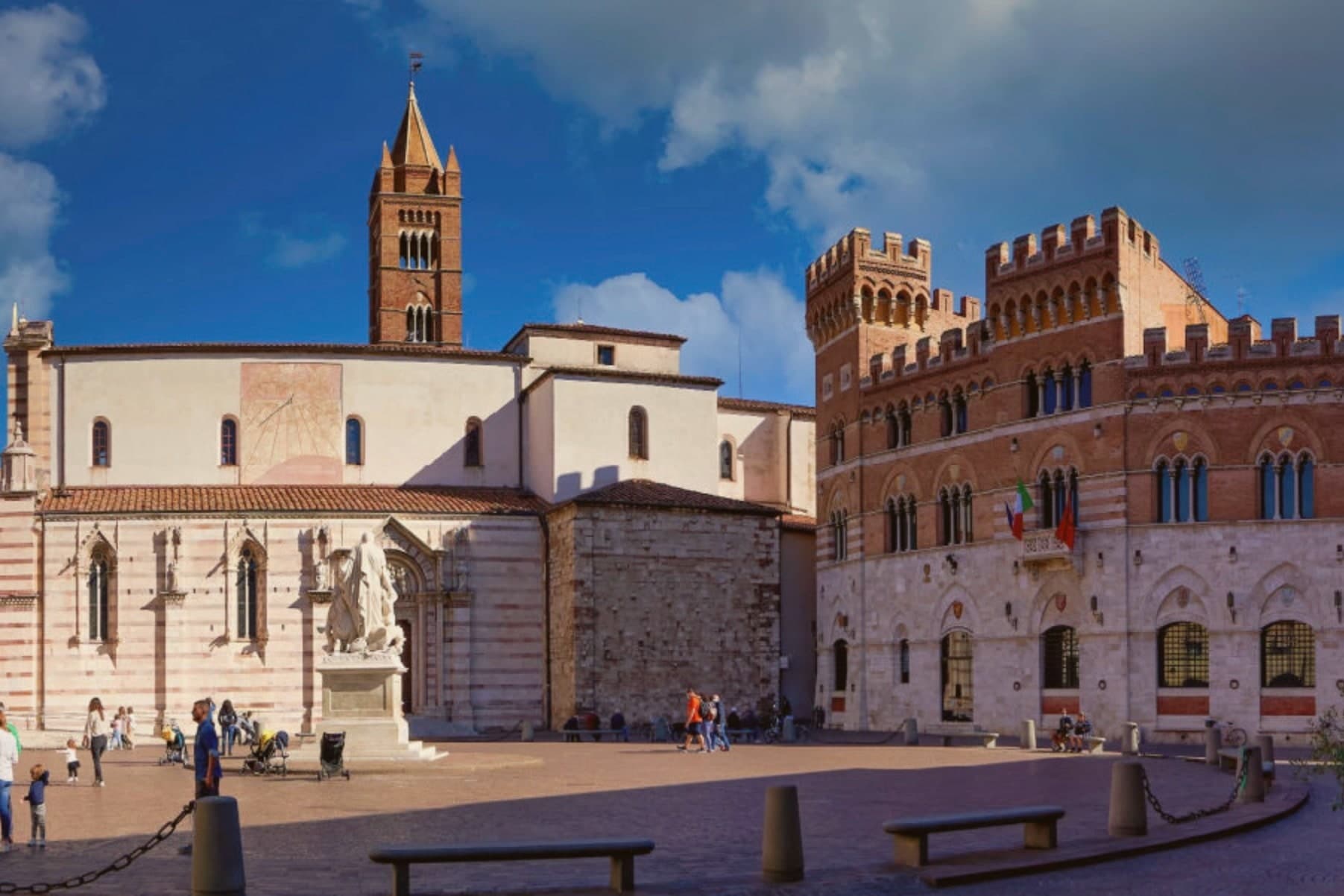
Why visit Grosseto
Grosseto sits on the right bank of the Ombrone, ten meters above sea level and twelve kilometers inland from the Tyrrhenian. The Roman city of Roselle was destroyed in 935 by Saracen pirates; refugees regrouped on the plain below and Grosseto inherited the bishopric.
From 1336 it was Sienese; in 1559 it passed to the Medici after the battle of Montalcino. Cosimo I commissioned Baldassarre Lanci to replace the medieval walls with a hexagonal bastioned circuit, begun in 1565 and finished a decade later.
The walls are intact. Six bastions, two main gates, a continuous earthwork four kilometers around, now planted and used as the city's promenade.
Inside, the Duomo di San Lorenzo holds a Romanesque-Gothic façade in alternating white and pink marble. The Cassero Senese, the Sienese fortress of 1345 swallowed into the later Medici walls, anchors the southeast corner.
Grosseto is the largest city of southern Toscana and the working capital of the Maremma.
L'Uva e il Malto, Canapone, Oste Scuro and 1 more have been named by a guide.
What to see in Grosseto
- Mura Medicee. Hexagonal bastioned circuit commissioned by Cosimo I in 1564, designed by Baldassarre Lanci, intact and walkable for the full four kilometers.
- Duomo di San Lorenzo. Thirteenth-century cathedral with a façade in alternating white and pink marble, Latin-cross plan, semicircular apse over the nave.
- Cassero Senese. Travertine-clad Sienese fortress completed in 1345, incorporated into the southeast corner of the Medici walls, now used for exhibitions.
How to get to Grosseto
There is a railway station in the town, so you can arrive without a car and never need one while you are here. Livorno is roughly 110 minutes away by road.
✷ We have written about Grosseto
“Everyone driving from Florence down to Rome crosses the Maremma without noticing, because there is nothing on that stretch to make them slow down. The hills give out. The cypresses stop. What opens up instead is flat open country, wheat and grass running off to a few low rises, the least Tuscan-looking part of Tuscany, a landscape you would call dull if you were being honest and which most guidebooks solve by leaving out.”
Read our piece on Grosseto →Maremma | The Last Cowboys of Tuscany
Our tip
May, September and October are the Maremma months. The walls and the Parco Regionale are open without the heat, the umbrella pines hold their shade, and the wild horses are visible at dawn near the Ombrone mouth. July and August push past thirty-five degrees and the city empties between one and six in the afternoon.
More from Anywhere Italy
- The best wine towns within 90 minutes of Florence
 The best coastal towns within two hours of Siena
 The best hidden hill towns within 90 minutes of Firenze
- The best olive oil towns within 90 minutes of Firenze
 The best hidden wine towns with a medieval festival in Toscana
 The best towns with a World Heritage site within 90 minutes of Pisa