
The best wine towns within 90 minutes of Florence
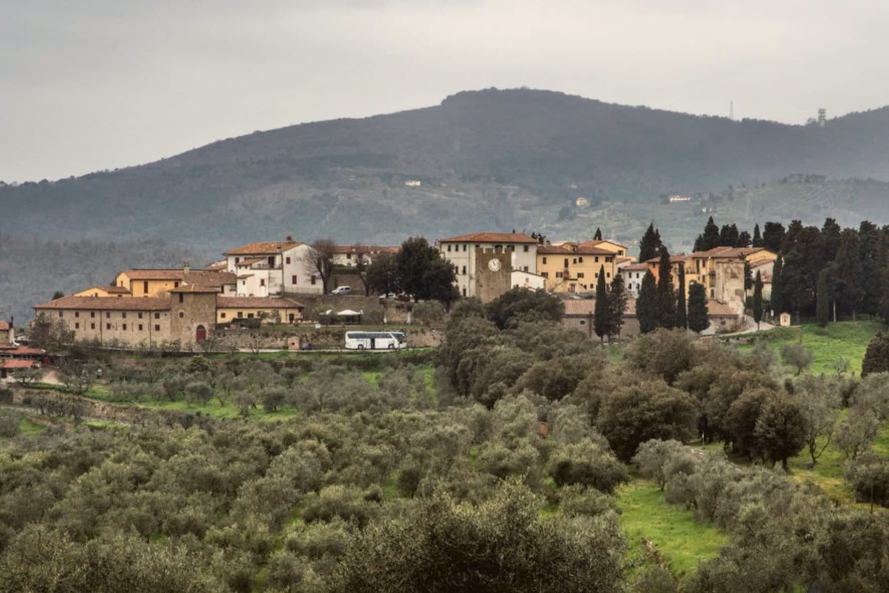
The hills south and west of Florence are built for wine, and they look it: ridges of vines running into oak and holm woods, cypress along the drive up to a farm, houses of pale limestone and pietra serena with cellar doors at street level. Autumn is the season the whole thing turns on, when the harvest is in and the enoteche pour Sangiovese by the glass alongside crostini di fegatini, pici and bistecca cut thick. Spring brings the lighter version, the wine bars with tables outside and a plate of pecorino with chestnut honey. Some of these towns sit inside the production zone of a wine that carries their own name on the label, which is a rare thing to be able to say about a place you can walk across in an afternoon.
Most visitors do the wine country as a day out from Florence, which means coaches to the estates along the main road and a queue for the tasting room at Castello di Brolio, then perhaps an afternoon in Siena. It works, and the wine is good, but the bigger cellars are geared to volume and the pattern rarely varies: two stops, a plate of cured meats, back to the city before dark. Peak season on that circuit is loud, and the tasting is timed.
The vines do not stop at the edge of the famous itinerary. The same Sangiovese hills continue east into Castelnuovo Berardenga, west into the Vernaccia terraces, north to the small Carmignano zone above the Arno and on into the hills below Bologna, and the towns there keep their own producers, their own festivals and their own tables. These are the smaller places inside those zones, all reachable from Florence in well under a morning's drive, where the person pouring usually made the wine.
Of the 42 communes we have mapped in a 90-minute drive of Florence, 7 qualify as wine towns: each sits inside the production zone of a protected wine. The smallest, Castellina in Chianti, has 2,651 residents.
Elsewhere in the catalogue: The best wine towns within two hours of Pisa and The best hidden hill towns within 90 minutes of Firenze.
Carmignano
Why visit Carmignano
Carmignano sits at 189 meters on the Montalbano hills, twenty kilometers west of Florence and ten southwest of Prato. The commune is built from separate frazioni rather than a single center: Artimino occupies the ridge above, Comeana lies apart with its own tombs, and the town itself holds the parish church at the lower elevation.
This layout puts a Renaissance villa, a pair of seventh-century BC tombs and a working wine appellation within the same small commune without any of them sitting next to each other. The vines of the Carmignano DOCG cover the same Montalbano slopes that were occupied first by the people who built the tombs at Comeana and later by the Medici, so the landscape reads as continuous use of one hillside across the centuries rather than as separate attractions laid on top of it.
Few communes this size hold a Medici villa, a seventh-century BC necropolis and a wine appellation across three distinct frazioni, each still doing what it was built or planted for.
Da Delfina have been named by a guide.
What to see in Carmignano
- Visitazione di Pontormo. Painted for the Pinadori family and still in place in the parish church of San Michele e San Francesco, the panel hangs where it was installed, a late Mannerist work seen in the setting it was made for rather than in a museum.
- Villa Medicea La Ferdinanda. The villa sits on the ridge above Artimino, its roofline broken by the chimneys that give it its nickname, looking out over the same slopes planted with vines below.
- Tumulo di Montefortini. Monumental Etruscan tomb at Comeana from the seventh century BC, 11 meters high and 60 in diameter, with two intact chambers visited through a corridor.
How to get to Carmignano
Prato is roughly 25 minutes away by road.
Our tip
April through June and September into October are the working months on the Montalbano: vine work in the surrounding hills, mild days, evening light over the Arno plain. Harvest runs from mid-September through October. July and August push into the low thirties and Florence twenty kilometers east bakes harder than the ridges here. Festa di San Michele a Carmignano falls in September.
Sasso Marconi
Why visit Sasso Marconi
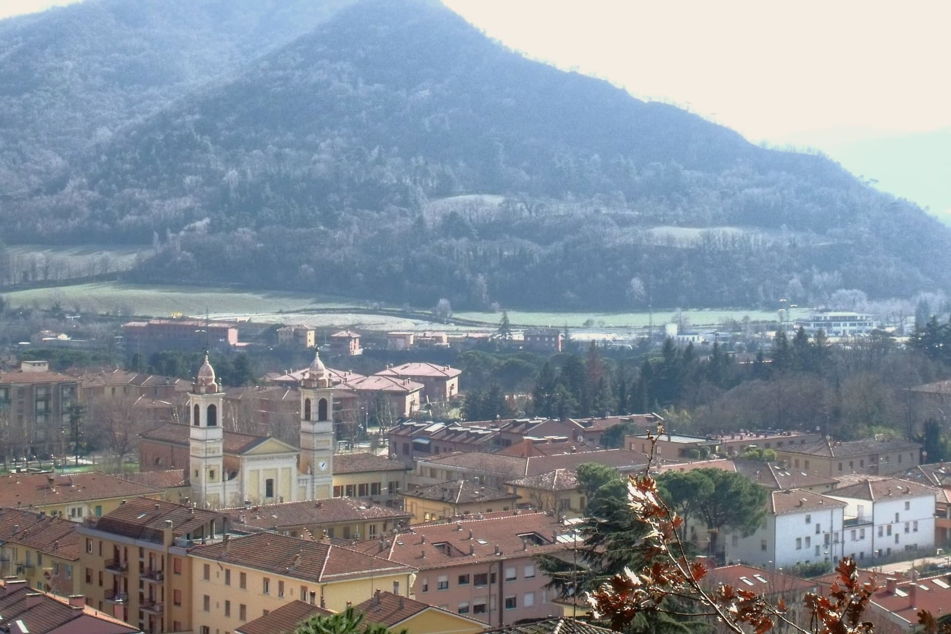
The Setta and Reno rivers meet below the rock that gives the town its name, at the point where the pre-Apennine hills begin their climb south of Bologna. The Sasso della Glosina dominates the bend, a Pliocene formation old enough to have shaped how the crossing below it was used long before the valley took its modern name.
The town itself was called Sasso Bolognese until 1938, when it was renamed for the family whose estate lies in the frazione of Pontecchio, on the valley floor rather than on the rock itself. The territory reaches from that river confluence up into the Apennine slopes, and the change in elevation shows in what the land produces: white truffle from the valley floor near the Reno, and vineyards on the hills around Pieve del Pino and Mongardino, recognition earned on two different registers of the same ground.
The lower town, built around the rivers and the old road to Pistoia, and the upper slopes, given to woods and terraced vines, read as one territory doing two different kinds of work.
Casa Mazzucchelli, Antica Trattoria la Grotta dal 1918 have been named by a guide.
What to see in Sasso Marconi
- Villa Griffone - Museo Marconi. Marconi family villa in the frazione of Pontecchio. The mausoleum sits alongside the attic laboratory, and the museum holds working reproductions of his early apparatus.
- Sasso della Glosina. The rock rises directly over the river bend, its bulk visible from the crossing below and from much of the surrounding valley.
- Confluenza Setta-Reno. Meeting of the two valleys at the foot of the rock, with the historic crossing of the Via Porrettana toward Pistoia.
How to get to Sasso Marconi
There is a railway station in the town, so you can arrive without a car and never need one while you are here. Bologna is roughly 26 minutes away by road.
Our tip
April through October is the working season in Sasso Marconi. Spring and early autumn are best on the Reno valley trails and at Villa Griffone, with mild temperatures and the Apennine foothills green or autumn-coloured. July and August can touch thirty-five degrees in the valley, though the higher frazioni stay cooler; many visitors come up from Bologna for a day on a weekend. Fira di Sdaz di Sasso Marconi falls in September.
Castellina in Chianti
Why visit Castellina in Chianti
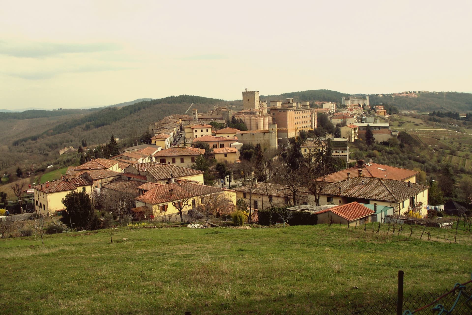
Castellina in Chianti sits at 578 meters on the watershed between the Arno and Ombrone basins, fifteen kilometers northwest of Siena and thirty-five south of Florence. Its position on the historic frontier between the two republics shaped the town: it was a Sienese border fortification reinforced in the fifteenth century by Filippo Brunelleschi and Giuliano da Sangallo against firearm warfare.
The Rocca with its fifteenth-century tower dominates the centro storico and now houses the Museo Archeologico del Chianti Senese, opened in 2006. The Via delle Volte runs the length of the eastern wall: an original ancient pomerium, once open to the sky, gradually built over by private houses against the wall and now a covered arcaded passage lined with workshops and trattorie.
The Tumulo Etrusco di Montecalvario, a sixth-century BC tomb with four burial chambers carved on the cardinal axes, sits a kilometer from the centro storico. The Gallo Nero of Chianti Classico DOCG is grown on the slopes below.
Albergaccio di Castellina, Osteria di Fonterutoli, Passo dopo Passo Osteria have been named by a guide.
What to see in Castellina in Chianti
- Rocca di Castellina. Fifteenth-century fortification with imposing keep, now housing the Museo Archeologico del Chianti Senese, opened in 2006.
- Via delle Volte. Covered arcaded walkway along the eastern wall, once an open pomerium, built over by houses pressing against the fortifications and now lined with workshops.
- Tumulo di Montecalvario. Sixth-century BC Etruscan tomb a kilometer from town, with four burial chambers carved on the cardinal compass points, excavated in the early 1900s.
How to get to Castellina in Chianti
Firenze is roughly 63 minutes away by road.
Our tip
April through June and September into October are the working months on the Chianti watershed: vine work, harvest from mid-September, mild days at 578 meters. The Festa del Vino in the second half of September fills the centro storico for a long weekend. July and August are warmer but stay below the inland Maremma heat, and the Via delle Volte is reliably cool.
San Gimignano
Why visit San Gimignano
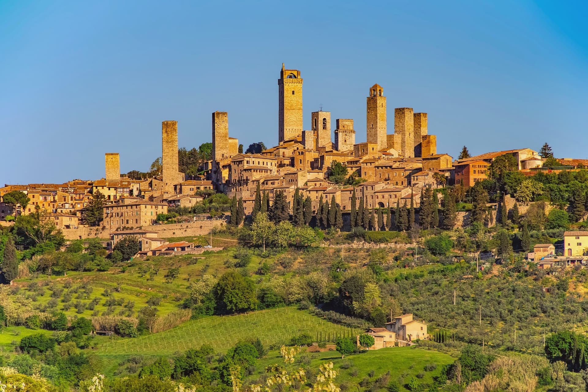
San Gimignano sits at 334 meters in the Val d'Elsa, halfway between Firenze and Siena on the medieval pilgrim road to Rome. Patrician families built 72 tower-houses in the twelfth and thirteenth centuries as proofs of wealth and platforms for vendettas; 14 still stand, the tallest being the Torre Grossa at 54 meters.
The town declared independence from the bishops of Volterra in 1199 and grew rich on saffron and Vernaccia, the white wine grown on the surrounding hills and praised since Dante. The Black Death of 1348 broke the boom; San Gimignano lost more than half its population and submitted to Florence.
That collapse is the reason the medieval skyline survived. UNESCO listed the historic centre in 1990 as a complete record of feudal architecture.
Roughly three million visitors come each year, more than 400 times the resident population, and the centro storico empties into the surrounding olive groves once the day-trippers leave.
Linfa, Da Pode, San Martino 26 have been named by a guide.
What to see in San Gimignano
- Torre Grossa. Fifty-four meter civic tower attached to the Palazzo Comunale, the tallest of the surviving 14, open for the climb to the panoramic terrace.
- Piazza della Cisterna. Triangular medieval square paved in brick around an octagonal well of 1287, lined by tower houses and Romanesque palaces.
- Collegiata di Santa Maria Assunta. Romanesque parish church on Piazza Duomo, walls covered by Bartolo di Fredi and Lippo Memmi frescoes of Old and New Testament scenes.
How to get to San Gimignano
Firenze is roughly 61 minutes away by road.
✷ We have written about San Gimignano
“We arrived in the afternoon, into the second half of the day’s crowd. Off-season meant it was groups and guides rather than a flood, but the shops were open and doing their worst, the same garbage souvenirs, the same pasta no one local would eat, and we walked through it the way you walk through a thing you have decided not to let ruin your evening. The towers stood over all of it, indifferent, which is their whole talent.”
Read our piece on San Gimignano →San Gimignano | The Town After Seven
Our tip
April through June and September into October are the months the town is worth a full day rather than three hours. The buses still come, but late afternoon empties the piazzas and lets the towers take their light. July and August push temperatures past thirty and the centro storico becomes uncomfortable between two and six, when the stone radiates heat. Fiere delle Messi di San Gimignano falls in June.
Castelnuovo Berardenga
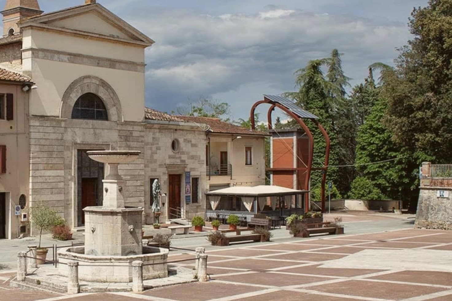
Why visit Castelnuovo Berardenga
The commune sits east of Siena, where the hills give way to the clay swells of the Crete Senesi. The name comes from the Terra Berardinga, the area controlled in the tenth century by a Frankish nobleman named Berardo, and the borgo grew up around the castle walls the Sienese Republic raised against Florence.
The centro storico, the villa and gardens at its heart, and the surrounding zone of vineyards form one continuous pattern rather than separate parts: fortress town above, wine country falling away below it toward the clay hills. Across the wider territory, 13 castles, 70 churches and 200 farms record the medieval pattern of the Sienese contado, a scatter of small fortified points and parish churches administering land rather than one dominant center.
The place reads as a border post that outlived its military purpose and settled into agriculture and the arts, its castle now a clock tower, its noble villa now a music foundation, its walls now overlooking rows of Sangiovese.
Il Visibilio, Poggio Rosso, L'Asinello and 4 more have been named by a guide.
What to see in Castelnuovo Berardenga
- Villa Chigi Saracini. Eighteenth-century villa and Italian garden inside the centro storico, its park designed by the Sienese composer Guido Chigi Saracini, whose family foundation still runs the Accademia Musicale Chigiana in Siena.
- Torre dell'Orologio. Surviving tower of the fortress, now bearing the civic clock, the highest visible point of the centro storico.
- Chiesa dei Santi Giusto e Clemente. Eighteenth-century parish church with a neoclassical façade, built on the site of an earlier Romanesque pieve.
How to get to Castelnuovo Berardenga
There is a railway station in the town, so you can arrive without a car and never need one while you are here. Firenze is roughly 77 minutes away by road.
✷ We have written about Castelnuovo Berardenga
“The wine is the whole economy of these hills, every village with its own, the region’s name stamped on the most famous red in Italy. Tuscan food runs to cured and roasted meat, so the wine ran red to meet it, lighter than you expect, almost fruity, easy, made to sit beside a steak and not to be lectured about. Here is the only wine knowledge you need on this road: it is all good.”
Read our piece on Castelnuovo Berardenga →Road to Siena | The Long Way Is the Better Way
Our tip
April through June and September into October are the months Chianti Classico shows best, the green hills moving toward the gold of harvest. The Sagra del Vino runs the second weekend of September. July and August push past thirty and the centro storico empties between two and six; the cellars on the surrounding hills offer cool tastings and longer rentals.
Montepulciano
Why visit Montepulciano
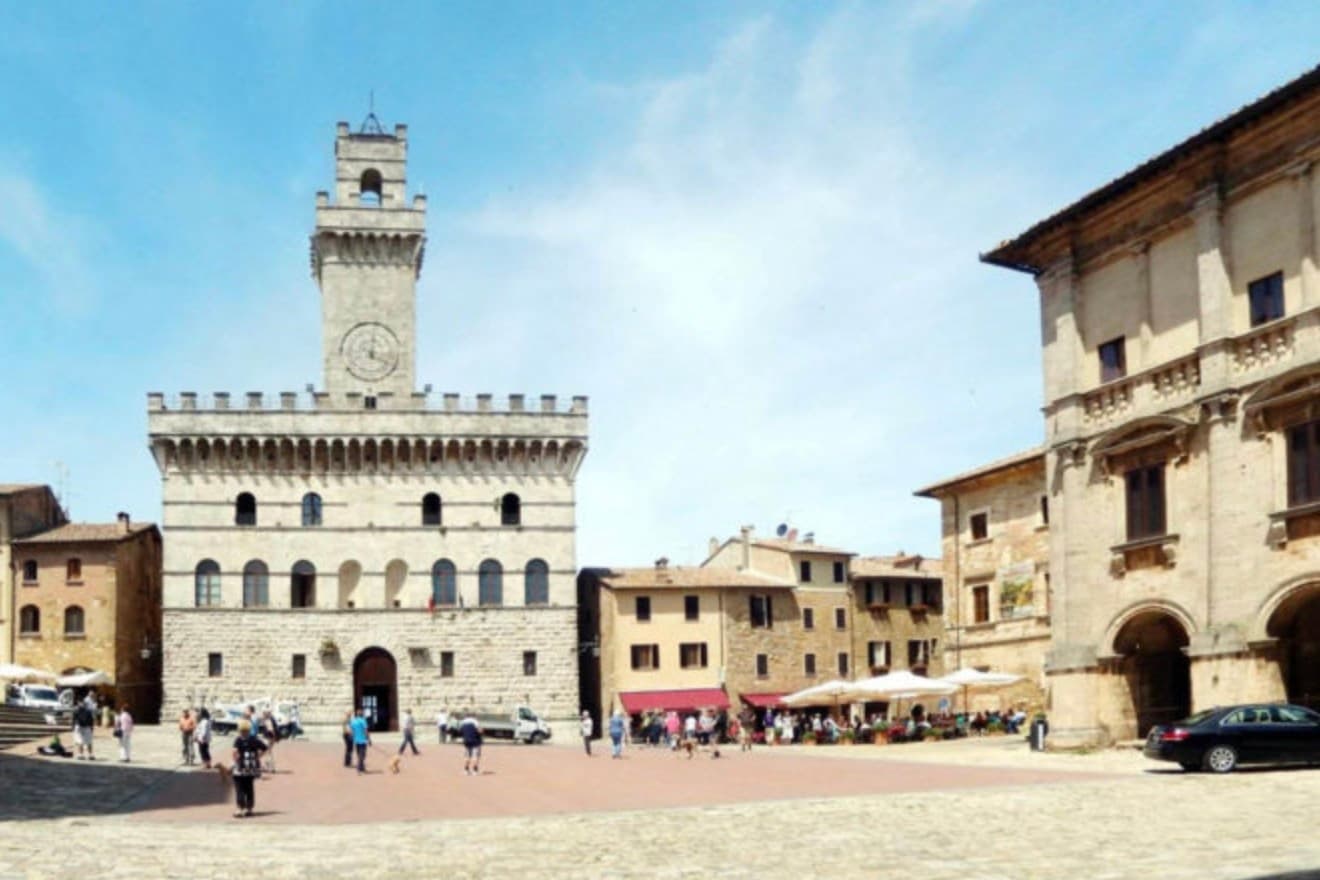
The ridge runs between the Val di Chiana and the Val d'Orcia, 70 kilometers southeast of Siena, and the town follows its spine uphill: streets climb from the gates toward the high point, where the main square sits ringed by the buildings that define the skyline from below. The origin predates the Renaissance fabric by centuries.
Etruscan tombs survive in the surrounding hills, though almost nothing of that period shows in the centro storico itself, which was rebuilt wholesale in the fifteenth and sixteenth centuries over whatever came before. The wine and the festival both use the climb as their setting rather than their subject: the cellars are cut into the rock beneath the palazzi, keeping a constant temperature for aging, and the barrel race each August sends two men from each of the eight contrade hauling an eighty-kilogram cask up the same gradient that every visitor covers on foot, only slower.
The steepness that shaped the defensive site nine centuries ago is still what a person feels first, in the legs, before the buildings register at all.
Ristorante Caffè Pasticceria Poliziano, Osmosi, Le Logge del Vignola and 3 more have been named by a guide.
What to see in Montepulciano
- Tempio di San Biagio. A 13-meter dome and travertine façade standing alone outside the walls, the ground falling away below it so the building reads as a single volume against the hillside.
- Piazza Grande. The high piazza at the top of the ridge, ringed by the Duomo, the Palazzo Comunale and the Palazzo Tarugi, all rebuilt in the fifteenth and sixteenth centuries.
- Palazzo Comunale. Town hall designed by Michelozzo in the fifteenth century, its tower offering a view over the Val di Chiana and Val d'Orcia.
How to get to Montepulciano
There is a railway station in the town, so you can arrive without a car and never need one while you are here. Perugia is roughly 57 minutes away by road.
✷ We have written about Montepulciano
“Now, the postcard itself, the towns, and here I have less to say than you would expect, because Pienza and Montepulciano have become, and I mean this precisely, the canteens of a theme park. They are where you go to park, walk a pretty street, use the toilet, refill the water, eat a plate of something, and buy a thing to take home. They are the food court between the rides.”
Read our piece on Montepulciano →Val d'Orcia | The Postcard Is Constructed
Our tip
April through June and September into October are the working months on the ridge: vine work in the surrounding hills, mild days, evening light that lingers over the Val d'Orcia. July and August push into the low thirties and the climb to Piazza Grande slows even the residents. The Bravìo delle Botti runs the last Sunday of August and fills the town. Calici di Stelle falls in July.
Greve in Chianti
Why visit Greve in Chianti
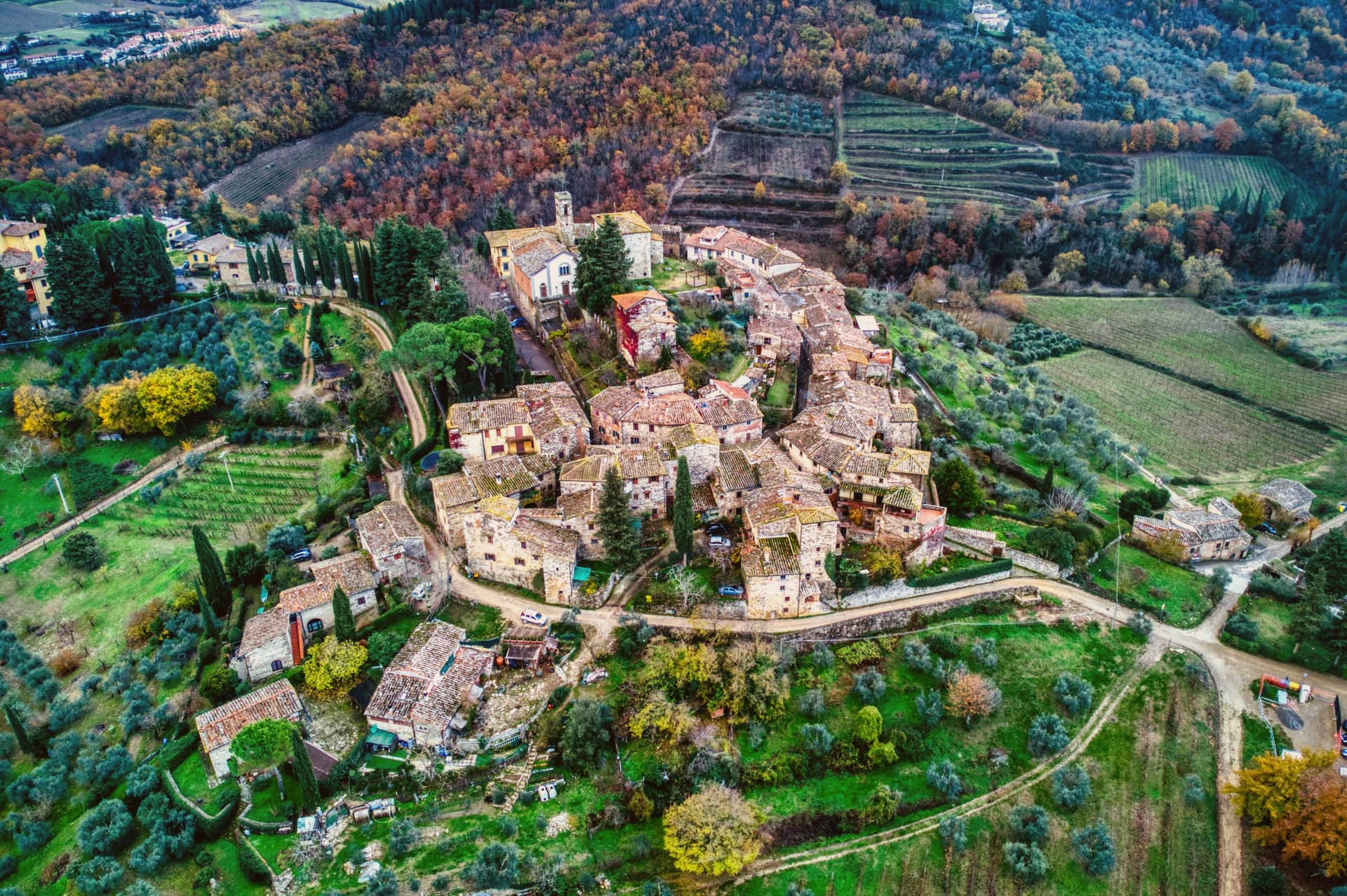
Greve sits at 236 meters in the Val di Greve, thirty-one kilometers south of Firenze and forty-two north of Siena, on the small fast river that gave the town its name. The valley narrows here enough that the road to Firenze runs past the castle estates on the slopes to the north before dropping into the town itself, and the walled hamlet above Greve looks down on the piazza from its kilometer of higher ground, a settlement some centuries older than the square below it, its tenth-century walls predating the piazza's sixteenth-century arcades.
The piazza is the point around which the rest of the town organizes itself: shops and a market under the arcades, a rebuilt church closing its south end, and the roads out toward the castles and the hamlet all beginning at its edges. The Saturday market fills the piazza.
The wine festival in early September empties the surrounding cellars into glasses for three days. What holds the place together is the geography more than any single monument: a market town at a river crossing, ringed by the vineyard slopes and the older hill settlement that all feed into the same triangular square.
Enoteca Baldi, Castello Vicchiomaggio, Officina della Bistecca and 2 more have been named by a guide.
What to see in Greve in Chianti
- Piazza Matteotti. The arcades shelter wine shops, butchers and pasticcerie, wrapped around the irregular triangle of paving with the navigator's bronze figure watching the center.
- Chiesa di Santa Croce. Neoclassical parish church on the south point of the piazza, rebuilt in the nineteenth century after earthquake damage.
- Castello di Verrazzano. Vineyard estate on the hills north of town, producing Chianti Classico on slopes tied to the family name that reached New York Bay.
How to get to Greve in Chianti
Firenze is roughly 44 minutes away by road.
Our tip
April through June and September into October are the months when the Chianti hills are at their best, green or gold depending on the harvest. July and August push past thirty degrees and the piazza empties between two and five. The wine harvest runs late September and the cellars open in turns. Expo Chianti Classico falls in September.
More from Anywhere Italy
- The best wine towns within two hours of Pisa
 The best hidden hill towns within 90 minutes of Firenze
- The best olive oil towns within 90 minutes of Firenze
 The 9 best towns with a serious restaurant that eat well within 90 minutes of Firenze
 The best hidden wine towns with a medieval festival in Toscana
 The best hidden wine towns you can reach by train in the province of Siena