
The best towns you can reach by train that hold a World Heritage site in Piemonte
90 towns visited, 910 to go. Follow along, free: Subscribe on Substack
Piemonte is a region of long horizons and short walks: rice fields flooded silver in spring, vine-combed hills the color of rust in October, and behind everything the wall of the Alps. The building material changes as you move, from the pink and gray stone of the Val d'Ossola to the brick and stucco of the Savoy plain, and the food changes with it, from bagna cauda and tajarin to hazelnut cakes and cheeses aged in mountain cellars. The World Heritage listings here are not single monuments so much as whole landscapes and systems, chapels climbing a wooded hillside, royal residences ringing a capital, hills planted with nebbiolo. Trains run through most of it, because the railways were laid to serve industry and the lakes long before tourism arrived.
Torino takes the bulk of the attention, and reasonably so, with its arcades, its Egyptian museum and its baroque core that anchors the Savoy listing. Autumn brings the truffle crowds to Alba, and the queues in the market spill down the side streets. Both are easy days out and both are busy for the obvious reason that they are good.
The listings do not stop at the city limits. The same royal circuit, the same sacred mountains, the same hills and lakeshores continue outward to towns with a station, a bar by the platform and considerably fewer people photographing the same facade. These are the ones on this list, reachable without a car and holding, or sitting inside, protected ground of their own.
Of the 65 communes we have mapped in Piemonte, 7 qualify as towns you can reach by train with a World Heritage site: we have confirmed each is reachable without a car, and each holds or sits inside a UNESCO World Heritage site. The smallest, Orta San Giulio, has 1,047 residents.
Elsewhere in the catalogue: The best towns with a World Heritage site that eat well in Piemonte and The 9 best hill towns with a World Heritage site in Piemonte.
Why visit Orta San Giulio
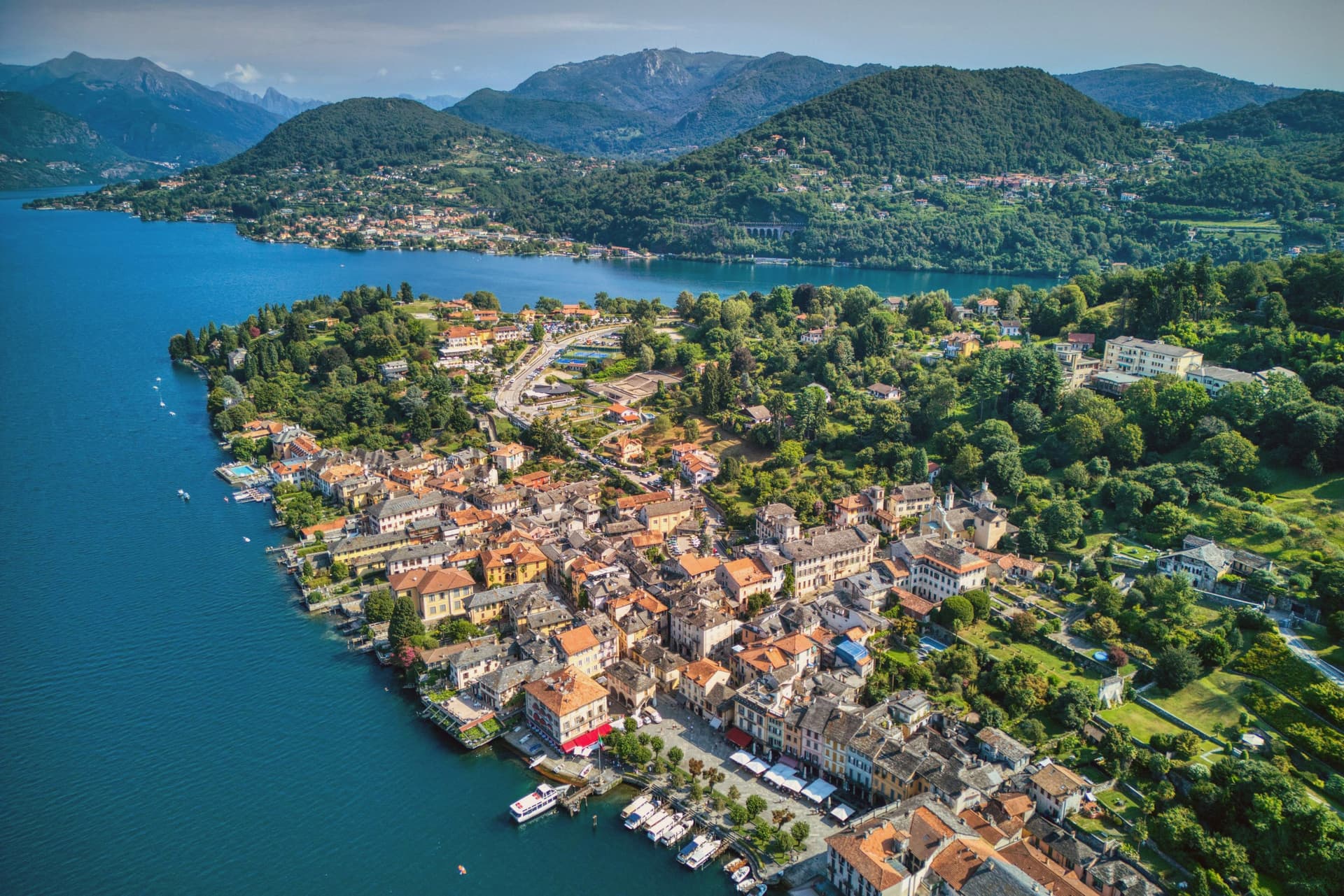
The town occupies a promontory pushed into the eastern shore of the lake, facing the small island 275 meters long and 140 meters wide. The two are close enough that the island reads as an extension of the town rather than a separate place, and a five-minute motorboat from the piazza is the only way across.
The old town holds three of Italy's quality marks at once: Borghi più belli, Bandiera Arancione, and the UNESCO inscription of 2003. The relationship between the three parts of the town explains how it works: the waterfront square and its lanes sit at lake level, facing the island directly across the water, while the hill above holds the devotional complex, reached by climbing away from the shore rather than along it.
Piazza Motta was also the seat of the Comunità della Riviera di San Giulio, an autonomous federation of lake towns that survived from the Middle Ages to the mid-eighteenth century, which is why the square, not the hill or the island, was built as a civic center. What results is a town in three registers at once: civic life at the water's edge, monastic life offshore, and devotional life on the hill above, each occupying its own ground and visible from the others.
What to see in Orta San Giulio
- Basilica di San Giulio. Serpentine ambo inside and a silver shrine dated 1697. Reached by boat, the basilica stands close to the water's edge, the focal point of the view from every point on the promontory.
- Piazza Motta and Palazzo della Comunità. The broletto's arcades face the water directly, and the square narrows toward the boat landing where the crossing to the island begins.
- Sacro Monte di Orta. The chapels climb the wooded hillside in sequence, each framing a scene, with the town and the lake opening up in views between them as the path gains height.
How to get to Orta San Giulio
It has its own railway station. Novara is about 46 min away by road. The full route from Milan.
Our tip
April through June brings the Sacro Monte chapels into the chestnut shade and the lake water warm enough for the open-air bars on Piazza Motta. July and August fill the ferry to the island and the piazza turns over by the hour; the centro pedestrian zone slows to a queue at lunch. September and October are the clearest window: low light on the basilica across the water, fewer day-trippers from Milano, and the Sacro Monte path almost empty after eleven.
Why visit Racconigi
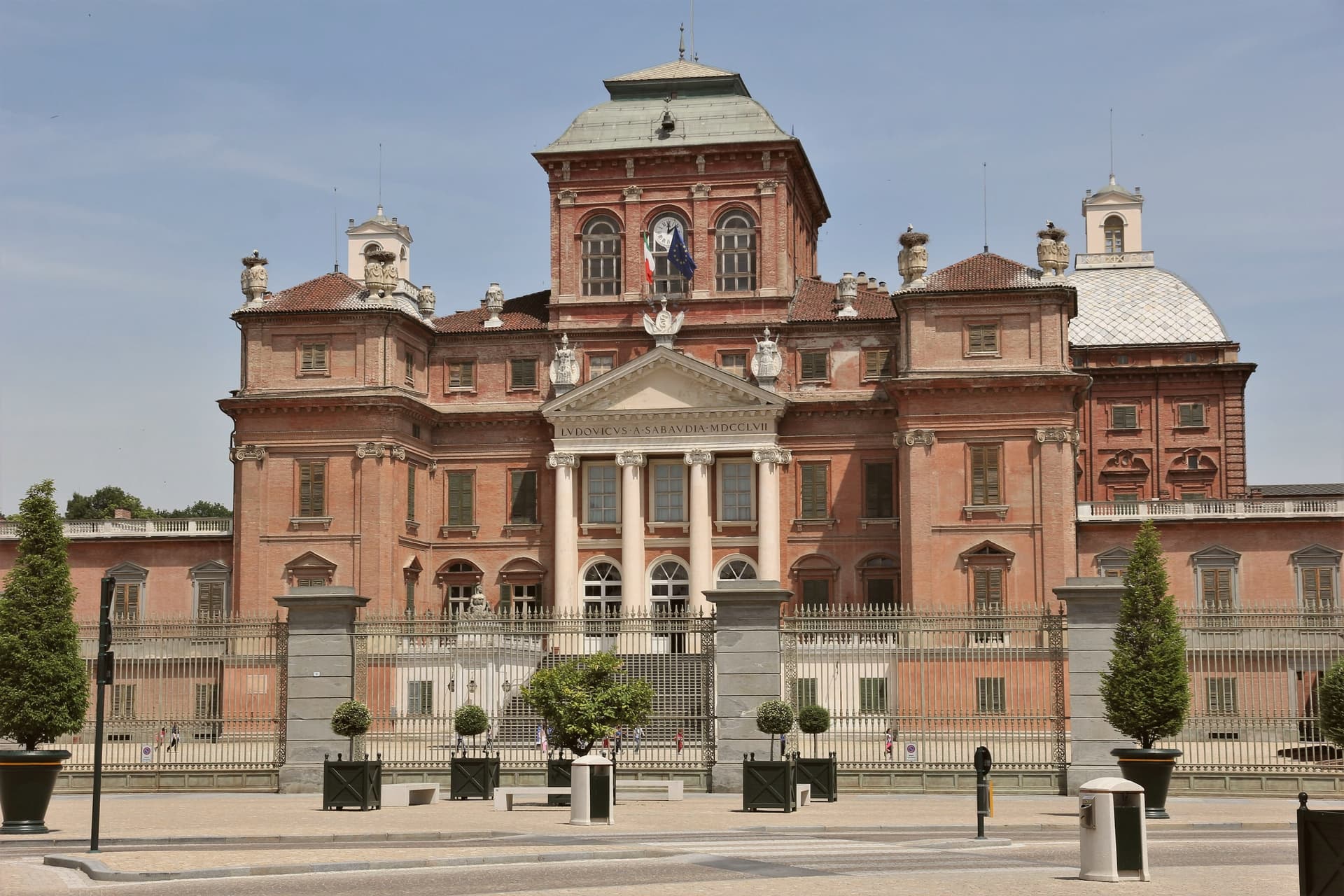
Racconigi sits at 262 meters on the Po plain, 35 kilometers south of Torino. The town passed in turn through the hands of the marquises of Saluzzo, the princes of Acaia and the Savoia-Carignano, and it was this last line that shaped what stands today.
Duke Carlo Emanuele I granted the estate in 1630 to his nephew Tommaso Francesco, founder of the Carignano branch, and the fortress that resulted was later opened out into a country residence set within its own designed landscape rather than confined behind walls. The park was remade twice, first on French lines in 1755, then reworked eighty years later by a German landscaper into the lakes, canals and follies that surround the building now.
The center for stork reintroduction occupies a farmhouse next to this park, so the estate and the breeding site share ground rather than sitting apart in different parts of town. The old center, between the castle and the station, is where the smaller scale of daily Racconigi meets the scale of the estate that gives the town its name recognition.
What holds these pieces together is that Racconigi's identity was built from the outside in: a noble residence and its grounds first, a town organized around servicing and adjoining it second.
What to see in Racconigi
- Castello Reale di Racconigi. Eleventh-century fortified core remodelled by Guarino Guarini in the late seventeenth century, its pagoda-roofed central pavilion the mark of that conversion, restored continuously since 1980.
- Parco Reale. 170-hectare romantic park laid out in 1755 by the French gardener Molard on Le Nôtre's designs, redrawn in 1835 by Xavier Kurten with lakes, canals and follies.
- Centro Anatidi e Cicogne LIPU. Farmhouse site beside the park where the reintroduction program was run, now the country's largest stork colony descending from the birds released there.
How to get to Racconigi
It has its own railway station. Torino is about 49 min away by road. The full route from Turin.
Our tip
April through June is the best window: castle and Parco Reale on long opening hours, the storks on the nests in the LIPU center, mild temperatures on the plain south of Torino. July and August touch the mid-thirties and afternoons in the park are hard work; the castle stays cool. September and October are the second strong window, vendemmia on the surrounding plain, fewer visitors than spring.
Why visit Domodossola
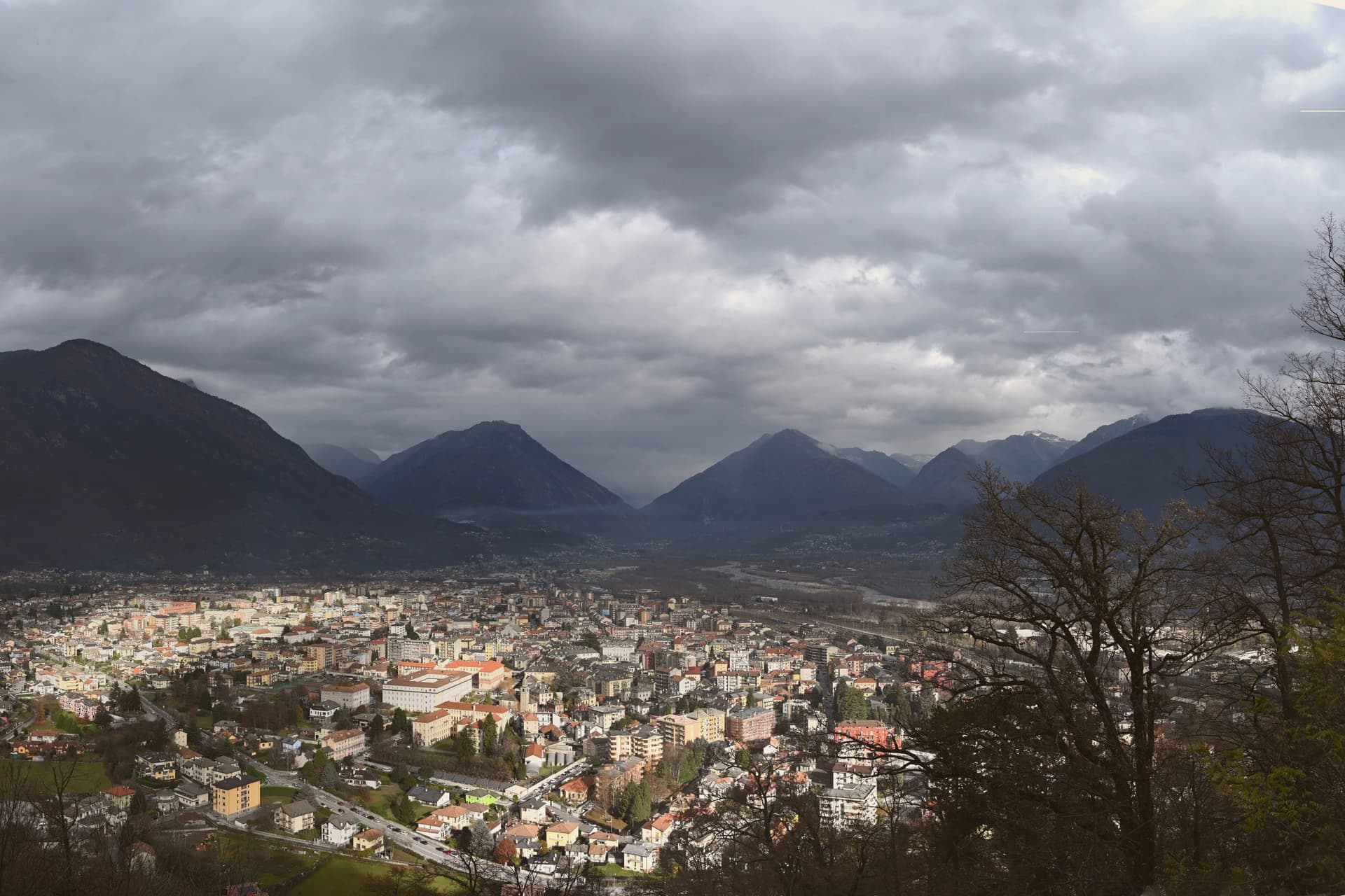
Domodossola sits at 272 meters at the confluence of the Bogna and Toce rivers, the historic capital of the Ossola valleys and the Italian end of the Simplon Pass. Two Capuchin friars chose the hill above the town in 1656, and the sanctuary that follows still marks the skyline.
The medieval core is built around the market square, its porticoes and merchant houses forming the center of the borgo, with the rest of the centro storico spreading out behind it in arcaded streets. The Castle of Charlemagne once stood at Piazza Tibaldi, until 1804, when Napoleon ordered it demolished to open the Sempione road.
The longer story of the pass arrived in 1906, when a rail tunnel under the Alps ran 19,803 meters from Iselle, up the valley from Domodossola, to Brig in Switzerland, the longest railway tunnel in the world for most of the twentieth century. Between the hill, the square and the tunnel, the town reads as a hinge point: a valley capital shaped as much by what passes through it toward Switzerland as by what was built to stay.
What to see in Domodossola
- Sacro Monte Calvario. A Special Nature Reserve on the hill above town. The twelve Via Crucis chapels lead up to the sanctuary in sequence, started in 1657.
- Piazza Mercato. The porticoes still shelter the square's merchant houses, their balconies and carved loggettes intact above the arcades.
- Centro storico medievale. The walled core beyond the square, arcaded streets between fifteenth-century palazzi, named Borgo della Cultura after recent restoration.
How to get to Domodossola
It has its own railway station. Novara is about 1 h 33 min away by road. The full route from Milan.
Our tip
April through June and September through October are the working months for Domodossola: alpine light, full ferry-and-train connections through the Simplon, and walkable temperatures in the centro storico. July and August warm into the high twenties on the valley floor but stay cool on the Mattarella hill, where the Sacro Monte chapels sit in beech shade. November through March is quiet but never closed.
Why visit Ivrea
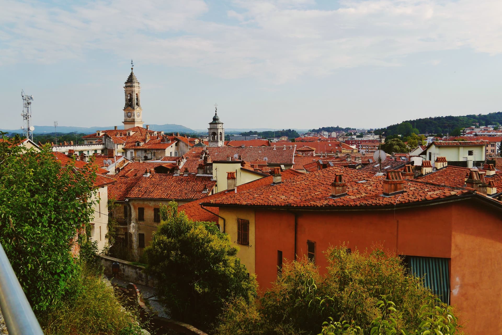
Ivrea sits at 267 meters where the town meets the river that drains the Aosta valley before it reaches the Po, the Dora Baltea, guarding the Alpine routes into Gaul that made the site worth fortifying in the first place. The medieval town grew upward from that Roman garrison into a seat of regional power, and centuries later the same streets became the frame for an industrial experiment: Camillo Olivetti opened a typewriter factory here in 1908, and his son Adriano rebuilt the town around its workers, threading glass-walled plants, housing, schools, libraries, and cultural centers into the landscape rather than beside it.
The Cinque Laghi lie north of the center, five small lakes left by the Balteo glacier, a different register of water from the Dora Baltea that carried the Roman and industrial town below. The layers do not so much replace each other as sit stacked: a Roman garrison town, a medieval capital, and a twentieth-century factory city occupy the same ground on the same river, and the carnival each February, with its reenacted revolt, is the one moment the town stages its own long memory in public.
What to see in Ivrea
- Castello di Ivrea. Fourteenth-century red-brick castle of the Savoy on the hill above the centro storico, with four towers and views over the Dora Baltea.
- Duomo di Santa Maria Assunta. Ninth-century cathedral on the site of a Roman temple, with Romanesque crypt and bell tower, the religious anchor of medieval Ivrea.
- MAAM - Museo a Cielo Aperto dell'Architettura Moderna. Open-air museum of the ICO factories and the Talponia underground housing, walkable ground for tracing how the glass-walled plants and worker facilities sit against the town.
How to get to Ivrea
It has its own railway station. Torino is about 56 min away by road. The full route from Turin.
Our tip
April through October is the open season. May and June green the morainic hills around the Cinque Laghi and the Olivetti factory tours run on full schedule. September and October are dry and quiet, the time to walk the UNESCO industrial route without summer heat.
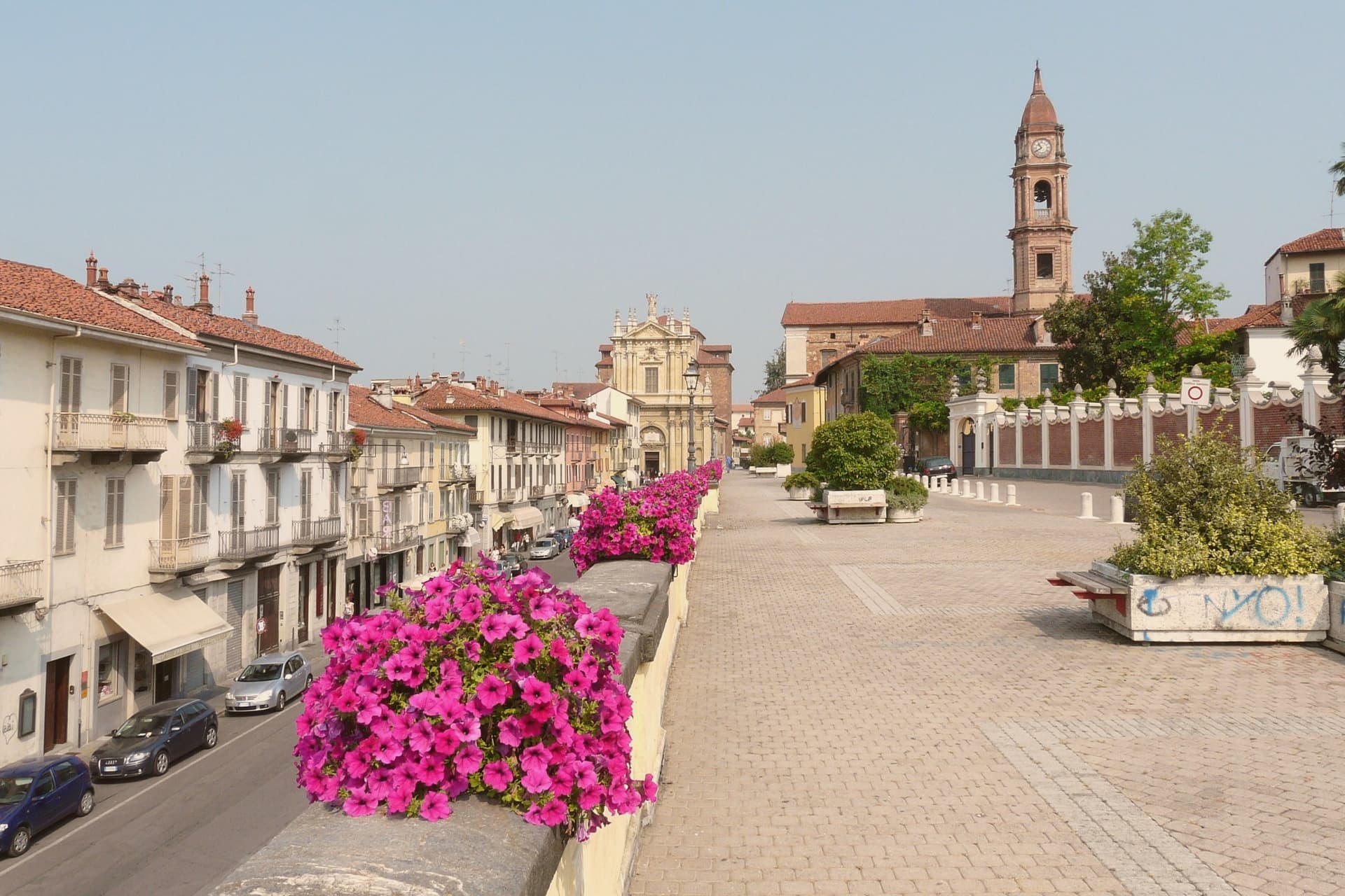
Why visit Bra
Bra sits at 290 meters in the Roero hills, fifty kilometers southeast of Torino, on the north edge of the Langhe-Roero-Monferrato UNESCO wine landscape. The old center, with its porticoed Corso Garibaldi and Via Cavour, is the working core of town; above it a nineteenth-century pavilion looks out over the surrounding hills, and below, on the Tanaro, a frazione occupies the site of a Roman colony inside a former Savoy royal estate.
Carlo Petrini founded Slow Food here in 1986 in response to a McDonald's planned next to the Spanish Steps in Rome, and the movement's headquarters has stayed in town since. In 1999 Bra was one of the four founding cities of Cittaslow, the small-town quality-of-life network.
The biennial Cheese fair, the largest event in the world for raw-milk cheeses, fills the old center in odd-numbered Septembers, alongside the town's own DOP cheese and its ground veal sausage, eaten raw by local custom. A town this size holding a global food movement, a gastronomic university, and a Roman site within its own borders is not an accident of promotion: it reflects a place that has treated eating and its history as civic matters worth building institutions around.
What to see in Bra
- La Zizzola. Octagonal pavilion on the hill above town, reached as the best panoramic point over the Langhe and Roero.
- Palazzo Mathis. Fourteenth-century palazzo on the central piazza with frescoed main floor and eighteenth-century oil-painted door covers, now used for exhibitions.
- Palazzo Traversa. Fifteenth-century building housing the Museo di Archeologia, Storia e Arte, with finds from the Roman colony of Pollentia.
How to get to Bra
It has its own railway station. Torino is about 54 min away by road. The full route from Turin.
Our tip
April through June and September into October are the months Bra runs cleanest. The Roero hills color up around the town, the cellars hold tastings, and the Cheese fair takes the centro storico in September of odd years. July and August get hot in the Tanaro plain below, and the porticoes on Corso Garibaldi become the cool part of town between four and seven in the afternoon.
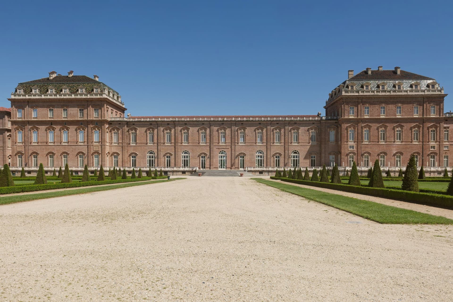
Why visit Venaria Reale
Venaria Reale sits at 269 meters fifteen kilometers northwest of Torino, on the lowland that ran into the Savoy hunting forests of the Mandria. The modern name comes from the Latin ars venatoria, hunting.
In 1658 Duke Carlo Emanuele II commissioned court architect Amedeo di Castellamonte to build a residence for hunting parties and court leisure, with a coordinated plan for palace, park, hunting wood and adjoining village. In 1716 Filippo Juvarra enlarged the complex with the Galleria Grande, the Cappella di Sant'Uberto, the Citroniera and the Scuderia, lifting the Reggia to one of the major baroque set pieces of Europe.
The Savoy Residences entered the UNESCO list in 1997. After two centuries as a military barracks the palace was restored across eight years from 1999 to 2007, in the largest cultural restoration project in European Union history, with 1,800 operators on site.
The Reggia now opens eighty thousand square meters of floor surface and sixty hectares of gardens, with the three thousand fenced hectares of the Parco della Mandria beyond.
What to see in Venaria Reale
- Reggia di Venaria. UNESCO baroque palace begun in 1658 by Amedeo di Castellamonte for Duke Carlo Emanuele II, with 80,000 m² of floors and 60 hectares of gardens.
- Galleria Grande. Filippo Juvarra's barrel-vaulted gallery of 1716, one of the longest enfilades of baroque court architecture in Europe.
- Cappella di Sant'Uberto. Royal chapel designed by Juvarra inside the palace, completed in the second decade of the eighteenth century for the hunting court.
How to get to Venaria Reale
It has its own railway station. Torino is about 28 min away by road. The full route from Turin.
Our tip
April through June is the best window for the gardens of the Reggia and the long walks through the Parco della Mandria, with parterres in full bloom and the hunting park green. September and October bring cooler air over the gardens and the start of the autumn exhibition season inside the Galleria Grande. July and August touch the mid-thirties on the Torino plain; the palace interiors stay cool, the Citroniera and the chapel hold the heat at bay, but the gardens flatten in midday glare.
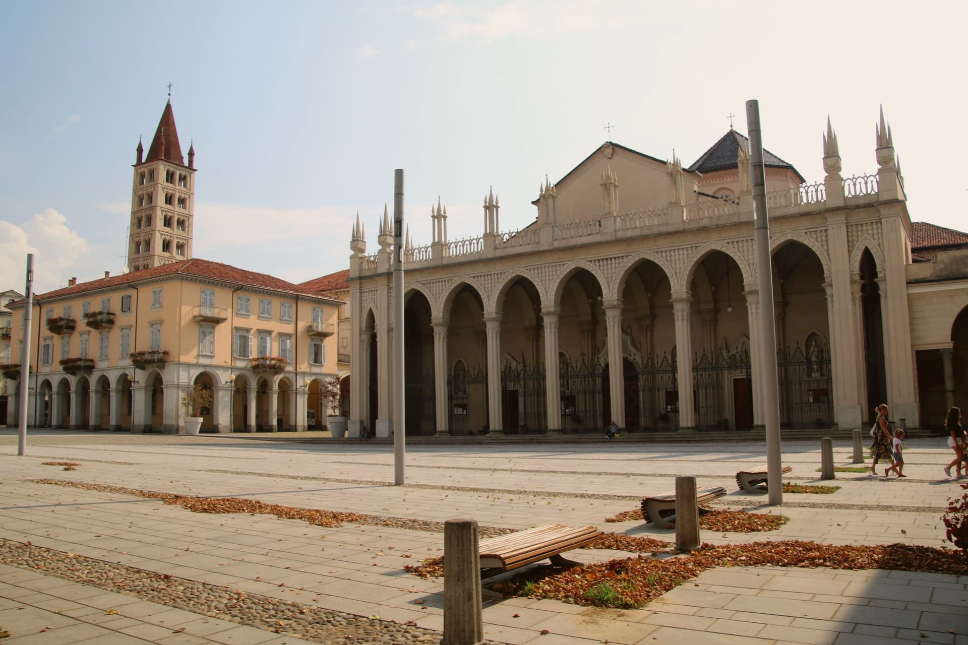
Why visit Biella
Biella sits at 417 meters at the foot of the Biellese Alps, in a basin where fast Alpine streams cut down from Mont Mars and the Oropa range. The statutes of 1245 already named the woolworkers' and weavers' guilds, and the city built itself around them: by the nineteenth century, vertical mills along the streams had turned Biella into the Manchester of Italy.
The names still on the labels, Zegna, Cerruti, Piacenza, Fila, were founded in the Biellese. The upper town, Biella Piazzo, sits above the modern Piano on a small hill, reached since 1885 by a water-counterbalance funicular that still runs the same 60-meter climb.
The Romanesque Baptistery on Piazza Duomo is the city's oldest stone, ninth or tenth century, set next to the cathedral. Above the city, the Sacro Monte di Oropa belongs to the UNESCO Sacri Monti site, and Biella was named a UNESCO Creative City for Crafts and Folk Art in 2019.
What to see in Biella
- Biella Piazzo. Medieval upper town on a small hill above the modern Piano, with arcaded palazzi and narrow stone streets, reached by funicular since 1885.
- Funicolare del Piazzo. Historic funicular opened in December 1885, covering a 60-meter altitude gradient in 177 meters between Via Curiel and Via Avogadro.
- Battistero di Biella. Romanesque baptistery on Piazza Duomo, ninth to tenth century, the oldest standing monument in the city.
How to get to Biella
It has its own railway station. Novara is about 1 h 3 min away by road. The full route from Turin.
Our tip
April through June brings green pastures on the Biellese Alps and clean light off the streams that built the mills. September and October are the dry, gold months, when the chestnut woods around Oropa turn and the textile fairs run in town. July and August stay cooler than the Po Valley but can sit humid; the upper Piazzo holds breeze that the Piano does not.
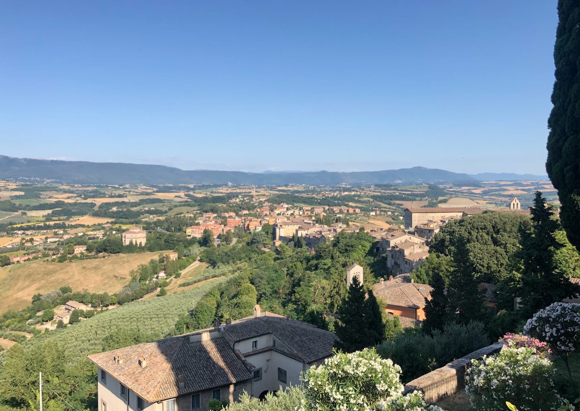
Read a sample letter
Todi | The Beverly Hills of Umbria
An unusually global town on a clay hill
Letters from the towns we visit. Free.
The button takes you to the letter's own page on Substack, where you leave your email. About the letter
More from Anywhere Italy
- The best towns with a World Heritage site that eat well in PiemontePiemonteeats wellWorld Heritage7 towns · smallest 1,047 residents
- The 9 best hill towns with a World Heritage site in PiemontePiemontehill townWorld Heritage9 towns · smallest 503 residents
- The best towns with a World Heritage site within 75 minutes of TurinNear Turinwithin 75 minWorld Heritage7 towns · smallest 503 residents · closest 28 min away
- The best towns you can reach by train within an hour of TurinNear Turinby trainwithin 60 min7 towns · smallest 5,911 residents · closest 28 min away
- The best hidden towns with a World Heritage site in PiemontePiemonteWorld Heritagehidden7 towns · smallest 503 residents
- The prettiest villages you can reach by train in PiemontePiemonteby trainprettiest villages7 towns · smallest 197 residents