
The 7 best towns with a serious restaurant that eat well within 90 minutes of Trento
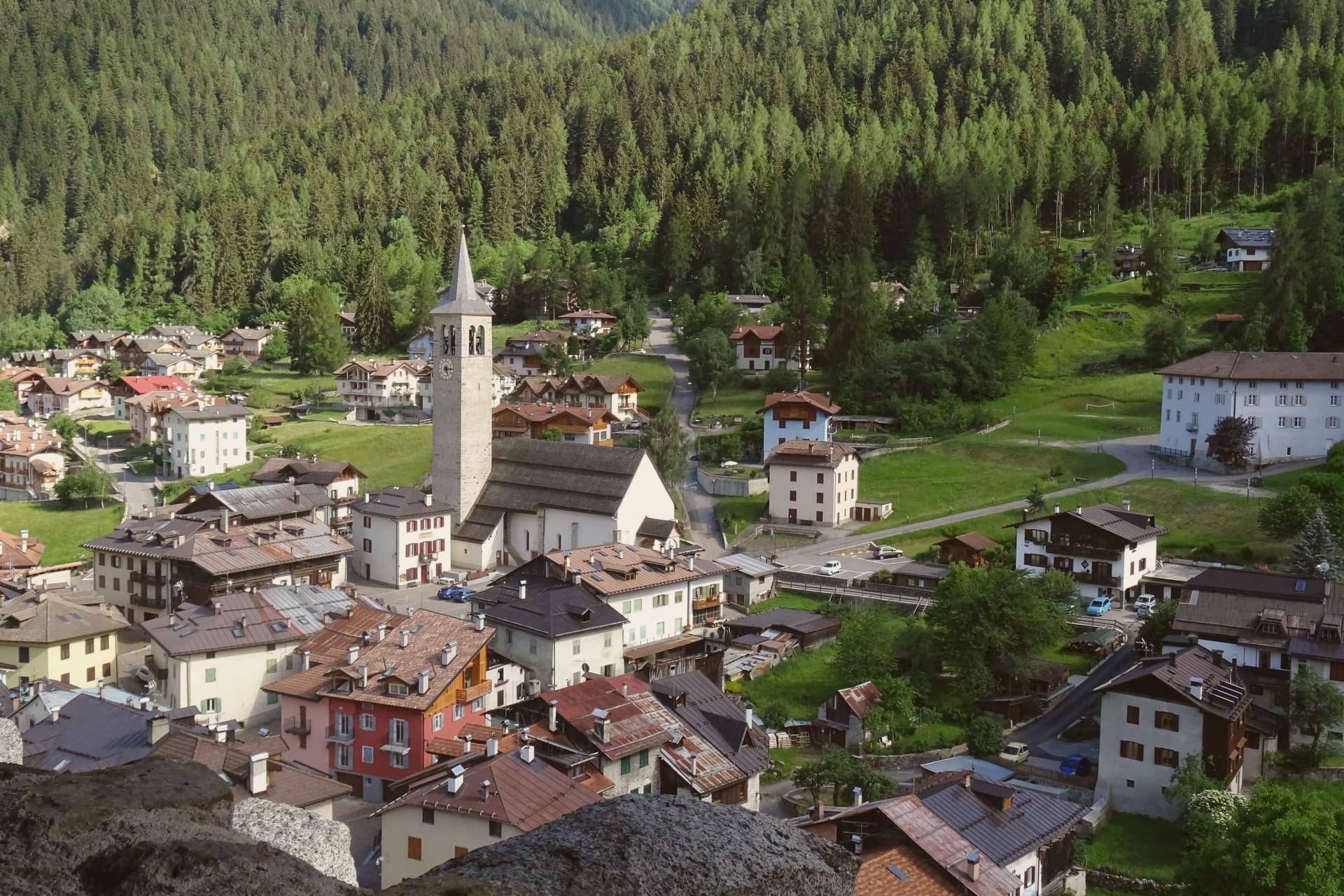
The cooking around Trento changes with the altitude. Down by the lake it is olive oil, lemons, carp and trout, salads dressed with capers grown on stone walls, and white wines from vineyards that run almost to the water. Climb into the valleys and it turns to butter, barley soups, canederli, polenta with mountain cheese, venison in the autumn and apple cake at the end. The houses shift with it too, from pale lakeside stucco under vines to dark timber balconies stacked with firewood, and the best season for eating is arguably late September, when the apples come in and the tourist traffic thins.
Most visitors to this stretch treat Sirmione and Desenzano as the definition of Lake Garda, and in high summer the southern shore takes the weight of it: coach parks, queues for the thermal spa, restaurant terraces turning tables twice at lunch. Trento itself absorbs the rest, its centre busy with day trippers doing the castle and the cathedral square before driving on. Both are worth the time. Both are also where prices climb fastest and where a kitchen can fill its room without trying very hard.
The same lake and the same valleys continue north and east, and so do the kitchens. These are smaller places, some on the water and some well above it, where a serious restaurant sits in a town that otherwise goes about its business. Fewer people eat here, and the cooking has to be good for its own reasons rather than for the passing trade.
Of the 18 communes we have mapped within 90 minutes of Trento, 7 qualify as towns with a serious restaurant that eat well: each holds a restaurant listed by the most demanding of the guides, and a dining guide has named a table in each. The smallest, Ossana, has 819 residents.
Elsewhere in the catalogue: The best towns with a serious restaurant in the province of Trento and The best lake towns within 75 minutes of Trento.
Ossana
Why visit Ossana
Ossana sits at 1,003 metres in upper Val di Sole, where the Vermigliana stream joins the Noce and the road climbs to the Passo del Tonale on the border with Lombardy. The keep was probably raised in the Lombard period, long before the 1191 record that first names it, and stood over the junction of the valley route and the mountain iron mines that made it worth holding.
Its owners changed with the centuries, prince-bishops, counts, and eventually an Austrian pacifist, tracing the wider shifts of power through the Adige and Sole valleys onto one hill above the village. The village below has kept its stone houses close around that hill, small enough that the castle is never out of sight from the streets.
What the place adds up to is a settlement built and rebuilt around a single point of control, the keep watching a road that once carried ore and armies and now carries travellers over the Tonale pass.
Antica Osteria have been named by a guide.
What to see in Ossana
- Castello di San Michele. Fortress dominating the village, restored by the Province of Trento and open as a visitable monument. It controlled the route between the Adige valley and the Brescian uplands, and the iron mines in the surrounding mountains.
- Borgo di Ossana. Compact historic centre of stone houses around the castle hill, recognised as one of I Borghi più Belli d'Italia in 2022.
- Chiesa di San Vigilio. Parish church of the village, with origins in the medieval period and frescoes inside the apse, a few steps below the castle.
How to get to Ossana
Trento is roughly 90 minutes away by road.
Our tip
June through September is the high-valley summer: trails open into the Stelvio National Park and the Adamello-Presanella group, the castle keeps long visiting hours, and night skies are dark enough for the village's dark-sky programme. December through March is the ski half of the year, with the Tonale and Pejo lifts ten kilometres away and the December presepi display drawing weekend visitors from across Trentino. April, May, October and November are the closure months.
Limone sul Garda
Why visit Limone sul Garda
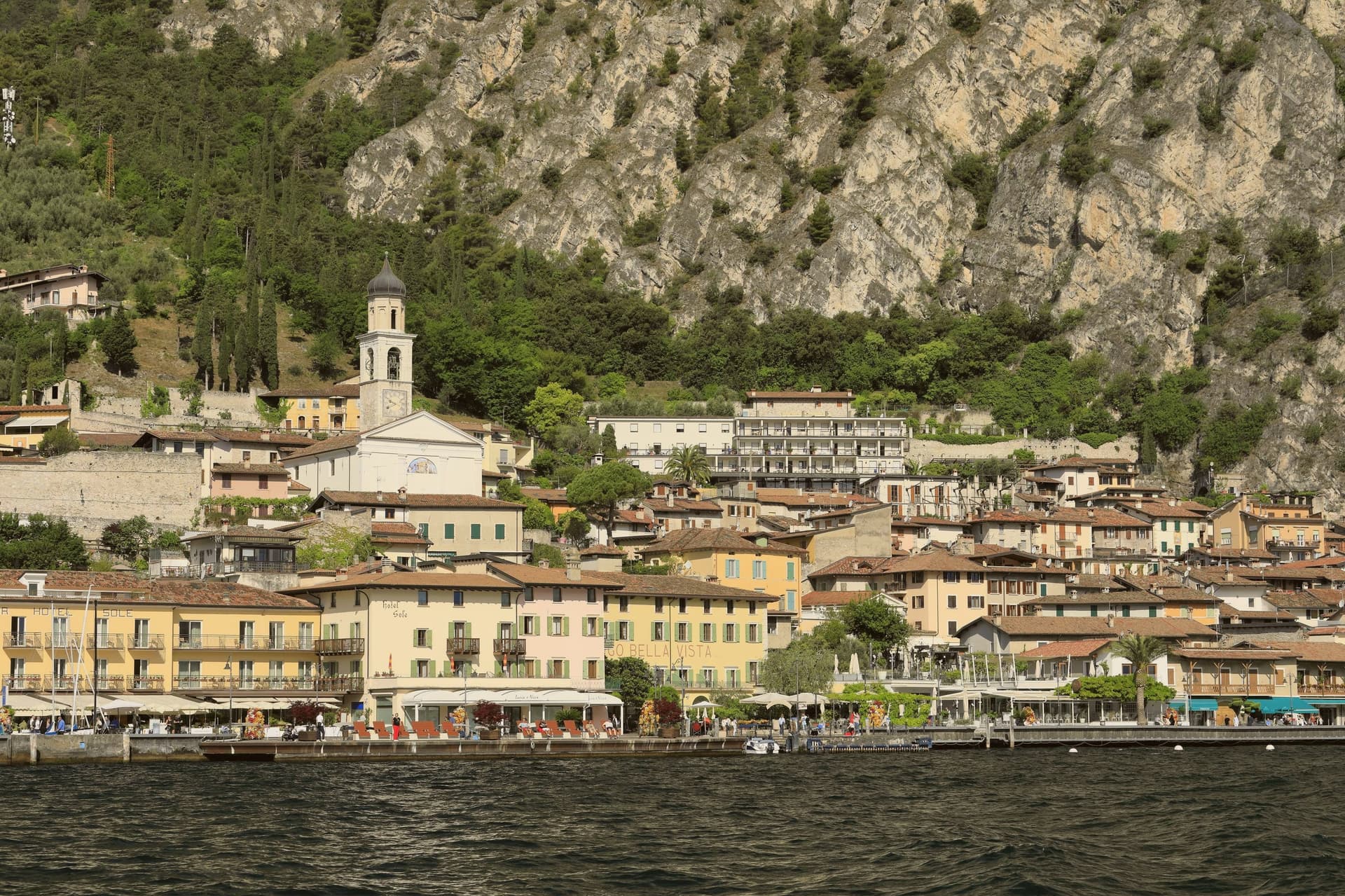
Limone sul Garda sits on the western shore of Lake Garda at the foot of vertical limestone cliffs, the northernmost commercial lemon-growing town in the world at almost 46 degrees north. The Latin limes, meaning border, gave the place its name; the Bettoni counts gave it its industry.
From the seventeenth century, limonaie, stone-pillared greenhouses heated and covered through winter, allowed lemons to be exported to Austria, Germany, Poland and Russia. The road to Riva del Garda, the Gardesana Occidentale, was carved into the cliff and finished in 1932; until then the town reached the outside world by boat or mule track.
In 1974 a Milanese pharmacologist traced a mutant apolipoprotein, ApoA-1 Milano, to a single eighteenth-century resident, Giovanni Pomarelli. Roughly forty of his descendants in town carry the variant, which suppresses cardiovascular disease and helps a handful of residents past one hundred.
Senso Lake Garda Alfio Ghezzi have been named by a guide.
What to see in Limone sul Garda
- Limonaia del Castèl. Restored seventeenth-century lemon greenhouse on stone pillars above the lake, demonstrating the heated wooden cover that protected the trees through winter.
- Chiesa di San Benedetto. Eighteenth-century parish church on the lake front, with a single nave and Baroque altars rebuilt over an older medieval foundation.
- Centro storico. Tight grid of stone alleys between the old harbour and the cliff, with narrow porticoes that survive from the pre-road fishing and citrus village.
How to get to Limone sul Garda
Trento is roughly 57 minutes away by road.
Our tip
April through June and September into October are the months that suit Limone. The lake holds spring temperatures, the lemons flower, the cliff above the town keeps morning shade until noon. July and August fill the lakefront and the cycle path, with peak crowds on weekends drawn from Verona, Milano and German-speaking Europe.
Malcesine
Why visit Malcesine
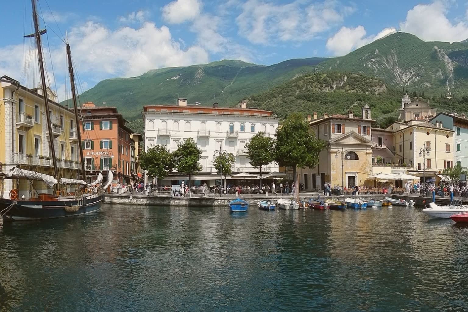
Malcesine sits at 89 meters on the eastern shore of Lake Garda, forty kilometers northwest of Verona and immediately south of Trentino-Alto Adige. The town strings together five lakeside frazioni between Navene and Cassone, pinched between the water and the slopes of Monte Baldo, which rises to 2,218 meters behind the rooftops.
The Castello Scaligero, built by the della Scala family of Verona in the thirteenth century around an older white-stone keep, is the defining building. On 14 September 1786 Johann Wolfgang Goethe was questioned in front of it on suspicion of being an Austrian spy after drawing sketches; he later devoted several pages to the episode in Italienische Reise.
The Monte Baldo cable car, opened in 1962 and rebuilt with rotating cabins in 2002, lifts walkers and paragliders to 1,750 meters in ten minutes. Olive groves along the lower slopes carry the Garda DOP olive oil designation.
Vecchia Malcesine have been named by a guide.
What to see in Malcesine
- Castello Scaligero. Thirteenth-century Scaliger fortress on a rock above the lake, with an older white-stone keep, the rooms where Goethe was held briefly in 1786 and a museum on Monte Baldo flora.
- Palazzo dei Capitani. Fifteenth-century Venetian palazzo on the lakefront, residence of the Captains of the Lake during the Republic of Venice, with a lakeside loggia and gardens.
- Monte Baldo. 2,218-meter ridge behind the town, reached by a two-stage cable car with rotating cabins; the summit is a botanical reserve known since the sixteenth century as Hortus Europae.
How to get to Malcesine
Trento is roughly 65 minutes away by road.
Our tip
April through June and September through October are the months Malcesine is built for. The cable car runs to Monte Baldo through clear spring and autumn air, the windsurfers fill Val di Sogno when the Ora picks up at midday, and the centro storico is busy but walkable. July and August push past thirty degrees on the lake and the village queues for the cable car from eight in the morning; many German and Austrian families have rented apartments here for generations.
Brentonico
Why visit Brentonico
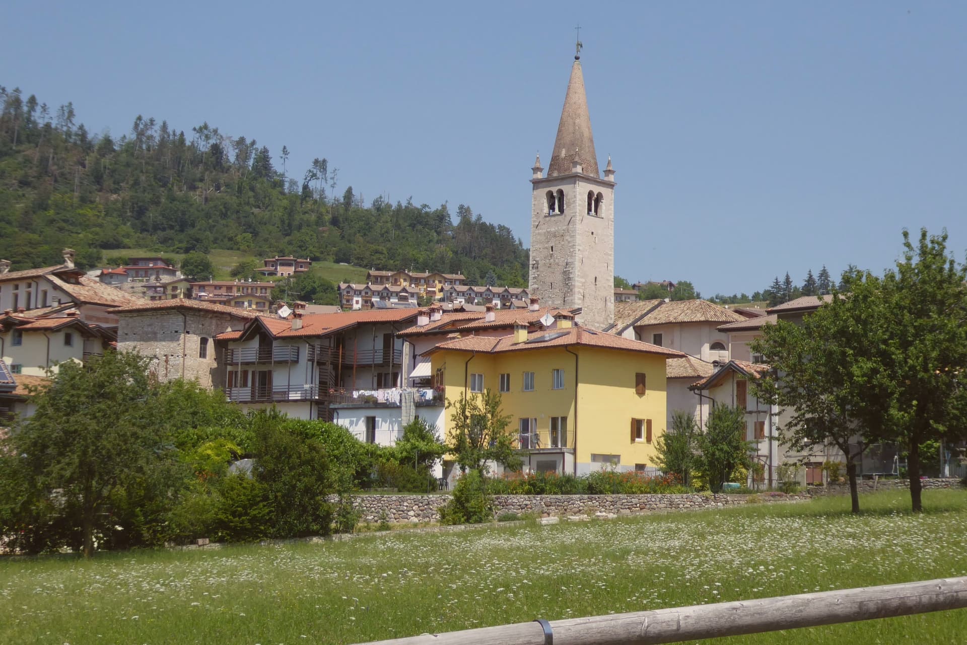
Brentonico sits at 692 metres on a plateau between Lake Garda and the Vallagarina. The commune runs from 500 metres in the valley to over 2,000 at the ridge, an altitude range wide enough to hold a chestnut hamlet at one end and ski hamlets at the other.
Castione, the lower hamlet, faces the Adige valley and lives by its terraces. San Valentino, Polsa and San Giacomo, the upper hamlets above 1,200 metres, face the opposite way, toward pasture and snow.
Palazzo Eccheli-Baisi anchors the centre and has changed hands once in a way that says something about the town: built in 1597 by mine managers, it passed in 1840 to a family of salami merchants, before ending up, in this century, as a house for fossils and for the office that manages the mountain's protected slope. That slope, and the garden set in front of the palace, both draw on the same fact: the mountain was named by European botanists for what grows on it, and the town's two conservation projects, one wild, one planted, sit on either side of the same building.
Above Crosano the ground still carries the trenches of the First World War, dug where the Austro-Hungarian line crossed the plateau. The valley below has been worked for chestnuts and the ridge above was fought over, and the palace in the centre now holds the record of both.
Maso Palù have been named by a guide.
What to see in Brentonico
- Palazzo Eccheli-Baisi. The building's later life traces the town's own turns: sold in 1840 by the founding mine-manager family to salami merchants, it now sits open to visitors as museum and park office at once, fossils in the rooms where ore accounts were once kept.
- Giardino Botanico di Brentonico. Opened in 2005 at 690 metres, directly in front of the palace, the garden gathers native and rare Monte Baldo plants into a plot small enough to walk in an afternoon.
- Parco Naturale Locale del Monte Baldo. The protected slope is where the mountain earns its old reputation: paths through it cross the endemic flora that gave the range its name among European botanists.
How to get to Brentonico
Trento is roughly 42 minutes away by road.
Our tip
May through October brings the warm months on the plateau, with the botanical garden in flower from late May, the Monte Baldo paths open above 1,500 metres, and the chestnut hamlets cool against the heat of the Vallagarina below. June and July see the rare Monte Baldo endemics in bloom on the upper slopes. October is the chestnut harvest, the busiest month in Castione, with the marroni roasted at autumn sagre.
Levico Terme
Why visit Levico Terme
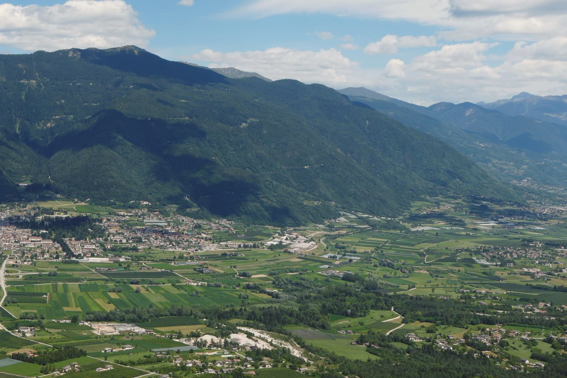
Levico Terme sits at 520 metres in the Valsugana, twenty kilometres east of Trento, between the Lagorai chain and the high plateaus of Folgaria and Lavarone. The settlement passed under Habsburg jurisdiction in 1779 and was elevated to city rank in 1894 by decree of Franz Joseph I.
The spa quarter, the park and the lake sit close together at the edge of the old centre, with the fort watching all three from the hill above. The historic centre, with its imperial-era villas and the parish church of Santissimo Redentore, grew up around the spa rather than the other way round: the streets follow the shape of a resort built in the space of a few decades under Austro-Hungarian rule, rather than a town that predates it.
What survives is a place whose entire layout, from park gate to lakeshore to the fort on the ridge, still reads as the imperial spa it was built to be.
Boivin have been named by a guide.
What to see in Levico Terme
- Parco delle Terme. Grounds laid out by Georg Ziehl around the spa buildings and the hotel, with paths shaded by mature planting where the Christmas market sets up each winter.
- Grand Hotel Imperial. Art Nouveau facade facing the park it anchors, the rooms where Empress Elisabeth stayed still forming the core of the working hotel.
- Terme di Levico. The spa buildings that gave the town its purpose, drawing on water piped down from the mountain springs and still run as a treatment centre today.
How to get to Levico Terme
There is a railway station in the town, so you can arrive without a car and never need one while you are here. Trento is roughly 30 minutes away by road.
Our tip
Levico runs year-round: the thermal cures operate from spring through autumn, the Christmas market fills the Habsburg park through December, and the spa hotels stay open through the cold months. May through October is the lake season, with the Bandiera Blu waters warm enough for swimming from mid-June and the sailing and windsurfing clubs open. June through August can hit thirty degrees in the valley floor; the park and the lakeside hold the heat better than the centro storico in the afternoon.
Riva del Garda
Why visit Riva del Garda
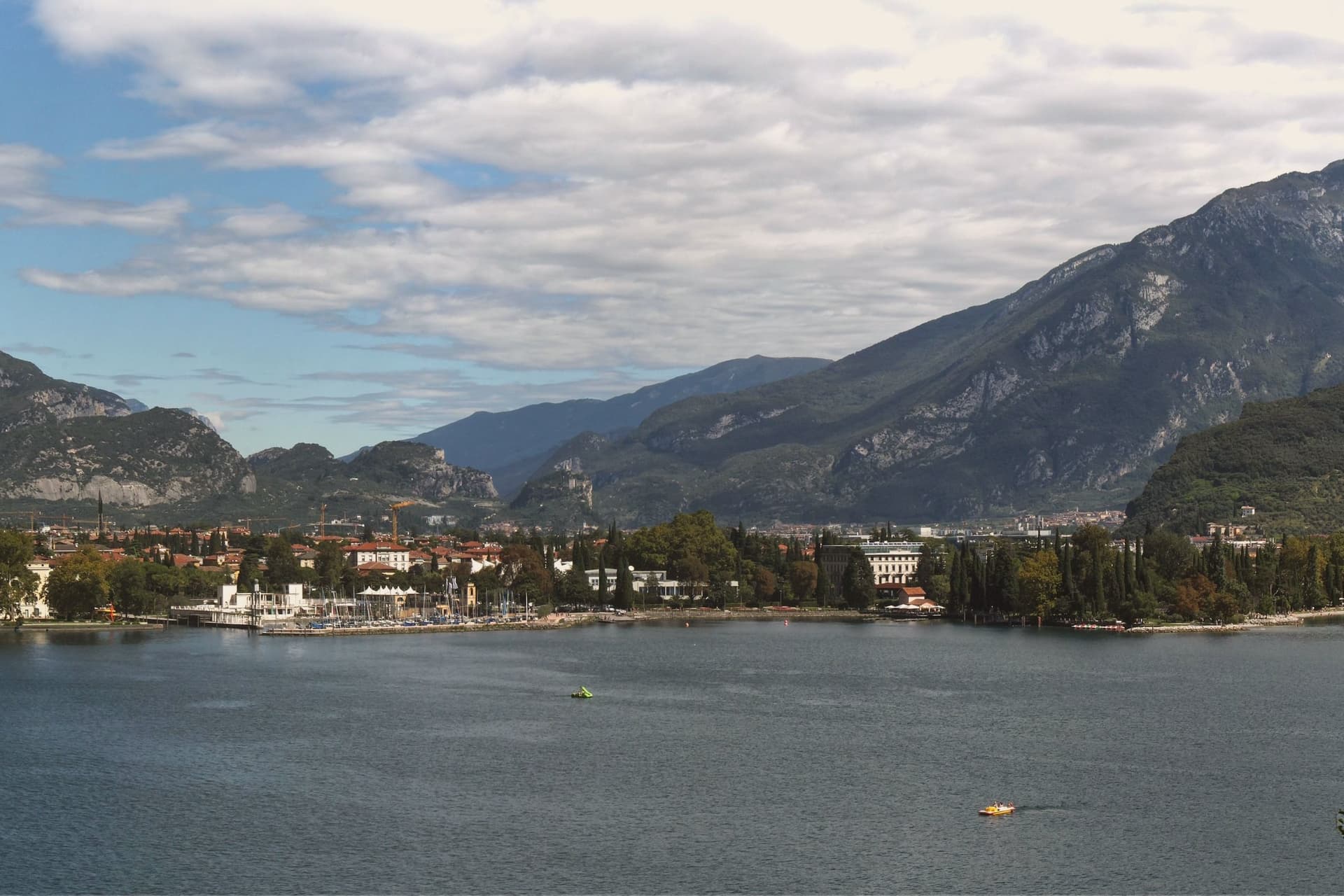
The town sits where the lake narrows between the Brescian shore and the cliffs of Monte Rocchetta, at 73 metres above sea level. It belonged to the Scaligeri of Verona in the twelfth century, then to Venice, then to the Prince-Bishops of Trento, then to Austria-Hungary from 1815 until 1918.
The Habsburg century left it the Mitteleuropean spa town where Kafka, Nietzsche and Thomas Mann came to write and recover. The old town and the harbour meet at Piazza III Novembre, anchored by the civic tower on one side and the water on the other, while above, the fortified tower clings to the mountain that closes the lake off to the north.
Down the shore, the gorge at Varone cuts into the territory of Tenno, a short distance from the town but a different landscape entirely, narrow and wet where the lakefront is open. The thermal Ora blows north up the lake in the afternoon and the cooler Pelèr blows south in the morning, the cycle that has made the town one of Europe's main windsurfing and sailing centres.
What holds the place together is the layering: a fortified lake port, fought over by three powers, turned into a rest cure for writers from across the continent, and now given over to wind.
Al Volt, Villetta Annessa, Antiche Mura and 1 more have been named by a guide.
What to see in Riva del Garda
- Rocca di Riva. The moated fortress stands ringed by water in the centre of the old town. Inside, the MAG Museo Alto Garda holds the archaeology and picture collection built up across the centuries the building itself lived through.
- Torre Apponale. First documented in 1273, the tower carries 165 steps to a terrace over the lake, with the Anzolim weather vane turning on top.
- Chiesa dell'Inviolata. Octagonal baroque church built in 1603, with altarpieces by Palma il Giovane and a frescoed dome, commissioned by Gaudenzio Madruzzo as a pilgrimage shrine.
How to get to Riva del Garda
Trento is roughly 48 minutes away by road.
Our tip
April through October is the working season on the north Garda. April and May open with cycling and via ferrata on the cliffs above the lake, the water still cool. June and September are the cleanest months, with the wind reliable for sailing and the temperature in the mid-twenties.
Feltre
Why visit Feltre
Feltre sits at 325 meters on a hill above the Stizzon, near its confluence with the Piave, seventy kilometers north of Padova. Roman Feltria was a municipium on the Via Claudia Augusta.
The defining episode in the city's appearance came in 1510, during the War of the League of Cambrai, when troops under Maximilian I of Habsburg sacked the town after the Venetian defeat at Agnadello, burning most of it. The city rebuilt over the next sixty years, and that reconstruction shapes how its parts relate to each other still.
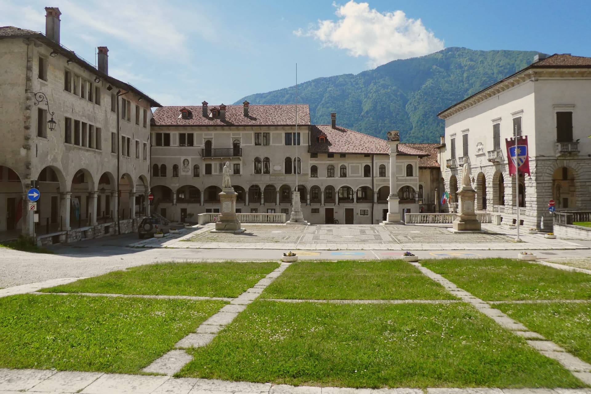
The upper city, the citadel built around the main square, holds the seat of civic government, the medieval keep with its views to the peaks and forests north of the city, and the church of San Rocco. Below it, the long arcaded street through the lower city carries the same sixteenth-century idiom down the hill, so the whole centro storico reads as one build rather than a patchwork of eras.
What Feltre offers, in the end, is a rare case where destruction produced coherence: a single burning followed by a single, unhurried rebuilding, and the town has looked essentially like itself ever since.
Aurora, Enoteca Contemporanea have been named by a guide.
What to see in Feltre
- Piazza Maggiore. Main square of the upper city, at the highest point of the centro storico, surrounded by Renaissance palaces and the citadel walls.
- Palazzo della Ragione. Sixteenth-century town hall on the square with a loggia traditionally attributed to Andrea Palladio.
- Castello di Alboino. Medieval keep above the centro storico, named for the Lombard king Alboin, with views across the Piave valley to the peaks north of the city.
How to get to Feltre
There is a railway station in the town, so you can arrive without a car and never need one while you are here. Trento is roughly 81 minutes away by road.
Our tip
April through October is the working season. The hill stays a few degrees cooler than the Piave valley below, and the Vette Feltrine to the north stay walkable from May to October. The Palio di Feltre runs the first weekend of August: five rioni in costume, archery, a horse race around Piazza Maggiore, and the city fills past its 20,000 residents.
More from Anywhere Italy
- The best towns with a serious restaurant in the province of Trento
 The best lake towns within 75 minutes of Trento
 The prettiest small villages within 90 minutes of Trento
- The best small towns that eat well in the province of Trento
 The best ski towns with a serious restaurant in Trentino-Alto Adige/Südtirol
 The best towns with a serious restaurant that eat well within 90 minutes of Verona