
The best lake towns within 75 minutes of Trento
Water sits everywhere in this corner of the Alps, held between limestone walls and olive terraces. North of Verona the lake climbs into a fjord, with cypress and lemon on the western shore and Monte Baldo dropping straight into the water on the eastern one. Higher up, near the Brenta Dolomites, the lakes turn glacial and cold, ringed by larch and pale stone houses with wide wooden balconies. Spring brings asparagus and the first lake sardines grilled with oil from the local frantoi, and by late summer the whole shoreline smells of rosemary and warm stone.
The famous stop is Sirmione, on its narrow peninsula in the south, and the crowds are easy to understand: a Scaliger castle at the entrance, Roman ruins at the tip, thermal water beneath. In high season the causeway queues and the main street moves at a shuffle, and the day boats from Desenzano add to it. Lake Como takes the same pressure further west, with Bellagio absorbing most of it.
The same water continues north, and the mountains that make the views also keep the towns small. Ferries cross between shores, the cycle path runs behind the vineyards, and the road to Riva passes through tunnels cut in rock above the surface. These are the towns on that stretch, plus the quieter lakes inland towards the Brenta group, all within a comfortable drive of Trento.
Of the 26 communes we have mapped in a 75-minute drive of Trento, 10 qualify as lake towns: each sits on the water. The smallest, Molveno, has 1,108 residents.
Two more lists worth reading alongside this one: The best lake towns within two hours of Bolzano and The best small towns on Lake Garda's eastern shore.
Molveno
Why visit Molveno
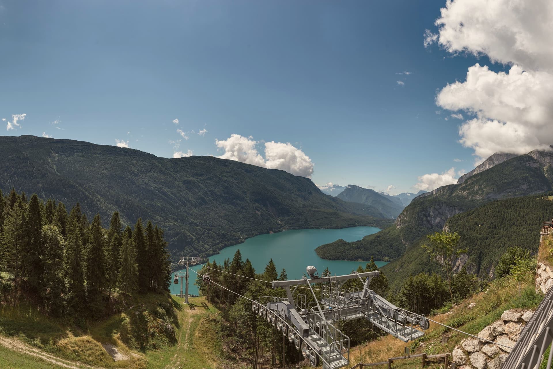
Molveno sits at 864 metres on the northern shore of a lake formed by a landslide about 4,000 years ago, held in on one side by the Brenta Dolomites and on the other by Monte Paganella. The village and its historic centre face the water from below the plateau of Pradel, which rises behind it and is reached by cable car, so the two halves of the place, lake shore and high ground, look at each other across the same stretch of blue.
The cemetery church stands slightly apart, above the centre, on the same slope. The lake is second-largest in the region by surface and the deepest in Trentino.
The nature park that holds the Brenta group begins right at the western shore, which means the mountains are not a backdrop seen from Molveno but a boundary the village is built against. The result is a place with almost no distance between the water, the settlement and the wild ground above it: the whole of Molveno can be read as a narrow shelf between a deep lake and a limestone wall.
The town sits on the water, at 864 metres.
What to see in Molveno
- Lago di Molveno. Four kilometres of water at 864 metres, formed by a landslide around 4,000 years ago, ringed by the Brenta Dolomites on one side and Monte Paganella on the other.
- Chiesa di San Vigilio. Gothic 13th-century church inside the village cemetery above the historic centre, with stone walls and a separate bell tower.
- Parco Naturale Adamello-Brenta. Largest protected area in Trentino, beginning at Molveno's western shore, with the Brenta Dolomites, brown bears, glaciers and a network of rifugi.
How to get to Molveno
Trento is roughly 71 minutes away by road.
Our tip
April through October is the running season for the lake. The water stays cold but is swimmable from late June through August; the perimeter path is 11 kilometres of mostly flat shoreline. July and August bring Italian-family crowds and full hotels around the small village core.
Limone sul Garda
Why visit Limone sul Garda
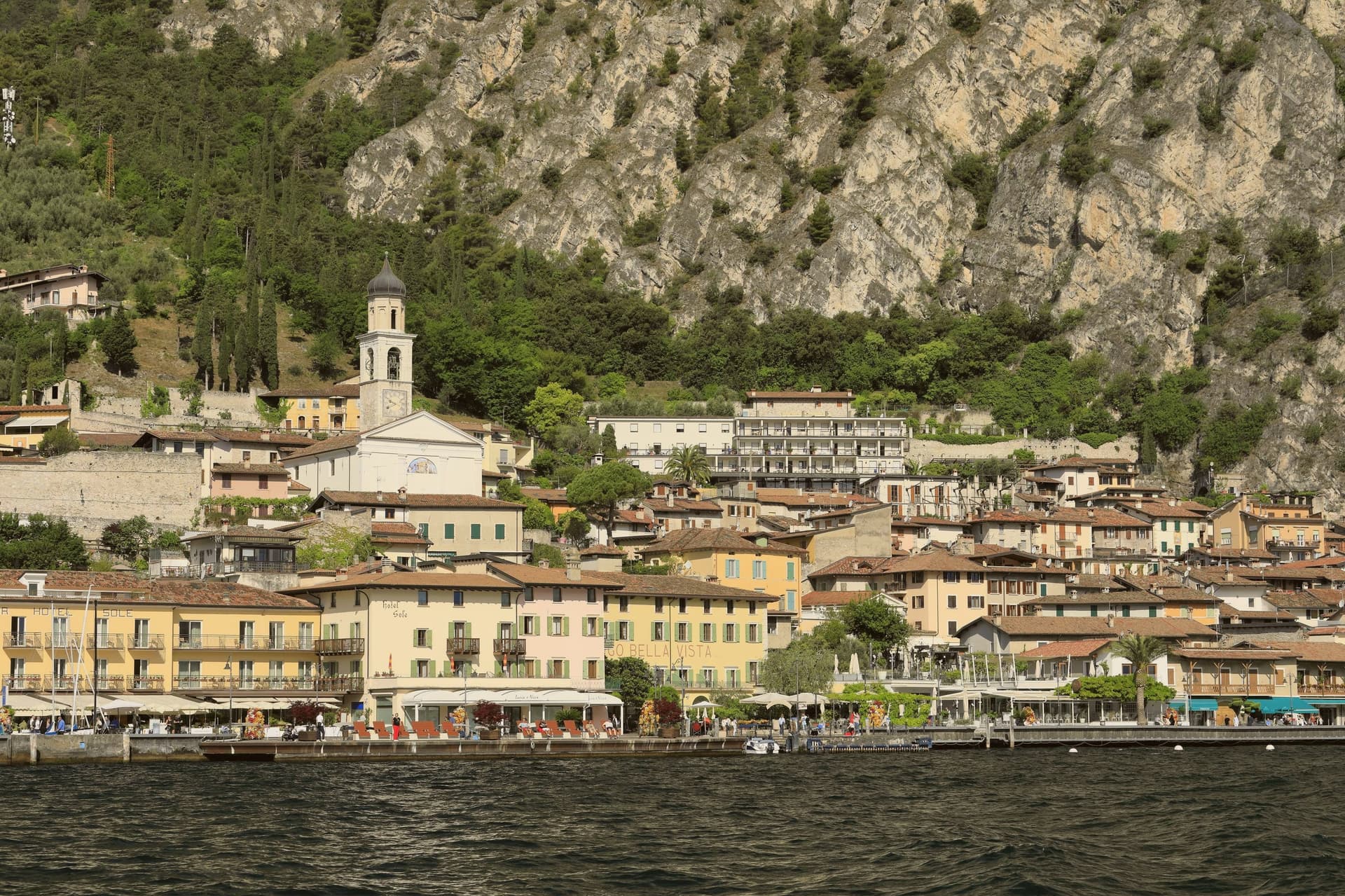
Limone sul Garda sits on the western shore of Lake Garda at the foot of vertical limestone cliffs, the northernmost commercial lemon-growing town in the world at almost 46 degrees north. The Latin limes, meaning border, gave the place its name; the Bettoni counts gave it its industry.
From the seventeenth century, limonaie, stone-pillared greenhouses heated and covered through winter, allowed lemons to be exported to Austria, Germany, Poland and Russia. The road to Riva del Garda, the Gardesana Occidentale, was carved into the cliff and finished in 1932; until then the town reached the outside world by boat or mule track.
In 1974 a Milanese pharmacologist traced a mutant apolipoprotein, ApoA-1 Milano, to a single eighteenth-century resident, Giovanni Pomarelli. Roughly forty of his descendants in town carry the variant, which suppresses cardiovascular disease and helps a handful of residents past one hundred.
The town sits on the water, at 65 metres.
What to see in Limone sul Garda
- Limonaia del Castèl. Restored seventeenth-century lemon greenhouse on stone pillars above the lake, demonstrating the heated wooden cover that protected the trees through winter.
- Chiesa di San Benedetto. Eighteenth-century parish church on the lake front, with a single nave and Baroque altars rebuilt over an older medieval foundation.
- Centro storico. Tight grid of stone alleys between the old harbour and the cliff, with narrow porticoes that survive from the pre-road fishing and citrus village.
How to get to Limone sul Garda
Trento is roughly 57 minutes away by road.
Our tip
April through June and September into October are the months that suit Limone. The lake holds spring temperatures, the lemons flower, the cliff above the town keeps morning shade until noon. July and August fill the lakefront and the cycle path, with peak crowds on weekends drawn from Verona, Milano and German-speaking Europe.
San Zeno di Montagna
Why visit San Zeno di Montagna
The village sits thirty kilometers northwest of Verona. It took its current name in 1871, after unification, borrowing the name of Verona's patron saint; before that it was called Montagna di Monte Baldo, a plainer name tied directly to the mountain above it.
Pastoralism here goes back to the Copper and Bronze ages, when small communities drove herds up from the plain in summer along routes that still cross the mountain. Sheep and goats gave way to cattle as the dominant economy in the seventeenth century.
The frazione of Prada, reached by cable car from the lakeshore, holds the longest of these pasture terraces, its Church of San Bartolomeo built for the shepherds who worked the ground seasonally rather than for a settled parish. Below, the chestnut groves that ring the village are a separate, older layer of the economy, worked at lower altitude while the herds went up.
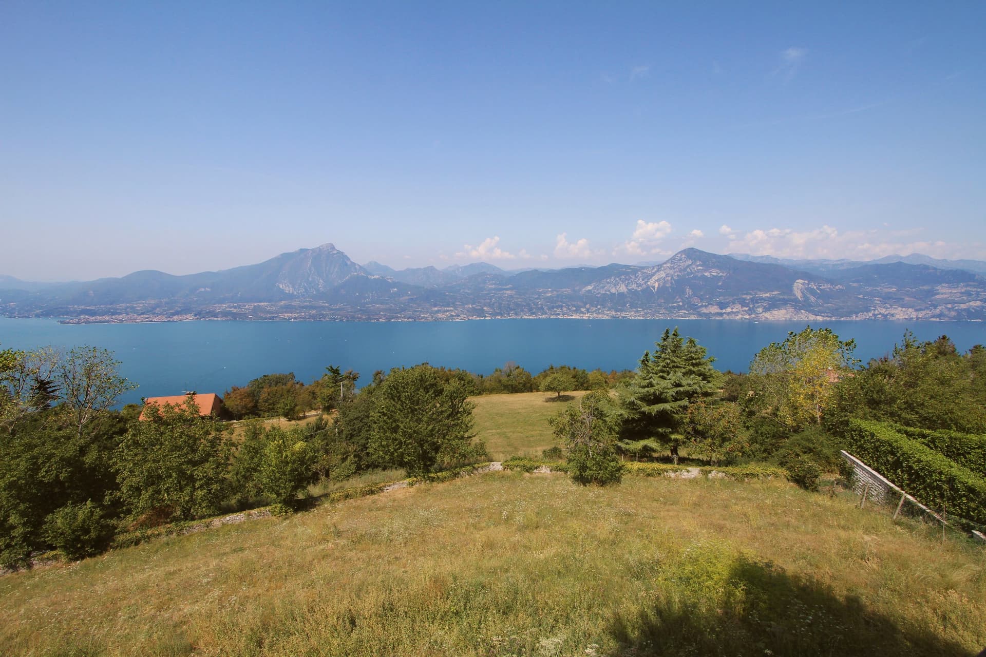
What emerges is a village organized on a vertical axis: lake view at one elevation, chestnut groves at another, pasture and summer huts higher still, each belonging to a different rhythm of use rather than to a single center.
The town sits on the water, at 680 metres.
What to see in San Zeno di Montagna
- Balcone del Garda. The viewpoint that names the commune, a place to stand at the edge of the ridge and take in the water and the opposite shore at once.
- Monte Baldo. Regional park rising above the village, its slopes still worked as pasture, with the old herding paths climbing through it toward the grass terraces higher up.
- Prada. Three-kilometer grass terrace on the mountain, reachable by cable car from the lakeshore, with the Church of San Bartolomeo standing among the summer pasture huts.
How to get to San Zeno di Montagna
Verona is roughly 51 minutes away by road.
Our tip
April through June and September through October are the months the commune works best. The chestnut groves green up in spring, the Baldo opens for walking, and the lake below stays cool enough to swim in by June. October brings the Festa delle Castagne over three weekends, with roasted Marrone di San Zeno and the woods turning to ochre and rust.
Torri del Benaco
Why visit Torri del Benaco
Torri del Benaco sits thirty kilometers northwest of Verona, opposite the Gulf of Salò. The name carries the old Roman name for the lake, Benacus, and the towers refer to the medieval fortifications still standing along the lakefront.
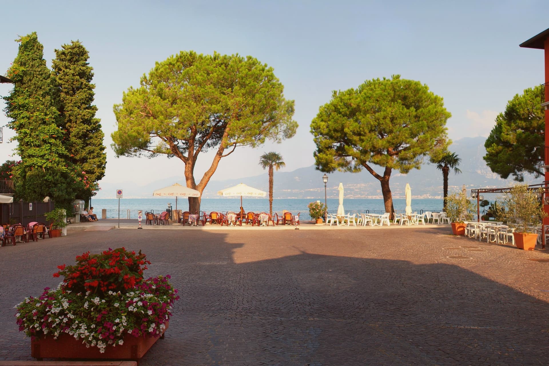
The fortress there was rebuilt over a tenth-century structure and now houses rooms on local fishing, olive cultivation and the prehistoric rock carvings found above the town. The harbor is enclosed by the old walls and towers that give the town its name, with the ferry pier and lakefront promenade running south toward Garda; the crossing to Toscolano-Maderno on the Brescian shore runs year-round, the only winter crossing on the upper lake.
Above the harbor, the frazioni of Albisano, Pai and Crero hold the hillside, their olive groves supplying oil sold under the Garda DOP label. The harbor and the narrow lanes behind it form the working center of a commune that has lived on the lake since the Roman period, its geography read straight off the name: towers below, groves above, water in between.
The town sits on the water, at 67 metres.
What to see in Torri del Benaco
- Castello Scaligero. Castle rebuilt by Antonio della Scala in 1383 over a tenth-century fortress, now an ethnographic museum on fishing, olive oil and the Monte Luppia rock carvings.
- Porto and Lungolago. Medieval harbor enclosed by old walls and towers, with the ferry pier and the lakefront promenade running south toward Garda.
- Albisano. Hilltop frazione 250 meters above the lake, with a panoramic terrace over the basin and the parish church of San Martino.
How to get to Torri del Benaco
Verona is roughly 46 minutes away by road.
Our tip
April through October is the working season. April and May bring the lake back to swimming temperature and the olive groves into flower. June through August fills the harbor and the lungolago with German and Austrian visitors; midweek mornings are still walkable, weekends queue.
Malcesine
Why visit Malcesine
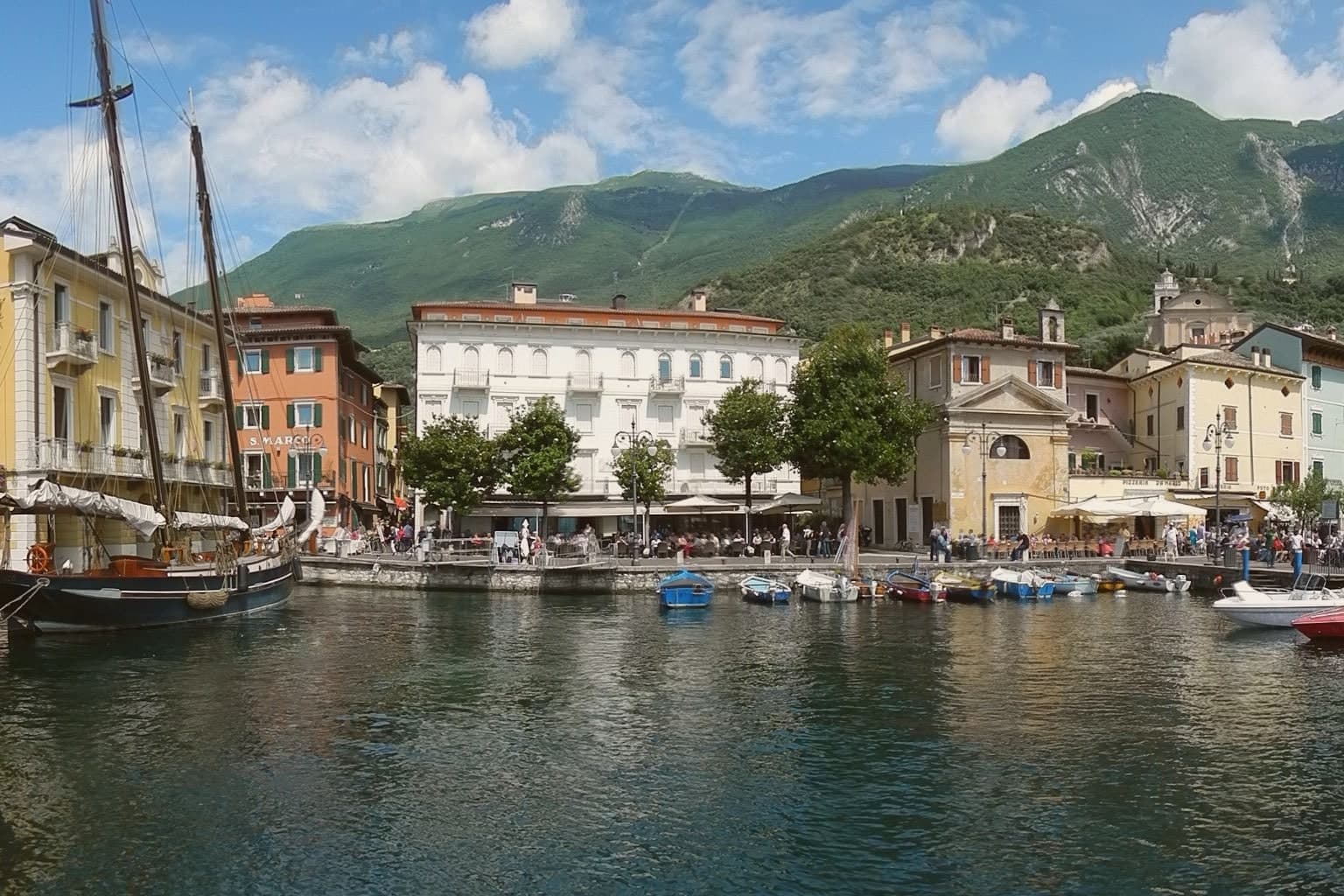
Malcesine sits at 89 meters on the eastern shore of Lake Garda, forty kilometers northwest of Verona and immediately south of Trentino-Alto Adige. The town strings together five lakeside frazioni between Navene and Cassone, pinched between the water and the slopes of Monte Baldo, which rises to 2,218 meters behind the rooftops.
The Castello Scaligero, built by the della Scala family of Verona in the thirteenth century around an older white-stone keep, is the defining building. On 14 September 1786 Johann Wolfgang Goethe was questioned in front of it on suspicion of being an Austrian spy after drawing sketches; he later devoted several pages to the episode in Italienische Reise.
The Monte Baldo cable car, opened in 1962 and rebuilt with rotating cabins in 2002, lifts walkers and paragliders to 1,750 meters in ten minutes. Olive groves along the lower slopes carry the Garda DOP olive oil designation.
The town sits on the water, at 89 metres.
What to see in Malcesine
- Castello Scaligero. Thirteenth-century Scaliger fortress on a rock above the lake, with an older white-stone keep, the rooms where Goethe was held briefly in 1786 and a museum on Monte Baldo flora.
- Palazzo dei Capitani. Fifteenth-century Venetian palazzo on the lakefront, residence of the Captains of the Lake during the Republic of Venice, with a lakeside loggia and gardens.
- Monte Baldo. 2,218-meter ridge behind the town, reached by a two-stage cable car with rotating cabins; the summit is a botanical reserve known since the sixteenth century as Hortus Europae.
How to get to Malcesine
Trento is roughly 65 minutes away by road.
Our tip
April through June and September through October are the months Malcesine is built for. The cable car runs to Monte Baldo through clear spring and autumn air, the windsurfers fill Val di Sogno when the Ora picks up at midday, and the centro storico is busy but walkable. July and August push past thirty degrees on the lake and the village queues for the cable car from eight in the morning; many German and Austrian families have rented apartments here for generations.
Costermano sul Garda
Why visit Costermano sul Garda
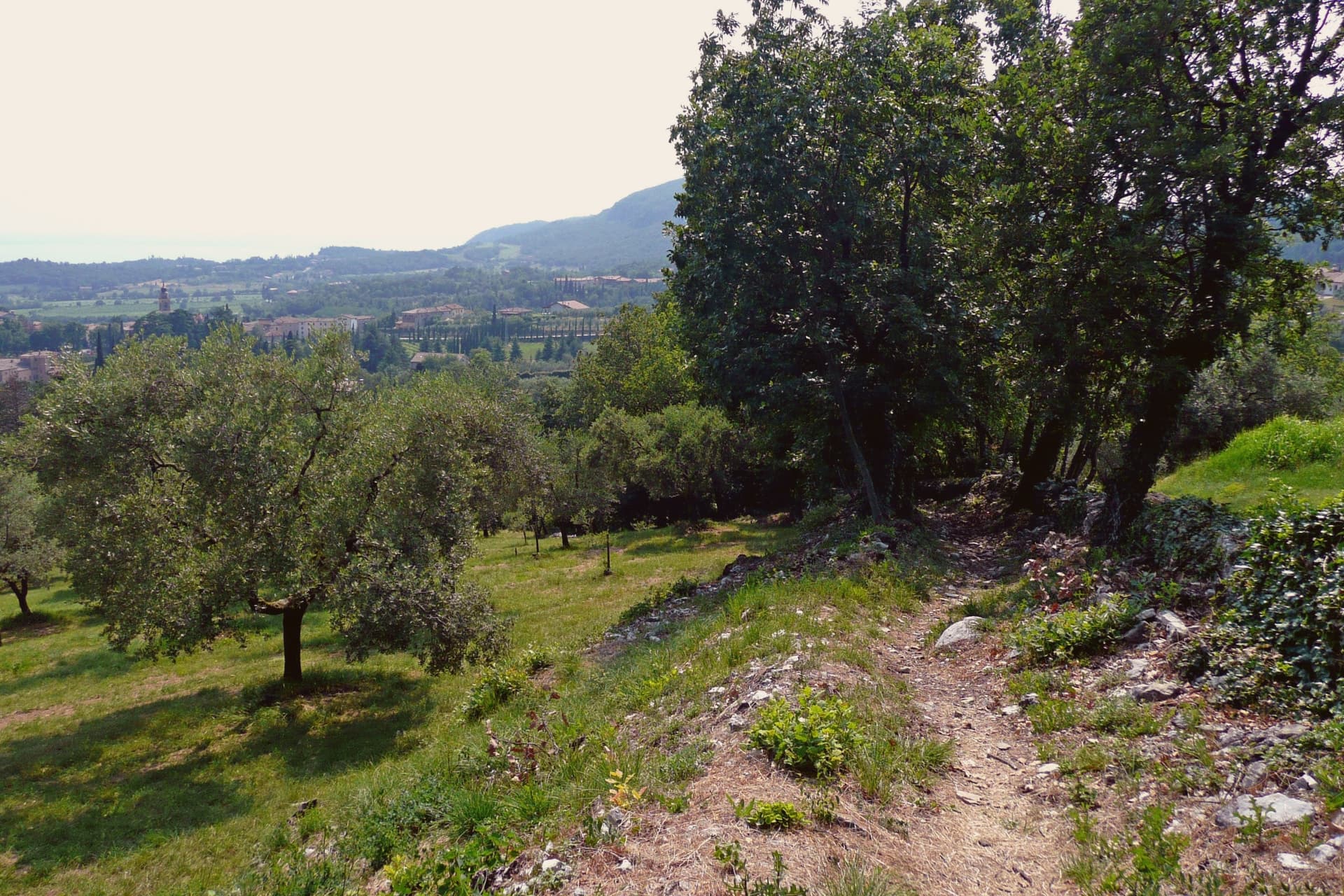
The commune sits on a moraine amphitheater twenty-five kilometers northwest of Verona. The hills were a feud of the Brescia monastery of Santa Giulia in the early Middle Ages, then passed through Scaliger and Venetian rule before joining Italy in 1866; the name sul Garda was added only in 2018, to anchor the town's tourism identity to the water it sits above rather than on.
That distinction matters here: this is not a lakefront village but a hill settlement looking down at the shore, its center, its cemetery hill, and its vineyard slopes arranged around the belvedere at Marciaga rather than around a harbor. The economy runs on olive oil and hillside vines, and on the holiday accommodation that has filled these slopes since the 1970s, but the single largest reason people come here is not agricultural.
The cemetery holds the dead of a war fought decades after the monastery's feud and centuries after the Scaliger lords, and it sits on the same morainal hill as the sanctuary, the parish church, and the vine rows, a place where the working landscape and the memorial landscape occupy the same short walk rather than separate zones.
The town sits on the water, at 237 metres.
What to see in Costermano sul Garda
- Santuario della Madonna del Castello. Sanctuary on the spur of Marciaga, its fifteenth-century frescoes intact, with a terrace looking over Lake Garda and the eastern shore.
- Deutsche Soldatenfriedhof. The graves cover the hillside above the lake, laid out since 1967 for the dead of the Second World War, a place kept in silence rather than commentary.
- Chiesa di San Siro. Parish church rebuilt in the nineteenth century in the center of the village, its freestanding campanile visible from the surrounding slopes, with a sightline to Monte Baldo across the water.
How to get to Costermano sul Garda
There is a railway station in the town, so you can arrive without a car and never need one while you are here. Verona is roughly 34 minutes away by road.
Our tip
April through October is the working window. April and May bring the lake back to swimming temperature on the shore four kilometers below, and the morainal hills into wildflower. June through August fills the holiday rentals and the lakefront day-traffic from Garda and Bardolino; the hills stay a few degrees cooler than the shore.
Lazise
Why visit Lazise
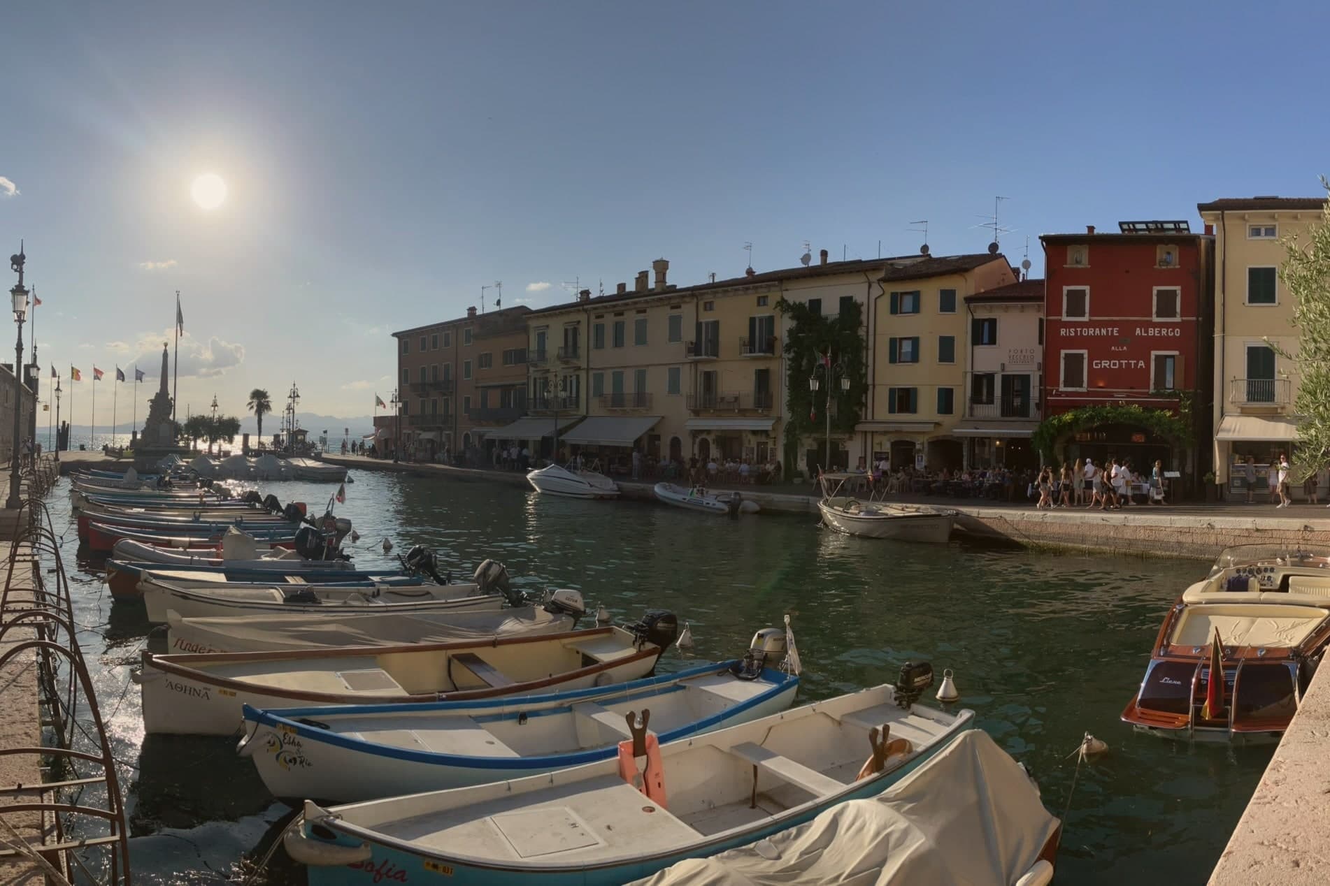
Lazise sits at 76 meters on the southeastern shore of Lake Garda, twenty kilometers northwest of Verona. The first walls went up shortly after the 983 charter; Venice took the town in 1405 and held it until Napoleon arrived in 1796, and Porta Lion, on the south, still carries the winged lion of Saint Mark from that period of rule.
The castle anchors the southern corner of the fortifications while the harbor sits enclosed within their reach, and the church and the customs house both face onto that same stretch of water, one built for worship and later pressed into use as a warehouse, the other built outright for Venice to tax what passed through the port. Behind the town, the morainic hills carry the vines of the Bardolino DOC, and Lazise counts itself among the Veneto's wine and honey communes.
The town reads, in short, as a small fortified port whose walls, harbor and customs works were all built to serve and guard the same trade on the same shore.
The town sits on the water, at 76 metres.
What to see in Lazise
- Castello Scaligero. Rectangular fortress at the south corner of the walls, with five square towers and a fortified dock built for the lake galleys, facing Lake Garda.
- Mura medievali. Thirteen surviving towers and three gates, San Zeno, Nuova and Lion, ring the old town along the shore of Lake Garda.
- Chiesa di San Nicolò. Romanesque church on the harbor, with frescoes attributed to the Giotto school and a former function as a customs warehouse.
How to get to Lazise
Verona is roughly 36 minutes away by road.
Our tip
April through June and September through October are the right months for Lazise. The walled centro storico stays cool from the lake breeze, the harbor fills with sailboats, and the Bardolino hills behind the town are green in spring and gold in October. July and August are warm and very crowded: the southern Garda shore concentrates more than half of the lake's tourist beds, and the gates of Lazise queue from morning.
Bardolino
Why visit Bardolino
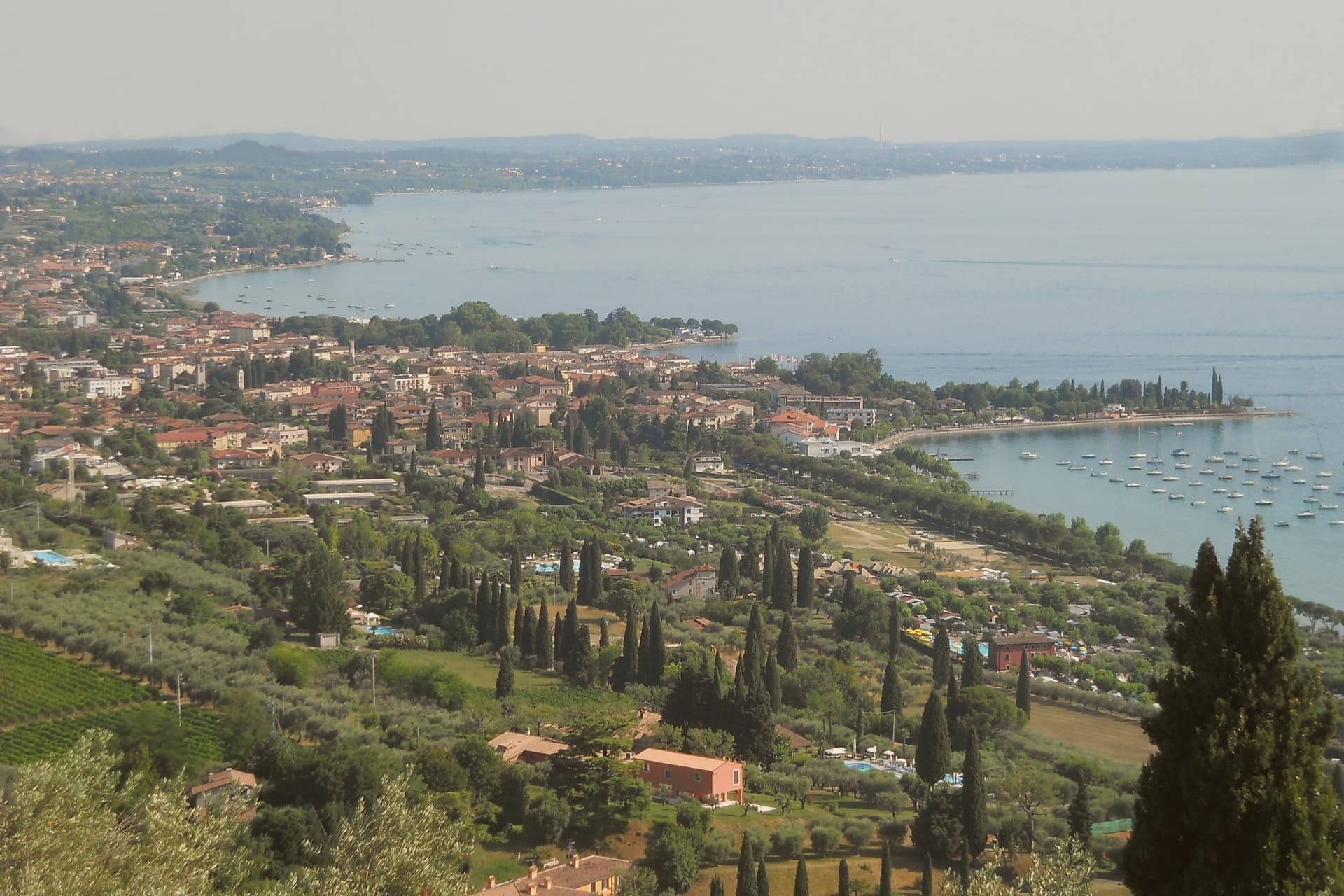
Bardolino sits on the eastern shore of Lake Garda at 65 meters, twenty-five kilometers northwest of Verona. The hills behind town have been planted with vines since the Roman period, and the modern DOC was granted in 1968.
Three grapes do the work: Corvina, Rondinella and Molinara. Long maceration produces Bardolino, the light red the town has lived on since the nineteenth century; short skin contact produces Chiaretto, the rosé that has overtaken the red in current sales.
Two churches hold the medieval line. San Zeno in the centro storico is ninth-century, one of the oldest in the province of Verona.
San Severo, built between the late eleventh and early twelfth centuries on the foundations of an earlier church mentioned in an 893 charter of Berengario, is the town's Romanesque anchor. The lakefront has been a tourist promenade since the 1950s.
The Palio del Chiaretto runs the first weekend of June; the Festa dell'Uva e del Vino runs the first week of October.
The town sits on the water, at 65 metres.
What to see in Bardolino
- Chiesa di San Severo. Romanesque church built between the late eleventh and early twelfth centuries on the foundations of a structure mentioned in a 893 charter.
- Chiesa di San Zeno. Ninth-century church in the centro storico, one of the oldest in the province of Verona, on a Latin cross plan with a small apse.
- Centro storico. Walled medieval core around Piazza Matteotti, with arcaded streets dating to the Venetian period from the fifteenth century.
How to get to Bardolino
There is a railway station in the town, so you can arrive without a car and never need one while you are here. Verona is roughly 36 minutes away by road.
Our tip
April through October is the working season. April and May bring the lake back to swimming temperature and the Romanesque churches at their quietest. June through August fills the lungolago with German and Austrian visitors; weekends are crowded, weekday mornings still manageable. Bardolino Freddo falls in August.
Peschiera del Garda
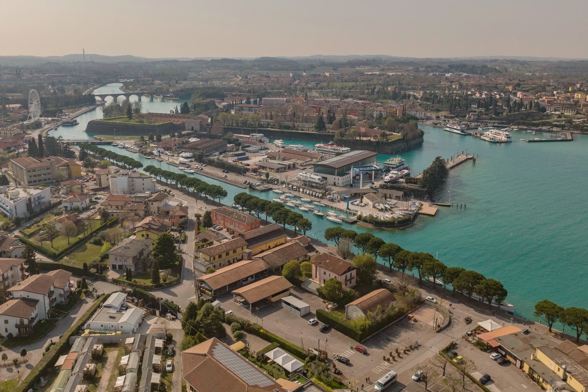
Why visit Peschiera del Garda
Peschiera sits at 68 meters on the Mincio at the point where the river leaves Lake Garda, twenty-five kilometers west of Verona. The Romans called it Ardelica.
The town the Republic of Venice rebuilt in 1549 was set on the medieval walls' corners, with a moat fed by the river, and the design came from Guidobaldo della Rovere before its execution on site. Austria took the town in 1815 and folded it into a wider system with Verona, Mantua and Legnago, the four together holding Lombardy-Venetia until 1866; Peschiera held the northwest corner of that arrangement, the point closest to the lake.
The fortress and the marsh settlement belong to different periods and different UNESCO listings, one Bronze Age and lakeside, one sixteenth-century and defensive, but both sit on the same stretch of water where the Mincio gathers itself before running south. The river itself is the town's organizing fact: it leaves the lake, splits into three canals to cross the walls, and rejoins below the railway bridge.
What Peschiera adds up to is a place built twice on the same threshold, where a lake becomes a river and a river becomes a border worth fortifying.
The town sits on the water, at 68 metres.
What to see in Peschiera del Garda
- Mura veneziane. Pentagonal fortress designed by Michele Sanmicheli for Venice from 1549, with five bastions, a moat fed by the Mincio and three water gates.
- Canali del Mincio. Three canals cross the fortress and rejoin below the railway bridge; the central one runs through the main square inside the walls.
- Piazza Ferdinando di Savoia. Main square inside the walls, bordered by the Palazzo del Comando, the Voltoni arches over the Mincio and the Caserma Catterin.
How to get to Peschiera del Garda
There is a railway station in the town, so you can arrive without a car and never need one while you are here. Verona is roughly 30 minutes away by road.
Our tip
April through June and September through October are the strongest months in Peschiera. The fortress walls, the moat and the Mincio canals are at their clearest in spring and autumn, and the lakefront south of the walls fills with sailing and ferry traffic. July and August push past thirty degrees and the southern Garda concentrates much of the lake's day-trip volume; the parking lots around the railway station queue from midmorning.
Riva del Garda
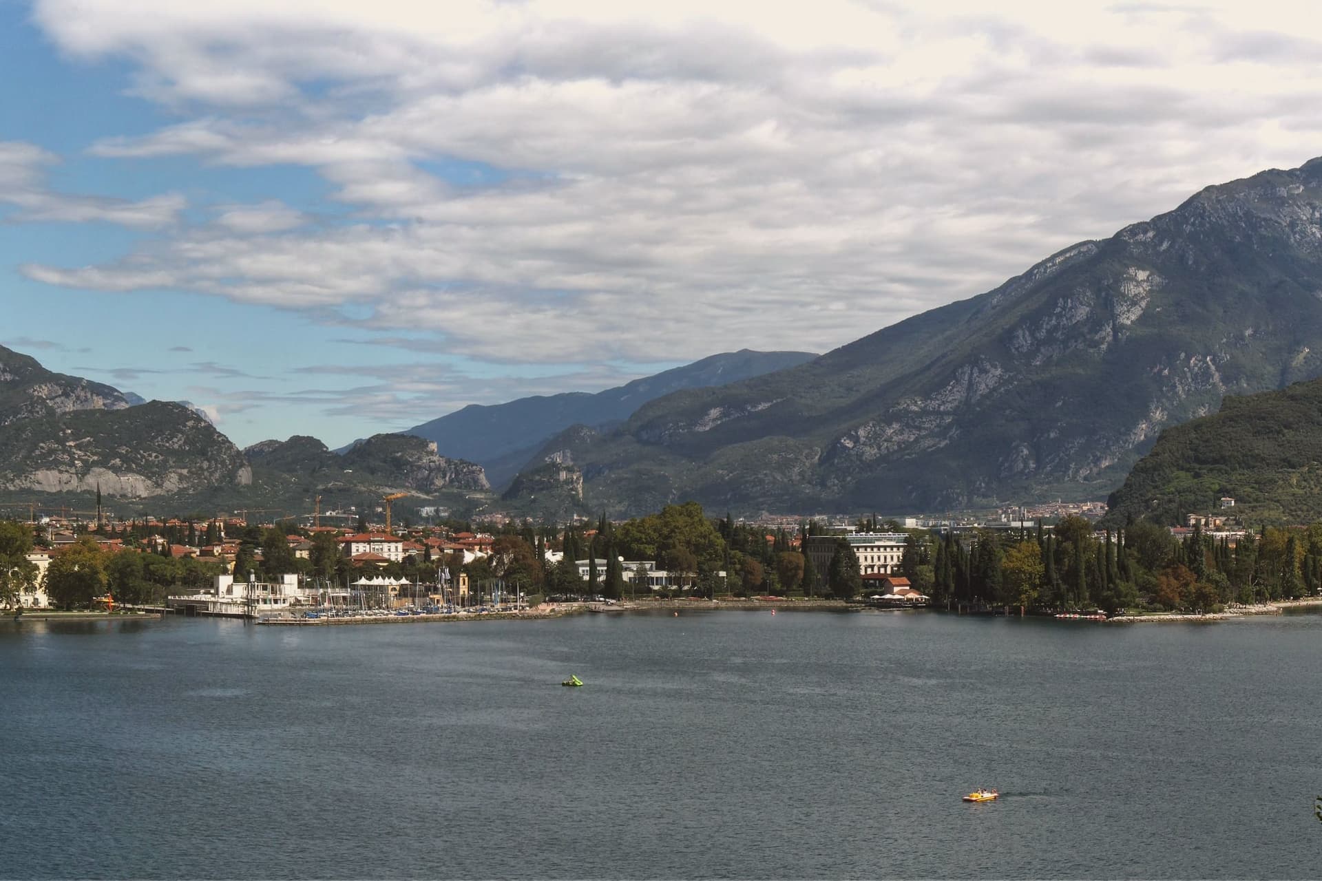
Why visit Riva del Garda
The town sits where the lake narrows between the Brescian shore and the cliffs of Monte Rocchetta, at 73 metres above sea level. It belonged to the Scaligeri of Verona in the twelfth century, then to Venice, then to the Prince-Bishops of Trento, then to Austria-Hungary from 1815 until 1918.
The Habsburg century left it the Mitteleuropean spa town where Kafka, Nietzsche and Thomas Mann came to write and recover. The old town and the harbour meet at Piazza III Novembre, anchored by the civic tower on one side and the water on the other, while above, the fortified tower clings to the mountain that closes the lake off to the north.
Down the shore, the gorge at Varone cuts into the territory of Tenno, a short distance from the town but a different landscape entirely, narrow and wet where the lakefront is open. The thermal Ora blows north up the lake in the afternoon and the cooler Pelèr blows south in the morning, the cycle that has made the town one of Europe's main windsurfing and sailing centres.
What holds the place together is the layering: a fortified lake port, fought over by three powers, turned into a rest cure for writers from across the continent, and now given over to wind.
The town sits on the water, at 73 metres.
What to see in Riva del Garda
- Rocca di Riva. The moated fortress stands ringed by water in the centre of the old town. Inside, the MAG Museo Alto Garda holds the archaeology and picture collection built up across the centuries the building itself lived through.
- Torre Apponale. First documented in 1273, the tower carries 165 steps to a terrace over the lake, with the Anzolim weather vane turning on top.
- Chiesa dell'Inviolata. Octagonal baroque church built in 1603, with altarpieces by Palma il Giovane and a frescoed dome, commissioned by Gaudenzio Madruzzo as a pilgrimage shrine.
How to get to Riva del Garda
Trento is roughly 48 minutes away by road.
Our tip
April through October is the working season on the north Garda. April and May open with cycling and via ferrata on the cliffs above the lake, the water still cool. June and September are the cleanest months, with the wind reliable for sailing and the temperature in the mid-twenties.
More from Anywhere Italy
- The best lake towns within two hours of Bolzano
- The best small towns on Lake Garda's eastern shore
- The best lake towns within two hours of Venice
 The best lake towns within two hours of Parma
- The best wine towns within 75 minutes of Trento
 The 7 best towns with a serious restaurant that eat well within 90 minutes of Trento