
The prettiest small villages that eat well within 90 minutes of Pescara
Abruzzo eats like a mountain region that happens to have a coast. Behind Pescara the land climbs fast into the Majella and the Gran Sasso, and the villages up there are built from pale local limestone, with arched doorways, external stairs and squares that hold the cold well into spring. The food follows the altitude: arrosticini of castrated mutton over a narrow brazier, saffron from the Navelli plain, ventricina, pecorino aged in the high pastures, and pasta cut on the chitarra. Come in autumn for truffles and mushrooms, or in high summer when the coastal heat makes the beech woods the sensible choice.
Most visitors give the interior an afternoon at most. The Adriatic beaches take the bulk of the traffic, and inland the coaches head for Sulmona, for the confetti shops and the Ovid connections and the great aqueduct arches along Piazza Garibaldi, then leave again before dinner. It is a good town and it earns the attention, but on an August Saturday the parking spills far down the valley road and the restaurants are turning tables at speed. The same is true of the trailhead car parks in the Majella national park on any clear weekend.
The mountains do not stop at Sulmona, and neither do the kitchens. The same limestone, the same wool-trade history and the same shepherd cooking carry on through smaller villages ringing the massif and down towards the Marche border, places with a couple of streets, a church worth the walk up, and one dining room a guide has thought worth naming. They are within reach of Pescara for a day, though they reward a night, and fewer people make the drive.
Of the 61 communes we have mapped within 90 minutes of Pescara, 10 qualify as prettiest villages that eat well: each has passed the national assessment of Italy's most beautiful villages, and a dining guide has named a table in each. This list is the small ones, 7 in all, ordered smallest first. The smallest, Pescocostanzo, has 1,081 residents.
Elsewhere in the catalogue: The prettiest villages that eat well in Abruzzo and The best hidden towns with a serious restaurant that eat well within 90 minutes of Pescara.
Pescocostanzo
Why visit Pescocostanzo
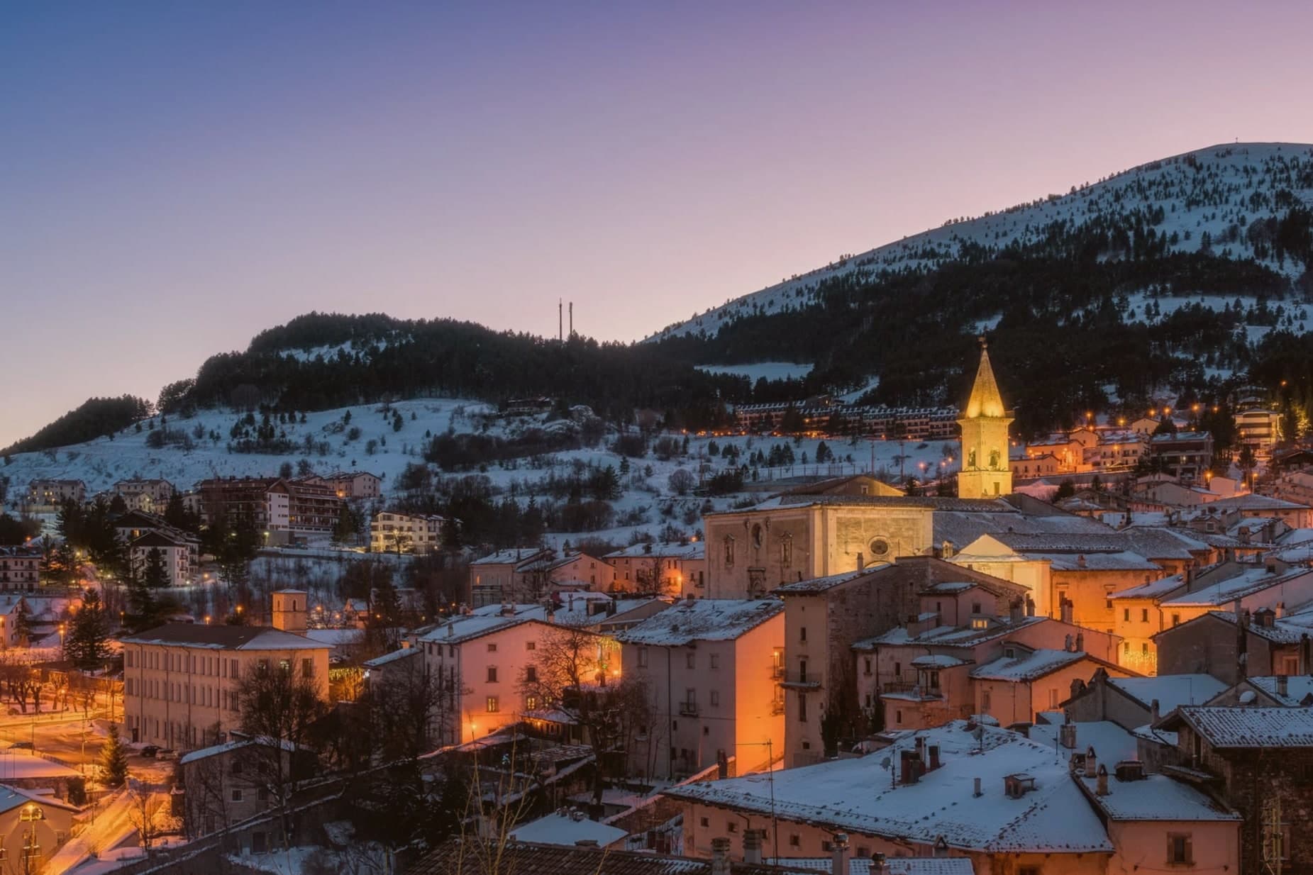
Pescocostanzo sits at 1,395 meters at the southern edge of the Quarto Grande plateau, the high karst basin above the Sangro valley. The town was reshaped between 1456 and the eighteenth century under the Capua family and a generation of Lombard masons who arrived to build for them.
The plan is unusually regular for a mountain commune: a grid of stone houses oriented to the wind, surrounded by woods and pasture. The Collegiata di Santa Maria del Colle, restructured by Cosimo Fanzago in the seventeenth century, is one of the rare five-nave churches in Abruzzo.
Its wrought iron Chapel of the Sacrament gate, made by Sante di Rocco between 1699 and 1707, is the masterpiece of local ironwork. Bobbin lace, merletto al tombolo, is still made here.
The Museo del Merletto a Tombolo inside Palazzo Fanzago shows the technique and the patterns. Filigree gold, carved wood, and lace are still sold on the Corso Roma.
La Corniola, Essentia have been named by a guide.
What to see in Pescocostanzo
- Collegiata di Santa Maria del Colle. Five-nave church begun in the late Middle Ages and remodeled by Cosimo Fanzago in the seventeenth century.
- Museo del Merletto a Tombolo. Inside Palazzo Fanzago, displays the local bobbin lace tradition with patterns, tools, and live demonstrations.
- Palazzo Fanzago. Designed by the baroque architect Cosimo Fanzago in 1624, the seat of the lace museum and civic offices.
How to get to Pescocostanzo
Pescara is roughly 84 minutes away by road.
Our tip
December through March brings snow and the ski season, with the Monte Calvario lifts linking to the Alto Sangro system at Roccaraso and Rivisondoli twenty minutes away. June through September is the second season. At 1,395 meters Pescocostanzo rarely crosses twenty-two degrees even in August, and the Bosco di Sant'Antonio offers beech-shaded walks.
Pacentro
Why visit Pacentro
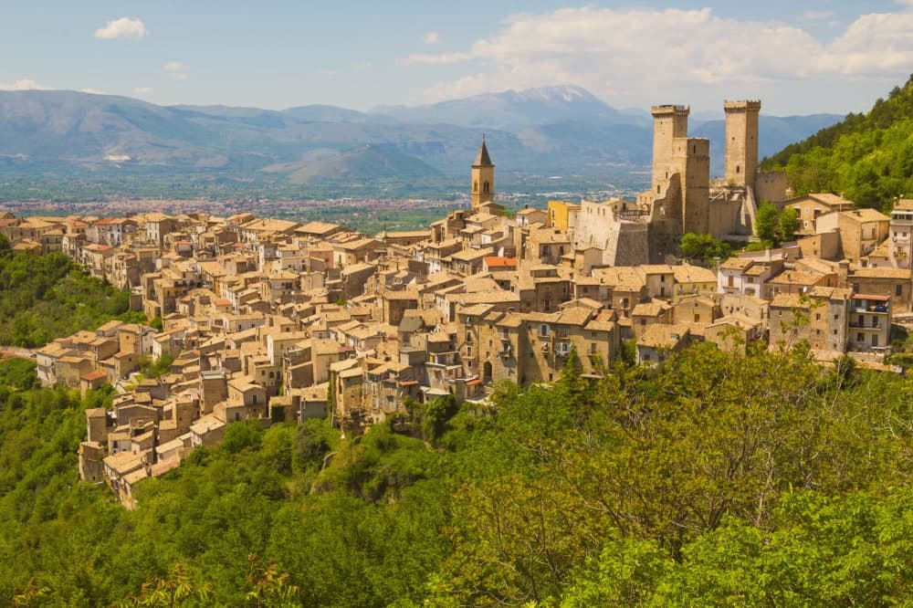
Pacentro sits at 650 meters on a hill spur in the Peligna valley, eight kilometers from Sulmona and inside the Maiella National Park. The Castello Caldora, with its three surviving square towers, dominates the village from the Colle Castello above.
The site has held a castle since the eleventh century; the structure visible today was begun by the Caldora-Cantelmo family in the late fourteenth century and bought by the comune in 1957 and restored. On the first Sunday of September, the Corsa degli Zingari sends barefoot runners down a rocky slope from Monte Ardinghi into the village in honor of the Madonna di Loreto.
The race is documented since the fifteenth century. The other thing people come for is the Ciccone house.
Madonna's paternal grandparents, Gaetano Ciccone and Michelina Di Iulio, emigrated from Pacentro in 1919. The pop singer visited in 2013.
Taverna dei Caldora have been named by a guide.
What to see in Pacentro
- Castello Caldora-Cantelmo. Late fourteenth-century fortress on the Colle Castello, three of its four corner towers still standing, restored after 1957.
- Borgo medievale. Stone houses arranged on terraces below the castle, listed among the Borghi più belli d'Italia, preserved in its medieval plan.
- Chiesa di Santa Maria Maggiore. Sixteenth-century parish church with a baroque interior, holding the Madonna di Loreto honored in the September race.
How to get to Pacentro
Pescara is roughly 69 minutes away by road.
Our tip
May through October is when Pacentro opens. The first Sunday of September brings the Corsa degli Zingari and the biggest crowd of the year, with runners descending barefoot from Monte Ardinghi and the village in procession by evening. July and August can be warm in the valley but the elevation keeps Pacentro itself cooler than Sulmona below.
Scanno

Why visit Scanno
Scanno sits in the Sagittario valley, ringed by the Majella foothills and the Marsicano massif. The lake lies three kilometers down the valley from the town, at a lower elevation, so the walk between them moves from stone alleys to open water framed by the same slopes that produced it: a landslide off the mountain dammed the Tasso river and left the basin behind.
The town's isolation, closed in by the surrounding massifs, is what let the older costume and its headdress survive into the era of the camera, and it is what drew photographers to record it rather than something they invented. The goldsmiths' filigree, made in the same stone streets the women walked, belongs to the same thread: a village shaped by its enclosure in the mountains, still making by hand what it has always made.
Terra dell'Albergo Centrale Scanno have been named by a guide.
What to see in Scanno
- Lago di Scanno. Seen from above, the water reads as a clean heart shape against the valley walls.
- Centro storico. Stone-alley medieval centre where the black costume, with its folded headdress some historians trace to Balkan or Eastern origins, is still worn by older women against limewashed walls.
- Chiesa di Santa Maria della Valle. Parish church first documented in the eleventh century, rebuilt in the seventeenth, with a Renaissance portal and Baroque interior.
How to get to Scanno
Pescara is roughly 80 minutes away by road.
Our tip
June through September is the summer window: trails open in the national park, the lake holds a Blue Flag for swimming, and the centro fills with photographers chasing the Giacomelli setups. December through March is the second season for snow, with skiing on Monte Rotondo and Passo Godi nearby. April, May, October and November are quiet, with many family-run hotels closed and the lake side restaurants shuttered.
Caramanico Terme
Why visit Caramanico Terme
The name carries the Lombard arimannia, a settled clan of the late Middle Ages, and the town grew under the D'Aquino family in the fourteenth and fifteenth centuries, when the main religious buildings went up. Terme was added to the name in 1960, recognising what had been known and used since at least 1576, when the first chemical analyses of the local waters were recorded.
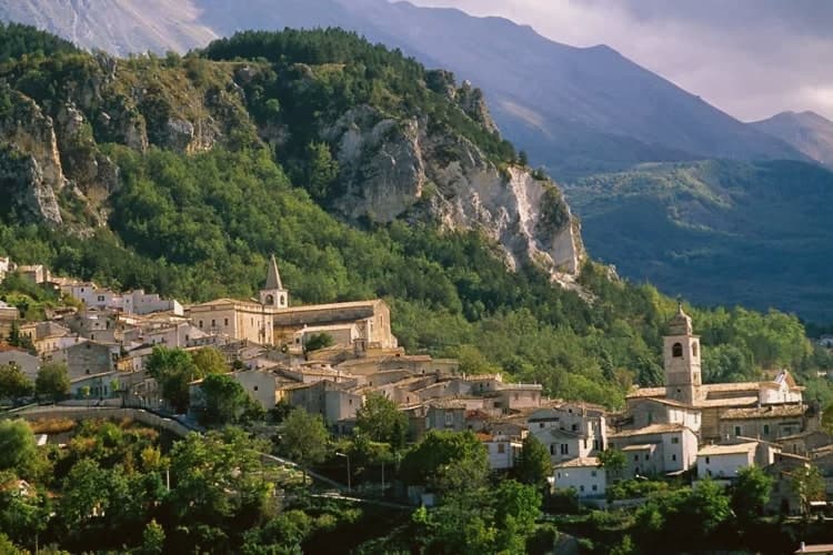
The village sits between Monte Morrone and the Majella, with the historic core on the hilltop above and the spa lower down, closer to the meeting of the two rivers. The abbey stands apart from both, five kilometers out, a separate outpost from the town it belongs to.
What holds the place together is the water: a medieval settlement, a fourteenth-century noble family's building program, and a twentieth-century name change all trace back to the same springs that first drew analysis in 1576.
Locanda del Barone have been named by a guide.
What to see in Caramanico Terme
- Abbazia di San Tommaso Becket. Romanesque, standing unfinished since work stopped, the walls left mid-build over the older pieve beneath. The distance from the centre keeps it apart from the rest of the town's sights, reached on its own.
- Chiesa di Santa Maria Maggiore. Fifteenth-century church with a Gothic exterior and an ogival portal showing the Coronation of the Virgin dated 1476.
- Terme di Caramanico. The spa complex built around the two springs, with treatment programs for respiratory, ENT, skin and joint conditions organized across the site today.
How to get to Caramanico Terme
Pescara is roughly 61 minutes away by road.
Our tip
The thermal baths run all year and pull a steady winter cure clientele. April through June and September into November are the best hiking months in the Orfento, with cool morning air through the beech wood and the river running fast. July and August are warm in the village but cool in the gorge; the spa's indoor pools are the summer escape. Mercato Settimanale Di Caramanico Terme falls in October.
Rocca San Giovanni
Why visit Rocca San Giovanni
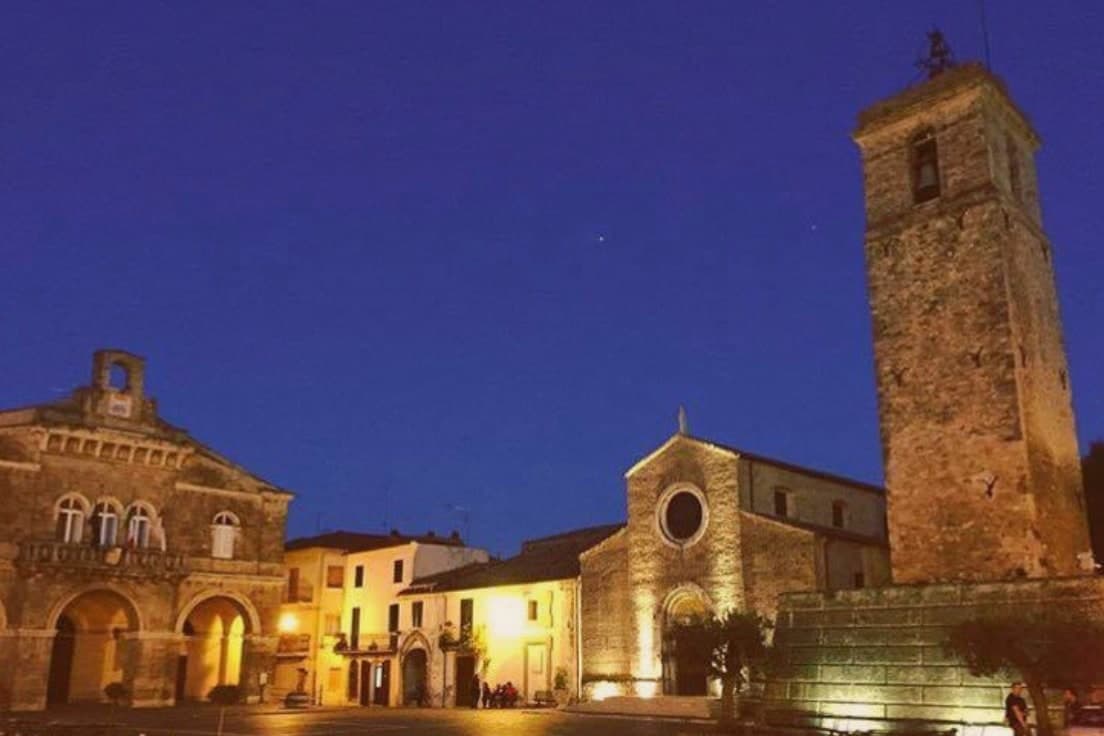
Rocca San Giovanni stands on a rocky hill above the Adriatic between the mouths of the Sangro and Feltrino rivers. The village was founded by Oderisius I, abbot of the nearby abbey, who feared Norman advances on Chieti and built a fortified settlement as a defensive outpost for his monastery.
The relationship between the two places is vertical: the abbey holds the lower slope toward the water, three kilometers down, while the fortified village occupies the high ground it was built to defend, the walls still tracing that original defensive purpose. The coast beneath both is fished from timber platforms that give the shoreline its name, and the old railway bed that once ran along that shore has become a path connecting the beach, the abbey, and the hill town in a single line of movement.
The vineyards run the other direction, down from the hill toward the sea, so the whole territory reads as a set of descending bands: castle, monastery, rail line, water, each built to serve or watch the one below it.
Caldora Punta Vallevò have been named by a guide.
What to see in Rocca San Giovanni
- Abbazia di San Giovanni in Venere. The abbey sits on a panoramic terrace above the Adriatic, one of Abruzzo's major religious sites, its Romanesque stone visible from the slope above long before the village walls come into view.
- Centro storico. The walled medieval core is listed among the Borghi più belli d'Italia, its streets narrow and contained within the old fortified perimeter built to watch the coast below.
- Chiesa di San Matteo Apostolo. Three-nave Romanesque parish church inside the walls, restored multiple times, with a nineteenth-century classical town hall alongside.
How to get to Rocca San Giovanni
There is a railway station in the town, so you can arrive without a car and never need one while you are here. Pescara is roughly 44 minutes away by road.
Our tip
May through September is the coastal season. The beaches below the village fill in July and August, but the centro storico above stays quieter. June and September are the best balance, when sea temperatures are good but the crowds thinner.
Ripatransone
Why visit Ripatransone
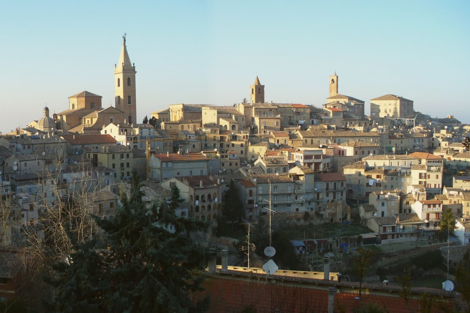
Ripatransone sits at 494 meters on a ridge between the Tesino and Menocchia valleys, twenty kilometers from Ascoli Piceno and seven from the Adriatic, with views from the Sibillini and Gran Sasso to the coast that earned it the nickname Belvedere del Piceno. The hill has been inhabited since prehistory and was settled by the Umbri and then the Piceni; after centuries of Roman quiet a medieval town grew here from a circle of castles unified in 1096.
Pope Pius V raised it to City and diocesan see in 1571. The name combines ripa, cliff, with Transone, the first feudal lord.
The Vicolo più stretto d'Italia, the narrowest alley in Italy at 43 centimeters and 32 at its tightest point, runs between two stone houses near Via Margherita: shoulders go sideways. The Cavallo di Fuoco, a wooden horse covered in fireworks that gallops across the main piazza on the Sunday after Easter, has run since 1682.
Iervasciò, Trattoria da Rita have been named by a guide.
What to see in Ripatransone
- Vicolo più stretto d'Italia. The narrowest alley in Italy, 43 centimeters wide and 32 at its tightest point, between two stone houses near Via Margherita.
- Piazza XX Settembre. The main square of the centro storico, with the Palazzo del Podestà, the Cathedral of San Gregorio Magno and the medieval Torre Civica.
- Cattedrale di San Gregorio Magno. Cathedral built between the seventeenth and eighteenth centuries on the site of an earlier church, raised to cathedral status by Pope Pius V in 1571.
How to get to Ripatransone
Pescara is roughly 70 minutes away by road.
Our tip
April through June and September into October are the working months for Ripatransone. The Tesino and Menocchia valleys turn green from April, the Cavallo di Fuoco runs on the Sunday after Easter, and the autumn light brings the clearest views from the ridge across to the Sibillini and the sea. July and August touch the low thirties; the ridge breeze keeps the centro storico cooler than the coastal plain seven kilometers below. Festival Frittella di Zia Maria falls in September.
Offida
Why visit Offida
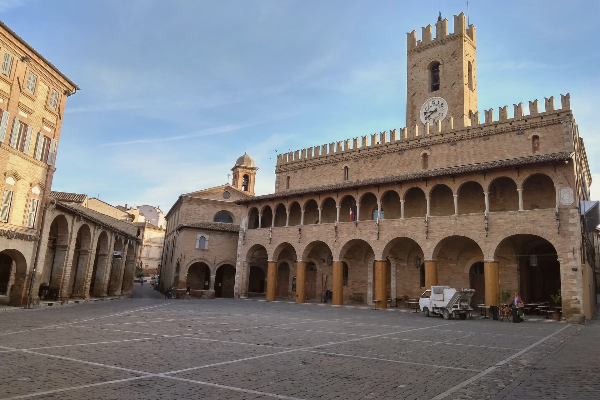
Offida sits at 293 meters on a cliff between the Tesino and Tronto valleys, twenty-three kilometers from Ascoli Piceno. The Chiesa di Santa Maria della Rocca rises on a rock spur at the western edge of the village, surrounded on three sides by cliffs that drop into two valleys: a Romanesque-Gothic temple in brick and travertine, raised by Master Albertino in 1330 on an older Benedictine foundation, with a double row of trilobed arches around the apse.
Inside, the apse and transept hold the fresco cycle of the Master of Offida, an anonymous monk painter who carried Giotto's lesson through the Rimini school, with the Marriage of Saint Catherine and Saint Christopher dated by inscription to 1367. Bobbin lace, merletto a tombolo, has been worked in town since the fifteenth century; the Museo del Merletto in Palazzo De Castellotti holds the collection.
The Carnevale Storico, with the Bove finto run and the Vlurd fire bundles, dates from before Lent in early February.
Osteria Ophis, Blob Caffè & Ristorante have been named by a guide.
What to see in Offida
- Chiesa di Santa Maria della Rocca. Romanesque-Gothic brick-and-travertine church raised in 1330 by Master Albertino on a rock spur west of town, with the Master of Offida fresco cycle dated 1367 in the transept.
- Museo del Merletto a Tombolo. Inside Palazzo De Castellotti, with the lace collection, tools, historical documents and demonstrations of the bobbin-lace work practiced in town since the fifteenth century.
- Palazzo Comunale. Civic palace on the long Piazza del Popolo, with a portico, the Teatro Serpente Aureo and the access to the Museo del Merletto and the archaeological museum.
How to get to Offida
Pescara is roughly 74 minutes away by road.
Our tip
April through June and September into October are the best months for Offida. The hills around the town turn green by April and gold through the September harvest, the wine cellars run open tastings between vendemmia and St. Martin, and the Pecorino and Passerina vineyards stand out along the ridges. Sagra del Chichìripieno falls in August.
More from Anywhere Italy
- The prettiest villages that eat well in Abruzzo
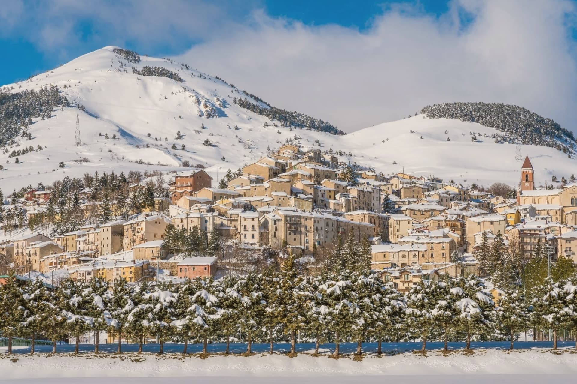 The best hidden towns with a serious restaurant that eat well within 90 minutes of Pescara
- The 6 prettiest villages with a serious restaurant within 90 minutes of Pescara
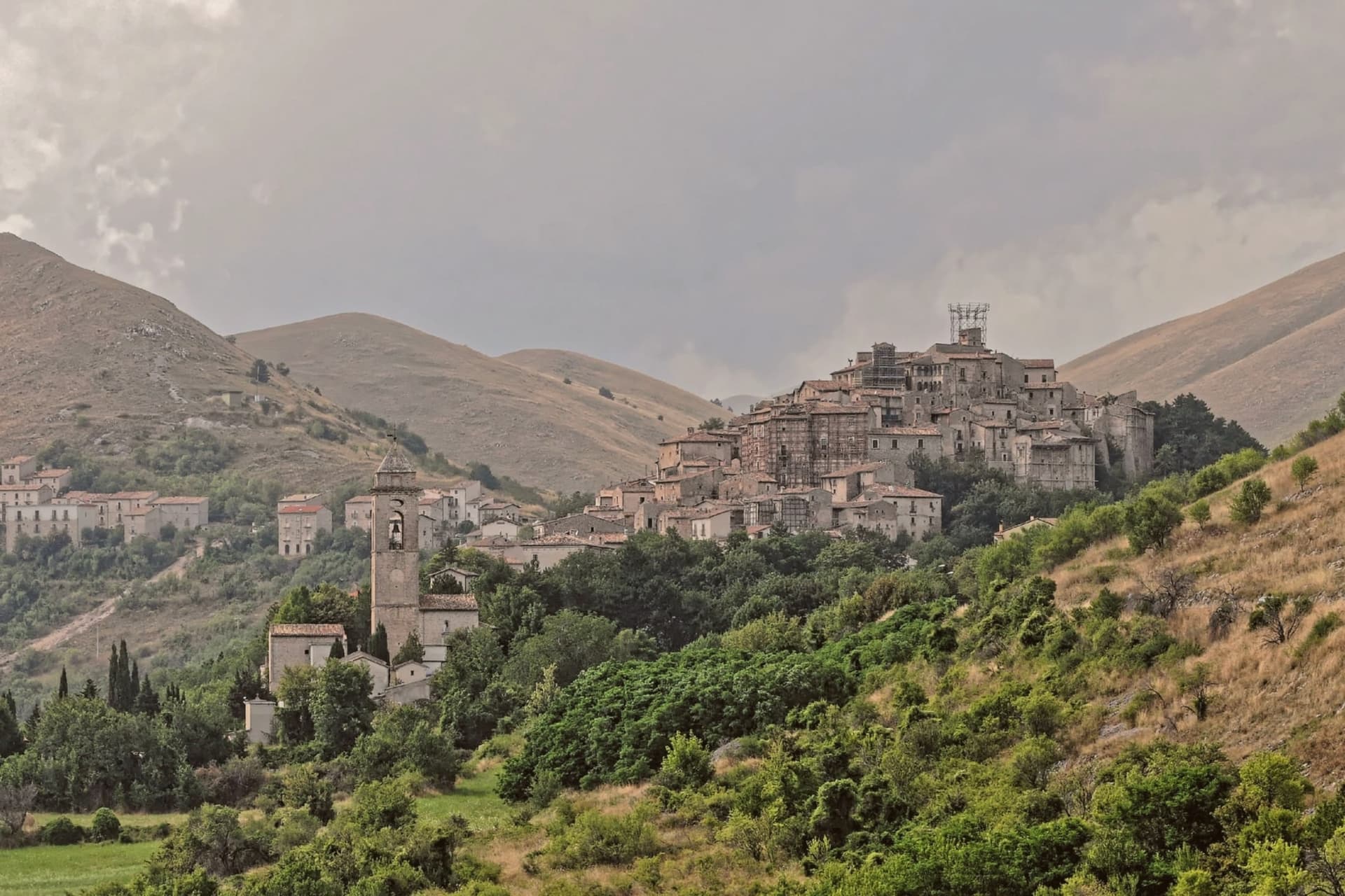 The prettiest small villages inside a national park in Abruzzo
 The prettiest villages inside a national park within 90 minutes of Pescara
- The 6 best small towns that eat well in the province of L'Aquila